California Maps
to
3
25
5,466
195
25
4
2
1
5
11
9
2
4
1
2
1
1
1
21
14
9
3
3
13
11
11
3
3
25
25
25
1
1
1
1
Item Ships From: California
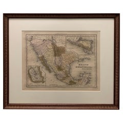
1834 Mexico & Guatemala Framed Map by H.S. Tanner
Located in Stamford, CT
1834 Mexico & Guatemala map of published by H.S. Tanner, Philadelphia, Pennsylvania. Engraved by J. Knight.
As found high end custom framing with carved wood frame, custom matting a...
Category
1830s American American Classical Antique California Maps
Materials
Glass, Wood, Paper
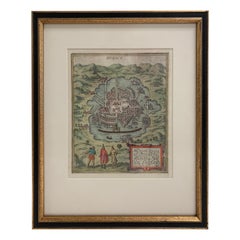
Mexico City by Braun & Hogenberg c. 1590
By Georg Braun and Frans Hogenberg
Located in Stamford, CT
Mexico by Braun & Hogenberg c. 1590
Category
Mid-19th Century European Spanish Colonial Antique California Maps
Materials
Glass, Wood, Paper
Framed 1838 Mexico & Gulf of Mexico Map
Located in Stamford, CT
Framed 1838 Mexico & Gulf of Mexico map. Printed by Fisher, Son & Co. of London in 1838. As found framed condition. Map has not been examined outside of th...
Category
1830s English American Classical Antique California Maps
Materials
Glass, Wood, Paper
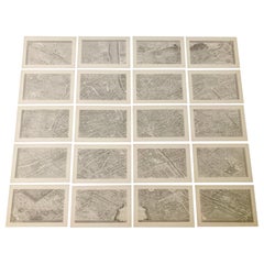
French 18th Century Map of Paris by Turgot
By Michel Etienne Turgot
Located in Los Angeles, CA
Complete Paris map set of etchings by Turgot. This printing is from the 1960s and have warm natural color to the paper. Frame each individually to your liking. The overall dimension ...
Category
1960s French French Provincial Vintage California Maps
Materials
Paper
$4,500 / set
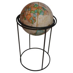
1970's rotating replogle world globe
Located in Los Angeles, CA
An elegant world globe by Paul Mc Cobb, the brass patina is much nicer in person
Category
1970s American Mid-Century Modern Vintage California Maps
Materials
Brass
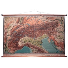
Vintage Swedish Topographic School Map of European Alps, Made in Sweden 1922
Located in Los Angeles, CA
Vintage Swedish Topographic School map of European Alps, Made in Sweden 1922
This vintage Swedish school map is so unique and a great example of why t...
Category
1920s Swedish Vintage California Maps
Materials
Linen, Wood, Paper
Antique Weber Costello 30" Floor Globe 1914-1924
By Costello
Located in Los Angeles, CA
Lucky to find a 30" globe in this condition. The best that Weber Constello ever put out.
Category
20th Century American American Craftsman California Maps
Materials
Brass
Antique Map of California as an Island "The 5 Californias" by Robert de Vaugondy
Located in San Diego, CA
A very nice and rare antique map entitled "Carte de la Californie Suivant" (The 5 Californias), by Didier Robert de Vaugondy of Paris, circa 1772. The map itself measures 15.5" x 13...
Category
Mid-19th Century American Antique California Maps
Materials
Paper
1608 Hispaniae Novae Sive Magnae Vera Descriptio Framed Mexico Map
Located in Stamford, CT
1608 Hispaniae Novae Sive Magnae Vera Descriptio Framed Mexico Map. As found custom black wooden frame/ matting.
This map is based on the work of Abraham Ortelius as is an example o...
Category
Early 1600s Mexican Spanish Colonial Antique California Maps
Materials
Glass, Wood, Paper
1826 Antigo Impero Messicano Mexico Hand Colored Framed Map
Located in Stamford, CT
1826 Antigo Impero Messicano Mexico Hand Colored Framed Map. As found black wood frame.
Category
1820s Mexican Spanish Colonial Antique California Maps
Materials
Glass, Wood, Paper
Huge Europe and Asia Vintage Wall Map
Located in San Diego, CA
A huge Europe and Asia vintage wall map, circa 1950s. The map is in fair vintage condition and measures 78"W x 73"H". #2863
Category
Mid-20th Century American California Maps
Materials
Paper
$380 Sale Price
20% Off
Cram's 16" Deluxe Globe W/Daily Sun Ray and Season Indicator
Located in San Francisco, CA
Cram's 16" Deluxe Globe W/Daily Sun Ray and Season Indicator
1936
Category
1930s Vintage California Maps
Materials
Metal
Early San Francisco View by Henry Firks Printed by W.H. Jones in 1849
Located in San Francisco, CA
A tinted lithographic view of San Francisco, made during the gold rush, showing a panoramic view of the bay's waterfront from the south along Montgomery Street to Telegraph Hill. The...
Category
Mid-19th Century American Victorian Antique California Maps
Materials
Paper
1847 Amerique Septentrionale Framed Map
Located in Stamford, CT
1847 Amerique Septentrionale Framed Map Illustrated by Raimond Bonheur. As found framed condition.
Category
1840s American American Classical Antique California Maps
Materials
Glass, Wood, Paper
Massive Vintage Wall Map of the Soviet Union 'Sowjetunion' by Karl Wenschow
By Denoyer-Geppert
Located in San Diego, CA
A massive vintage wall map of the Soviet Union (Sowjetunion) published by Karl Wenschow in Munich, Germany, circa 1950s. The map was distributed by De...
Category
Mid-20th Century American California Maps
Materials
Paper, Wood
$540 Sale Price
20% Off
1705 Golfe de Mexico and Florida Framed Map
Located in Stamford, CT
Framed map of Mexico & Florida circa 1705, Paris. Small map with Mexico and the Gulf Coast. Inset text indicating Panama, Acapulco, Mexico City and the Mississippi. Extends North to ...
Category
Early 1700s French Spanish Colonial Antique California Maps
Materials
Glass, Wood, Paper
Vintage "View of the Center of Paris Taken from the Air" Lithograph Map
Located in San Diego, CA
A very stylish "View of the Center of Paris Taken from the Air" lithograph map published by the Paris Ministry of Tourism, circa early 1950s. The piece measures 27" x 43" and shows...
Category
20th Century French Mid-Century Modern California Maps
Materials
Paper
$680 Sale Price
20% Off
America Septentrionalis by Carroli Allard (1648-1709) Copper Plate Engraving
Located in San Francisco, CA
"Recentissuma Novi Orbis Sive Americae Septentrionale et Meriodionalis"
A hand-colored copper plate engraving of North and South America by Carel Allard depicting recent discoveries...
Category
Late 17th Century Dutch Antique California Maps
Materials
Paper
Large 1856 Mexico & Guatemala Framed Map by Charles Desilver
Located in Stamford, CT
Large 1856 Mexico & Guatemala Framed map. Published by Charles Desilver, Philadelphia, Pennsylvania.
As found high end custom framing with black giltwood frame, custom matting and UV...
Category
1850s American American Classical Antique California Maps
Materials
Glass, Wood, Paper
Framed Mercator Hondius Hispania Nova Atlas Minor Map
Located in Stamford, CT
Framed colored example of this decorative and important minature map. Newly framed in brown wood frame with gold trim.
Mercator Hondius “Atlas Minor” pu...
Category
17th Century Dutch Spanish Colonial Antique California Maps
Materials
Glass, Wood, Paper
1868 Map of the Upper Part of the Island of Manhattan Above 86th Street
By Wm. Rogers Mfg. Co.
Located in San Francisco, CA
This wonderful piece of New York City history is over 150 years old. It depicts 86th street and above. It was lithographed by WC Rogers and company. It was made to show what was the Battle of Harlem during the Revolutionary war...
Category
1860s American American Colonial Antique California Maps
Materials
Paper
Scarce U.S. Coast Survey Map Depicting Entrance to San Francisco Bay Dated 1856
Located in San Francisco, CA
A fine example of the 1856 U.S. Coast lithographic survey nautical chart of the entrance to San Francisco bay and the city. Published in 1856 by the Office of the Coast Survey the of...
Category
Mid-19th Century American Antique California Maps
Materials
Paper
Mid-18th Century Hand Drawn English Farm Map on Vellum, circa 1740s
Located in San Francisco, CA
Mid-18th century hand drawn English farm map on Vellum circa 1740s
Henry Maxted & Isaac Terry, Surveyors.
A Map of a Farm in the Parish of Blean in the County of KENT: Belonging to Mrs Elizabeth Hodgson circa 1743.
A beautiful hand drawn map...
Category
Mid-18th Century English Antique California Maps
Materials
Lambskin
Vintage Swedish School Map of Vastergötland, Made in Sweden 1920
Located in Los Angeles, CA
Vintage Swedish School Map of Vastergötland, Made in Sweden 1920
Västergötland also known as West Gothland or the Latinized version Westrogothia in older literature, is one of the...
Category
1920s Swedish Vintage California Maps
Materials
Linen, Wood, Paper
Antique Framed Pen and Ink on Fabric Map of Cornwall from Early 19th Century
Located in Los Angeles, CA
This English fabric map of Cornwall, rendered in pen-and-ink, showcases exquisite hand-drawn details and charming faded sepia tones. Encased in a classic frame, this piece elegantly ...
Category
Early 19th Century English Antique California Maps
Materials
Walnut, Fabric
Related Items
Antique Map of the Region of Tokyo and Nagasaki in Japan, 1922
Located in Langweer, NL
Antique map of Japan titled 'Japan - Environs of Tokio & Nagasaki'. Old map of Japan, includes inset maps of Tokyo, Nagasaki and surroundings. This map or...
Category
20th Century California Maps
Materials
Paper
$171 Sale Price
20% Off
H 23.23 in W 17.72 in D 0 in
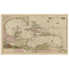
Engraving of a Map of Florida, the Gulf Coast, Caribbean & Central America, 1728
Located in Langweer, NL
This exceptional antique map, titled "Nouvelle Carte Marine de Toute les Cotes de l´Amerique" and alternatively known as "Nieuwe groote en seer Curieuse Paskaart van Geheel-WestIndie...
Category
Mid-18th Century Dutch Antique California Maps
Materials
Paper
$16,300
H 24.61 in W 40.56 in D 0.02 in
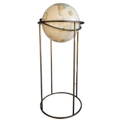
Replogle Terrestrial Floor Globe
By Replogle Globes
Located in Asbury Park, NJ
This floor globe by Replogle floats within a ring of walnut, supported by four 'turned' chrome stiles, which connect to a base of walnut. The ...
Category
1960s American Mid-Century Modern Vintage California Maps
Antique Political Map of the Japanese Empire, 1922
Located in Langweer, NL
Antique map of Japan titled 'Japanese Empire - Political Map'. Old map of Japan depicting Japan, Korea and surroundings. This map originates from 'The Ti...
Category
20th Century California Maps
Materials
Paper
Plan of Paris, France, by A. Vuillemin, Antique Map, 1845
Located in Colorado Springs, CO
This large and detailed plan of Paris was published by Alexandre Vuillemin in 1845. The map conveys a wonderful amount of information and is decorated throughout with pictorial vigne...
Category
1840s American Antique California Maps
Materials
Paper
1950s Replogle Glass Illuminated Precision Globe
By Replogle Globes
Located in Brooklyn, NY
This 10" 'Precision' Globe was manufactured in the early 1950s by Replogle (Chicago, IL) and edited by cartographer, Gustav Brueckmann. Composed of p...
Category
1950s American Mid-Century Modern Vintage California Maps
Materials
Metal, Brass
Antique World Globe From Fleet Street London 1923 on Wooden Stand
Located in Reading, Berkshire
Antique Terrestrial Geographia of Fleet Street London 12"inch World Globe on handcrafted Wooden Three Legged Base 1923
Made 55 Fleet Street, London
Beautiful desktop globe, showcas...
Category
1920s British Art Deco Vintage California Maps
Materials
Wood, Paper
$1,318 Sale Price
25% Off
H 18.51 in Dm 11.82 in
Vintage Replogle Classical Mahogany Floor World Globe Signed C1940
Located in Big Flats, NY
***Reduced In-House Delivery Rates - Click on “Ask Seller” to Request a Quote***
Vintage Replogle Classical Mahogany Floor World Globe Signed C1940. ...
Category
20th Century California Maps
Materials
Wood
$1,160 Sale Price
20% Off
H 38 in W 20 in D 20 in
Detailed Regional Map of the Gulf of Bengal and the Lower Ganges River, ca.1750
Located in Langweer, NL
Title of this original and rare antique map: Nouvelle Carte Du Royaume De Bengale
Mapmaker: Jacques-Nicolas Bellin (1703-1772).
He was among the most important mapmakers of the eighteenth century. In 1721, at only the age of 18, he was appointed Hydrographer to the French Navy. In August 1741, he became the first Ingénieur de la Marine of the Dépôt des cartes...
Category
1750s Antique California Maps
Materials
Paper
$599 Sale Price
20% Off
H 11 in W 13.5 in D 0.02 in
Antique Map of the City of Visby 'Sweden' by F. Hogenberg, 1598
Located in Langweer, NL
This is a wonderful bird's-eye plan/view of the oldest city in Sweden.
Visby, the largest city on the island of Gotland was an important Viking city and the main centre of the Hanseatic League...
Category
16th Century Antique California Maps
Materials
Paper
$2,331 Sale Price
20% Off
H 23.04 in W 27.96 in D 0.99 in
Four 18th Century Engraved and Hand-Colored Maps by Weigel
By Christoph Weigel
Located in Copenhagen, K
Small collection of four engraved maps of Italy, Balkan and of Central Asia.
Two are of Italy, one Corsica and Northern Italy and the other of the Southern Italian boot...
Category
18th Century German Antique California Maps
Materials
Paper
$450 / item
H 15.75 in W 18.12 in D 0.79 in
Braun PC3 Record Player by Wilhelm Wagenfeld and Dieter Rams
By Braun, Wilhelm Wagenfeld, Dieter Rams
Located in Vienna, AT
Record player Braun Pc3 Design in Germany in 1950s by Wilhelm Wagenfeld, Dieter Rams for Max Braun AG, Frankfurt a. M.,
Fully restored by a Brun specialist.
Category
1950s German Mid-Century Modern Vintage California Maps
Materials
Steel
Previously Available Items
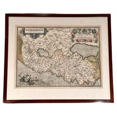
"Terra Sancta" Map of the Holy Land by Abraham Ortelius (1527-1598) Framed
By Abraham Ortelius
Located in San Francisco, CA
Abraham Ortelius (1527-1598) was a cartographer, geographer and map maker from Antwerp in the Spanish Netherlands. He created the first modern atlas, titled in Latin "Theatrum Orbis ...
Category
17th Century Belgian Baroque Antique California Maps
Materials
Paper
World Globe in the Style of Paul McCobb
By Replogle Globes, Paul McCobb
Located in Fulton, CA
A Mid-Century Modern articulating world globe on stand attributed to Paul McCobb. Tubular metal base with a bronze patina. Globe by Replogle.
Category
Mid-20th Century American Mid-Century Modern California Maps
Materials
Metal
Map of Ireland Titled "Hiberniae Britannicae Insulae Nova Descriptio Irland"
By Abraham Ortelius
Located in San Francisco, CA
Abraham Ortelius (1527-1598) was a cartographer, geographer and maker from Antwerp in the Spanish Netherlands. He created the first modern atlas titled in Latin Theatrum Orbis Terrar...
Category
Early 18th Century Belgian Antique California Maps
Materials
Paper
Vintage 1939 Map of the Philippines and 1939 Cenus
Located in Van Nuys, CA
This vintage piece is a 1939 map of the Philippines accompanied by a census, sourced from Volume V of a book containing historical statistical information. Encased in a stylish black...
Category
1930s British Colonial Vintage California Maps
Materials
Paper
Vintage Strategy Chalk Teaching Globe on Stand by A.J. Nystrom Co
By A.J. Nystrom & Co
Located in San Diego, CA
Vintage strategy chalk teaching globe on aluminum stand by A.J. Nystrom Co., circa 1960s. The globe is in good original condition and measures 17"D x 21"H with the base of the stand ...
Category
20th Century American Mid-Century Modern California Maps
Materials
Steel, Chrome
Silk Needlework Map of England and Wales Signed Anna Brewster Dated 1783
Located in San Francisco, CA
A charming silk needlework depiction of England and Wales executed in 1783 by Anna Brewster. This Georgian map sampler is signed and dated in the upper lef...
Category
Late 18th Century English Georgian Antique California Maps
Materials
Canvas, Silk
H 24.5 in W 21.5 in D 1.5 in
Mid-Century Modern Desktop Scholastic World Globe on Brass Stand
Located in San Jose, CA
Vintage desk or tabletop globe map with stand in brass by Scholastic. This piece rotates on a full swing meridian and displays plenty of vintage charm. The p...
Category
1960s Mid-Century Modern Vintage California Maps
Materials
Brass
Vintage Swedish School Map of Europe, Large, Made in Sweden, 1905
Located in Los Angeles, CA
Vintage Swedish School Map of Europe - LARGE - Made in Sweden, 1905
This vintage Swedish school map is so unique and a great example of why these are so collectible.
Wooden pol...
Category
Early 1900s Swedish Antique California Maps
Materials
Linen, Wood, Paper
Antique Whimsical Map of San Diego, California by Jo Mora for Marston Stores
By A. Marston & Co., Jo Mora
Located in San Diego, CA
Antique whimsical map of San Diego, California by Jo Mora for Marston Stores, circa 1928. The rare map itself measures 22" x 27" and is presented in its original thin wood frame measuring 25.25" x 30.5". The map and frame are in fair to poor condition with a number of stains, blotches folds and wrinkles (please see pictures). The frame also has some damage to it. It is a very, very rare map with only 2,000 copies ever made. #1968
Jo Mora’s spectacular pictorial map of San Diego; an historical account of the city of San Diego, created by the brilliant and incomparable Jo Mora in 1928. George Marston, owner of the Marston Department Store, commissioned Mora to create one of his signature cartes, with San Diego as the subject matter, for the 50th ‘Golden’ Anniversary of The Marston Company. As a prominent philanthropist and benefactor of the city, George W. Marston eventually earned the unofficial title of “San Diego’s First Citizen”. It has been suggested that Mora and Marston probably met at the Bohemian Grove...
Category
Early 20th Century American California Maps
Materials
Paper
H 30.5 in W 25.25 in D 0.5 in
Antique Map of Manhattan, New York City by Thomas Cowperthwait & Co. 1850
Located in San Diego, CA
A very nice antique map of Lower Manhattan, New York City by Thomas Cowperthwait & Co., circa 1850. The map itself measures 13" x 16" and is professionally presented in a nice black ...
Category
Mid-19th Century American Antique California Maps
Materials
Paper
Map of American Indian Reservations 1884 in Period Walnut Frame
Located in San Francisco, CA
Washington: Department of the Interior. This interesting 1884 map presents the Indian Reservations in the United States and its territories covering the entire United States with Ala...
Category
1880s American Antique California Maps
Materials
Walnut, Paper
Mid-17th Century Birdseye View of Amsterdam Hand Colored Map, circa 1650
Located in San Francisco, CA
Mid-17th century bird’s-eye view of Amsterdam hand colored map, circa 1650
A fine old map with good color
Amsterdam was the one of the leading...
Category
Mid-17th Century Dutch Antique California Maps
Materials
Paper
Recently Viewed
View AllMore Ways To Browse
Used Fruit Machines
Used Olive Barrel
Used Potting Shed
Used Restaurant Counters
Used Slipcovers
Versace By Rosenthal
Vesta Case English
Vicenza Stone
Victorian Pill Box
Victorian Stoves
Vignoli Faenza
Vintage 1950s Vanity Dresser
Vintage 4 Drawer Wood Dressers
Vintage 6 Drawer Metal Storage
Vintage Alan White Furniture
Vintage Aluminum Shaker
Vintage Bavaria Bowl
Vintage Blanket Box Chest
