Continental Europe Maps
to
4,200
5,168
5,520
197
5,167
1
2
2
2
1
2,844
2,005
318
1
179
12
1
68
3
3
3
2
3
1
5,149
17
11
10
8
463
192
89
81
53
5,168
5,168
5,168
104
58
20
14
13
Item Ships From: Continental Europe
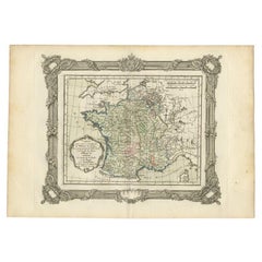
Antique Map of France at the Beginning of the 17th Century by Zannoni, 1765
By G. A. Rizzi-zannoni
Located in Langweer, NL
Antique map France titled 'Carte pour servir à intelligence de l'Histoire de France (..)'. Beautiful old map of France. This map originates from 'At...
Category
18th Century Antique Continental Europe Maps
Materials
Paper
$151 Sale Price
20% Off
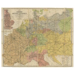
Antique Railway Folding Map of Central Europe by Müller, 1870
Located in Langweer, NL
Antique map titled 'Karte der Eisenbahnen Mittel-Europa's (..)'. Railway folding map of Central Europe. Published by Carl Flemming, 1870.
Category
Late 19th Century Antique Continental Europe Maps
Materials
Paper
$716 Sale Price
20% Off
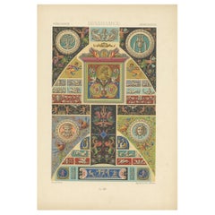
Antique Print of Decorative Art in the Renaissance Period, 1869
Located in Langweer, NL
Old print of decorative art in the Renaissance period. This print originates from 'L'Ornement polychrome'. A beautiful work containing about 2000 patterns of all the styles of Art ol...
Category
19th Century Antique Continental Europe Maps
Materials
Paper
$171 Sale Price
20% Off
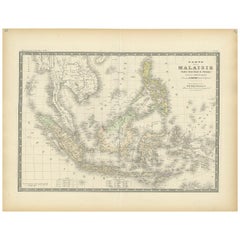
Antique Map of the East Indies by Levasseur, '1875'
Located in Langweer, NL
Antique map titled 'Carte de la Malaisie'. Large map of the East Indies. This map originates from 'Atlas de Géographie Moderne Physique et Politique' by A. Levasseur. Published 1875.
Category
Late 19th Century Antique Continental Europe Maps
Materials
Paper
$447 Sale Price
25% Off
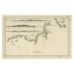
Antique Coastal Views and a Map of Van Diemens Land (Tasmania), Australia, 1803
Located in Langweer, NL
Antique map Tasmania titled 'Kaart van Diemens Land'.
Coastal views and a map of van Diemens Land (Tasmania). Originates from 'Reizen Rondom de Waereld ...
Category
Early 1800s Antique Continental Europe Maps
Materials
Paper
$821 Sale Price
20% Off
Antique Map of the Region of Poitou by Janssonius, 1657
By Johannes Janssonius
Located in Langweer, NL
Antique map 'Pictauiae Ducatus Descriptio vulgo le Pais de Poictov'. Decorative map of the region of Poitou with Rochelle, Nantes, etc., France. This map originates from 'Atlas Novus...
Category
Mid-17th Century Antique Continental Europe Maps
Materials
Paper
$525 Sale Price
20% Off
Antique Map of the Region of Pays de Caux by Janssonius, 1657
By Johannes Janssonius
Located in Langweer, NL
Antique map 'Le Pais de Caux'. Decorative map of the region of Pays de Caux, France. This map originates from 'Atlas Novus, Sive Theatrum Orbis Orbis Terrarum: In quo Galliae, Helvet...
Category
Mid-17th Century Antique Continental Europe Maps
Materials
Paper
$525 Sale Price
20% Off
Antique Map of Sweden and Norway by W. G. Blackie, 1859
Located in Langweer, NL
Antique map titled 'Sweden and Norway'. Original antique map of Sweden and Norway. This map originates from ‘The Imperial Atlas of Modern Geography’. Published by W. G. Blackie, 1859.
Category
Mid-19th Century Antique Continental Europe Maps
Materials
Paper
$238 Sale Price
20% Off
17th Century Cartographic Marvel: A Detailed Engraving of Guangzhou (Kanton)
Located in Langweer, NL
This engraving of Guangzhou ("Kanton") is from a French edition of Olfert Dapper's work. The French edition titled "Description de l’Empire de la Chine" was published in 1674. It is ...
Category
1670s Antique Continental Europe Maps
Materials
Paper
$1,050 Sale Price
20% Off
Antique Map of Spain and Portugal by Lowry, '1852'
Located in Langweer, NL
Antique map titled 'Spain and Portugal'. Original map of Spain and Portugal. This map originates from 'Lowry's Table Atlas constructed and engraved ...
Category
Mid-19th Century Antique Continental Europe Maps
Materials
Paper
$95 Sale Price
20% Off
Crossroads of Empires: A John Tallis Map of the Isthmus of Panama, 1851
Located in Langweer, NL
The Tallis map of the Isthmus of Panama is a beautifully detailed work, characteristic of the maps produced by John Tallis & Company, which was one of the last cartographic firms to ...
Category
1850s Antique Continental Europe Maps
Materials
Paper
$276 Sale Price
20% Off
Antique Map of the Franconia Region by Scherer, 1699
Located in Langweer, NL
Antique map titled 'Franconia multa numerat loca deiparae sacra in quibus magna recipit à dei matre beneficia.' Detailed uncommon map of the Franconia region in Germany. Source unkno...
Category
17th Century Antique Continental Europe Maps
Materials
Paper
$214 Sale Price
20% Off
Minho: A Legacy of Lush Landscapes and Living Traditions in Portugal, 1903
Located in Langweer, NL
Ths authentic print is a historical map of the Minho region in the northwestern part of Portugal. The map includes detailed geographical features, such as rivers, mountain ranges, an...
Category
Early 1900s Antique Continental Europe Maps
Materials
Paper
$324 Sale Price
20% Off
Original Antique Map of Turkey, Asia Minor and Cyprus
By Gerard Mercator
Located in Langweer, NL
Antique map titled 'Natoliae sive Asia Minor'. Original old map of Turkey, Asia Minor and Cyprus. Includes a decorative cartouches, sailing ship, sea mon...
Category
Early 17th Century Antique Continental Europe Maps
Materials
Paper
$802 Sale Price
20% Off
Antique Map of North America from an Old Dutch School Atlas, 1852
Located in Langweer, NL
Antique map titled 'Noord-Amerika'. Map of North America. This map originates from 'School-Atlas van alle deelen der Aarde' by Otto Petri. Artists and Engra...
Category
19th Century Antique Continental Europe Maps
Materials
Paper
$210 Sale Price
20% Off
Old Handcolored Antique Map of Pays De Caux in Normandy, France, ca.1640
Located in Langweer, NL
Antique map titled 'Le Pais de Caux'.
Old map of Pays de Caux, France. Pays de Caux is an area in Normandy occupying the greater part of the French département of Seine Maritime ...
Category
1640s Antique Continental Europe Maps
Materials
Paper
$1,289 Sale Price
20% Off
Copper-Engraved Map Showing the Algerian Coast of North Africa, Published 1683
Located in Langweer, NL
Antique map titled 'Partie de Barbarie, ou est le Royaume d'Alger (..)'.
Copper-engraved map showing the Algerian coast of North Africa. Published 1683.
Artists and Engravers:...
Category
1680s Antique Continental Europe Maps
Materials
Paper
$324 Sale Price
20% Off
Circa 1802 Map of the Troad Region by Tardieu – From the Voyage de la Troade
Located in Langweer, NL
This is a large fold-out map titled *Carte de la Troade*, measuring approximately 53.5 x 68 cm, engraved by Tardieu, and extracted from the atlas of *Voyage de la Troade, fait dans l...
Category
Early 1800s French Antique Continental Europe Maps
Materials
Paper
$223 Sale Price
25% Off
Original Antique Map of Egypt by Van Dùren '1749'
Located in Langweer, NL
Decorative German antique engraving with titled 'Neue Vorstellung von Aegypten (..)'. It concerns a rare original antique map of Egypt. This map o...
Category
Mid-18th Century Antique Continental Europe Maps
Materials
Paper
$245 Sale Price
25% Off
Old Ptolemaic Map of the Region Between the Persian Gulf and Caspian Sea, 1598
Located in Langweer, NL
"Tabula Asiae V", Ptolemy/Ruscelli
Subject: Persia - Iran
Period: 1598 (published)
Publication: Geografia di Claudio Tolomeo Allessadrino…
Claudius Ptolemy was a mathematician, ast...
Category
16th Century Antique Continental Europe Maps
Materials
Paper
$382 Sale Price
20% Off
Antique Architectural Print of Pavilions for English Gardens by Le Rouge, 1776
Located in Langweer, NL
Antique print titled 'Pavillons Grottes pour les Jardins Anglais'. Copper engraving showing pavilions for English gardens. This print originates from 'J...
Category
18th Century Antique Continental Europe Maps
Materials
Paper
$324 Sale Price
20% Off
Pl. 2 Antique Print of Vauxhall Gardens by Le Rouge, c.1785
Located in Langweer, NL
Antique print titled 'Vue d'une partie du Voxhal de Londres'. Copper engraving of Vauxhall gardens, London. This print originates from 'Jardins Anglo-Chinois à la Mode' by Georg Loui...
Category
18th Century Antique Continental Europe Maps
Materials
Paper
Antique Architectural Print of Villa a Deauville in France, Chabat, c.1900
Located in Langweer, NL
Antique print titled 'Villa a Deauville, Mr. H. Blondel Architecte, Mr. Breney Architecte'. This print depicts the design of a building in France. Originates from 'La Brique et La Te...
Category
20th Century Continental Europe Maps
Materials
Paper
Antique Map of Southern Germany by F. de Wit, circa 1680
Located in Langweer, NL
This antique map depicts a portion of southern Germany that included the historic regions of Bavaria, the Palatinate, Prussia-Brandenburg, the Rhineland and Saxony. Regensberg, Freis...
Category
Late 17th Century Antique Continental Europe Maps
Materials
Paper
$663 Sale Price
20% Off
Antique Map of France in Ancient Roman Times, 1880
Located in Langweer, NL
Antique map titled 'Gaule indépendante et Romaine'.
Old map of Gaul or France in ancient Roman times. The map covers from the southern part of England (Britannia) to the north of S...
Category
19th Century Antique Continental Europe Maps
Materials
Paper
$181 Sale Price
20% Off
1874 Map of the United States with Territorial Boundaries
Located in Langweer, NL
Title: 1874 Map of the United States with Territorial Boundaries
Description: This is an 1874 map titled "Map of the United States," showcasing the country during a period of rapid ...
Category
1870s Antique Continental Europe Maps
Materials
Paper
$248 Sale Price
20% Off
Europe Divided into Principal States by Jean Denis Janvier, Paris, 1782
Located in Langweer, NL
This is a historical map of Europe titled "L'Europe divisee en ses Principaux Etats," created by Jean Denis Janvier in 1782.
This beautiful map depicts the political boundaries and...
Category
1780s Antique Continental Europe Maps
Materials
Paper
Very Rare Antique Print of the Kings Celebrations in Pegu, Myanmar, 1682
Located in Langweer, NL
Plate: 'Konings feesten tot Pegu.' (Kings celebrations in Pegu.)
On this plate: 1. The King. 2. And the Queen, sprinkling water on each other. 3. Their children. 4. Officers. 5. ...
Category
1680s Antique Continental Europe Maps
Materials
Paper
$439 Sale Price
20% Off
Old Map of the Eastern Region of the Kingdom of Algiers, Algeria, 1773
Located in Langweer, NL
Antique map titled 'Kaart van het Oostelyke Deel van het Ryk van Algiers'.
Old map of the eastern region of the Kingdom of Algiers, Algeria. Originates from the first Dutch edito...
Category
1770s Antique Continental Europe Maps
Materials
Paper
$439 Sale Price
20% Off
Antique Map of The United States Southern Section by A & C. Black, 1870
Located in Langweer, NL
Antique map titled 'United States Southern Section'. Original antique map of Map of The United States Southern Section. This map originates from ‘Black's General Atlas of The World’....
Category
Late 19th Century Antique Continental Europe Maps
Materials
Paper
$238 Sale Price
20% Off
Antique Plan of Ancient Syracuse, Plan of ancient Syracuse, Sicily, Italy
Located in Langweer, NL
Antique print titled 'Plan de l'Ancienne Ville de Syracuse'. Plan of ancient Syracuse, Sicily, Italy. This print originates from 'Histoire Universelle (..)'.
Artists and Engravers...
Category
18th Century Antique Continental Europe Maps
Materials
Paper
$171 Sale Price
20% Off
Antique Map of Vermont
Located in Langweer, NL
Antique map titled 'Vermont'. Original antique map of Vermont, United States. This print originates from 'Encyclopaedia Britannica', Ninth Edition. Publ...
Category
Late 19th Century Antique Continental Europe Maps
Materials
Paper
$276 Sale Price
20% Off
Original Antique Engraving of Algiers in Algeria, 1773
Located in Langweer, NL
Antique print titled 'Algiers'. Old print with a view of Algiers, Algeria. With Dutch legend. Originates from the first Dutch editon of an interesting travel account of Northern Afri...
Category
18th Century Antique Continental Europe Maps
Materials
Paper
$467 Sale Price
20% Off
Original Antique Map of Italy with an Inset of Sardinia, 1882
Located in Langweer, NL
Embark on a historical odyssey with an original Antique Map of Italy from the esteemed 'Comprehensive Atlas and Geography of the World,' meticulously crafted in 1882. This captivatin...
Category
1880s Antique Continental Europe Maps
Materials
Paper
$200 Sale Price
20% Off
Map of Western Australia & Swan River, insets of Perth, Aboriginals, Sheep, 1851
Located in Langweer, NL
Antique map titled 'Western Australia, Swan River'. Map of Western Australia and Swan River, surrounded by illustrations of Perth, Aborigines and sheep shea...
Category
1850s Antique Continental Europe Maps
Materials
Paper
$305 Sale Price
20% Off
Gateway to the Steppes: Tallis's Masterpiece Map of Indepent Tartary, 1851
Located in Langweer, NL
The map is of "Independent Tartary," a historical region in Central Asia that covered parts of what are now Kazakhstan, Uzbekistan, Turkmenistan, and surrounding areas. The map was p...
Category
1850s Antique Continental Europe Maps
Materials
Paper
$315 Sale Price
20% Off
Antique Map of the City of Copenhagen in Denmark c.1720
Located in Langweer, NL
Antique map titled 'Copenhagen'. Original antique map of the city of Copenhagen, Denmark. This map originates from 'Unterschiedliche dieser Zeit Beruffene Laender, Gegenden, Staedte ...
Category
18th Century Danish Antique Continental Europe Maps
Materials
Paper
Trás-os-Montes: A Cartographic Exploration of Portugal's Hidden Province in 1903
Located in Langweer, NL
This print is an original historical map of the Trás-os-Montes region in the northeastern part of Portugal, dated 1903. Trás-os-Montes is often translated as "behind the mountains," ...
Category
Early 1900s Antique Continental Europe Maps
Materials
Paper
$296 Sale Price
20% Off
Antique Map of Italy with Hand-Colored Borders, 1852
Located in Langweer, NL
Antique map titled 'Italië'. Map of Italy. This map originates from 'School-Atlas van alle deelen der Aarde' by Otto Petri. Artists and Engravers: Published by A. Baedeker (Otto Petr...
Category
19th Century Antique Continental Europe Maps
Materials
Paper
$210 Sale Price
20% Off
Antique Map of Russia in Asia and Siberia, with Frame Style Border
Located in Langweer, NL
Antique map titled 'Sibérie ou Russie d'Asie'. Attractive map of Russia in Asia and Siberia. This map originates from Maison Basset's 1852 edition of 'Atlas Illustre Destine a l'ense...
Category
Mid-19th Century Antique Continental Europe Maps
Materials
Paper
$143 Sale Price
20% Off
Antique Print of Graves Near the City of Nanjing in China, 1665
Located in Langweer, NL
Antique print titled 'Graf-Steden'. Old print depicting graves near the city of Nanjing, China. This print originates from 'Het gezantschap der Nee^rlandtsche Oost-Indische Compagnie...
Category
17th Century Antique Continental Europe Maps
Materials
Paper
$210 Sale Price
20% Off
Antique Map of the Island of Psara by Dapper, 1688
Located in Langweer, NL
Antique map titled 'Sara.' Map of Psara ( Psyra or Ipsera) Island (North East Aegean Islands), Greece. This map originates from 'Nauwkeurige Beschrijving der eilanden in de Archipel ...
Category
17th Century Antique Continental Europe Maps
Materials
Paper
$143 Sale Price
20% Off
1726 Valentyn's Map of Bali and Lombok, Original Engraving
Located in Langweer, NL
This antique map is a detailed 18th-century chart of the island of Bali, one of the many islands of Indonesia, with an inset of the neighboring island Lombok, attributed to François ...
Category
Early 18th Century Antique Continental Europe Maps
Materials
Paper
$1,432 Sale Price
20% Off
Antique Map of the Region of Bengkulu in Indonesia, 1900
Located in Langweer, NL
Antique map of the region of Benkulu, Sumatra. Also depicting Enggano Island. This map originates from 'Atlas van Nederlandsch Oost- en West-Indië' by I. Dornseiffen.
Artists and E...
Category
20th Century Continental Europe Maps
Materials
Paper
Old Map of the Lower Bishopric of Münster (1726-1750) by Sanson & Ottens, c.1750
Located in Langweer, NL
Historical Map of the Lower Bishopric of Münster (1726-1750) by Sanson & Ottens – Hand-Colored Copperplate Engraving
The map titled "BASSE PARTIE DE L'EVESCHE DE MUNSTER" is a detai...
Category
1750s Antique Continental Europe Maps
Materials
Paper
Turkey in Asia: Biblical Regions and the Holy Land from The Royal Atlas (1856)
Located in Langweer, NL
This antique map titled "Turkey in Asia (Biblical Regions) The Holy Land and its Borders" comes from "The Royal Illustrated Atlas", which was published in 1856 by A. Fullarton & Co. ...
Category
Mid-19th Century Antique Continental Europe Maps
Materials
Paper
$630 Sale Price
20% Off
Antique Map of Java 'Indonesia' by Chatelain, 1719
Located in Langweer, NL
Antique map titled 'Carte de l'Ile de Java: Partie Occidentale, Partie Orientale, Dressee tout Nouvellement Sur Les Memoires Les Plus Exacts (..)'. This beautiful map of Java exists ...
Category
Early 18th Century Antique Continental Europe Maps
Materials
Paper
Original Antique Map of the Duchy of Luxembourg by De Wit, Amsterdam circa 1680
Located in Langweer, NL
Map of the Duchy of Luxembourg by De Wit, Amsterdam circa 1680
Rare original antique map of the Duchy of Luxembourg by Frederick de Wit, published in Amsterdam circa 1680. A highly ...
Category
Late 17th Century Dutch Antique Continental Europe Maps
Materials
Paper
Imperii Persici Delineatio: A 1722 Cartographic Masterpiece of Persia by Schenk
Located in Langweer, NL
Title: IMPERII PERCICI delineatio ex scriptis potissimum geographicis Arabum et Persarum
Cartographer: Petrus Schenk (Pieter Schenk), 1722
An original antique hand-colored engraved...
Category
1720s Antique Continental Europe Maps
Materials
Paper
$1,098 Sale Price
20% Off
Antique Map of Japan, the Kurile Islands and Liu Kiu Islands, 1886
Located in Langweer, NL
The map is an exquisite piece, showcasing Japan's vibrant geography. Engraved by J. Bartholomew and published by George Philip & Son in London & Liverpool, it presents a detailed and...
Category
Late 19th Century Antique Continental Europe Maps
Materials
Paper
$114 Sale Price
20% Off
Antique Engravings of Mauritius and Indonesia, incl de Banda Islands, c.1730
Located in Langweer, NL
Title on page: "Ins. de Cerno a. Nostatibus Mauritius Nominata [on sheet with] Gunnanappi Labetacq [and] Civitas Gammelamme [and] Rex Tubatus", Le Clerc, Jean
This sheet includes fo...
Category
1730s Antique Continental Europe Maps
Materials
Paper
$525 Sale Price
20% Off
1700 Guillaume Delisle Map: Western Mediterranean & Moorish North Africa
Located in Langweer, NL
1700 Guillaume Delisle Map: Western Mediterranean & Moorish North Africa
This hand-colored map from 1700 by Guillaume Delisle, titled "In Notitiam Ecclesiasticam Africae Tabula Geographica," offers a detailed look at the regions under Moorish control during the later medieval period.
It encompasses the northern African coast from Morocco to Libya, the Iberian Peninsula, and the western Mediterranean, including notable islands such as Sardinia, Corsica, Malta, the Balearics, and Sicily, where a smoking Mount Etna is depicted.
The map is embellished with three decorative cartouches, adding artistic flair to the detailed geographical renderings.
Engraved by Jean Baptiste Liebaux, the map measures 25.2 inches wide by 19.1 inches high.
It features a sharp impression with contemporary outline color, later enhanced cartouches, and is printed on a bright sheet with a Society of Jesus watermark.
The condition is very good, with an archivally repaired centerfold separation at the bottom and light toning along the edges.
Keywords:
- Guillaume Delisle map
- Western Mediterranean historical map
- Northern Africa map...
Category
Early 1700s Antique Continental Europe Maps
Materials
Paper
$869 Sale Price
20% Off
Antique Map of Friesland, Province in The Netherlands, 1864
Located in Langweer, NL
Antique map titled 'De Provincie Friesland'. Map of the province of Friesland, the Netherlands. This map originates from 'F. C. Brugsma's Atlas van het Koninkrijk der Nederlanden (.....
Category
19th Century Antique Continental Europe Maps
Materials
Paper
$133 Sale Price
20% Off
Antique Map of Greece, Turkey and surroundings with original coloring
Located in Langweer, NL
Antique map titled 'Nieuwe Kaart van Europisch Turkyen na de alderlaatste ontdekking in t licht gebracht'. Antique map of Greece with Crete and Cyprus, Turkey and the Black Sea. Publ...
Category
Mid-18th Century Antique Continental Europe Maps
Materials
Paper
$658 Sale Price
20% Off
Detailed Decorative Antique Map of the Coast of Malabar and Coromandel, India
Located in Langweer, NL
Antique map titled 'Carte des Côtes de Malabar et de Coromandel'. Finely engraved map of the southern part of India, first issued in 1723 by acclaimed French mapmaker Guillaume De L’Isle. It focuses on trade routes within India, as well as the Coromandel and Malabar Coasts...
Category
Mid-18th Century Antique Continental Europe Maps
Materials
Paper
$1,146 Sale Price
20% Off
Antique Architecture Print of a Composite Portico by Neufforge, c.1770
Located in Langweer, NL
Antique print titled 'Plan et Elevation d'un Portique Composite (..)'. Old print showing the design of a Composite portico. This print originates from 'Recueil Élémentaire d?Architec...
Category
18th Century Antique Continental Europe Maps
Materials
Paper
Old Map of The Kurile Islands, from Hokkaido, Japan to Kamchatka, Russia, c.1750
Located in Langweer, NL
Antique map titled 'Carte des Iles Kouriles'. Original antique map of the Kuril Islands.
The Kuril Islands or Kurile Islands are a volcanic archipelago that stretches approximate...
Category
1750s Antique Continental Europe Maps
Materials
Paper
$315 Sale Price
20% Off
Antique Map of India to Southeast Asia
Located in Langweer, NL
Antique map titled 'Indes en-decà et au-delà du Gange'. Original old map of India to Southeast Asia, showing India, Nepal, Bhutan, Sri Lanka (Ceylon), Myanmar (Birma), part of Indone...
Category
Mid-19th Century Antique Continental Europe Maps
Materials
Paper
$181 Sale Price
20% Off
Map of Europe Highlighting Ancient and Modern Geographical Divisions (1794)
Located in Langweer, NL
Map of Europe Highlighting Ancient and Modern Geographical Divisions (1794). Germany, France, Italy, Spain, and the British Isles – Map by D’Anville (1794).
This detailed 18th-cent...
Category
1790s Antique Continental Europe Maps
Materials
Paper
$1,613 Sale Price
20% Off
Antique Map of Russia in Europe by Lowry, 1852
Located in Langweer, NL
Antique map titled 'Russia in Europe'. Original map of Russia in Europe. This map originates from 'Lowry's Table Atlas constructed and engraved from the most recent Authorities' by J...
Category
Mid-19th Century Antique Continental Europe Maps
Materials
Paper
$95 Sale Price
20% Off
Recently Viewed
View AllMore Ways To Browse
Vintage Industrial Bins
Vintage Liquor Labels
Vintage Utensil Holders
Vintage Wicker Wine Bottles
Vintage Wrought Iron Fire Screen
Viso Porcelain
Wall Mount Water Fountains
Wedding Cabinets and Armoires
Wedgwood Green Jasperware
Wedgwood Portrait
West German Pot
White Ceramic Garden Stool
White Ironstone China
White Lacquer Bar Cart
Woman With Water Jug
Wooden Chest 1800
Wooden Tea Cart
Worcester Jug
