Massachusetts Maps
to
70
5,436
241
70
38
19
13
6
3
2
4
2
2
1
1
1
63
2
1
1
27
25
23
17
5
70
70
70
2
1
Item Ships From: Massachusetts
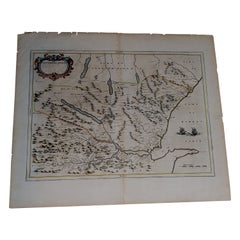
1654 Joan Blaeu Map the Sutherland, Scotland, Entitled "Southerlandia, "Ric0007
Located in Norton, MA
1654 Joan Blaeu map of the
Sutherland, Scotland, entitled
"Southerlandia,"
Hand Colored
Ric0007
Description:
Lovely map centered on Sedan and D...
Category
17th Century Dutch Antique Massachusetts Maps
Materials
Paper
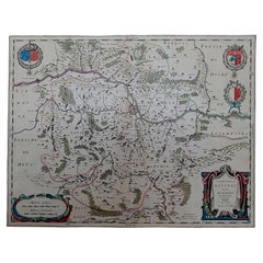
1640 Joan Bleau Map Entitled"Diocecese de rheims et le pais de rethel, " Eic.a011
Located in Norton, MA
1640 Joan Bleau map entitled
"Diocecese de rheims et le pais de rethel,"
Ric.a011
OAN BLAEU
Diocecese de Rheims, et le pais de Rethel.
Handcolored engraving, c.1640.
...
Category
17th Century Dutch Antique Massachusetts Maps
Materials
Paper
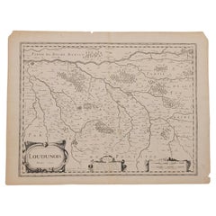
1627 Map Entitled "Loudunois, " Signed on the Back, Ric.a013
Located in Norton, MA
1627 map entitled
"Loudunois,"
Signed on the Back
Ric.a013
cartography close up double-page hand-colored elevated view no person print hand-tinted hilly close-up early 17th-...
Category
17th Century Dutch Antique Massachusetts Maps
Materials
Paper
1656 Jansson Map Metz Region of France Entitled "Territorium Metense" Ric0014
Located in Norton, MA
1656 Jansson map Metz Region of France entitled "Territorium Metense."
Ric0014
" Authentic" - Map of the historical region surrounding Metz, in Lorraine, France.
Oriented with ...
Category
17th Century Dutch Antique Massachusetts Maps
Materials
Paper
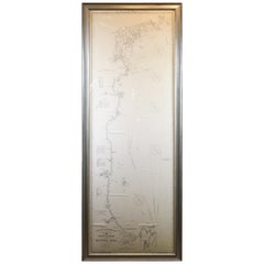
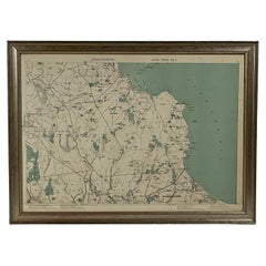
Original 1910 George Eldridge Chart
Located in Norwell, MA
Original framed 1910 George Eldridge chart "E" showing Gloucester to the Kennebec river. Showing the coast of Maine in great detail. Towns includ...
Category
20th Century Unknown Massachusetts Maps
1891 Map of Plymouth County Mass
Located in Norwell, MA
Original 1891 map showing Sandwich, Bourne, Plymouth Carver, Middleborough, Plympton and Kingston. Showing Long Beach in Plymouth also as well as all shore points. Cape Cod Bay is ma...
Category
1890s North American Antique Massachusetts Maps
Materials
Paper
Chart of Boston's North Shore
Located in Norwell, MA
Rarely found restrike of an 1804 chart by Nathanael Bowditch of the Harbors of Salem, Marblehead, Beverly, and Manchester.
Showing the Islands of Great Misery, Satan, Cuney, Winter,...
Category
1980s North American Vintage Massachusetts Maps
Materials
Paper
Original 1891 Walker Map
Located in Norwell, MA
Original 1891 map of Massachusetts by Walker. Towns include Cambridge, Boston, Dedham, Ashland, Brookline, Newton etc... burl wood frame. Measures...
Category
19th Century Antique Massachusetts Maps
Map of Harwich, Massachusetts
Located in Norwell, MA
Turn of the century map of Harwich, Massachusetts. Plate from a Cape Cod County Map book showing the Barnstable county town of Harwich including Allens Harbor, Pleasant Lake, Harwich...
Category
20th Century Massachusetts Maps
1891 Map of Norfolk County Massachusetts
Located in Norwell, MA
1891 map of Norfolk county Massachusetts including the towns of Wrentham, Franklin, Medfield, Sherborn, Norwood etc., measures: 23 x 31.
Category
19th Century Antique Massachusetts Maps
Recently Viewed
View AllMore Ways To Browse
Crystal Glass Luster Antique
Czech Malachite Glass
Daum France Limited Edition
David Palombo Menorahs
Dino Martens On Sale
Dip Pen
Dip Pens
Dorothy Draper Espana Chest
Dorothy Draper Heritage
Drexel Danish Modern
Drexel Heritage French
Dried Gourd
Dry Bar With Stools 3
Dutch Clog
Egyptian Granite
Elephant Howdah
Enamel Peacock Feather
English Chinoiserie Chest
