Antique Wall World Map

5
to
58
999
76
556
479
302
158
40
40
22
16
15
13
12
11
10
10
9
6
6
5
5
5
4
4
3
3
2
2
2
2
2
1
1
1
1
1
1
1
1
16
13
9
8
6
Sort By
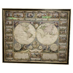
Colored wall map of the WORLD
By Chambon
Located in ZWIJNDRECHT, NL
huge wall map of the world in two hemispheres printed on two sheets, depicting the Eastern and Western
Category

Mid-18th Century French French Provincial Antique Wall World Map

Materials

Wood, Paper

Antique Colored wall map of the WORLD
Colored wall map of the WORLD
Free Shipping
H 45 in W 57 in D 0.8 in
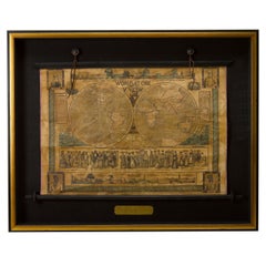
1847 “World at One View” Antique Hand-Colored Wall Map of the World
Located in Colorado Springs, CO
This is a highly desirable hanging wall map of the "World at One View", published in 1847 by Ensign
Category

19th Century American Antique Wall World Map

Materials

Paper

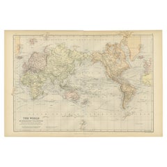
Colorful Detailed Antique Map of The World on Mercators Projection, 1882
Located in Langweer, NL
The 'World of Mercator's Projection' is a map with a stunning portrayal of global geography and
Category

1880s Antique Wall World Map

Materials

Paper

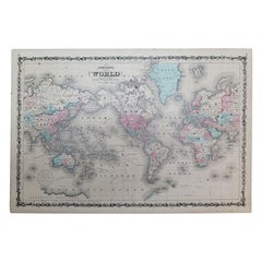
1864 Johnson's Map of the World on Mercator's Projection, Ric.B009
Located in Norton, MA
An 1864 Johnson's map of the World on Mercator's Projection Ric.b009 About this Item
Category

19th Century Dutch Antique Wall World Map

Materials

Paper

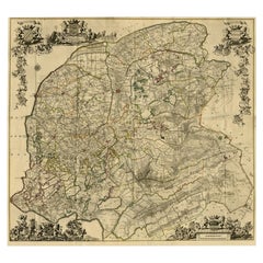
Large Antique Wall Map of Friesland by Vegelin van Claerbergen, 1739
Located in Langweer, NL
. Heeren Gedeputeerde Staeten'. Rare and large attractive wall map of Friesland, the so-called 'Vegelin
Category

18th Century Antique Wall World Map

Materials

Paper

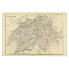
Original Antique Map of Switzerland, 1882
Located in Langweer, NL
'Comprehensive Atlas and Geography of the World,' meticulously crafted in 1882. This exquisite map intricately
Category

1880s Antique Wall World Map

Materials

Paper

Original Antique Map of Switzerland, 1882
H 14.97 in W 22.45 in D 0 in
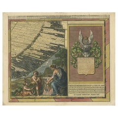
Antique Map of Delfland by Cruquius, 1712
Located in Langweer, NL
Map no. 25 of a large wall map of Delfland, The Netherlands. The map covers the region of Polder
Category

18th Century Antique Wall World Map

Materials

Paper

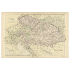
Original Antique Map of The Austrian Empire, 1882
Located in Langweer, NL
'Comprehensive Atlas and Geography of the World,' meticulously crafted in 1882. This intricate map beautifully
Category

1880s Antique Wall World Map

Materials

Paper

Original Antique Map of Russia in Europe, 1882
Located in Langweer, NL
'Comprehensive Atlas and Geography of the World,' meticulously crafted in 1882. This exquisite map intricately
Category

1880s Antique Wall World Map

Materials

Paper

Original Antique Map of Spain and Portugal, 1882
Located in Langweer, NL
'Comprehensive Atlas and Geography of the World,' meticulously crafted in 1882. This remarkable map intricately
Category

1880s Antique Wall World Map

Materials

Paper

Large Antique Map of Delfland by Cruquius, 1712
Located in Langweer, NL
Map no. 20 of a large wall map of Delfland, The Netherlands. The map covers the region of Pijnacker
Category

18th Century Antique Wall World Map

Materials

Paper

Antique Map of The German Empire (West Sheet), 1882
Located in Langweer, NL
, Bavaria & c. This isn't just a map; it's a gateway to a captivating past. Its presence on your wall
Category

1880s Antique Wall World Map

Materials

Paper

Antique Map of The German Empire (East Sheet), 1882
Located in Langweer, NL
'Comprehensive Atlas and Geography of the World,' meticulously crafted in 1882. This exquisite map intricately
Category

1880s Antique Wall World Map

Materials

Paper

1633 Map Entitled "Beauvaisis Comitatus Belova Cium, Ric.0002
Located in Norton, MA
den Keere * 1595 Europe (wall map): with Pieter van den Keere * 1598 World and the Continents * 1599
Category

17th Century Dutch Antique Wall World Map

Materials

Paper

Antique Map of Asia Showing Its Political Divisions, 1874
Located in Langweer, NL
company had specialized in the production of school atlases and wall maps of America. They were one of the
Category

19th Century Antique Wall World Map

Materials

Paper

Antique Map of Friesland by De Wit, c.1690
Located in Langweer, NL
cartographic material including separate terrestrial maps and sea charts, sea and terrestrial atlases, wall
Category

17th Century Antique Wall World Map

Materials

Paper

Antique Map of Friesland by De Wit, c.1690
H 20.87 in W 24.41 in D 0 in
Road Map, John Ogilby, No 54, London, Yarmouth, Britannia
By John Ogilby
Located in BUNGAY, SUFFOLK
-sixth year, as a publisher of maps and geographical accounts. Ogilby was born outside Dundee, in
Category

1670s English Baroque Antique Wall World Map

Materials

Paper

Antique Map of Vlaams-Brabant by Homann Heirs, c.1720
By Homann Heirs
Located in Langweer, NL
decorators all over the world. Our collection includes a wide range of authentic antique maps from the 16th
Category

18th Century Antique Wall World Map

Materials

Paper

Antique Map of Alentejo: Land of Tradition and Tranquility, 1903
Located in Langweer, NL
The image is a historical original antique map of the Alentejo region in Portugal. This map
Category

Early 1900s Antique Wall World Map

Materials

Paper

Antique Map of the Region of Pasuruan, Java, Indonesia, 1726
Located in Langweer, NL
"Map of the region around Pasuruan. It shows the location of rice fields, the village Bangil, as
Category

18th Century Antique Wall World Map

Materials

Paper

Original Antique Map of Italy with an Inset of Sardinia, 1882
Located in Langweer, NL
'Comprehensive Atlas and Geography of the World,' meticulously crafted in 1882. This captivating map intricately
Category

1880s Antique Wall World Map

Materials

Paper

1915 "San Francisco City and County" Hanging Map by W. Bashford Smith
Located in Colorado Springs, CO
Presented is a rare wall map of San Francisco by W. Bashford Smith. Published in San Francisco in
Category

1910s American Art Deco Antique Wall World Map

Materials

Wood, Paper

Original Antique Map of the Philippines, Malaysia, Indonesia, Singapore, c.1690
Located in Langweer, NL
Antique map titled 'Isole dell' Indie, diuise in Filippine, Molucche e della Sonda'. Old map of
Category

1690s Antique Wall World Map

Materials

Paper

Ávila in a Historical Map of 1902: A Geographic and Administrative Overview
Located in Langweer, NL
The map is of the province of Ávila, one of the provinces of the autonomous community of Castile
Category

Early 1900s Antique Wall World Map

Materials

Paper

Antique Map of China, Tartary and Central Asia by Blaeu, c.1645
Located in Langweer, NL
Blaeu drew this map this part of the world was almost entirely unknown. Blaeu relied on the journals of
Category

17th Century Antique Wall World Map

Materials

Paper

Antique Map of the Region of Paris by Homann Heirs, c.1720
By Homann Heirs
Located in Langweer, NL
(..).' Incredibly detailed map showing everything from tiny villages to forests, farmland, walled cities and more
Category

18th Century Antique Wall World Map

Materials

Paper

Antique Map of Tibet, The Gobi Desert and China by Bellin, circa 1764
Located in Langweer, NL
antique maps to collectors, historians, educators and interior decorators all over the world. Our
Category

18th Century Antique Wall World Map

Materials

Paper

Map Road Strip Britannia Sheet 2 John Ogilby London Aberistwith Islip Bramyard
By John Ogilby
Located in BUNGAY, SUFFOLK
of England and Wales. Strip map Islip to Bramyard, on a scale of approximately one inch to the mile
Category

17th Century English Baroque Antique Wall World Map

Materials

Paper

Road Map John Ogilby No 75 Kings Lyn Harwich, Britannia Framed Wallhanging
By John Ogilby
Located in BUNGAY, SUFFOLK
, as a publisher of maps and geographical accounts. Ogilby was born outside Dundee, in 1600, the
Category

1670s European Baroque Antique Wall World Map

Materials

Paper

Map Road John Ogilby Britannia No 74 Ipswich to Norwich Cromer Framed
By John Ogilby
Located in BUNGAY, SUFFOLK
his sixty-sixth year, as a publisher of maps and geographical accounts. Ogilby was born outside
Category

1670s English Baroque Antique Wall World Map

Materials

Paper

Antique Map of Ambon with Inset of the Victoria Castle, Moluku, Indonesia, 1726
Located in Langweer, NL
Antique map titled 'Caart van het Eyland Ambonia in het bijsonder. ' This is a print of an antique
Category

18th Century Antique Wall World Map

Materials

Paper

Antique Map of Cities of the Province of Che-Kiang in China, 1738
Located in Langweer, NL
Antique map titled 'Cities of the Province of Che-Kyang'. Old map depicting four walled cities of
Category

18th Century Antique Wall World Map

Materials

Paper

Antique Map of Cities of the Province of Che-Kyang in China, 1738
Located in Langweer, NL
Antique print China titled 'Cities of the Province of Che-Kyang'. Old map depicting four walled
Category

18th Century Antique Wall World Map

Materials

Paper

Antique Map of Denmark with Details of Fortresses, Cities, Towns Etc, c.1680
Located in Langweer, NL
terrestrial atlases, wall maps, and town views. Many of his maps were superbly colored by master Dutch
Category

17th Century Antique Wall World Map

Materials

Paper

Antique Map of Cities in the Hubei and Hunan Provinces of China, 1755
By Jacques-Nicolas Bellin
Located in Langweer, NL
world. Our collection includes a wide range of authentic antique maps from the 16th to the 20th
Category

18th Century Antique Wall World Map

Materials

Paper

Empires of the East: An Ornate Tallis Map of Tibet, Mongolia, and Manchuri, 1851
Located in Langweer, NL
This original - with hand-colored borders- map of Tibet, Mongolia, and Manchuria is an example of
Category

1850s Antique Wall World Map

Materials

Paper

Road Map No43 London to Kings Lynn, Royston to Downham, John Ogilby, Britannia
By John Ogilby
Located in BUNGAY, SUFFOLK
John Ogilby (British 1600-1676) Cosmographer and Geographick Printer to Charles II. A road map
Category

Late 17th Century British Charles II Antique Wall World Map

Materials

Paper

Road Map John Ogilby London St David's Britannia No 15 Abingdon Monmouth Framed
By John Ogilby
Located in BUNGAY, SUFFOLK
John Ogilby (British 1600-1676) Cosmographer and Geographick Printer to Charles II. A road map from
Category

1670s English Baroque Antique Wall World Map

Materials

Paper

Antique Map of China and Korea incl Formosa and Hainan, by Janssonius, ca.1650
Located in Langweer, NL
troughout the map. Including the Islands of Formosa (Taiwan) and Hainan. The Great Wall of China is also
Category

17th Century Antique Wall World Map

Materials

Paper

Original Antique Map of the South Part of Italy with an Inset of Malta, 1882
Located in Langweer, NL
walls. Bring home this antique map today and let its historical charm transport you to the captivating
Category

1880s Antique Wall World Map

Materials

Paper

Handsome Old Detailed Map of the Low Countries by Famous Mapmaker Blaeu, ca.1635
Located in Langweer, NL
sought after- detailed map of the Low Countries by the world most famous map maker Blaeu. With beautiful
Category

1630s Antique Wall World Map

Materials

Paper

Old Detailed Trade Route and Shipping Map from Italy to the Low Countries, c1671
Located in Langweer, NL
, sea and terrestrial atlases, wall maps, and town views. Many of his maps were superbly colored by
Category

17th Century Antique Wall World Map

Materials

Paper

Rare Unusual Antique Map of Asia with a Landbridge from Korea to America, 1717
Located in Langweer, NL
Antique map titled 'L'Asie Suivant les Nouvelles Decouvertes (..).' Interesting and very unusual
Category

18th Century Antique Wall World Map

Materials

Paper

Antique Map of Walcheren in the Province of Zeeland, the Netherlands, ca.1910
Located in Langweer, NL
Antique map of Walcheren, part of the province of Zeeland, the Netherlands. Shows the cities of
Category

1910s Antique Wall World Map

Materials

Paper

City View of Nuremberg, Germany: An 18th Century Hand-Colored Map by M. Seutter
By Matthew Seutter
Located in Alamo, CA
colorful plan of the city of Nuremberg depicts the city walls and ramparts, as well as buildings and
Category

Mid-18th Century German Antique Wall World Map

Materials

Paper

Road Map Britannia No 32 the Road from London to Barnstable John Ogilby Framed
By John Ogilby
Located in BUNGAY, SUFFOLK
A road map from Britannia, by John Ogilby Esq., Cosmographer and Geographick Printer to Charles II
Category

Late 17th Century English Charles II Antique Wall World Map

Materials

Paper

Road Map Britannia No 15 London to St Davids John Ogilby Brown Gilt Frame
By John Ogilby
Located in BUNGAY, SUFFOLK
Lechlade, to Fairford, to Barnsley to Gloucester showing Monmouth as the destination. A road map from
Category

Late 17th Century British Charles II Antique Wall World Map

Materials

Paper

Antique Map of Asia and the East Indies and Korea as a Peninsula, ca.1660
Located in Langweer, NL
Antique map titled 'Asiae nova delineatio'. Decorative map of Asia and the East Indies. The map
Category

17th Century Antique Wall World Map

Materials

Paper

Road Map Britannia No 25 London to the Lands End, John Ogilby Brown Gilded Frame
By John Ogilby
Located in BUNGAY, SUFFOLK
Senan in Cornwall. By John Ogilby His Majesties Cosmographer. A road map from Britannia, 1675/6. No 25
Category

Late 17th Century British Charles II Antique Wall World Map

Materials

Paper

Road Map Britannia 1675/6 No 5 Road London to Barwick, London Stilton Grey Frame
By John Ogilby
Located in BUNGAY, SUFFOLK
John Ogilby (British 1600-1676) cosmographer and geographick printer to Charles II. A road map from
Category

Late 17th Century British Charles II Antique Wall World Map

Materials

Paper

Lugo 1901: A Cartographic Chronicle of Galicia's Ancient Roman Walled City
Located in Langweer, NL
for its well-preserved Roman walls, which encircle the old town and are a UNESCO World Heritage site
Category

Early 1900s Antique Wall World Map

Materials

Paper

Antique Map of the World by Ferrario '1831'
Located in Langweer, NL
Original antique map of the world. This print originates from 'Costume Antico e Moderno: Palestine
Category

Mid-19th Century Antique Wall World Map

Materials

Paper

Antique Map of the World by Ferrario '1831'
H 9.45 in W 13.39 in D 0.02 in
Original Antique World War One Humoros Wap Map Of The World WWI Japan Caricature
Located in London, GB
Original antique World War One satirical map of Europe and Asia portraying the outbreak of WWI
Category

1910s Japanese Antique Wall World Map

Materials

Paper

19th Century Embroidered Silk Panel Map Of The World
Located in Forney, TX
-crafted in Continental Europe in the 19th century, depicting map of the world, double hemisphere, having a
Category

19th Century European Victorian Antique Wall World Map

Materials

Silk, Thread

Maps of the Ancient World and the Posterity of Noah, 1820
Located in Langweer, NL
Two maps on one sheet. Hhand colored engraved lithograph, depicting the world as known to the
Category

19th Century Antique Wall World Map

Materials

Paper

Antique 20th Century Large Scrolled Map Of The World, George Philips c.1918
Located in Royal Tunbridge Wells, Kent
Antique early-20th Century large commercial map of the world by George Philips. This scrolled map
Category

1910s British Other Antique Wall World Map

Materials

Wood, Paper

1800s French Map of the World in Two Hemispheres - Le Dictionnaire Géographique
Located in Montréal, CA
Mappe-Monde. En deux Hemispheres Pour le Dictionnaire Géographique. Author: Vosgien and Caillot Source / Publication: Le Dictionnaire Géographique, ou Description de toutes les Parti...
Category

Early 19th Century French Antique Wall World Map

Materials

Paper

Ancient Cartography of Britannia and Hibernia, Published in 1880
Located in Langweer, NL
This map depicts the geographical area of Great Britain and Ireland, labeled "BRITANNIA et HIBERNIA
Category

1880s Antique Wall World Map

Materials

Paper

Zaragoza: Crossroads of Heritage - The 1901 Cartographic Chronicle
Located in Langweer, NL
The print on sale is a historical map of the province of Zaragoza, Spain, dated 1901. The title on
Category

Early 1900s Antique Wall World Map

Materials

Paper

A Catalonian Cartographic Depiction of Tarragona Province, 1901
Located in Langweer, NL
are part of the Archaeological Ensemble of Tárraco, a UNESCO World Heritage site. The map details the
Category

Early 1900s Antique Wall World Map

Materials

Paper

  • 1
  • ...
Get Updated with New Arrivals
Save "Antique Wall World Map", and we’ll notify you when there are new listings in this category.

Antique Wall World Map For Sale on 1stDibs

Choose from an assortment of styles, material and more with respect to the antique wall world map you’re looking for at 1stDibs. Frequently made of paper, fabric and metal, every antique wall world map was constructed with great care. Whether you’re looking for an older or newer antique wall world map, there are earlier versions available from the 18th Century and newer variations made as recently as the 20th Century. An antique wall world map is a generally popular piece of furniture, but those created in Baroque, Georgian and Victorian styles are sought with frequency. A well-made antique wall world map has long been a part of the offerings for many furniture designers and manufacturers, but those produced by Cook, James Cook and Jacobus Houbraken are consistently popular.

How Much is a Antique Wall World Map?

The average selling price for an antique wall world map at 1stDibs is $264, while they’re typically $82 on the low end and $275,000 for the highest priced.

Finding the Right prints for You

Prints are works of art produced in multiple editions. Though several copies of a specific artwork can exist, collectors consider antique and vintage prints originals when they have been manually created by the artist or are “impressions” that are part of the artist’s intent for the work.

Modern artists use a range of printmaking techniques to produce different types of prints such as relief, intaglio and planographic. Relief prints are created by cutting away a printing surface to leave only a design. Ink or paint is applied to the raised parts of the surface, and it is used to stamp or press the design onto paper or another surface. Relief prints include woodcuts, linocuts and engravings.

Intaglio prints are the opposite of relief prints in that they are incised into the printing surface. The artist cuts the design into a block, plate or other material and then coats it with ink before wiping off the surface and transferring the design to paper through tremendous pressure. Intaglio prints have plate marks showing the impression of the original block or plate as it was pressed onto the paper.

Artists create planographic prints by drawing a design on a stone or metal plate using a grease crayon. The plate is washed with water, then ink is spread over the plate and it adheres to the grease markings. The image is then stamped on paper to make prints.

All of these printmaking methods have an intricate process, although each can usually transfer only one color of ink. Artists use separate plates or blocks for multiple colors, and together these create one finished work of art.

Find prints ranging from the 18th- and 19th-century bird illustrations by J.C. Sepp to mid-century modern prints, as well as numerous other antique and vintage prints at 1stDibs. Browse the collection today and read about how to arrange wall art in your space.

Read More

In Francks Deceus’s ‘Mumbo Jumbo #5,’ the Black Experience Is . . . Complicated

Despite the obstacles, the piece’s protagonist navigates the chaos without losing his humanity.

12 Floral-Accented Rooms with a Handmade, Folkloric Feel

Who needs a flower garden? Just use your imagination — and some beautifully patterned wallpaper or fabric — to bring the outdoors in.

This Wolf Kahn Pastel Is the Epitome of Beauty at Its Most Essential

A longtime admirer of Kahn’s work, 1stDibs editorial director Anthony Barzilay Freund explores why it’s relevant now more than ever.

Why Jules Chéret Was the King of the Modern Poster

The streets of fin-de-siècle Paris were set aglow with colorful poster ads, thanks to the printing techniques invented by Jules Chéret. Now, the Milwaukee Art Museum is celebrating this undersung talent in America's first solo show dedicated his exuberant works.

Anna Condo’s Multifaceted Career Spans Film, Photography and NFTs

From her historic Manhattan townhouse, the talented creator and curator of 1stDibs' latest NFT exhibition tells us about the art in her home and how she got involved with cryptoart.

How Keith Rivers Went from NFL Linebacker to Blue-Chip Art Aficionado

The former football player is as serious about becoming a great contemporary-art patron as he once was about making tackles. Here, Rivers tells us how he got the collecting bug and how his tastes have evolved over the years.

More Than Ever, the Female Design Council Is Embracing Funked-Up Creativity

The organization's "Womxn’s History Month" collection celebrates female-identified creators pushing the boundaries of technique and material.

This New Orleans Antiques Dealer’s Stylish Home Doubles as Her Art Studio

A former lawyer, Karina Gentinetta has achieved second-act success as a furniture gallerist and painter.