Map Of Madagascar

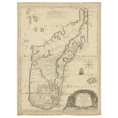
Antique Map of Madagascar by Mariette 'c.1670'
Located in Langweer, NL
Antique map titled 'Isle Dauphine communement nommée par les Europeens Madagascar, et St. Laurens
Category

Antique Mid-17th Century Maps

Materials

Paper

Antique Map of Madagascar by Mariette 'c.1670'
H 24.22 in W 18.12 in D 0.02 in
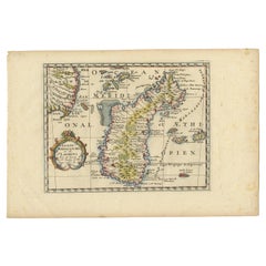
Antique Map of Madagascar by N. Sanson, circa 1680
By Nicolas Sanson
Located in Langweer, NL
Antique map titled 'Isle de Madagascar ou de St. Laurens. Tiree de Sanutu &c'. Antique map of
Category

Antique Late 17th Century Maps

Materials

Paper

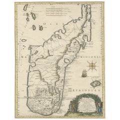
Beautiful Antique Map of Madagascar, The Comoros Islands & Reunion Island, 1667
Located in Langweer, NL
Antique map titled 'Isle d'Auphine, communement Nommée par les Europeens Madagascar, et St. Laurens
Category

Antique 1660s Maps

Materials

Paper

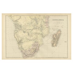
Antique Decorative Coloured Map of South Africa and Madagascar, 1882
Located in Langweer, NL
The map of South Africa is from the Blackie & Son Atlas, published in 1882. This historical map is
Category

Antique 1880s Maps

Materials

Paper

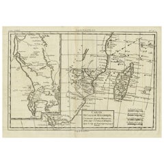
Antique Map of Mozambique Channel with Madagascar and Inset of Cape Region, 1780
Located in Langweer, NL
Antique map titled 'Carte du canal de Mosambique, contenant l'Isle de Madagascar avec les Cotes
Category

Antique 18th Century Maps

Materials

Paper

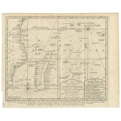
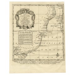
Antique Map of the Coast of Zanguebar and Madagascar 'Africa' by J. van Schley
Located in Langweer, NL
Decorative map of the area between the east coast of South Africa, the Seychelles, Mauritius and
Category

Antique Mid-18th Century Maps

Materials

Paper

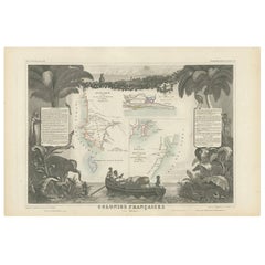
Antique Map of the French Colonies in Senegal and Madagascar by V. Levasseur
By Victor Levasseur
Located in Langweer, NL
French colonies located in Senegal and Madagascar within Africa. Surrounding the map are captivating
Category

Antique Mid-19th Century Maps

Materials

Paper

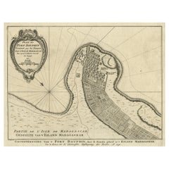
Antique Plan of Fort Dauphin on Madagascar of the East Coast of Africa, 1756
Located in Langweer, NL
Antique map titled 'Plan du Fort Dauphin (..) - Grondtekening van 't Fort Dauphin'. Plan of
Category

Antique 1750s Maps

Materials

Paper

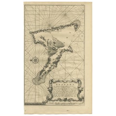
Antique Map of Anjouan Island by Valentijn, 1726
By F. Valentijn
Located in Langweer, NL
situated between Madagascar and Africa. The map is oriented with north to the left with the King's Palace
Category

Antique Early 18th Century Dutch Maps

Original Detailed Antique Map of the East Coast of Africa, 1747
Located in Langweer, NL
Antique map titled 'Carte de la coste Orientale d'Afrique - Kaart van de Oostkust van Afrika
Category

Antique 1740s Maps

Materials

Paper

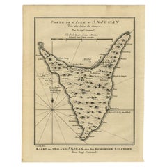
Antique Map of Anjouan or Ndzuani Island, Part of The Comoros, 1749
Located in Langweer, NL
Antique map titled ‘Carte de L’Isle D’Anjouan - Kaart van 't Eiland Anjouan’. Original antique map
Category

Antique 18th Century Maps

Materials

Paper

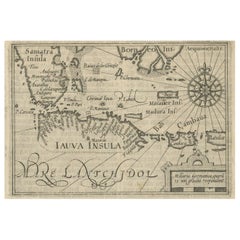
Rare Small Map of Sumatra, Java, Borneo, Macassar, Madura, Bali, 1614
Located in Langweer, NL
One of the first maps of the Indonesia islands of Java, Bali, Sumbawa etc. in early days of the
Category

Antique Early 17th Century Maps

Materials

Paper

Antique Map of Mozambique and Cape of Good Hope with Kingdom Monomotapa, 1780
Located in Langweer, NL
Antique map titled 'Carte Du Canal De Mozambique.' The main map, on the right, covers from the Cape
Category

Antique 18th Century Maps

Materials

Paper

Antique Map of the Islands Near Batavia, Capital of the Dutch East Indies, 1682
Located in Langweer, NL
Antique map titled 'Caerte van de Eylanden voor Batavia.' Map of the islands near Batavia
Category

Antique 17th Century Maps

Materials

Paper

Old Map of Indian Ocean & Sumatra, Java, Borneo, India, Arabia, Africa, c.1783
Located in Langweer, NL
and Madagascar. This map originates from 'Illustrations de Histoire naturelle des minéraux' by Buffon
Category

Antique 1780s Maps

Materials

Paper

"Africa Vetus": a 17th Century Hand-Colored Map by Sanson
By Nicolas Sanson
Located in Alamo, CA
This original hand-colored copperplate engraved map of Africa entitled "Africa Vetus, Nicolai
Category

Antique Late 17th Century French Maps

Materials

Paper

Africa: A Large 17th Century Hand-Colored Map by Sanson and Jaillot
By Nicolas Sanson
Located in Alamo, CA
This large original hand-colored copperplate engraved map of Africa entitled "L'Afrique divisee
Category

Antique 1690s French Maps

Materials

Paper

Antique Engraving of the Island Nzwani or Anzuany of the Comoros Islands, 1726
Located in Langweer, NL
Historical titles: Ansjouan, Ansuany, Anjouan, Anzuani, Anzuany Country: Comoros The map is taken
Category

Antique 1720s Maps

Materials

Paper

Original Antique Print of the Chinese City of Kinnungam with its Ramparts, 1665
Located in Langweer, NL
in Batavia until 1670. He then disappeared without trace on Madagascar, traveling in a sloop from
Category

Antique 1660s Maps

Materials

Paper

Rare Engravings of Council of War in Bantam and Javanese Local Traders, 1614
Located in Langweer, NL
text of the first voyage around the Cape to the East Indies (including a visit to Madagascar), the
Category

Antique Early 17th Century Maps

Materials

Paper

Original Vintage Poster Illustrated Map Madagascar French Colony Industry Travel
Located in London, GB
Original vintage travel poster for Madagascar located in the Indian Ocean near Africa featuring an
Category

Vintage 1930s French Posters

Materials

Paper

Rare Print of a Malagasy of the Tribe of Betsimtsavaks, Madagascar, 1850
Located in Langweer, NL
Malagasy of the Tribe of Betsimtsavaks, Madagascar. This print originates from 'Costumes Moderne (Musée de
Category

Antique 19th Century Prints

Materials

Paper

Giant Egg of the Extinct 'Elephant Bird'
Located in London, GB
, illustrative of the unique fauna and flora which developed on the island of Madagascar after the island split
Category

Antique 15th Century and Earlier Malagasy Natural Specimens

Materials

Eggshell

Giant Egg of the Extinct 'Elephant Bird'
Free Shipping
H 11.23 in Dm 7.76 in
Antique Print of Church Valley on the Island of St. Helena and a Hunting Scene
By Johannes Nieuhof
Located in Langweer, NL
1670. He then disappeared without trace on Madagascar, traveling in a sloop from which he had landed to
Category

Antique 18th Century Prints

Materials

Paper

Antique Chart of the Southern Pole, Showing Three Routes of Captain Cook, 1803
Located in Langweer, NL
Antique map titled 'Kaart van het Zuider Halfrond'. Circular chart within a square frame centred on
Category

Antique 19th Century Prints

Materials

Paper

People Also Browsed

Four 18th Century Engraved and Hand-Colored Maps by Weigel
By Christoph Weigel
Located in Copenhagen, K
Small collection of four engraved maps of Italy, Balkan and of Central Asia. Two are of Italy, one Corsica and Northern Italy and the other of the Southern Italian boot. All are...
Category

Antique 18th Century German Maps

Materials

Paper

Konno Card Holder in Stainless Steel and Dark Grey by Georg Jensen
By Georg Jensen
Located in New York, NY
Hiromichi Konno’s cardholder is intended to simplify the process of exchanging business cards by bringing elegance to the business world. Designer Hiromichi Konno had a Mission: to m...
Category

21st Century and Contemporary Chinese Modern More Desk Accessories

Materials

Stainless Steel

16th Century Italian Renaissance Carving of a Male Saint
Located in Stamford, CT
16th century Italian carved and polychromed figure of a male saint or prophet with a wonderful presence. Shown holding an open book in his right hand with flames at his feet, mid-16t...
Category

Antique 16th Century Italian Renaissance Religious Items

Materials

Wood

21st Century Sagres Sideboard Veneered Poplar Wood Root Translucent Varnish
Located in RIO TINTO, PT
Sagres is an iconic parish in the south of Portugal: Algarve. This beautiful place inspired Malabar to create the Sagres Sideboard, a stunning contemporary piece. The polished brass ...
Category

21st Century and Contemporary Portuguese Sideboards

Materials

Brass, Gold Leaf

[World War Two map] - Dunkirk to Berlin June 1940.
Located in London, GB
[World War Two map] Dunkirk to Berlin June 1940 - July 1945 - A Map of the Journeys Undertaken by The Rt. Hon. Sir Winston Churchill, K.G., O.M. C.H. in Defence of the British Commo...
Category

1940s Other Art Style More Art

Materials

Color

Antique Map of Bourbon/Reunion 'France' by V. Levasseur, 1854
By Victor Levasseur
Located in Langweer, NL
Antique map titled 'Ile de la Réunion'. Map of the French department of Ile. Bourbon or Reunion. Bourbon, or Reunion, is a volcanic island off the coast of Africa. It is one of Franc...
Category

Antique Mid-19th Century Maps

Materials

Paper

Antique Map of Bourbon, or Reunion, Colony of France
Located in Langweer, NL
Original antique map titled 'Ile de la Réunion'. This is a fascinating map of the French department of Ile. Bourbon or Reunion. Bourbon, or Reunion, is a volcanic island off the coas...
Category

Antique Mid-19th Century Maps

Materials

Paper

Nice Decorative Hand-Colored Antique Map of Italy, ca.1745
Located in Langweer, NL
Antique map Italy titled 'A New Map of Italy from the lastest observations'. Antique map of Italy originating from 'Geography Anatomiz'd: or, The Geographical Grammar'. Artists a...
Category

Antique 1740s Maps

Materials

Paper

Map of The Italian Peninsula with the islands of Sicily, Sardinia, Corsica, 1880
Located in Langweer, NL
This map, titled "ITALIA, Sicilia, Sardinia, Corsica," represents the Italian Peninsula along with the islands of Sicily, Sardinia, and Corsica. Inset maps offer detailed views of "R...
Category

Antique 1880s Maps

Materials

Paper

Antique Map of Southern Italy by J. Tallis, circa 1851
Located in Langweer, NL
Decorative and detailed mid-19th century map of Southern Italy which was drawn and engraved by John Rapkin (vignettes by A. H. Wray and J. Rogers) and published in John Tallis & Co.'...
Category

Antique Mid-19th Century Maps

Materials

Paper

Antique Map of France under the reign of Henry III by Zannoni, 1765
Located in Langweer, NL
Antique map France titled 'Carte de la réunion des Comtés d'Evreux et d'Alencon (..)'. Beautiful old map of France. This map originates from 'Atlas Historique de la France Ancienne e...
Category

Antique 18th Century Maps

Materials

Paper

Antique Map of Italy, North Part, by W. G. Blackie, 1859
Located in Langweer, NL
The "Antique Map of Italy, North Part" by W. G. Blackie, dated 1859, is a historically significant cartographic piece, showcasing the northern region of Italy in the mid-19th century...
Category

Antique Mid-19th Century Maps

Materials

Paper

"TAMALE CART" BLACK FOLK ARTIST FROM SAN ANTONIO TEXAS ARTIST
By Johnny Banks
Located in San Antonio, TX
Johnny Banks (1912-1988) San Antonio Artist Image Size: 10.5 x 13.5 Frame Size: 17.25 x 20.25 Medium: Multimedia "Tamale Cart" Biography Johnny Banks (1912-1988) In my opinion one of...
Category

20th Century Folk Art Mixed Media

Materials

Color Pencil, Crayon

Stunning Antique Map of Northern Italy by J.B. Homann, circa 1745
By Johann Baptist Homann
Located in Langweer, NL
This beautiful hand-colored map covers from Bergamo east as far as Albona (Labin) and from Vipiteno Sterzing south as far as Florence. The map is exceptionally detailed, noting tow...
Category

Antique Mid-18th Century Maps

Materials

Paper

Antique Map of India and Ceylon, along with the Maldives
Located in Langweer, NL
Antique map titled 'Stato del Mogol con l'Isole di Ceilan e Maldive'. Beautiful map of India and Ceylon, along with the Maldives. Includes a large decorative title cartouche. The map...
Category

Antique Late 18th Century Maps

Materials

Paper

Antique German Print of a Meeting at Court, c.1650
Located in Langweer, NL
Antique print titled 'Des Königs Mündigkeit'. This print depicts a meeting at court. Source unknown, to be determined. Artists and Engravers: Anonymous. Condition: Good, genera...
Category

Antique 17th Century Prints

Materials

Paper

Recent Sales

Rare Small Engravings of the Dutch Siege of Malacca in 1606, Published in 1614
Located in Langweer, NL
includes the text of the first voyage around the Cape to the East Indies (including a visit to Madagascar
Category

Antique 1610s Maps

Materials

Paper

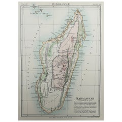
Original Antique Map of Madagascar, East Africa, 1889
Located in St Annes, Lancashire
Great map of Madagascar Drawn and Engraved by W. & A.K. Johnston Published By A & C Black
Category

Antique 1880s Scottish Victorian Maps

Materials

Paper

Original Antique Map of Madagascar, East Africa, 1889
1 bid
No Reserve
H 11 in W 8 in D 0.07 in
Antique Map of Madagascar by N. Sanson, circa 1683
Located in Langweer, NL
Antique map titled 'Isle de Madagascar ou de St. Laurens. Tiree de Sanutu &c'. Antique map of
Category

Antique Late 17th Century Maps

Get Updated with New Arrivals
Save "Map Of Madagascar", and we’ll notify you when there are new listings in this category.

Map Of Madagascar For Sale on 1stDibs

At 1stDibs, there are many versions of the ideal map of Madagascar for your home. A map of Madagascar — often made from paper, eggshell and shell — can elevate any home. Your living room may not be complete without a map of Madagascar — find older editions for sale from the 18th Century and newer versions made as recently as the 20th Century. Nicolas Sanson, F. Valentijn and Victor Levasseur each produced at least one beautiful map of Madagascar that is worth considering.

Finding the Right collectibles-curiosities for You

Antique and vintage collectibles and curiosities can bring whimsy and wonder to any interior. 

Decorating with old scientific instruments, historical memorabilia and vintage musical instruments, as well as other authentic collectibles and curiosities that can be found on 1stDibs, presents an opportunity to create a unique, natural history museum-like atmosphere in your home that can provoke conversation as often as it pays tribute to how far we’ve come in understanding our world. 

And bringing collectibles and curiosities into your space is actually on trend — Wunderkammern, or curiosity cabinets, were all the rage in Europe during the 1500s and continued to have adherents there and in the U.S. in the following centuries. Today, however, they’re experiencing a real surge in popularity and influencing how many interior designers are furnishing and decorating homes — combining contemporary with antique, scientific with tribal, earthly with extraterrestrial, Les Lalanne tables with Flemish tapestries.

The original Wunderkammern were entire rooms filled with objects demonstrating their owners’ worldly knowledge: A proper one included artificiala or preciosa (objets d’art); naturalia (such as skeletons, shells, minerals); exotica (taxidermy or dried plants); and scientifica (scientific instruments), frequently alongside religious relics and ancient artifacts.

Pay tribute to a history of rich and diverse musical traditions that have taken shape all over the world by decorating your home with a collection of antique and vintage musical instruments — with a little help from strong hanging wire or some wall hooks, vintage brass instruments such as a gong, French horn or trumpet can help elevate a home office or complement the efforts you’ve made to ensure a welcoming vibe in your home’s entryway. Bells or antique wind instruments can add provocative metallic contrasts to dark woods as tabletop decorative objects.  

Create an intriguing focal point with Georgian scientific instruments, such as stick barometers with mahogany cases or lacquered brass telescopes. These items stem from an era named for the monarchies of the four King Georges, who ruled England in succession starting in 1714 (plus King William’s reign, which lasted until 1837). Just as there was beautiful jewelry produced during the period that today is coveted by collectors, there is much to be found in the collectibles and curiosities realm too.

Wanderlust, nostalgia and a shared love of good design are contributing factors to certain trends in decorating — just as vintage trunks and luggage have reappeared as furniture or home accents in a bedroom or foyer, decorating with globes, maps or nautical objects is similarly rooted in the allure of travel and a penchant for the stylish finishing touch that collectibles bring to our homes.

Find a wide range of antique and vintage collectibles and curiosities on 1stDibs.

Questions About Map Of Madagascar
  • 1stDibs ExpertApril 5, 2022
    A Madagascar ruby is mined from the island of Madagascar. The island is known to have a wealth of ruby deposits. The rubies found here can be quite large, have good clarity and are an intense, medium-to-deep red color. Shop a variety of Madagascar ruby jewelry on 1stDibs.

Read More

Pamela Shamshiri Shares the Secrets behind Her First-Ever Book and Its Effortlessly Cool Interiors

The sought-after designer worked with the team at Hoffman Creative to produce a monograph that beautifully showcases some of Studio Shamshiri's most inspiring projects.

Moroccan Artworks and Objects Take Center Stage in an Extraordinary Villa in Tangier

Italian writer and collector Umberto Pasti opens the doors to his remarkable cave of wonders in North Africa.

Montecito Has Drawn Royalty and Celebrities, and These Homes Are Proof of Its Allure

Hollywood A-listers, ex-pat aristocrats and art collectors and style setters of all stripes appreciate the allure of the coastal California hamlet — much on our minds after recent winter floods.

Whaam! Blam! Pow! — a New Book on Pop Art Packs a Punch

Publishing house Assouline and writer Julie Belcove have teamed up to trace the history of the genre, from Roy Lichtenstein, Andy Warhol and Yayoi Kusama to Mickalene Thomas and Jeff Koons.

The Sparkling Legacy of Tiffany & Co. Explained, One Jewel at a Time

A gorgeous new book celebrates — and memorializes — the iconic jeweler’s rich heritage.

What Makes a Gem-Encrusted Chess Set Worth $4 Million?

The world’s most opulent chess set, weighing in at 513 carats, is literally fit for a king and queen.

Tauba Auerbach’s Geometric Pop-Up Book Is Mighty Rare, Thanks to a Hurricane

This sculptural art book has an epic backstory of its own.

Step inside the Storied Mansions of Palm Beach’s Most Effervescent Architect

From Spanish-style courtyards to fanciful fountains, these acclaimed structures abound in surprising and elegant details.