18th Century and Earlier More Prints
to
24
100
90
27
19
2
Overall Width
to
Overall Height
to
34
2
1
26
13
11
7
5
238
496
4,438
3,006
27
55
82
125
232
364
753
1,029
578
389
176
133
103
2
7
3
2
2
2
2
2
2
2
1
1
1
1
1
1
1
1
1
1
1
204
44
19
12
12
31
61
139
26
Period: 18th Century and Earlier
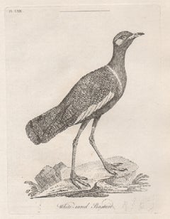
White-eared Bustard, 18th century bird engraving by John Latham
By John Latham
Located in Melbourne, Victoria
Copper-line engraving. 1781. From John Latham's 'General Synopsis of Birds' 1781-1785, and its Supplements. Plate number top left. Laid paper.
John Latham was the leading English or...
Category
Naturalistic 18th Century and Earlier More Prints
Materials
Engraving
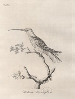
Harlequin Humming-Bird, 18th century bird engraving by John Latham
By John Latham
Located in Melbourne, Victoria
Copper-line engraving. 1781. From John Latham's 'General Synopsis of Birds' 1781-1785, and its Supplements. Plate number top left. Laid paper.
John Latham was the leading English or...
Category
Naturalistic 18th Century and Earlier More Prints
Materials
Engraving
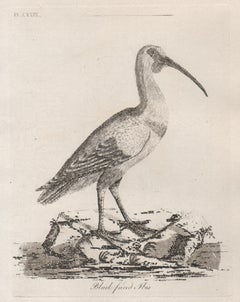
Black faced Ibis, 18th century bird engraving by John Latham
By John Latham
Located in Melbourne, Victoria
Copper-line engraving. 1781. From John Latham's 'General Synopsis of Birds' 1781-1785, and its Supplements. Plate number top left. Laid paper with watermark.
John Latham was the lea...
Category
Naturalistic 18th Century and Earlier More Prints
Materials
Engraving
West Germany: Original Hand Colored 17th Century Map by Johannes Janssonius
Located in Alamo, CA
An original hand colored copperplate engraved map entitled in Latin "Archiepiscopatus Maghdeburgensis et Anhaltinus Ducatus cum terris adjacentibus", published in Amsterdam in 1640 i...
Category
Old Masters 18th Century and Earlier More Prints
Materials
Engraving
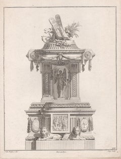
French Neoclassical design for a Pulpit, engraving after Delafosse
Located in Melbourne, Victoria
Copper-line engraving. C1768.
Delafosse was a French decorative designer, engraver and architect. Apprenticed for a time to a sculptor, by 1767 he styled himself an 'architect and professor of design'. He published the first volume of his most important work, 'Nouvelle Iconologie Historique' in 1768, containing 110 plates of his designs for furniture, decorative arts and architectural...
Category
French School 18th Century and Earlier More Prints
Materials
Engraving
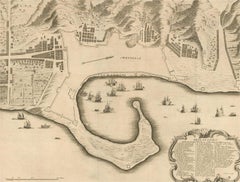
18th Century Map Engraving - Plan of the Works of the City of Messina, Sicily
Located in Corsham, GB
A map of Messina, a harbour city in northeast Sicily. Inscribed with the title in plate to the lower edge, 'Plan of the Works of the City of Messina, one of the strongest and most co...
Category
18th Century and Earlier More Prints
Materials
Engraving
$285 Sale Price
20% Off
Esper Antique 18th century Moth engraving with original hand-colouring
Located in Melbourne, Victoria
A German copper-line engraving with original hand-colouring of a moth, caterpillars and chrysalis. Printed on hand made laid paper. Engraved by JC Bock.
From Eugenius Esper's "Die S...
Category
Naturalistic 18th Century and Earlier More Prints
Materials
Engraving
Esper Antique 18th century Butterfly engraving with original hand-colouring
By JC Bock
Located in Melbourne, Victoria
A German copper-line engraving with original hand-colouring of butterflies. Printed on hand made laid paper. Engraved by JC Bock.
From Eugenius Esper's "Die Schmetterlinge in Abbild...
Category
Naturalistic 18th Century and Earlier More Prints
Materials
Engraving
Shells, French 18th century natural history marine sea shell engraving
Located in Melbourne, Victoria
18th century natural history engraving depicting shells by Robert Benard after Henry Joseph Redoute.
Henry Redoute was the bro...
Category
Victorian 18th Century and Earlier More Prints
Materials
Engraving
Theories of Planetary Orbits: A Framed 18th C. Celestial Map by Doppelmayr
Located in Alamo, CA
This 18th century hand-colored copperplate celestial map by Johann Doppelmayr entitled "Astronomia Comparativa in qua Planetarum Primaria Phaenomena" (Co...
Category
18th Century and Earlier More Prints
Materials
Engraving
French Neoclassical design for a Pulpit, engraving after Delafosse
Located in Melbourne, Victoria
Copper-line engraving. C1768.
Delafosse was a French decorative designer, engraver and architect. Apprenticed for a time to a sculptor, by 1767 he styled himself an 'architect and professor of design'. He published the first volume of his most important work, 'Nouvelle Iconologie Historique' in 1768, containing 110 plates of his designs for furniture, decorative arts and architectural...
Category
French School 18th Century and Earlier More Prints
Materials
Engraving
French Neoclassical Design engraving for Braziers
Located in Melbourne, Victoria
Copper-line engraving. C1768.
Delafosse was a French decorative designer, engraver and architect. Apprenticed for a time to a sculptor, by 1767 he styled himself an 'architect and professor of design'. He published the first volume of his most important work, Nouvelle Iconologie Historique in 1768, containing 110 plates of his designs for furniture, decorative arts and architectural...
Category
French School 18th Century and Earlier More Prints
Materials
Engraving
Map of Denmark, 1724
Located in Houston, TX
Extraordinary copper engraved map of Denmark by cartographer Christoph Weigel from 1724. Shows counties, rivers and towns. Ornate title cartouche. Original hand-color. Over 250 years old.
Original antique map displayed...
Category
Other Art Style 18th Century and Earlier More Prints
Materials
Paper, Ink, Watercolor
Esper Antique 18th century Moth engraving with original hand-colouring
Located in Melbourne, Victoria
A German copper-line engraving with original hand-colouring of a moth, caterpillars and chrysalis. Printed on hand made laid paper. Engraved by JC Bock.
From Eugenius Esper's "Die S...
Category
Naturalistic 18th Century and Earlier More Prints
Materials
Engraving
Champignon de la France, a French antique mushroom engraving, 1791
Located in Melbourne, Victoria
'Le Bolet Bisannuel' & 'Le Bolet Coriace'
A French copper-line engraving with original printed colouring of mushrooms by Jean Baptiste Francois Buillard (1742-1793).
From Bulliard's 'Histoire des Champignons de la France', a series of engravings describing the mushrooms of France, published in Paris in 1791. This series of engravings are 'probably the first botanical work completely colour-printed without retouching by hand' (Great Flower Books...
Category
Naturalistic 18th Century and Earlier More Prints
Materials
Engraving
Kamtschatka, Russia: Engraving by J. Webber from Capt. Cook's 3rd Voyage Journal
By John Webber
Located in Alamo, CA
"A View of the Town and Harbour of St Peter and St Paul, in Kamtschatka" is an engraving created by Charles Grignion, from a drawing by John Webber (1752-1793), who was the artist on...
Category
18th Century and Earlier More Prints
Materials
Engraving
Shells, French 18th century natural history marine sea shell engraving
Located in Melbourne, Victoria
18th century natural history engraving depicting shells by Robert Benard after Henry Joseph Redoute.
Henry Redoute was the bro...
Category
Victorian 18th Century and Earlier More Prints
Materials
Engraving
Danube River, Italy, Greece and Croatia: A Hand-colored 18th C. Homann Map
Located in Alamo, CA
"Fluviorum in Europa principis Danubii" is a hand-colored map of the region about the Danube river created by Johann Baptist Homann (1663-1724) in his 'Atlas Novus Terrarum', publish...
Category
Old Masters 18th Century and Earlier More Prints
Materials
Engraving
The Card Game: An Early 17th Century Engraving by A. Voet after Cornelis de Vos
By Alexander Voet
Located in Alamo, CA
A 17th century engraving entitled "The Card Game" by old master artist Alexander de Voet after a painting by Cornelis de Vos, created in 1632. The pain...
Category
Old Masters 18th Century and Earlier More Prints
Materials
Engraving
Shells, French 18th century natural history marine sea shell engraving
Located in Melbourne, Victoria
18th century natural history engraving depicting shells by Robert Benard after Henry Joseph Redoute.
Henry Redoute was the bro...
Category
Victorian 18th Century and Earlier More Prints
Materials
Engraving
Champignon de la France, a French antique mushroom engraving, 1791
Located in Melbourne, Victoria
'L'Agaric Piedfu'
A French copper-line engraving with original printed colouring of mushrooms by Jean Baptiste Francois Buillard (1742...
Category
Naturalistic 18th Century and Earlier More Prints
Materials
Engraving
Giovanni Piranesi Marble Urns and Vases and Lamps Etching C.1770
Located in San Francisco, CA
G.B. Piranesi Marble Urns and Vases and Lamps Etching c.1770
Beautiful 18th century etching by Giovanni Battista Piranesi (1720-1778)
Loose translation of the text: Knight Gio. Bat...
Category
Old Masters 18th Century and Earlier More Prints
Materials
Etching
Tournai (Tournay), Belgium: A 16th Century Hand-colored Map by Braun & Hogenberg
Located in Alamo, CA
This is a 16th century original hand-colored copperplate engraved map of Tournai, Belgium, entitled "Tornacum" by Georg Braun & Franz Hogenberg, in volume IV of their famous city atlas "Civitates Orbis Terrarum", published in Cologne or Augsberg, Germany in 1575. The map provides a bird's-eye view of the walled city of Tournai, the second oldest city in Belgium. It lies approximately one hour by car southwest of Brussels or from Ghent. The names of thirty of its streets, prominent buildings, churches and squares are listed in a key within a strap-work cartouche in the lower left. These locations are numbered in the key corresponding to their locations on the map.
This colorful map of Tournai (Tornacum or Tournay as it was called in the 16th century) includes the title in Latin in a cartouche in the upper center. Three crests are present across the upper map. A man and two woman are standing on a hill in the foreground in the lower right dressed in the style of 16th century upper class residents of the town.
This is an English translation of an excerpt of Braun's description of Tornai: “Tornacum or Turnacum is a city in Gallia Belgica, situated on the Schelde in the territory of the Nervii, called Tournai by its French inhabitants, but Dorneck by the Germans. Tournai has always been a large and powerful city, with an abundance of goods and commercial activities and wonderfully resourceful craftsmen, who invent new articles every day, and although some of these go out of use they constantly conceive of other new things, both useful and delightful, so that they have at all times something that provides work and a means of livelihood for the poor."
ReferencesVan der Krogt 4, 4435, State 1; Taschen, Braun and Hogenberg...
Category
Old Masters 18th Century and Earlier More Prints
Materials
Engraving
Shells, French 18th century natural history marine sea shell engraving
Located in Melbourne, Victoria
18th century natural history engraving depicting shells by Robert Benard after Henry Joseph Redoute.
Henry Redoute was the bro...
Category
Victorian 18th Century and Earlier More Prints
Materials
Engraving
Roman Hills, Aqueducts and Roads: An Early 18th Century Map by Jan Goeree
Located in Alamo, CA
This richly engraved map of Rome and its environs entitled "Urbis Cum Vicis Seu Pagis Adiacentibus Dissertationi III De Aq et Aqueaed Veteris Promae Praemissa Authore Raph Fabretto G...
Category
Old Masters 18th Century and Earlier More Prints
Materials
Engraving
Captain Cook's Exploration of Tahiti: 18th C. Hand-colored Map by Bellin
Located in Alamo, CA
This beautiful 18th century hand-colored copper plate engraved map is entitled "Carte de l'Isle de Taiti, par le Lieutenant J. Cook" was created by Jacques Nicolas Bellin and publish...
Category
18th Century and Earlier More Prints
Materials
Engraving
L'Isle de France map
By Cornelis Danckerts II
Located in Wilton Manors, FL
Gouvernement general de l'Isle de France : ou sont la France, le Valois, Soissonnois, le Beauvaisis, Laonnois, la Brie, Francoise, l'Hurepoix noyonnois et les comtes de Senlis et de ...
Category
18th Century and Earlier More Prints
Materials
Laid Paper, Engraving
California: 18th Century Hand-colored Map by de Vaugondy
By Didier Robert de Vaugondy
Located in Alamo, CA
This is an 18th century hand-colored map of the western portions of North America entitled "Carte de la Californie et des Pays Nord-Ouest separés de l'Asie par le détroit d'Anian, ex...
Category
18th Century and Earlier More Prints
Materials
Engraving
Venice: An 18th Century Etched View of the Grand Canal & Rialto Bridge by Lovisa
Located in Alamo, CA
This is an early 18th century etching of the Grand Canal and Rialto Bridge in Venice entitled "Altra Veduta del Ponte di Rialto" by Domenico Lovisa, f...
Category
18th Century and Earlier More Prints
Materials
Etching
View of Emden, Germany: A 16th Century Hand-colored Map by Braun & Hogenberg
Located in Alamo, CA
This is a 16th century original hand-colored copperplate engraved map of a bird's-eye View of Embden, Germany entitled " Emuda, vulgo Embden vrbs Frisia orientalis primaria" by Georg Braun & Franz Hogenberg, in volume II of their famous city atlas "Civitates Orbis Terrarum", published in Cologne, Germany in 1575.
This is a beautifully colored and detailed map of Emden, a seaport in northwestern Germany, along the Ems River and perhaps portions of over Dollart Bay, near the border with the Netherland. The map depicts a bird's-eye view of the city from the southwest, as well as a view of the harbor and an extensive system of canals. Numerous ships of various sizes, as well as two rowboats containing numerous occupants are seen in the main waterway in the foreground and additional boats line two canals in the center of the city. Two men and two women are shown on a hill in the foreground on the right, dressed in the 16th century style of nobility. Two ornate crests are included in each corner. A title strap-work cartouche is in the upper center with the title in Latin. The crest on the right including Engelke up de Muer (The Little Angel on the Wall) was granted by Emperor Maximilian I in 1495.
This is an English translation of an excerpt of Braun's description of Embden: "In Emden, the capital of East Frisia, rich merchants live in very fine houses. The city has a broad and well-situated harbour, which in my opinion is unique in Holland. Frisia and the whole of the Netherlands, for the ships can anchor here right under the city walls. They have also extended the harbour as far as the New Town, so that up to 400 ships can now find shelter here when the sea is rough."
The emphasis on the harbor and waterways within the city highlights the importance of Emden's place as a seaport at this time. Embden developed from a Dutch/Flemish trading settlement in the 7th-8th centuries into a city as late as late 14th century. In 1494 it was granted staple rights, and in 1536 the harbour was extended. In the mid-16th century Emden's port was thought to have the most ships in Europe. Its population then was about 5,000, rising to 15,000 by the end of the 16th century. The Ems River flowed directly under the city walls, but its course was changed in the 17th century by the construction of a canal. Emden has canals within its city limits, a typical feature of Dutch towns, which also enabled the extension of the harbor. In 1744 Emden was annexed by Prussia and is now part of Germany. It was captured by French forces in 1757 during the Seven Years' War, but recaptured by Anglo-German forces in 1758. During the Napoleonic French era, Emden and the surrounding lands of East Frisia were part of the short-lived Kingdom of Holland.
References:Van der Krogt 4, 1230, State 2; Taschen, Braun and Hogenberg...
Category
Old Masters 18th Century and Earlier More Prints
Materials
Engraving
Black Stork, "Ciconia Nigra": An 18th Century Hand-colored Frisch Engraving
Located in Alamo, CA
This is a rare 18th Century hand-colored copperplate engraving entitled "Ciconia Nigra" (Black Stork) by Johann Leonhard Frisch is plate 197 fro...
Category
Naturalistic 18th Century and Earlier More Prints
Materials
Engraving
The Normandy Region of France: A 17th C. Hand-colored Map by Sanson and Jaillot
Located in Alamo, CA
This large hand-colored map entitled "Le Duché et Gouvernement de Normandie divisée en Haute et Basse Normandie en divers Pays; et par evêchez, avec le Gouvernement General du Havre ...
Category
18th Century and Earlier More Prints
Materials
Engraving
Venice: 18th Century View of the Grand Canal by Lovisa
Located in Alamo, CA
This is an early 18th century etching of the Grand Canal in Venice entitled "Veduta del Canal Grande dirimpetto la Pescaria di Rialto" by Domenico Lovisa, first published in 1720 in ...
Category
18th Century and Earlier More Prints
Materials
Etching
Cadiz Island: A Framed 17th Century Hand-colored Map from Blaeu's Atlas Major
Located in Alamo, CA
This is a 17th century hand-colored map entitled "Insula Gaditana Isla de Cadiz" from Johannes (Joan) Blaeu's Atlas Maior, published in Amsterdam in 1662.
The map provides an excellent plan of Cadiz Island on the southwest coast of Spain, with its harbor, fortifications, agricultural fields and several surrounding salt processing areas. Numerous sailing ships of various sizes are included in and around the harbor and bay, including five large sailing ships, as well as twenty-four smaller ships. There is a small compass rose overlying the bay. The bridge to the mainland from the island is shown on the right. There is an extremely ornate and colorful title cartouche in the lower left, with its mythological figures reminiscent of Raphael’s Galatea fresco at the Villa Farnesina in Rome. The vibrant colors are vividly preserved. The master colorist tried to emulate a painting by using various tones to create a three-dimensional effect.
Blaeu's name is present in the plate in the lower right. Blaeu stated in his description of Cadiz: “The main wealth of the islanders consists of salt, which they harvest, and
the tuna fisheries.”
This 17th century hand-colored map is framed in an ornate, partially textured bronze-colored wood frame and glazed with UV protected conservation glass. There is a vertical center fold, as issued. There is a faint crease in the lower right and faint color offset on the left from the right side of the map, resulting from having been in an atlas for hundreds of years. Small foci of paint are present in the upper portion of the left margin and in the left corner margin. The map is otherwise in very good condition.
Due in large part to their powerful trade empire, the Dutch became known for cartography in the seventeenth century. This period is considered the Golden Age of Dutch cartography. Their publishing houses produced the highest quality work in Europe, particularly those maps and charts of foreign lands, and Dutch map-making set the bar for cartographic accuracy and artistry into the early-eighteenth century. Some of the most well-known cartographers worked in Amsterdam during this period. Perhaps the most famous of these was the Blaeu family. Willem Janszoon Blaeu, set up shop in Amsterdam. His son, Johannes (Joan), succeeded him upon his death in 1638, continuing in his father’s position as Hydrographer to the Dutch East India Company and selling maps to the public. The Blaeu map presses, located near Amsterdam’s Dam Square...
Category
Old Masters 18th Century and Earlier More Prints
Materials
Engraving
China: An Original 18th Century Hand-colored Map by E. Bowen
Located in Alamo, CA
This is an original 18th century hand-colored map entitled "A New & Accurate Map of China, Drawn from Surveys made by the Jesuit Missionaries, by order of the Emperor. The whole bein...
Category
Old Masters 18th Century and Earlier More Prints
Materials
Engraving
Southeastern Ireland: A 17th Century Hand Colored Map by Mercator and Hondius
Located in Alamo, CA
A 17th century copperplate hand-colored map entitled "The Second Table of Ireland, Udrone" by Gerard Mercator and Jodocus Hondius, published in Amsterdam in 1635 in 'Cosmographicall ...
Category
18th Century and Earlier More Prints
Materials
Engraving
Utrecht, Netherlands: A Large 17th Century Hand-colored Map by Sanson & Jaillot
Located in Alamo, CA
This large hand-colored map entitled "La Seigneurie d'Utrecht. Dressé sur les memoires les plus nouveaux par le Sr. Sanson" was originally created by Nicholas Sanson d'Abbeville. Thi...
Category
18th Century and Earlier More Prints
Materials
Engraving
Portugal: A Large 17th Century Hand-colored Map by Sanson and Jaillot
Located in Alamo, CA
This large hand-colored map entitled "Le Royaume de Portugal et des Algarves Divisee en see Archeveches, Eveches et Territoires Par le Sr Sanson" was originally created by Nicholas S...
Category
18th Century and Earlier More Prints
Materials
Engraving
Southeastern England: A 17th Century Hand-Colored Map by Mercator and Hondius
Located in Alamo, CA
A 17th century copperplate hand-colored map entitled "The Sixt Table of England" by Gerard Mercator and Jodocus Hondius, published in Amsterdam in 1635 in 'Cosmographicall Descriptio...
Category
18th Century and Earlier More Prints
Materials
Engraving
White Stork "Ardea Ciconia": An 18th Century Hand-colored Engraving by Nozeman
Located in Alamo, CA
This is a rare 18th Century hand-colored large folio-sized copperplate engraving entitled "Ardea Ciconia" (White Stork) by Cornelius Nozeman in volume II of his publication 'Nederlan...
Category
Naturalistic 18th Century and Earlier More Prints
Materials
Engraving
L'Isle de France: A Hand-colored 17th Century Map by De Wit
Located in Alamo, CA
This colorful and detailed 17th century hand-colored copperplate map by Frederick De Wit was published in Amsterdam between 1666 and 1760. The map depicts the Île-de-France, which is one of the ancient provinces of France. Paris is located in the center of the map, with Versailles to the southwest The map extends from Rouen in the west to Reims in the east. The area around Paris, the Véxin Français, was the original domain of the king of France. Other areas were ruled by French feudal lords. For example, the Véxin Normand area was the domain of the Duke of Normandy...
Category
Old Masters 18th Century and Earlier More Prints
Materials
Engraving
Antique 1765 Wine Country Folding Map of France, Bordeau etc.
Located in Paonia, CO
Route du Carosse de Bordeaux, part de Paris tous les Mardis a 11 matin. a et pafse 1765 is a comprehensive map with two routes through the wine country of France starting in Paris going south...
Category
Other Art Style 18th Century and Earlier More Prints
Materials
Etching
Edinburgh, Scotland: An Original 17th C. Hand-Colored Engraved Sea Chart
By Captain Greenvile Collins
Located in Alamo, CA
This hand-colored sea chart is entitled "Edinburgh Firth" from "Great Britain's Coasting Pilot. Being a New and Exact Survey of the Sea-Coast of England" by Captain Greenville Collin...
Category
18th Century and Earlier More Prints
Materials
Engraving
Christopher Saxton & William Kip - Framed 17th Century Engraving, Merionith
Located in Corsham, GB
An early copper-engraved county map of Merioneth, based on the work of Christopher Saxton (1540-1610), and engraved by William Kip (fl.1598-1610) for William Camden's 'Britannia'. Wi...
Category
18th Century and Earlier More Prints
Materials
Engraving
18th Century Hand Colored Engraving of a Camel from Pennant's " British Zoology"
Located in Alamo, CA
An 18th Century Hand Colored Engraving of a Camel from Thomas Pennant's famous publication on natural history "The British Zoology, Published under the Inspection of the Cymmrodorion...
Category
Naturalistic 18th Century and Earlier More Prints
Materials
Engraving
Belgium and the Netherlands: A Hand-colored 17th Century Map by Visscher
Located in Alamo, CA
This is an original hand-colored 17th century map of Belgium by Nicolaus (Nicolas) Visscher II entitled "Belgium Foederatum emendate auctum et novissime editum", published in Amsterdam in 1678. The map shows the seven provinces comprising the Belgium federation or the Republic of the Seven United Netherlands or the Dutch Republic as it was also known. The republic was formed when an alliance of seven Dutch provinces in the Spanish Netherlands revolted against rule by Spain in 1579 (the Union of Utrecht) and declared their independence in 1581 (the Act of Abjuration). The seven provinces were Groningen, Frisia, Overijssel, Guelders, Utrecht, Holland and Zeeland. This was a predecessor state to the Netherlands and the first fully independent Dutch nation state. Amsterdam, Delft, Rouen, Utrecht, Brugge, Ghent, and Antwerp are all included on the map. A small inset map in the lower right depicts the course of the Maas River from Maastricht to Wessem. There is a decorative cartouche in the upper left corner and a distance scale cartouche in the lower right corner.
The map is presented in an attractive antiqued medium brown-colored wood frame with gold-colored inner and outer trim and a light tan-colored fabric mat. The frame measures 26.63" high by 30" wide by 0.75" deep. There is some darkening of the red areas in the map, presumably related to oxidation of the original iron containing pigment over time. There are also a few scattered spots. The map is otherwise in very good condition.
The Visscher family were one of the great cartographic families of the 17th century. Begun by Claes Jansz Visscher...
Category
Other Art Style 18th Century and Earlier More Prints
Materials
Engraving
North Holland, Netherlands: A Large 17th C. Hand-colored Map by Sanson & Jaillot
Located in Alamo, CA
This large hand-colored map entitled "Le Comte De Hollande Dressee sur les Memoires les plus Nouveaux" was originally created by Nicholas Sanson d'Abbeville. This version was publish...
Category
18th Century and Earlier More Prints
Materials
Engraving
Eurasian Teal Duck: An 18th Century Hand-colored Nozeman Engraving "Anas Crecca"
Located in Alamo, CA
This is a rare 18th Century hand-colored large folio-sized copperplate engraving entitled "Anas Crecca" (Eurasian Teal) by Cornelius Nozeman in volume II of his publication 'Nederlan...
Category
Naturalistic 18th Century and Earlier More Prints
Materials
Engraving
Map of Broversavia - Etching by George Braun - Late 16th Century
Located in Roma, IT
This Map of Broversavia is an original etching realized by George Braun (1541 – 1622)
The state of preservation of the artwork is good and aged on the edges of the sheet with a few...
Category
18th Century and Earlier More Prints
Materials
Etching
Framed 18th Century Hand Colored German Book Page W/ Illustration and Text
Located in San Francisco, CA
Framed 18th Century Hand Colored German Book Page W/ Illustration and Text
Antique Book Page
German Text
Dimensions 10" wide x 15" high
The fram...
Category
18th Century and Earlier More Prints
Materials
Handmade Paper
Persiae, Armeniae, Natoliae et Arabiae Descriptio per Frederick deWit 1666 map
Located in Paonia, CO
Map of Persiae, Armeniae, Natoliae et Arabiae Descriptio per F de Wit 1688 engraving from: Atlas Contractus Orbis Terrarum Praecipuas ac Novissimas Complectens Tabulas. Amsterdam, N. Visscher, 1656-77. (Koeman III, Vis5-8) This highly decorative map of the Middle East is by the Dutch engraver, publisher, and map seller...
Category
Realist 18th Century and Earlier More Prints
Materials
Engraving
Caps of the Natives of Oonalashka (Alaska) Captain Cooks Voyage by John Webber
By John Webber
Located in Paonia, CO
Caps of the Natives of Oonalashka (Alaska) is from the 1784 First Edition Atlas Accompanying Capt. James Cook and King; Third and Final Voyage of Captain James Cook. John Webber (175...
Category
Realist 18th Century and Earlier More Prints
Materials
Engraving
Maniere de Construire Les Colonnes, Roubo French cabinetmaking design engraving
Located in Melbourne, Victoria
'Maniere de Construire Les Colonnes en Bois'
French copper-line engraving by Michelinot after Andre Jacob Roubo (1739–1791). 18th century laid watermarked paper.
From Roubo's 'L'Ar...
Category
French School 18th Century and Earlier More Prints
Materials
Engraving
Construction des Parclauses, Roubo French cabinetmaking design engraving
Located in Melbourne, Victoria
'Construction des Parclauses et Le Profil des Museaux'
French copper-line engraving by Milsan after Andre Jacob Roubo (1739–1791). 18th century laid watermarked paper.
From Roubo's...
Category
French School 18th Century and Earlier More Prints
Materials
Engraving
Elevations de Diverses Armoires, Roubo French cabinetmaking design engraving
Located in Melbourne, Victoria
'Elevations de Diverses Armoires Pour Les Sacristies'
French copper-line engraving by Berthault after Andre Jacob Roubo (1739–1791). 18th century laid watermarked paper.
From Roubo...
Category
French School 18th Century and Earlier More Prints
Materials
Engraving
Les Cabinets D'Histoire Naturelle, Roubo French cabinetmaking design engraving
Located in Melbourne, Victoria
'Differentes Sortes D'Armoires Pour Les Cabinets D'Histoire Naturelle'
French copper-line engraving by Pelletier after Andre Jacob Roubo (1739–1791). 18th century laid watermarked p...
Category
French School 18th Century and Earlier More Prints
Materials
Engraving
A View of London as it was in the Year 1647 pub. by Boydell 1756
Located in Paonia, CO
A View of London as it was in the Year 1647 is a hand colored copper engraving published by the well known British publisher and engraver John Boydell (1720-1804) and engraved by R.Benning sold at Cheapside London 1756. Panoramic view on two sheets conjoined as issued linen mounted. Lettered with title in French and English along the base of the image including a numbered key to the structures. In very good condition except for one 1/8 inch tear in the sky to the left of the middle seam that is barely noticeable. This is a large very detailed panorama of London...
Category
Other Art Style 18th Century and Earlier More Prints
Materials
Etching
Still Thinking About These?
All Recently ViewedMore Ways To Browse
Gustav Klutsis
Ihap Hulusi
Ivan Navarro
James B Painter
James Bond Movie Posters
Jan V Roy Posters
John Lennon On Sale
Lait Pur Sterilize
Lake District Vintage Travel Poster
Land Rover Poster
Le Frou Frou Vintage Poster
Leon De Pas
Leon Wuidar
Lillian Snelling
Man Ray Electro Magie
Maurin Quina Print
Michael Schwab Posters
Miroslav Sutej
