Schreiber Maps
to
10
10
10
10
10
10
10
10
10
104
63
28
24
Creator: Schreiber
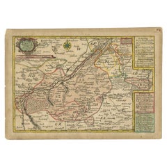
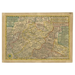
Antique Map of the Region of Zeitz in Germany, 1749
By Schreiber
Located in Langweer, NL
Antique map titled 'Das Stifft Zeitz (..)'. Map of the region of Zeitz, Germany. Zeitz is a town in the Burgenlandkreis district, in Saxony-Anhalt, Germany. It is situated on the riv...
Category
18th Century Antique Schreiber Maps
Materials
Paper
$316 Sale Price
20% Off
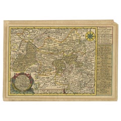
Rare Antique Map of the Region of Freyburg in Germany, 1749
By Schreiber
Located in Langweer, NL
Antique map titled 'Die Chursaechsisch Aemter in Thüringen Freyburg (..)'. Map of the region of Freyburg, Germany. This map originates from 'Atlas Selectus von allen...
Category
18th Century Antique Schreiber Maps
Materials
Paper
$89 Sale Price
20% Off
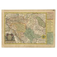
Antique Map of the Region of Annaburg by Schreiber, 1749
By Schreiber
Located in Langweer, NL
Antique map titled 'Die Aemter Annaburg, Schweinitz (..)'. Map of the region of Annaburg, Germany. This map originates from 'Atlas Selectus von allen Konigreichen und Landern der Wel...
Category
18th Century Antique Schreiber Maps
Materials
Paper
$89 Sale Price
20% Off
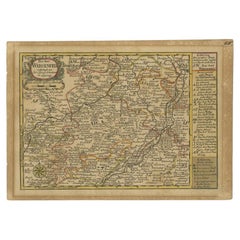
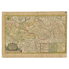
Antique Map of the Region of Weißenfels by Schreiber, 1749
By Schreiber
Located in Langweer, NL
Antique map titled 'Das Amt Weissenfels (..)'. Map of the region of Weißenfels, Germany. This map originates from 'Atlas Selectus von allen Konigreichen und Landern der Welt' by Joha...
Category
18th Century Antique Schreiber Maps
Materials
Paper
$89 Sale Price
20% Off
Antique Map of the Region of Schwarzburg by Schreiber, 1749
By Schreiber
Located in Langweer, NL
Antique map titled 'Die Südliche Fürstenthum Schwartzburg (..)'. Map of the region of Schwarzburg, Germany. This map originates from 'Atlas Selectus von allen Konigreichen und Lander...
Category
18th Century Antique Schreiber Maps
Materials
Paper
$89 Sale Price
20% Off
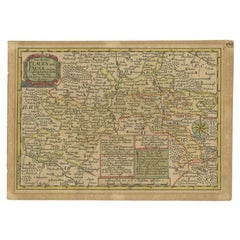
Antique Map of the Region of Plauen by Schreiber '1749'
By Schreiber
Located in Langweer, NL
Antique map titled 'Die Aemter Plauen und Pausa (..)'. Map of the region of Plauen, Germany. This map originates from 'Atlas Selectus von allen Konigreichen und Landern der Welt' by ...
Category
18th Century Antique Schreiber Maps
Materials
Paper
$89 Sale Price
20% Off
Antique Map of the Region of Dölitzsch by Schreiber, 1749
By Schreiber
Located in Langweer, NL
Antique map titled 'Die Aemter Doelitsch, Bitterfeld und Zörbig'. Map of the region of Dölitzsch, Germany. This map originates from 'Atlas Selectus von allen Konigreichen und Landern...
Category
18th Century Antique Schreiber Maps
Materials
Paper
$89 Sale Price
20% Off
Antique Map of the Region of Voigtsberg by Schreiber, 1749
By Schreiber
Located in Langweer, NL
Antique map titled 'Das Amt Voigtsberg (..)'. Map of the region of Voigtsberg, Germany. This map originates from 'Atlas Selectus von allen Konigreichen und Landern der Welt' by Johan...
Category
18th Century Antique Schreiber Maps
Materials
Paper
$89 Sale Price
20% Off
Antique Map of the Region of Weida by Schreiber, 1749
By Schreiber
Located in Langweer, NL
Antique map titled 'Das Amt Weida (..)'. Map of the region of Weida, Germany. This map originates from 'Atlas Selectus von allen Konigreichen und Landern der Welt' by Johann Georg Sc...
Category
18th Century Antique Schreiber Maps
Materials
Paper
$134 Sale Price
20% Off
Antique Map of the Region of Weißensee by Schreiber, 1749
By Schreiber
Located in Langweer, NL
Antique map titled 'Die Chursaechsischen Aemter in Thüringen gelegen Sachsenburg, Weissensee (..)'. Map of the region of Weißensee, Germany. This map originates from 'Atlas Selectus von allen...
Category
18th Century Antique Schreiber Maps
Materials
Paper
$373 Sale Price
20% Off
Related Items
Original Antique Map of Ancient Greece, Achaia, Corinth, 1786
Located in St Annes, Lancashire
Great map of Ancient Greece. Showing the region of Thessaly, including Mount Olympus
Drawn by J.D. Barbie Du Bocage
Copper plate engraving by P.F Tardieu
Original hand color...
Category
1780s French Other Antique Schreiber Maps
Materials
Paper
New Map of North America from the Latest Discoveries, 1763
Located in Philadelphia, PA
A fine antique 18th century map of the North American seaboard.
Entitled "A New Map of North America from the Latest Discoveries 1763".
By the Cartographer/Engraver - John Spil...
Category
Mid-18th Century English Georgian Antique Schreiber Maps
Materials
Paper
Original Antique Map of Ancient Greece- Boeotia, Thebes, 1787
Located in St Annes, Lancashire
Great map of Ancient Greece. Showing the region of Boeotia, including Thebes
Drawn by J.D. Barbie Du Bocage
Copper plate engraving by P.F T...
Category
1780s French Other Antique Schreiber Maps
Materials
Paper
Original Antique Map of The United States of America by Dower, circa 1835
Located in St Annes, Lancashire
Nice map of the USA
Drawn and engraved by J.Dower
Published by Orr & Smith. C.1835
Unframed.
Free shipping
Category
1830s English Antique Schreiber Maps
Materials
Paper
$60
H 12.25 in W 9.25 in D 0.07 in
Original Antique Map of The London Underground. 1911
Located in St Annes, Lancashire
Superb map of The London Underground
Published by Ward Lock, 1911
Folding map. Printed on paper
Unframed.
Good condition/ Minor repair to an edge tear on right edge ( shown in ...
Category
1910s English Vintage Schreiber Maps
Materials
Canvas, Paper
Original Antique Map of The Philippines. C.1900
Located in St Annes, Lancashire
Fabulous map of The Philippines
Original color.
Engraved and printed by the George F. Cram Company, Indianapolis.
Published, C.1900.
Unframed.
Free shipping.
Category
1890s American Antique Schreiber Maps
Materials
Paper
Original Antique Map of Spain and Portugal, circa 1790
Located in St Annes, Lancashire
Super map of Spain and Portugal
Copper plate engraving by A. Bell
Published, circa 1790.
Unframed.
Category
1790s English Other Antique Schreiber Maps
Materials
Paper
Antique Map of Principality of Monaco
By Antonio Vallardi Editore
Located in Alessandria, Piemonte
ST/619 - "Old Geographical Atlas of Italy - Topographic map of ex-Principality of Monaco" -
ediz Vallardi - Milano -
A somewhat special edition ---
Category
Late 19th Century Italian Other Antique Schreiber Maps
Materials
Paper
Vintage "View of the Center of Paris Taken from the Air" Lithograph Map
Located in San Diego, CA
A very stylish "View of the Center of Paris Taken from the Air" lithograph map published by the Paris Ministry of Tourism, circa early 1950s. The piece measures 27" x 43" and shows...
Category
20th Century French Mid-Century Modern Schreiber Maps
Materials
Paper
$680 Sale Price
20% Off
H 43 in W 27 in D 0.25 in
Map of the Republic of Genoa
Located in New York, NY
Framed antique hand-coloured map of the Republic of Genoa including the duchies of Mantua, Modena, and Parma.
Europe, late 18th century.
Dimension: 25...
Category
Late 18th Century European Antique Schreiber Maps
Original Antique Map of The World by Thomas Clerk, 1817
Located in St Annes, Lancashire
Great map of The Eastern and Western Hemispheres
On 2 sheets
Copper-plate engraving
Drawn and engraved by Thomas Clerk, Edinburgh.
Published by Mackenzie And Dent, 1817
...
Category
1810s English Antique Schreiber Maps
Materials
Paper
Original Antique Map of the American State of Colorado, 1903
Located in St Annes, Lancashire
Antique map of Colorado
Published By A & C Black. 1903
Original colour
Good condition
Unframed.
Free shipping
Category
Early 1900s English Antique Schreiber Maps
Materials
Paper
Previously Available Items
Antique Map of the Region of Sagan by Schreiber, 1749
By Schreiber
Located in Langweer, NL
Antique map titled 'Der Prievussische Creis in den Fürstenthume Sagan (..)'. Map of the region of Sagan, Prussia. This map originates from 'Atlas Selectus von allen Konigreichen und ...
Category
18th Century Antique Schreiber Maps
Materials
Paper
Antique Map of the Region of Gommern in Germany, 1749
By Schreiber
Located in Langweer, NL
Antique map titled 'Das Amt Gommern und die Graffschafft Barby (..)'. Map of the region of Gommern, Germany. This map originates from 'Atlas Selectus von allen Konigreichen und Lande...
Category
18th Century Antique Schreiber Maps
Materials
Paper
Antique Map of the Region of Gotha, Thuringia, Germany, 1749
By Schreiber
Located in Langweer, NL
Antique map titled 'Die Herzogthümer Gotha und Eisnach'. Map of the region of Gotha, Germany. This map originates from 'Atlas Selectus von allen Konigreichen und Landern der Welt' by...
Category
18th Century Antique Schreiber Maps
Materials
Paper
Schreiber maps for sale on 1stDibs.
Schreiber maps are available for sale on 1stDibs. These distinctive items are frequently made of paper and are designed with extraordinary care. There are many options to choose from in our collection of Schreiber maps, although brown editions of this piece are particularly popular. If you’re looking for additional options, many customers also consider maps by James Cook, Jakob van der Schley, and Pieter Van Der Aa. Prices for Schreiber maps can differ depending upon size, time period and other attributes — on 1stDibs, these items begin at $100 and can go as high as $421, while a piece like these, on average, fetch $100.
