Schreiber Collectibles and Curiosities
12
to
12
12
12
12
12
12
12
139
107
82
79
Creator: Schreiber
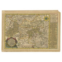
Rare Antique Map of the Region of Freyburg in Germany, 1749
By Schreiber
Located in Langweer, NL
Antique map titled 'Die Chursaechsisch Aemter in Thüringen Freyburg (..)'. Map of the region of Freyburg, Germany. This map originates from 'Atlas Selectus von allen...
Category
18th Century Antique Schreiber Collectibles and Curiosities
Materials
Paper
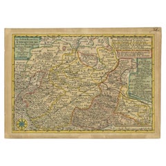
Antique Map of the Region of Schwarzburg by Schreiber, 1749
By Schreiber
Located in Langweer, NL
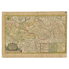
Antique map titled 'Die Südliche Fürstenthum Schwartzburg (..)'. Map of the region of Schwarzburg, Germany. This map originates from 'Atlas Selectus von allen Konigreichen und Lander...
Category
18th Century Antique Schreiber Collectibles and Curiosities
Materials
Paper
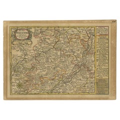
Antique Map of the Region of Weißenfels by Schreiber, 1749
By Schreiber
Located in Langweer, NL
Antique map titled 'Das Amt Weissenfels (..)'. Map of the region of Weißenfels, Germany. This map originates from 'Atlas Selectus von allen Konigreichen und Landern der Welt' by Joha...
Category
18th Century Antique Schreiber Collectibles and Curiosities
Materials
Paper
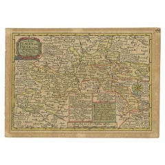
Antique Map of the Region of Plauen by Schreiber '1749'
By Schreiber
Located in Langweer, NL
Antique map titled 'Die Aemter Plauen und Pausa (..)'. Map of the region of Plauen, Germany. This map originates from 'Atlas Selectus von allen Konigreichen und Landern der Welt' by ...
Category
18th Century Antique Schreiber Collectibles and Curiosities
Materials
Paper
Antique Map of the Region of Gommern in Germany, 1749
By Schreiber
Located in Langweer, NL
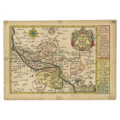
Antique map titled 'Das Amt Gommern und die Graffschafft Barby (..)'. Map of the region of Gommern, Germany. This map originates from 'Atlas Selectus von allen Konigreichen und Lande...
Category
18th Century Antique Schreiber Collectibles and Curiosities
Materials
Paper
Antique Map of the Region of Sagan by Schreiber, 1749
By Schreiber
Located in Langweer, NL
Antique map titled 'Der Prievussische Creis in den Fürstenthume Sagan (..)'. Map of the region of Sagan, Prussia. This map originates from 'Atlas Selectus von allen Konigreichen und ...
Category
18th Century Antique Schreiber Collectibles and Curiosities
Materials
Paper
Antique Map of the Region of Annaburg by Schreiber, 1749
By Schreiber
Located in Langweer, NL
Antique map titled 'Die Aemter Annaburg, Schweinitz (..)'. Map of the region of Annaburg, Germany. This map originates from 'Atlas Selectus von allen Konigreichen und Landern der Wel...
Category
18th Century Antique Schreiber Collectibles and Curiosities
Materials
Paper
Antique Map of the Region of Voigtsberg by Schreiber, 1749
By Schreiber
Located in Langweer, NL
Antique map titled 'Das Amt Voigtsberg (..)'. Map of the region of Voigtsberg, Germany. This map originates from 'Atlas Selectus von allen Konigreichen und Landern der Welt' by Johan...
Category
18th Century Antique Schreiber Collectibles and Curiosities
Materials
Paper
Antique Map of the Region of Dölitzsch by Schreiber, 1749
By Schreiber
Located in Langweer, NL
Antique map titled 'Die Aemter Doelitsch, Bitterfeld und Zörbig'. Map of the region of Dölitzsch, Germany. This map originates from 'Atlas Selectus von allen Konigreichen und Landern...
Category
18th Century Antique Schreiber Collectibles and Curiosities
Materials
Paper
Antique Map of the Region of Weida by Schreiber, 1749
By Schreiber
Located in Langweer, NL
Antique map titled 'Das Amt Weida (..)'. Map of the region of Weida, Germany. This map originates from 'Atlas Selectus von allen Konigreichen und Landern der Welt' by Johann Georg Sc...
Category
18th Century Antique Schreiber Collectibles and Curiosities
Materials
Paper
Antique Map of the Region of Zeitz in Germany, 1749
By Schreiber
Located in Langweer, NL
Antique map titled 'Das Stifft Zeitz (..)'. Map of the region of Zeitz, Germany. Zeitz is a town in the Burgenlandkreis district, in Saxony-Anhalt, Germany. It is situated on the riv...
Category
18th Century Antique Schreiber Collectibles and Curiosities
Materials
Paper
Antique Map of the Region of Weißensee by Schreiber, 1749
By Schreiber
Located in Langweer, NL
Antique map titled 'Die Chursaechsischen Aemter in Thüringen gelegen Sachsenburg, Weissensee (..)'. Map of the region of Weißensee, Germany. This map originates from 'Atlas Selectus von allen...
Category
18th Century Antique Schreiber Collectibles and Curiosities
Materials
Paper
Related Items
Original Antique Map of The United States of America, circa 1890
Located in St Annes, Lancashire
Great map of the USA
By The Stanford's Geographical Establishment
Original colour
Unframed.
Category
1890s English Victorian Antique Schreiber Collectibles and Curiosities
Materials
Paper
Set of 4 Antique Geographical Maps French-German War 1870-71
Located in Casale Monferrato, IT
Elegant late 19th century set of four antique geographical maps relating to the positioning of the armies in the Franco-German War 1870-71.
A...
Category
1890s Italian Antique Schreiber Collectibles and Curiosities
Materials
Paper
Colored wall map of the WORLD
By Chambon
Located in ZWIJNDRECHT, NL
“Mappe Monde, contenant les Parties Connues du Globe Terrestre”
CHAMBON, Gobert-Denis (France, 17.. - 1781)
Paris, Longchamps et Janvier, 1754
Size H. 115 x W. 145 cm.
Gobert-Denis Chambon made copper engraving after the work of Guillaume De L’Isle, published in 1754 by Jean Janvier and S.G. Longschamps.
A huge wall map of the world in two hemispheres printed on two sheets, depicting the Eastern and Western hemispheres supported by two male figures, decorated at the bottom right and left with two celestial hemispheres (boreal and southern) and at the bottom in the middle with an armillary sphere, in addition.
This map is most notable for its depiction of the Sea of Japan labeled "Mer de Corée" and of "Mer de L'Ouest" or Sea of the West - a great sea, easily the size of the Mediterranean, to flow from the then-known Strait of Juan de Fuca...
Category
Mid-18th Century French French Provincial Antique Schreiber Collectibles and Curiosities
Materials
Wood, Paper
Original Antique Map of The World by Thomas Clerk, 1817
Located in St Annes, Lancashire
Great map of The Eastern and Western Hemispheres
On 2 sheets
Copper-plate engraving
Drawn and engraved by Thomas Clerk, Edinburgh.
Published by Mackenzie And Dent, 1817
...
Category
1810s English Antique Schreiber Collectibles and Curiosities
Materials
Paper
1908 "Map of Texas" by The Kenyon Company
Located in Colorado Springs, CO
Presented is an antique map of the state of Texas, printed as a pocket map in 1908 by The Kenyon Company. The state map is brightly colored by county, with principal cities and towns listed. The congressional districts are numbered and boldly outlined in red. Rivers, roads, and railroads all appear prominently on this fantastic map...
Category
Early 1900s American Antique Schreiber Collectibles and Curiosities
Materials
Paper
Large Original Antique Map of the United States of America. 1891
By Rand McNally & Co.
Located in St Annes, Lancashire
Fabulous map of The United States
Original color
By Rand, McNally & Co.
Dated 1891
Unframed
Free shipping.
Category
1890s American Antique Schreiber Collectibles and Curiosities
Materials
Paper
No Reserve
H 20.5 in W 13.5 in D 0.07 in
Large Original Antique Map of the World, Fullarton, circa 1870
Located in St Annes, Lancashire
Great map of the World.
From the celebrated Royal Illustrated Atlas
Lithograph. Original color.
Published by Fullarton, Edinburgh, circa 1870.
Unframed.
Category
1870s Scottish Antique Schreiber Collectibles and Curiosities
Materials
Paper
No Reserve
H 18.5 in W 22.5 in D 0.07 in
Original Antique Map of The Netherlands, Engraved by Barlow, Dated 1807
Located in St Annes, Lancashire
Great map of Netherlands
Copper-plate engraving by Barlow
Published by Brightly & Kinnersly, Bungay, Suffolk.
Dated 1807
Unframed.
Category
Early 1800s English Antique Schreiber Collectibles and Curiosities
Materials
Paper
No Reserve
H 8 in W 10 in D 0.07 in
Original Antique Map of Russia By Arrowsmith. 1820
Located in St Annes, Lancashire
Great map of Russia
Drawn under the direction of Arrowsmith
Copper-plate engraving
Published by Longman, Hurst, Rees, Orme and Brown, 1820
Unframed.
Category
1820s English Antique Schreiber Collectibles and Curiosities
Materials
Paper
Map of the Republic of Genoa
Located in New York, NY
Framed antique hand-coloured map of the Republic of Genoa including the duchies of Mantua, Modena, and Parma.
Europe, late 18th century.
Dimension: 25...
Category
Late 18th Century European Antique Schreiber Collectibles and Curiosities
Large Original Antique Map of the Environs of Cork, Ireland, circa 1880
Located in St Annes, Lancashire
Great map of The Environs of Cork
Published circa 1880
Unframed
Free shipping.
Category
1880s Scottish Antique Schreiber Collectibles and Curiosities
Materials
Paper
No Reserve
H 13.5 in W 20 in D 0.07 in
Antique 18th Century Map of the Province of Pensilvania 'Pennsylvania State'
Located in Philadelphia, PA
A fine antique of the colony of Pennsylvania.
Noted at the top of the sheet as a 'Map of the province of Pensilvania'.
This undated and anonymous map is thought to be from the Gentleman's Magazine, London, circa 1775, although the general appearance could date it to the 1760's.
The southern boundary reflects the Mason-Dixon survey (1768), the western boundary is placed just west of Pittsburgh, and the northern boundary is not marked.
The map has a number of reference points that likely refer to companion text and appear to be connected to boundaries. The western and southern boundaries are marked Q, R, S, for example. A diagonal line runs from the Susquehanna R to the Lake Erie P. A broken line marked by many letters A, B, N, O, etc., appears in the east.
There are no latitude or longitude markings, blank verso.
Framed in a shaped contemporary gilt wooden frame and matted under a cream colored matte.
Bearing an old Graham Arader Gallery...
Category
18th Century British American Colonial Antique Schreiber Collectibles and Curiosities
Materials
Paper
H 10.25 in W 13.25 in D 0.5 in
Previously Available Items
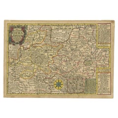
Antique Map of the Region of Gotha, Thuringia, Germany, 1749
By Schreiber
Located in Langweer, NL
Antique map titled 'Die Herzogthümer Gotha und Eisnach'. Map of the region of Gotha, Germany. This map originates from 'Atlas Selectus von allen Konigreichen und Landern der Welt' by...
Category
18th Century Antique Schreiber Collectibles and Curiosities
Materials
Paper
Schreiber collectibles and curiosities for sale on 1stDibs.
Schreiber collectibles and curiosities are available for sale on 1stDibs. These distinctive items are frequently made of paper and are designed with extraordinary care. There are many options to choose from in our collection of Schreiber collectibles and curiosities, although brown editions of this piece are particularly popular. If you’re looking for additional options, many customers also consider collectibles and curiosities by James Cook, Isaak Tirion, and F. Valentijn. Prices for Schreiber collectibles and curiosities can differ depending upon size, time period and other attributes — on 1stDibs, these items begin at $100 and can go as high as $421, while a piece like these, on average, fetch $100.
