Items Similar to Antique Map of Africa by Johnston (1909)


Want more images or videos?
Request additional images or videos from the seller
1 of 5
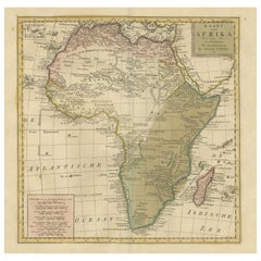
Antique Map of Africa by Johnston (1909)
$239.84
$299.7920% Off
£178.41
£223.0220% Off
€200
€25020% Off
CA$328.42
CA$410.5220% Off
A$365.16
A$456.4420% Off
CHF 190.66
CHF 238.3320% Off
MX$4,444.83
MX$5,556.0420% Off
NOK 2,432.79
NOK 3,040.9920% Off
SEK 2,279.41
SEK 2,849.2620% Off
DKK 1,522.49
DKK 1,903.1120% Off
Shipping
Retrieving quote...The 1stDibs Promise:
Authenticity Guarantee,
Money-Back Guarantee,
24-Hour Cancellation
About the Item
Antique map titled 'Africa'. Original antique map of Africa. This map originates from the ‘Royal Atlas of Modern Geography’. Published by W. & A.K. Johnston, 1909.
- Dimensions:Height: 19.49 in (49.5 cm)Width: 24.41 in (62 cm)Depth: 0.02 in (0.5 mm)
- Materials and Techniques:
- Period:
- Date of Manufacture:1909
- Condition:Minor fading. General age-related toning. Please study image carefully.
- Seller Location:Langweer, NL
- Reference Number:Seller: BG-12940-401stDibs: LU3054324697412
About the Seller
5.0
Recognized Seller
These prestigious sellers are industry leaders and represent the highest echelon for item quality and design.
Platinum Seller
Premium sellers with a 4.7+ rating and 24-hour response times
Established in 2009
1stDibs seller since 2017
2,510 sales on 1stDibs
Typical response time: <1 hour
- ShippingRetrieving quote...Shipping from: Langweer, Netherlands
- Return Policy
Authenticity Guarantee
In the unlikely event there’s an issue with an item’s authenticity, contact us within 1 year for a full refund. DetailsMoney-Back Guarantee
If your item is not as described, is damaged in transit, or does not arrive, contact us within 7 days for a full refund. Details24-Hour Cancellation
You have a 24-hour grace period in which to reconsider your purchase, with no questions asked.Vetted Professional Sellers
Our world-class sellers must adhere to strict standards for service and quality, maintaining the integrity of our listings.Price-Match Guarantee
If you find that a seller listed the same item for a lower price elsewhere, we’ll match it.Trusted Global Delivery
Our best-in-class carrier network provides specialized shipping options worldwide, including custom delivery.More From This Seller
View AllAntique Map of Africa, Highlighting Colonial Divisions, Geographic Features 1903
Located in Langweer, NL
Title: Antique Map of Africa, 1903, Highlighting Colonial Divisions and Geographic Features
Description: This antique map, titled "Africa," was engraved and published in 1903 by W. ...
Category
Early 20th Century Maps
Materials
Paper

Antique Map of Africa by A & C, Black, 1870
Located in Langweer, NL
Antique map titled 'Africa'. Original antique map of Africa. This map originates from ‘Black's General Atlas of The World’. Published by A & C. Black, 1870.
Category
Antique Late 19th Century Maps
Materials
Paper

$263 Sale Price
20% Off
Antique Map of Africa with European Language Borders, 1852
Located in Langweer, NL
Antique map titled 'Afrika'. Map of Africa. This map originates from 'School-Atlas van alle deelen der Aarde' by Otto Petri.
Artists and Engravers: Published by A. Baedeker (Otto...
Category
Antique 19th Century Maps
Materials
Paper

$153 Sale Price
20% Off
Antique Old Map of Africa with Insets of Mauritius, Reunion and Natal, 1882
Located in Langweer, NL
The uploaded image is a historical map of Africa from the 1882 atlas by Blackie & Son. The map includes the entire African continent, with various countries, regions, and topographic...
Category
Antique 1880s Maps
Materials
Paper
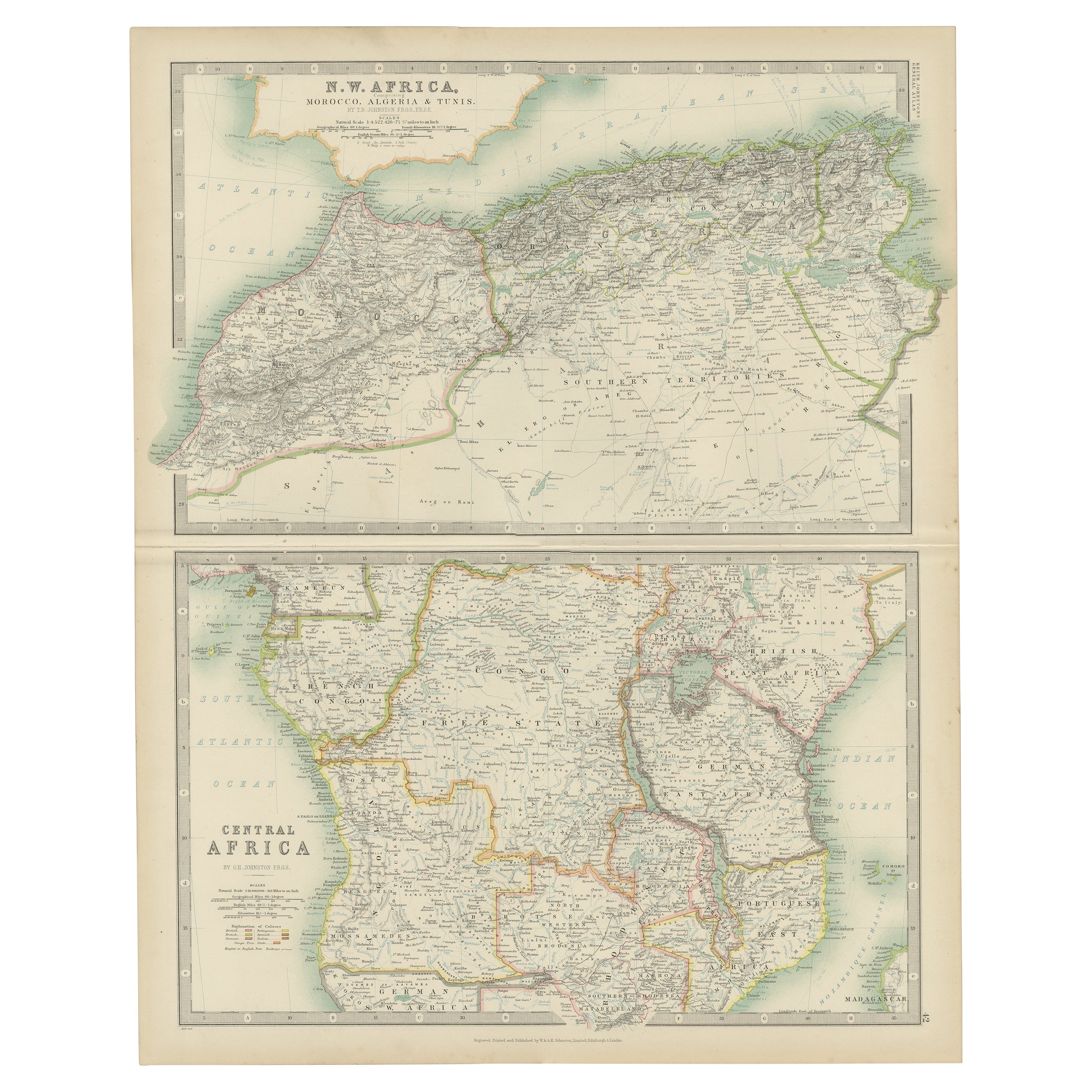
Antique Map of N.W. Africa & Central Africa by Johnston (1909)
Located in Langweer, NL
Antique map titled 'N.W. Africa & Central Africa'. Original antique map of N.W. Africa & Central Africa. This map originates from the ‘Royal Atlas of Modern Geography’. Published by ...
Category
Early 20th Century Maps
Materials
Paper
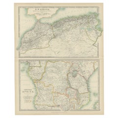
$239 Sale Price
20% Off
Antique Map of Africa with Original Hand Coloring
Located in Langweer, NL
Antique map titled 'Kaart van Afrika door den Heer d'Anville'. Detailed original old map of Africa, with very small inset map titled 'Vlaamsche Eilanden', which shows the Azores. Pub...
Category
Antique Mid-18th Century Maps
Materials
Paper
$748 Sale Price
20% Off
You May Also Like
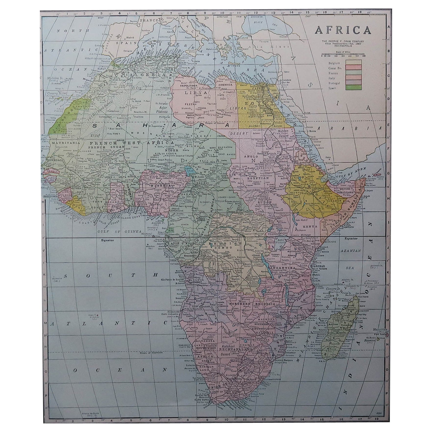
Large Original Antique Map of Africa. C.1900
Located in St Annes, Lancashire
Fabulous map of Africa
Original color.
Engraved and printed by the George F. Cram Company, Indianapolis.
Published, C.1900.
Unframed.
Free shipping.
Category
Antique 1890s American Maps
Materials
Paper

Original Antique Map of Africa by Dower, circa 1835
Located in St Annes, Lancashire
Nice map of Africa
Drawn and engraved by J.Dower
Published by Orr & Smith. C.1835
Unframed.
Free shipping
Category
Antique 1830s English Maps
Materials
Paper

"Africa Vetus": a 17th Century Hand-Colored Map by Sanson
By Nicolas Sanson
Located in Alamo, CA
This original hand-colored copperplate engraved map of Africa entitled "Africa Vetus, Nicolai Sanson Christianiss Galliar Regis Geographi" was originally created by Nicholas Sanson d...
Category
Antique Late 17th Century French Maps
Materials
Paper

Large University Chart “Africa Physical ” by Bacon
Located in Godshill, Isle of Wight
Large University chart “Africa Physical ” by Bacon
W&A K Johnston’s charts of physical maps by G W Bacon,
This is a Physical map of Africa, it is lithograph set on Linen mounte...
Category
Early 20th Century Beaux Arts Maps
Materials
Linen
Africa. Central. Century Atlas antique vintage map
Located in Melbourne, Victoria
'The Century Atlas. Africa. Central'
Inset map of 'Madagascar'.
Original antique map, 1903.
Central fold as issued. Map name and number printed on the reverse corners.
Sheet 29.5cm...
Category
Early 20th Century Victorian More Prints
Materials
Lithograph

Ancient Map of Africa - Etching - 19th century
Located in Roma, IT
This Map of Africa is an etching realized in the 19th century.
The state of preservation of the artwork is good. At the top of the paper, the inscription “Longitudine del Meridiano ...
Category
19th Century More Prints
Materials
Etching
More Ways To Browse
Antique Marine Maps
Antique Indian Maps
Antique Maps Of Wales
Antique Map Denmark
Antique World Globe Map
Hemispheres Map
Map New Holland
Treasure Map
Caribbean Antiques
19th Century Map Of Africa
Antique Malaysia
Antique Map Of Ireland
Ships Log
Map Of Egypt
Nautical Maps
Antique Maps Of Long Island
James Cook Map
Antique Doctors Office Furniture