Items Similar to Antique Map of Australia by Johnston '1909'
Want more images or videos?
Request additional images or videos from the seller
1 of 5
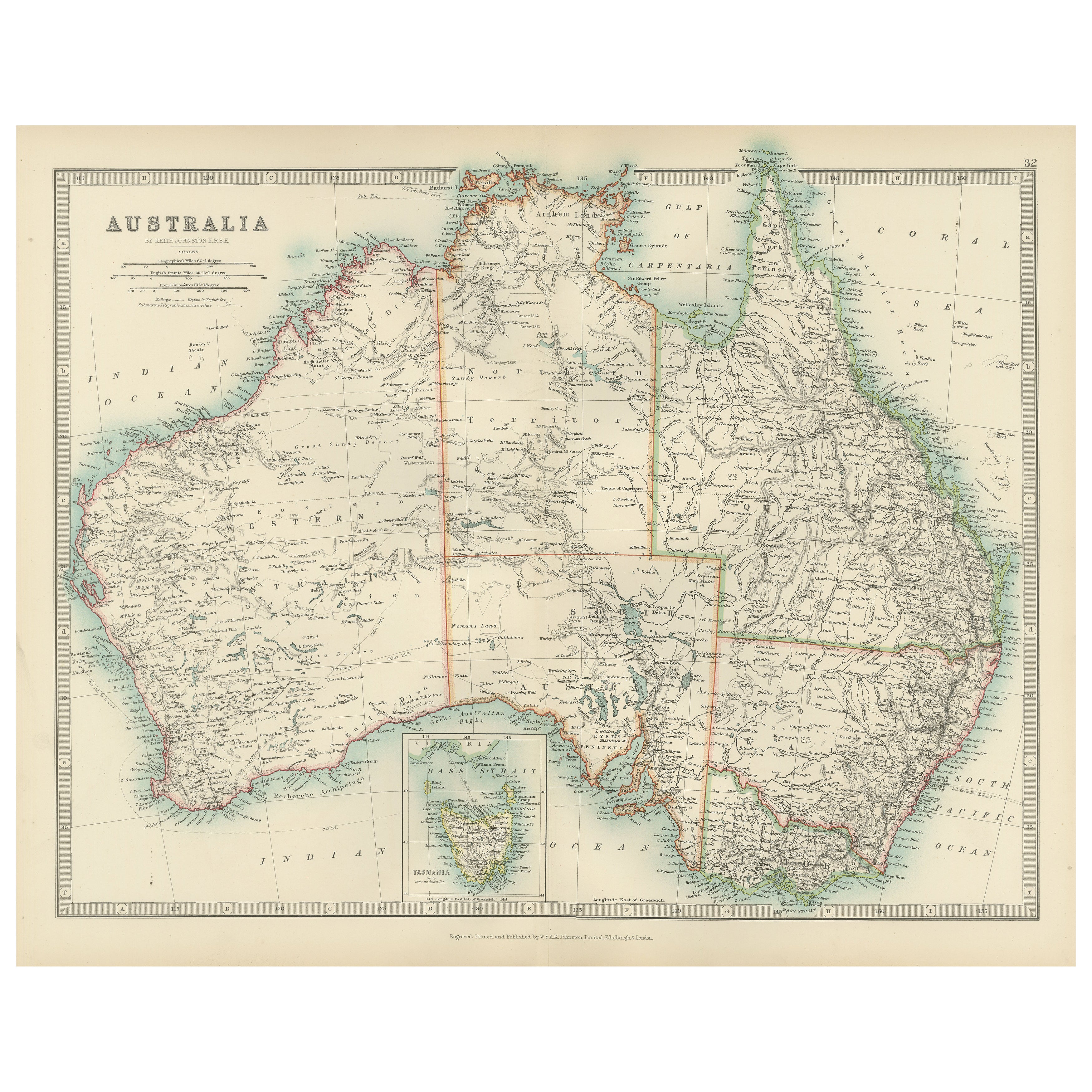
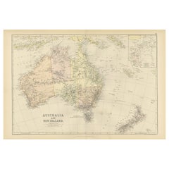
Antique Map of Australia by Johnston '1909'
$335.37
$419.2120% Off
£248.53
£310.6620% Off
€280
€35020% Off
CA$457.84
CA$572.3020% Off
A$509.33
A$636.6620% Off
CHF 267
CHF 333.7520% Off
MX$6,223.87
MX$7,779.8320% Off
NOK 3,399.86
NOK 4,249.8320% Off
SEK 3,200.50
SEK 4,000.6320% Off
DKK 2,131.90
DKK 2,664.8720% Off
Shipping
Retrieving quote...The 1stDibs Promise:
Authenticity Guarantee,
Money-Back Guarantee,
24-Hour Cancellation
About the Item
Antique map titled 'Australia'. Original antique map of Australia. With inset maps of Melbourne, Port Phillip, Adelaide, Perth, Sydney, Brisbane, Port Jackson and Hobart . This map originates from the ‘Royal Atlas of Modern Geography’. Published by W. & A.K. Johnston, 1909.
- Dimensions:Height: 19.49 in (49.5 cm)Width: 24.41 in (62 cm)Depth: 0.02 in (0.5 mm)
- Materials and Techniques:
- Period:
- Date of Manufacture:1909
- Condition:Minor fading. General age-related toning, some foxing. Please study image carefully.
- Seller Location:Langweer, NL
- Reference Number:Seller: BG-12940-371stDibs: LU3054324699012
About the Seller
5.0
Recognized Seller
These prestigious sellers are industry leaders and represent the highest echelon for item quality and design.
Platinum Seller
Premium sellers with a 4.7+ rating and 24-hour response times
Established in 2009
1stDibs seller since 2017
2,494 sales on 1stDibs
Typical response time: 1 hour
- ShippingRetrieving quote...Shipping from: Langweer, Netherlands
- Return Policy
Authenticity Guarantee
In the unlikely event there’s an issue with an item’s authenticity, contact us within 1 year for a full refund. DetailsMoney-Back Guarantee
If your item is not as described, is damaged in transit, or does not arrive, contact us within 7 days for a full refund. Details24-Hour Cancellation
You have a 24-hour grace period in which to reconsider your purchase, with no questions asked.Vetted Professional Sellers
Our world-class sellers must adhere to strict standards for service and quality, maintaining the integrity of our listings.Price-Match Guarantee
If you find that a seller listed the same item for a lower price elsewhere, we’ll match it.Trusted Global Delivery
Our best-in-class carrier network provides specialized shipping options worldwide, including custom delivery.More From This Seller
View AllAntique Map of Australia, 1903, with Colonial Divisions and Detailed Topography
Located in Langweer, NL
Title: Antique Map of Australia, 1903, with Colonial Divisions and Detailed Topography
Description: This antique map, titled "Australia," was engraved and published in 1903 by W. & ...
Category
Early 20th Century Maps
Materials
Paper

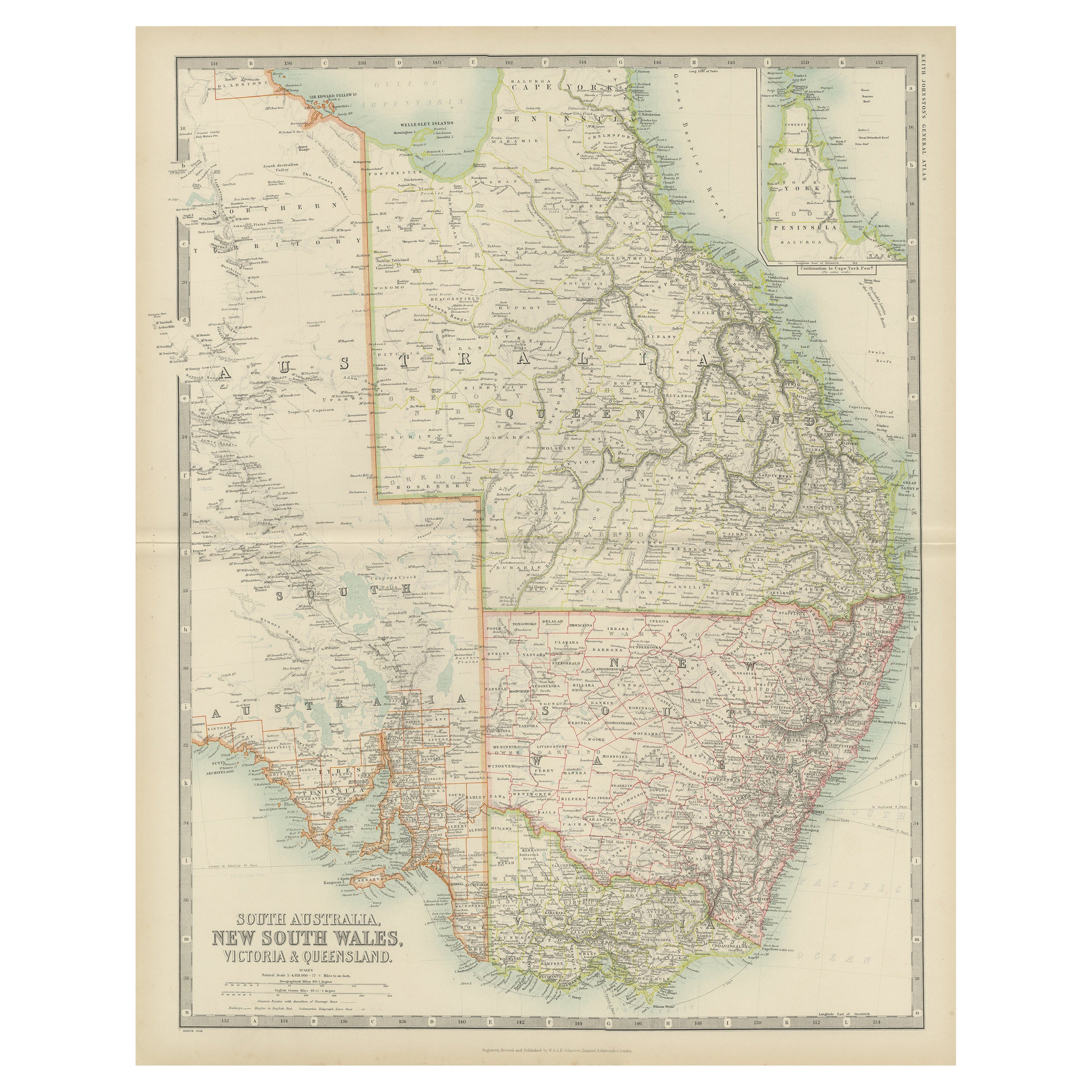
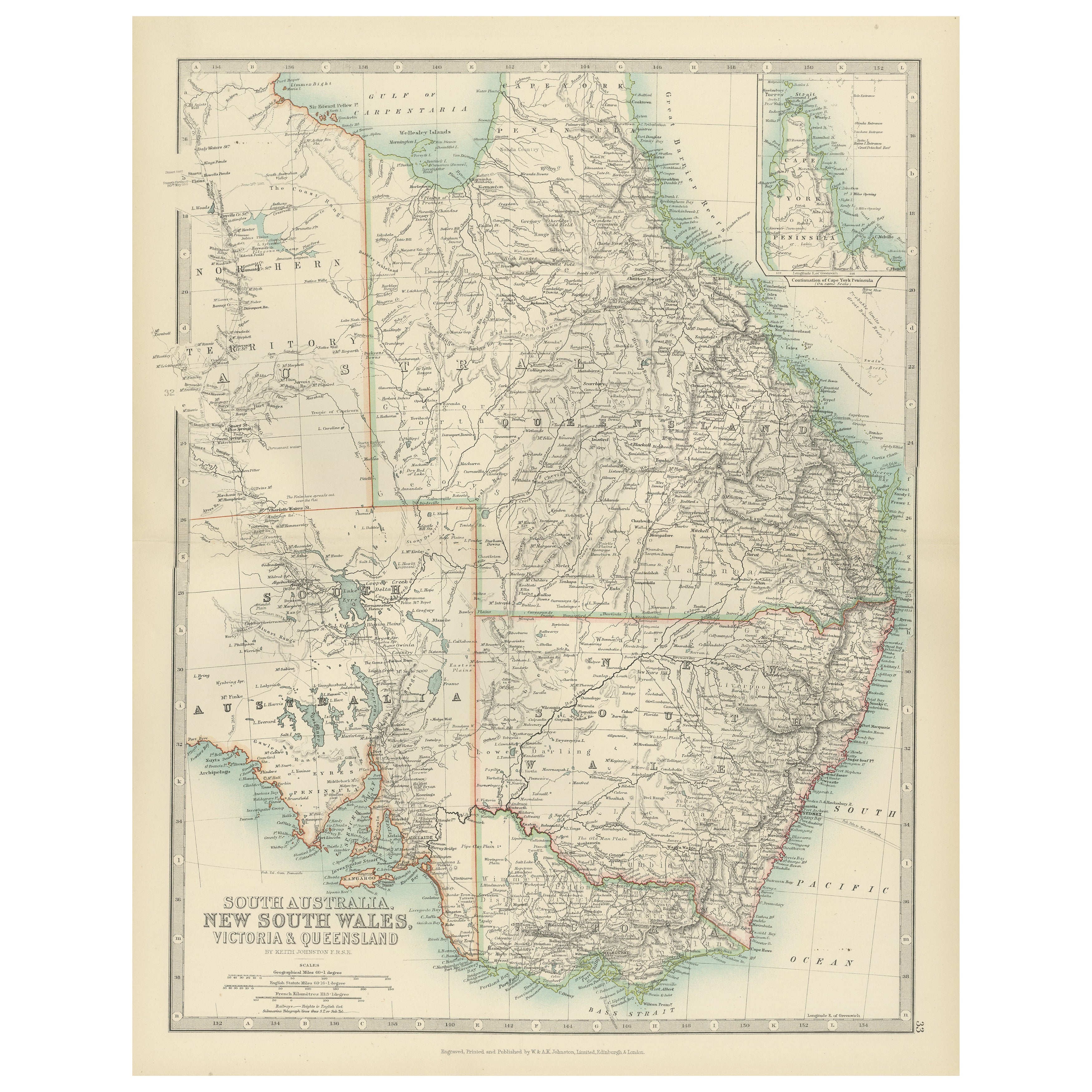
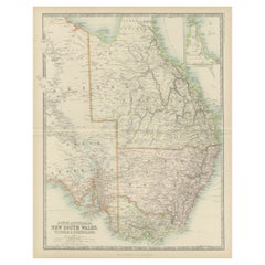
Antique Map of New South Wales by Johnston, '1909'
Located in Langweer, NL
Antique map titled 'South Australia, New South Wales, Victoria and Queensland'. Original antique map of New South Wales. With inset map of Cape York Pe...
Category
Early 20th Century Maps
Materials
Paper
$239 Sale Price
20% Off
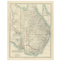
Antique Map of South Australia, New South Wales, Victoria and Queensland, 1903
Located in Langweer, NL
Title: Antique Map of South Australia, New South Wales, Victoria, and Queensland, 1903
Description:
This antique map, titled "South Australia, New South Wales, Victoria, and Queensl...
Category
Early 20th Century Maps
Materials
Paper
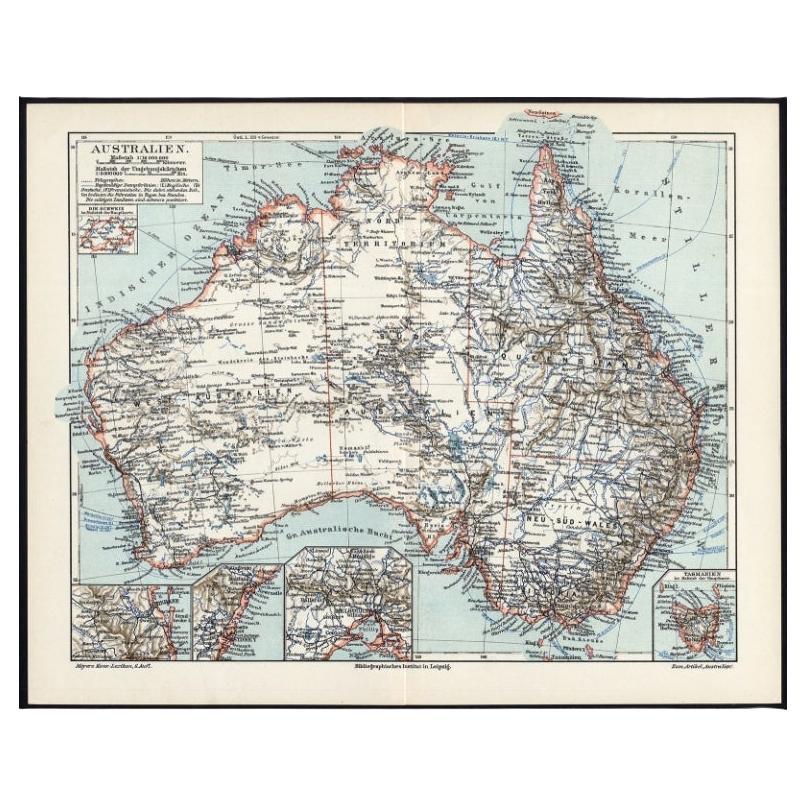
German Antique Map of Australia, Meyers, 1885
Located in Langweer, NL
Australien.' (Map of Australia. With inset maps of the large cities and Tasmania.) This attractive original old antique print / plate / map originate...
Category
Antique 19th Century Maps
Materials
Paper

$76 Sale Price
20% Off
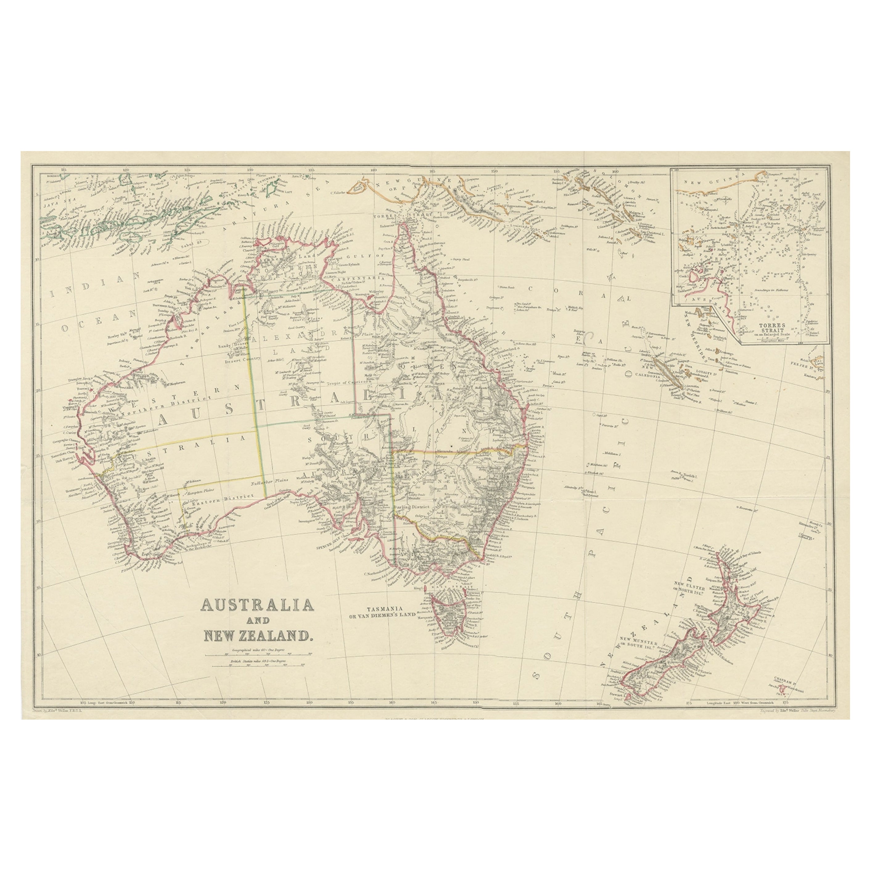
Antique Map of Australia and New Zealand, c.1860
Located in Langweer, NL
Antique map titled 'Australia and New Zealand'. Unusual edition of this map of Australia and New Zealand, on very thin paper and multiple folding lines. Source unknown, to be determi...
Category
Antique 19th Century Maps
Materials
Paper

$134 Sale Price
20% Off
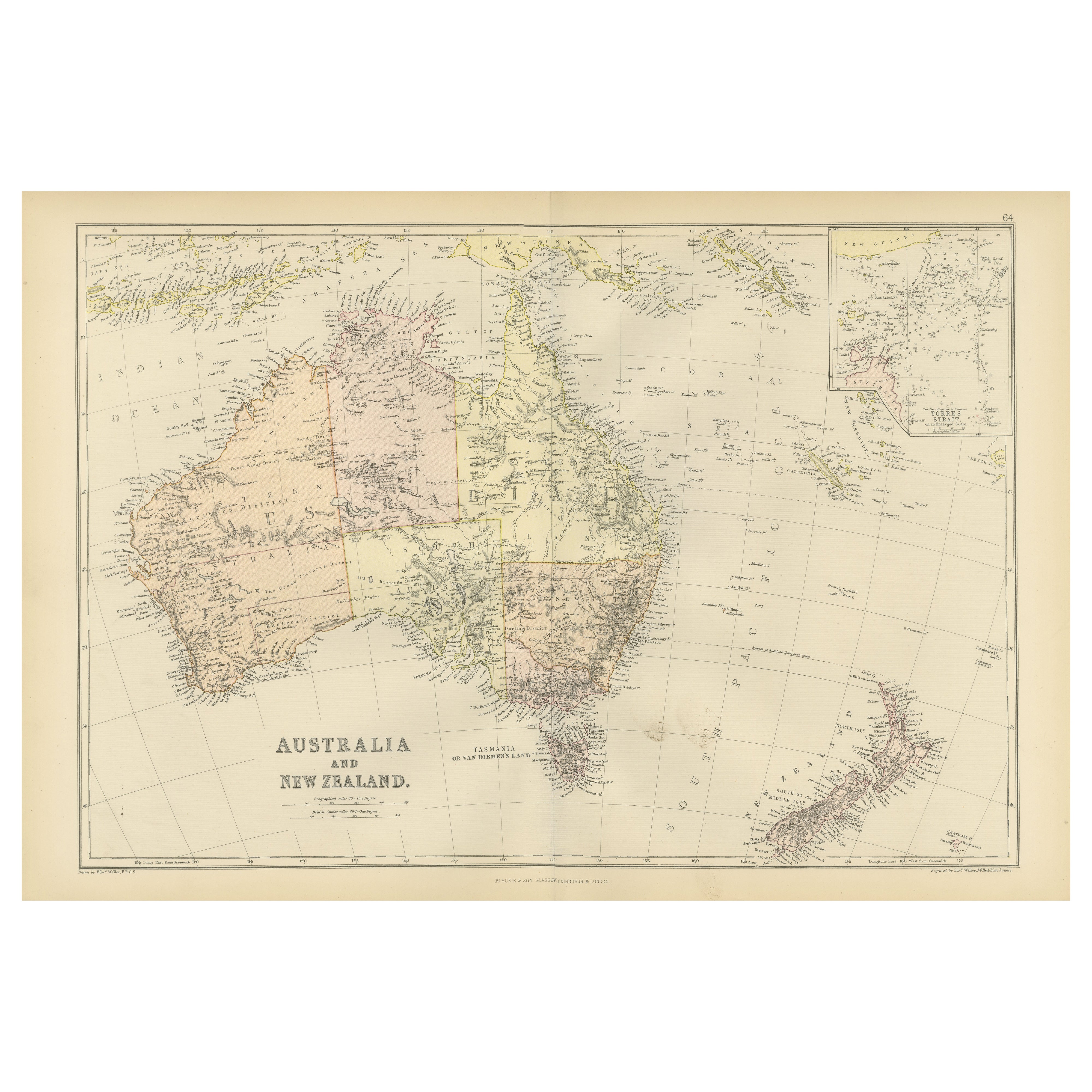
1882 Map of Australia and New Zealand with Regional and Geographical Features
Located in Langweer, NL
This 1882 map of Australia and New Zealand, published by Blackie and Son as part of the 'Comprehensive Atlas and Geography of the World,' provides a detailed and insightful look at t...
Category
Antique 1880s Maps
Materials
Paper
You May Also Like
Large Original Antique Map of Australia by Sidney Hall, 1847
Located in St Annes, Lancashire
Great map of Australia
Drawn and engraved by Sidney Hall
Steel engraving
Original colour outline
Published by A & C Black. 1847
Unframed
Free shipping.
Category
Antique 1840s Scottish Maps
Materials
Paper

Original Antique Map of Australia by Dower, circa 1835
Located in St Annes, Lancashire
Nice map of Australia
Drawn and engraved by J.Dower
Published by Orr & Smith. C.1835
Unframed.
Free shipping
Category
Antique 1830s English Maps
Materials
Paper

Australia, Tallis antique map, 1851
Located in Melbourne, Victoria
'Australia'
With decorative border surrounds and vignettes including a view of Sydney, Kangaroos, Natives of Australia Felix, Australian Parrots and Cockatoos and Natives of the Tri...
Category
19th Century Naturalistic Landscape Prints
Materials
Engraving

Antique Vintage Australia Wall Map By W & A K Johnston
By W. & A.K. Johnston
Located in Stockbridge, GB
Vintage Australia Wall Map By W & A K Johnston
A vintage school pull down wall map of Australia. The map has a wooden hanging pole at the top...
Category
Mid-20th Century British Schoolhouse Posters
Materials
Canvas, Wood
Original Antique Map of Tasmania, Australia by Dower, circa 1835
Located in St Annes, Lancashire
Nice map of Tasmania
Drawn and engraved by J.Dower
Published by Orr & Smith. C.1835
Unframed.
Free shipping
Category
Antique 1830s English Maps
Materials
Paper

Large Original Vintage Map of North America, circa 1920
Located in St Annes, Lancashire
Great map of North America
Original color. Good condition
Published by Alexander Gross
Unframed.
Category
Vintage 1920s English Edwardian Maps
Materials
Paper

More Ways To Browse
Australian Antique Furniture
Used Office Furniture Sydney
Adelaide Antique Furniture
Used Furniture Perth
Antique Perth
Antique Marine Maps
Antique Indian Maps
Antique Maps Of Wales
Antique Map Denmark
Antique World Globe Map
Hemispheres Map
Map New Holland
Treasure Map
Caribbean Antiques
19th Century Map Of Africa
Antique Malaysia
Antique Map Of Ireland
Ships Log