Items Similar to Antique Map of China and the East Indies by Lowry, 1852


Want more images or videos?
Request additional images or videos from the seller
1 of 5
Antique Map of China and the East Indies by Lowry, 1852
$412.52per set
£310.71per set
€350per set
CA$568.88per set
A$639.11per set
CHF 333.94per set
MX$7,800.65per set
NOK 4,240.02per set
SEK 3,991.08per set
DKK 2,664.07per set
About the Item
Antique map titled 'China & Indian Archipelago'. Two individual sheets of China and the East Indies. This map originates from 'Lowry's table Atlas constructed and engraved from the most recent authorities' by J.W. Lowry. Published 1852.
- Dimensions:Height: 9.65 in (24.5 cm)Width: 12.21 in (31 cm)Depth: 0.02 in (0.5 mm)
- Sold As:Set of 2
- Materials and Techniques:
- Period:
- Date of Manufacture:1852
- Condition:General age-related toning, blank verso. Minor wear, please study images carefully.
- Seller Location:Langweer, NL
- Reference Number:Seller: BG-12593-48 & BG-12593-491stDibs: LU3054321550592
About the Seller
5.0
Recognized Seller
These prestigious sellers are industry leaders and represent the highest echelon for item quality and design.
Platinum Seller
Premium sellers with a 4.7+ rating and 24-hour response times
Established in 2009
1stDibs seller since 2017
2,533 sales on 1stDibs
Typical response time: <1 hour
- ShippingRetrieving quote...Shipping from: Langweer, Netherlands
- Return Policy
Authenticity Guarantee
In the unlikely event there’s an issue with an item’s authenticity, contact us within 1 year for a full refund. DetailsMoney-Back Guarantee
If your item is not as described, is damaged in transit, or does not arrive, contact us within 7 days for a full refund. Details24-Hour Cancellation
You have a 24-hour grace period in which to reconsider your purchase, with no questions asked.Vetted Professional Sellers
Our world-class sellers must adhere to strict standards for service and quality, maintaining the integrity of our listings.Price-Match Guarantee
If you find that a seller listed the same item for a lower price elsewhere, we’ll match it.Trusted Global Delivery
Our best-in-class carrier network provides specialized shipping options worldwide, including custom delivery.More From This Seller
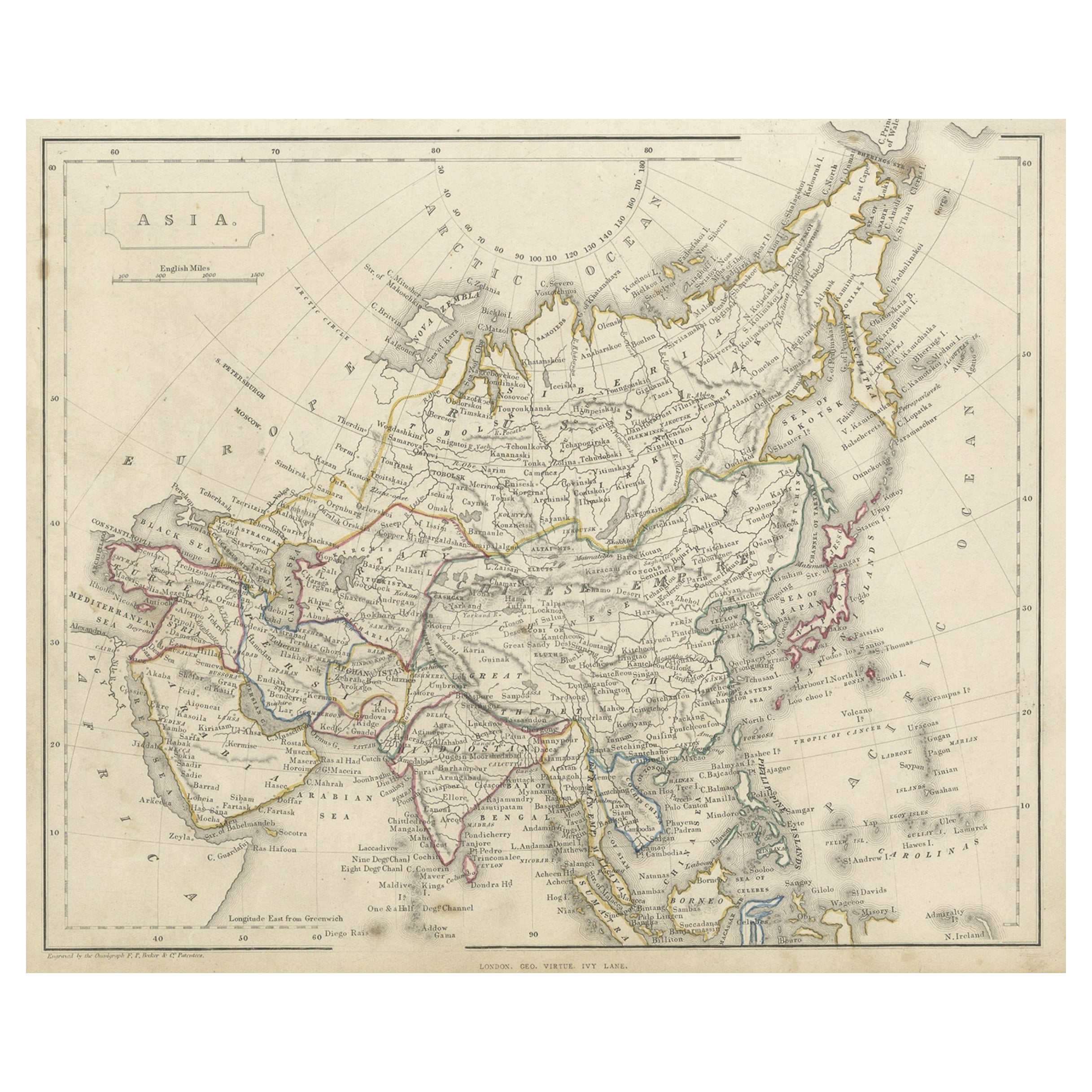
View AllAntique Map of Asia by A & C, Black, 1870
Located in Langweer, NL
Antique map titled 'Asia'. Original antique map of Asia. This map originates from ‘Black's General Atlas of The World’. Published by A & C. Black, 1870.
Category
Antique Late 19th Century Maps
Materials
Paper

$235 Sale Price
20% Off
Antique Steel Engraved Map of Asia, c.1860
Located in Langweer, NL
Antique map titled 'Asia'. Steel engraved map of Asia by F. P. Becker & Co.
Artists and Engravers: Engraved by F.P. Becker & Co. Published in London.
Condition: Very good, gen...
Category
Antique 19th Century Maps
Materials
Paper
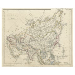
$74 Sale Price
20% Off
Antique Map of Asia by Young, c.1860
Located in Langweer, NL
Antique map titled 'Asia'. Steel engraved map of Asia by Francis Young.
Artists and Engravers: Engraved by Lewis Becker. Published by S.O. Beeton.
We sell original antique maps to...
Category
Antique 19th Century Maps
Materials
Paper

$127 Sale Price
20% Off
Antique Map of Asia by Balbi '1847'
Located in Langweer, NL
Antique map titled 'Asie'. Original antique map of Asia. This map originates from 'Abrégé de Géographie (..)' by Adrien Balbi. Published 1847.
Category
Antique Mid-19th Century Maps
Materials
Paper

$188 Sale Price
20% Off
Antique Map of Asia by Lapie, 1842
Located in Langweer, NL
Antique map titled 'Carte de l'Asie'. Map of Asia. This map originates from 'Atlas universel de géographie ancienne et moderne (..)' by Pierre M. Lapie and...
Category
Antique Mid-19th Century Maps
Materials
Paper

$565 Sale Price
20% Off
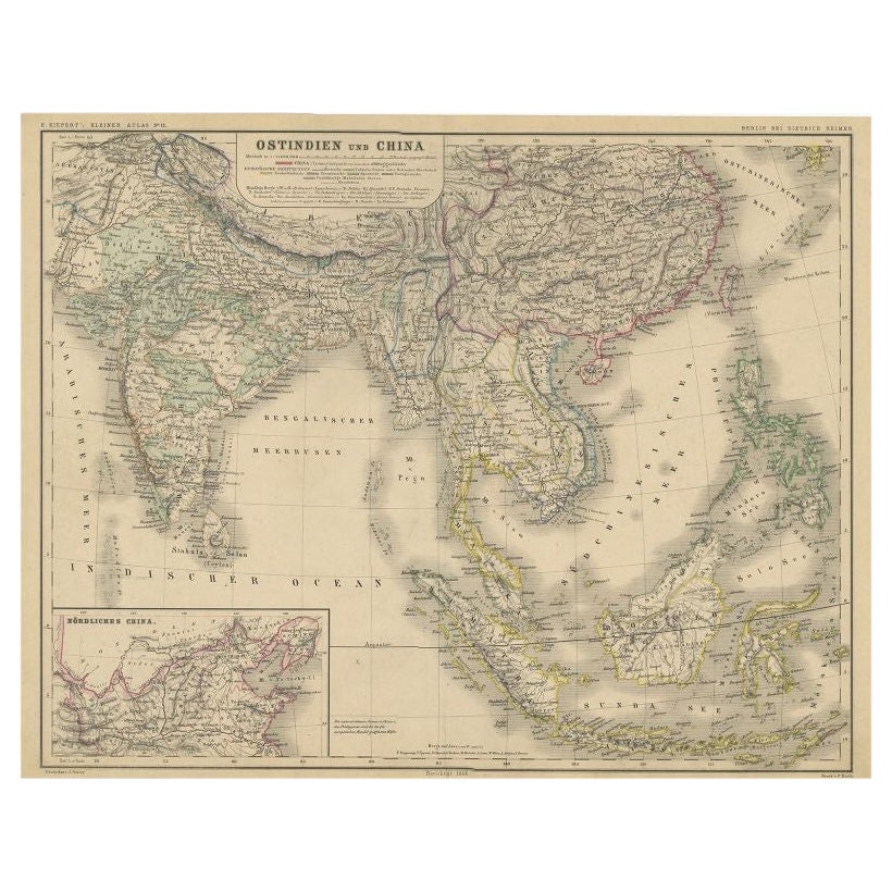
Antique Map of Southeast Asia and China by Kiepert, c.1870
By Thomas Kitchin
Located in Langweer, NL
Antique map titled 'Ostindien und China'. Old map of Southeast Asia and China. This map originates from 'H. Kiepert's Kleiner Atlas der Neueren Geographie für Schule und Haus'. Artis...
Category
Antique 19th Century Maps
Materials
Paper

You May Also Like
Large Original Antique Map of Asia by Sidney Hall, 1847
Located in St Annes, Lancashire
Great map of Asia
Drawn and engraved by Sidney Hall
Steel engraving
Original colour outline
Published by A & C Black. 1847
Unframed
Free shipping
Category
Antique 1840s Scottish Maps
Materials
Paper

Antique 1803 Italian Map of Asia Including China Indoneseia India
Located in Amsterdam, Noord Holland
Antique 1803 Italian Map of Asia Including China Indoneseia India
Very nice map of Asia. 1803.
Additional information:
Type: Map
Country of Manufacturing: Europe
Period: 19th centu...
Category
Antique 19th Century European Maps
Materials
Paper

$584 Sale Price
20% Off
Original Antique Map of China, Arrowsmith, 1820
Located in St Annes, Lancashire
Great map of China
Drawn under the direction of Arrowsmith
Copper-plate engraving
Published by Longman, Hurst, Rees, Orme and Brown, 1820
Unfr...
Category
Antique 1820s English Maps
Materials
Paper

Original Antique Map of The Eastern Hemisphere by Dower, circa 1835
Located in St Annes, Lancashire
Nice map of the Eastern Hemisphere
Drawn and engraved by J.Dower
Published by Orr & Smith. C.1835
Unframed.
Free shipping
Category
Antique 1830s English Maps
Materials
Paper

Super Rare Antique French Map of Chine and the Chinese Empire, 1780
Located in Amsterdam, Noord Holland
Super Rare Antique French Map of Chine and the Chinese Empire, 1780
Very nice map of Asia. 1780 Made by Bonne.
Additional information:
Type: Map
...
Category
Antique 18th Century European Maps
Materials
Paper

$584 Sale Price
32% Off
Large Original Vintage Map of S.E Asia, with a Vignette of Singapore
Located in St Annes, Lancashire
Great map of South East Asia
Original color. Good condition
Published by Alexander Gross
Unframed.
Category
Vintage 1920s English Maps
Materials
Paper

More Ways To Browse
Antique Indian Maps
Map Greece
Roman Map
Antique Maps Of Russia
Antique Roman Map
Maps Of Mediterranean
Mercator Map
Antique Railroad Furniture
Atlas Globe
Antique Mississippi Furniture
Framed World Map
Hand Drawn Map
Rare Compass
Antique Furniture Rollers
16th Century Scotland
Antique Wood Coat Of Arms
Antique Maps Australia
Antique Quadrant