Items Similar to Antique Map of China Including Korea and Taiwan by Vaugondy, 1749


Want more images or videos?
Request additional images or videos from the seller
1 of 6
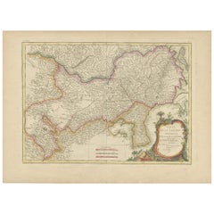
Antique Map of China Including Korea and Taiwan by Vaugondy, 1749
$479.67
$599.5920% Off
£356.83
£446.0320% Off
€400
€50020% Off
CA$656.83
CA$821.0420% Off
A$730.31
A$912.8920% Off
CHF 381.33
CHF 476.6620% Off
MX$8,889.66
MX$11,112.0720% Off
NOK 4,865.58
NOK 6,081.9720% Off
SEK 4,558.81
SEK 5,698.5220% Off
DKK 3,044.98
DKK 3,806.2220% Off
Shipping
Retrieving quote...The 1stDibs Promise:
Authenticity Guarantee,
Money-Back Guarantee,
24-Hour Cancellation
About the Item
Antique map titled 'Empire de la Chine'. Beautiful map of China including Korea and Taiwan (Formosa). This map originates from 'Atlas Universel (..)' by Gilles Robert de Vaugondy, 1749.
Frame included. We carefully pack our framed items to ensure safe shipping.
- Dimensions:Height: 10.83 in (27.5 cm)Width: 12.09 in (30.7 cm)Depth: 0.6 in (1.5 cm)
- Materials and Techniques:
- Period:
- Date of Manufacture:1749
- Condition:General age-related toning, minor wear. Original folding line. Frame included, lightly used. Please study images carefully.
- Seller Location:Langweer, NL
- Reference Number:Seller: BG-11663-11stDibs: LU3054321377952
About the Seller
5.0
Recognized Seller
These prestigious sellers are industry leaders and represent the highest echelon for item quality and design.
Platinum Seller
Premium sellers with a 4.7+ rating and 24-hour response times
Established in 2009
1stDibs seller since 2017
2,511 sales on 1stDibs
Typical response time: <1 hour
- ShippingRetrieving quote...Shipping from: Langweer, Netherlands
- Return Policy
Authenticity Guarantee
In the unlikely event there’s an issue with an item’s authenticity, contact us within 1 year for a full refund. DetailsMoney-Back Guarantee
If your item is not as described, is damaged in transit, or does not arrive, contact us within 7 days for a full refund. Details24-Hour Cancellation
You have a 24-hour grace period in which to reconsider your purchase, with no questions asked.Vetted Professional Sellers
Our world-class sellers must adhere to strict standards for service and quality, maintaining the integrity of our listings.Price-Match Guarantee
If you find that a seller listed the same item for a lower price elsewhere, we’ll match it.Trusted Global Delivery
Our best-in-class carrier network provides specialized shipping options worldwide, including custom delivery.More From This Seller
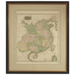
View AllAntique Map of Asia 'in Frame, circa 1739'
Located in Langweer, NL
Antique map titled 'Asia Dividida em suas Regioens & Principaes Estados'. Rare and uncommon map of Asia. Signed '1739'. Source unknown, to be determined.
...
Category
Antique Mid-18th Century Maps
Materials
Paper

$623 Sale Price
35% Off
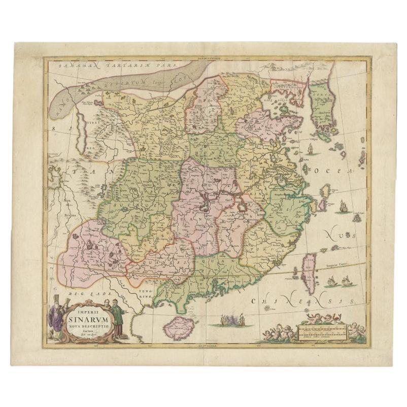
Antique Map of China and Korea incl Formosa and Hainan, by Janssonius, ca.1650
Located in Langweer, NL
Antique map titled 'Imperii Sinarum Nova Descriptio'. Beautiful map of China and Korea, much detail troughout the map. Including the Islands of Formosa (Taiwan) and Hainan. The Great...
Category
Antique 17th Century Maps
Materials
Paper
$2,830 Sale Price
20% Off
Antique Map of China, Korea, Japan and the Northern Philippines, circa 1780
Located in Langweer, NL
Antique map titled 'Carte de l'Empire de la Chine de la Tartarie Chinoise, et du Royaume de Corée'. Interesting and detailed map of China, Korea, Japan and the Northern Philippines. ...
Category
Antique Late 18th Century Maps
Materials
Paper

$287 Sale Price
20% Off
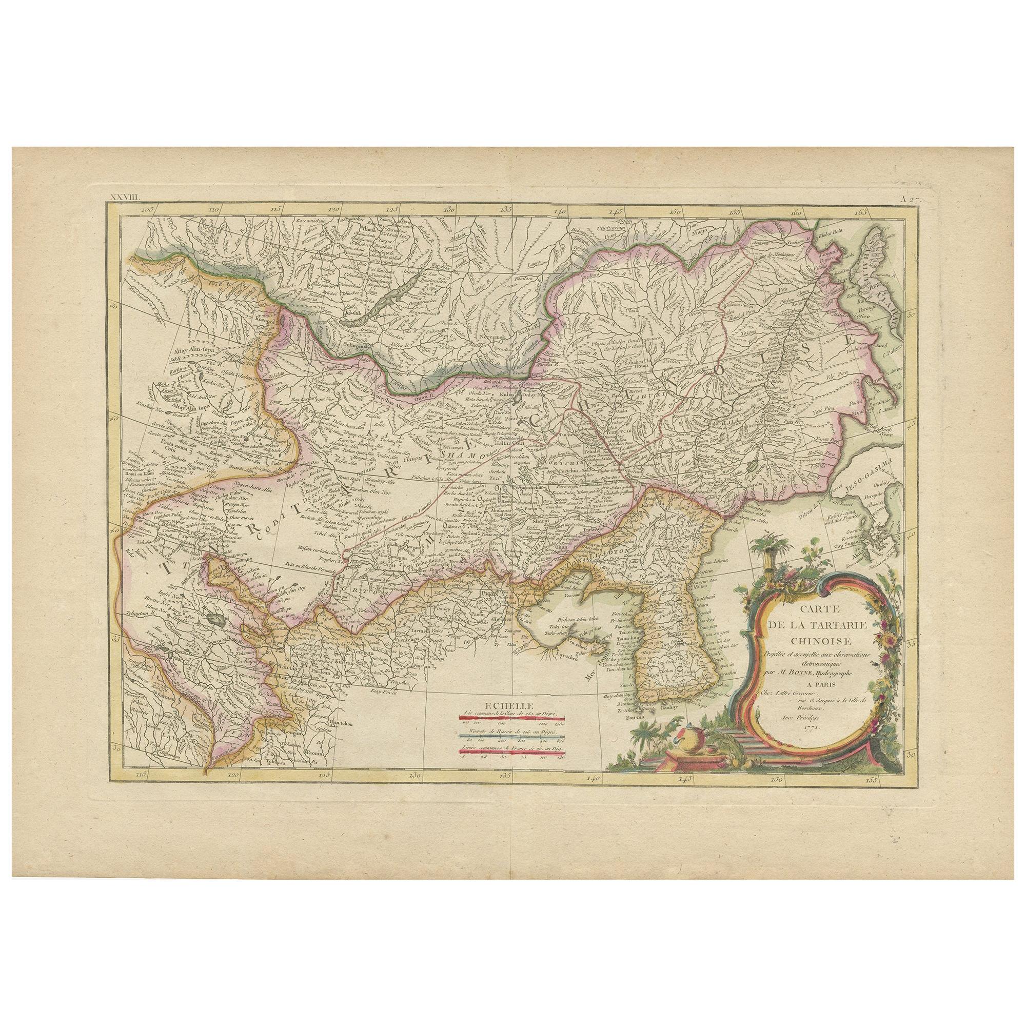
Antique Map of Korea and Southern China by Bonne '1771'
Located in Langweer, NL
Antique map titled 'Carte de la Tartarie Chinoise'. Original antique map of Korea and Southern China. Covers from the Lop Nor region eastward to K...
Category
Antique Mid-18th Century Maps
Materials
Paper
$551 Sale Price
20% Off
Antique Map of Asia by Tirion 'c.1760'
Located in Langweer, NL
Antique map titled 'Nuova Carta dell Asia'. Decorative map of Asia. Published by I. Tirion, circa 1760.
Category
Antique Mid-18th Century Maps
Materials
Paper

$1,055 Sale Price
20% Off
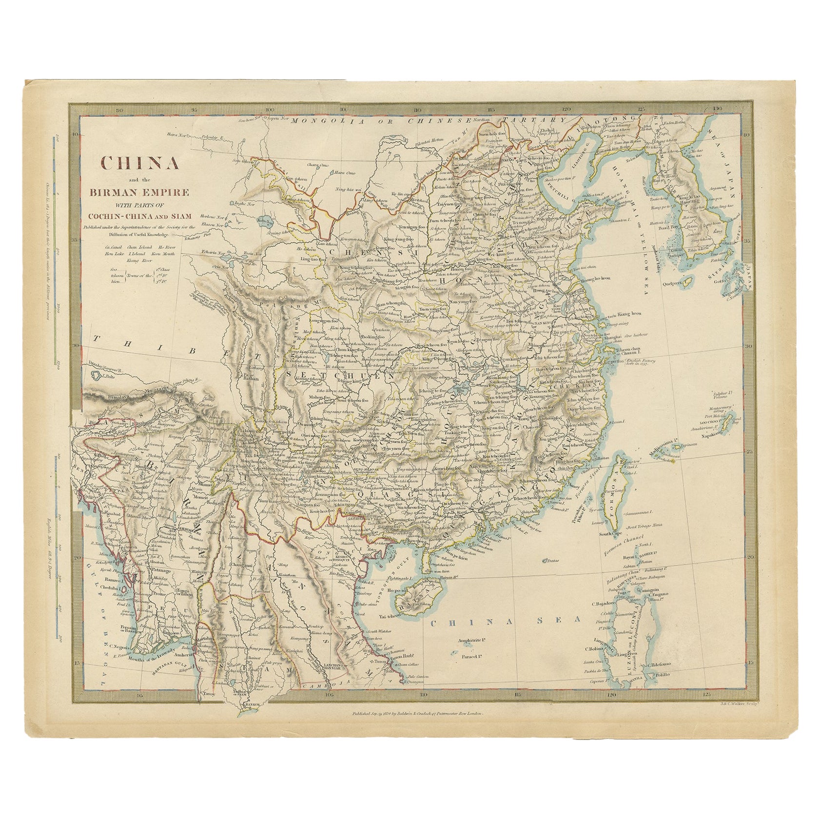
Antique Map of China, Also Depicting Formosa 'Taiwan' and Part of Korea, c.1840
Located in Langweer, NL
Antique map titled 'China'. Old map of China, also depicting Formosa (Taiwan) and part of Korea. Source unknown, to be determined.
Artists and Engravers: Anonymous.
Condition: ...
Category
Antique 19th Century Maps
Materials
Paper

$230 Sale Price
20% Off
You May Also Like
Super Rare Antique French Map of Chine and the Chinese Empire, 1780
Located in Amsterdam, Noord Holland
Super Rare Antique French Map of Chine and the Chinese Empire, 1780
Very nice map of Asia. 1780 Made by Bonne.
Additional information:
Type: Map
...
Category
Antique 18th Century European Maps
Materials
Paper

$584 Sale Price
33% Off
Framed Early 19th Century Drawn and Engraved Map of China
By John Knighton Thomson
Located in San Francisco, CA
Hand drawn and tinted engraved map of China dated 1815
Created for Thomson's New General Atlas
Edinburgh
Beautifully framed with a linen covered mat.
Category
Antique Early 19th Century European Prints
Materials
Paper
China: An Original 18th Century Hand-colored Map by E. Bowen
Located in Alamo, CA
This is an original 18th century hand-colored map entitled "A New & Accurate Map of China, Drawn from Surveys made by the Jesuit Missionaries, by order of the Emperor. The whole bein...
Category
Mid-18th Century Old Masters Landscape Prints
Materials
Engraving

Framed Map of China
Located in Greenwich, CT
Map of China, 19th century. European print map of China
Conservation frame with walnut frame
Overall dimension : 28 1/2" wide 31" high 2" depth with fra...
Category
Antique 19th Century European Qing Prints
Materials
Paper

$3,800
Antique French Map of Asia Including China Indoneseia India, 1783
Located in Amsterdam, Noord Holland
Very nice map of Asia. 1783 Dedie au Roy.
Additional information:
Country of Manufacturing: Europe
Period: 18th century Qing (1661 - 1912)
Condition: Overall Condition B (Good Used)...
Category
Antique 18th Century European Maps
Materials
Paper

$648 Sale Price
20% Off
Original Antique Map of China, Arrowsmith, 1820
Located in St Annes, Lancashire
Great map of China
Drawn under the direction of Arrowsmith
Copper-plate engraving
Published by Longman, Hurst, Rees, Orme and Brown, 1820
Unfr...
Category
Antique 1820s English Maps
Materials
Paper

More Ways To Browse
18th Century Safe
Antique Map Of Korea
Taiwan Map
Antique Maps Scotland
Denmark Map
Antique Maps Of North America
Wine Map
Map Greece
Roman Map
Antique Maps Of Russia
Antique Roman Map
Maps Of Mediterranean
Mercator Map
Antique Railroad Furniture
Atlas Globe
Antique Mississippi Furniture
Framed World Map
Hand Drawn Map