Items Similar to Antique Map of College Corner, Sugar Valley, New Lexington & Verona '1871'

Want more images or videos?
Request additional images or videos from the seller
1 of 5
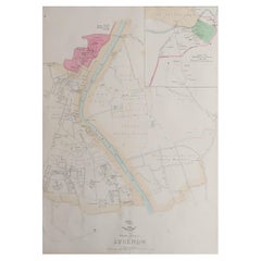
Antique Map of College Corner, Sugar Valley, New Lexington & Verona '1871'
$236.29
$295.3620% Off
£177.11
£221.3920% Off
€200
€25020% Off
CA$324.62
CA$405.7820% Off
A$362.41
A$453.0120% Off
CHF 189.90
CHF 237.3720% Off
MX$4,436.27
MX$5,545.3320% Off
NOK 2,411.71
NOK 3,014.6320% Off
SEK 2,273.93
SEK 2,842.4220% Off
DKK 1,522.47
DKK 1,903.0920% Off
Shipping
Retrieving quote...The 1stDibs Promise:
Authenticity Guarantee,
Money-Back Guarantee,
24-Hour Cancellation
About the Item
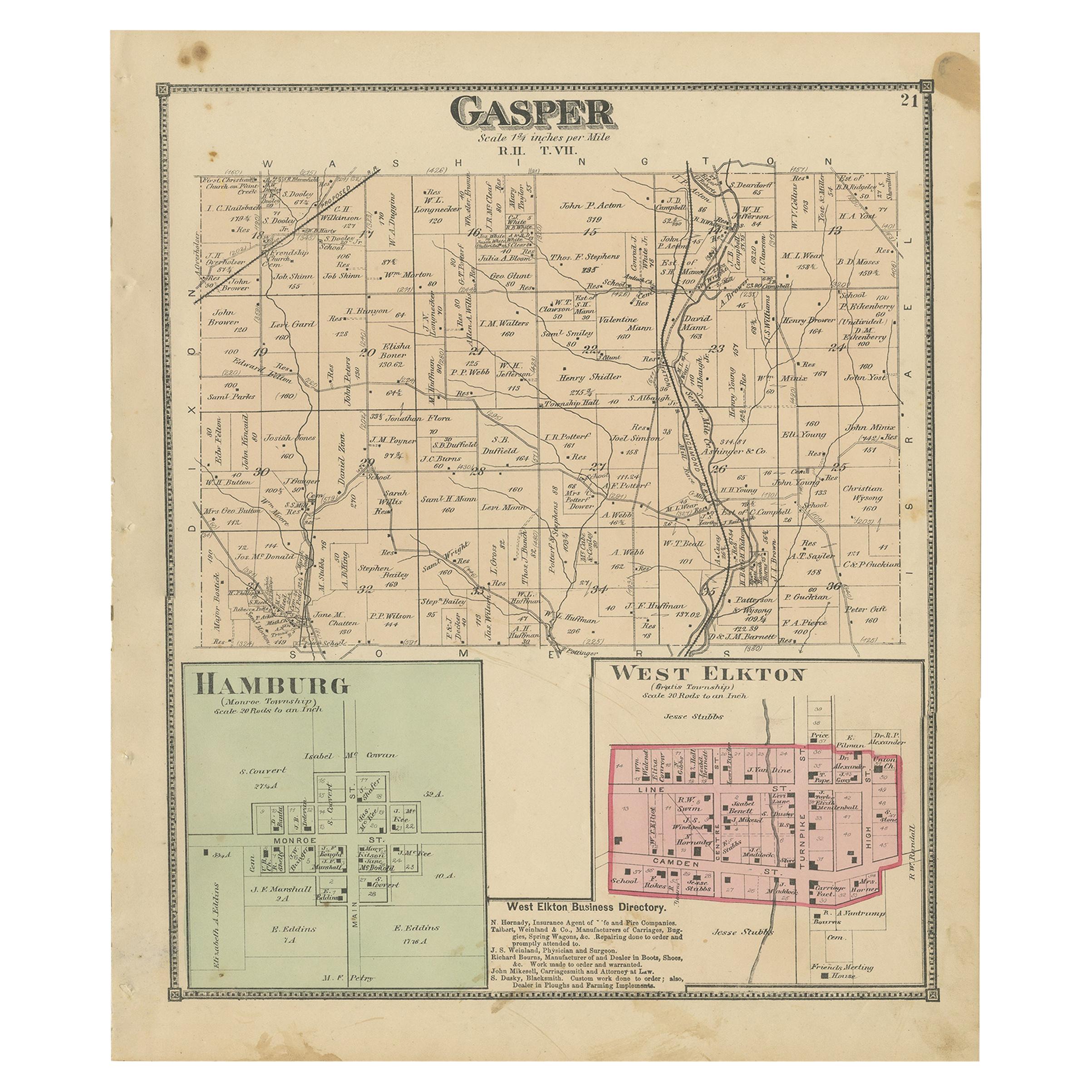
Antique map titled 'College Corner, Sugar Valley, New Lexington, Verona'. Original antique map of villages and communities of Ohio. This map originates from 'Atlas of Preble County Ohio' by C.O. Titus. Published 1871.
- Dimensions:Height: 14.97 in (38 cm)Width: 12.41 in (31.5 cm)Depth: 0.02 in (0.5 mm)
- Materials and Techniques:
- Period:
- Date of Manufacture:1871
- Condition:Original folding lines. Shows some wear and foxing. General age-related toning. Few small defects in margins. Please study images carefully.
- Seller Location:Langweer, NL
- Reference Number:Seller: BG-11874-61stDibs: LU3054321717062
About the Seller
5.0
Recognized Seller
These prestigious sellers are industry leaders and represent the highest echelon for item quality and design.
Platinum Seller
Premium sellers with a 4.7+ rating and 24-hour response times
Established in 2009
1stDibs seller since 2017
2,511 sales on 1stDibs
Typical response time: <1 hour
- ShippingRetrieving quote...Shipping from: Langweer, Netherlands
- Return Policy
Authenticity Guarantee
In the unlikely event there’s an issue with an item’s authenticity, contact us within 1 year for a full refund. DetailsMoney-Back Guarantee
If your item is not as described, is damaged in transit, or does not arrive, contact us within 7 days for a full refund. Details24-Hour Cancellation
You have a 24-hour grace period in which to reconsider your purchase, with no questions asked.Vetted Professional Sellers
Our world-class sellers must adhere to strict standards for service and quality, maintaining the integrity of our listings.Price-Match Guarantee
If you find that a seller listed the same item for a lower price elsewhere, we’ll match it.Trusted Global Delivery
Our best-in-class carrier network provides specialized shipping options worldwide, including custom delivery.More From This Seller
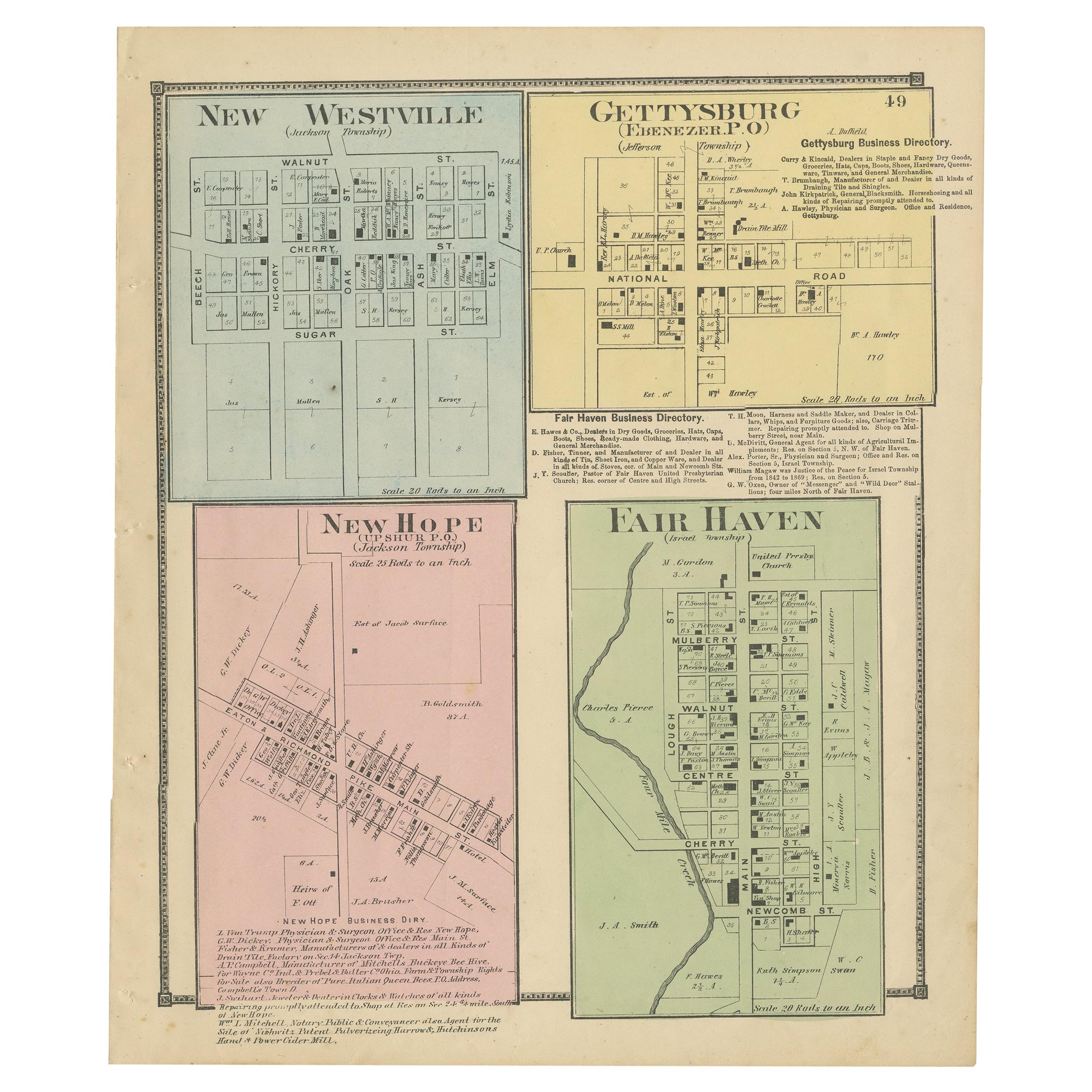
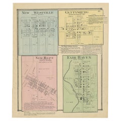
View AllAntique Map of New Westville, Gettysburg, New Hope & Fair Haven, 1871
Located in Langweer, NL
Antique map titled 'New Westville, Gettysburg, New Hope, Fair Haven'. Original antique map of villages and communities of Ohio. This map originates from 'Atlas of Preble County Ohio'...
Category
Antique Late 19th Century Maps
Materials
Paper
$236 Sale Price
20% Off
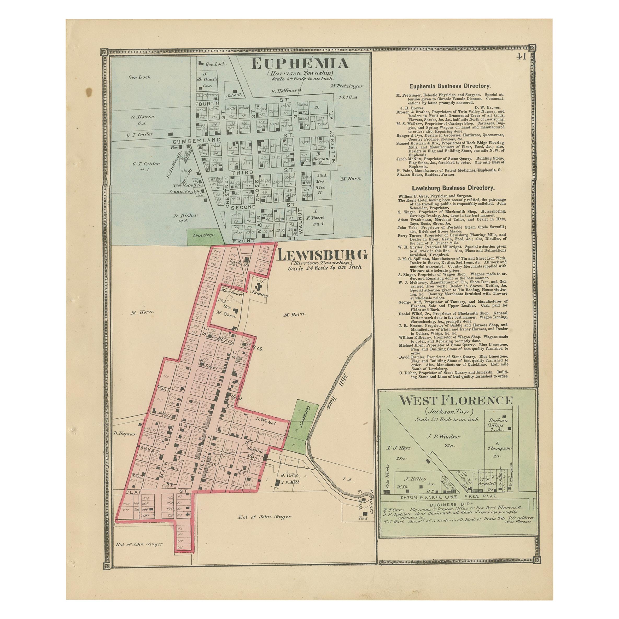
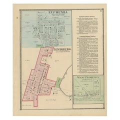
Antique Map of Euphemia, Lewisburg & West Florence, 1871
Located in Langweer, NL
Antique map titled 'Euphemia, Lewisburg, West Florence'. Original antique map of villages and communities of Ohio. This map originates from 'Atlas of Preble County Ohio' by C.O. Titu...
Category
Antique Late 19th Century Maps
Materials
Paper
$236 Sale Price
20% Off
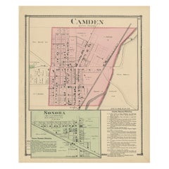
Antique Map of Camden and Sonora, 1871
Located in Langweer, NL
Antique map titled 'Camden, Sonora'. Original antique map of villages and communities of Ohio. This map originates from 'Atlas of Preble County Ohio' by C.O. Titus. Published 1871.
Category
Antique Late 19th Century Maps
Materials
Paper
$236 Sale Price
20% Off
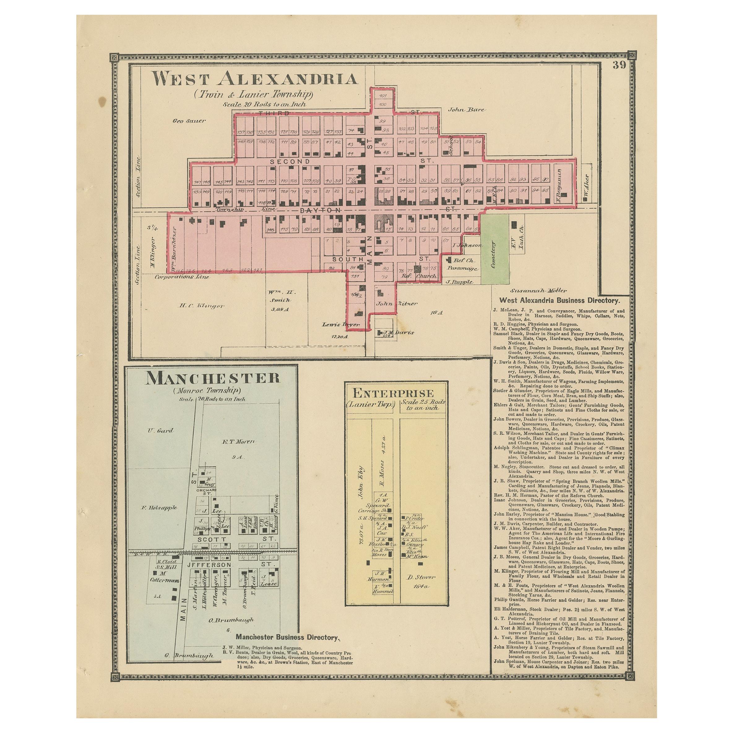
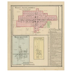
Antique Map of West Alexandria, Manchester & Enterprise, 1871
Located in Langweer, NL
Antique map titled 'West Alexandria, Manchester, Enterprise'. Original antique map of villages and communities of Ohio. This map originates from 'Atlas of Preble County Ohio' by C.O....
Category
Antique Late 19th Century Maps
Materials
Paper
$236 Sale Price
20% Off
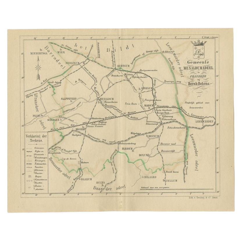
Antique Map of the Menaldumadeel Township by Behrns, 1861
Located in Langweer, NL
Antique map titled 'Gemeente Menaldumadeel'. Old map depicting the Menaldumadeel township including cities and villages like Berlikum, Wier, Menaldum, Dronrijp, Marsum, Engelum, Dein...
Category
Antique 19th Century Maps
Materials
Paper
$84 Sale Price
20% Off
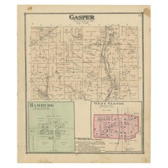
Antique Map of Gasper, Hamburg and West Elkton, 1871
Located in Langweer, NL
Antique map titled 'Gasper, Hamburg, West Elkton'. Original antique map of villages and communities of Ohio. This map originates from 'Atlas of Preble County Ohio' by C.O. Titus. Pub...
Category
Antique Late 19th Century Maps
Materials
Paper
$236 Sale Price
20% Off
You May Also Like
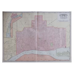
Large Original Antique City Plan of Detroit, USA, 1894
By Rand McNally & Co.
Located in St Annes, Lancashire
Fabulous colorful map of Detroit
Original color
By Rand, McNally & Co.
Published, 1894
Unframed
Free shipping.
Category
Antique 1890s American Maps
Materials
Paper
Large Original Antique City Plan of Montreal, Canada, circa 1900
By Rand McNally & Co.
Located in St Annes, Lancashire
Fabulous colorful map of Montreal
Original color
By Rand, McNally & Co.
Published, circa 1900
Unframed
Minor edge tears
Free shipping.
Category
Antique Early 1900s American Maps
Materials
Paper

Original Antique Map of the American State of Illinois ( Southern Part ), 1903
Located in St Annes, Lancashire
Antique map of Illinois ( Southern part )
Published By A & C Black. 1903
Original colour
Good condition
Unframed.
Free shipping
Category
Antique Early 1900s English Maps
Materials
Paper

Large Original Antique Map of New York State( Southern ), USA, C.1900
Located in St Annes, Lancashire
Fabulous map of Southern New York . With a vignette of Lower Manhattan
Original color.
Engraved and printed by the George F. Cram Company, Indianapolis.
Published, C.1900.
Unfram...
Category
Antique 1890s American Maps
Materials
Paper

Large Original Antique City Plan of Lucknow, India. Edward Weller, 1861
Located in St Annes, Lancashire
Great city plan of Lucknow
Lithograph engraving by Edward Weller
Original colour
Published, 1861
Unframed
Good condition / slight corner loss bottom right shown in last image
...
Category
Antique 1860s English Victorian Maps
Materials
Paper
Original Antique English County Map, Huntingdonshire, J & C Walker, 1851
Located in St Annes, Lancashire
Great map of Huntingdonshire
Original colour
By J & C Walker
Published by Longman, Rees, Orme, Brown & Co. 1851
Unframed.
Category
Antique 1850s English Other Maps
Materials
Paper

More Ways To Browse
Used College Furniture
Antique Ohio Maps
Antique Roman Map
Maps Of Mediterranean
Mercator Map
Antique Railroad Furniture
Atlas Globe
Antique Mississippi Furniture
Framed World Map
Hand Drawn Map
Rare Compass
Antique Furniture Rollers
16th Century Scotland
Antique Wood Coat Of Arms
Antique Maps Australia
Antique Quadrant
Caribbean Antique Furniture
Antique Native American Collectibles