Items Similar to Antique Map of the Eastern Hemisphere by Teesdale, '1831'


Want more images or videos?
Request additional images or videos from the seller
1 of 5
Antique Map of the Eastern Hemisphere by Teesdale, '1831'
$239.84
$299.7920% Off
£178.41
£223.0220% Off
€200
€25020% Off
CA$328.42
CA$410.5220% Off
A$365.16
A$456.4420% Off
CHF 190.66
CHF 238.3320% Off
MX$4,444.83
MX$5,556.0420% Off
NOK 2,432.79
NOK 3,040.9920% Off
SEK 2,279.41
SEK 2,849.2620% Off
DKK 1,522.49
DKK 1,903.1120% Off
Shipping
Retrieving quote...The 1stDibs Promise:
Authenticity Guarantee,
Money-Back Guarantee,
24-Hour Cancellation
About the Item
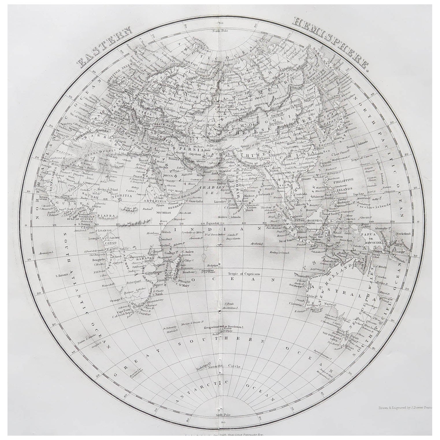
Antique map titled 'Eastern Hemisphere'. Hemispherical map of eastern hemisphere showing tracks of the navigators James Cook and John Gore. Plate 1 from: A new general atlas of the world, containing separate maps of its various countries and states, and exhibiting their boundaries & divisions, also the chains of mountains, rivers, lakes ... / by John Dower. London : Henry Teesdale, 1831.
- Dimensions:Height: 19.89 in (50.5 cm)Width: 19.49 in (49.5 cm)Depth: 0.2 in (5 mm)
- Materials and Techniques:
- Period:
- Date of Manufacture:1831
- Condition:Original folding line. Shows overall creasing and a few small defects/tears. Passe-partout/matting included. Please study image carefully.
- Seller Location:Langweer, NL
- Reference Number:Seller: BG-009231stDibs: LU3054324996292
About the Seller
5.0
Recognized Seller
These prestigious sellers are industry leaders and represent the highest echelon for item quality and design.
Platinum Seller
Premium sellers with a 4.7+ rating and 24-hour response times
Established in 2009
1stDibs seller since 2017
2,510 sales on 1stDibs
Typical response time: <1 hour
- ShippingRetrieving quote...Shipping from: Langweer, Netherlands
- Return Policy
Authenticity Guarantee
In the unlikely event there’s an issue with an item’s authenticity, contact us within 1 year for a full refund. DetailsMoney-Back Guarantee
If your item is not as described, is damaged in transit, or does not arrive, contact us within 7 days for a full refund. Details24-Hour Cancellation
You have a 24-hour grace period in which to reconsider your purchase, with no questions asked.Vetted Professional Sellers
Our world-class sellers must adhere to strict standards for service and quality, maintaining the integrity of our listings.Price-Match Guarantee
If you find that a seller listed the same item for a lower price elsewhere, we’ll match it.Trusted Global Delivery
Our best-in-class carrier network provides specialized shipping options worldwide, including custom delivery.More From This Seller
View AllAntique Map of the Eastern Hemisphere by Wyld, 1842
Located in Langweer, NL
Antique map titled 'Eastern Hemisphere'. Large map depicting the continents Europe, Asia, Afrika and Australia.
Artists and Engravers: James Wyld (1812–1887) was a British geograph...
Category
Antique 19th Century Maps
Materials
Paper

$1,054 Sale Price
20% Off
Antique Map of the Eastern Hemisphere by Wyld '1845'
Located in Langweer, NL
Antique map titled 'Eastern Hemisphere'. Original antique map of the eastern hemisphere. This map originates from 'An Atlas of the World, Comprehending Separate Maps of its...
Category
Antique Mid-19th Century Maps
Materials
Paper

$335 Sale Price
20% Off
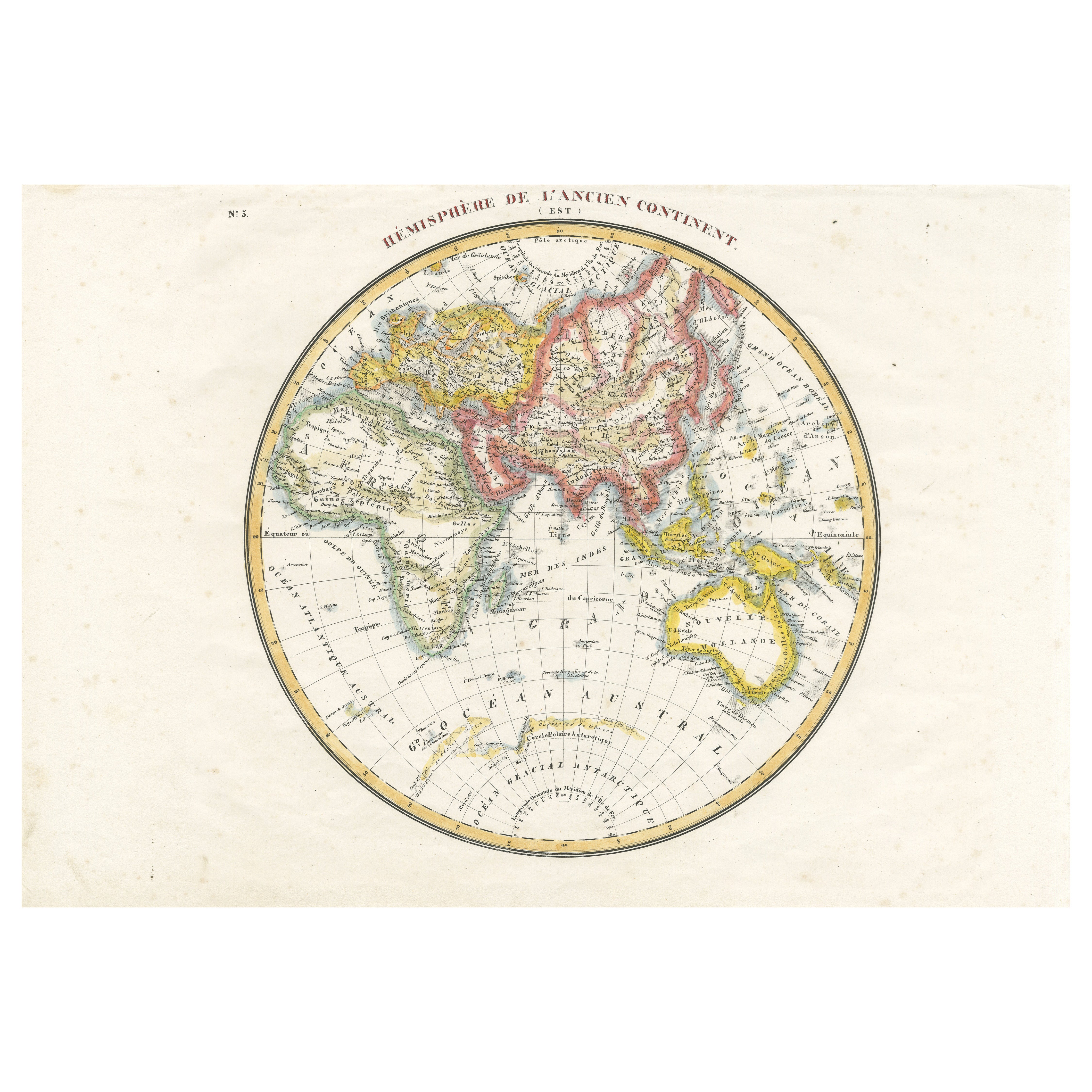
Antique Map of the Eastern Hemisphere by Lapie, France, circa 1830
Located in Langweer, NL
Antique Map of the Eastern Hemisphere by Lapie, France, circa 1830
This finely engraved and hand-colored antique map, titled Hémisphère de l'ancien continent (Eastern Hemisphere), w...
Category
Antique 1830s Maps
Materials
Paper
Antique Map of the Western Hemisphere by Wyld '1845'
Located in Langweer, NL
Antique map titled 'Western Hemisphere'. Original antique map of the western hemisphere. This map originates from 'An Atlas of the World, Comprehending Separate Maps of its...
Category
Antique Mid-19th Century Maps
Materials
Paper

$335 Sale Price
20% Off
Antique Map of The World in Hemispheres by W. G. Blackie, 1859
Located in Langweer, NL
Antique map titled 'The World in Hemispheres with other projections'. Original antique map of The World. This map originates from ‘The Imperial Atlas of Modern Geography’. Published ...
Category
Antique Mid-19th Century Maps
Materials
Paper

$293 Sale Price
30% Off
Antique Map of the World by Balbi '1847'
Located in Langweer, NL
Antique map titled 'Planisphère'. Original antique map of the world. This map originates from 'Abrégé de Géographie (..)' by Adrien Balbi. Pub...
Category
Antique Mid-19th Century Maps
Materials
Paper

$239 Sale Price
20% Off
You May Also Like
Original Antique Map of The Eastern Hemisphere by Dower, circa 1835
Located in St Annes, Lancashire
Nice map of the Eastern Hemisphere
Drawn and engraved by J.Dower
Published by Orr & Smith. C.1835
Unframed.
Free shipping
Category
Antique 1830s English Maps
Materials
Paper

Original Antique Map of The World by Dower, circa 1835
Located in St Annes, Lancashire
Nice map of the World
Drawn and engraved by J.Dower
Published by Orr & Smith. C.1835
Unframed.
Free shipping
Category
Antique 1830s English Maps
Materials
Paper

Original Antique Map of The World by Thomas Clerk, 1817
Located in St Annes, Lancashire
Great map of The Eastern and Western Hemispheres
On 2 sheets
Copper-plate engraving
Drawn and engraved by Thomas Clerk, Edinburgh.
Published by Mackenzie And Dent, 1817
...
Category
Antique 1810s English Maps
Materials
Paper

Original Antique Map of The Western Hemisphere by Dower, circa 1835
Located in St Annes, Lancashire
Nice map of the Western Hemisphere
Drawn and engraved by J.Dower
Published by Orr & Smith. C.1835
Unframed.
Free shipping
Category
Antique 1830s English Maps
Materials
Paper

Large Original Antique Map of The World, Fullarton, C.1870
Located in St Annes, Lancashire
Great map of the World. Showing both hemispheres
From the celebrated Royal Illustrated Atlas
Lithograph. Original color.
Published by Fullarton, Edinburgh, C.1870
Unframed.
Rep...
Category
Antique 1870s Scottish Maps
Materials
Paper

Map of the World - Original Etching - 1820
Located in Roma, IT
Map of the World is an Original Etching realized by an unknown artist of 19th century in 1820.
Very good condition on two sheets of white paper joine...
Category
1820s Modern Figurative Prints
Materials
Etching

More Ways To Browse
James Cook Map
Antique Navigator
Map New Holland
Treasure Map
Caribbean Antiques
19th Century Map Of Africa
Antique Malaysia
Antique Map Of Ireland
Ships Log
Map Of Egypt
Nautical Maps
Antique Maps Of Long Island
James Cook Map
Antique Doctors Office Furniture
Pirate Furniture
Railroad Collectibles
Antique Map Mexico
Framed Map Of Paris