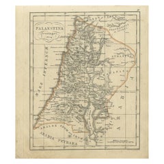
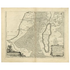
Antique Map of Palestine by Funke, 1825
View Similar Items

Want more images or videos?
Request additional images or videos from the seller
1 of 5
Antique Map of Palestine by Funke, 1825
Price:$115.74
About the Item
- Dimensions:Height: 9.93 in (25.2 cm)Width: 8.59 in (21.8 cm)Depth: 0 in (0.01 mm)
- Materials and Techniques:
- Period:
- Date of Manufacture:1825
- Condition:Condition: Very good, general age-related toning. Please study image carefully.
- Seller Location:Langweer, NL
- Reference Number:Seller: BG-11204-2-31stDibs: LU3054327623292
About the Seller
5.0
Recognized Seller
These prestigious sellers are industry leaders and represent the highest echelon for item quality and design.
Platinum Seller
Premium sellers with a 4.7+ rating and 24-hour response times
Established in 2009
1stDibs seller since 2017
2,533 sales on 1stDibs
Authenticity Guarantee
In the unlikely event there’s an issue with an item’s authenticity, contact us within 1 year for a full refund. DetailsMoney-Back Guarantee
If your item is not as described, is damaged in transit, or does not arrive, contact us within 7 days for a full refund. Details24-Hour Cancellation
You have a 24-hour grace period in which to reconsider your purchase, with no questions asked.Vetted Professional Sellers
Our world-class sellers must adhere to strict standards for service and quality, maintaining the integrity of our listings.Price-Match Guarantee
If you find that a seller listed the same item for a lower price elsewhere, we’ll match it.Trusted Global Delivery
Our best-in-class carrier network provides specialized shipping options worldwide, including custom delivery.More From This Seller
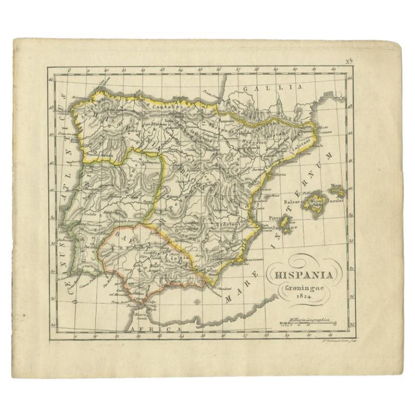
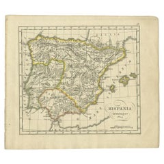
View AllAntique Map of Spain by Funke, 1825
Located in Langweer, NL
Antique map titled 'Hispania'. Old map of Spain originating from 'Atlas der Oude Wereld'. Artists and Engravers: Published by C. Ph. Funke and W. van Boek...
Category
Antique 19th Century Maps
Materials
Paper
$116 Sale Price
20% Off
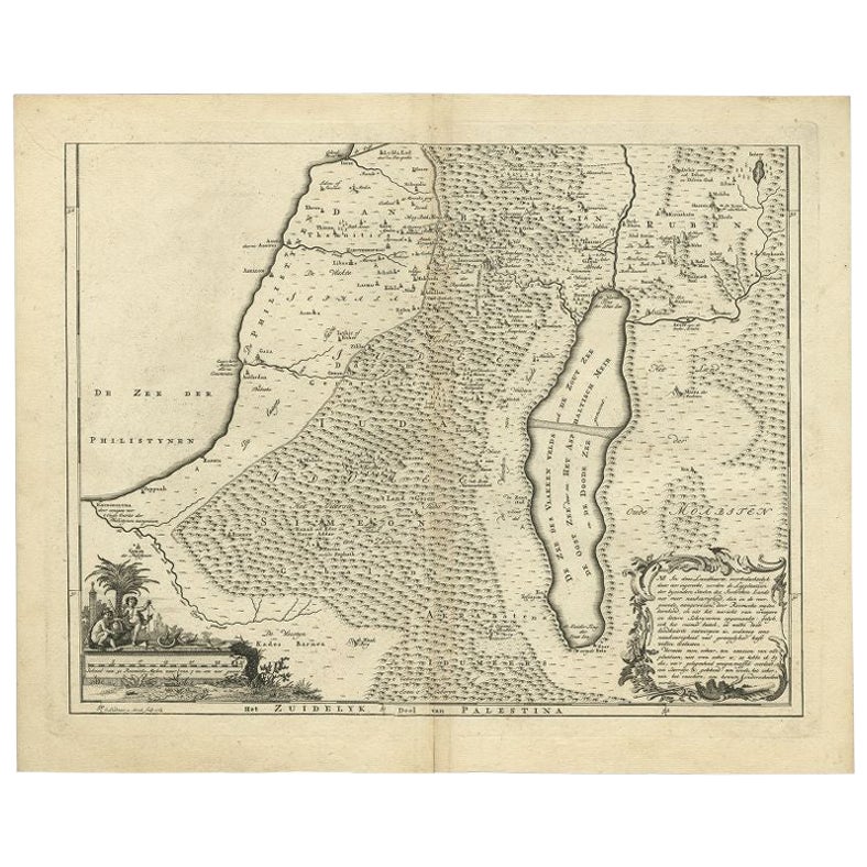
Antique Map of Southern Palestine by Bachiene, 1763
Located in Langweer, NL
"Antique map of the south part of Palestine. This simplified map shows the most important cities of the Jewish Land. Source unknown, to be determined. Artists and Engravers: Made by ...
Category
Antique 18th Century Maps
Materials
Paper
$305 Sale Price
20% Off
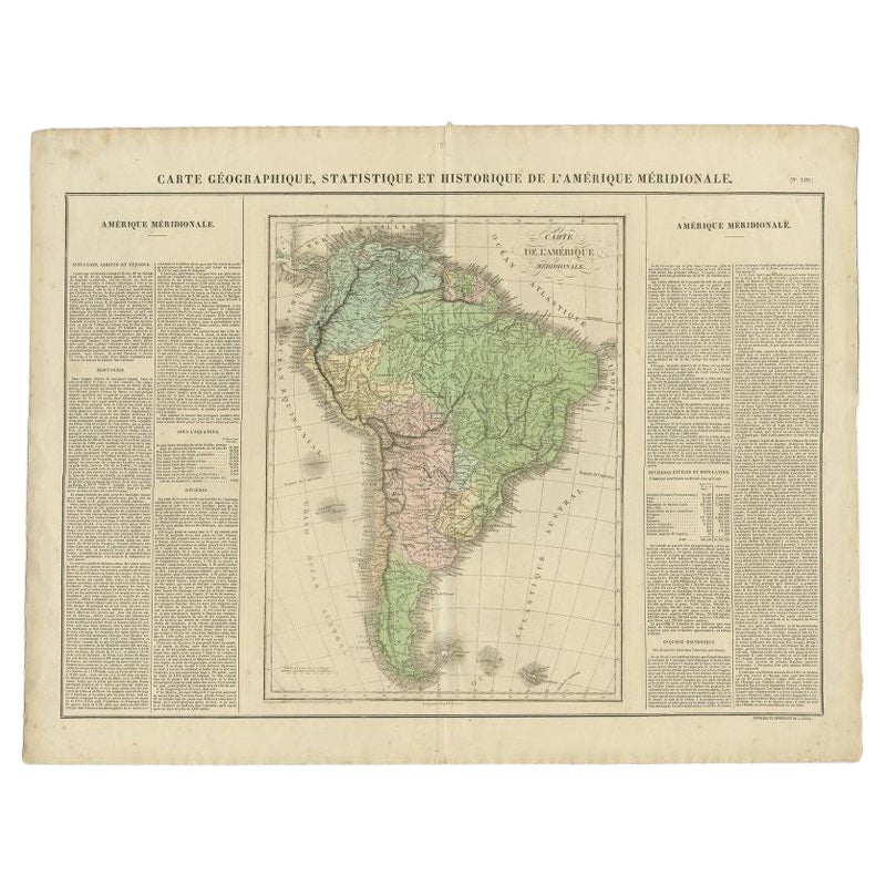
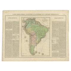
Antique Map of South America by Buchon, 1825
Located in Langweer, NL
Antique map titled 'Carte de l'Amérique méridionale'. Map of South America with attractive topography, surrounded on three sides by text on the history, geography, and economy of the...
Category
Antique 19th Century Maps
Materials
Paper
$129 Sale Price
20% Off
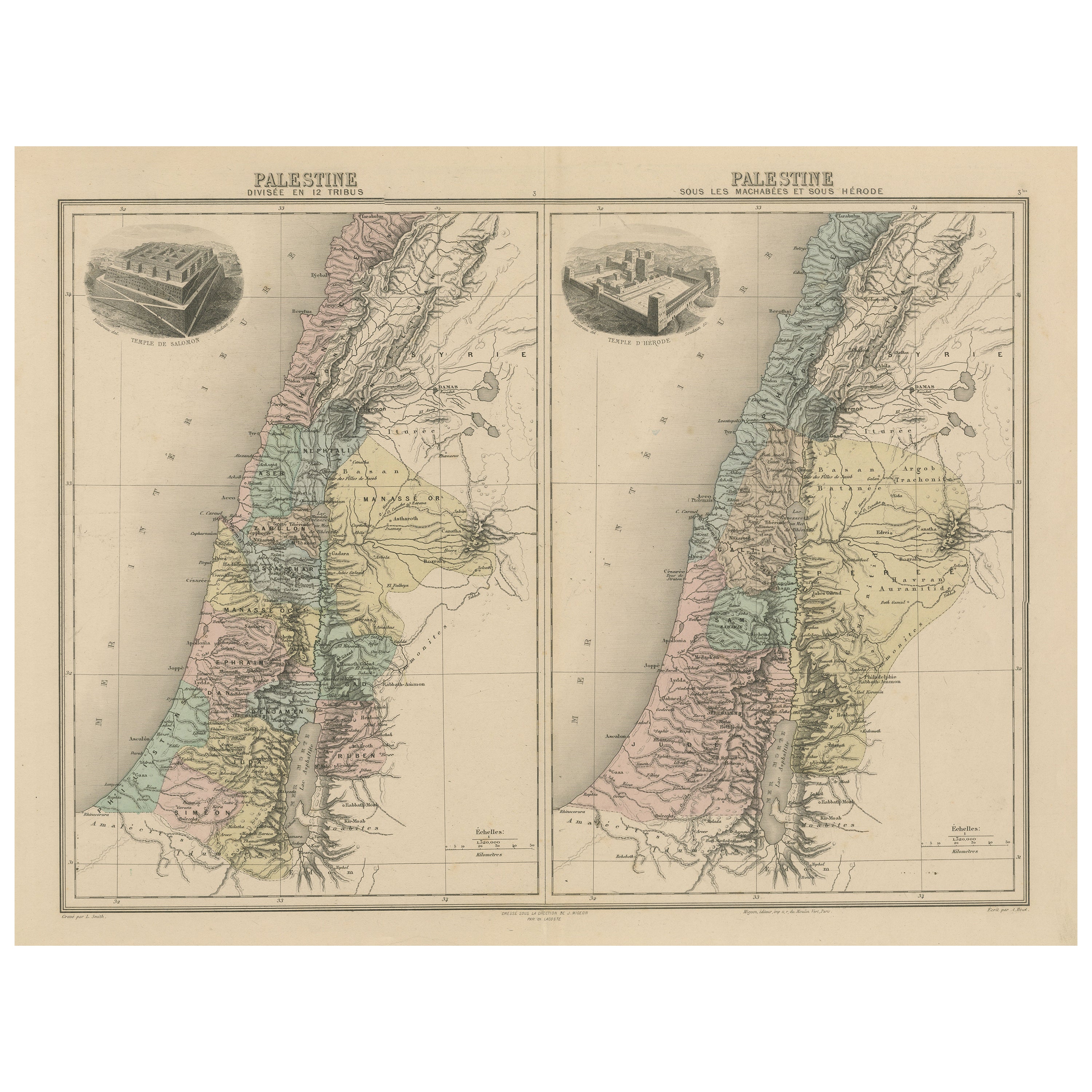
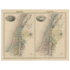
Palestine: Tribes & Maccabees – Antique Map by Migeon, Paris, 1892
Located in Langweer, NL
Palestine Divided into Tribes & Under the Maccabees – Antique Map by Migeon, 1892
This detailed antique map features two historical views of the Holy Land side by side: Palestine di...
Category
Antique Late 19th Century Maps
Materials
Paper
$321 Sale Price
20% Off
Antique Map of Polynesia and Australasia by Neele, 1825
Located in Langweer, NL
Antique map titled 'Polynesia and Australasia'. It shows Australia (New Holland), part of Asia, New Zealand and many islands. This map originates from 'Encyclopedia Londinensis'.
Category
Antique Early 19th Century Maps
Materials
Paper

$113 Sale Price
20% Off
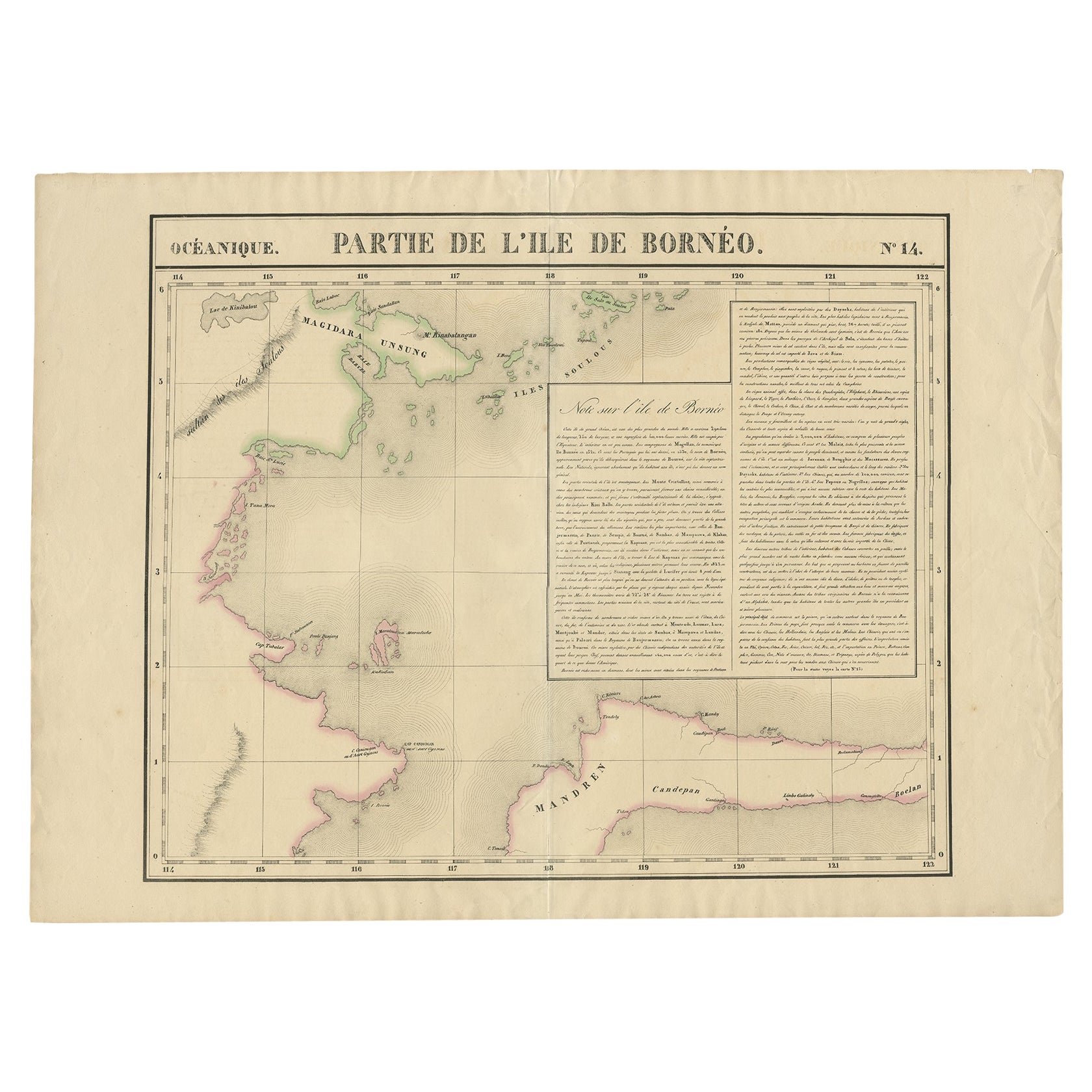
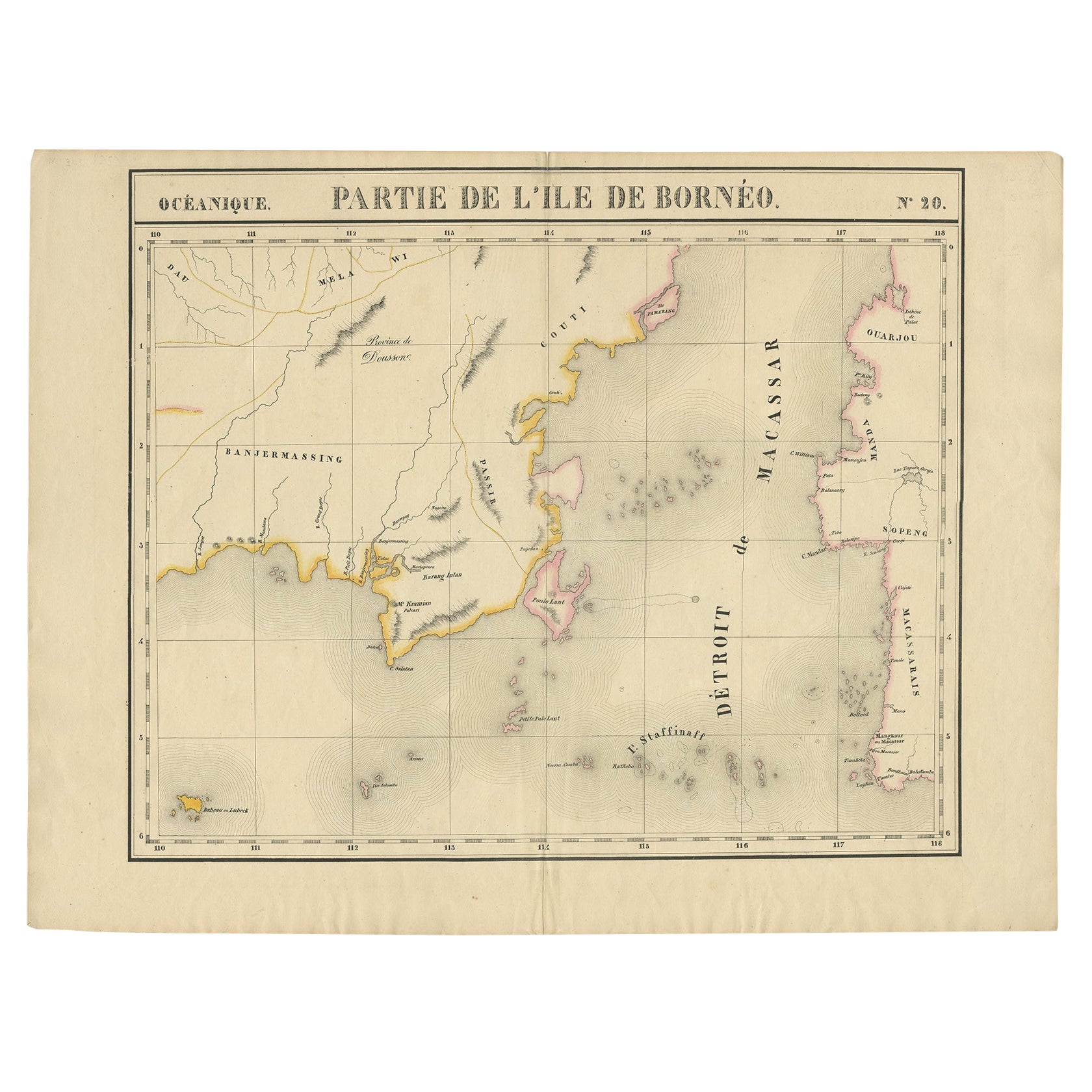
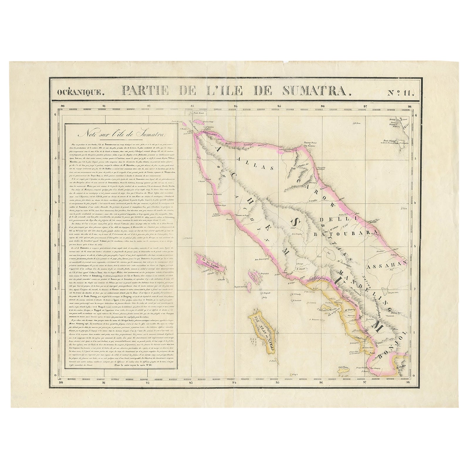
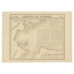
Antique Map of Part of Borneo 'Kalimantan' Indonesia by Vandermaelen, C.1825
Located in Langweer, NL
Antique map titled 'Partie de l'Ile de Bornéo'. Map of a portion of Borneo, showing Magidara Unsung, Isles Soulous, Mandren and Candepan, along with many other places in the area. Or...
Category
Antique 19th Century Maps
Materials
Paper
$585 Sale Price
20% Off
You May Also Like
Antique Map of Italy by Andriveau-Goujon, 1843
By Andriveau-Goujon
Located in New York, NY
Antique Map of Italy by Andriveau-Goujon, 1843. Map of Italy in two parts by Andriveau-Goujon for the Library of Prince Carini at Palazzo Carini i...
Category
Antique 1840s French Maps
Materials
Linen, Paper

$3,350 / set
Antique Map of Principality of Monaco
By Antonio Vallardi Editore
Located in Alessandria, Piemonte
ST/619 - "Old Geographical Atlas of Italy - Topographic map of ex-Principality of Monaco" -
ediz Vallardi - Milano -
A somewhat special edition ---
Category
Antique Late 19th Century Italian Other Prints
Materials
Paper

$359 Sale Price
62% Off
Geographical Antique Map of Principality of Monaco
By Bruno Santini
Located in Alessandria, Piemonte
ST/609 - Interesting antique color map of Monaco Principality in French language : "Carte qui contient le Principauté de Piémont, le Monferrat et la comté de...
Category
Antique Late 18th Century Italian Other Maps
Materials
Paper

$812 Sale Price
20% Off
1864 Map of North America, Antique Hand-Colored Map, by Adolphe Hippolyte Dufour
Located in Colorado Springs, CO
Offered is a map of North America entitled Amerique du Nord from 1864. This rare, separately published wall map was produced by Adolphe Hippolyte Dufour. This map includes vibrant an...
Category
Antique 1860s French Maps
Materials
Paper

Original Antique Map of Sweden, Engraved by Barlow, 1806
Located in St Annes, Lancashire
Great map of Sweden
Copper-plate engraving by Barlow
Published by Brightly & Kinnersly, Bungay, Suffolk. 1806
Unframed.
Category
Antique Early 1800s English Maps
Materials
Paper

Plan of Paris, France, by A. Vuillemin, Antique Map, 1845
Located in Colorado Springs, CO
This large and detailed plan of Paris was published by Alexandre Vuillemin in 1845. The map conveys a wonderful amount of information and is decorated throughout with pictorial vigne...
Category
Antique 1840s American Maps
Materials
Paper

Recently Viewed
View AllMore Ways To Browse
Map Of Palestine
Antique Map Palestine
Ipswich Antique Furniture
Maps Balkans
Missouri Map
Antique Maps Of Texas
Antique Maps Virginia
Antique Railroad Scale
Jamaican Antique
Hindeloopen Furniture
Romania Map
Stanford Antique Furniture
Sardinia Map
Victorian Staircase
Nantucket Map
Afghanistan Antique Map
Antique Map Of Hawaii
Antique Florida Map