Items Similar to Antique Map of Pennsylvania and New Jersey by Johnson, 1872
Want more images or videos?
Request additional images or videos from the seller
1 of 5
Antique Map of Pennsylvania and New Jersey by Johnson, 1872
$240.20
$300.2520% Off
£176.90
£221.1320% Off
€200
€25020% Off
CA$326.77
CA$408.4620% Off
A$363.11
A$453.8920% Off
CHF 190.28
CHF 237.8420% Off
MX$4,452.94
MX$5,566.1720% Off
NOK 2,426.85
NOK 3,033.5620% Off
SEK 2,283.09
SEK 2,853.8620% Off
DKK 1,522.57
DKK 1,903.2120% Off
Shipping
Retrieving quote...The 1stDibs Promise:
Authenticity Guarantee,
Money-Back Guarantee,
24-Hour Cancellation
About the Item
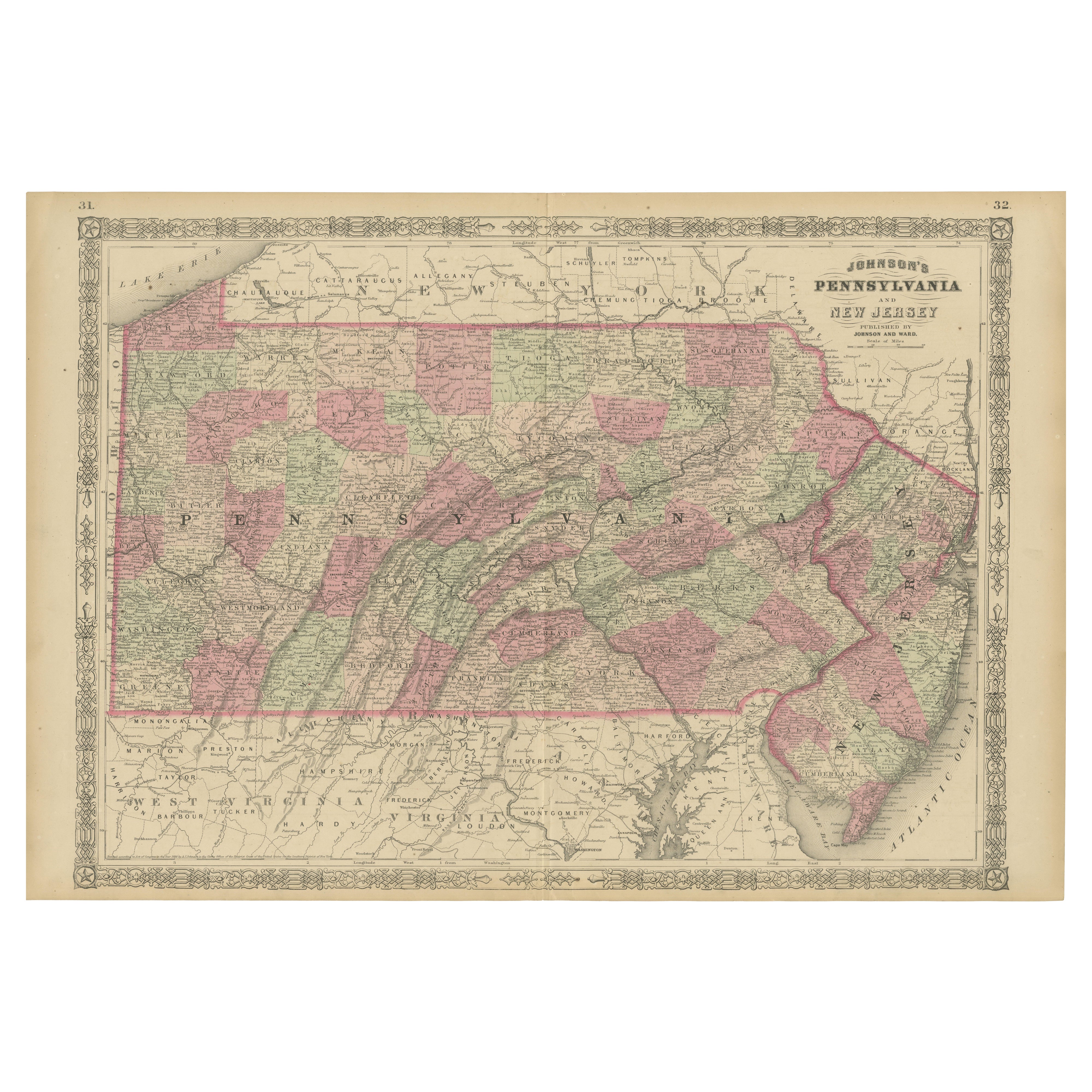
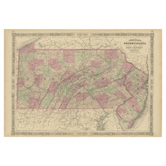
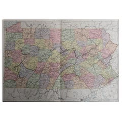
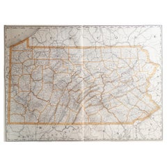
Antique map titled 'Johnson's Pennsylvania and New Jersey'. Original map showing Pennsylvania and New Jersey. This map originates from 'Johnson's New Illustrated Family Atlas of the World' by A.J. Johnson. Published 1872.
- Dimensions:Height: 18.12 in (46 cm)Width: 26.38 in (67 cm)Depth: 0.02 in (0.5 mm)
- Materials and Techniques:
- Period:
- Date of Manufacture:1872
- Condition:Large split on folding line. General age-related toning, shows minor wear and creasing. Some soiling. Original folding line. English text on verso. Please study images carefully.
- Seller Location:Langweer, NL
- Reference Number:Seller: BG-12592-381stDibs: LU3054321467592
About the Seller
5.0
Recognized Seller
These prestigious sellers are industry leaders and represent the highest echelon for item quality and design.
Platinum Seller
Premium sellers with a 4.7+ rating and 24-hour response times
Established in 2009
1stDibs seller since 2017
2,494 sales on 1stDibs
Typical response time: 1 hour
- ShippingRetrieving quote...Shipping from: Langweer, Netherlands
- Return Policy
Authenticity Guarantee
In the unlikely event there’s an issue with an item’s authenticity, contact us within 1 year for a full refund. DetailsMoney-Back Guarantee
If your item is not as described, is damaged in transit, or does not arrive, contact us within 7 days for a full refund. Details24-Hour Cancellation
You have a 24-hour grace period in which to reconsider your purchase, with no questions asked.Vetted Professional Sellers
Our world-class sellers must adhere to strict standards for service and quality, maintaining the integrity of our listings.Price-Match Guarantee
If you find that a seller listed the same item for a lower price elsewhere, we’ll match it.Trusted Global Delivery
Our best-in-class carrier network provides specialized shipping options worldwide, including custom delivery.More From This Seller
View AllHistoric 1864 Civil War Map of Pennsylvania and New Jersey with Coastal Focus
Located in Langweer, NL
Title: Historic 1864 Civil War Map of Pennsylvania and New Jersey with Coastal Focus
Description: This meticulously crafted antique map, titled "Johnson's Pennsylvania and New Jerse...
Category
Antique 1860s Maps
Materials
Paper
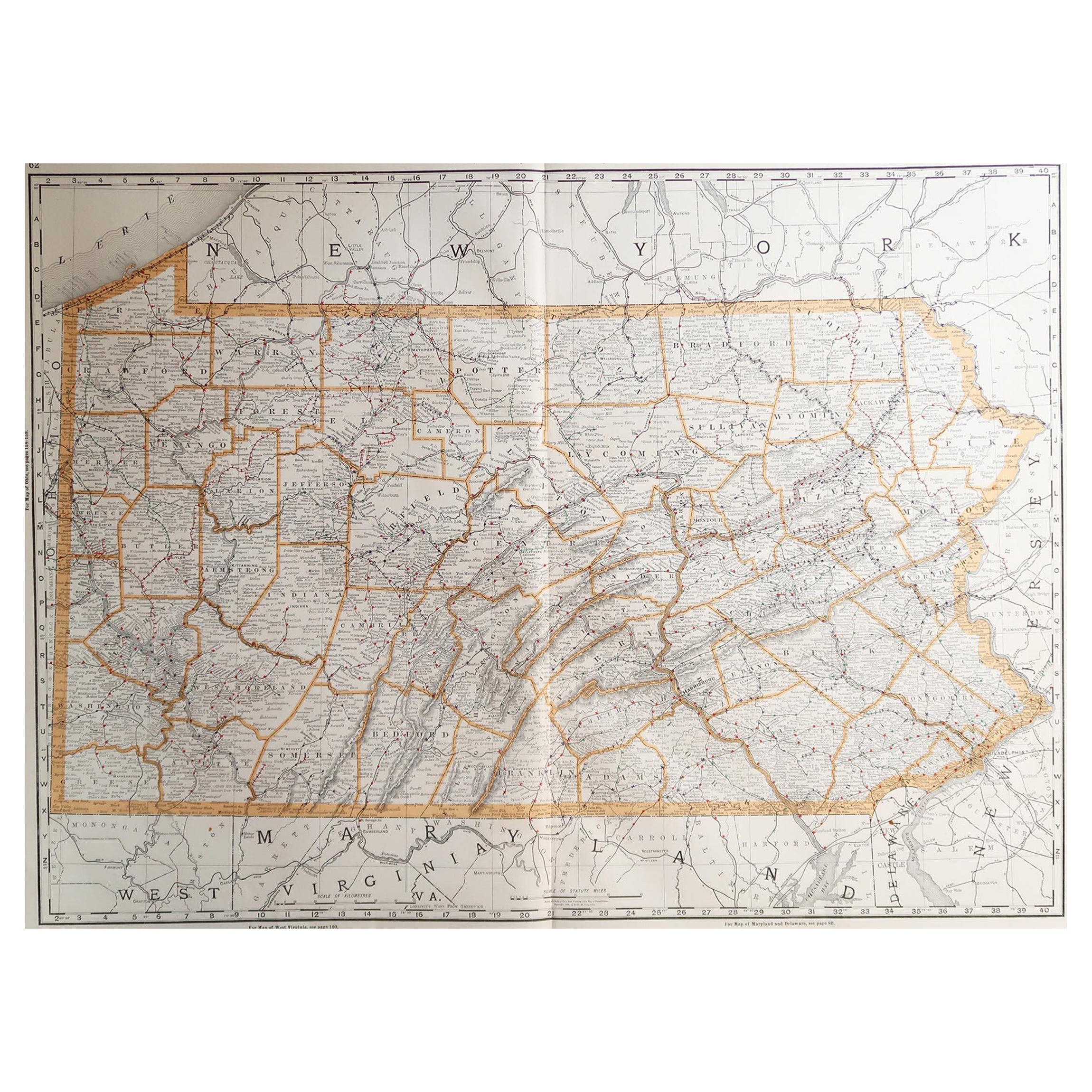
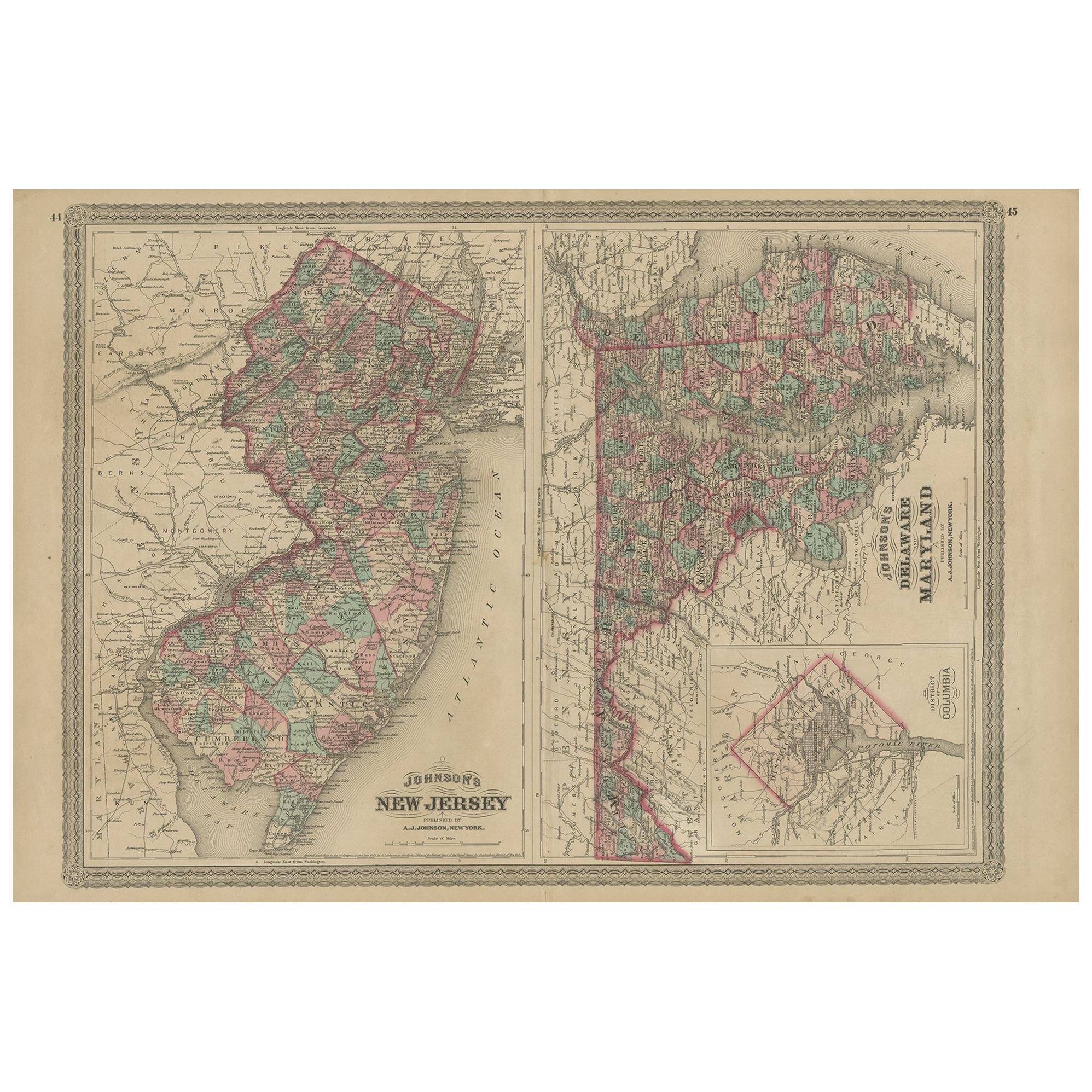
Antique Map of New Jersey, Delaware and Maryland by Johnson, 1872
Located in Langweer, NL
Antique map titled 'Johnson's New Jersey (..). Two maps on one sheet showing New Jersey, Delaware and Maryland. With inset map of the district of Columbia...
Category
Antique Late 19th Century Maps
Materials
Paper
$288 Sale Price
20% Off
Original Antique Map of Pennsylvania Showing Interesting Statistics Etc, 1825
Located in Langweer, NL
Attractive map of Pennsylvania with bordercoloring of the county and showing the various towns, roads, rivers, bridges, and a host of other details...
Category
Antique 1820s Maps
Materials
Paper
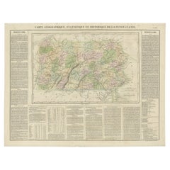
$336 Sale Price
20% Off
Antique Map of Virginia, Delaware, Maryland & West Virginia by Johnson, 1872
Located in Langweer, NL
Antique map titled 'Johnson's Viriginia (..). Original map of Virginia, Delaware, Maryland and West Virginia. This map originates from 'Johnson's New I...
Category
Antique Late 19th Century Maps
Materials
Paper
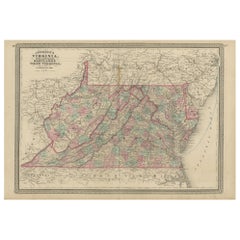
$240 Sale Price
20% Off
Antique Map of the Eastern United States by Levasseur '1875'
Located in Langweer, NL
Antique map titled 'Carte de la Region orientale des États-Unis et de la dominion du Canada'. Large map of the Eastern United States. This map originates from 'Atlas de Géographie Mo...
Category
Antique Late 19th Century Maps
Materials
Paper

$384 Sale Price
20% Off
Antique Map of the United States ' North East ' by Johnston '1909'
Located in Langweer, NL
Antique map titled 'United States of North America'. Original antique map of United States of North America ( North East ). This map orig...
Category
Early 20th Century Maps
Materials
Paper

$240 Sale Price
20% Off
You May Also Like
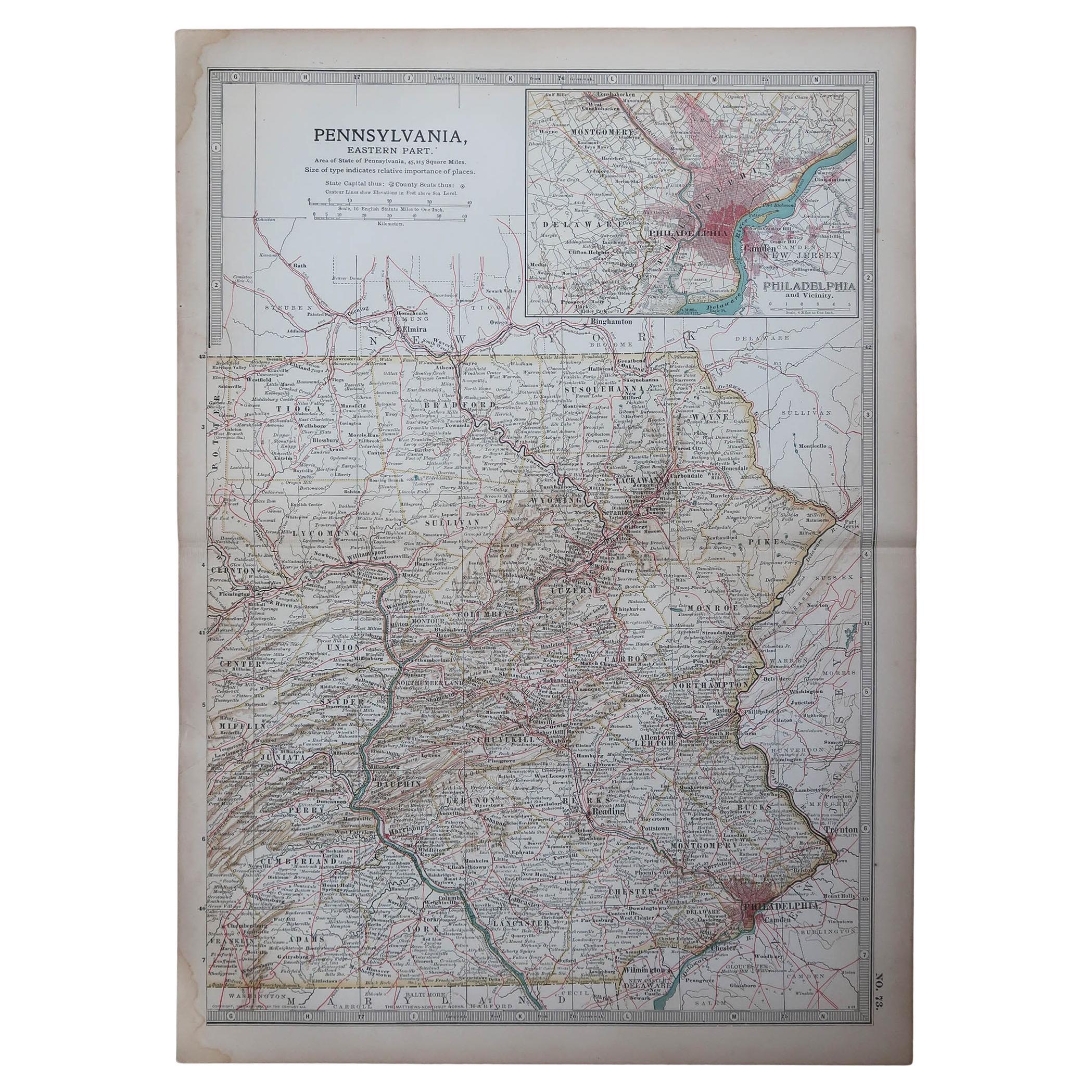
Original Antique Map of the American State of Pennsylvania( Eastern Part ), 1903
Located in St Annes, Lancashire
Antique map of Pennsylvania ( Eastern part )
Published By A & C Black. 1903
Original colour
Good condition
Unframed.
Free shipping
Category
Antique Early 1900s English Maps
Materials
Paper

Original Antique Map of the American State of Pennsylvania, 1889
Located in St Annes, Lancashire
Great map of Pennsylvania
Drawn and Engraved by W. & A.K. Johnston
Published By A & C Black, Edinburgh.
Original colour
Unframed.
Repair to a minor tear on bottom edge.
Category
Antique 1880s Scottish Victorian Maps
Materials
Paper
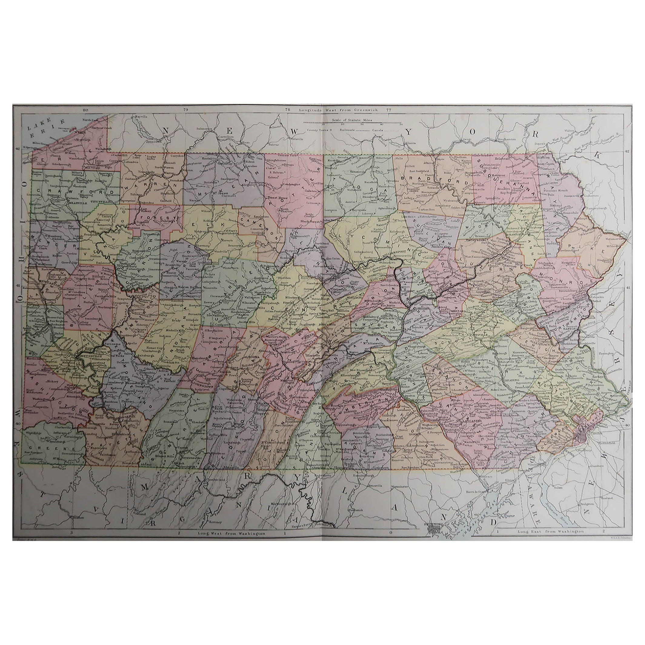
Large Original Antique Map of Pennsylvania, USA, 1894
By Rand McNally & Co.
Located in St Annes, Lancashire
Fabulous map of Pennsylvania
Original color.
By Rand, McNally & Co.
Published, 1894.
Unframed.
Free shipping.
Category
Antique 1890s American Maps
Materials
Paper
Original Antique Map of the American State of Pennsylvania( Western Part ), 1903
Located in St Annes, Lancashire
Antique map of Pennsylvania ( Western part )
Published By A & C Black. 1903
Original colour
Good condition
Unframed.
Free shipping
Category
Antique Early 1900s English Maps
Materials
Paper

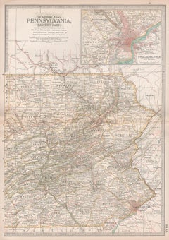
Pennsylvania, Eastern Part. USA. Century Atlas state antique vintage map
Located in Melbourne, Victoria
'The Century Atlas. Pennsylvania, Eastern Part.'
Original antique map, 1903.
Central fold as issued. Map name and number printed on the reverse corners.
Sheet 40cm by 29.5cm.
Category
Early 20th Century Victorian More Prints
Materials
Lithograph
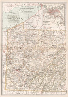
Pennsylvania, Western Part. USA Century Atlas state antique vintage map
Located in Melbourne, Victoria
'The Century Atlas. Pennsylvania, Western Part'
Original antique map, 1903.
Central fold as issued. Map name and number printed on the reverse corners.
Sheet 40cm by 29.5cm.
Category
Early 20th Century Victorian More Prints
Materials
Lithograph
More Ways To Browse
New Jersey 19th Century
Map Greece
Roman Map
Antique Maps Of Russia
Antique Roman Map
Maps Of Mediterranean
Mercator Map
Antique Railroad Furniture
Atlas Globe
Antique Mississippi Furniture
Framed World Map
Hand Drawn Map
Rare Compass
Antique Furniture Rollers
16th Century Scotland
Antique Wood Coat Of Arms
Antique Maps Australia
Antique Quadrant