Items Similar to Antique Planisphere with Constellations by Bion, 1751


Want more images or videos?
Request additional images or videos from the seller
1 of 5
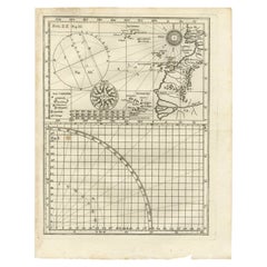
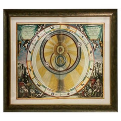
Antique Planisphere with Constellations by Bion, 1751
$192.16
$240.2020% Off
£141.52
£176.9020% Off
€160
€20020% Off
CA$261.42
CA$326.7720% Off
A$290.49
A$363.1120% Off
CHF 152.22
CHF 190.2820% Off
MX$3,562.35
MX$4,452.9420% Off
NOK 1,941.48
NOK 2,426.8520% Off
SEK 1,826.47
SEK 2,283.0920% Off
DKK 1,218.06
DKK 1,522.5720% Off
Shipping
Retrieving quote...The 1stDibs Promise:
Authenticity Guarantee,
Money-Back Guarantee,
24-Hour Cancellation
About the Item
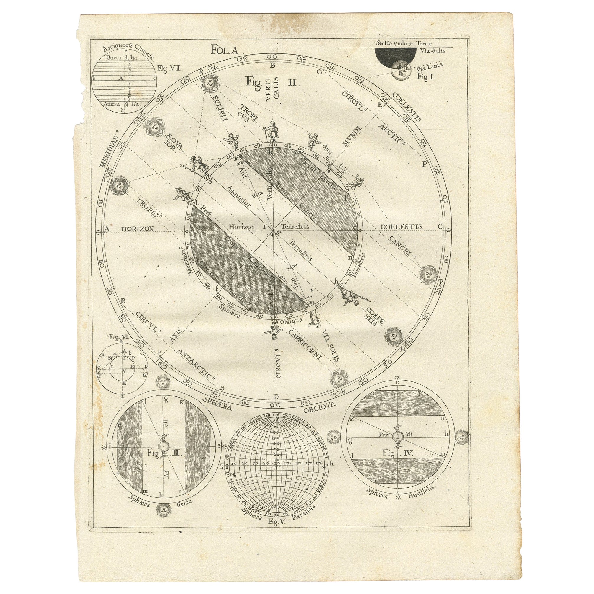
Antique map titled 'Planisphere Celeste'. Planisphere with various constellations. This map originates from 'L'Usage des globes célestes et terrestres et des sphères (..)' by N. Bion (1751).
- Dimensions:Height: 8.67 in (22 cm)Width: 11.03 in (28 cm)Depth: 0.02 in (0.5 mm)
- Materials and Techniques:
- Period:
- Date of Manufacture:1751
- Condition:Age-related toning, original folding lines. Blank verso, please study images carefully.
- Seller Location:Langweer, NL
- Reference Number:Seller: CD-122821stDibs: LU3054318373662
About the Seller
5.0
Recognized Seller
These prestigious sellers are industry leaders and represent the highest echelon for item quality and design.
Platinum Seller
Premium sellers with a 4.7+ rating and 24-hour response times
Established in 2009
1stDibs seller since 2017
2,494 sales on 1stDibs
Typical response time: 1 hour
- ShippingRetrieving quote...Shipping from: Langweer, Netherlands
- Return Policy
Authenticity Guarantee
In the unlikely event there’s an issue with an item’s authenticity, contact us within 1 year for a full refund. DetailsMoney-Back Guarantee
If your item is not as described, is damaged in transit, or does not arrive, contact us within 7 days for a full refund. Details24-Hour Cancellation
You have a 24-hour grace period in which to reconsider your purchase, with no questions asked.Vetted Professional Sellers
Our world-class sellers must adhere to strict standards for service and quality, maintaining the integrity of our listings.Price-Match Guarantee
If you find that a seller listed the same item for a lower price elsewhere, we’ll match it.Trusted Global Delivery
Our best-in-class carrier network provides specialized shipping options worldwide, including custom delivery.More From This Seller
View AllAntique Map of the World in Hemispheres by Keizer & de Lat, 1788
Located in Langweer, NL
Antique map titled 'Schuine Ronde Aard-Bolle waar van 't Middelpunt is Amsterdam (..)'. Interesting double hemisphere world map on polar projections. In North America, there is a large Island of California. Australia and New Zealand are shown with incomplete coastlines. The map contains six smaller astronomical...
Category
Antique Late 18th Century Maps
Materials
Paper

$480 Sale Price
20% Off
Antique Map Illustrating Solar Eclipses by Scherer, C.1703
Located in Langweer, NL
Antique map of an hemisphere and several figures illustrating the position of the earth, moon and sun. Printed for Scherer's 'Atlas Novus' (1702-1710).
Artists and Engravers: Heinrich Scherer (1628-1704) was a Professor of Hebrew, Mathematics and Ethics at the University of Dillingen until about 1680. Thereafter he obtained important positions as Official Tutor to the Royal Princes...
Category
Antique 18th Century Maps
Materials
Paper
$211 Sale Price
20% Off
Antique Map of the World with Polar Projections by Keizer & de Lat, 1788
Located in Langweer, NL
Antique map titled 'Schuine Ronde Aard-Klooten (..)'. Interesting double hemisphere world map with polar projections. In North America, there is a...
Category
Antique Late 18th Century Maps
Materials
Paper

$450 Sale Price
25% Off
Antique Map of the North Pole by V.M. Coronelli, circa 1692
By Vincenzo Coronelli
Located in Langweer, NL
Globe gore by Vincenzo Maria Coronelli shows the North Pole with the coasts of Canada, Greenland, Scandinavia and Siberia, and is decorated with pictorial scenes of bear, seal and wh...
Category
Antique Late 17th Century Maps
Materials
Paper

Rare Antique Map of Part of Europe and Africa by Scherer, C.1703
Located in Langweer, NL
Antique map with two figures. The upper figures showing part of Europe and Africa. Below a chart. Printed for Scherer's 'Atlas Novus' (1702-1710). Artists and Engravers: Heinrich Sch...
Category
Antique 18th Century Maps
Materials
Paper
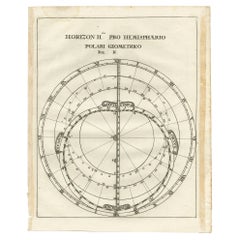
Antique Map of a Hemisphere by Scherer, c.1703
Located in Langweer, NL
Antique map depiciting a horizon/hemisphere. Printed for Scherer's 'Atlas Novus' (1702-1710).
Artists and Engravers: Heinrich Scherer (1628-1704) was a Professor of Hebrew, Mathematics and Ethics at the University of Dillingen until about 1680. Thereafter he obtained important positions as Official Tutor to the Royal Princes...
Category
Antique 18th Century Maps
Materials
Paper
$182 Sale Price
20% Off
You May Also Like
Cosmgraphy and Astrology, 1686 by Richard Blome from the First Edition
By Richard Blome
Located in BUNGAY, SUFFOLK
Cosmography & Astrology
Large oval engraved plate with inscriptions outlining the various parts of cosmography and astronomy; below, two emblematic figures with scientific instruments either side. Lettered with title, dedication, and various inscriptions. To his Excellency Roger Palmer, Earle of Castelmain and Baron of Limerick in Ireland, Embassador Extraordinary from his majesty King James II to his Holyness Pope Innocent 11th anno dom 1686. This plate is humbly DD by Richard Blome. On paper and retaining its original coloring.
Sheet width 26 ½ cm., 10 ½ in., height 41 ½ cm., 16 ½ in.,
In a part-gilded Sansovino frame...
Category
Antique 1680s English Charles II Decorative Art
Materials
Paper
Original Antique Map of The Eastern Hemisphere by Dower, circa 1835
Located in St Annes, Lancashire
Nice map of the Eastern Hemisphere
Drawn and engraved by J.Dower
Published by Orr & Smith. C.1835
Unframed.
Free shipping
Category
Antique 1830s English Maps
Materials
Paper

The Orbits of Venus and Mercury: An 18th C. Framed Celestial Map by Doppelmayr
By Johann Gabriel Doppelmayr 1
Located in Alamo, CA
This 18th century hand-colored copperplate celestial map by Johann Doppelmayr entitled "Phænomena Motuum Irregularium quos Planetar inferiores Venus et M...
Category
Early 18th Century Landscape Prints
Materials
Engraving
1718 Ides & Witsen Map "Route D'amsterdam a Moscow Et De La Ispahan Et Gamron
Located in Norton, MA
1718 Ides & Witsen map, entitled
"Route D'Amsterdam A Moscow Et De La Ispahan Et Gamron,"
Ric.b005
Subject: Eastern Europe and Central Asia
Period: 1718 (published)
Publicati...
Category
Antique Early 18th Century Dutch Maps
Materials
Paper

Italian Renaissance Style Framed Print Of A Celestial Map "Tychonic Planisphere"
Located in Queens, NY
Italian Renaissance style framed print of a celestial map depicting the beliefs of the Earth is stationary at the center of the planetary system with the Sun and Moon revolving the E...
Category
20th Century Italian Renaissance Paintings
Materials
Brass
WORLD MAP - Planisphaerium Terrestre Sive Terrarum Orbis... 1696
By Carel Allard
Located in Santa Monica, CA
CAREL ALLARD (1648 – 1709)
PLANISPHAERIUM TERRESTRE SIVE TERRARUM ORBIS… 1696 (Shirley 578)
Engraving, 20 ½ x 23 ½”, sheet 21 x 24 1/8". A stunning double hemisphere World Map...
Category
17th Century Old Masters Landscape Prints
Materials
Engraving

More Ways To Browse
Antique Constellation Map
Antique Planisphere
Antique Maps Of Africa
Antiques Compasses
Antique Navigation
Colonial Furniture Company
Mississippi Furniture
Antique Scottish Wood Furniture
Indonesia Map
Antique Framed Map Engravings
Atlas Furniture Company
Used Office Furniture Edinburgh
Antique 16th Century Plates
Scotland Map
Antique Maps Indonesia
Map Of Japan
Antique Rollers
Compass Rose Antique