Items Similar to Frisia Occidentalis, A Rare Antique Engraving of Friesland, The Netherlands


Want more images or videos?
Request additional images or videos from the seller
1 of 6
Frisia Occidentalis, A Rare Antique Engraving of Friesland, The Netherlands
$2,350.39
$2,937.9920% Off
£1,748.45
£2,185.5720% Off
€1,960
€2,45020% Off
CA$3,218.49
CA$4,023.1120% Off
A$3,578.52
A$4,473.1520% Off
CHF 1,868.51
CHF 2,335.6320% Off
MX$43,559.32
MX$54,449.1520% Off
NOK 23,841.33
NOK 29,801.6620% Off
SEK 22,338.19
SEK 27,922.7320% Off
DKK 14,920.40
DKK 18,650.5020% Off
Shipping
Retrieving quote...The 1stDibs Promise:
Authenticity Guarantee,
Money-Back Guarantee,
24-Hour Cancellation
About the Item
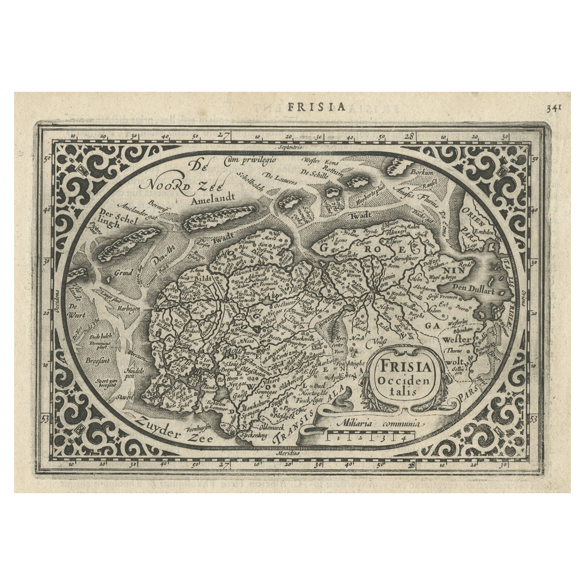
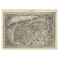
Antique map titled 'Frisia Occidentalis.' - A very decorative map of the Dutch province Friesland, also showing the Wadden islands Terschelling and Ameland. With coats of arms of the municipalities of the area in the borders. A coat of arms in the lower right corner and a title cartouche in the lower left corner. A legend in the top right and a compass rose in the top left corner. From: "Chronique ofte historische geschiedenisse van Vrieslant” by P. Winsemius, published 1622.
Artists and Engravers: Made by 'Engraver: Petro Harlingensis. Publisher: Joannes Lamrinck.' after 'Cartographer: Adrianus Metius & Gerard Freitag.'. Cartographer: Bernardus Schotanus a Sterringa (1640-1704).
- Dimensions:Height: 17.49 in (44.4 cm)Width: 22.49 in (57.1 cm)Depth: 0.08 in (2 mm)
- Materials and Techniques:Paper,Engraved
- Period:1620-1629
- Date of Manufacture:1622
- Condition:Very good, given age. Original folds, as issued, but neatly flattened out. Margins cropped close to the image edge. A small crease in the top right corner. General age-related toning and/or occasional minor defects from handling.
- Seller Location:Langweer, NL
- Reference Number:Seller: PCT-566431stDibs: LU3054330782312
About the Seller
5.0
Recognized Seller
These prestigious sellers are industry leaders and represent the highest echelon for item quality and design.
Platinum Seller
Premium sellers with a 4.7+ rating and 24-hour response times
Established in 2009
1stDibs seller since 2017
2,511 sales on 1stDibs
Typical response time: <1 hour
- ShippingRetrieving quote...Shipping from: Langweer, Netherlands
- Return Policy
Authenticity Guarantee
In the unlikely event there’s an issue with an item’s authenticity, contact us within 1 year for a full refund. DetailsMoney-Back Guarantee
If your item is not as described, is damaged in transit, or does not arrive, contact us within 7 days for a full refund. Details24-Hour Cancellation
You have a 24-hour grace period in which to reconsider your purchase, with no questions asked.Vetted Professional Sellers
Our world-class sellers must adhere to strict standards for service and quality, maintaining the integrity of our listings.Price-Match Guarantee
If you find that a seller listed the same item for a lower price elsewhere, we’ll match it.Trusted Global Delivery
Our best-in-class carrier network provides specialized shipping options worldwide, including custom delivery.More From This Seller
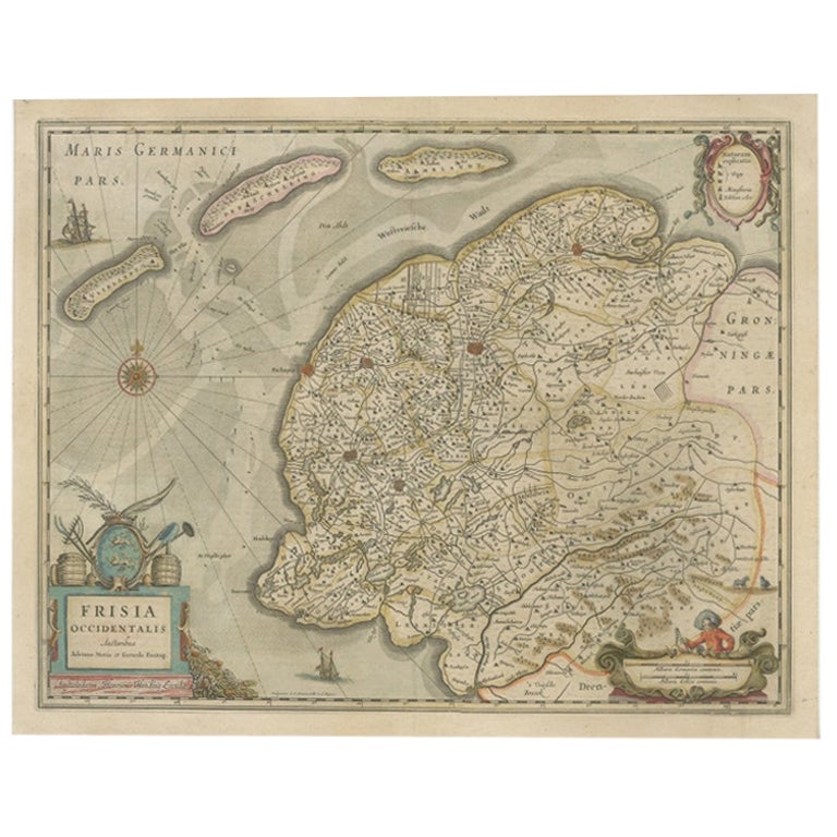
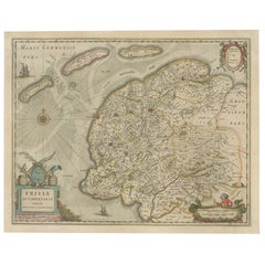
View AllOld Antique Map of the Province of Friesland, the Netherlands, c.1580
Located in Langweer, NL
Antique map titled 'Frisia Occidentalis'. Old map of the province of Friesland, the Netherlands. This map is also known as the 'Pauwenkaart' ('peacock map'), referring to the peacock next to the inset map. Based on a manuscript map...
Category
Antique 16th Century Maps
Materials
Paper
$911 Sale Price
20% Off
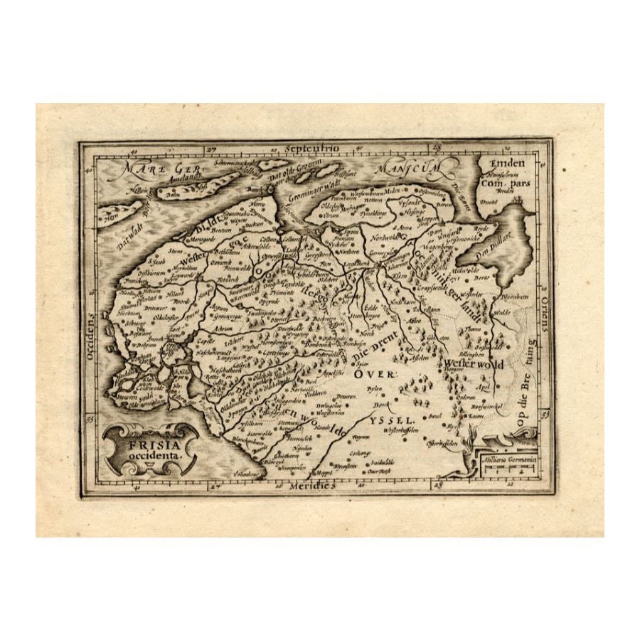
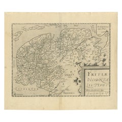
Antique Map of Friesland and Groningen, Provinces of the Netherlands, 1628
Located in Langweer, NL
Antique map Friesland titled 'Frisia Occidentalis'. Small, decorative map of the province of Friesland, the Netherlands. Second state, out of three, originating from 'Atlas Minor' by...
Category
Antique 17th Century Maps
Materials
Paper
$335 Sale Price
20% Off
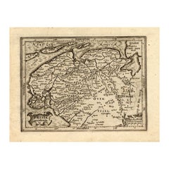
Antique Map of Friesland, The Netherlands, 1638
Located in Langweer, NL
Antique map titled 'Frisia Occidentalis'.
Original antique map of Friesland, the Netherlands. First state, originating from 'Atlantis novi pars secunda' published 1638.
Artis...
Category
Antique 17th Century Maps
Materials
Paper
$455 Sale Price
20% Off
Original Antique Map of Friesland by Guicciardini, 1612
Located in Langweer, NL
Antique map titled 'Frisiae Occidentalis Typus'. Original antique map of the province of Friesland, the Netherlands. This map originates from 'Beschryvinghe van alle de Neder-Landen'...
Category
Antique 17th Century Maps
Materials
Paper
$527 Sale Price
20% Off
Antique Map of Friesland by Guicciardini, 1613
Located in Langweer, NL
Antique map titled 'Frisia Occidenta.' (Map of the province of Friesland, the Netherlands.) This original old antique print / plate originates from the scarse French edition of 'Desc...
Category
Antique 17th Century Maps
Materials
Paper
$268 Sale Price
20% Off
Antique Map of East Frisia by Ortelius, c.1595
Located in Langweer, NL
Antique print, titled: 'Frisia Orientalis.' Map of East Frisia originating from 'Theatrum Orbis Terrarum'. It is based on the manuscript map by Jon Bloe...
Category
Antique 16th Century Maps
Materials
Paper

$815 Sale Price
20% Off
You May Also Like
Engraving Depicting 16th Century Map of Terra Sancta
Located in Buchanan, MI
Abraham Ortelius (Flemish, 1527-1598) Terra Sancta.
Engraving depicting 16th century map of Terra Sancta. Site 15" x 19.5.
Category
Antique 18th Century and Earlier Maps
Materials
Paper

1643 Willem&Joan Blaeu Map NW Flanders "Flandriae Teutonicae Pars Prientalior
Located in Norton, MA
1643 Willem and Joan Blaeu map of northwest Flanders, entitled
"Flandriae Teutonicae Pars Prientalior,"
Ric0012
" Authentic" - Map of the northwest Fl...
Category
Antique 17th Century Dutch Maps
Materials
Paper

1646 Jansson Map Entitled "Procinvia Connactiae, " Ric.a006
Located in Norton, MA
1646 Jansson map entitled
"Procinvia connactiae,"
Ric.a006
Description: The PROVINCE of CONNAVGT 490 x 380From vol 4 of Jansson's Atlas Novus 1646, published in Amsterdam with...
Category
Antique 17th Century Unknown Maps
Materials
Paper

1633 Map Entitled "Beauvaisis Comitatus Belova Cium, Ric.0002
Located in Norton, MA
1633 map entitled
"Beauvaisis Comitatus Belova Cium,"
Hand Colored
Ric.0002
Description: Cartographer : - Hondius, Henricus 1587-1638
Artists and Engravers:Jodocus Hondius, one of the most notable engravers of his time. He is known for his work in association with many of the cartographers and publishers prominent at the end of the sixteenth and the beginning of the seventeenth century. A native of Flanders, he grew up in Ghent, apprenticed as an instrument and globe maker and map engraver. In 1584, to escape the religious troubles sweeping the Low Countries at that time, he fled to London where he spent some years before finally settling in Amsterdam about 1593. In the London period he came into contact with the leading scientists and geographers of the day and engraved maps in The Mariner\\\\\\\\\\\\\\\'s Mirrour, the English edition of Waghenaer\\\\\\\\\\\\\\\'s Sea Atlas, as well as others with Pieter van den Keere, his brother-in-law. No doubt his temporary exile in London stood him in good stead, earning him an international reputation, for it could have been no accident that Speed chose Hondius to engrave the plates for the maps in The Theatre of the Empire of Great Britaine in the years between 1605 and 1610. In 1604 Hondius bought the plates of Mercator\\\\\\\\\\\\\\\'s Atlas which, in spite of its excellence, had not competed successfully with the continuing demand for the Ortelius Theatrum Orbis Terrarum. To meet this competition Hondius added about 40 maps to Mercator\\\\\\\\\\\\\\\'s original number and from 1606 published enlarged editions in many languages, still under Mercator\\\\\\\\\\\\\\\'s name but with his own name as publisher. These atlases have become known as the Mercator/Hondius series. The following year the maps were reengraved in miniature form and issued as a pocket Atlas Minor. After the death of Jodocus Hondius the Elder in 1612, work on the two atlases, folio and miniature, was carried on by his widow and sons, Jodocus II and Henricus, and eventually in conjunction with Jan Jansson in Amsterdam.
In all, from 1606 onwards, nearly 50 editions with increasing numbers of maps with texts in the main European languages were printed. Summaries of these issues are given under the entry for Gerard Mercator. Jodocus Hondius the Elder * 1588 Maps in The Mariner\\\\\\\\\\\\\\\'s Mirrour (Waghenaer/Ashley) * 1590 World Map...
Category
Antique 17th Century Dutch Maps
Materials
Paper

1592 Abraham Ortelius Map "Lorraine: Lotharingiae Nova Descripti, Ric.A005
Located in Norton, MA
1592 Abraham Ortelius map entitled
"Lorraine: Lotharingiae Nova Descripti
Ric.a005
Description: Ortelius is best known for producing the atlas from which this map comes from, "...
Category
Antique 16th Century Dutch Maps
Materials
Paper

1627 Hendrik Hondius Map Entitled "Vltoniae Orientalis Pars, " Ric.a009
Located in Norton, MA
1627 Hendrik Hondius map entitled
"Vltoniae orientalis pars,"
Ric.a009
Title:
Vltoniae orientalis : pars
Title (alt.) :
Ultoniae orientalis pars
Creator:
Mercator, Gerh...
Category
Antique 17th Century Dutch Maps
Materials
Paper

More Ways To Browse
Coat Of Arms Engraving
Cham Antiques
Antique Furniture Trinidad
Cornwall Map
Marie Galante
Patagonia Map
Shepherd And Hedger
Vignola Furniture
Washington Dc Map
Antique Map Of Cornwall
Coronelli Globe
Vintage Bartholomew Maps
Antique Alabama Map
Cape Cod Map
Goa France
Antique Planisphere
Charlotte Reine
Dutch Malacca