Items Similar to A Handsome & Detailed Map of the Duchy of Mecklenburg & Pomerania, Germany, 1680

Want more images or videos?
Request additional images or videos from the seller
1 of 5
A Handsome & Detailed Map of the Duchy of Mecklenburg & Pomerania, Germany, 1680
$699.42
$874.2720% Off
£524.26
£655.3220% Off
€592
€74020% Off
CA$960.88
CA$1,201.1120% Off
A$1,072.74
A$1,340.9220% Off
CHF 562.10
CHF 702.6220% Off
MX$13,131.35
MX$16,414.1920% Off
NOK 7,138.65
NOK 8,923.3120% Off
SEK 6,730.84
SEK 8,413.5520% Off
DKK 4,506.52
DKK 5,633.1520% Off
Shipping
Retrieving quote...The 1stDibs Promise:
Authenticity Guarantee,
Money-Back Guarantee,
24-Hour Cancellation
About the Item
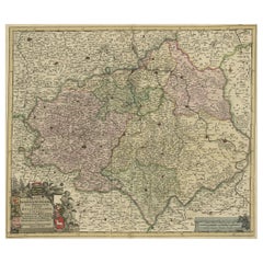
Antique map titled 'Ducatus Meklenburgicus in quo sunt Ducatus Vandaliae et Meklenburgi Ducatus et Comitatus Swerinensis.'
A handsome and detailed map of the Duchy of Mecklenburg and Pomerania in Germany. The map is fully engraved with towns, political boundaries, rivers, and forests. The map is embellished with a title cartouche with putti and coats of arms. Below another cartouche with scale and putti. Source unknown, to be determined.
Artists and engravers: Made by 'Frederick de Wit' after an anonymous artist. Frederik/Frederick de Wit (Amsterdam 1630-1706), was a famous engraver and publisher in Amsterdam. He acquired many of the printing plates of Blaeu and Janssonius when it came to auction. His map were very popular because of the quality of the engravings and the beautiful colouring. After his death his work was re-issued by Pieter Mortier and Covens & Mortier.
- Dimensions:Height: 21.03 in (53.4 cm)Width: 24.22 in (61.5 cm)Depth: 0 in (0.02 mm)
- Materials and Techniques:
- Period:1680-1689
- Date of Manufacture:circa 1680
- Condition:Condition: Good. Edges browned and a few spots in the margins. Vertical creases left and right of middle fold. Small soft crease bottom right corner. Original middle fold as issued. General age-related toning and/or occasional minor handling defects.
- Seller Location:Langweer, NL
- Reference Number:Seller: PCT-58031 1stDibs: LU3054327310532
About the Seller
5.0
Recognized Seller
These prestigious sellers are industry leaders and represent the highest echelon for item quality and design.
Platinum Seller
Premium sellers with a 4.7+ rating and 24-hour response times
Established in 2009
1stDibs seller since 2017
2,511 sales on 1stDibs
Typical response time: <1 hour
- ShippingRetrieving quote...Shipping from: Langweer, Netherlands
- Return Policy
Authenticity Guarantee
In the unlikely event there’s an issue with an item’s authenticity, contact us within 1 year for a full refund. DetailsMoney-Back Guarantee
If your item is not as described, is damaged in transit, or does not arrive, contact us within 7 days for a full refund. Details24-Hour Cancellation
You have a 24-hour grace period in which to reconsider your purchase, with no questions asked.Vetted Professional Sellers
Our world-class sellers must adhere to strict standards for service and quality, maintaining the integrity of our listings.Price-Match Guarantee
If you find that a seller listed the same item for a lower price elsewhere, we’ll match it.Trusted Global Delivery
Our best-in-class carrier network provides specialized shipping options worldwide, including custom delivery.More From This Seller
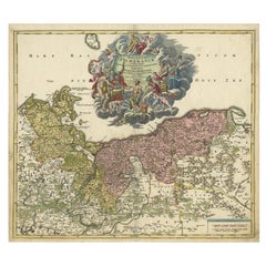
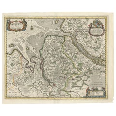
View AllAntique Map of Mecklenburg-Vorpommern in Germany by J.B. Homann, c.1720
Located in Langweer, NL
Antique Map of Mecklenburg-Vorpommern by J.B. Homann, c.1720
Old colored antique map of Mecklenburg-Vorpommern by Johann Baptist Homann. This stunning map, titled "Ducatus Meklenbur...
Category
Antique 1720s Maps
Materials
Paper
$510 Sale Price
20% Off
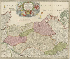
Regional Antique Map of the Baltic, Extending from Stralsund to Dantzig, ca.1720
Located in Langweer, NL
Antique map titled 'Ducatus Pomeraniae (..)'. Regional map of the Baltic, extending from Stralsund and Rugia in the west to Dantzig and Culman on the Vistula in the east. Large carto...
Category
Antique 1720s Maps
Materials
Paper
$841 Sale Price
20% Off
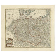
Antique Map of the German Empire, Johannes Janssonius van Waesbergen, circa 1670
Located in Langweer, NL
Antique map titled 'Nova Totius Germaniae Descriptio'. Uncommon map of the German Empire including the Netherlands, Germany, Switzerland, Austria, Bohemia,...
Category
Antique Late 17th Century Maps
Materials
Paper
$661 Sale Price
20% Off
Old Detailed Map of the Historical Regions of the Duchy of Saxony, Germany, 1680
Located in Langweer, NL
Antique map titled 'Circuli Saxoniae Superior Pars Meridionalis in qua sunt Ducatus Saxoniae, Comitatus Mansfeldiae, et Voitlandiae, Landgraviat Thuringiae, Marchionatus Misniae Prin...
Category
Antique 1680s Maps
Materials
Paper
$680 Sale Price
20% Off
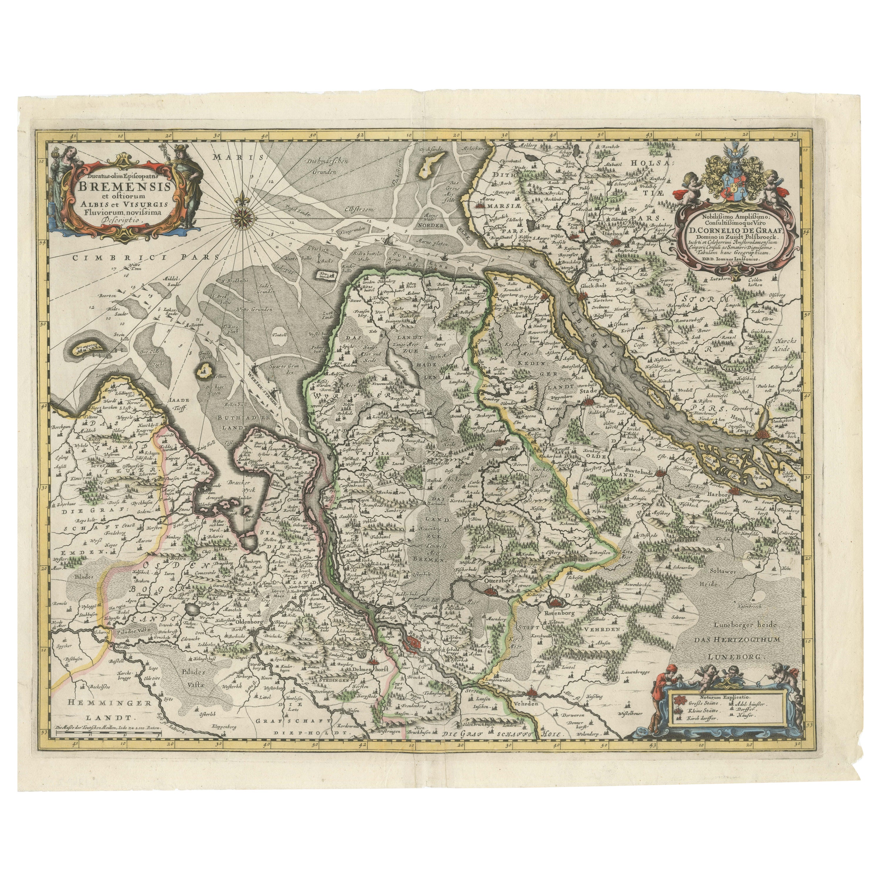
Johannes Janssonius' 17th-Century Map of the Duchy of Bremen in Germany
Located in Langweer, NL
The map titled "Ducatus olim Episcopatus Bremensis et ostiorum Albis et Visurgis Fluviorum novissima Descriptio" by Johannes Janssonius provides a rich historical and geographical il...
Category
Antique 1650s Maps
Materials
Paper
$727 Sale Price
20% Off
Antique Map of the Saxony Region 'Germany' by F. de Wit, circa 1680
Located in Langweer, NL
A detailed map of a region in eastern Germany. Cartouches depict coat of arms surrounded by cherubs. The map is fully engraved with towns, political boundaries, rivers and forests. P...
Category
Antique Late 17th Century Dutch Maps
Materials
Paper

You May Also Like
17th Century Hand-Colored Map of a Region in West Germany by Janssonius
By Johannes Janssonius
Located in Alamo, CA
This attractive highly detailed 17th century original hand-colored map is entitled "Archiepiscopatus Maghdeburgensis et Anhaltinus Ducatus cum terris adjacentibus". It was published ...
Category
Antique Mid-17th Century Dutch Maps
Materials
Paper

Prussia, Poland, N. Germany, Etc: A Hand-colored 17th Century Map by Janssonius
By Johannes Janssonius
Located in Alamo, CA
This is an attractive hand-colored copperplate engraved 17th century map of Prussia entitled "Prussia Accurate Descripta a Gasparo Henneberg Erlichensi", published in Amsterdam by Joannes Janssonius in 1664. This very detailed map from the golden age of Dutch cartography includes present-day Poland, Latvia, Lithuania, Estonia and portions of Germany. This highly detailed map is embellished by three ornate pink, red, mint green and gold...
Category
Antique Mid-17th Century Dutch Maps
Materials
Paper

A Hand Colored 17th Century Janssonius Map of Prussia: Poland, N. Germany, etc.
By Johannes Janssonius
Located in Alamo, CA
An attractive hand-colored copperplate engraved 17th century map of Prussia entitled "Prussia Accurate Descripta a Gasparo Henneberg Erlichensi", published in Amsterdam by Joannes Janssonius in 1664. This very detailed map from the golden age of Dutch cartography includes present-day Poland, Latvia, Lithuania, Estonia and portions of Germany. This highly detailed map is embellished by three ornate pink, red, mint green and gold...
Category
Mid-17th Century Old Masters Landscape Prints
Materials
Engraving

18th Century Hand-Colored Homann Map of Germany, Including Frankfurt and Berlin
By Johann Baptist Homann
Located in Alamo, CA
An 18th century hand-colored map entitled "Tabula Marchionatus Brandenburgici et Ducatus Pomeraniae quae sunt Pars Septentrionalis Circuli Saxoniae Superioris" by Johann Baptist Homa...
Category
Antique Early 18th Century German Maps
Materials
Paper

1643 Willem&Joan Blaeu Map NW Flanders "Flandriae Teutonicae Pars Prientalior
Located in Norton, MA
1643 Willem and Joan Blaeu map of northwest Flanders, entitled
"Flandriae Teutonicae Pars Prientalior,"
Ric0012
" Authentic" - Map of the northwest Fl...
Category
Antique 17th Century Dutch Maps
Materials
Paper

West Germany: Original Hand Colored 17th Century Map by Johannes Janssonius
By Johannes Janssonius
Located in Alamo, CA
An original hand colored copperplate engraved map entitled in Latin "Archiepiscopatus Maghdeburgensis et Anhaltinus Ducatus cum terris adjacentibus", published in Amsterdam in 1640 i...
Category
Mid-17th Century Old Masters More Prints
Materials
Engraving

More Ways To Browse
Coat Of Arms Engraving
Ptolemy Map
Map Of Jerusalem
1820 World Map
Cyprus Antique Maps
Antique Ecuador
Antique Map Of Thailand
Antique Mississippi Map
Antique Ohio Maps
Burgundy Map
John Speed Maps
Antique Map Of Turkish Empire
Antique Portuguese Scales
Canadian Atlas Furniture
Prussia Map
Afghanistan Map
Malabar Map
Antique Compass Made In France