Paper Maps
to
4,214
5,457
176
5,635
3
54
29
14
9
9
5
1
1
1
1
1
1
2,955
2,241
439
3
282
23
5
126
8
35
7
2
3
3
2
5,638
127
59
35
32
800
307
225
215
144
5,638
5,638
5,638
104
58
28
21
15
Material: Paper
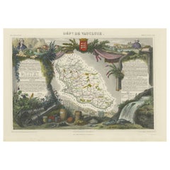
Old Map of Vaucluse, France: A Cartographic Celebration of Viticulture, 1852
Located in Langweer, NL
This original hand-colored map is from the "Atlas National Illustré," a work by Victor Levasseur, a French geographer and cartographer known for his richly illustrated maps.
The map...
Category
1850s Antique Paper Maps
Materials
Paper
$324 Sale Price
20% Off
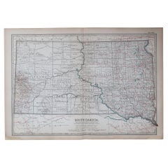
Original Antique Map of the American State of South Dakota, 1903
Located in St Annes, Lancashire
Antique map of South Dakota
Published By A & C Black. 1903
Original colour
Good condition
Unframed.
Free shipping
Category
Early 1900s English Antique Paper Maps
Materials
Paper
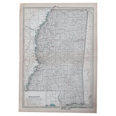
Original Antique Map of the American State of Mississippi, 1903
Located in St Annes, Lancashire
Antique map of Mississippi
Published By A & C Black. 1903
Original colour
Good condition
Unframed.
Free shipping
Category
Early 1900s English Antique Paper Maps
Materials
Paper
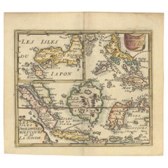
1692 Jacq. Peeters Map: East Indies, Indonesia, Japan, Philippines and Singapore
Located in Langweer, NL
1692 Jacques Peeters Map: East Indies, Indonesia & Japan with Unique Inset
This hand-colored map from 1692, created by Jacques Peeters, captures the islands of Indonesia, the Philippines, and features a unique inset of Japan.
It closely resembles Nicolas de Fer's map and is primarily based on Sanson's influential maps. The map meticulously details cities, smaller settlements, rivers, mountain chains, and forests, offering a comprehensive view of the region's geography.
The inset map of Japan stands out due to its distinctive shape and influences, reflecting different cartographic sources. Notable features include the marked equator and detailed latitude and longitude indications on the borders.
The map measures 6.5 inches in width by 5.5 inches in height and is in excellent condition, with a dark impression, slight toning, and a minor centerfold crease.
Keywords:
- East Indies map
- Indonesia historical map
- Philippines map...
Category
1690s Antique Paper Maps
Materials
Paper
$630 Sale Price
20% Off
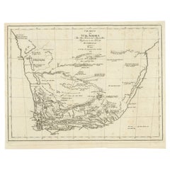
Antique Map of South Africa showing the Travels of Truter and Somerville
Located in Langweer, NL
Antique map titled 'Charte von Süd-Afrika'. Original antique map of South Africa showing the travels of Truter and Somerville. Published ci...
Category
Early 19th Century Antique Paper Maps
Materials
Paper
$401 Sale Price
20% Off
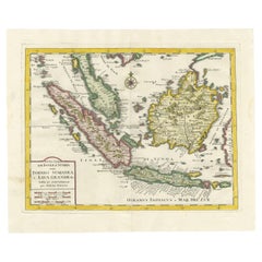
Antique Map of the Sunda Islands by Tirion 'c.1760'
Located in Langweer, NL
Antique map titled 'Nuova Carta delle Isole di Sunda come Borneo, Sumatra e Iava Grande'. Detailed map of the Sunda Islands, Southeast Asia, extending from the tip of Cambodia to Jav...
Category
Mid-18th Century Antique Paper Maps
Materials
Paper
$931 Sale Price
20% Off
Antique Map of the World on Mercator Projection by Anson, 1749
Located in Langweer, NL
Antique map titled 'Nieuwe Wereld Kaart waar in de Reizen van den Hr. Anson rondsom de Wereld'. Original antique map of the world on Mercator'...
Category
18th Century Antique Paper Maps
Materials
Paper
$438 Sale Price
25% Off
1826 Antigo Impero Messicano Mexico Hand Colored Framed Map
Located in Stamford, CT
1826 Antigo Impero Messicano Mexico Hand Colored Framed Map. As found black wood frame.
Category
1820s Mexican Spanish Colonial Antique Paper Maps
Materials
Glass, Wood, Paper
Antique Map of Egypt and Arabia Petraea by A & C. Black, 1870
Located in Langweer, NL
Antique map titled 'Egypt and Arabia Petraea'. Original antique map of Egypt and Arabia Petraea. This map originates from ‘Black's General Atlas of The World’. Published by A & C. Bl...
Category
Late 19th Century Antique Paper Maps
Materials
Paper
$145 Sale Price
30% Off
Original Antique Map of the Region Between the Gulf of Lybia and the Red Sea
Located in Langweer, NL
Original antique map titled 'Aegyptus et Cyrene'. Detailed ancient map of the region between the Gulf of Lybia and the Red Sea, with marvelous detail along the Mediterranean Coastline and the Nile, Egypt. This map originates from 'Philippi Cluveri Introductionis in universam geographiam (..)' by P. Clüver. Published 1729.
Philipp Clüver was an Early Modern German geographer and historian. Cluver's Geography was one of the most enduring works of the 17th & 18th Centuries, issued by several different publishers with many different sets of maps...
Category
Early 18th Century Antique Paper Maps
Materials
Paper
$401 Sale Price / item
20% Off
Antique Map of the Cities of the Province of Hu-Quang by Basire, 1738
Located in Langweer, NL
Antique print titled 'Cities of the Province of Hu-Quang'. Old map depicting four walled cities of the Chinese Qing dynasty province of Hu-Quang (modern day HUNAN and part of surroun...
Category
18th Century Antique Paper Maps
Materials
Paper
$194 Sale Price
20% Off
18th-Century Map of Holstein and Surrounding Duchies by Homann Heirs
Located in Langweer, NL
18th-Century Map of Holstein and Surrounding Duchies by Homann Heirs
Description: This finely detailed 18th-century map by the Homann Heirs (Homannische Erben) illustrates the Duc...
Category
1750s Antique Paper Maps
Materials
Paper
Cartographic Survey of Pontevedra, 1902: Crossroads of Galicia"
Located in Langweer, NL
This original old map of over 100 years old depicts the province of Pontevedra as it was in 1902. Pontevedra is located in the northwest of Spain, in the autonomous community of Galicia. This coastal province is bordered by the Atlantic Ocean to the west and Portugal to the south. It is a region known for its rugged coastline, which includes the famous Rías Baixas, a series of four estuarine inlets that are known for their scenic beauty, beaches, and seafood. The interior of the province is characterized by a hilly landscape that gradually rises from the coast to the interior.
Pontevedra's capital, which shares the same name, is renowned for its well-preserved old town, rich medieval history, and the iconic Sanctuary of the Pilgrim Virgin...
Category
Early 1900s Antique Paper Maps
Materials
Paper
$305 Sale Price
20% Off
Detailed Map of Southeast Asia From the Tip of Cambodia to Java, 1739
Located in Langweer, NL
Antique map titled 'Nieuwe kaart van de Sundasche Eilanden als Borneo, Sumatra en Groot Iava & c'.
Detailed map of Southeast Asia, extending from the tip of Cambodia to Java. Thi...
Category
1730s Antique Paper Maps
Materials
Paper
$618 Sale Price
24% Off
Antique Engraving of Tinian, an Island of the Northern Mariana Islands, 1757
Located in Langweer, NL
Antique print titled 'Vue de la Rde de Tinian
Gezigt van de Rheede van Tinian (..)'. Views of the south-west side of the island of Tinian and a view of the anchorage of Tinian, w...
Category
1750s Antique Paper Maps
Materials
Paper
$343 Sale Price
20% Off
Decorative Map of the French Regions of Picardy, Artois & French Flanders, c1780
Located in Langweer, NL
Antique map titled 'Carte des Gouvernements de Flandre Francoise, d'Artois, de Picardie et du Boulenois.'
An attractive example of Rigobert Bonne's 1771 decorative map of the Fre...
Category
1780s Antique Paper Maps
Materials
Paper
$659 Sale Price
20% Off
Antique Map of the Siege of Syracuse by the Athenians, 1648 – Thucydides
Located in Langweer, NL
Antique Map of the Siege of Syracuse by the Athenians, 1648 – Thucydides
This finely engraved plan depicts the Siege of Syracuse, one of the most dramatic episodes of the Peloponnes...
Category
Mid-17th Century English Antique Paper Maps
Materials
Paper
$706 Sale Price
20% Off
Huelva 1901: A Cartographic Presentation of Andalusia's Atlantic Frontier
Located in Langweer, NL
The map displays the province of Huelva, located in the southwestern part of the autonomous community of Andalusia in Spain, as of the year 1901. It outlines various geographic and m...
Category
Early 1900s Antique Paper Maps
Materials
Paper
$343 Sale Price
20% Off
Antique Map of Eastern Europe, Incl Montenegro & Serbia & a Budapest Map, 1890
Located in Langweer, NL
Antique map titled 'Osterreich-Ungarn in 4 Blattern, Blatt 4.'
Map of Eastern Europe, with Montenegro in the lower left corner, the southern ...
Category
1890s Antique Paper Maps
Materials
Paper
Antique Print of Chinese Vessels Near Lantam, China, 1665
Located in Langweer, NL
Antique print titled 'Lantam'. Old print depicting Chinese ships on the coast of Lantam. Also depicted are Chinese village houses. This print originates f...
Category
17th Century Antique Paper Maps
Materials
Paper
Antique Print of the Town Hall of Batavia or Jakarta in Todays Indonesia, 1770
Located in Langweer, NL
Antique optical print titled 'Prospect des Rathhauses in Batavia (..)'. View of the town hall of Batavia, Indonesia. This is an optical print, also called 'vue optique' or 'vue d'opt...
Category
18th Century Antique Paper Maps
Materials
Paper
$544 Sale Price
20% Off
Antique Decorative County Map of Huntingdonshire, England, 1804
Located in Langweer, NL
Antique county map of Huntingdonshire first published c.1800. Cities illustrated include Kimbolton, Chesterton, Folkesworth, and Great Stewkeley.
Charles Smith was a cartographer ...
Category
Early 1800s Antique Paper Maps
Materials
Paper
$310 Sale Price
20% Off
Austria by Wolfgang Lazius – A Magnificent 16th-Century Map from Ortelius
Located in Langweer, NL
Title:
Avstriae Descrip – Wolfgang Lazius’ Map of Austria, 16th Century
Description:
This extraordinary map of Austria pays homage to the Austrian humanist and cartographer Wo...
Category
16th Century Antique Paper Maps
Materials
Paper
Antique Map of Catalonia by Blaeu, circa 1650
Located in Langweer, NL
Antique map titled 'Catalonia'. Antique map of Catalonia, extending from C. De Romani on the Northern Coast to Alfachs and Panicola in Valencia on the southern end of the coast and s...
Category
Mid-17th Century Antique Paper Maps
Materials
Paper
$859 Sale Price
20% Off
Antique Map of the Area around the Abbey in Soligny-la-Trappe 'c.1710'
Located in Langweer, NL
Antique map titled 'La nouvelle Thebaide ou la Carte tres particuliere et exacte de l'Abbaye de la Maison Dieu Nostre Dame de la Trappe (..)'. Rare, original map of the area around t...
Category
Early 18th Century Antique Paper Maps
Materials
Paper
$764 Sale Price
20% Off
Antique Map of Peru, Ecuador and Bolivia by Lapie, 1842
Located in Langweer, NL
Antique map titled 'Carte du Perou et du Haut Perou'. Map of Peru, Ecuador and Bolivia. This map originates from 'Atlas universel de géographie ancienne et...
Category
19th Century Antique Paper Maps
Materials
Paper
$228 Sale Price
20% Off
Antique Map of Guadeloupe and Dependencies – France Pittoresque, c. 19th Century
Located in Langweer, NL
Antique Map of Guadeloupe and Dependencies – France Pittoresque, c. 19th Century
This finely engraved antique map of Guadeloupe and its dependencies originates from France Pittore...
Category
1830s Antique Paper Maps
Materials
Paper
Antique Map of Spain and Portugal by Levasseur, '1875'
Located in Langweer, NL
Antique map titled 'Carte générale de l'Espagne et du Portugal (..)'. Large map of Spain and Portugal. This map originates from 'Atlas de Géographie Moder...
Category
Late 19th Century Antique Paper Maps
Materials
Paper
$358 Sale Price
40% Off
Early Woodcut Map of Franconia and Surrounding Regions, 1628
Located in Langweer, NL
Title: Early Woodcut Map of Franconia and Surrounding Regions, 1628
Franconia (Franckenlande) is a region in Germany. Historically, Franconia was a significant part of the Holy Roma...
Category
1620s Antique Paper Maps
Materials
Paper
Antique Miniature Map of the Turkish Empire by Bertius '1618'
Located in Langweer, NL
Antique miniature map titled 'Turcicum Imperium'. Rare miniature map of the Turkish Empire. This map originates from 'Tabularum Geographicarum Contractarum Libri septem (..)' by P. B...
Category
Early 17th Century Antique Paper Maps
Materials
Paper
$716 Sale Price
20% Off
Original Antique Bird's Eye View Plan of Hoorn, The Netherlands by Blaeu, c.1700
Located in Langweer, NL
Antique map titled 'Horna vulgo Hoorn'.
Bird's eye view plan of Hoorn, The Netherlands. With title cartouche, coats of arms and key. From an atlas published by De Wit, ca. 1698-1...
Category
Early 1700s Antique Paper Maps
Materials
Paper
$897 Sale Price
20% Off
Original Antique Map of South America. C.1780
Located in St Annes, Lancashire
Great map of South America
Copper-plate engraving
Published C.1780
Two small worm holes to left side of map
Unframed.
Category
Early 1800s English Georgian Antique Paper Maps
Materials
Paper
Large Antique County Map of North Wales, England
Located in Langweer, NL
Antique map titled 'A Map of North Wales from the best Authorities'. Original old county map of North Wales, England. Engraved by John Cary. Originates from 'New British Atlas' by Jo...
Category
Early 19th Century Antique Paper Maps
Materials
Paper
$171 Sale Price
20% Off
Antique Map of Denmark with Schleswig & Holstein by A & C. Black, 1870
Located in Langweer, NL
Antique map titled 'Denmark with Schleswig & Holstein'. Original antique map of Denmark with Schleswig & Holstein. This map originates from ‘Black's General Atlas of The World’. Publ...
Category
Late 19th Century Antique Paper Maps
Materials
Paper
$125 Sale Price
40% Off
Antique Map of Western Europe by H. Kiepert, circa 1870
Located in Langweer, NL
Antique map titled 'Gallia, Britannia, Germania'. This map depicts a large part of Western Europe including countries like Germany, France, Great Britain, The Netherlands and more. T...
Category
Late 19th Century German Antique Paper Maps
Materials
Paper
Antique Map of South America by A & C. Black, 1870
Located in Langweer, NL
Antique map titled 'South America'. Original antique map of Map of South America. This map originates from ‘Black's General Atlas of The World’. Published by A & C. Black, 1870.
Category
Late 19th Century Antique Paper Maps
Materials
Paper
$262 Sale Price
20% Off
A Catalonian Cartographic Depiction of Tarragona Province, 1901
Located in Langweer, NL
This image depicts a historical map of the province of Tarragona, which is in the northeastern part of Spain, within the autonomous community of Catalonia. The map is dated 1901, sug...
Category
Early 1900s European Antique Paper Maps
Materials
Paper
$292 Sale Price
50% Off
Antique Map of South America by Reichard, 1820
Located in Langweer, NL
Antique map titled 'Süd America'. Decorative antique map of South America with an inset map of Ecuador. Artists and Engravers: Published b...
Category
19th Century Antique Paper Maps
Materials
Paper
$83 Sale Price
20% Off
Map of East Frisian Islands & Northwestern Tip of Germany, Ostfriesland, c.1595
Located in Langweer, NL
Antique map titled 'Frisia Orientalis'. Beautiful map of east Frisian islands and the northwestern tip of Germany, Ostfriesland. With people in local costumes. Ornamented inset of the Eems estuary. Based on a manuscript map...
Category
16th Century Antique Paper Maps
Materials
Paper
$1,671 Sale Price
20% Off
Antique Print of the Residence of Sir Gregory Page by Miller, c.1770
Located in Langweer, NL
Antique print titled 'Elevation of the Flank of Sir Gregory Page'. Architectural elevation of the residence of Sir Gregory Page.
Sir Gre...
Category
18th Century Antique Paper Maps
Materials
Paper
$716 Sale Price
20% Off
Blaeu Map of Ottoman Balkans – Walachia Bulgaria Romania, circa 1665
Located in Langweer, NL
Blaeu Map of Ottoman Balkans – Walachia Bulgaria Romania, circa 1665
This is an original hand-coloured antique map titled “Walachia, Servia, Bulgaria, Romania,” published by Joan Bl...
Category
17th Century Dutch Antique Paper Maps
Materials
Paper
Hand Colored Antique Map of the Department of Haute Loire, France
Located in Langweer, NL
Antique map titled 'Dept. de la Haute Loire'. Map of the French department of Haute Loire, France. This area of France is part of the Loire Valley wine growing...
Category
Mid-19th Century Antique Paper Maps
Materials
Paper
$324 Sale Price
20% Off
1882 Cartographic Views of Ireland's North and South Regions
Located in Langweer, NL
Title: 1882 Maps of Ireland: Northern and Southern Regions
These two maps provide a detailed representation of Ireland as it was in 1882, divided into the northern and southern regi...
Category
1880s Antique Paper Maps
Materials
Paper
Antique Map of Siberia, Russia, 1859
Located in Langweer, NL
Antique map titled 'Siberia or Northern Asia'. Original antique map of Siberia or Northern Asia. This map originates from ‘The Imperial Atlas of Modern Geography’. Published by W. G....
Category
Mid-19th Century Antique Paper Maps
Materials
Paper
$238 Sale Price
20% Off
Northern Schleswig and Haderslev Map by Johannes Mejer and Johannes Blaeu, 1662
Located in Langweer, NL
The map shows the Duchy of Schleswig, which spans the area between the North Sea coast, Kolding, and Flensburg. The maps were originally published by Johannes Mejer in the regional a...
Category
1660s Antique Paper Maps
Materials
Paper
$534 Sale Price
20% Off
Old Print of a Peasant of Hermannstadt 'Sibiu', Transylvania, 1804
Located in Langweer, NL
Old print of a peasant of the neighbourhood of Hermannstadt (Sibiu), Transylvania.
This print originates from 'The Costume of the Hereditary States of the House of Austria' by William Miller.
Artists and Engravers: Engraved by William Ellis.
Category
Early 1800s Antique Paper Maps
Materials
Paper
$248 Sale Price
20% Off
Antique Map of Germany, the Netherlands, Bohemia, Bavaria and Switzerland, 1785
Located in Langweer, NL
Antique map titled 'Germany and the Netherlands from the latest authorities'. Depicts Germany, the Netherlands and the surrounding region including Bohemia, Bavaria, and Switzerland....
Category
18th Century Antique Paper Maps
Materials
Paper
$133 Sale Price
20% Off
Antique Map of Switzerland by Lapie, 1842
Located in Langweer, NL
Antique map titled 'Carte de la Suisse ou Helvetie'. Map of Switzerland. This map originates from 'Atlas universel de géographie ancienne et moderne...
Category
Mid-19th Century Antique Paper Maps
Materials
Paper
$477 Sale Price
20% Off
Japanese Isles Map by Mallet, 1683 – Decorative Miniature Map
Located in Langweer, NL
1683 Map of Japan Isles by Mallet – Decorative Miniature Map
This is an original antique map titled “Isles du Japon,” created by Alain Manesson Mallet and published in Paris in 1683...
Category
1680s French Antique Paper Maps
Materials
Paper
A Stunning 1744 Bowen Map: South East Germany & Queen of Hungary’s Dominions
Located in Langweer, NL
Title: A New and Correct Map of the South East part of Germany, 1744
This map by Emanuel Bowen, dating to around 1744, beautifully captures the southeastern part of Germany. The det...
Category
1740s Antique Paper Maps
Materials
Paper
Antique Map of Egypt and Palestina by H. Kiepert 'circa 1870'
Located in Langweer, NL
Antique map titled 'Aegyptus, Phoenice et Palestina'. With inset maps of Tyrus, Alexandria and Hierosolyma. This map originates from 'Atlas Antiquus. Zwölf Karten zur Alten Geschicht...
Category
Late 19th Century Antique Paper Maps
Materials
Paper
$152 Sale Price
20% Off
Antique Plan of Aigues-Mortes, France
Located in Langweer, NL
Antique map titled 'Plan d'Aiguesmortes et environs'. Original plan of the region of Aigues-Mortes, France. This map originates from 'Le Petit Atlas Maritime (..)' by J.N. Bellin. Pu...
Category
Mid-18th Century Antique Paper Maps
Materials
Paper
$324 Sale Price
20% Off
Antique Lithography Map, Oxfordshire, English, Framed Cartography, Robert Morden
Located in Hele, Devon, GB
This is an antique lithography map of Oxfordshire. An English, framed atlas engraving of cartographic interest by Robert Morden, dating to the late 17th century and later.
Superb l...
Category
Late 17th Century British William and Mary Antique Paper Maps
Materials
Paper
Detailed Original Antique Map of the Region of Rome in Italy, c.1870
Located in Langweer, NL
Antique map titled 'Roma Urbs'. Old map of Italy, it shows three inset maps of the region of Rome. This map originates from 'Atlas Antiquus, twaalf k...
Category
19th Century Antique Paper Maps
Materials
Paper
Large Original Vintage Map of North America, circa 1920
Located in St Annes, Lancashire
Great map of North America
Original color. Good condition
Published by Alexander Gross
Unframed.
Category
1920s English Edwardian Vintage Paper Maps
Materials
Paper
Pavillon de la Grande Tuilerie – French Architectural Lithograph, La Brique
Located in Langweer, NL
Pavillon de la Grande Tuilerie – French Architectural Lithograph, La Brique
This striking antique architectural lithograph shows the pavilion of the Grande Tuilerie de Bourgogne (Mo...
Category
20th Century French Paper Maps
Materials
Paper
Girona 1902: Geographic and Infrastructural Map of Catalonia’s Northern Province
Located in Langweer, NL
The map provided is of the province of Girona (in Catalan, Girona), located in the northeast of Spain, within the autonomous community of Catalonia, as of the year 1902. Here are the...
Category
Early 1900s Antique Paper Maps
Materials
Paper
$372 Sale Price
20% Off
Rare 17th-Century Map of Dauphiné in Southeastern France by F. De Wit, ca.1688
Located in Langweer, NL
Title: Rare Hand-Colored 17th-Century Map of Dauphiné by Frederik De Wit c. 1688
Description: This captivating 17th-century map of Dauphiné, titled "Nova et Accurata Delphinatus Vul...
Category
1680s Antique Paper Maps
Materials
Paper
Antique Map of the Harbour of Taloo by J. Cook, 1803
By James Cook
Located in Langweer, NL
Antique map French Polynesia titled 'Schets van de Havenen aan de Noord Zijde van Eimeo'. Plan of the harbour of Taloo in the Island of Moorea, one of the Society Islands, French Polynesia. Originates from 'Reize rondom de Waereld door James Cook...
Category
Early 19th Century Dutch Antique Paper Maps
Materials
Paper
Rare Old Map of the City of Stavoren, Friesland, the Netherlands, 1616
Located in Langweer, NL
Antique map titled 'Staveren'.
Old map of the city of Stavoren, Friesland. This map originates from 'Rerum Frisicarum Historia' by U. Emmius.
Artists and Engravers: Nicolaes ...
Category
1610s Antique Paper Maps
Materials
Paper
$811 Sale Price
20% Off
Recently Viewed
View AllMore Ways To Browse
Antique Wellington Chests
Antonio Cassi Ramelli
Archimede Seguso Birds
Art Deco Coasters
Art Deco Footballer
Art Deco Music Cabinet
Art Deco Waterfall Bedroom Furniture
Art Deco Waterfall Bedroom
Art Deco Whisky
Art Foulard
Art Nouveau Sunflower
Arts And Crafts Silver Coffee Pot
Asian Pink Bowl
Avesn Vase
Baccarat Carafe
Bakelite Bird
Bakelite Cocktail Picks
Bamboo Ikebana Vase
