Paper Maps
to
4,234
5,376
169
5,547
3
55
29
13
9
5
5
1
1
1
1
1
1
2,913
2,197
437
3
280
23
5
126
8
35
7
2
3
3
2
5,550
122
55
34
32
622
282
199
137
124
5,550
5,550
5,550
104
59
28
21
15
Material: Paper
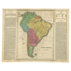
Interesting Original Antique Map of South America, 1822
Located in Langweer, NL
Antique map titled 'South America'.
Map of South America with attractive topography, surrounded on three sides by text on the history, geography, and economy of the continent. Sh...
Category
19th Century Antique Paper Maps
Materials
Paper
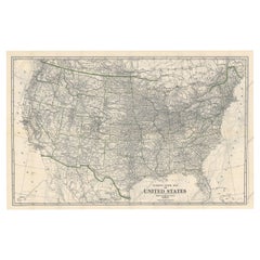
Old Map of the American Railroad Network and All Weather Roads on Verso, 1931
Located in Langweer, NL
This is the “New Census Edition” of Clason’s United States Green Guide. It features two large maps of the United States on a single sheet.
The recto map shows the complete road net...
Category
1930s Vintage Paper Maps
Materials
Paper
$425 Sale Price
20% Off
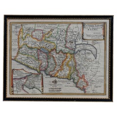
Map Holy Land La Terre Sainte Engraved van Loon Published N de Fer 1703 French
Located in BUNGAY, SUFFOLK
La Terre Sainte, The Holy Land, Tiree Des Memoires De M.De.La Rue. Par N. de Fer. Geographe de Sa Majeste Catoliq et de Monseigneur le Dauphin. Avec Privil du Roi 1703
Detailed map of the Holy Land from Nicholas de Fer's L'Atlas Curieux ou le Monde. East is oriented at the top.
MAKER Nicolas de Fer 1646-1720
The French cartographer and engraver, Nicolas de Fer, was a master at creating maps that were works of art. The maps that he published were printed during the Baroque period when the decorative arts were characterized by ornate detail. De Fer’s detailed maps and atlases were valued more for their decorative content than their geographical accuracy.
Nicolas de Fer was born in 1646. His father, Antoine de Fer, owned a mapmaking firm. At the age of twelve, Nicolas was apprenticed to a Parisian engraver named Louis Spirinx. The family business was starting to decline when his father died in 1673. Nicolas de Fer’s mother, Genevieve, took over the business after the death of her husband. In 1687 the business was passed on to Nicolas and the profits increased after he took over the firm. Nicolas de Fer was a prolific cartographer who produced atlases and hundreds of single maps. He eventually became the official geographer to King Louis XIV of France and King Philip V...
Category
Early 1700s French Louis XIV Antique Paper Maps
Materials
Paper
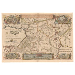
Circa 1686 Daniel Stoopendaal Map: Biblical Sites from Paradise to Canaan
Located in Langweer, NL
Circa 1686 Daniel Stoopendaal Map: Biblical Sites from Paradise to Canaan
This circa 1686 hand-colored map by Daniel Stoopendaal, titled "De Gelegentheyt van 't Paradys en 't Landt Canaan," beautifully illustrates the Middle East, extending from the Mediterranean to the Persian Gulf.
The map features numerous Biblical locations, such as the Garden of Eden, the wanderings of the Children of Israel, and the story of Jonas and the whale.
It is adorned with elaborate decorations, including a banner-style title cartouche and four corner vignettes depicting scenes from Genesis: Paradise, the creation of Adam and Eve, Eve offering the apple, and their expulsion from Eden.
The bottom center showcases a dramatic portrayal of Noah's Ark. Measuring 18.3 inches wide by 11.9 inches high, this first state map includes Dutch text on the reverse and is in good condition, with a crisp impression, light toning along the centerfold, and a small chip in the bottom margin.
Keywords:
- Daniel Stoopendaal map
- Biblical map
- Garden of Eden
- Land of Canaan
- Middle East historical map
- Noah's Ark map
- Adam and Eve
- 17th-century Bible...
Category
1680s Antique Paper Maps
Materials
Paper
$793 Sale Price
20% Off
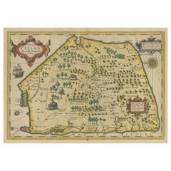
Antique Map of Sri Lanka with an unusual five-sided shape, circa 1606
Located in Langweer, NL
Antique map titled 'Ins. Ceilan quae incolis Tenarisin dicitur'. This exquisite, early map of Sri Lanka is shown with an unusual five-sided shape. North is oriented to the left by an...
Category
Early 17th Century Antique Paper Maps
Materials
Paper
$604 Sale Price
20% Off
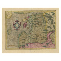
Original Antique Map of the Northern Baltic Region
Located in Langweer, NL
Title: "Livonia: Antique Map of the Northern Baltic Region"
Description: This antique map, titled "Livonia," is a detailed representation of the northern Baltic region. Centered on ...
Category
Early 17th Century Antique Paper Maps
Materials
Paper
$935 Sale Price
20% Off
Antique Map of Sweden by Bowen, 1747
Located in Langweer, NL
Antique map titled 'A New & Accurate Map of Sweden'. This map covers Sweden and Finland (shown as part of Sweden) as well as parts of modern day Estonia,...
Category
18th Century Antique Paper Maps
Materials
Paper
$255 Sale Price
20% Off
Antique Print of a Ruin in Peru, South America, 1857
Located in Langweer, NL
Untitled print of a ruin in Peru. This print originates from 'Die Kunstwerke vom Alterthum bis auf die Gegenwart, oder, Wegweiser durch das ganze Gebiet der bildenden Kunst : enthalt...
Category
19th Century Antique Paper Maps
Materials
Paper
$151 Sale Price
20% Off
Detailed Antique Map of Hungary and Transylvania by Tirion, 1753
Located in Langweer, NL
Title: Nieuwe Kaart van’t Koninkryk Hongaryen en Zevenbergen by Isaak Tirion, 1753 – Antique Map of Hungary and Transylvania
Description: This is an antique 1753 map titled *Nieuwe Kaart van’t Koninkryk Hongaryen en Zevenbergen*, created by the notable Dutch cartographer and publisher Isaak Tirion. The map showcases the Kingdom of Hungary and the region of Transylvania (referred to as "Zevenbergen") as they appeared in the mid-18th century. Tirion’s maps are well-known for their clarity, precision, and attention to geographic detail, making them highly sought after by collectors of antique maps.
This map provides a detailed view of Hungary and Transylvania, including borders, towns, cities, rivers, and mountain ranges. It was created using the latest discoveries and updates of the time and reflects the political landscape of the region, which was part of the Habsburg Empire during a period of territorial changes and consolidations. The map’s borders are highlighted with color to distinguish different regions, and significant cities such as Buda, Pest, and Debrecen are clearly labeled.
Isaak Tirion was one of the most prominent Dutch publishers of the 18th century, particularly known for his *Nieuwe en Beknopte Hand-Atlas* (New and Concise Hand Atlas) series, which included a wide range of maps of Europe and beyond. His works were appreciated for their cartographic accuracy and artistic quality.
This map is a valuable piece for collectors interested in 18th-century European maps, particularly those that highlight Central Europe, Hungary, Transylvania, and the Habsburg Empire. It is a fine example of the craftsmanship of Isaak Tirion and offers insight into the historical geography of the region.
Condition: Excellent for its age, with finely preserved hand-coloring and wide margins. Slight edge wear typical of maps from this period.
Effective keywords that may help attract collectors or enthusiasts interested in historical maps of Hungary, Transylvania, and Central Europe:
- Antique map of Hungary
- Historical map of Transylvania
- 18th-century map of Central Europe
- Habsburg Empire map
- Isaak Tirion map
- Nieuwe Kaart van’t Koninkryk Hongaryen en Zevenbergen
- Kingdom of Hungary map...
Category
1750s Antique Paper Maps
Materials
Paper
$570 Sale Price
30% Off
1851 Map of "Independent Tartary", Ric. R018
Located in Norton, MA
1851 Map of
Independent Tartary
"Russia"
Ric.r018
A highly decorative 1851 map of Independent Tartary by John Tallis and John Rapkin. Covers the regions between the Caspian Sea and Lake Bakquash and between Russia and Afghanistan. These include the ancient Silk Route kingdoms of Khiva, Tartaria, Kokand, and Bokhara. Today this region roughly includes Kazakhstan, Uzbekistan, Turkmenistan, Kyrgyzstan, and Tajikistan. This wonderful map offers a wealth of detail for anyone with an interest in the Central Asian portion of the ancient Silk Road. Identifies various caravan routes, deserts, wells, and stopping points, including the cities of Bokhara and Samarkand. Three vignettes by W. Bragg decorate the map, these including an image of Tartars on a Journey, a horseback Bride Chase, and a tartar camp site. Surrounded by a vine motif border. Engraved by J. Rapkin for John Tallis's 1851 Illustrated Atlas .
Tartary Antique Map...
Category
19th Century Unknown Antique Paper Maps
Materials
Paper
Antique Map of Europe by Levasseur, '1875'
Located in Langweer, NL
Antique map titled 'Carte générale de l'Europe'. Large map of Europe. This map originates from 'Atlas de Géographie Moderne Physique et Politique' by A. Levasseur. Published 1875.
Category
Late 19th Century Antique Paper Maps
Materials
Paper
$354 Sale Price
40% Off
Antique Chart of the Passage of Comets in the Southern Sky, circa 1740
Located in Langweer, NL
Antique map titled 'Motus Comtarum in Hemispaerio Australi (..)'. This uncommon chart depicts the passage of comets in the southern sky between the years 1530-1704. Centered on the ecliptic poles and shows the constellation figures based on classical mythology, without showing the stars. The paths of dozens of comets are illustrated, eincluding those sighted by Tycho Brahe...
Category
Mid-18th Century Antique Paper Maps
Materials
Paper
$2,214 Sale Price
25% Off
Large 1695 Hand-Colored Engraved Map of Gascony (Gascogna), France
Located in Langweer, NL
This map, created by Giacomo Cantelli da Vignola in 1695, represents the "General Government of Guyenne and Gascony" in southwest France. Cantelli da Vignola was a renowned Italian c...
Category
1690s Antique Paper Maps
Materials
Paper
$2,125 Sale Price
20% Off
Antique Map of the Holy Land, with vignette of the Garden of Eden
Located in Langweer, NL
Antique map titled 'Hondius his Map of Paradise'. Beautiful map of the region bounded by the Holy Land. Syria, Mesopotamia, Chaldea and part of Arabia. W...
Category
Mid-17th Century Antique Paper Maps
Materials
Paper
$453 Sale Price
20% Off
Map of Tartary by Isaak Tirion: Detailed Cartography of Northern Asia, ca.1740
Located in Langweer, NL
This is an antique map titled "Nieuwe Kaart van Tartarie," which translates to "New Map of Tartary." The map was created by Isaak Tirion, a prominent Dutch cartographer and publisher...
Category
1740s Antique Paper Maps
Materials
Paper
$623 Sale Price
20% Off
Antique Print of Cairo in Egypt, 1698
Located in Langweer, NL
Untitled antique print with two views of Cairo, Egypt. 78: Palace of Sultan Gori. 79. Tower and aqueduct. This print originates from 'Reizen van Cornelis de Bruyn, door de vermaardst...
Category
17th Century Antique Paper Maps
Materials
Paper
$274 Sale Price
20% Off
Map of Tasmania with Illustrations of Local Fauna and Colonial Landmarks, 1851
Located in Langweer, NL
John Tallis & Company was renowned for their detailed and ornate maps during the 19th century. Their maps are distinguished by the intricate borders and vignettes that are as informa...
Category
1850s Antique Paper Maps
Materials
Paper
$274 Sale Price
20% Off
Antique Map of the Antilles by Meyer, 1878
Located in Langweer, NL
Antique map titled 'Die Antillen'. Old map of the Antilles, it shows Jamaica, Puerto Rico, the Bahamas and Cuba. With inset maps of the Lesser Antilles and Havana. This map originate...
Category
19th Century Antique Paper Maps
Materials
Paper
$80 Sale Price
20% Off
Old Engraving of Longvek or Lavek (Eauweck), the Second Capital City of Cambodia
Located in Langweer, NL
Antique print titled 'Eauweck, capitale de Camboye'. Decorative panoramic view of the town of Longvek (or Lavek) in Cambodia. It was the second capital city during the Cambodia's Mid...
Category
18th Century Antique Paper Maps
Materials
Paper
$283 Sale Price
20% Off
Antique Map of the Province of Constantine, Algeria by Migeon, 1880
Located in Langweer, NL
Antique map titled 'Province de Constantine'. Old map of the province of Constantine, Algeria. The Department of Constantine existed from 1848 to 1962 and was one of the three admini...
Category
19th Century Antique Paper Maps
Materials
Paper
$99 Sale Price
20% Off
Mercator's Ptolemaic Map of Ancient Assyria, Media, and Persia
Located in Langweer, NL
This map, "Asiae I Tab:", features the region corresponding to modern-day Iran and Iraq, intricately depicted in Gerard Mercator's edition of Claudius Ptolemy's "Tabulae Geographicae...
Category
16th Century Antique Paper Maps
Materials
Paper
$1,077 Sale Price
20% Off
Antique Print of a Landscape with Rock Formation in New Zealand by Cook, 1803
By Cook
Located in Langweer, NL
Antique print New Zealand titled 'Gezigt van eene doorboorde Rots in Nieuw-Zeeland'. Antique print depicting a landscape with rock formation,...
Category
19th Century Antique Paper Maps
Materials
Paper
$217 Sale Price
20% Off
French Antique Map of Oceania with Details of the Australian Colonies, c.1840
Located in Langweer, NL
Antique map Oceania titled 'Océanie par C.V. Monin'. Old map of Oceania with an inset of New South Wales. Originates from 'Atlas Classique de la Géographie Ancienne (..)'.
Artists ...
Category
19th Century Antique Paper Maps
Materials
Paper
$207 Sale Price
20% Off
Mapping the Heart of France: Willem Blaeu's 17th Century Île-de-France, ca.1650
Located in Langweer, NL
This original antique map titled "Le Gouvernement de l'Isle de France" represents the Île-de-France region, which historically was one of the provinces of France and contained the ci...
Category
1650s Antique Paper Maps
Materials
Paper
$359 Sale Price
20% Off
Antique Map of England and Wales Depicting the Period of the Saxon Heptarchy
Located in Langweer, NL
Antique map titled 'Britain as divided under the Saxon Heptarchy'. An antique copper engraving map of England and Wales by Joseph Ellis depicting the period of the Saxon Heptarchy. E...
Category
Late 18th Century Antique Paper Maps
Materials
Paper
$415 Sale Price
20% Off
Antique Map of Northern Germany, Including Schleswig-Holstein and Hamburg
Located in Langweer, NL
Antique map titled 'Basse Partie de la Basse Saxe ou sont les Duchés de Sleswick, Holsace, Meckelenbourg et Lauvenbourg (..)'. Original old map of northern Germany, including Schlesw...
Category
Mid-17th Century Antique Paper Maps
Materials
Paper
$510 Sale Price
20% Off
French Guiana and Cayenne: Mid-19th Century Map from France Pittoresque Series
Located in Langweer, NL
This map titled "Guyane" is part of the France Pittoresque series and provides a detailed view of French Guiana along with a plan of the city of Cayenne.
Features:
- The map showcases the broader region of French Guiana, indicating key rivers, settlements, and the coastline along the Atlantic Ocean.
- To the left, there's an inset labeled "Plan de la Ville de Cayenne", which shows the street layout, squares, and main buildings of the capital city, Cayenne. This inset provides a more detailed view of the urban area, highlighting its geometric grid layout near the coast.
- The larger map outlines geographical features such as rivers (e.g., Oyapock and Maroni), forests, and territories in the surrounding area, including the neighboring Brazilian Empire...
Category
1850s Antique Paper Maps
Materials
Paper
$113 Sale Price
20% Off
Attractive Antique Map showing Denmark and part of Sweden and Germany c.1750
By Isaak Tirion
Located in Langweer, NL
Antique map titled 'Nieuwe Kaart van het Koninkryk van Deenemarken (..).' Attractive detailed map showing Denmark and a part of Sweden and Germany. Title in block-style cartouche wit...
Category
18th Century Antique Paper Maps
Materials
Paper
$519 Sale Price
20% Off
Antique Map of Central Sweden by J. Blaeu, 1662
Located in Langweer, NL
A striking, rare map with a cartouche dedicated to Gabriel Bengtsson Oxenstierna. Published by J. Bleau, Amsterdam, 1662. Contemporary coloring.
Category
Mid-17th Century Antique Paper Maps
Materials
Paper
$864 Sale Price
20% Off
Newfoundland and St. Pierre & Miquelon: Uncoloured French Map of circa 1820
Located in Langweer, NL
The map is titled "Île et Banc de Terre-Neuve avec les Îles St. Pierre et Miquelon", depicting Newfoundland and the French islands of St. Pierre and Miquelon. It is from the Petit Atlas National series.
Features:
- The map is divided into two sections:
1. The left side shows Newfoundland (Terre-Neuve) and its surrounding waters, including important locations such as the Île du Cap Breton and Grand Bank fishing areas.
2. The right side focuses on St. Pierre and Miquelon, a French overseas territory near Newfoundland.
- Administrative divisions and key geographic features, such as capes, bays, and towns, are labeled on the map.
Historical Context:
- This map is part of a collection meant to showcase France's overseas colonies and territories, including the small but significant St. Pierre and Miquelon, which has been under French control for centuries and was a critical fishing and trading hub.
- The Petit Atlas National series was typically published in the early 19th century, and this map likely dates from the same period, around 1815–1820.
Here the text transalated:
Here is the translation of the text from French to English:
---
**NOTICE.**
The islands of St. Pierre and Miquelon, the only remaining French possession in this part of America since the loss of Canada, are located a few miles from the southern coast of Newfoundland, which belongs to the English. Their relatively fertile soil is broken up by hills that give rise to small streams.
**Grande Miquelon**, the northernmost of the two islands, has a circumference of about 9 to 10 leagues. It offers a convenient port for fishing boats.
**Petite Miquelon**, to the south of Grande Miquelon, has a circumference of about 6 leagues. It is well-watered and well-wooded.
**Saint Pierre**, to the south-southwest of the two other islands, presents a somewhat similar appearance but is devoid of trees. Although it is the smallest of the three islands, it is the most important due to the size of its harbor, which can accommodate 30 to 40 ships of various sizes, and because of its favorable coastline for the preparation, preservation, and export of cod. On its eastern coast, at the bottom of a beautiful bay, lies the town of Saint Pierre, the only notable settlement on the three islands. It is the residence of a naval officer who, under the title of Commander, governs the colony.
The permanent population is about 2,000 souls, of which 800 reside in Saint Pierre. However, sailors come to the islands from the coasts of Brittany and Normandy during the cod fishing season on the Grand Banks of Newfoundland and the Gulf of St. Lawrence. In 1833, it was estimated that about 14,000 sailors were employed in this fishery, and the purchase of supplies required by the colony was valued at over one million francs.
---
This translation reflects the original notice describing the French islands of St. Pierre and Miquelon, with details about their geography, population, and economic activities related to the fishing industry.
People searching for maps or information about Newfoundland and the French islands of St. Pierre and Miquelon use the following keywords:
1. Newfoundland map...
Category
1820s Antique Paper Maps
Materials
Paper
$151 Sale Price
20% Off
Guadeloupe and Dependencies: 19th Century French Map and Inset of Pointe-à-Pitre
Located in Langweer, NL
This map titled "La Guadeloupe et ses Dépendances" (Guadeloupe and its Dependencies) is from a Petit Atlas National series, focusing on the French Caribbean islands of Guadeloupe, Ma...
Category
1820s Antique Paper Maps
Materials
Paper
$132 Sale Price
20% Off
Antique Map of the Region of Mansfeld, Saxony-Anhalt, Germany
Located in Langweer, NL
Antique map titled 'Mansfeldiae Comitatus Descriptio'. Original antique map of the region of Mansfeld, Saxony-Anhalt, Germany. Shows the area between Halle a. d. Saale, Aschersleben,...
Category
Early 17th Century Antique Paper Maps
Materials
Paper
$623 Sale Price
20% Off
Antique Map of Japan with Scale and Compass Rose, c.1730
Located in Langweer, NL
Antique map titled 'Naauwkeurige Kaart van 'T Keizerryk Japan (..).'
Attractive detailed map of Japan. With scale and compass rose. This map originates from 'Hedendaegsche historie...
Category
18th Century Antique Paper Maps
Materials
Paper
$850 Sale Price
20% Off
Decorative Antique Map of Cyprus and Asia Minor by Christoph Weigel, Circa 1720
Located in Langweer, NL
Title: Asiae Peninsula sive Asia Intra Taurum by Christoph Weigel, Circa 1720 – Decorative Antique Map of Cyprus and Asia Minor
Description: Thi...
Category
1720s Antique Paper Maps
Materials
Paper
$623 Sale Price
20% Off
Rare 1864 Civil War Era Map of Arkansas, Mississippi, and Louisiana
Located in Langweer, NL
Title: Rare 1864 Civil War Era Map of Arkansas, Mississippi, and Louisiana
Description: This captivating antique map, titled "Johnson's Arkansas, Mississippi, and Louisiana," was pu...
Category
1860s Antique Paper Maps
Materials
Paper
Antique Map of the United States of America, also showing the Caribbean
Located in Langweer, NL
Antique map titled 'Verein-Staaten von Nord-America, Mexico, Yucatan u.a.'. Very detailed map of the United States of America showing the ...
Category
Mid-19th Century Antique Paper Maps
Materials
Paper
$774 Sale Price
20% Off
Antique Map of Europe Stretching from Northern Africa to the Baltic Sea, 1719
Located in Langweer, NL
Antique map titled 'Carte de la Germanie et les diferents Etats ou ses Peuples ont porté leurs conquestes'. Original antique map of Europe stretching from northern Africa to the Balt...
Category
18th Century Antique Paper Maps
Materials
Paper
$453 Sale Price
20% Off
Large Antique County Map of Nottinghamshire, England
Located in Langweer, NL
Antique map titled 'A Map of Nottinghamshire from the best Authorities'. Original old county map of Nottinghamshire, England. Engraved by John Cary. Originates from 'New British Atla...
Category
Early 19th Century Antique Paper Maps
Materials
Paper
$226 Sale Price
20% Off
1663 Blaeu's Engraved Map of Frankfurt with Decorative Coats of Arms
Located in Langweer, NL
This map, titled "Novam Hanc Territorii Francofurtensis Tabulam," is an exquisite hand-colored engraved map from around 1663, created by the renowned cartographers J. and C. Blaeu of...
Category
1660s Antique Paper Maps
Materials
Paper
$935 Sale Price
20% Off
Pair Antique Italian Maps of the North American Eastern Seaboard
Located in New York, NY
Pair antique Italian maps of the North American Eastern Seaboard. Late 18th early 19th century original Italian documentation of the East Coast of the United States from Passamaquadd...
Category
Late 18th Century Italian Antique Paper Maps
Materials
Wood, Paper
Large Scale Antique Scroll Map of Lincolnshire, England, Dated 1778
Located in St Annes, Lancashire
Wonderful scroll map of Lincolnshire
By Captain Armstrong, 1778
Copper plate engraving on paper laid on canvas
Original ebonized wood frame with lovely t...
Category
1770s English Georgian Antique Paper Maps
Materials
Wood, Paper
Antique Map of Egypt, '1875'
Located in Langweer, NL
Antique map titled 'Carte des l'Égypte'. Large map of Egypt. This map originates from 'Atlas de Géographie Moderne Physique et Politique' by A. Levasseur....
Category
Late 19th Century Antique Paper Maps
Materials
Paper
$330 Sale Price
30% Off
Huy (Huum) Cityscape 1574: Historical Copper Engraving by Braun & Hogenberg
Located in Langweer, NL
Title: Huum opp. condrusorum caput (...) Anno partae salutis 1574.
**Type:** Print (Colored Copper Engraving)
**Year:** Circa 1580
**Technique:** Colored Copper Engraving
**Medium:...
Category
16th Century Antique Paper Maps
Materials
Paper
$604 Sale Price
20% Off
Antique Map of The World in Hemispheres on Various Projections, 1882
Located in Langweer, NL
This stunning 1882 'Antique Map of The World in Hemispheres' showcases an exquisite blend of cartographic precision and artistic elegance. Crafted under the watchful eye of W.G. Blac...
Category
1880s Antique Paper Maps
Materials
Paper
$264 Sale Price
20% Off
1907 Chart of Nantucket Harbor by George Eldridge
Located in Norwell, MA
Chart of Nantucket Harbor from 1907 by cartographer George W. Eldridge. The chart shows the channel passing by the jetty into the harbor, by Brant Point to Steamboat Wharf. Also show...
Category
Early 1900s North American Antique Paper Maps
Materials
Paper
Map of Southern Spain Depicting Castile, Andalusia, Granada, Murcia and Valencia
Located in Langweer, NL
Antique map titled 'Partie Meridionale Des Etats de Castille (..)'. Decorative and highly detailed map of the southern part of Castile, Spain, including a decorative cartouche. Publi...
Category
Mid-18th Century Antique Paper Maps
Materials
Paper
$623 Sale Price
20% Off
Original Hand-Colored Antique Costume Print of a Peasant from Hungary, 1804
Located in Langweer, NL
Old print of a Hungarian peasant. This print originates from 'The Costume of the Hereditary States of the House of Austria' by William Miller.
Artists and Engravers: Engraved by William Ellis.
Category
Early 1800s Antique Paper Maps
Materials
Paper
$264 Sale Price
20% Off
A General View of Jerusalem in the Early Part of the 18th Century" (circa 1752)
Located in Langweer, NL
The print is signed by the artist "S. Mynde sc." in the lower right corner. This suggests that the maker of the print is Samuel Mynde, a known engraver from the 18th century. His wor...
Category
1750s Antique Paper Maps
Materials
Paper
$415 Sale Price
20% Off
Antique Print of the City of Rome, Italy by Münster, C.1580
Located in Langweer, NL
Antique print titled 'Abbildung der Statt Rom/wie sie under Keyser Vespasiano und zu Plinii zeiten gewesen'. Woodcut of ancient Rome. This print originates from Munster's Cosmographi...
Category
16th Century Antique Paper Maps
Materials
Paper
$529 Sale Price
20% Off
The Travel Sale: Natural History and Maps. November 2001: Sotheby's London
By Sotheby's
Located in valatie, NY
The Travel Sale: Natural History and Maps. November 2001: Sotheby's London. 1st Ed softcover. Lots 1-16; New Zealand 17-22; China Trade and Far East Asia 23-51; India 52-74; Africa 7...
Category
21st Century and Contemporary English Paper Maps
Materials
Paper
Antique Map of Oregon
Located in Langweer, NL
Antique map titled 'Oregon'. Original antique map of Oregon, United States. This print originates from 'Encyclopaedia Britannica', Ninth Edition. Publish...
Category
Late 19th Century Antique Paper Maps
Materials
Paper
$274 Sale Price
20% Off
Map of French Guiana, Suriname and Cayenne: Plan from Petit Atlas National, 1820
Located in Langweer, NL
This map, titled "Guyane" (French Guiana), is part of the Petit Atlas National series, focusing on French colonies. Here are the key elements of the map and its context:
Features:
-...
Category
1820s Antique Paper Maps
Materials
Paper
$151 Sale Price
20% Off
Detailed Antique Map of the Windward Islands in the Caribbean
Located in Langweer, NL
Antique map titled 'Carte des Antilles Francoises et des Isles Voisines'. Original antique map of the French Antilles, covering an area stretching from Guadeloupe in the north to Gre...
Category
Early 18th Century Antique Paper Maps
Materials
Paper
$888 Sale Price
20% Off
Antique Map of the Southern United States with Inset Map of New Orleans
Located in Langweer, NL
Antique map titled 'Die Staaten von Arkansas Mississippi, Louisiana & Alabama'. Detailed map of the region, which includes the Florida Panhandle. Shows many roads, rivers, forts, etc...
Category
Mid-19th Century Antique Paper Maps
Materials
Paper
$132 Sale Price
20% Off
Large Antique County Map of Norfolk, England
Located in Langweer, NL
Antique map titled 'A Map of Norfolk from the best Authorities'. Original old county map of Norfolk, England. Engraved by John Cary. Originates from 'N...
Category
Early 19th Century Antique Paper Maps
Materials
Paper
$264 Sale Price
20% Off
Antique Print of the Chief Temple in Hakodate in Japan, 1856
Located in Langweer, NL
Antique print titled ‘Chief Temple Hakodadi‘. View of the chief temple in Hakodate, Japan. This print originates from 'Narrative of the expedition of an American squadron to the Chin...
Category
19th Century Antique Paper Maps
Materials
Paper
$245 Sale Price
20% Off
Antique Map of the World in Hemispheres by Keizer & de Lat, 1788
Located in Langweer, NL
Antique map titled 'Schuine Ronde Aard-Bolle waar van 't Middelpunt is Amsterdam (..)'. Interesting double hemisphere world map on polar projections. In North America, there is a large Island of California. Australia and New Zealand are shown with incomplete coastlines. The map contains six smaller astronomical...
Category
Late 18th Century Antique Paper Maps
Materials
Paper
$472 Sale Price
20% Off
Large Antique County Map of Cornwall and the Isles of Scilly, England
Located in Langweer, NL
Antique map titled 'A Map of Cornwall from the best Authorities'. Original old county map of Cornwall, England. With inset map of the Scilly Islands. Engraved by John Cary. Originate...
Category
Early 19th Century Antique Paper Maps
Materials
Paper
$302 Sale Price
20% Off
Antique Map of Tennessee, Kentucky, Virginia, Alabama, Georgia and Surroundings
Located in Langweer, NL
Antique map of part of the United States showing Alabama, Georgia, North Carolina, South Carolina, Tennessee, Kentucky, Virginia and part of Florida. With inset maps of the southern ...
Category
Mid-19th Century Antique Paper Maps
Materials
Paper
$637 Sale Price
25% Off
Orginal Antique Handcolored Map of the Turkish Empire, 1748
Located in Langweer, NL
Antique map titled 'L'Empire des Turcs'. Old map of the Turkish Empire with an inset of the North African regions. Originates from 'Atlas Nouveau Portatif' by G.L. le Rouge.
Artis...
Category
18th Century Antique Paper Maps
Materials
Paper
$337 Sale Price
35% Off
Recently Viewed
View AllMore Ways To Browse
Antique Wellington Chests
Antonio Cassi Ramelli
Archimede Seguso Birds
Art Deco Coasters
Art Deco Footballer
Art Deco Music Cabinet
Art Deco Waterfall Bedroom Furniture
Art Deco Waterfall Bedroom
Art Deco Whisky
Art Foulard
Art Nouveau Sunflower
Arts And Crafts Silver Coffee Pot
Asian Pink Bowl
Avesn Vase
Baccarat Carafe
Bakelite Bird
Bakelite Cocktail Picks
Bamboo Ikebana Vase
