Items Similar to Navarra in Cartographic Detail: A 1902 Map of the Crossroads of Northern Spain


Want more images or videos?
Request additional images or videos from the seller
1 of 6
Navarra in Cartographic Detail: A 1902 Map of the Crossroads of Northern Spain
$326.18
$407.7220% Off
£242.64
£303.3020% Off
€272
€34020% Off
CA$446.65
CA$558.3120% Off
A$496.61
A$620.7620% Off
CHF 259.30
CHF 324.1320% Off
MX$6,044.97
MX$7,556.2120% Off
NOK 3,308.59
NOK 4,135.7420% Off
SEK 3,099.99
SEK 3,874.9920% Off
DKK 2,070.59
DKK 2,588.2320% Off
Shipping
Retrieving quote...The 1stDibs Promise:
Authenticity Guarantee,
Money-Back Guarantee,
24-Hour Cancellation
About the Item
The original antique map for sale shows the Spanish province of Navarra as it was in 1902. Here's a brief description and a potential title for the map:
Description:
- The map details the topography, roadways, and rail lines of Navarra.
- Geographic features, such as mountains and rivers, are colored and contoured, indicating varied elevation and terrain.
- Red lines mark the railways, and thicker red lines denote major roads, reflecting the transportation network of the era.
- Populated places such as towns and cities are labeled, showing the urban landscape.
- The boundary of Navarra is outlined, demarcating it from neighboring provinces and France to the north.
- The map includes a scale of kilometers for distance measurement, a legend (Signos Convencionales), and the coat of arms of Navarra featuring the chains from the historic Kingdom of Navarre.
About Navarra:
Navarra is a region known for its rich history, including its former status as an independent kingdom. The province is characterized by diverse landscapes, from the Pyrenees mountains in the north to the Ebro river valley in the south. It is home to the famous San Fermín festival in Pamplona, where the running of the bulls takes place. The region has a unique cultural identity, with a strong Basque influence in the north. Navarra has been known for its agricultural produce, including vineyards producing renowned wines.
- Dimensions:Height: 14.77 in (37.5 cm)Width: 20.08 in (51 cm)Depth: 0 in (0.02 mm)
- Materials and Techniques:
- Period:1900-1909
- Date of Manufacture:1902
- Condition:Good condition. Central vertical folding lines as issued. Aged paper with typically warm, yellowish-brown hue, especially around the edges. Check the images carefully.
- Seller Location:Langweer, NL
- Reference Number:Seller: BG-13642-301stDibs: LU3054338032342
About the Seller
5.0
Recognized Seller
These prestigious sellers are industry leaders and represent the highest echelon for item quality and design.
Platinum Seller
Premium sellers with a 4.7+ rating and 24-hour response times
Established in 2009
1stDibs seller since 2017
2,511 sales on 1stDibs
Typical response time: <1 hour
- ShippingRetrieving quote...Shipping from: Langweer, Netherlands
- Return Policy
Authenticity Guarantee
In the unlikely event there’s an issue with an item’s authenticity, contact us within 1 year for a full refund. DetailsMoney-Back Guarantee
If your item is not as described, is damaged in transit, or does not arrive, contact us within 7 days for a full refund. Details24-Hour Cancellation
You have a 24-hour grace period in which to reconsider your purchase, with no questions asked.Vetted Professional Sellers
Our world-class sellers must adhere to strict standards for service and quality, maintaining the integrity of our listings.Price-Match Guarantee
If you find that a seller listed the same item for a lower price elsewhere, we’ll match it.Trusted Global Delivery
Our best-in-class carrier network provides specialized shipping options worldwide, including custom delivery.More From This Seller
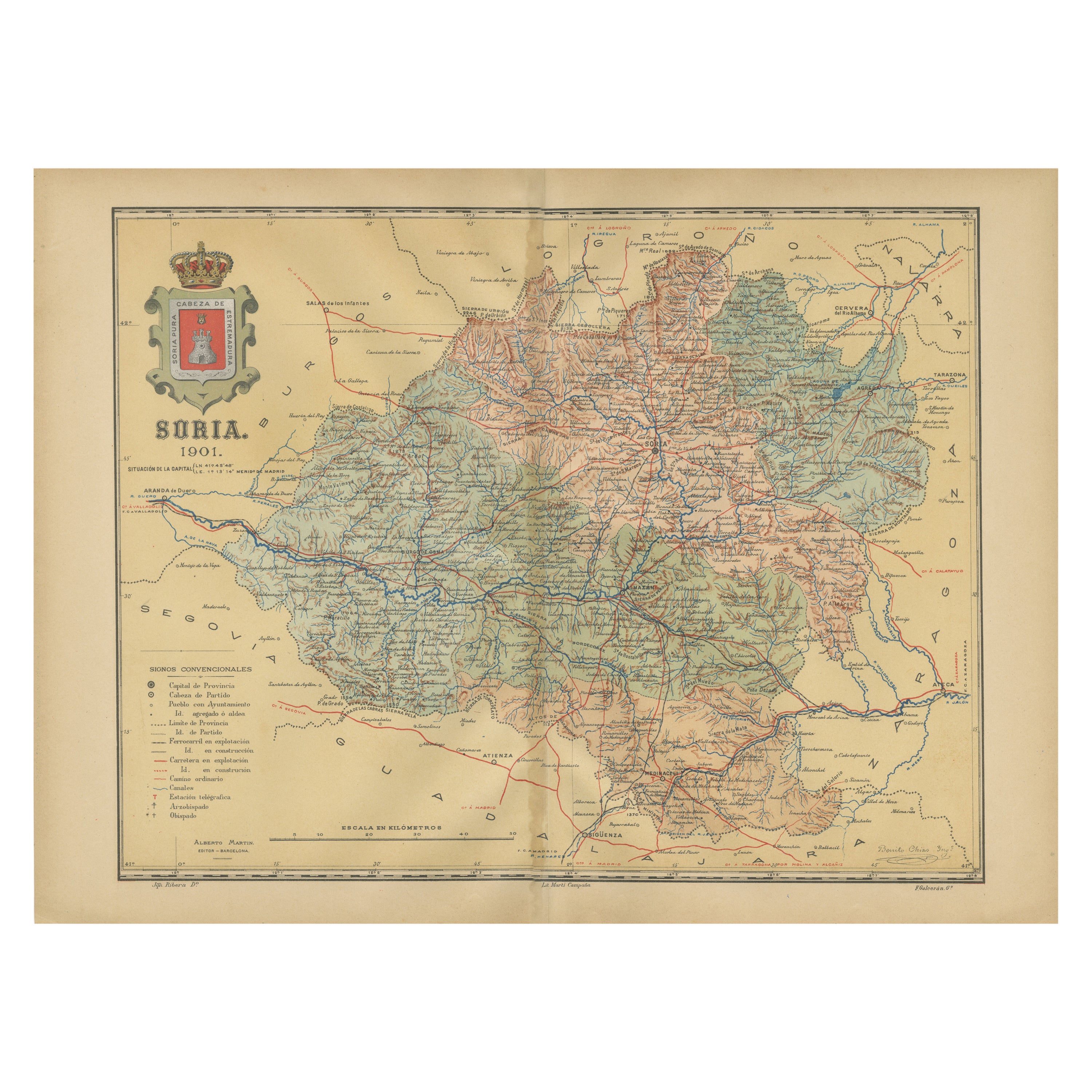
View AllMap of Soria Province, 1901: Detailed Cartography of Northeastern Spain
Located in Langweer, NL
The map is a historical map of the province of Soria from 1901.
A decorative coat of arms enhances the aesthetic of the map, signifying the historical and cultural significance of ...
Category
Antique Early 1900s Maps
Materials
Paper

$316 Sale Price
20% Off
Free Shipping
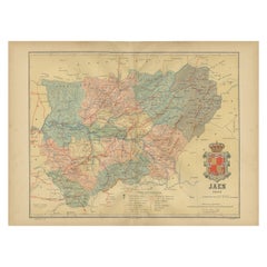
Jaén 1902: A Cartographic Depiction of Andalusia's Olive Heartland
Located in Langweer, NL
This original antique map displays the province of Jaén, located in the autonomous community of Andalusia in southern Spain, as of the year 1902. It contains various geographic and i...
Category
Antique Early 1900s Maps
Materials
Paper
$278 Sale Price
20% Off
Free Shipping
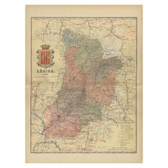
Lleida 1902: A Cartographic Perspective of Catalonia's Gateway to the Pyrenees
Located in Langweer, NL
The map for sale shows the province of Lleida, located in the western part of Catalonia, Spain, as of 1902. Here are the key features depicted on the map:
- **Topography**: The map ...
Category
Antique Early 1900s Maps
Materials
Paper
$287 Sale Price
20% Off
Free Shipping
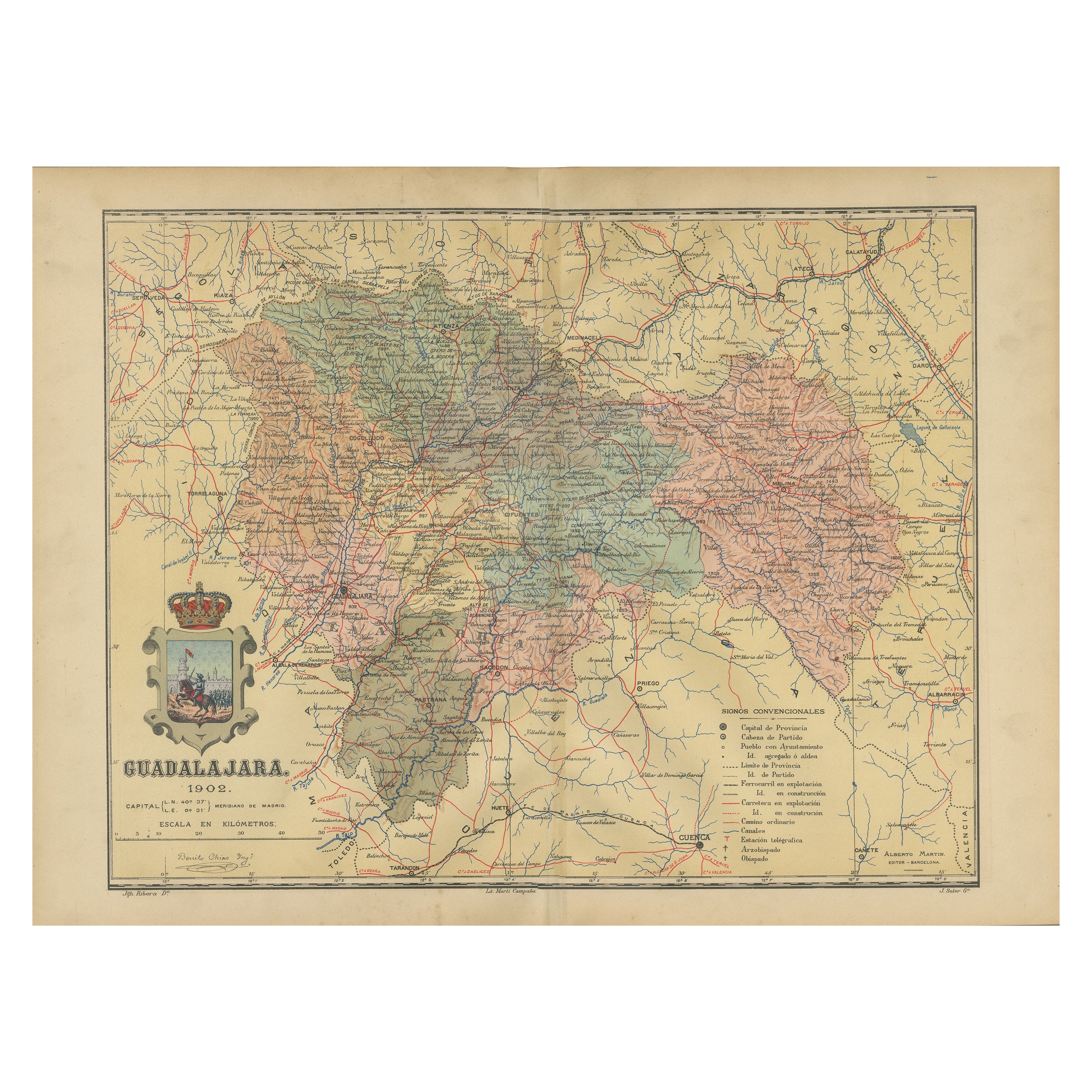
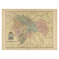
Guadalajara 1902: A Cartographic Image of Castilla-La Mancha's Northern Province
Located in Langweer, NL
The map illustrates the province of Guadalajara, part of the autonomous community of Castilla-La Mancha in Spain, as of 1902. The map includes various geographic and infrastructural ...
Category
Antique Early 1900s Maps
Materials
Paper
$278 Sale Price
20% Off
Free Shipping
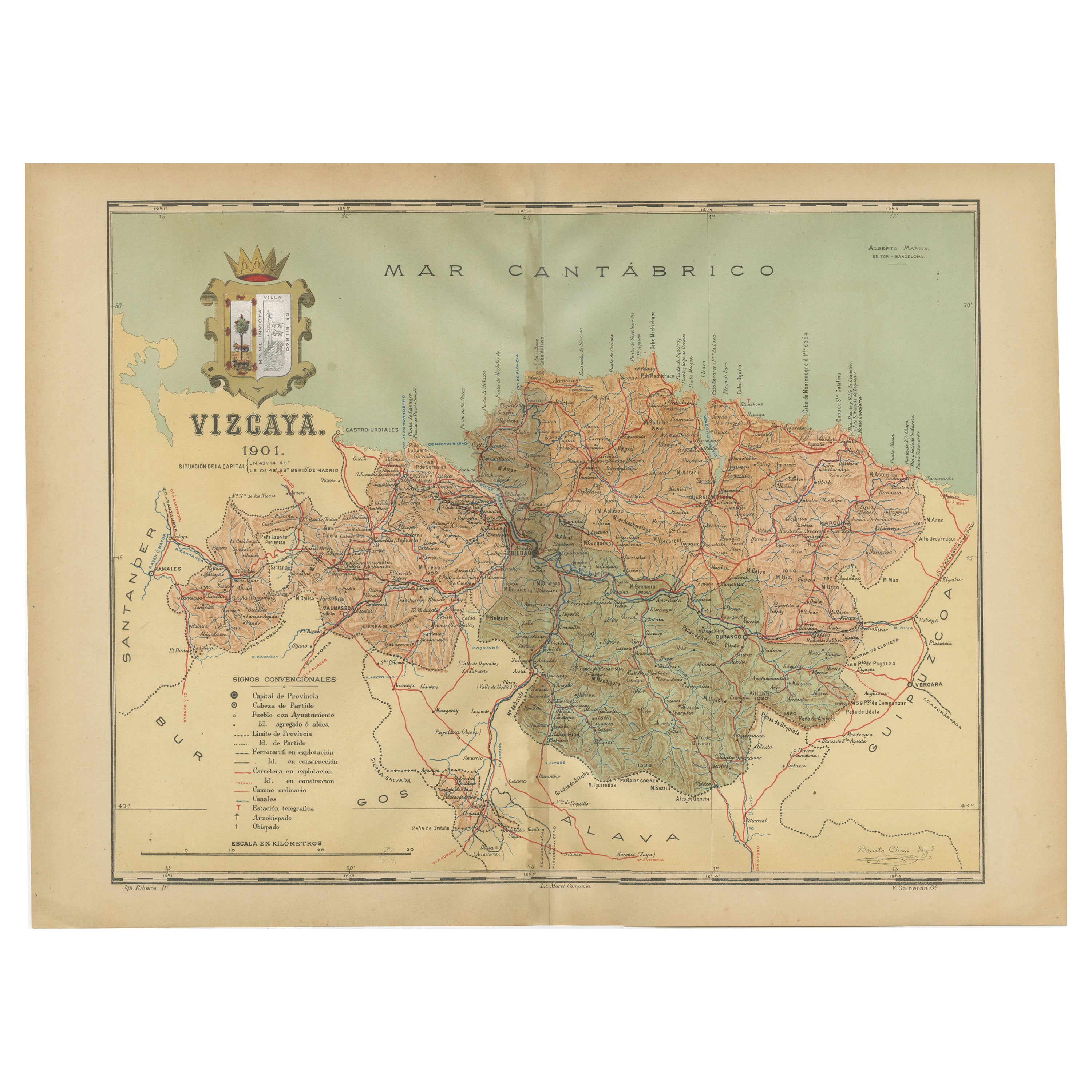
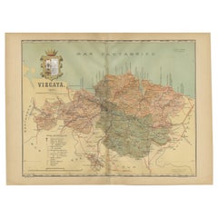
Cartographic Heritage: The 1901 Map of the Vizcaya Province in Spain
Located in Langweer, NL
This is a historical map of the province of Vizcaya (Biscay) in Spain, dated 1901. The title on the map is "VIZCAYA. 1901." It shows the topographical details of the region with cont...
Category
Antique Early 1900s Maps
Materials
Paper
$306 Sale Price
20% Off
Free Shipping
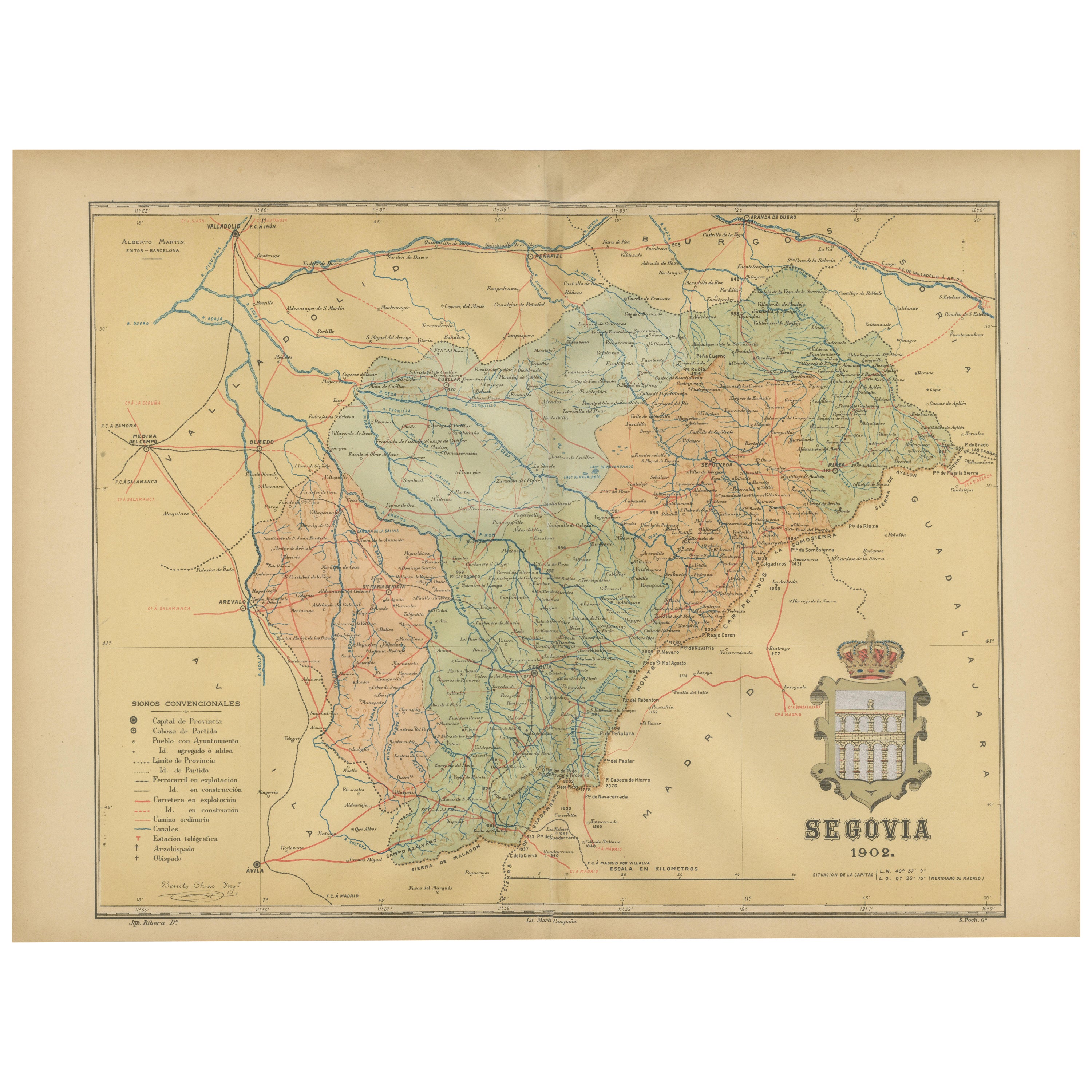
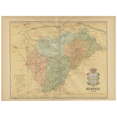
Topographical and Administrative Cartography of Segovia in Spain, 1902
Located in Langweer, NL
An original old map of the province of Segovia from the year 1902. Segovia is a historic area located in the central part of Spain, northwest of Madrid. Known for its rich history, a...
Category
Antique Early 1900s Maps
Materials
Paper
$278 Sale Price
20% Off
Free Shipping
You May Also Like
Large Original Vintage Map of Spain, circa 1920
Located in St Annes, Lancashire
Great map of Spain
Original color.
Good condition
Published by Alexander Gross
Unframed.
Category
Vintage 1920s English Maps
Materials
Paper

Ancient National Atlas of France with Marengo
Located in Alessandria, Piemonte
Ancient National Atlas of France with the department of Marengo: a rare French etching dated 1806.
ST/178.
Category
Antique Early 19th Century French Other Prints
Materials
Paper

1849 Map of "Europaische Russland", 'Meyer Map of European Russia', Ric. R017
Located in Norton, MA
1849 Map of
"Europaische Russland"
( Meyer Map of European Russia)
Ric.r017
A lovely map of European Russia dating to 1849 by Joseph Meyer. It covers the European portions of...
Category
Antique 19th Century Unknown Maps
Materials
Paper

Austria-Hungary, Western Part. Century Atlas antique vintage map
Located in Melbourne, Victoria
'The Century Atlas. Austria-Hungary, Western Part'
Original antique map, 1903.
Central fold as issued. Map name and number printed on the reverse corners.
Sheet 40cm by 29.5cm.
Category
Early 20th Century Victorian More Prints
Materials
Lithograph

Large Original Antique Map of Cyprus. 1894
Located in St Annes, Lancashire
Superb Antique map of Cyprus
Published Edward Stanford, Charing Cross, London 1894
Original colour
Good condition
Unframed.
Free shipping
Category
Antique 1890s English Maps
Materials
Paper

1839 Map of Karte Des "Russischen Reiches in Europa Und Asien" Ric.R0013
Located in Norton, MA
1839 map of Karte Des
"Russischen Reiches in Europa and Asien"
Ric.r013
Map of the European and Asian parts of Russian Empire. Karte der Russischen Reiches in Europa und Asien...
Category
Antique 19th Century Unknown Maps
Materials
Paper

More Ways To Browse
Railway Map
French Wine Map
Antique Basque
Antique Oushak
Mid Century Danish Directors Chairs
Moller 70
Argentina Travel Poster
Century Furniture Faux Bamboo
Early American Chairs
Hans Muller
Vintage Wood Table With Glass Top
19th Century Square Table
Antonio Bonet
Galle Chairs
Large Chinese Rug
1940s Vintage French Art Deco
20th Century Spanish Table
Antonio Bellini