Items Similar to Old Copperplate Engraving of Fort St. James on the Gambra River, Africa, c.1760

Want more images or videos?
Request additional images or videos from the seller
1 of 5
Old Copperplate Engraving of Fort St. James on the Gambra River, Africa, c.1760
$153.36
$191.7020% Off
£114.17
£142.7120% Off
€128
€16020% Off
CA$210.07
CA$262.5920% Off
A$233.64
A$292.0520% Off
CHF 122
CHF 152.5020% Off
MX$2,843.17
MX$3,553.9620% Off
NOK 1,558.13
NOK 1,947.6620% Off
SEK 1,461.25
SEK 1,826.5720% Off
DKK 974.42
DKK 1,218.0220% Off
Shipping
Retrieving quote...The 1stDibs Promise:
Authenticity Guarantee,
Money-Back Guarantee,
24-Hour Cancellation
About the Item
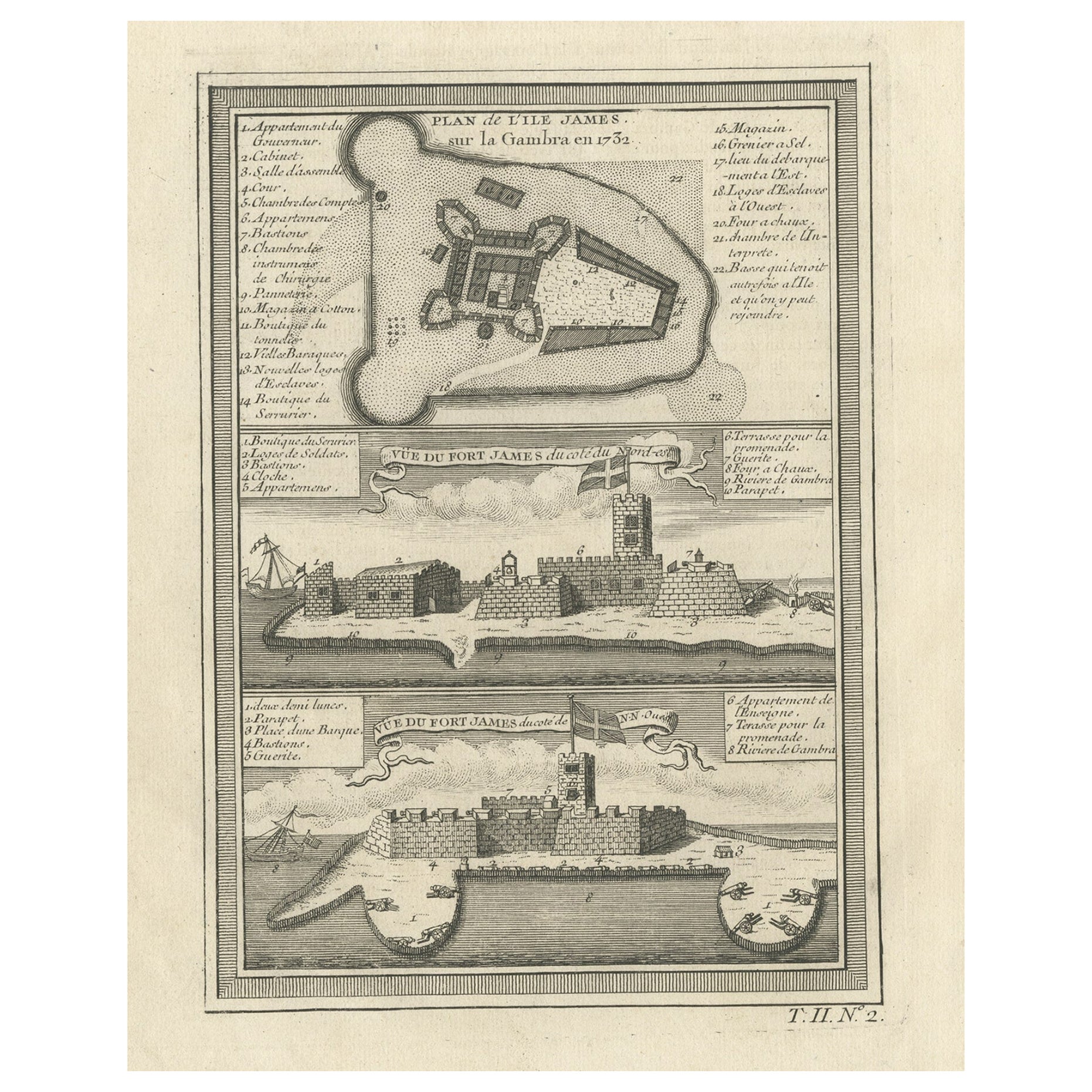
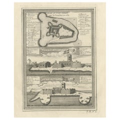
Plan de l’Isle James sur la Gambra en 1732 (…).
Copperplate engraving/etching on Hand laid (Verge) paper.
Sheet size: 19,7 x 26,7 cm. Image size: 13,8 x 19,8 cm.
From vol. 3 of a Dutch ed. of Prevost’s monumental work: ‘Historische Beschryving der Reizen […]’, published in The Hague by Pieter de Hondt, 1748. Antoine Francois Prevost d’Exiles’ (or Abbe Prevost’s) multi-volume “Histoire Generale Des Voyages” (1746-1759): ultimately 17 quarto volumes recounting major voyages of discovery and descriptions of far flung parts and including around 240 maps, plans and charts of those areas. These maps, plans and charts were mostly produced by Jacques Nicolas Bellin, the influential French hydrographer. Bellin’s work spans from around 1740 to the 1770s; interestingly he signed his plates in a variety of styles – J. Bellin, N. Bellin, N.B., M.B. (Monsieur Bellin) and S.B. (Seigneur Bellin).
Made by Jakob van der Schley after an anonymous artist. Engraver: Jakob van der Schley (Amsterdam 1715-1779) was a Dutch draughtsman and engraver. He studied under Bernard Picart and became heavily influenced by his style.
Condition: Very good, given age. General age-related toning and/or occasional minor defects from handling. Please study scan carefully.
- Dimensions:Height: 10.01 in (25.4 cm)Width: 7.8 in (19.8 cm)Depth: 0 in (0.02 mm)
- Materials and Techniques:
- Period:1760-1769
- Date of Manufacture:circa 1760
- Condition:
- Seller Location:Langweer, NL
- Reference Number:Seller: BL-00070 1stDibs: LU3054326681842
About the Seller
5.0
Recognized Seller
These prestigious sellers are industry leaders and represent the highest echelon for item quality and design.
Platinum Seller
Premium sellers with a 4.7+ rating and 24-hour response times
Established in 2009
1stDibs seller since 2017
2,510 sales on 1stDibs
Typical response time: <1 hour
- ShippingRetrieving quote...Shipping from: Langweer, Netherlands
- Return Policy
Authenticity Guarantee
In the unlikely event there’s an issue with an item’s authenticity, contact us within 1 year for a full refund. DetailsMoney-Back Guarantee
If your item is not as described, is damaged in transit, or does not arrive, contact us within 7 days for a full refund. Details24-Hour Cancellation
You have a 24-hour grace period in which to reconsider your purchase, with no questions asked.Vetted Professional Sellers
Our world-class sellers must adhere to strict standards for service and quality, maintaining the integrity of our listings.Price-Match Guarantee
If you find that a seller listed the same item for a lower price elsewhere, we’ll match it.Trusted Global Delivery
Our best-in-class carrier network provides specialized shipping options worldwide, including custom delivery.More From This Seller
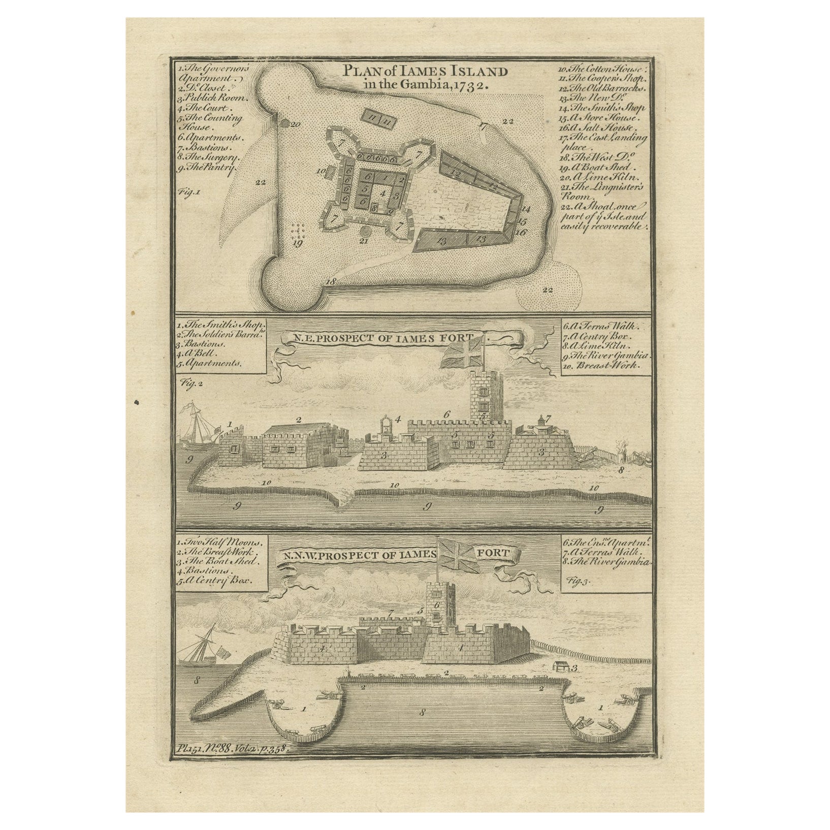
View AllOld Print of Fort James on Kunta Kinteh Island on the Gambia River, Africa, 1746
Located in Langweer, NL
Antique print titled 'Plan de l’lle James sur la Gambra en 1732, Vue de Fort James du côte du Nord-Est, Vue de Fort James du côte de N.N. Ouest'.
Old print of Kunta Kinteh Island on the Gambia...
Category
Antique 1740s Maps
Materials
Paper
$172 Sale Price
20% Off
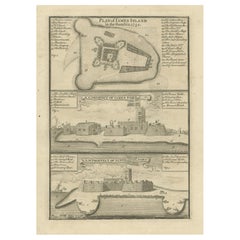
Antique Print with a Plan of Kunta Kinteh Island and views of Fort James, Gambia
Located in Langweer, NL
Antique print titled 'Plan of Iames Island in the Gambia - N.E. Prospect of Iames Fort - N.N.W. Prospect of Iames Fort'. Print with a plan of Kunta Kinteh I...
Category
Antique Mid-18th Century Prints
Materials
Paper
$210 Sale Price
20% Off
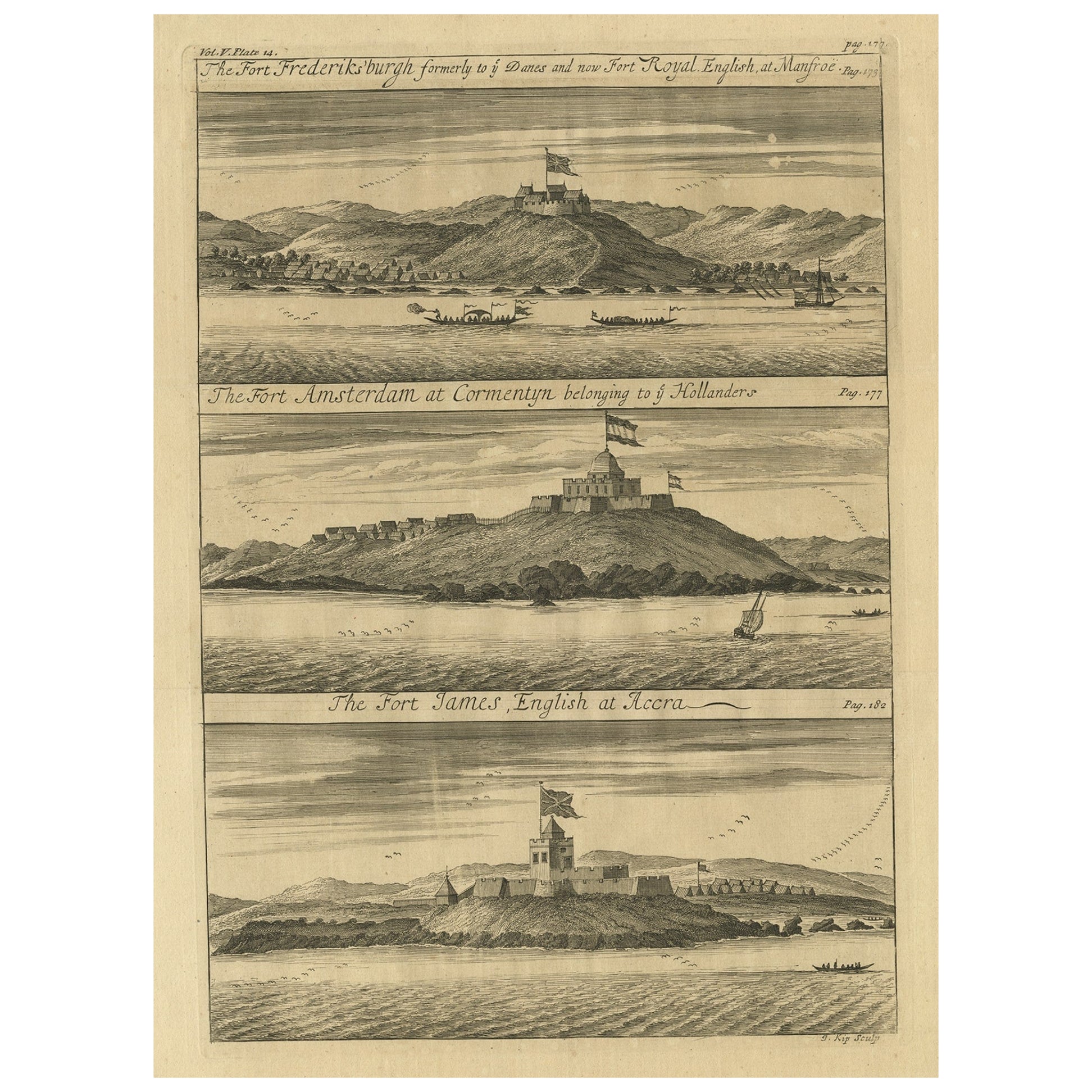
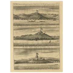
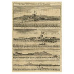
Copperplate Engraving Showing Forts on the West African Gold Coast, Ghana, 1744
Located in Langweer, NL
Antique print, titled: 'The Fort Fredricksburg formerly to ye Danes and now Fort Royal (…).' - A three panel copperplate engraving showing three forts on the West African Gold Coast, Ghana; a) The Fort Fredricksburgh formerly to ye Danes and now Fort Royal. English at Manfroe, b) The Fort Amsterdam at Cormentyn belonging to ye Hollanders, c) The Fort James, English at Accra. From: "A Collection of Voyages and Travels" published by John and Awnsham Churchill in London in 1744.
Artists and Engravers: Made by 'Johannes Kip' after 'A. Churchill'. Johannes Kip (b Amsterdam, 1653; d London, 1722). Dutch draughtsman, engraver and dealer, active in England. He was a pupil of Bastiaen Stopendaal (1636–1707) from 1668 to 1670. His earliest dated engravings are of 1672 (e.g. the Siege of Groningen , Hollstein, no. 4), and he supplied numerous plates for books published from that date onwards. His work brought him into contact with the court of William of Orange and in 1686 he produced six plates depicting William of Orange, his Wife and Attendants near The Hague (Hollstein, no. 5). Shortly after the Glorious Revolution of 1688 Kip followed the court to England. After settling in Westminster, he worked extensively for London publishers, engraving works after Francis Barlow, Caius Gabriel Cibber (e.g. Interior of the Danish Church in London , 1697; Hollstein, no. 6) and other London-based artists. His engravings were principally destined for book illustrations. The work for which Kip is best remembered is his large corpus...
Category
Antique 1740s Prints
Materials
Paper
$345 Sale Price
20% Off
Antique Map of Gorée Island ‘Senegal’ by J.N. Bellin, 1764
Located in Langweer, NL
Nautical antique chart of Gorée Senegal including a letter key to the island's fortifications. Gorée is known as the location of the House of Slaves built by an Afro-French Métis fam...
Category
Antique Mid-18th Century Maps
Materials
Paper

$311 Sale Price
20% Off
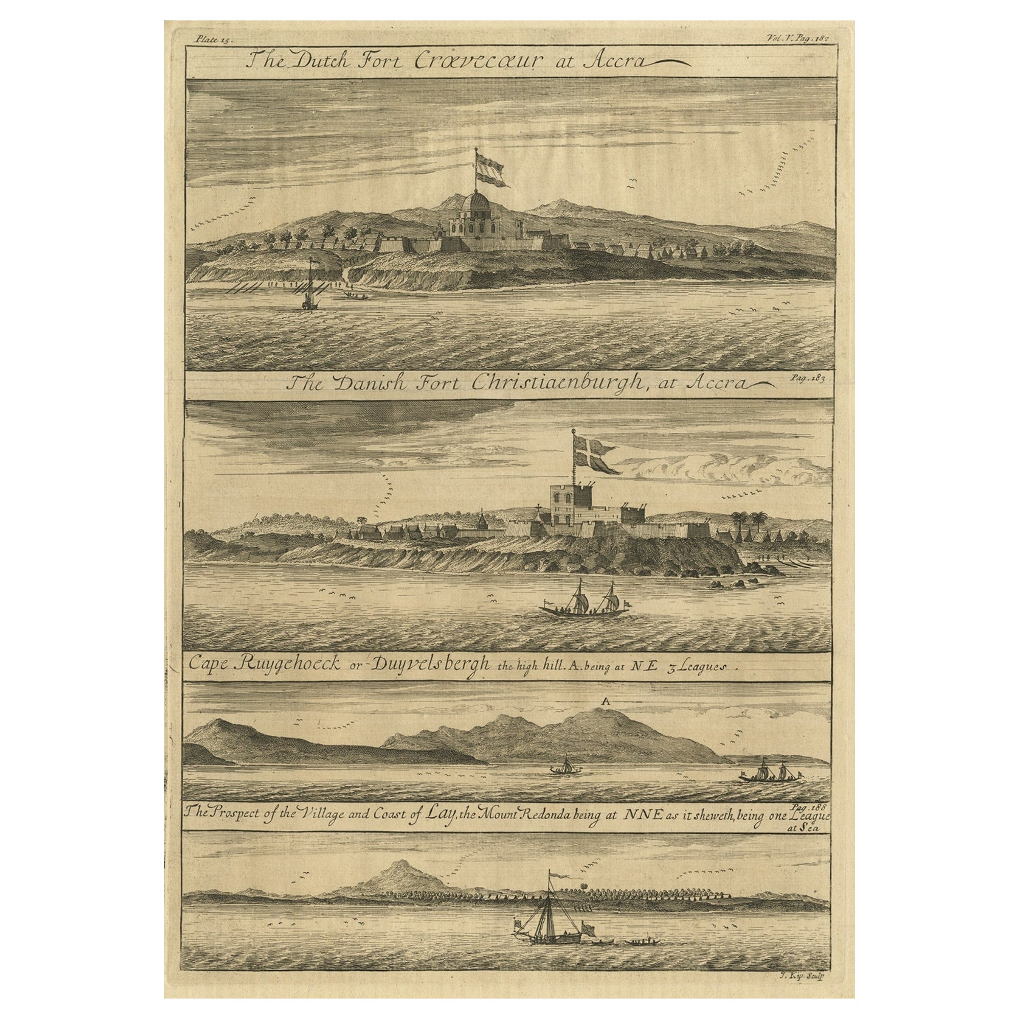
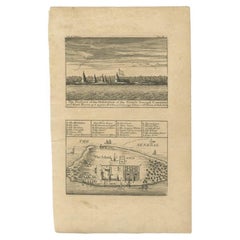
Rare Engraving of Dutch and Danish Forts on the West African Gold Coast, 1744
Located in Langweer, NL
Antique print, titled: 'The Dutch Fort Croevecoeur (…).'
A four panel plate showing forts on the West African Gold Coast, Ghana; a) The Dutch Fort Croevecoeur at Accra, b) The Danish Fort Christiaenburgh at Accra, c) Cape Ruygehoeck or Duyvelsbergh, d) The Prospect of the Village and Coast of Lay, the mount Redonda being at NNE. Ussher Fort is a fort in Accra, Ghana. It was built by the Dutch in 1649 as Fort Crevecoeur. From: "A Collection of Voyages and Travels" published by John and Awnsham Churchill in London in 1744.
Artists and Engravers: Made by 'Johannes Kip' after 'A. Churchill'. Johannes Kip (b Amsterdam, 1653; d London, 1722). Dutch draughtsman, engraver and dealer, active in England. He was a pupil of Bastiaen Stopendaal (1636–1707) from 1668 to 1670. His earliest dated engravings are of 1672 (e.g. the Siege of Groningen , Hollstein, no. 4), and he supplied numerous plates for books published from that date onwards. His work brought him into contact with the court of William of Orange and in 1686 he produced six plates depicting William of Orange, his Wife and Attendants near The Hague (Hollstein, no. 5). Shortly after the Glorious Revolution of 1688 Kip followed the court to England. After settling in Westminster, he worked extensively for London publishers, engraving works after Francis Barlow, Caius Gabriel Cibber (e.g. Interior of the Danish Church in London , 1697; Hollstein, no. 6) and other London-based artists. His engravings were principally destined for book illustrations. The work for which Kip is best remembered is his large corpus...
Category
Antique 1740s Maps
Materials
Paper
$431 Sale Price
20% Off
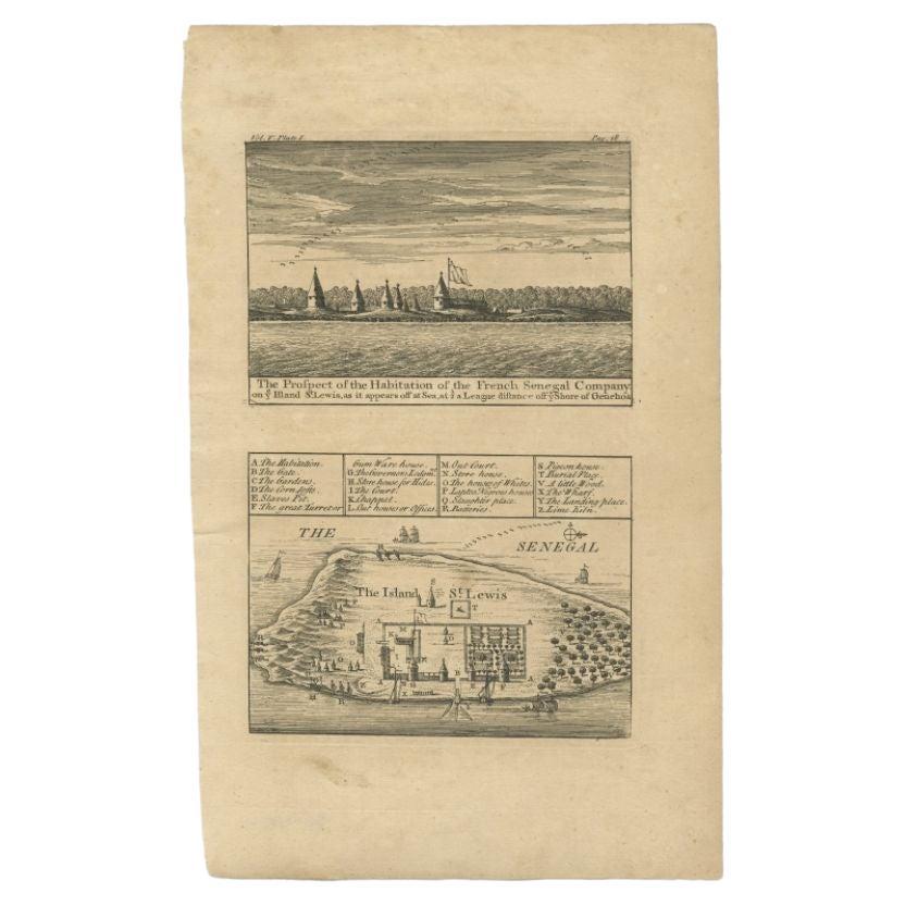
Antique Plan and View of Saint-Louis, Senegal, Africa, 1746
Located in Langweer, NL
Antique print titled ‘The Prospect of the Habitation of the French Senegal Company’. Plan and view of Saint-Louis, Senegal, Africa. This print originates from 'A Collection of Voyage...
Category
Antique 18th Century Prints
Materials
Paper
$287 Sale Price
20% Off
You May Also Like
17th-18th Century Siege of Graves Mapping Engraving By Willian III
Located in Kingston, NY
RARE French 17th-18th Century Enhanced Siege of Graves Mapping Engraving BY William III, also widely known as William of Orange,
The Siege of Grave in Dutch Brabant started by Monsie...
Category
Antique 17th Century French Prints
Materials
Paper

17th Century Toulouse, Savve, Sommieres Topographical Map by Iohan Peeters
Located in New York, NY
Fine topographical 17th century map of Toulouse, Savve and Sommieres by Iohan Peeters
Beautiful engraving of the capital of France's Occitanie Region, Toulouse, called La Ville Rose- the Pink City, for the terracotta bricks used in its many buildings, giving the city a distinct apricot-rose hue. An important cultural and educational center, the city's residents included Nobel Prize winners and world renown artists- Henri de Toulouse-Lautrec, Henri Martin, Jean-Auguste-Dominique Ingres, Antonin Mercie, Alexandre Falguiere and more recently Cyril Kongo...
Category
Antique 17th Century Dutch Maps
Materials
Paper

17th Century Topographical Engraving Nantes & St. Malo, France, by Iohan Peeters
Located in New York, NY
The ancient city of Saint Malo in North Western France has long been associated with adventure on the high seas, piracy and exploration. It was the birthplace of several important in...
Category
Antique 17th Century Dutch Maps
Materials
Paper

17th Century Topographical Map, Champagne-Ardenne, Marsal, Maubert Iohan Peeters
Located in New York, NY
Fine topographical 17th century map by Iohan Peeters of Marsal and Maubert Fontaine in the Champagne-Ardennes Region of North Eastern France.
Fabulous period engraving for a Wine Ce...
Category
Antique 17th Century Dutch Maps
Materials
Paper

17th Century Topographical Map of Cote D'azur, Avignon, Frejus by Iohan Peeters
Located in New York, NY
Fine topographical 17th century map by Iohan Peeters of the towns of Avignon and Frejus in the Cote d'Azur-Provence-Alpes Region of Southeastern France.
Beautifully suited decorativ...
Category
Antique 17th Century Dutch Maps
Materials
Paper

West Coast of Africa, Guinea & Sierra Leone: An 18th Century Map by Bellin
By Jacques-Nicolas Bellin
Located in Alamo, CA
Jacques Bellin's copper-plate map entitled "Partie de la Coste de Guinee Dupuis la Riviere de Sierra Leona Jusquau Cap das Palmas", depicting the coast of Guinea and Sierra Leone in ...
Category
Antique Mid-18th Century French Maps
Materials
Paper

More Ways To Browse
Copperplate Engraving
African Antiques
Persian Maps
Antique Map Of The Philippines
Large Map Of Italy
Used Marine Compass
West Indies Colonial
Antique Pamphlets
Sicily Map
Thailand Map
Antique Maps Of Russian Empire
Antique Navigational Tools
Australian Colonial
Antique German Compass
Key Trade Sign
Spanish Galleon
World Map Of Trade Routes
Antique Puerto Rico