North American Maps
to
10
73
72
146
6
5
4
3
2
1
2
102
42
22
11
5
12
5
3
4
2
1
3
1
135
19
8
7
6
724
332
218
146
140
146
146
146
28
2
2
2
1
Place of Origin: North American
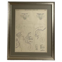
Mariners Chart of Quicks Hole and Tarpaulin Cove by George Eldridge 1901
Located in Norwell, MA
Nautical chart showing the harbor and local waters of Naushon Island Quick Holes. The chart display depths buoys, lightness, etc., The chart shows the cove in Naushon with ships stor...
Category
Early 1900s Antique North American Maps
Materials
Paper
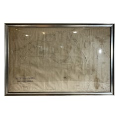
1873 Martha's Vineyard and Nantucket Chart
Located in Norwell, MA
Original chart of Nantucket and Martha's Vineyard by George Eldridge, Cartographer, 125 State Street, Boston. Dated 1873. Mounted to canvas. Also showing the coast of Cape Cod includ...
Category
1870s Antique North American Maps
Materials
Paper
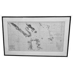
Scarce U.S. Coast Survey Map Depicting Entrance to San Francisco Bay Dated 1856
Located in San Francisco, CA
A fine example of the 1856 U.S. Coast lithographic survey nautical chart of the entrance to San Francisco bay and the city. Published in 1856 by the Office of the Coast Survey the of...
Category
Mid-19th Century Antique North American Maps
Materials
Paper
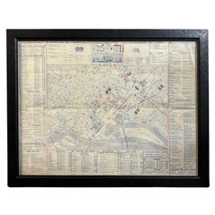
1943 "USO Map Guide to Washington"
Located in Colorado Springs, CO
This is a WWII map of Washington, DC, issued as a guide for service men and women visiting or working in the city during the war. The map was created by Allen F. Free and published a...
Category
1940s Mid-Century Modern Vintage North American Maps
Materials
Paper
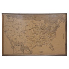
Vintage Framed United States Map
Located in Queens, NY
Vintage aged paper map of the United States mounted on particle board and framed in a simple wooden frame.
Category
20th Century Mid-Century Modern North American Maps
Materials
Wood, Paper
Original Antique Map of US Possessions In The Pacific Ocean, C.1900
Located in St Annes, Lancashire
Fabulous map of US possessions in the Pacific Ocean
Original color.
Engraved and printed by the George F. Cram Company, Indianapolis.
Published, C.1900.
Unframed.
Free shipping.
Category
1890s Antique North American Maps
Materials
Paper
1840 "New Map of the City of New York With Part of Brooklyn & Williamsburg"
Located in Colorado Springs, CO
Presented is a hand-colored, engraved folding map titled "New Map of the City of New York With Part of Brooklyn & Williamsburg" by J. Calvin Smith. The map was issued bound in the bo...
Category
1840s Antique North American Maps
Materials
Paper
1912 "Panoramic View of New York City and Vicinity" by Jacob Ruppert
Located in Colorado Springs, CO
This is an attractive and very scarce map of New York, published by the Yorkville brewer Jacob Ruppert in 1912. The map shows an expansive view of the region reaching from Sandy Hook in the south and Yonkers to the north, to Hicksville in the east and past Newark to the west. This beautifully colored birds eye view shows waterways with all shipping traffic, boroughs, and clearly labeled railroad routes. It is presented on period dowels and backed on its original linen.
Jacob Ruppert was born in New York City in 1842 to Bavarian immigrants. His father owned a brewery in Manhattan where young Jacob learned the business of brewing. In 1862, Jacob established the Jacob...
Category
1910s Vintage North American Maps
Materials
Paper
Framed Belmont Park Racetrack Barn Area Guide Map
Located in New York, NY
This piece was acquired from the Belmont Park racetrack in Elmont, New York. It displays an itemized map of the barn area at Belmont Park. It is made of acrylic with a black wood fra...
Category
20th Century North American Maps
Materials
Acrylic, Wood
1840 Map of the City of Washington Published by William M. Morrison
Located in Colorado Springs, CO
This map, printed in 1840, is a detailed representation of Washington, D.C. in the mid-19th century. The map shows block numbers, wards, and government buildings as well as details o...
Category
1840s Federal Antique North American Maps
Materials
Paper
1939 "A Good-Natured Map of the United States" by Greyhound
Located in Colorado Springs, CO
Presented is an original 1939 map, titled “A Good-Natured Map of the United States Setting Forth the Services of the Greyhound Lines and a Few Principal Connecting Bus Lines.” This brightly colored pictographic map was one of several similar United States maps...
Category
1930s Art Deco Vintage North American Maps
Materials
Paper
1890 "Map of Oregon, Kansas, California, and the Territories" by S. A. Mitchell
By Samuel Augustus Mitchell 1
Located in Colorado Springs, CO
Presented is an 1890 map "Map of Oregon, Kansas, California, and the Territories" by S. A. Mitchell Jr. The map was issued in the atlas “Mitchell's New Intermediate Geography” publis...
Category
1890s Victorian Antique North American Maps
Materials
Paper
Wychmere Harbor Allens Harbor Map Circa 1890
Located in Norwell, MA
Map of Harwich Mass showing Wychmere Harbor, Doane's Creek, Allens Harbor, Herring River, Pleasant Lake, Grassy Pond, Paddocks Pond, Hinkleys Pond, etc., This is an original period m...
Category
1890s Antique North American Maps
Materials
Paper
Large Original Antique Map of Oregon, USA, 1894
By Rand McNally & Co.
Located in St Annes, Lancashire
Fabulous map of Oregon.
Original color.
By Rand, McNally & Co.
Published, 1894.
Unframed.
Free shipping.
Category
1890s Antique North American Maps
Materials
Paper
Large Original Antique Map of South Carolina, USA, 1894
By Rand McNally & Co.
Located in St Annes, Lancashire
Fabulous map of South Carolina
Original color
By Rand, McNally & Co.
Published, 1894
Unframed
Free shipping.
Category
1890s Antique North American Maps
Materials
Paper
Large Original Antique Map of New Hampshire, USA, 1894
By Rand McNally & Co.
Located in St Annes, Lancashire
Fabulous map of New Hampshire
Original color
By Rand, McNally & Co.
Published, 1894
Unframed
Free shipping.
Category
1890s Antique North American Maps
Materials
Paper
1868 Map of the Upper Part of the Island of Manhattan Above 86th Street
By Wm. Rogers Mfg. Co.
Located in San Francisco, CA
This wonderful piece of New York City history is over 150 years old. It depicts 86th street and above. It was lithographed by WC Rogers and company. It was made to show what was the Battle of Harlem during the Revolutionary war...
Category
1860s American Colonial Antique North American Maps
Materials
Paper
Large Original Antique City Plan of Minneapolis and St Paul, USA, circa 1900
By Rand McNally & Co.
Located in St Annes, Lancashire
Fabulous colorful map of Minneapolis and St Paul, Minnesota.
Original color
By Rand, McNally & Co.
Published, circa 1900
Unframed
Minor edge tears
Free shipping.
Category
Early 1900s Antique North American Maps
Materials
Paper
1856 U.S. Coast Survey Map of Chesapeake Bay and Delaware Bay
Located in Colorado Springs, CO
Presented is U.S. Coast Survey nautical chart or maritime map of Chesapeake Bay and Delaware Bay from 1856. The map depicts the region from Susquehanna, Maryland to the northern Outer Banks in North Carolina. It also shows from Richmond and Petersburg, Virginia to the Atlantic Ocean. The map is highly detailed with many cities and towns labeled throughout. Rivers, inlets, and bays are also labeled. Various charts illustrating more specific parts of the region are marked on the map using dotted lines. The lines form boxes, and the corresponding chart number and publication date are given. Extensive triangulation surveys were conducted the length of Chesapeake Bay and are illustrated here. Hampton Roads, Virginia is labeled, along with the James, York, and Rappahannock Rivers, which were all extensively surveyed.
The chart was published under the supervision of A. D. Bache, one of the most influential and prolific figures in the early history of the U.S. Coast Survey, for the 1856 Report of the Superintendent of the U.S. Coast Survey. Alexander Dallas Bache (1806-1867) was an American physicist, scientist, and surveyor. Bache served as the Superintendent of the U.S. Coast Survey from 1843 to 1865. Born in Philadelphia, Bache toured Europe and composed an important treatise on European Education. He also served as president of Philadelphia's Central High School and was a professor of natural history and chemistry at the University of Pennsylvania. Upon the death of Ferdinand Rudolph Hassler, Bache was appointed Superintendent of the United States Coast Survey.
The Office of the Coast Survey, founded in 1807 by President Thomas Jefferson and Secretary of Commerce Albert Gallatin...
Category
1850s Antique North American Maps
Materials
Paper
"The United States from the Latest Authorities" Antique Wall Map, 1835
Located in Colorado Springs, CO
This is a 1835 map of “The United States from the Latest Authorities” by Ezra Strong. A hand-colored engraved wall map of the eastern half of the United States, this map has a large inset of the "Oregon District" and several engraved city views and two portraits.
The primary map extends to Mexico Texas and the Missouri Territory, showing the course of the Missouri River to Ft. Mandan and Old Ft. Mandan, and noting many forts along the river. The territories to the east of Missouri Territory are separately delineated as Sioux District and Huron District. The western details of the map are very good for a map of this time period, with many Native American settlements, villages, forts and other details noted.
The map is bordered with vignettes of Boston, New York, Philadelphia, Hartford, Cincinnati, and Baltimore. Each vignette notes the date settled, primary settler, and the population as of 1830. Two portraits of LaFayette and George Washington are presented in full length with related biographical information.
A large inset map at lower right shows the Oregon District, centered on the Columbia River and extending to the Rocky Mountains. This is one of the earliest commercial appearances of a separate map of Oregon...
Category
1830s Antique North American Maps
Materials
Paper
19th C. Terrestrial Globe on Stand for H.B. Nims After Copley
Located in Bridgeport, CT
Manufactured for H.B. Nims & Co., Troy New York, last quarter 19th c. After the original engravings by Charles Copley done in 1852.
Printed paper on wood with brass/ bronze meridian ring and a flat circular printed center horizon ring on wood labeled with the months of the year with notes. Mounted on a fine leafy iron baluster...
Category
Late 19th Century Victorian Antique North American Maps
Materials
Bronze, Iron
1854 Map of Massachusetts, Connecticut and Rhode Island, Antique Wall Map
Located in Colorado Springs, CO
This striking wall map was published in 1854 by Ensign, Bridgman & Fanning and has both full original hand-coloring and original hardware. This impression is both informative and highly decorative.
The states are divided into counties, outlined in red, green, and black, and subdivided into towns. Roads, canals, and railroad lines are prominently depicted, although they are not all labeled. The mapmakers also marked lighthouses, banks, churches, and prominent buildings, with a key at right. The map is an informative and comprehensive overview of the infrastructural development of New England prior to the Civil War. Physical geographies depicted include elevation, conveyed with hachure marks, rivers and lakes. The impression features an inset map of Boston...
Category
19th Century Antique North American Maps
Materials
Paper
1918 American Frohse Anatomical Chart, A. J. Nystrom, Max Brodel Illustrator
By Max Brödel, A.J. Nystrom & Co
Located in Buffalo, NY
Antique American Frohse Anatomical pull down chart, by A. J. Nystrom, ,revised and augmented by Max Brodel illustrator... Amazing color, patina, age appropriate wear. dated 1918..
Max (Paul Heinrich) Brödel
1870-1941
Brödel, an illustrator and the first director of the Art as Applied to Medicine program at Johns Hopkins...
Category
1910s Steampunk Vintage North American Maps
Materials
Wood, Paper
1891 Map of Plymouth County Mass
Located in Norwell, MA
Original 1891 map showing Sandwich, Bourne, Plymouth Carver, Middleborough, Plympton and Kingston. Showing Long Beach in Plymouth also as well as all shore points. Cape Cod Bay is ma...
Category
1890s Antique North American Maps
Materials
Paper
Chart of Boston's North Shore
Located in Norwell, MA
Rarely found restrike of an 1804 chart by Nathanael Bowditch of the Harbors of Salem, Marblehead, Beverly, and Manchester.
Showing the Islands of Great Misery, Satan, Cuney, Winter,...
Category
1980s Vintage North American Maps
Materials
Paper
Pair of Floor Standing Globes by Gilman Joslin
By Gilman Joslin
Located in Lymington, Hampshire
A pair of 16-inch floor standing globes by Gilman Joslin, each set into a cast-iron tripod base with an acanthus-leaf baluster support on three b...
Category
19th Century Antique North American Maps
Materials
Iron
$66,338 / set
