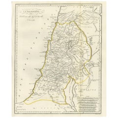
Original Antique Map of Palestine, 1800
View Similar Items

Want more images or videos?
Request additional images or videos from the seller
1 of 5
Auction endedBrowse Current Auctions
Original Antique Map of Palestine, 1800
Price:$245.71
$419.71List Price
About the Item
- Dimensions:Height: 15.56 in (39.5 cm)Width: 12.8 in (32.5 cm)Depth: 0.02 in (0.5 mm)
- Materials and Techniques:
- Period:
- Date of Manufacture:1800
- Condition:General age-related toning. Original folding lines. Minor wear, blank verso. Please study image carefully.
- Seller Location:Langweer, NL
- Reference Number:Seller: BG-12359-311stDibs: LU3054320941652
About the Seller
5.0
Recognized Seller
These prestigious sellers are industry leaders and represent the highest echelon for item quality and design.
Platinum Seller
Premium sellers with a 4.7+ rating and 24-hour response times
Established in 2009
1stDibs seller since 2017
2,510 sales on 1stDibs
Authenticity Guarantee
In the unlikely event there’s an issue with an item’s authenticity, contact us within 1 year for a full refund. DetailsMoney-Back Guarantee
If your item is not as described, is damaged in transit, or does not arrive, contact us within 7 days for a full refund. Details24-Hour Cancellation
You have a 24-hour grace period in which to reconsider your purchase, with no questions asked.Vetted Professional Sellers
Our world-class sellers must adhere to strict standards for service and quality, maintaining the integrity of our listings.Price-Match Guarantee
If you find that a seller listed the same item for a lower price elsewhere, we’ll match it.Trusted Global Delivery
Our best-in-class carrier network provides specialized shipping options worldwide, including custom delivery.More From This Seller
View AllAntique Map of Asia by A. Blondeau, circa 1800
Located in Langweer, NL
This is a fine circa 1800 map of Asia by Alexandre Blondeau. It covers the entire continent from Africa and the Mediterranean east to the Bering Sea and south as far as Java and New ...
Category
Antique Early 19th Century Maps
Materials
Paper

$268 Sale Price
20% Off
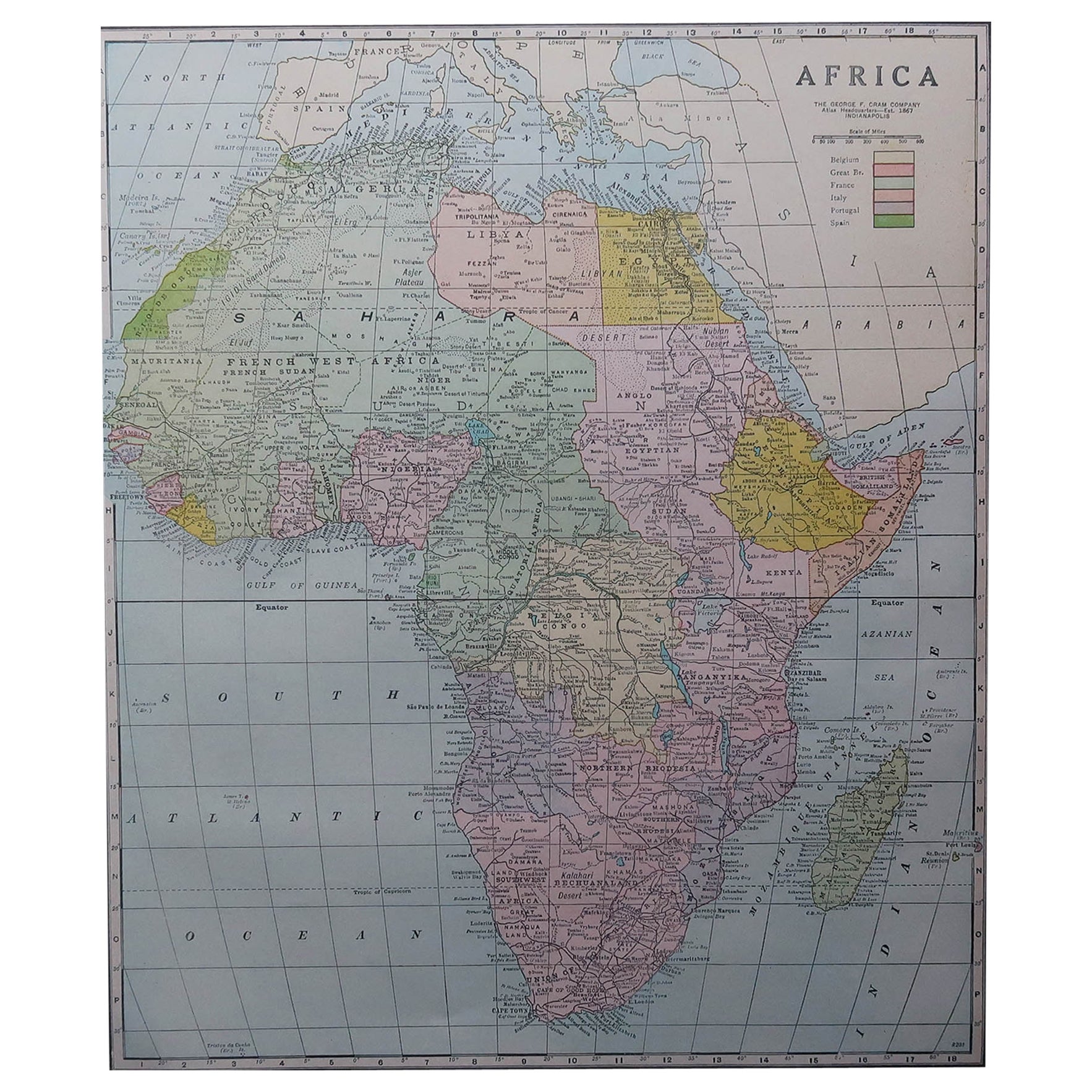
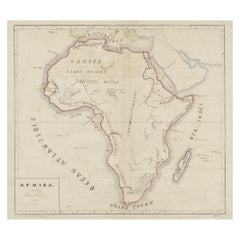
Original Antique Map of Africa
Located in Langweer, NL
Antique map titled 'Afrika'. Original antique map of Africa, drawn by Van Beusekom. Published by 'Seyffardt's Boekhandel' in Amsterdam, circa 1870.
Category
Antique Late 19th Century Maps
Materials
Paper
$326 Sale Price
20% Off
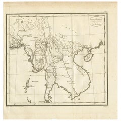
Antique Map of the Burmese Empire by Symes, '1800'
Located in Langweer, NL
Antique map titled 'Empire Birman d'après une carte'. Map of the Burmese Empire. This map originates from 'Relation de l'Ambassade Anglaise, envoyée en 1795 dans le Royaume d'Ava, ou...
Category
Antique Early 19th Century Maps
Materials
Paper
$167 Sale Price
20% Off
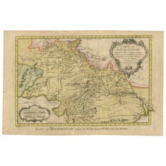
Original Antique Map of Northern India
By Jakob van der Schley
Located in Langweer, NL
Antique map titled 'Carte de l'Indoustan (..) - Kaart van Hindoestan (..)'. Original antique map of northern India. This map originates from 'His...
Category
Antique Mid-18th Century Maps
Materials
Paper
$211 Sale Price
20% Off
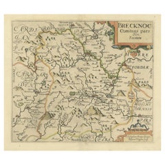
Original Antique Map of Brecknockshire, Wales
Located in Langweer, NL
Antique map titled 'Brecknoc comitaus pars olim silurum'. Original old map of Brecknockshire, Wales. Engraved by R. Vaughan after Christopher Saxton. Published circa 1640.
Category
Antique Mid-17th Century Maps
Materials
Paper
$422 Sale Price
20% Off
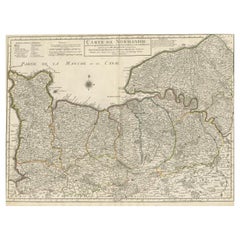
Original Antique Map of Normandy, France
Located in Langweer, NL
Antique map titled 'Carte de Normandie (..)'. Attractive map of Normandy, France. it depicts the former French Duchy of Normandy, covers the region fro...
Category
Antique Mid-18th Century Maps
Materials
Paper
$757 Sale Price
20% Off
You May Also Like
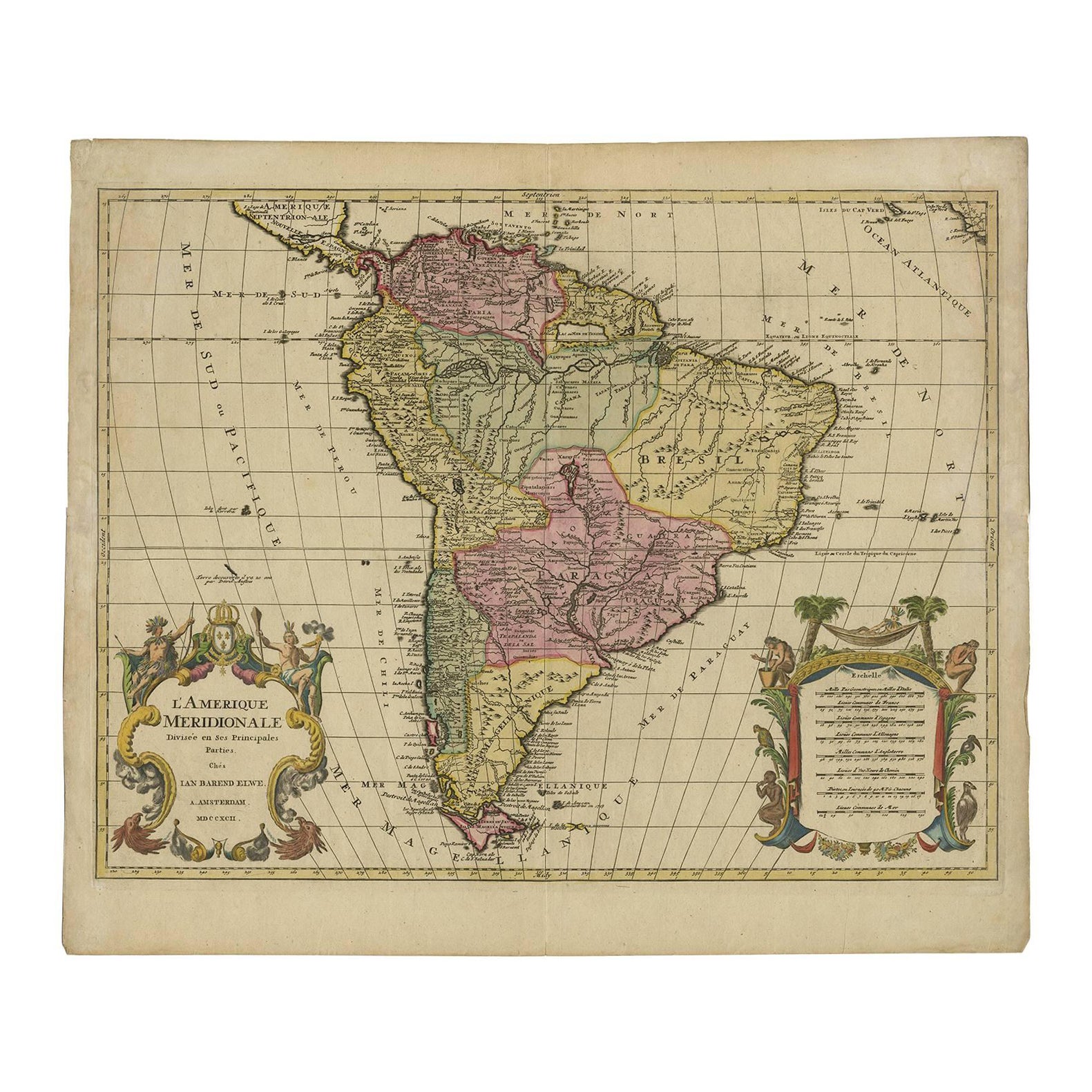
Original Antique Map of South America. C.1780
Located in St Annes, Lancashire
Great map of South America
Copper-plate engraving
Published C.1780
Two small worm holes to left side of map
Unframed.
Category
Antique Early 1800s English Georgian Maps
Materials
Paper

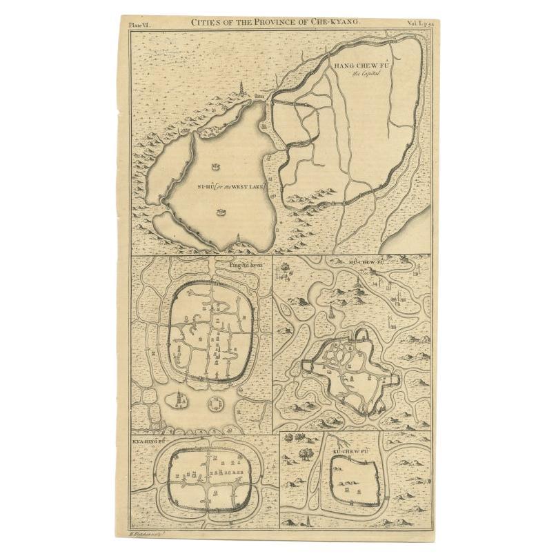
Original Antique Map of China, Arrowsmith, 1820
Located in St Annes, Lancashire
Great map of China
Drawn under the direction of Arrowsmith
Copper-plate engraving
Published by Longman, Hurst, Rees, Orme and Brown, 1820
Unfr...
Category
Antique 1820s English Maps
Materials
Paper

Original Antique Map of Ireland- Kerry. C.1840
Located in St Annes, Lancashire
Great map of Kerry
Steel engraving
Drawn under the direction of A.Adlard
Published by How and Parsons, C.1840
Unframed.
Category
Antique 1840s English Maps
Materials
Paper

Original Antique Map of Europe, Arrowsmith, 1820
Located in St Annes, Lancashire
Great map of Europe
Drawn under the direction of Arrowsmith.
Copper-plate engraving.
Published by Longman, Hurst, Rees, Orme and Brown, 1820
...
Category
Antique 1820s English Maps
Materials
Paper

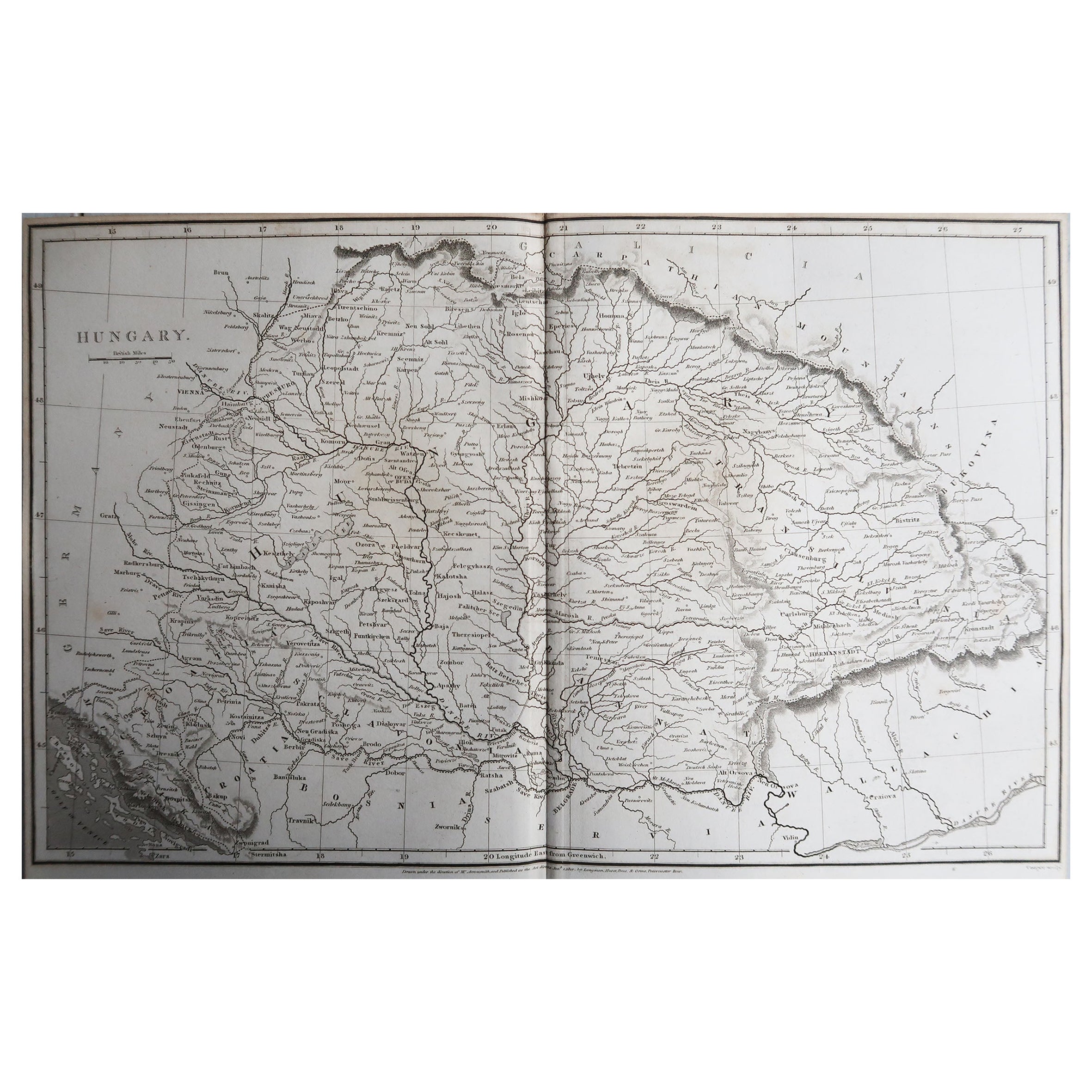
Original Antique Map of Hungary, Arrowsmith, 1820
Located in St Annes, Lancashire
Great map of Hungary
Drawn under the direction of Arrowsmith.
Copper-plate engraving.
Published by Longman, Hurst, Rees, Orme and Brown, 1820
Unframed.
Category
Antique 1820s English Maps
Materials
Paper

Original Antique Map of South Africa, Arrowsmith, 1820
Located in St Annes, Lancashire
Great map of South Africa.
Drawn under the direction of Arrowsmith.
Copper-plate engraving.
Published by Longman, Hurst, Rees, Orme and Br...
Category
Antique 1820s English Maps
Materials
Paper

Recently Viewed
View AllMore Ways To Browse
Map Of Palestine
Antique Map Palestine
Antique Compass Map
Blaeu Maps
Antique Collectables Australia
Military Map
Antique Maps Scotland
Mississippi Antique
Denmark Map
Antique Maps Of North America
Wine Map
Map Greece
Roman Map
Antique Maps Of Russia
Antique Roman Map
Maps Of Mediterranean
Mercator Map
Antique Railroad Furniture