1840s Maps
to
50
65
12
77
3
1
2,976
2,230
476
3
290
34
10
126
9
37
9
2
5
4
3
3
76
4
1
1
1
19
13
8
8
7
77
77
77
4
1
1
1
1
Period: 1840s
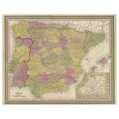
Old Map of Spain and Portugal, with an Inset Map of the Region of Madrid, 1846
Located in Langweer, NL
Antique map titled 'Kingdom of Spain and Portugal'.
Old map of Spain and Portugal, with an inset map of the region of Madrid. This map originates from 'A New Universal Atlas Cont...
Category
Antique 1840s Maps
Materials
Paper
$205 Sale Price
20% Off
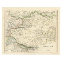
Steel Engraved Map of Central Asia Covering the Chinese Empire, Tibet Etc, C1843
Located in Langweer, NL
Antique map titled 'Central Asia (Middle Division)'.
Steel engraved map of Central Asia covering the Chinese Empire, Tibet and surroundings. This map originates from 'Gilberts Mo...
Category
Antique 1840s Maps
Materials
Paper
$242 Sale Price
20% Off
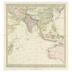
Antique Map of Southern Asia, the East Indies and the Indian Ocean, ca.1840
Located in Langweer, NL
Original antique map of Southern Asia, the East Indies and the Indian Ocean. Also shows part of Australia. Published circa 1840.
Artists and Engravers: ...
Category
Antique 1840s Maps
Materials
Paper
$298 Sale Price
20% Off
Antique Nautical Portolano of Port St. Antoine by Antoine Roux, France, 1844
By Antoine Roux
Located in Milan, IT
Antique portolano, nautical map of Port St. Antoine engraved on a copper plate by Antoine Roux, Marseille, France, 1844, from his work Recueil des principaux plans des ports et de Ra...
Category
French Antique 1840s Maps
Materials
Paper
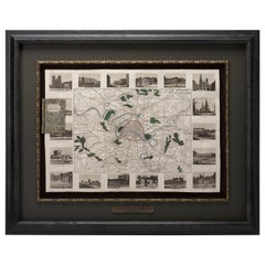
Antique Map of Paris, "Carte Routiere des Environs de Paris" 1841
Located in Colorado Springs, CO
This beautiful hand-colored road map of Paris was published in 1841. The map shows Paris and the surrounding area in a folding pocket map. Organized and detailed for travelers, this ...
Category
French Antique 1840s Maps
Materials
Paper
Antique Map of Italy by Andriveau-Goujon, 1843
By Andriveau-Goujon
Located in New York, NY
Antique Map of Italy by Andriveau-Goujon, 1843. Map of Italy in two parts by Andriveau-Goujon for the Library of Prince Carini at Palazzo Carini i...
Category
French Antique 1840s Maps
Materials
Linen, Paper
$3,350 / set
1840 "New Map of the City of New York With Part of Brooklyn & Williamsburg"
Located in Colorado Springs, CO
Presented is a hand-colored, engraved folding map titled "New Map of the City of New York With Part of Brooklyn & Williamsburg" by J. Calvin Smith. The map was issued bound in the bo...
Category
American Antique 1840s Maps
Materials
Paper
1840 Map of the City of Washington Published by William M. Morrison
Located in Colorado Springs, CO
This map, printed in 1840, is a detailed representation of Washington, D.C. in the mid-19th century. The map shows block numbers, wards, and government buildings as well as details o...
Category
American Federal Antique 1840s Maps
Materials
Paper
Northern Asia, Asiatic Russia, Old Map of Russia in Asia, 1849
Located in Langweer, NL
Antique map titled 'Northern Asia - Asiatic Russia'.
Old map of Russia in Asia. This map originates from 'Sharpe's Corresponding Atlas (..)' by J. Sharpe.
Artists and Engravers: Published by Chapman and Hall.
Category
Antique 1840s Maps
Materials
Paper
$167 Sale Price / item
20% Off
Old Fish Print Named Opah, Cravo, Moonfish, Kingfish or Jerusalem Haddock, 1842
Located in Langweer, NL
Antique print, titled: 'Poissons Plate 10 - Le Lampris Tachete (Lampris guttatus).' -
This rare plate shows the Lampris guttatus, commonly known as the opah, cravo, moonfish, kin...
Category
Antique 1840s Maps
Materials
Paper
$727 Sale Price
20% Off
Rare Decorative Hand-coloured Antique Plate of The Gaimard's Ray Fish, 1842
Located in Langweer, NL
Antique print, titled: 'Poissons Plate 3 - La Raie de Gaimard (Raia gaimardi).' - This rare plate shows the Gaimard's ray. From: 'Voyage en Islande et au Groenland' by M. Paul Gaimar...
Category
Antique 1840s Maps
Materials
Paper
$876 Sale Price
20% Off
The Empires of Mauritania, Carthage & Numidia 'Barbary Coast', Africa, 1842
Located in Langweer, NL
Antique map titled 'Carte de l'Afrique Propre de la Numidie (..)'.
Map of the empires of Mauritania, Carthage and Numidia (Barbary Coast). This map originates from 'Atlas univers...
Category
Antique 1840s Maps
Materials
Paper
$316 Sale Price
20% Off
Antique Decorative Map of Portugal and Spain, 1842
Located in Langweer, NL
Antique map titled 'Carte de la Peninsule comprenant l'Espagne et le Portugal'.
Map of Spain and Portugal. This map originates from 'Atlas universel de géographie ancienne et mod...
Category
Antique 1840s Maps
Materials
Paper
$335 Sale Price
20% Off
Old Print Depicting Inhabitants of Van Diemen's Land, Tasmania, Australia, c1845
Located in Langweer, NL
Antique print titled 'Bewohner von Diemensland, Habitans de terre de Diemen'.
This print depicts inhabitants of Van Diemen's Land, Tasmania/Australia. O...
Category
Antique 1840s Maps
Materials
Paper
$316 Sale Price
20% Off
Old Print Depicting the Marble Mountain Rock of Hoi An, Vietnam, c.1840
Located in Langweer, NL
Description: Antique print Vietnam titled 'Rochers de marbre à l'extrémité ouest de l'Ile d'Hoïane, près de la petite ville de Tourane en Cochinchine'.
Old print depicting the marble mountain rock of Hoi An...
Category
Antique 1840s Maps
Materials
Paper
$316 Sale Price
20% Off
Interesting Antique Map of the Development of the Mapping of the America's, 1841
Located in Langweer, NL
Title: "De ontdekking van Amerika. Voorgesteld in eene reeks geschiedkundige kaarten".
Collection of hand-colored engraved maps by D. VEELWAARD on 1 sheet, "Dertiende aflevering,...
Category
Antique 1840s Maps
Materials
Paper
$1,165 Sale Price
20% Off
William IV Folio Stand, High Quality Work, circa 1840
Located in Saint-Ouen, FR
A William IV folio stand, circa 1840
High quality work.
English.
Category
English Antique 1840s Maps
Materials
Wood


