Items Similar to Plan of Vänersborg, Sweden – Antique Map by Merian, c.1680 Theatrum Europaeum


Video Loading
Want more images or videos?
Request additional images or videos from the seller
1 of 11
Plan of Vänersborg, Sweden – Antique Map by Merian, c.1680 Theatrum Europaeum
$283.03
$353.7920% Off
£211.86
£264.8220% Off
€240
€30020% Off
CA$389.54
CA$486.9220% Off
A$434.18
A$542.7220% Off
CHF 227.80
CHF 284.7520% Off
MX$5,302.02
MX$6,627.5220% Off
NOK 2,884.42
NOK 3,605.5220% Off
SEK 2,726.22
SEK 3,407.7720% Off
DKK 1,827.05
DKK 2,283.8120% Off
About the Item
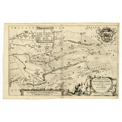
Plan of Vänersborg, Sweden – Antique Map by Merian, c.1680 Theatrum Europaeum
Antique map titled 'Grundtriss und Situation von der Statt und Vöstung Wennersburg'. This early copper engraved town plan depicts the fortified Swedish city of Vänersborg, located on the southern shore of Lake Vänern. The map shows the city’s defensive structures and surrounding water routes, with a compass rose orienting the viewer.
Originating from Merian's renowned work Theatrum Europaeum, published circa 1680, the map captures a time when Sweden held significant military and political influence in Northern Europe. The simplicity of the cartography and the fine engraving reflect the style and purpose of Merian's historical chronicles, which documented European events and cities of strategic importance.
A numbered key identifies key landmarks, including fortifications, gates, and waterways. The map is both a historical document and an artistic engraving, offering a glimpse into the military planning and urban layout of Vänersborg in the 17th century.
Condition report: Very good condition. Strong impression on laid paper with visible plate mark. Minor age-related toning and a vertical centerfold as issued. Wide margins, one small tear at the edge of the margin, no repairs.
Framing tips: Best suited to a classic black or dark wood frame with a soft white or pale gray mat to complement the monochrome engraving and emphasize its historical character.
- Dimensions:Height: 13.39 in (34 cm)Width: 14.97 in (38 cm)Depth: 0.02 in (0.5 mm)
- Materials and Techniques:Paper,Engraved
- Place of Origin:
- Period:Late 17th Century
- Date of Manufacture:circa 1680
- Condition:Very good condition. Strong impression on laid paper with visible plate mark. Minor age-related toning and a vertical centerfold as issued. Wide margins, one small tear at the edge of the margin, no repairs.
- Seller Location:Langweer, NL
- Reference Number:Seller: BG-12526-51stDibs: LU3054319678522
About the Seller
5.0
Recognized Seller
These prestigious sellers are industry leaders and represent the highest echelon for item quality and design.
Platinum Seller
Premium sellers with a 4.7+ rating and 24-hour response times
Established in 2009
1stDibs seller since 2017
2,513 sales on 1stDibs
Typical response time: <1 hour
- ShippingRetrieving quote...Shipping from: Langweer, Netherlands
- Return Policy
Authenticity Guarantee
In the unlikely event there’s an issue with an item’s authenticity, contact us within 1 year for a full refund. DetailsMoney-Back Guarantee
If your item is not as described, is damaged in transit, or does not arrive, contact us within 7 days for a full refund. Details24-Hour Cancellation
You have a 24-hour grace period in which to reconsider your purchase, with no questions asked.Vetted Professional Sellers
Our world-class sellers must adhere to strict standards for service and quality, maintaining the integrity of our listings.Price-Match Guarantee
If you find that a seller listed the same item for a lower price elsewhere, we’ll match it.Trusted Global Delivery
Our best-in-class carrier network provides specialized shipping options worldwide, including custom delivery.More From This Seller
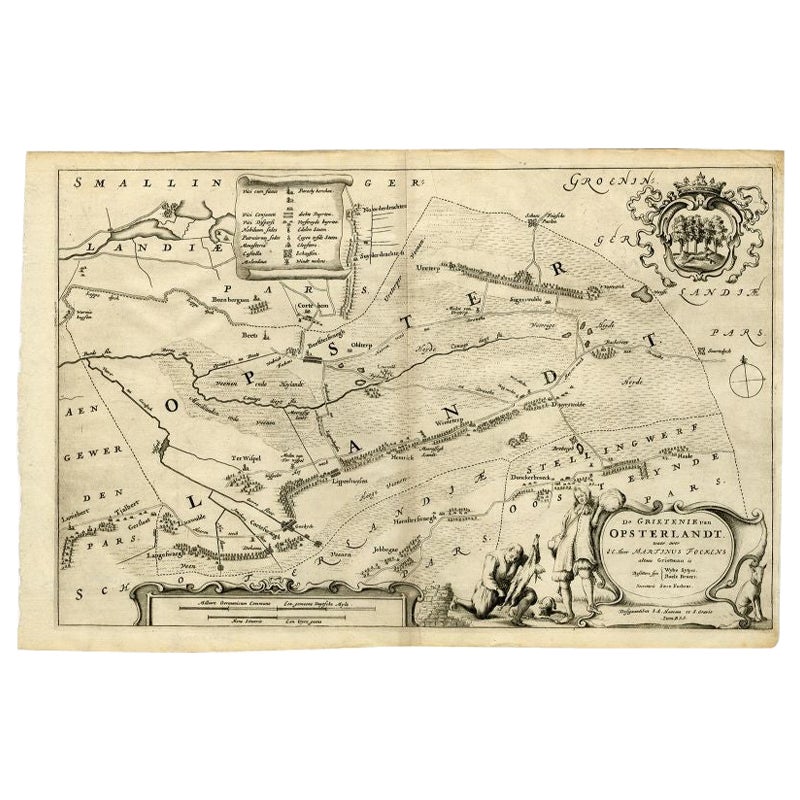
View AllAntique Map of the Region of Opsterland by Schotanus, 1664
By B. Schotanus
Located in Langweer, NL
Antique map titled 'De Grietenie van Opsterlandt : waer over d'e. heer Martinus Fockens altans grietman is, bysitters syn Wybe Sytjes, Boele Broers, secretaris Saco Fockens.' Detaile...
Category
Antique 17th Century Maps
Materials
Paper
$254 Sale Price
20% Off
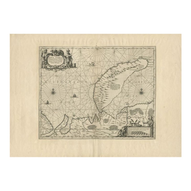
Antique Map of Nova Zembla by Janssonius, c.1650
Located in Langweer, NL
Antique map titled 'Nova Zemla, waygats fretum Nassovi cum et terra Samoiedum singula omnium emendatissime descripta'. This map depicts Nova Zembla and the northern continental coast...
Category
Antique 17th Century Maps
Materials
Paper

$374 Sale Price
20% Off
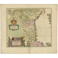
Antique Map of Central Sweden by J. Blaeu, 1662
Located in Langweer, NL
A striking, rare map with a cartouche dedicated to Gabriel Bengtsson Oxenstierna. Published by J. Bleau, Amsterdam, 1662. Contemporary coloring.
Category
Antique Mid-17th Century Maps
Materials
Paper
$863 Sale Price
20% Off
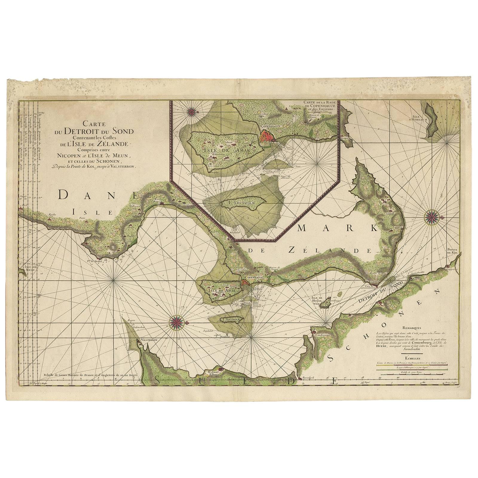
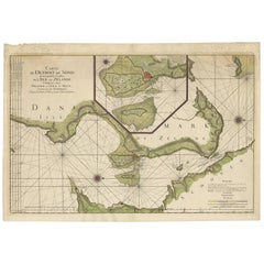
Antique Map: Carte du Détroit du Sond with Copenhagen Inset, 1693
Located in Langweer, NL
Antique Map: Carte du Détroit du Sond with Copenhagen Inset, Jaillot/Mortier, 1693
This rare and striking antique map, titled *Carte du détroit du Sond contenant les costes de l’Is...
Category
Antique Late 17th Century Maps
Materials
Paper
$2,122 Sale Price
20% Off
Free Shipping
Antique Map of the Bay of Batavia by Van der Aa, c.1720
Located in Langweer, NL
Antique map titled 'La Rade de Batavia'. A small early 18th century black and white map of the Bay of Batavia (Jakarta), Indonesia. Published by P....
Category
Antique 18th Century Maps
Materials
Paper

$254 Sale Price
20% Off
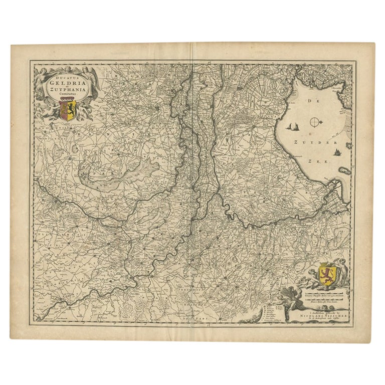
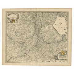
Antique Map of the Dutch Province of Gelderland by Visscher, c.1670
Located in Langweer, NL
Antique map titled 'Ducatus Geldria et Zutphania Comitatus'. Map of the Duchy of Gelre (Gelderland) and the county of Zutphen, The Netherlands. Artists and Engravers: Made after the ...
Category
Antique 17th Century Maps
Materials
Paper
You May Also Like
1646 Jansson Map Entitled "Procinvia Connactiae, " Ric.a006
Located in Norton, MA
1646 Jansson map entitled
"Procinvia connactiae,"
Ric.a006
Description: The PROVINCE of CONNAVGT 490 x 380From vol 4 of Jansson's Atlas Novus 1646, published in Amsterdam with...
Category
Antique 17th Century Unknown Maps
Materials
Paper

1627 Hendrik Hondius Map Entitled "Vltoniae Orientalis Pars, " Ric.a009
Located in Norton, MA
1627 Hendrik Hondius map entitled
"Vltoniae orientalis pars,"
Ric.a009
Title:
Vltoniae orientalis : pars
Title (alt.) :
Ultoniae orientalis pars
Creator:
Mercator, Gerh...
Category
Antique 17th Century Dutch Maps
Materials
Paper

Rare Original Map of New Amsterdam (New York) – “Restitutio”, ca. 1674 –
Located in Dronten, NL
An exceptionally rare and original 17th-century engraving of New Amsterdam, now New York City, published by the renowned Amsterdam cartographer Carel (Carolus) Allard around 1674. Kn...
Category
Antique 17th Century Dutch Maps
Materials
Paper

1654 Joan Blaeu Map the Sutherland, Scotland, Entitled "Southerlandia, "Ric0007
Located in Norton, MA
1654 Joan Blaeu map of the
Sutherland, Scotland, entitled
"Southerlandia,"
Hand Colored
Ric0007
Description:
Lovely map centered on Sedan and D...
Category
Antique 17th Century Dutch Maps
Materials
Paper

Antique Map - Gallia - Etching by Johannes Janssonius - 1650s
By Johannes Janssonius
Located in Roma, IT
Antique Map - Gallia is an antique map realized in 1650 by Johannes Janssonius (1588-1664).
The Map is Hand-colored etching, with coeval watercoloring.
Good conditions with slight ...
Category
1650s Modern Figurative Prints
Materials
Etching

1657 Janssonius Map of Vermandois and Cappelle, Ric. A-004
Located in Norton, MA
1657 Janssonius map of
Vermandois and Cappelle
Ric.a004
Description: Antique map of France titled 'Descriptio Veromanduorum - Gouvernement de la Cappelle'. Two detailed maps o...
Category
Antique 17th Century Unknown Maps
Materials
Paper

More Ways To Browse
Swedish 17th Century Furniture
Antique Swedish Copper
Indonesia Map
Antique Framed Map Engravings
Atlas Furniture Company
Used Office Furniture Edinburgh
Antique 16th Century Plates
Scotland Map
Antique Maps Indonesia
Map Of Japan
Antique Rollers
Compass Rose Antique
Dutch Empire
Swiss Antiques And Collectables
Antique Compass Map
Blaeu Maps
Coat Of Arms German
Antique Collectables Australia