George III Maps
to
2
1
3
77
35
18
13
6
5
4
4
4
3
1
1
2
1
3
2
2
1
1
3
3
2
3
3
3
Style: George III
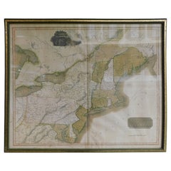
English Engraved Hand Colored Map of the North Eastern United States, circa 1817
Located in Charleston, SC
English copper engraved hand colored map of the North Eastern United States matted under glass in a gilt frame, Early 19th Century. Drawn and Engraved for Thomson's New General Atlas...
Category
1810s English Antique George III Maps
Materials
Glass, Giltwood, Paint, Paper
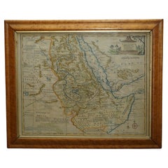
London 1744 Published Watercolour Antique Map of East Africa by Eman Bowen
Located in West Sussex, Pulborough
We are delighted to offer for sale this New and Accurate Map of Nubia & Abissinia, together with all the Kingdoms Tributary Thereto, and bordering upon them published in 1744 by Emanuel Bowen
This is a decorative antique engraved map of East Africa...
Category
1740s English Antique George III Maps
Materials
Paper
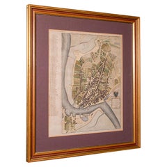
Antique Town Plan Map, Poole, English, Framed Cartography, Georgian, Circa 1780
Located in Hele, Devon, GB
This is an antique town plan map of Poole in Dorset. An English, framed atlas engraving, dating to the 18th century and later.
Fascinating cartography with annotated streets and pl...
Category
Late 18th Century British Antique George III Maps
Materials
Glass, Wood, Paper
Related Items
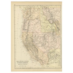
Antique Map of The United States of North America, Pacific States, 1882
Located in Langweer, NL
The map is from the same 1882 Blackie Atlas and focuses on the Pacific States of the United States of America during that period. Here are some details and historical context about t...
Category
1880s Antique George III Maps
Materials
Paper
$240 Sale Price
20% Off
H 14.97 in W 11.03 in D 0 in
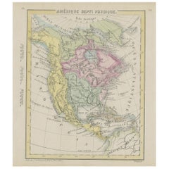
Small Map of the United States
Located in Langweer, NL
Antique map titled 'Amérique septe. Physique'. Small map of the United States. lithographed by C. Callewaert brothers in Brussels circa 1870.
Category
Mid-19th Century Antique George III Maps
Materials
Paper
Antique Map of Venezuela by Montanus, 1671
Located in Langweer, NL
Antique map titled 'Venezuela cum parte Australi Novae Andalusiae'. The map extends from Coquibocoa to the Orinoque River, centered on Bariquicemento and Cape de Curiacao. Large cart...
Category
Mid-17th Century English Antique George III Maps
Materials
Paper
Original Antique Map or City Plan of Geneva, Switzerland. Circa 1835
Located in St Annes, Lancashire
Nice map of Geneva
Drawn and engraved by J.Dower
Published by Orr & Smith. C.1835
Unframed.
Free shipping
Category
1830s English Antique George III Maps
Materials
Paper
$60
H 9.25 in W 12.25 in D 0.07 in
Antique Map of the United States by Titus '1871'
Located in Langweer, NL
Antique map titled 'The United States of America'. Original antique map of the United States. This map originates from 'Atlas of Prebl...
Category
Late 19th Century Antique George III Maps
Materials
Paper
$768 Sale Price
20% Off
H 16.54 in W 26.78 in D 0.02 in
Antique Map of the United States by Balbi '1847'
Located in Langweer, NL
Antique map titled 'Etats-Unis'. Original antique map of the United States. This map originates from 'Abrégé de Géographie (..)' by Ad...
Category
Mid-19th Century Antique George III Maps
Materials
Paper
$192 Sale Price
20% Off
H 9.06 in W 11.23 in D 0.02 in
Antique Map of Italy by R. Bonne, circa 1780
Located in Langweer, NL
Beautiful map of Italy, Corsica, Sardinia and Sicily. Highly detailed, showing towns, rivers, some topographical features and political boundaries. Published by R. Bonne, circa 1780.
Category
Late 18th Century Antique George III Maps
Materials
Paper
Antique English Georgian Treen Dog Snuff Box 18th Century
Located in Newark, England
From our collectables, we are delighted to offer this Georgian Treen Dog Snuff Box. The Treen Snuff Box beautifully formed in the shape of a naive dog ...
Category
Late 18th Century English Antique George III Maps
Materials
Wood
Spectacular Antique Original Engraving of a Town Plan of Jerusalem, 1708
Located in Langweer, NL
Description: Antique map titled 'Erster Abriss der Stadt Jerusalem wie sie Furnemblich zur Zeit des Hernn Christi beschaffen (..).'
Spectacular town plan...
Category
Early 1700s Antique George III Maps
Materials
Paper
$1,297 Sale Price
20% Off
H 16.93 in W 20.6 in D 0 in
Very Decorative Original Antique Map of the World, Published in France in c.1780
Located in Langweer, NL
Antique map titled 'L'Ancien Monde Et Le Nouveau en Deux Hemispheres' - Double hemisphere map of the World, showing the contemporary geographical...
Category
18th Century Antique George III Maps
Materials
Paper
$739 Sale Price
20% Off
H 10.24 in W 17.6 in D 0 in
Original Antique Map or City Plan of Rome, Italy. Circa 1835
Located in St Annes, Lancashire
Nice map of Rome
Drawn and engraved by J.Dower
Published by Orr & Smith. C.1835
Unframed.
Free shipping
Category
1830s English Antique George III Maps
Materials
Paper
Original Antique Map or City Plan of Venice, Italy. Circa 1835
Located in St Annes, Lancashire
Nice map of Venice
Drawn and engraved by J.Dower
Published by Orr & Smith. C.1835
Unframed.
Free shipping
Category
1830s English Antique George III Maps
Materials
Paper
Previously Available Items
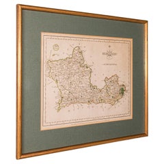
Antique County Map, Berkshire, English, Framed, Cartography, John Cary, C.1790
Located in Hele, Devon, GB
This is an antique county map of Berkshire. An English, framed atlas engraving of cartographic interest by John Cary, dating to the late 18th century and later.
Superb lithography ...
Category
Late 18th Century British Antique George III Maps
Materials
Glass, Wood, Paper
H 13.59 in W 15.36 in D 0.99 in
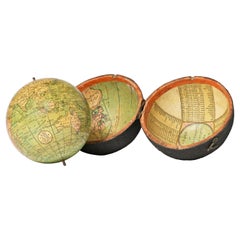
Pocket Globe John and William Cary, London 1791
By Cary’s
Located in Milano, IT
John and William Cary
Pocket globe
London, 1791
The pocket globe is contained in its original case, which itself is covered in shark skin.
Few and slight gaps in the original p...
Category
1790s English Antique George III Maps
Materials
Shagreen, Paper
Pocket Globe John and William Cary, London, 1791
By Cary’s
Located in Milano, IT
John and William Cary
Pocket globe
London, 1791
The pocket globe is contained in its original case, which itself is covered in shark skin.
Few and slight gaps in the original p...
Category
1790s English Antique George III Maps
Materials
Shagreen, Paper
Early 19th Century Celestial Globe by Cary
Located in Greenwich, CT
Fine Georgian Celestial globe by J. & W. Cary of London, circa 1800, the mahogany Stand with ring turned urn shaft and standing on slipper feet, with co...
Category
1790s English Antique George III Maps
Materials
Mahogany, Paper
George Iii maps for sale on 1stDibs.
Find a broad range of unique George III maps for sale on 1stDibs. Many of these items were first offered in the 19th Century, but contemporary artisans have continued to produce works inspired by this style. If you’re looking to add vintage maps created in this style to your space, the works available on 1stDibs include more furniture and collectibles, decorative objects, wall decorations and other home furnishings, frequently crafted with paper, giltwood and other materials. If you’re shopping for used George III maps made in a specific country, there are England, Europe, and United Kingdom pieces for sale on 1stDibs. It’s true that these talented designers have at times inspired knockoffs, but our experienced specialists have partnered with only top vetted sellers to offer authentic pieces that come with a buyer protection guarantee. Prices for maps differ depending upon multiple factors, including designer, materials, construction methods, condition and provenance. On 1stDibs, the price for these items starts at $1,231 and tops out at $4,800 while the average work can sell for $3,015.
Recently Viewed
View AllMore Ways To Browse
Bavarian Porcelain Vases
Beer Tankard
Bjorn L
Black Cabinet With Flowers And Birds
Black Tansu Chest
Blue Morpho
Blue Opaline Crystal Vases
Bow Front Buffet
Boy And Girl Statues
Brass Donkey
Brass Hound
Bread Oven
Bronze Atlas Sculpture
Bronze Door Stop
Bronze Shakespeare Sculpture
Buddha Bell
Bull Terrier
Butlers Chest
