Items Similar to Antique Print of the Sea of Azov and the Crimean peninsula by Veith, circa 1855
Want more images or videos?
Request additional images or videos from the seller
1 of 5
Antique Print of the Sea of Azov and the Crimean peninsula by Veith, circa 1855
$523.30
$654.1220% Off
£389.39
£486.7320% Off
€440
€55020% Off
CA$718.98
CA$898.7320% Off
A$802.44
A$1,003.0620% Off
CHF 422.18
CHF 527.7220% Off
MX$9,747.48
MX$12,184.3520% Off
NOK 5,352.08
NOK 6,690.1120% Off
SEK 5,008.88
SEK 6,261.1020% Off
DKK 3,349.55
DKK 4,186.9420% Off
About the Item
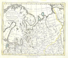
Antique lithograph titled 'Das Asow'sche und das Schwarze Meer mit Umgebung'. Rare view on the Sea of Azov, the Crimean peninsula and surroundings. In the foreground, military units leaving the area. Published by J. Veith, circa 1855.
- Dimensions:Height: 19.3 in (49 cm)Width: 27.56 in (70 cm)Depth: 0.02 in (0.5 mm)
- Materials and Techniques:
- Period:
- Date of Manufacture:circa 1855
- Condition:General age-related toning. Few tears in the margins. Blank verso, please study images carefully.
- Seller Location:Langweer, NL
- Reference Number:Seller: BG-122391stDibs: LU3054317515801
About the Seller
5.0
Recognized Seller
These prestigious sellers are industry leaders and represent the highest echelon for item quality and design.
Platinum Seller
Premium sellers with a 4.7+ rating and 24-hour response times
Established in 2009
1stDibs seller since 2017
2,565 sales on 1stDibs
Typical response time: <1 hour
- ShippingRetrieving quote...Shipping from: Langweer, Netherlands
- Return Policy
Authenticity Guarantee
In the unlikely event there’s an issue with an item’s authenticity, contact us within 1 year for a full refund. DetailsMoney-Back Guarantee
If your item is not as described, is damaged in transit, or does not arrive, contact us within 7 days for a full refund. Details24-Hour Cancellation
You have a 24-hour grace period in which to reconsider your purchase, with no questions asked.Vetted Professional Sellers
Our world-class sellers must adhere to strict standards for service and quality, maintaining the integrity of our listings.Price-Match Guarantee
If you find that a seller listed the same item for a lower price elsewhere, we’ll match it.Trusted Global Delivery
Our best-in-class carrier network provides specialized shipping options worldwide, including custom delivery.More From This Seller
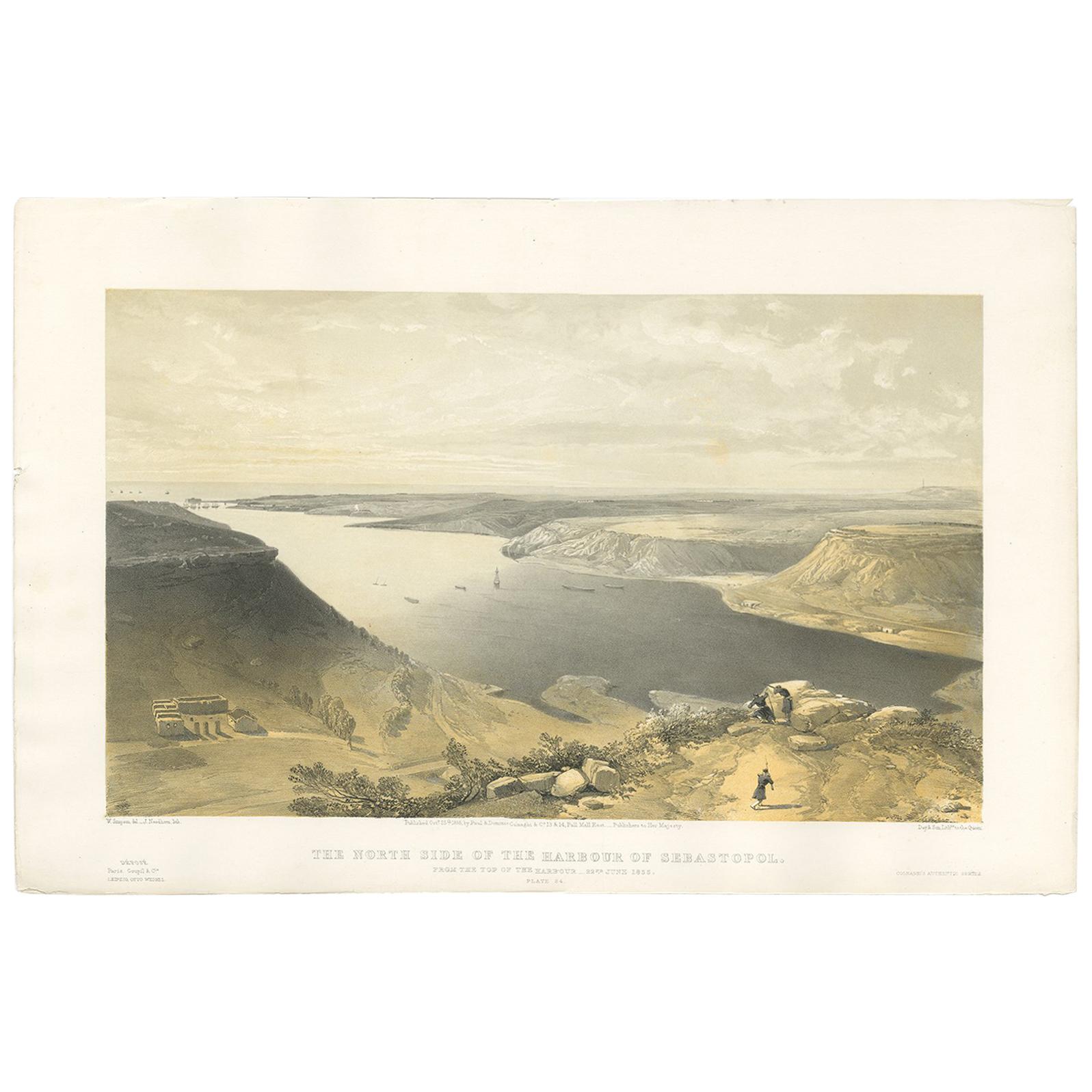
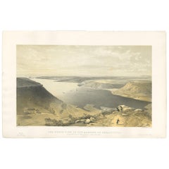
View AllAntique Print of the Harbour of Sebastopol 'Crimean War' by W. Simpson, 1855
Located in Langweer, NL
Antique print titled 'The North side of the harbour of Sebastopol. From the top of the harbour, 22nd June 1855'. This print originates from 'The Seat of the War in the East' by W. Si...
Category
Antique Mid-19th Century Prints
Materials
Paper
$333 Sale Price
20% Off
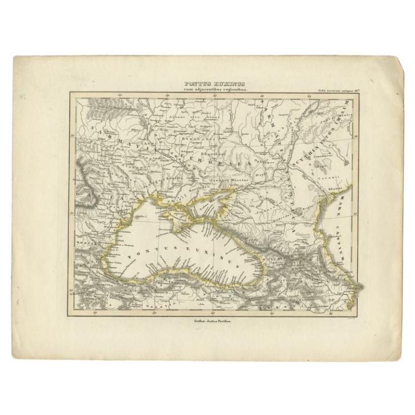
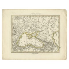
Antique Map of the Black Sea by Perthes, 1848
Located in Langweer, NL
Antique map titled 'Pontus Euxinus'. Old map of the Black Sea and surroundings originating from 'Orbis Terrarum Antiquus in usum Scholarum'. Artists and Engravers: Published by Justu...
Category
Antique 19th Century Maps
Materials
Paper
$94 Sale Price
20% Off
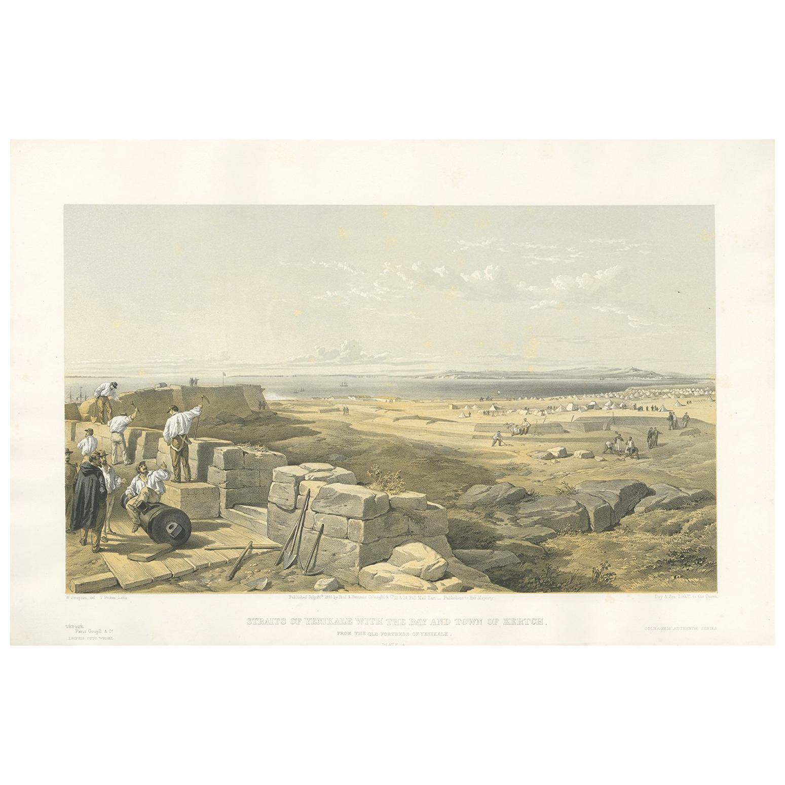
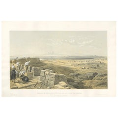
Antique Print of the Straits of Yenikale 'Crimean War' by W. Simpson, 1855
Located in Langweer, NL
Antique print titled 'Straits of Yenikale with the Bay and Town of Kertch. From the old Fortress of Yenikale'. This print originates from 'The Seat of the War in the East' by W. Simp...
Category
Antique Mid-19th Century Prints
Materials
Paper
$333 Sale Price
20% Off
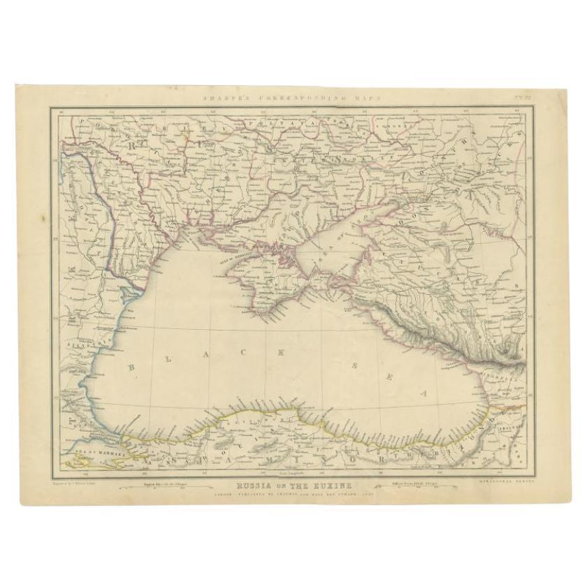
Antique Map of the Black Sea and Surroundings by Sharpe, 1849
Located in Langweer, NL
Antique map titled 'Russia on the Euxine'. Old map of the Black Sea and the surrounding (Russia). This map originates from 'Sharpe's Corresponding Atlas (..)' by J. Sharpe. Artists and Engravers: Published by Chapman and Hall...
Category
Antique 19th Century Maps
Materials
Paper

$90 Sale Price
20% Off
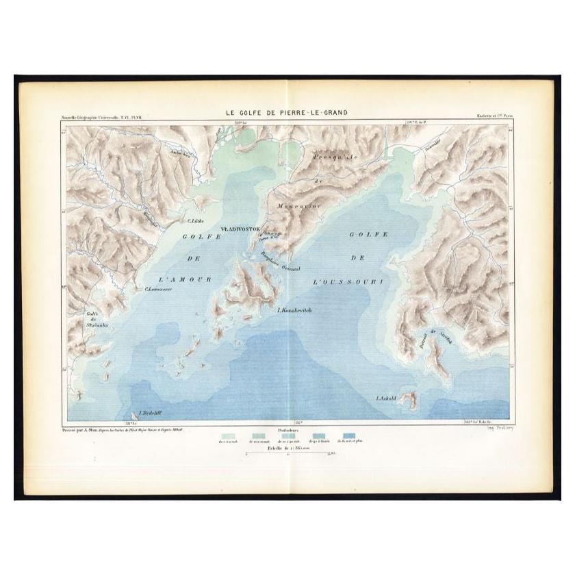
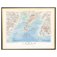
Antique Map of the Peter the Great Gulf by Reclus, 1881
Located in Langweer, NL
Antique map titled 'Le Golfe de Pierre-Le-Grand.' This map shows the Peter The Great Gulf in the Sea of Japan adjoining the coast of Russia's Primorski...
Category
Antique 19th Century Maps
Materials
Paper
$84 Sale Price
20% Off
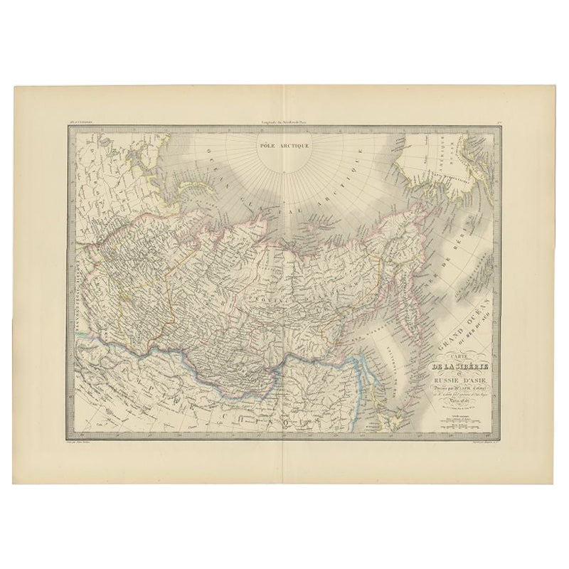
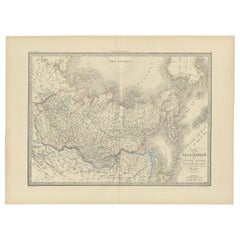
Antique Map of Siberia by Lapie, 1842
Located in Langweer, NL
Antique map titled 'Carte de la Sibérie ou Russie d'Asie'. Map of Siberia. This map originates from 'Atlas universel de géographie ancienne et moderne (..)' by Pierre M. Lapie and Al...
Category
Antique 19th Century Maps
Materials
Paper
$333 Sale Price
20% Off
You May Also Like
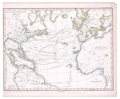
The Atlantic Ocean - Original Etching by A. Stieler - 1857
Located in Roma, IT
The Atlantic Ocean is an original colored print realized in 1857.
Hand-colored engraving made in Gotha (Germany) by Adolf Stieler.
Good conditions except for some light yellowing t...
Category
1950s Figurative Prints
Materials
Etching
1860 Large Map "Carte De La Siberie Russie D'asie, " Ric.R0001
Located in Norton, MA
Large 1860 map "Carte De La Siberie Russie D'Asie," R-0001
" Authentic" - 1860 map "Carte De La Siberie Russie D'Asie,"
Dimension: Paper: 68 cm W x 51 cm H ; Sight: 51cm W x 4...
Category
Antique 19th Century Unknown Maps
Materials
Paper

Antique Lithography Map, Black Sea, English, Framed, Cartography, Victorian
Located in Hele, Devon, GB
This is an antique lithography map of the Black Sea region. An English, framed atlas engraving of cartographic interest by John Rapkin, dating to the early Victorian period and later...
Category
Antique Mid-19th Century British Early Victorian Maps
Materials
Wood

Large1852 Map "Russian Empire" Ric.r0011
Located in Norton, MA
Large
1852 map "Russian Empire"
George Phillips & Son 1852
Ric.r0011
Dimension: Paper: 67 cm W x 52 cm H ; Sight: 60cm W x 50 cm H
Condition: Good Condition with aged tonin...
Category
Antique 19th Century Unknown Maps
Materials
Paper

Map of Russia - Original Etching - Late 19th Century
Located in Roma, IT
This Map of Russia is an etching realized by an anonymous artist.
The state of preservation of the artwork is good with some small diffused stains.
Sheet dimension:27.5 x 44
At t...
Category
Late 19th Century Modern Figurative Prints
Materials
Etching
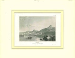
Ancient View of Cyprus - Original Lithograph - Mid-19th Century
Located in Roma, IT
Cyprus is an original modern artwork realized in the mid-19th Century.
Original B/W Lithograph on Ivory Paper.
Inscripted on the lower margin in Capital Letters: Cyprus Hauptstad...
Category
Mid-19th Century Modern Landscape Prints
Materials
Lithograph
More Ways To Browse
Edward Lear Lithograph
Linocut Prints
Polynesian Wall
Encyclopedia Britannica
Used Catholic Vestments
Waterfowl Prints
Albers Embossing
Antique Vegetable Prints
Botanical Wall Chart
Edmund Dulac
Emperor Maximilian
Fox Hunting Lithographs
Java Bird
Kip Engraving
Sarony Major Knapp
Vintage Botanical Chart
Antique Badger
Armando Testa