Late 17th Century Prints
to
218
250
3
253
Height
to
Width
to
3
5,275
9,775
5,515
874
1,209
1,729
1,683
199
80
206
257
248
311
414
704
366
226
253
1
1
1
1
44
24
6
5
3
253
253
253
3
3
2
2
1
Period: Late 17th Century
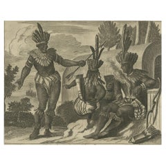
Engraving of a Ceremonial Gathering in New Spain in New Spain by Montanus, 1673
Located in Langweer, NL
This detailed copper engraving originates from Arnoldus Montanus' "Die Unbekannte Neue Welt oder Beschreibung des Welt-teils Amerika und des Sud-Landes", depicting a ceremonial gathering in New Spain...
Category
Dutch Antique Late 17th Century Prints
Materials
Paper
$372 Sale Price
30% Off
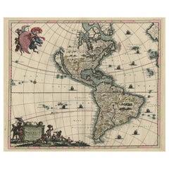
Rare Antique Map of the Americas with Island California by Danckerts, c.1680
Located in Langweer, NL
Rare Antique Map of the Americas with Island California by Justus Danckerts, ca. 1696
This exceptional antique map titled Novissima et Accuratissima Totius Americae Descriptio per I...
Category
Dutch Antique Late 17th Century Prints
Materials
Paper
$3,310 Sale Price
20% Off
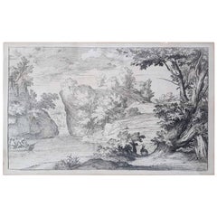
17th Century Flaemish Abraham Genoels II "Landscape with Rabbit" Etching
By Abraham Genoels II
Located in Cagliari, IT
Beautiful etching by Abraham Genoels II (Antwerp 1640-1723) from a painting by Adam Frans van der Meulen (Brussels 1844-Paris 1690).
Excellent state of conservation with wide margin...
Category
Belgian Antique Late 17th Century Prints
Materials
Copper
$926 Sale Price
20% Off
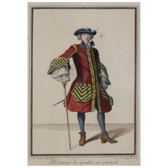
Copper Engraving Depicting the High Quality of the Fashion Under Louis XIV, 1684
Located in Langweer, NL
Beautiful engraving of Jean Dieu de Saint-Jean with title 'Homme de qualité en Surtout'
(translated in English: Man of of a particular quality). This original copper engraving is ha...
Category
Antique Late 17th Century Prints
Materials
Paper
$334 Sale Price
20% Off
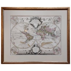
Original Antique Hand-colored World Map with or without Frame, '1696'
Located in Langweer, NL
Antique world map titled 'Mappe-Monde dressee sur les Observations de Mrs. de l'Academie Royale des Sciences (..)'. Beautiful original antique world map...
Category
French Antique Late 17th Century Prints
Materials
Paper
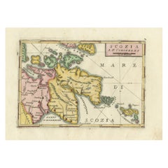
Scozia – Antique Map of Scotland by Coronelli, circa 1690
Located in Langweer, NL
Map of Scotland by Coronelli, c.1690 – “Scozia A.P. Coronelli”
This finely engraved and hand-colored map depicts Scotland, titled Scozia A.P. Coronelli, produced by the renowned Ven...
Category
Italian Antique Late 17th Century Prints
Materials
Paper
Copper Engraving of Hispaniola - Indigenous Life in America by Montanus, 1673
Located in Langweer, NL
This original copper engraving, extracted from the scarce German edition of Arnoldus Montanus' "Die Unbekante Neue Welt oder Beschreibung des Welt-teils Amerika und des Sud-Landes", ...
Category
Antique Late 17th Century Prints
Materials
Paper
$399 Sale Price
24% Off
Pair of Road Maps of England by John Ogilby
Located in Essex, MA
The first road maps of England. London to Holyhead and London to Carlisle. Nicely framed and matted. These are plates removed from a book. These are fir...
Category
English Antique Late 17th Century Prints
Materials
Paper
$1,850 / set
Panoramic View of Isfahan in 17th Century Persia by J.C. Haffner, ca.1690
Located in Langweer, NL
Panoramic View of Isfahan in the Late 17th Century by J.C. Haffner
The translation of the German text on the engraving:
"A. The Meidan or Great Market and Promenade Square in front...
Category
Antique Late 17th Century Prints
Materials
Paper
$1,339 Sale Price
20% Off
Map of The East Indies with the Route of Capt. William Dampier's Voyage, 1698
Located in Langweer, NL
Antique map titled 'Kaart van Oost Indie'.
Old map of the East Indies. It shows the routes of Captain William Dampier's voyage throughout the regio...
Category
Antique Late 17th Century Prints
Materials
Paper
$698 Sale Price
20% Off
Gorgeous Antique World Map by the Dutch Mapmaker Visscher, published circa 1679
Located in Langweer, NL
Antique map titled 'Novissima Totius Terrarum Orbis Tabula, Auctore Nicolao Visscher'. Gorgeous example of Nicholas Visscher's World map, which appeared...
Category
Dutch Antique Late 17th Century Prints
Materials
Paper
Antique Print of the Hindu God Vishnu Incarnated as Krishna, 1672
Located in Langweer, NL
This original antique print shows the Hindu god Vishnu incarnated as Krishna. Dutch text on verso. From: 'Naauwkeurige Beschryvinge van Malabar en Choromande...
Category
Antique Late 17th Century Prints
Materials
Paper
$229 Sale Price
20% Off
Antique Map of Greece by Allard (c.1698)
Located in Langweer, NL
Antique map titled 'Hellas seu Graecia Universa' Detailed map of Greece, with Crete, the Aegean Islands, and part of Turkey. With two cartouches, compass rose and scale. Carolus Alla...
Category
Antique Late 17th Century Prints
Materials
Paper
$937 Sale Price
20% Off
Venetian Fortress Paleokastro on Crete – Antique Print, Hand-Coloured, 1688
Located in Langweer, NL
Antique Print of Paleokastro Castle on Crete, Dapper, 1688
This fine hand-coloured engraving depicts the fortress of Paleokastro (Palaiokastro) on the north coast of Crete. The view...
Category
Dutch Antique Late 17th Century Prints
Materials
Paper
The Martyrdom of Father John Forest, Burned by Order of Henry VIII in 1538
Located in Langweer, NL
Engraving of the burning at the stake of a Franciscan friar. Here is a detailed analysis, including a description and a translated version of the text:
The text at the bottom reads:...
Category
Antique Late 17th Century Prints
Materials
Paper
$420 Sale Price
20% Off
Cultural Encounter in New Mexico, Copper Engraving Published in 1673
Located in Langweer, NL
This original copper engraving hails from Arnoldus Montanus' seminal work, "Die Unbekannte Neue Welt oder Beschreibung des Welt-teils Amerika und des Sud-Landes," a comprehensive depiction of the Americas published in 1673.
It presents a vivid scene set in colonial New Mexico, showcasing a moment of interaction—possibly a ceremonial or everyday event—between indigenous people and European settlers or explorers. The detailed attire and adornments of the figures suggest a narrative rich in cultural exchange and complexity. This piece is not only a reflection of the artistic style and engraving techniques of the 17th century but also serves as a historical document capturing the early encounters between different worlds.
Published in Amsterdam by Jacob Meurs, this rare German edition offers a unique glimpse into the perceptions and imaginations of European society regarding the New World during the Age of...
Category
Antique Late 17th Century Prints
Materials
Paper
$404 Sale Price
24% Off
Antique Map of Northern Italy by F. de Wit, 1690
Located in Langweer, NL
A very decorative map centered on Genua, and including the towns of Milan, Torino, Parma, Cremona, etc. Decorative title cartouche upper right, five putti holding the arms of the reg...
Category
Antique Late 17th Century Prints
Materials
Paper
$526 Sale Price
20% Off
Antique Map of the North Pole by V.M. Coronelli, circa 1692
Located in Langweer, NL
Globe gore by Vincenzo Maria Coronelli shows the North Pole with the coasts of Canada, Greenland, Scandinavia and Siberia, and is decorated with pictorial scenes of bear, seal and wh...
Category
Italian Antique Late 17th Century Prints
Materials
Paper
$993 Sale Price
40% Off
Antique Map of Denmark by F. de Wit, 1680
Located in Langweer, NL
Antique map titled 'Dania Regnum'. Large, attractive map of Denmark, Sleschwig-Holstein and southern Sweden. Good detail throughout. Embellished with a title cartouche with the Danis...
Category
Antique Late 17th Century Prints
Materials
Paper
$923 Sale Price
20% Off
Botanical Illustration of the Castor Oil Plant (Ricinus communis), 1696
Located in Langweer, NL
The print titled "Ricinus Americanus Major Rubicundus" depicts the Ricinus communis plant, commonly known as the castorbean or castor-oil-plant. This plant is notable for its large, ...
Category
Antique Late 17th Century Prints
Materials
Paper
$516 Sale Price
20% Off
Antique Map of the Saxony Region 'Germany' by F. de Wit, circa 1680
Located in Langweer, NL
A detailed map of a region in eastern Germany. Cartouches depict coat of arms surrounded by cherubs. The map is fully engraved with towns, political boundaries, rivers and forests. P...
Category
Dutch Antique Late 17th Century Prints
Materials
Paper
Finely Detailed Map Covering Northern Italy, Austria, Slovenia & Croatia, c.1690
Located in Langweer, NL
Antique map titled 'Exactissima Tabula, qua tam Danubii Fluvii Pars Superior'.
Very finely detailed map covering the region of northern Italy, Austria, Slovenia and Croatia. The co...
Category
Antique Late 17th Century Prints
Materials
Paper
$1,769 Sale Price
20% Off
Antique Print of the Royal Flagship of the English Fleet by P. Mortier, c.1693
Located in Langweer, NL
Antique print titled 'Vaisseau Royal de l'Angleterre, Konincklyke Schip van Engeland'. Beautiful hand-coloured engraving of the Royal Flagship of the English Fleet. Originally publis...
Category
Antique Late 17th Century Prints
Materials
Paper
$2,822 Sale Price
20% Off
Original Hand-coloured Antique Map of Pomerania by Sanson '1684'
Located in Langweer, NL
Antique map titled 'Le Duche de Pomeranie divise en ses Principales Parties (..)'. Large map of Pomerania. Pomerania is a historical region on the southern shore of the Baltic Sea in...
Category
Antique Late 17th Century Prints
Materials
Paper
$898 Sale Price
20% Off
Original Antique Hand- Map of Africa by Allard '1697'
Located in Langweer, NL
Antique map titled 'Novissima et Perfectissima Africae (..)'. Beautiful large map of Africa. This is the 3rd state of the map, with climate notation add...
Category
Antique Late 17th Century Prints
Materials
Paper
$1,166 Sale Price
35% Off
Original Antique Sea Chart of the Northern Part of Hispaniola, Western Cuba
Located in Langweer, NL
Antique map titled 'Pas kaart van de Noord Kust van Espaniola (..)'. Beautiful sea chart of the northern part of Hispaniola, western Cuba. The map includes the Turks & Caicos Islands and southern part of the Bahamas. Shows Guanahami or S. Salvador. Guanahani is an island in the Bahamas that was the first land in the New World sighted and visited by Christopher Columbus' first voyage, on October 12, 1492. It is not known precisely which island it was, and several theories have been put forth by historians. Guanahani is the native Taíno name; Columbus called it San Salvador. Originates from 'De Nieuwe Groote Lightende Zee-Fakkel'. Published by J. van Keulen, circa 1684.
The Van Keulens were a family of chartmakers and publishers. The firm, In de Gekroonde Lootsman (In the Crowned Pilot), was founded in 1678 by Johannes van Keulen (1654-1715). Van Keulen originally registered his business as a vendor of books and instruments (specifically cross-staffs). In 1680, however, he gained a privilege from the States of Holland and West Friesland for the publication of pilot guides and sea atlases.
In that year, van Keulen released his Zee-Atlas (Sea Atlas), which secured him a name in the competitive maritime publishing market. In 1681, he published the first volume of Nieuwe Lichtende Zee-Fakkel (New Shining Sea Torch). This would be the first of an eventual five volumes originally published between 1680 and 1684. A sixth volume was added in 1753. The Zee-Fakkel won van Keulen lasting fame. The atlas had charts compiled by Claes Jansz Vooght and artwork from Jan Luyken...
Category
Antique Late 17th Century Prints
Materials
Paper
$1,817 Sale Price
20% Off
Copper Engraving of Ceremonial Life in New Spain by Montanus, 1673
Located in Langweer, NL
This detailed copper engraving is from Arnoldus Montanus' "Die Unbekannte Neue Welt oder Beschreibung des Welt-teils Amerika und des Sud-Landes," which offers a glimpse into the cere...
Category
Antique Late 17th Century Prints
Materials
Paper
$430 Sale Price
20% Off
Old Map of the Mughal Empire, Persia in the West to Lake Chimay etc., ca.1685
Located in Langweer, NL
Antique map titled 'L'Empire du Grand Mogol'. Old map of India and Central Asia.
The map extends from Persia in the West to Lake Chimay and the Bay of Bengal...
Category
Antique Late 17th Century Prints
Materials
Paper
$306 Sale Price
20% Off
Antique Map of Flanders 'Belgium' by F. de Wit, circa 1680
Located in Langweer, NL
Antique map titled 'Comitatus Flandriae Tabula, in Lucem Edita'. Large map of Flanders, Belgium. Published by F. de Wit, circa 1680.
Category
Antique Late 17th Century Prints
Materials
Paper
$574 Sale Price
20% Off
Antique Map of Japan and Korea by Sanson, 'c.1690'
Located in Langweer, NL
Antique map titled 'Les Iles du Iapon (..)'. Original antique map, with beautiful (later) hand coloring, of Japan and the Island of Corey (Korea). Uncommon edition, with '234' at top...
Category
Antique Late 17th Century Prints
Materials
Paper
$945 Sale Price
20% Off
Antique Map of Belgium and Northern France by F. de Wit, circa 1680
Located in Langweer, NL
Antique map titled 'Belgii Regii Accuratissima Tabula Pluribus Locis Recens Emen'. Large map of Belgium and Northern France. Published by F. de Wit, circa 1680.
Category
Antique Late 17th Century Prints
Materials
Paper
$621 Sale Price
20% Off
South Sweden Map with Inset of Halmstad – Antique Map by Frederik de Wit, c.1680
Located in Langweer, NL
South Sweden Map with Inset of Halmstad – Antique Map by Frederik de Wit, c.1680
This richly detailed antique map titled Accurata Scaniae, Blekingae et Hallandiae Descriptio present...
Category
Dutch Antique Late 17th Century Prints
Materials
Paper
$799 Sale Price
20% Off
Rare 17th Century Engraving of Solor Island Fort and Bay, Indonesia, circa 1670
Located in Langweer, NL
Rare 17th Century Engraving of Solor Island Fort and Bay, Indonesia, circa 1670
Description:
This rare and finely detailed 17th-century copper engraving depicts the bay and fort of ...
Category
French Antique Late 17th Century Prints
Materials
Paper
Salsta Castle in Pastoral Uppland, Sweden: A Dahlberg Engraving, 1694
Located in Langweer, NL
Title: "Salsta Castle in Pastoral Uppland: A Dahlberg Engraving, 1710"
Description: This original hand-colored engraving from 1694, entitled 'SAALSTAD,' presents a stately view of S...
Category
Antique Late 17th Century Prints
Materials
Paper
$239 Sale Price
20% Off
Coat of Arms of Theodorus Van Bleiswijk, Mayor of Schiedam, Netherlands, Ca.1680
Located in Langweer, NL
Antique print, titled: 'De Heer en Mr. Theodorus van Bleyswijk, Hoogheemraadt, Regerendt Borgermeester der Stad Schiedam.' -
Coat of arms of Theodorus van Bleiswijk, mayor of Sch...
Category
Antique Late 17th Century Prints
Materials
Paper
$430 Sale Price
20% Off
Ritual Dance in Brazil in the 17th Century on a Copper Engraving by Montanus
Located in Langweer, NL
Title: "Ritual Dance in Brazil"
Description: This original copper engraving from Arnoldus Montanus' "Die Unbekannte Neue Welt oder Beschreibung des Welt-teils Amerika und des Sud-La...
Category
Antique Late 17th Century Prints
Materials
Paper
$404 Sale Price
24% Off
Copper Engraving of Daily Life in New Spain in The 17th Century, 1673
Located in Langweer, NL
This original copper engraving depicts a lively scene of daily life in New Spain from Arnoldus Montanus' "Die Unbekannte Neue Welt oder Beschreibung des Welt-teils Amerika und des Su...
Category
German Antique Late 17th Century Prints
Materials
Paper
$430 Sale Price
20% Off
Copper Engraving of Conquest and Culture in New Spain by Montanus, 1673
Located in Langweer, NL
This evocative original copper engraving, featured in Arnoldus Montanus' "Die Unbekannte Neue Welt oder Beschreibung des Welt-teils Amerika und des Sud-Landes," presents a scene from...
Category
Antique Late 17th Century Prints
Materials
Paper
$430 Sale Price
20% Off
Saint Arno, Bishop of Metz – French Religious Engraving, circa 1670
Located in Langweer, NL
Saint Arno, Bishop of Metz – 17th Century French Engraving
This original 17th-century engraving depicts Saint Arno (Arnulf) of Metz, a prominent 7th-century Frankish bishop and sain...
Category
French Antique Late 17th Century Prints
Materials
Paper
Antique Print Mercury Descending to Earth Made After a Fresco by Raphael, 1693
Located in Langweer, NL
Antique print titled 'Mercurius uocalis Deus ex Louis mandato Deos omnes ad concionem conuocat de Cupidinis ac Psyches coniugio sententiam laturi'. Mercury descending to earth can be seen in a red waving coat. Garlands with flowers and fruits frame the picture. Winged figures, a lion and birds are to the right and left of Mercury. Above a wall ledge are two arched windows framed by garlands.
This print originates from a series of twelve plates engraved by Nicolas Dorigny after a fresco by Raphael which can be found in Villa Farnesina. The Villa Farnesina is a Renaissance suburban villa in the Via della Lungara, in the district of Trastevere in Rome, central Italy. The villa was built for Agostino Chigi, a rich Sienese banker and the treasurer of Pope Julius II. Chigi also commissioned the fresco decoration of the villa by artists such as Raphael, Sebastiano del Piombo...
Category
Antique Late 17th Century Prints
Materials
Paper
$2,391 Sale Price
20% Off
The Martyrdom of Carthusian Monks Humphrey Middlemore, William Exmew, and Others
Located in Langweer, NL
This engraving depicts a group of Carthusian monks being executed, likely by hanging, in a gruesome scene reminiscent of the religious persecution during the Reformation. Here is a detailed analysis, a translated version of the text, and context for the engraving:
The text at the bottom reads:
"VMFRIDVS MIDELMOR, GULIELMUS EXMEY, ende verscheijden andere Carthuysers worden gehanghen."
Translation: "Humphrey Middlemore, William Exmew, and various other Carthusians are hanged."
The engraving depicts the martyrdom of Humphrey Middlemore, William Exmew, and several other Carthusian monks, who are shown being hanged. In the foreground, one monk lies dead or unconscious on a bench, while another man—likely the executioner—prepares a knife, suggesting the process of drawing and quartering. A large cauldron stands...
Category
Antique Late 17th Century Prints
Materials
Paper
$416 Sale Price
20% Off
Set of 5 Antique Prints of Various Characters by De La Fage 'C.1698'
Located in Langweer, NL
Set of five antique prints depicting various characters such as nymphs. These prints are part of a series titled 'Recueil des meilleurs desseins de Raimond La Fage...
Category
Antique Late 17th Century Prints
Materials
Paper
$478 Sale Price / set
20% Off
Antique Map of West Africa, focused on the Congo and Angola
Located in Langweer, NL
Original antique map titled 'Regna Congo et Angola'. Decorative 17th Century English map of a portion of West Africa, focused on the Congo and Angola. The map is centered on the Zair...
Category
Antique Late 17th Century Prints
Materials
Paper
$813 Sale Price
20% Off
Antique Print of the City of Surat, Gujarat, India, 1683
Located in Langweer, NL
Antique print titled 'Additions pour l'Asie reponz dans aux chifres (..) - Surate ou Souratte'. View of the city of Surat, southeastern Gujarat state, west-central India. With variou...
Category
Antique Late 17th Century Prints
Materials
Paper
$86 Sale Price
20% Off
Rare Engraving of Mount Sinai with St. Catherine's Monastery and Bedouins, 1680
Located in Langweer, NL
Rare antique print titled ‘Bergh Sinai of Sint Catryn’.
This engraving shows Mount Sinai (also known as Mount Horeb) with St. Catherine's Monastery at the foot of the mountains a...
Category
Antique Late 17th Century Prints
Materials
Paper
$660 Sale Price
20% Off
Daily Life in Brazil in the early 17th Century on a Copper Engraving by Montanus
Located in Langweer, NL
"Daily Life in Brazil"
This striking copper engraving, part of Arnoldus Montanus' "Die Unbekannte Neue Welt oder Beschreibung des Welt-teils Amerika und des Sud-Landes", presents a ...
Category
Dutch Antique Late 17th Century Prints
Materials
Paper
$376 Sale Price
30% Off
Antique Map of the Strait of Malacca, Malay Peninsula & Dutch Indies, c.1670
Located in Langweer, NL
Antique map titled 'Indiae Orientalis, nec non Insularum Adiacentium Nova Descriptio.'
Map of Southeast Asia. The map centers on the Strait of Malacca and Malay Peninsula. It ext...
Category
Antique Late 17th Century Prints
Materials
Paper
$2,248 Sale Price
20% Off
Eudamidas' Final Moments: A Scene from Lucian's 'Toxaris, or Friendship, ca.1680
Located in Langweer, NL
Title: "Testament of Eudamidas of the City of Corinth"
Description: This print depicts a scene from Lucian's 'Toxaris, or Friendship,' where Corinthian Eudamidas is seen lying in a ...
Category
Antique Late 17th Century Prints
Materials
Paper
$574 Sale Price
20% Off
Antique Map of the Region of Bouchain and Cambrai by Visscher 'circa 1680'
Located in Langweer, NL
Antique map titled 'Carte Nouvelle des Environs de Bouchain & Cambray'. Uncommon map of the region of Bouchain and Cambrai (Cambray, France) showing the camps of two armies.
Category
Antique Late 17th Century Prints
Materials
Paper
$478 Sale Price
20% Off
Dardanelles Strait, with a Perspective of the City of Constantinople, 1693
Located in Langweer, NL
Title: "Veue des Dardanelles de Constantinople, 1693"
Description: This historical copper engraving, crafted by Nicholas de Fer between 1646 and 1720 in Paris, is a remarkable depic...
Category
Antique Late 17th Century Prints
Materials
Paper
$325 Sale Price
20% Off
't Huys van Niel: A Flemish Residence from the Duchy of Brabant, c.1678
Located in Langweer, NL
This original engraving titled "'t Huys van Niel" (also known as "Praetorium de Niele") depicts a historic building located in the province of Antwerp, Belgium. This copperplate engr...
Category
Antique Late 17th Century Prints
Materials
Paper
$95 Sale Price
20% Off
Scenes from 17th Century Chile: A Glimpse of Early Indigenous Cultures, 1673
Located in Langweer, NL
The image is a historical copper engraving from 1673, taken from the German edition of Arnoldus Montanus' work, which is known for its depiction of the Americas and the Southern land...
Category
Antique Late 17th Century Prints
Materials
Paper
$425 Sale Price
20% Off
Old Map of the Empire of the Assyriens & the Tigres and Euphrates Rivers, 1683
Located in Langweer, NL
Antique map titled 'Empire des Assyriens' and 'Assyrie Chaldee et Mesopotamie selon les Anciens'.
Two maps on one sheet, the upper sheet showing the Empire of the Assyriens and the second showing the region of the Tigres and Euphrates Rivers. This map originates from Alain Manesson Mallet's 'Description de l 'Univers'.
Artists and engravers: Alain Manesson Mallet (1630–1706) was a French cartographer and engineer. He started his career as a soldier in the army of Louis XIV, became a Sergeant-Major in the artillery and an Inspector of Fortifications. He also served under the King of Portugal, before returning to France, and his appointment to the court of Louis XIV. His military engineering and mathematical background led to his position teaching mathematics at court. His major publications were Description de L'Univers (1683) in 5 volumes, and Les Travaux de Mars ou l'Art de la Guerre (1684) in 3 volumes.
His Description de L'Universe contains a wide variety of information, including star maps...
Category
Antique Late 17th Century Prints
Materials
Paper
$267 Sale Price
20% Off
Maritime Scene in the Aegean Archipelago with Fortifications & Ships, circa 1680
Located in Langweer, NL
Title: Canal Scene in the Archipelago – Engraving by Lucas Vorsterman after Jan Peeters, Antwerp, circa 1680
Description: This copperplate engraving depicts a lively maritime sce...
Category
Antique Late 17th Century Prints
Materials
Paper
Early Original Antique Map of South East Asia with Large Parts Still Unknown
Located in Langweer, NL
Antique map titled 'Insulae Indiae Orientalis'. Original antique map of Southeast Asia. Shows towns, villages, landmarks, mountains, and rivers. Relief shown pictorially. This map or...
Category
Antique Late 17th Century Prints
Materials
Paper
$440 Sale Price
20% Off
The Execution of Three Jesuit Martyrs in London in 1581, Published in ca.1680
Located in Langweer, NL
The engraving shows a scene of martyrdom involving members of the Jesuit Society.
The text at the bottom reads: "P. EDMONDUS CAMPIANUS, ROBERTUS SHERWINUS, ende ALEXANDER BRIANTUS ...
Category
Antique Late 17th Century Prints
Materials
Paper
$420 Sale Price
20% Off
Schelenora Manor: The Elegance of 17th Century Swedish Nobility, ca.1699
Located in Langweer, NL
This is an antique hand-colored print depicting the manor known as Schelenora, showing the building's facade and garden. The engraving is part of the collection "Suecia Antiqua et Hodierna" ("Ancient and Modern Sweden") by Erik Dahlbergh, a monumental work illustrating the grandeur of Sweden during its period as a great power.
Sköldnora Manor, previously known as Skällnora, is located in Fresta parish, Upplands Väsby municipality, Stockholm County, on the eastern shore of Lake Norrviken. The estate dates back to 1276 and has a rich history including ownership by Birger Persson, the father of Saint Bridget, in 1296. The original main building depicted in "Suecia antiqua et hodierna" was demolished in 1718. The current main building, completed in 1741, showcases Rococo...
Category
Antique Late 17th Century Prints
Materials
Paper
$440 Sale Price
20% Off
Old Print of Farmers Harvesting Cinnamon on the Island Ceylon or Sri Lanka, 1672
Located in Langweer, NL
Antique print, titled: 'Hoe men de Caneel schilt opt Eyland Ceylon.'
This rare original plate shows a group of farmers harvesting cinnamon on the island of Ceylon / Sri Lanka. Du...
Category
Antique Late 17th Century Prints
Materials
Paper
$363 Sale Price
20% Off
Antique Print of a Beached Whale by Van der Gouwen 'c.1680'
Located in Langweer, NL
Antique print titled 'Een Walvisch lang zo voeten, gestrandt op de Hollandtse zee-kust, tusschen Schevelingen en Katwyk, in Sprokkelmaandt, 1598'. Beautiful original antique print of...
Category
Antique Late 17th Century Prints
Materials
Paper
$1,435 Sale Price
20% Off
The Execution of Doctor Reginaldus for Opposing Henry VIII's Reformation, c.1680
Located in Langweer, NL
The engraving depicts a historical execution scene, likely related to religious persecution. Below is a detailed description and analysis of the image and text:
The text at the bott...
Category
Antique Late 17th Century Prints
Materials
Paper
$420 Sale Price
20% Off
Recently Viewed
View AllMore Ways To Browse
Antique Japanese Satsuma Tea Sets
Antique Japanese Shibayama
Antique Military Saddles
Antique Nantucket Signs
Antique Oak Card Cabinet
Antique Pegasus
Antique Peugeot
Antique Red Transferware
Antique Salt Dishes
Antique Silver Grape Scissors
Antique Smiths Clocks
Antique Sterling Silver Toast Rack
Antique Stoneware Teapot
Antique Sun Dial
Antique Welsh Oak Cabinet
Antique Wine Server
Architect File Cabinet
Art Deco Bronze Antelope
