Benelux Maps
to
4,163
5,137
5,526
200
5,136
1
1
2,834
1,991
311
1
179
8
67
3
3
3
1
2
5,127
10
8
2
2
489
186
107
89
60
5,137
5,137
5,137
104
58
20
14
13
Item Ships From: Benelux
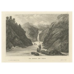
Antique Print of the Yamuna River in India, 1839
Located in Langweer, NL
Antique print titled 'Die Quelle des Jumna'. View of the Yamuna river, India. This print originates from 'Meyer´s Universum oder Abbildung und Beschreibung des Sehenswerthesten und M...
Category
19th Century Antique Benelux Maps
Materials
Paper
$104 Sale Price
20% Off
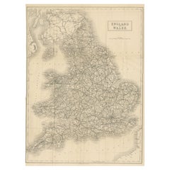
Antique Folding Map of England and Wales
Located in Langweer, NL
Antique map titled 'England and Wales'. Original folding map of England and Wales. Publishes by A. & C. Black, circa 1890.
Category
Late 19th Century Antique Benelux Maps
Materials
Paper
$397 Sale Price
20% Off
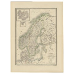
Antique Map of Scandinavia by Lapie, 1842
Located in Langweer, NL
Antique map titled 'Carte de la Scandinavie comprenant les Royaumes de Suède de Norwege et de Danemark'. Map of Scandinavia including Sweden, Norway and Denma...
Category
Mid-19th Century Antique Benelux Maps
Materials
Paper
$520 Sale Price
20% Off
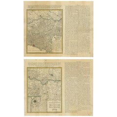
Set of Two Antique Maps of Northern Italy by Homann Heirs, 1754
Located in Langweer, NL
Set of two maps of northern Italy showing the position of troups during the war in April and March 1746. The area covered includes the course of the River Po between Valenza (north of Alexandria) and San Benedetto...
Category
Mid-18th Century Antique Benelux Maps
Materials
Paper
$841 Sale Price / set
20% Off
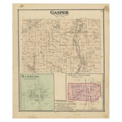
Antique Map of Gasper, Hamburg and West Elkton, 1871
Located in Langweer, NL
Antique map titled 'Gasper, Hamburg, West Elkton'. Original antique map of villages and communities of Ohio. This map originates from 'Atlas of Preble County Ohio' by C.O. Titus. Pub...
Category
Late 19th Century Antique Benelux Maps
Materials
Paper
$236 Sale Price
20% Off
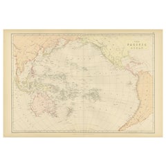
1882 Map of the Pacific Ocean Highlighting Islands and Surrounding Regions
Located in Langweer, NL
This 1882 map of the Pacific Ocean, published by Blackie and Son as part of the 'Comprehensive Atlas and Geography of the World,' presents a detailed and fascinating overview of the ...
Category
1880s Antique Benelux Maps
Materials
Paper
Antique Map of Western Polynesia, 1849
Located in Langweer, NL
Antique map titled 'Ost-Polynesien'. Detailed map of the western Pacific extending from the Celebes to Samoa and including part of Australia. Insets of...
Category
Mid-19th Century Antique Benelux Maps
Materials
Paper
$165 Sale Price
30% Off
Antique Map of Asia Minor, Region of the Nile and Region of the City of Carthage
Located in Langweer, NL
Three antique maps on one sheet titled 'Natoliae quae olim Asia Minor [with] Aegypti recentior descriptio [with] Carthaginis Celeberrimisinus Typus'. The first map covers Asia Minor,...
Category
16th Century Antique Benelux Maps
Materials
Paper
$472 Sale Price
20% Off
Original Antique 17th-Century Map of Shaangxi (Xensi) Province, China – by Blaeu
Located in Langweer, NL
Antique 17th-Century Map of Shaangxi Province, China – "Xensi" by Blaeu, Featuring Decorative Cartouches
Description: This exquisite 17th-century map of Shaangxi Province, historically known as Xensi Province, is an exceptional work by Johannes Blaeu, one of the most celebrated mapmakers of the Dutch Golden Age. Originally published in Blaeu's groundbreaking 'Novus Atlas Sinensis', this map is a masterful blend of geography and artistry. Blaeu's atlas was created in collaboration with Martino Martini, a Jesuit missionary whose insights into China provided European audiences with unprecedented geographical accuracy.
The map meticulously charts Shaangxi's mountains, rivers, mines, cities, and towns, with names rendered in Latin. It also features a detailed section of the Great Wall of China, a symbol of the region's historical significance. The artistry of this map is further enhanced by its elaborate cartouches. At the top, a Chinese warrior is beautifully illustrated, while the lower-left corner displays a deer, possibly a reference to the elusive Pere David deer...
Category
1650s Antique Benelux Maps
Materials
Paper
Old Antique Map of Borneo 'Kalimantan Indonesia, Sabah Malaysia & Brunei'
Located in Langweer, NL
Antique map titled 'Kaart van het Eyland Borneo'. Original antique map of the island of Borneo. Published 1724-1726 by Joannes van Braam and Gerard Onder de ...
Category
Early 18th Century Antique Benelux Maps
Materials
Paper
$1,513 Sale Price
20% Off
Antique Map of the Ancient British Isles by Janssonius 'circa 1640'
Located in Langweer, NL
Antique map titled 'Insularum Britannicarum Acurata Delineatio'. Original antique map of the ancient British Isles. England and Wales are labelled as B...
Category
Mid-17th Century Antique Benelux Maps
Materials
Paper
$898 Sale Price
20% Off
Cartographic Elegance of Touraine: A 17th-Century Map Showing French Heritage
Located in Langweer, NL
"Ducatus Turonensis - Touraine," is a original antique historical map of the Touraine region, which is located in the heart of France, centered...
Category
1630s Antique Benelux Maps
Materials
Paper
$463 Sale Price
20% Off
Old Original Miniature View of the Skyline of Miaco 'Kyoto, Japan', 1683
Located in Langweer, NL
Antique print titled 'De l'Asie Figure XXV, Miaco'.
Miniature view of the skyline of Miaco (Kyoto, Japan). This print originates from 'Description de l'Univers', published 1683.
...
Category
1680s French Antique Benelux Maps
Materials
Paper
$226 Sale Price
20% Off
Early Woodcut Map of Franconia and Surrounding Regions, 1628
Located in Langweer, NL
Title: Early Woodcut Map of Franconia and Surrounding Regions, 1628
Franconia (Franckenlande) is a region in Germany. Historically, Franconia was a significant part of the Holy Roma...
Category
1620s Antique Benelux Maps
Materials
Paper
Homann Heirs Map of France – Antique Hand-Colored, circa 1745
Located in Langweer, NL
Antique map titled 'Gallia Postarum geographice designata in qua Cursus Postarum Secundum Statum (..)'. Unusual postal map of France, with coat of arms. Very detailed map showing all...
Category
Mid-18th Century German Antique Benelux Maps
Materials
Paper
$378 Sale Price
20% Off
Antique Map of the Duchy of Lüneburg, Lower Saxony, Germany
Located in Langweer, NL
Antique map titled 'Ducatus Luneburgensis (..)'. Map of the Duchy of Lüneburg in Lower Saxony, Germany. Published by J. Janssonius, circa 1664.
Jan Janssonius (also known as Johann ...
Category
Mid-17th Century Antique Benelux Maps
Materials
Paper
$510 Sale Price
20% Off
Antique Map of Senegal, West Africa
Located in Langweer, NL
Original antique map titled 'Carta del Senegal'. Antique map of Senegal, West Africa. This map originates from 'Compendio della storia generale dei viaggi (..)'. Published by De la Harpe...
Category
Mid-18th Century Antique Benelux Maps
Materials
Paper
$340 Sale Price
20% Off
Antique Map of French Colonies – La France, 19th Century
Located in Langweer, NL
Title: Antique Map of French Colonies – La France, 19th Century
Description: This antique 19th-century map, titled La France, presents a detailed depiction of France’s overseas c...
Category
1870s Antique Benelux Maps
Materials
Paper
Antique Plan of Emden in Germany by Guicciardini, 1612
Located in Langweer, NL
Antique map Emden titled 'Civitas Embda, eo modo situata cum essit controversia inter ipsam et suum Comitem anno'. Small plan of the city of Emden, Germany, Also depicted is part of ...
Category
17th Century Antique Benelux Maps
Materials
Paper
$359 Sale Price
20% Off
Rare Fish Print of the Norway Redfish 'Sebastes Viviparus' and the Sculpin, 1842
Located in Langweer, NL
Antique print, titled: 'Poissons Plate 9 - La Sebaste du Nord (Sebastes septentrionalis) - Le Cotte Scorpion (Cottus scorpius).' - This rare plate shows the Norway redfish (Sebastes ...
Category
1840s Antique Benelux Maps
Materials
Paper
$718 Sale Price
20% Off
Territorium Francofurtens – Moses Pitt’s 17th-Century Map of Frankfurt
Located in Langweer, NL
Title: Territorium Francofurtens – Moses Pitt’s 17th-Century Map of Frankfurt
Description:
This rare 17th-century map, titled Territorium Francofurtens, was published by Moses ...
Category
1690s Antique Benelux Maps
Materials
Paper
Antique Map of Northern Germany and the Netherlands – circa 1806
Located in Langweer, NL
Title: Antique Map of Northern Germany and the Netherlands – circa 1806
Description: This finely engraved antique map, titled L'Allemagne 1re Feuille, depicts the northern regions...
Category
Early 1800s Antique Benelux Maps
Materials
Paper
Old German Antique Map of Iran and Arabia, 1866
Located in Langweer, NL
Antique map titled 'Vorder-Asien oder Iran, Turan, Arabien, Kleinasien und die Kaukasus Länder'. Large map centered on Iran. It shows the area from Turkey to Mumbai in India. Include...
Category
19th Century Antique Benelux Maps
Materials
Paper
$236 Sale Price
20% Off
Antique Map of Europe by Lapie, 1842
Located in Langweer, NL
Antique map titled 'Carte de l'Europe'. Map of Europe. This map originates from 'Atlas universel de géographie ancienne et moderne (..)' by Pierre M. Lapie and Alexandre E. Lapie. Pi...
Category
Mid-19th Century Antique Benelux Maps
Materials
Paper
$472 Sale Price
20% Off
Antique Map of the Low Countries by Seutter, c.1745
Located in Langweer, NL
Antique map titled ‘XVII Provinciae Belgii sive Germaniae Inferioris (..)’. Detailed hand colored map of the Low Countries. Includes colored decorative cartouche, compass rose and co...
Category
18th Century Antique Benelux Maps
Materials
Paper
$470 Sale Price
20% Off
Original Antique Map of Southern India and Ceylon 'Present-Day Sri Lanka'
By Jakob van der Schley
Located in Langweer, NL
Antique map titled 'Suite de la Carte de l'Indoustan (..) - Vervolg van de Kaart van Hindoestan (..)'. Original antique map of Southern India and Ceylon (present-day Sri Lanka). This...
Category
Mid-18th Century Antique Benelux Maps
Materials
Paper
$794 Sale Price
20% Off
Antique Map of French Polynesia by Cook Showing His Route, 1803
Located in Langweer, NL
Antique map Tahiti titled 'Kaart van de Eilanden in den omtrek van Otahiti (..)'. Antique map of French Polynesia with the tracks around the island of Tahiti by Captain Byron, Wallis...
Category
19th Century Antique Benelux Maps
Materials
Paper
$449 Sale Price
20% Off
Old Architectural Design Print of Villa Boulevard de Boulogne, Chabat, c.1900
Located in Langweer, NL
Antique print titled 'Villa Boulevard de Boulogne (Seine) Mr. L. Magne, Architecte'. This print depicts the design of a villa in France. Originates from 'La Brique et La Terre Cuite'...
Category
20th Century Benelux Maps
Materials
Paper
$118 Sale Price
20% Off
Original Antique Print of the Women of Tonga Tabu, c.1836
Located in Langweer, NL
Antique print titled 'Wohnung der Frauen des Palu'. Old print with a view of the hut of the women of Tonga Tabu. This print originates from 'Entdeckungs, Reise der Franzosischen Corv...
Category
19th Century Antique Benelux Maps
Materials
Paper
$245 Sale Price
20% Off
A Stunning 1744 Bowen Map: South East Germany & Queen of Hungary’s Dominions
Located in Langweer, NL
Title: A New and Correct Map of the South East part of Germany, 1744
This map by Emanuel Bowen, dating to around 1744, beautifully captures the southeastern part of Germany. The det...
Category
1740s Antique Benelux Maps
Materials
Paper
World Map in Two Hemispheres: Eastern & Western - 1802 Tardieu Atlas
Located in Langweer, NL
Antique Map with Title: "Mappemonde en Deux Hémisphères"
Publication Details:
- **Atlas Title:** Nouvel Atlas Universel de Géographie Ancienne et Moderne
- **Purpose:** For the Nouvelle Edition de la Géographie de Guthrie
- **Mapmakers:** P. F. Tardieu, with contributions from various geographical works
- **Publisher:** Chez Hyacinthe Langlois, Libraire, quai des Augustins, n° 45
- **Year:** An X - 1802 (French Revolutionary Calendar)
**Geographical Scope:**
This antique map illustrates a double-hemisphere world map, showing both the Eastern (Old World) and Western (New World) hemispheres. It provides a global perspective, capturing the entire known world as understood in the early 19th century.
**Map Features:**
- **Hemispheres Displayed:**
- **Western Hemisphere:** The Americas, labeled as "Hémisphère Occidental ou Nouveau Monde...
Category
Early 1800s Antique Benelux Maps
Materials
Paper
$435 Sale Price
20% Off
Antique Print with Coastal Views of Islands Near The American Coast by Cook
Located in Langweer, NL
Antique print America titled 'Gezigten der Landen van de West-Kust van Amerika, ten westen van Cook's Voyage'. Coastal views of various islands of the American coast, near Cook's riv...
Category
19th Century Antique Benelux Maps
Materials
Paper
$359 Sale Price
20% Off
Antique Map of the City of Batavia by Van der Aa 'c.1730'
Located in Langweer, NL
Antique map titled 'Plan de la Ville et du Chateau de Batavia en l'Isle de Iava - Ware affbeeldinge wegens het Casteel ende Stadt Batavia gelegen op groot Eylant Java'. Detailed plan...
Category
Mid-18th Century Antique Benelux Maps
Materials
Paper
$1,134 Sale Price
20% Off
1882 Map of Queensland, New South Wales, and Victoria with Detailed Features
Located in Langweer, NL
This 1882 map of Queensland, New South Wales, and Victoria, published by Blackie and Son as part of the 'Comprehensive Atlas and Geography of the World,' provides a detailed depictio...
Category
1880s Antique Benelux Maps
Materials
Paper
L'isle De La Martinique Caribbean Copper Engraving Original Handcoloring, 1704
Located in Langweer, NL
The original hand-colored map titled "Isle de la Martinique," published in 1704 and part of De Fer's Atlas Curieux, is a cartographic masterpiece offering an intricate portrayal of t...
Category
Late 19th Century Antique Benelux Maps
Materials
Paper
$699 Sale Price
20% Off
Large Sea Chart of the British Islands, 1918
Located in Langweer, NL
Antique map titled 'The British Islands'.
Large sea chart of the British Islands. It shows Ireland, Scotland, England, the Shetland Islands and part of Fra...
Category
1910s Vintage Benelux Maps
Materials
Paper
$529 Sale Price
20% Off
Western Roman Empire Map: British Isles & Gaul - 1802 Tardieu Atlas
Located in Langweer, NL
Antique Map Description and title: "Partie Occidentale de l'Empire Romain ou du Monde connu des Anciens d'Après d'Anville"
Publication Details:
- **Atlas Title:** Nouvel Atlas Univ...
Category
Early 1800s Antique Benelux Maps
Materials
Paper
$416 Sale Price
20% Off
Antique Map of Asia and the East Indies and Korea as a Peninsula, ca.1660
Located in Langweer, NL
Antique map titled 'Asiae nova delineatio'. Decorative map of Asia and the East Indies. The map shows Korea as a peninsula. In China the Great Wall is depicted, as well as a long str...
Category
17th Century Antique Benelux Maps
Materials
Paper
$2,364 Sale Price
20% Off
Large Antique County Map of Hertfordshire, England
Located in Langweer, NL
Antique map titled 'A Map of Hartfordshire from the best Authorities'. Original old county map of Hertfordshire, England. Engraved by John Cary. Originates from 'New British Atlas' b...
Category
Early 19th Century Antique Benelux Maps
Materials
Paper
$264 Sale Price
20% Off
Antique Map of Southern Mindanao, Sulawesi and Gilolo 'Halmahera', Indonesia
Located in Langweer, NL
Antique lithograph, with a text vignette on Borneo. This important map for the Philippines shows Southern Mindanao, and the area between Sulawesi, Mindanao and Gilolo (today: Halmahe...
Category
Early 19th Century Antique Benelux Maps
Materials
Paper
$534 Sale Price
20% Off
Old Prints of Costumes of Hungary, Tyrol, Sweden, Romania, Holland, Etc., Ca1875
Located in Langweer, NL
Antique costume print including many different costumes including costumes of Hungary, Tyrol, Sweden and others.
This print originates from 'Blätter für Kostümkunde. Historische ...
Category
1870s Antique Benelux Maps
Materials
Paper
$208 Sale Price
20% Off
Antique Map of the Bay of Cordes and Surroundings by Hawkesworth, 1774
Located in Langweer, NL
Antique print titled 'Baye et Havre de Cordes (..)'. Four maps on the one sheet of; Cordes Bay, Port Famine, Woods Pay, Port Gallant, Fortescue Bay, Chile based on the voyage of John...
Category
18th Century Antique Benelux Maps
Materials
Paper
$105 Sale Price
20% Off
Antique Map of the Province of Zuid-Holland by Keizer & De Lat, 1788
Located in Langweer, NL
Antique map titled 'La Sud Hollande (..)'. Uncommon antique map of the province of Zuid-Holland, the Netherlands. This map originates from 'Nieuwe Natuur- Geschied- en Handelkundige ...
Category
18th Century Antique Benelux Maps
Materials
Paper
Pl. XLII Villa a Fontenay-Sous-Bois, Chabat, C.1900
Located in Langweer, NL
Antique print titled 'Villa A Fontenay-Sous-Bois, Mr. Ed. Jandelle-Ramier, Architecte'. This print depicts the design of a villa in France. Originates from 'La Brique et La Terre Cui...
Category
20th Century Benelux Maps
Materials
Paper
$113 Sale Price
20% Off
Antique Map of Franconia, a region of Germany, '1811'
By John Cary
Located in Langweer, NL
Antique map titled 'A New Map of the Circle of Franconia'. Detailed map of Franconia in Northwestern Germany. Covers from Upper Saxony south to Swabia, west to the Lower Rhine and we...
Category
Early 19th Century Antique Benelux Maps
Materials
Paper
$236 Sale Price
20% Off
Old Map Showing Info Related to the Ottoman Wars including Conflict Dates, c1690
Located in Langweer, NL
"Corso del Danubio da Vienna Sui a Vicopoli, e Paesi Adiacenti - Northwestern Sheet", Coronelli, Vincenzo Maria
Subject: Central Europe, Danube River
Period: 1690 (circa)
Publicatio...
Category
1690s Italian Antique Benelux Maps
Materials
Paper
$624 Sale Price
20% Off
Print of the Solemn Celebration Sapan Giacche in Pegu, Burma 'Myanmar', 1725
Located in Langweer, NL
Antique print, titled: 'Fete Solennelle de Pegu appelee Sapan Giacche'
This plate shows the Solemn celebration called Sapan Giacche in Pegu or Bago, the capital of the Bago Regio...
Category
1720s Antique Benelux Maps
Materials
Paper
$321 Sale Price
20% Off
17th-Century Original Antique Map of Guangxi Province, China – Qvangsii by Blaeu
Located in Langweer, NL
Title: Antique 17th-Century Map of Guangxi Province, China – "Qvangsii" by Blaeu, Richly Illustrated and Colored
Description: This fascinating 17th-century map of Guangxi Province, historically referred to as "Qvangsii," was crafted by Johannes Blaeu and published in 1655 as part of the *Novus Atlas Sinensis*. Blaeu’s atlas, created in collaboration with Jesuit missionary Martino Martini, introduced European audiences to the geography of China in an unprecedented way. Guangxi Province, known for its striking karst landscapes and important historical trade routes, is depicted here in remarkable detail.
The map highlights the province’s topography, including mountain ranges, rivers, and towns, all meticulously engraved and labeled in Latin. It also captures key trade connections and cultural significance, as Guangxi historically served as a bridge between China and Southeast Asia. The decorative cartouche at the top left is adorned with figures in traditional Chinese costumes, symbolizing the cultural richness of the region and adding artistic elegance to the map.
This map was engraved using the copperplate technique, known for its ability to produce fine, detailed lines. The hand-coloring further enhances the visual impact, clearly distinguishing territorial divisions and natural features. Blaeu’s reputation for both accuracy and artistry is evident in this piece, making it a collector’s item of historical and aesthetic significance.
Guangxi Province, historically referred to as "Qvangsii," is renowned for its breathtaking natural beauty, unique karst landscapes, and cultural diversity. It is famous for its dramatic limestone formations, verdant hills, and picturesque rivers, making it one of the most visually striking regions in China. Guangxi has historically been a significant trade corridor between China and Southeast Asia, contributing to its cultural and economic importance. It is also home to various ethnic minority groups, including the Zhuang, Miao, and Dong, whose traditions and festivals enrich the region's cultural tapestry.
Important places in Guangxi include Guilin, known for its iconic karst mountains and the Li River, which has inspired poets and artists for centuries. Yangshuo, a town near Guilin, is celebrated for its stunning natural scenery and outdoor activities. Nanning, the provincial capital, is an important economic and cultural hub. The Longji Rice Terraces, also known as the Dragon’s Backbone, are an engineering marvel and a popular tourist destination. Beihai, a coastal city, is known for its silver beaches and maritime trade history.
Keywords for this map include 17th-century China map, Guangxi Province, Qvangsii map, antique Chinese maps...
Category
1650s Antique Benelux Maps
Materials
Paper
Antique Map of the Arabian Desert by Cellarius, 1731
Located in Langweer, NL
Antique map titled 'Arabia Petraea et Deserta.' Arabian desert with present day Israel, Jordania, Iraq. With decorative cartouche showing dromedaries. T...
Category
18th Century Antique Benelux Maps
Materials
Paper
$165 Sale Price
20% Off
Antique Map of the Region of Maine by Janssonius, circa 1650
By Johannes Janssonius
Located in Langweer, NL
Antique map of France titled 'Diocese du Mans vulgo le Mains'. Decorative map of the region of Maine, France. Published by J. Janssonius.
Category
Mid-17th Century Antique Benelux Maps
Materials
Paper
$425 Sale Price
20% Off
Antique Map of Spain by Covens & Mortier, c.1740
Located in Langweer, NL
Antique map Spain titled 'L?Espagne dressée sur la Description qui en a eté faite par Rodrigo Mendez Sylva (..)'. Beautiful map of Spain with decorat...
Category
18th Century Antique Benelux Maps
Materials
Paper
$496 Sale Price
20% Off
Cartographic Treasures: A Journey Through the Gascogne and Guyenne Regions, 1680
Located in Langweer, NL
The antique map titled "Gouvernement de La Guienne & Gascogne" depicts the region of Gascogne and Guyenne, known for their wine production, in France.
This map is a rare edition, u...
Category
Late 17th Century Antique Benelux Maps
Materials
Paper
$709 Sale Price
20% Off
Antique Map of the Holy Land, with vignette of the Garden of Eden
Located in Langweer, NL
Antique map titled 'Hondius his Map of Paradise'. Beautiful map of the region bounded by the Holy Land. Syria, Mesopotamia, Chaldea and part of Arabia. W...
Category
Mid-17th Century Antique Benelux Maps
Materials
Paper
$453 Sale Price
20% Off
Antique Colourful and Decorative County Map of Bedfordshire, England, 1804
Located in Langweer, NL
Antique county map of Bedfordshire first published c.1800. Villages, towns, and cities illustrated include Bedford, Todington, and Potton.
Charl...
Category
Early 1800s Antique Benelux Maps
Materials
Paper
$307 Sale Price
20% Off
Antique Map of the City of Verdun by Merian, c.1650
Located in Langweer, NL
Antique map titled 'Verdun'. Orginal antique map of Verdun, a small city in the Meuse department in Grand Est in northeastern France. This map originates from 'Topographia Germaniae'...
Category
17th Century Antique Benelux Maps
Materials
Paper
$55 Sale Price
20% Off
Île-de-France Map, including Paris - Hand-Colored Engraving by F. De Wit c. 1688
Located in Langweer, NL
Title: Hand-Colored 17th-Century Map of Île-de-France by Frederik De Wit c. 1688
Description: This striking map, "Le Gouvernement de l’Isle de France," showcases the Île-de-France r...
Category
1680s Antique Benelux Maps
Materials
Paper
Badajoz 1901: A Cartographic Record of Extremadura's Largest Province in Spain
Located in Langweer, NL
This original antique map for sale is of the province of Badajoz, part of the autonomous community of Extremadura in Spain, dated 1901. It illustrates several important features:
Th...
Category
Early 1900s Antique Benelux Maps
Materials
Paper
$293 Sale Price
20% Off
Antique Map of the Holy Land, showing the travels of Abraham, Isaac and Jacob
Located in Langweer, NL
Antique map titled 'Tabula Itineraria Patriarcharum Abrahami, Isaaci et Iacobi'. Decorative regional map of the Holy Land, showing the travels of Abraham, Isaac and Jacob. Published ...
Category
Mid-17th Century Antique Benelux Maps
Materials
Paper
$529 Sale Price
20% Off
Pl. XX Villa Mon Caprice, Chabat, c.1900
Located in Langweer, NL
Antique print titled 'Villa mon Caprice Villers-Sur-Mer. Mr. E. Macé, Architecte'. This print depicts the design of a building in France. Originates from 'La Brique et La Terre Cuite...
Category
20th Century Benelux Maps
Materials
Paper
$121 Sale Price
20% Off
Old Map of the East Coast of Honshu with an Inset, Japan, c.1785
Located in Langweer, NL
Antique map titled ‘Part of Japan or Nippon'.
View of the Coast of Japan when we first saw it: The Hill a bearing West 3 miles distant. London Published by Allexer Hogg at the Kings Arms...
Category
1780s Antique Benelux Maps
Materials
Paper
$208 Sale Price
20% Off
Recently Viewed
View AllMore Ways To Browse
Greek Key Dresser
Green Glass Bud Vase Vintage
Gucci Tray
Half Moon Shelves
Handblown Glass Decanter
Heart Shaped Glass Dish
Hepplewhite Drop Leaf Table
Herend Cup
Hermes Dish
Horse Head Barware
Horse Mantel Clock
Large Limoges Platter
Michelangelo David Statue
Michelin Guide
Persian Khatam
Royal Worcester Aesthetic
Russell Woodard Aluminum
Russian Silver Niello
