Continental Europe Maps
to
4,203
5,136
5,489
200
5,135
1
2
2
2
1
2,810
2,007
318
1
179
12
1
68
3
3
3
2
3
1
5,117
17
11
10
8
408
147
81
80
52
5,136
5,136
5,136
104
59
20
14
13
Item Ships From: Continental Europe
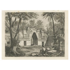
Original Rare Antique Print of a Ruin in Peru, 1857
Located in Langweer, NL
Untitled print of a ruin in Peru. This print originates from 'Die Kunstwerke vom Alterthum bis auf die Gegenwart, oder, Wegweiser durch das ganze Gebiet der bildenden Kunst : enthalt...
Category
19th Century Antique Continental Europe Maps
Materials
Paper
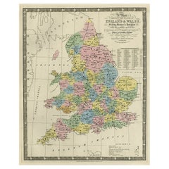
Colourful Antique Map of England and Wales Divided in Counties, 1854
Located in Langweer, NL
Antique map titled 'A Map Shewing the Places in England & Wales Sending Members to Parliament with the numbers returned, divisions of counties and population, places of county electi...
Category
19th Century Antique Continental Europe Maps
Materials
Paper
$617 Sale Price
20% Off
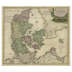
Antique Map of Denmark with Schleswig-Holstein and the South of Sweden, c.1750
Located in Langweer, NL
Antique map titled 'General Charte von Konigreich Daenemark nebst dem Herzogthum Holstein.' Denmark with Schleswig-Holstein and the southern coast of Sweden. The large title cartouch...
Category
18th Century Antique Continental Europe Maps
Materials
Paper
$351 Sale Price
20% Off
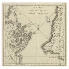
Antique Map of Cook's Strait in New Zealand, 1803
Located in Langweer, NL
Antique map New Zealand titled 'Kaart van Cooks Straat in Nieuw Zeeland'. Antique map of Cook's Strait in New Zealand. Originates from 'Reizen ...
Category
19th Century Antique Continental Europe Maps
Materials
Paper
$617 Sale Price
20% Off
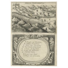
Very Rare Antique Print of the Valley of Terebinthus in Arabia, 1673
Located in Langweer, NL
Antique print titled 'Vallis Therebinthi'. Old print of the Valley of Terebinthus, below a decorative cartouche with lettered key and surrounded by 2 cherubins. This print originates...
Category
17th Century Antique Continental Europe Maps
Materials
Paper
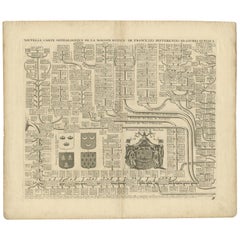
Two Antique Genealogy Charts of the Royal House of France, Coats of Arms, 1732
Located in Langweer, NL
Antique print titled 'Nouvelle Carte Genealogique de la Maison Royale de France (..)'. Set of two prints depicting a genealogical chart of the Royal ...
Category
18th Century Antique Continental Europe Maps
Materials
Paper
$522 Sale Price / set
20% Off
Antique Map of Martinique with Title Cartouche Garnished with Sugar Cane, c.1760
Located in Langweer, NL
Antique map titled 'Het Westindisch Eiland Martenique'. Decorative map of Martinique filled with good detail of roads, topography, soundings, villages, windmills, and plantations. Th...
Category
18th Century Antique Continental Europe Maps
Materials
Paper
$884 Sale Price
20% Off
Rare Antique Miniature Map of Pakistan, India and Cambaia, ca.1618
Located in Langweer, NL
Old 17th century miniature antique map of 'Cambaia' , from the 1616 edition of Jadocus Hondius Atlas by Petrus Bertius.
Original copperplate engraving with hand coloring.
Carto...
Category
17th Century Antique Continental Europe Maps
Materials
Paper
$370 Sale Price
20% Off
Antique Map of China, Korea, Japan and the Northern Philippines, circa 1780
Located in Langweer, NL
Antique map titled 'Carte de l'Empire de la Chine de la Tartarie Chinoise, et du Royaume de Corée'. Interesting and detailed map of China, Korea, Japan and the Northern Philippines. ...
Category
Late 18th Century Antique Continental Europe Maps
Materials
Paper
$285 Sale Price
20% Off
Historic 1857 Map of North-East Africa & Arabia – Fine Engraving
Located in Langweer, NL
North-East Africa and Arabia Map 1857
This detailed antique print shows “Mittel- und Nord-Afrika (östl. Theil) und Arabien” meaning “Central and North Africa (eastern part) and Arab...
Category
Mid-19th Century German Antique Continental Europe Maps
Materials
Paper
Pl. 81 Antique Print of Decorative Art in the 17th Century by Racinet, 1869
Located in Langweer, NL
Old print of decorative art in the 17th century. This print originates from 'L'Ornement polychrome'. A beautiful work containing about 2000 patterns of all the styles of Art old and ...
Category
19th Century Antique Continental Europe Maps
Materials
Paper
Antique Map of the Netherlands by Guicciardini, 1582
Located in Langweer, NL
Antique map titled 'Hollandiae Cattorum Regionis Typus'. Early copper engraving of the Netherlands in the 2nd state, numbered 30 bottom right. This map originates from 'Description d...
Category
16th Century Antique Continental Europe Maps
Materials
Paper
$565 Sale Price
20% Off
Antique Map of South America by Johnston '1909'
Located in Langweer, NL
Antique map titled 'South America, Southern Sheet'. Depicting Chile, Argentina, Brazil, Patagonia, the Falkland Island and more. With inset maps of Valparaiso, Rio de Janeiro and Bue...
Category
Early 20th Century Continental Europe Maps
Materials
Paper
$237 Sale Price
20% Off
Antique Genealogy Chart of the Margraviates and Baden-Durlach, Germany, 1732
Located in Langweer, NL
Antique print titled 'Genealogie de la Maison de Baden (..)'. Chart of the genealogy of the Margraviates Baden-Baden and Baden-Durlach. This print orginates from 'Atlas Historique'. ...
Category
18th Century Antique Continental Europe Maps
Materials
Paper
$266 Sale Price
20% Off
Antique Map of New Zealand and Tasmania, 1904
Located in Langweer, NL
This large antique map is taken from; 'Andrees Allgemeiner Handatlas in 126 Haupt-Und 139 Nebenkarten', Bielefeld; Leipzig: Velhagen & Klasing 1899. Andrees Allgemeiner Handatlas was...
Category
20th Century Continental Europe Maps
Materials
Paper
$85 Sale Price
20% Off
Antique Map of the Region of Verona 'Italy' by Ortelius, circa 1584
Located in Langweer, NL
Antique map titled 'Veronae Urbis Terratorium'. Original antique map of the Verona region, Italy. Centered on Verona, and including Mantua, and Lago de Garda. Published by A. Orteliu...
Category
Late 19th Century Antique Continental Europe Maps
Materials
Paper
$855 Sale Price
20% Off
Antique Map of Belgium by J. Tallis, circa 1851
Located in Langweer, NL
A highly decorative and detailed mid-19th century map of Belgium which was drawn and engraved by J. Rapkin (vignettes by J. Marchant and J. B. Allen) an...
Category
Mid-19th Century Antique Continental Europe Maps
Materials
Paper
$237 Sale Price
20% Off
Pl. 7 Antique Print of Moorish Garden Elements by Le Rouge, 1776
Located in Langweer, NL
Antique print titled 'Pavillon Moresque Temple - Temple Moresque'. Copper engraving showing Moorish garden elements including a pavilion and temple. This print originates from 'Jardi...
Category
18th Century Antique Continental Europe Maps
Materials
Paper
Antique Map of Arabia by Tardieu '1843'
Located in Langweer, NL
Antique map titled 'Arabie'. Attractive small map of Arabia. This map originates from 'Dictionnaire Universel de Geographie Moderne' 4th Edition, by A.Pe...
Category
Mid-19th Century Antique Continental Europe Maps
Materials
Paper
$190 Sale Price
20% Off
Antique Print of Oedidee, a Native from Bora Bora, 1803
Located in Langweer, NL
Antique print titled 'Oedidee Jongman van Bolabola'.
Antique print of Oedidee, a native from Bora Bora. Originates from 'Reizen Rondom de Waereld door James Cook (..)'.
Artis...
Category
Early 1800s Antique Continental Europe Maps
Materials
Paper
$171 Sale Price
20% Off
Antique Map of the Region of Poitou by Ortelius, circa 1600
Located in Langweer, NL
Antique map titled 'Poictou'. Original antique map of the region of Poitou, a former province of west-central France whose capital city was Poitiers. Published by A. Ortelius, circa ...
Category
Early 17th Century Antique Continental Europe Maps
Materials
Paper
$570 Sale Price
20% Off
Old Map of the Oceans Around Australia, Indonesia and New Zealand, 1880
Located in Langweer, NL
Antique map titled 'Océanie'.
Old map of the oceans around Australia, Indonesia and New Zealand. With vignettes of people from Polynesia and the old monument Laparouse. This map ...
Category
1880s Antique Continental Europe Maps
Materials
Paper
$209 Sale Price
20% Off
Antique Map of Artois in the North of France by Famous Mapmaker Blaeu, c.1640
Located in Langweer, NL
Antique map titled 'Artesia Comitatus Artois'. Map of Artois or Artesia, France. Artois is former province located in the northwestern part of France, boarding Belgium (Flanders) on ...
Category
17th Century Antique Continental Europe Maps
Materials
Paper
$456 Sale Price
20% Off
Original Old Map East of Stockholm, the Island Ljusterö and Värmdö, Sweden, 1720
Located in Langweer, NL
Antique map titled 'Accurate Carte der Upländischen Scheren mit der Situation und Gegend umb die Konigle Schwedisch Haupt und Residentz Stadt Stockholm.'
Map of the area east of ...
Category
1720s Antique Continental Europe Maps
Materials
Paper
$1,093 Sale Price
20% Off
De Natsche – Ceremony for the King's Son, Tonga c.1795
Located in Langweer, NL
De Natsche – Ceremony for the King's Son, Tonga c.1795
This antique print depicts a grand ceremony held in honour of the son of the King of Tonga, known as the Natsche, in the villa...
Category
Early 1800s European Antique Continental Europe Maps
Materials
Paper
$560 Sale Price
20% Off
Antique Map of Siberia and Chinese Tartary, Incl Nova Zembla, ca.1732
Located in Langweer, NL
Antique map of Tartary titled 'Nieuwe Kaart van Tartarie na de alderlaatste ondekking int ligt gebracht tot Amsterdam door Isaak Tirion'.
Map op Siberia and Chinese tartary. In t...
Category
1730s Antique Continental Europe Maps
Materials
Paper
$817 Sale Price
20% Off
Antique Map of Denmark and Southern Sweden, c.1658
Located in Langweer, NL
Antique map titled 'Royaume de Danemarq.' Map centered on Sjaelland and covers all of Denmark and part of southern Sweden where a dramatic title cartouche obscures the interior. Sour...
Category
17th Century Antique Continental Europe Maps
Materials
Paper
$256 Sale Price
20% Off
Original Antique Print of a Castle in Madrid, Spain, 1833
Located in Langweer, NL
Antique print titled 'Schloss zu Madrid'.
Lithograph of a castle in Madrid, Spain. This print originates from 'Neuen Bildergalerie für die Jugend'.
Artists and Engravers: Ano...
Category
1830s Antique Continental Europe Maps
Materials
Paper
Antique Map of the German Empire by Levasseur, '1875'
Located in Langweer, NL
Antique map titled 'Carte générale de l'Europe Centrale (..)'. Large map of the German Empire. This map originates from 'Atlas de Géographie Moderne Phys...
Category
Late 19th Century Antique Continental Europe Maps
Materials
Paper
$380 Sale Price
20% Off
Old Map of the Western Part of Central Europe, c.1680
Located in Langweer, NL
Antique map titled 'Carta nova accurate del Passagio et strada dalli Paesi Bassi'. Old map of the western portion of Central Europe. Oriented to the Northeast.
Artists and Engrav...
Category
17th Century Antique Continental Europe Maps
Materials
Paper
$356 Sale Price
20% Off
Antique Map of the Prussian Monarchy by Levasseur, '1875'
Located in Langweer, NL
Antique map titled 'Carte générale de la Monarchie Prussienne (..)'. Large map of the Prussian Monarchy. This map originates from 'Atlas de Géographie Moderne Physique et Politique' ...
Category
Late 19th Century French Antique Continental Europe Maps
Materials
Paper
$332 Sale Price
30% Off
Antique Genealogy Chart of the Landgraviate Hessen-Kassel, Germany, 1732
Located in Langweer, NL
Antique print titled 'Genealogie de la Maison de Hesse Cassel'. Chart of the genealogy of the Landgraviate Hessen-Kassel / Hesse-Cassel. This includes the coats of arms of both Hesse-Cassel and Hesse-Darmstadt. This print orginates from 'Atlas Historique'.
The Landgraviate of Hesse-Kassel (German: Landgrafschaft Hessen-Kassel), spelled Hesse-Cassel during its entire existence, was a state in the Holy Roman Empire that was directly subject to the Emperor. The state was created in 1567 when the Landgraviate of Hesse was divided upon the death of Philip I, Landgrave of Hesse. His eldest son William IV inherited the northern half of the Landgraviate and the capital of Kassel. The other sons received the Landgraviate of Hesse-Marburg, the Landgraviate of Hesse-Rheinfels and the Landgraviate of Hesse-Darmstadt.
During the Napoleonic reorganisation of the Empire in 1803, the Landgrave of Hesse-Kassel was elevated to an Electorate and Landgrave William IX became an Imperial Elector. Many members of the Hesse-Kassel House served in the Danish military gaining high ranks and power in the Oldenburg realm due to the fact that many Landgraves were married to Danish princesses...
Category
18th Century Antique Continental Europe Maps
Materials
Paper
$247 Sale Price
20% Off
Antique Map of the Kingdom of Sweden and Norway by Keizer & de Lat, 1788
Located in Langweer, NL
Antique map titled 't Koninkryk van Zweden en Noorwegen'. Uncommon original antique map of the Kingdom of Sweden and Norway. This map originates from 'Nieuwe Natuur- Geschied- en Han...
Category
Late 18th Century Antique Continental Europe Maps
Materials
Paper
$332 Sale Price
20% Off
Rare Original Map of New Amsterdam (New York) – “Restitutio”, ca. 1674 –
Located in Dronten, NL
An exceptionally rare and original 17th-century engraving of New Amsterdam, now New York City, published by the renowned Amsterdam cartographer Carel (Carolus) Allard around 1674. Kn...
Category
17th Century Dutch Antique Continental Europe Maps
Materials
Paper
Antique Map of Landes ‘France’ by V. Levasseur, 1854
By Victor Levasseur
Located in Langweer, NL
Antique map titled 'Dépt. des Landes'. Map of the French department Landes, France. This area is known for its production of Chalossais, a white cow cheese with a gentle, acidic edge...
Category
Mid-19th Century Antique Continental Europe Maps
Materials
Paper
$171 Sale Price
20% Off
Antique Map of Scandinavia by Van der Aa 'circa 1710'
Located in Langweer, NL
Antique map titled 'Scandinavie Septentrionale' and 'Scandinavie Meridionale'. Copper engraving with two maps on one sheet. The upper map depicts Northern Scandinavia with Norway, Sw...
Category
Early 18th Century Antique Continental Europe Maps
Materials
Paper
$665 Sale Price
20% Off
Antique Map of Siberia by Levasseur '1875'
Located in Langweer, NL
Antique map titled 'Carte de la Russie d'Asie Sibérie'. Large map of Siberia. This map originates from 'Atlas de Géographie Moderne Physique et Politique' by A. Levasseur. Published ...
Category
Late 19th Century Antique Continental Europe Maps
Materials
Paper
$380 Sale Price
20% Off
Antique Map of the City of Jerusalem by N. Visscher, 1702
Located in Langweer, NL
Antique map titled 'Die Heylige en Wytvermaerde stadt Jerusalem Eerst Genaemt Salem, Genesis 14 vers 18'. This map originates from 'Biblia. Ouden ende Nieuwen Testaments (..)'. Publi...
Category
Early 18th Century Antique Continental Europe Maps
Materials
Paper
$3,279 Sale Price
20% Off
1882 Original Antique Map of New Zealand with Inset of Auckland's Environs
Located in Langweer, NL
This 1882 map of New Zealand, published by Blackie and Son as part of the 'Comprehensive Atlas and Geography of the World,' provides a detailed representation of the North Island and...
Category
1880s Antique Continental Europe Maps
Materials
Paper
Sweden & Norway – Antique Map of Scandinavia with Stockholm Inset, 1865
Located in Langweer, NL
Sweden & Norway – Antique Map of Scandinavia with Stockholm Inset, 1865
This finely detailed antique map titled Sweden & Norway (Scandinavia) offers a comprehensive 19th-century vie...
Category
Mid-19th Century English Antique Continental Europe Maps
Materials
Paper
$261 Sale Price
20% Off
Antique Map of Prussia by Blaeu, circa 1635
By Willem Blaeu
Located in Langweer, NL
Antique map titled 'Prussiae Nova Tabula'. Rare early edition of Blaeu's map of Prussia, embellished with a gorgeous large format cartouche, compass ros...
Category
Mid-17th Century Antique Continental Europe Maps
Materials
Paper
$684 Sale Price
20% Off
Antique Nautical Portolano of Isle De Poro by Antoine Roux, France, 1844
By Antoine Roux
Located in Milan, IT
Antique portolano, nautical map of Isle De Poro engraved on a copper plate by Antoine Roux, Marseille France 1844, from his work Recueil des principaux plans des ports et de Rades de...
Category
1840s French Antique Continental Europe Maps
Materials
Paper
Antique Map of Spain, Mauritia and Africa by H. Kiepert, circa 1870
By Heinrich Kiepert
Located in Langweer, NL
Antique map titled 'Hispania, Mauretania et Africa'. This map originates from 'Atlas Antiquus. Zwölf Karten zur Alten Geschichte' by H. Kiepert. Published in Berlin, circa 1870.
Category
Late 19th Century Antique Continental Europe Maps
Materials
Paper
$142 Sale Price
20% Off
Antique Map of the Region of Venice, Italy by F. De Wit, circa 1700
Located in Langweer, NL
Antique map of the Dominion of Venice, extending from Stato di Milano and Genoa to Istria. Including Lake Garda, Venice and Istria.
Category
Early 18th Century Antique Continental Europe Maps
Materials
Paper
$560 Sale Price
20% Off
South Sweden Map with Inset of Halmstad – Antique Map by Frederik de Wit, c.1680
Located in Langweer, NL
South Sweden Map with Inset of Halmstad – Antique Map by Frederik de Wit, c.1680
This richly detailed antique map titled Accurata Scaniae, Blekingae et Hallandiae Descriptio present...
Category
Late 17th Century Dutch Antique Continental Europe Maps
Materials
Paper
$803 Sale Price
20% Off
Plan of Pondicherry Fortifications and Attacks, France, c.1750
Located in Langweer, NL
Plan of Pondicherry Fortifications and Attacks, France, c.1750
This finely engraved map depicts the fortified city of Pondicherry, titled "Plan de Pondichéry et de ses attaques." It...
Category
Mid-18th Century French Antique Continental Europe Maps
Materials
Paper
19th-Century Decorative Map of British America with Arctic and Pacific Vignettes
Located in Langweer, NL
19th-Century Decorative Map of British America with Arctic and Pacific Vignettes
This 19th-century map of British America, drawn and engraved by J. Rapkin and published by J & F T...
Category
1850s Antique Continental Europe Maps
Materials
Paper
An Original Antique Mid-17th Century Blaeu Map of Styria in Southeastern Austria
Located in Langweer, NL
This is an antique map of Styria (referred to as “Stiria” or “Steyrmarck”), published by the renowned Dutch cartographer Willem Janszoon Blaeu (often simply “Blaeu”). The first editi...
Category
1640s Antique Continental Europe Maps
Materials
Paper
Antique Map of Mecklenburg-Vorpommern in Germany by J.B. Homann, c.1720
Located in Langweer, NL
Antique Map of Mecklenburg-Vorpommern by J.B. Homann, c.1720
Old colored antique map of Mecklenburg-Vorpommern by Johann Baptist Homann. This stunning map, titled "Ducatus Meklenbur...
Category
1720s Antique Continental Europe Maps
Materials
Paper
$513 Sale Price
20% Off
Guadalajara 1902: A Cartographic Image of Castilla-La Mancha's Northern Province
Located in Langweer, NL
The map illustrates the province of Guadalajara, part of the autonomous community of Castilla-La Mancha in Spain, as of 1902. The map includes various geographic and infrastructural ...
Category
Early 1900s Antique Continental Europe Maps
Materials
Paper
$275 Sale Price
20% Off
Map of Choromandel & Malabar, Incl Kerala, Tamil Nadu & Part of Sri Lanka, 1726
Located in Langweer, NL
Antique map titled 'Nieuwe kaart van Choromandel ende Malabar.'
Original antique map of Southern India documenting the VOC's areas of influence. Included is Kerala, Tamil Nadu...
Category
1720s Antique Continental Europe Maps
Materials
Paper
$815 Sale Price
30% Off
18th Century Original Dutch Map of Martinique in The West Indies by Isaak Tirion
Located in Langweer, NL
This is an 18th-century Dutch map of Martinique, titled *Het Westindisch Eiland Martinique*. The map was produced by Isaak Tirion, a renowned Dutch cartographer and publisher known for his precise and beautifully crafted maps. The cartouche in the lower left corner, adorned with decorative elements, adds to the aesthetic appeal of the map.
### Key Features:
- Martinique: The map offers detailed topographical information of the island, including mountains, rivers, and settlements.
- Geographical Details: Locations such as Fort Royal, Bay de St. Pierre, and Point de Cloche are marked, showcasing significant features of the island.
- Cartouche: The ornate cartouche, featuring tropical plants, reflects the importance of the island's agricultural production during the colonial period, particularly its sugar plantations.
This map captures Martinique during its time as a French colony and provides valuable insight into the island’s layout and strategic significance in the Caribbean. The attention to coastal detail highlights the importance of Martinique as a hub of maritime activity.
The map’s combination of aesthetic elegance and cartographic precision makes it a remarkable piece for collectors and those interested in Caribbean colonial...
Category
1760s Antique Continental Europe Maps
Materials
Paper
$418 Sale Price
20% Off
Map of Comitatus Marchia et Ravensberg: Historical Counties in Germany, c.1660
Located in Langweer, NL
Antique map titled 'Comitatus Marchia et Ravensberg'. This map depicts two historical counties of the Holy Roman Empire: Marks and Ravensberg. Major cities, towns, mountains, and riv...
Category
Mid-17th Century Antique Continental Europe Maps
Materials
Paper
$418 Sale Price
20% Off
1876 Map of the United States: Detailing the Railroads and Unsettled Territories
Located in Langweer, NL
Stanford’s Smaller Railway Map of the United States, 1876
This original 1876 map, titled "Stanford's Smaller Railway Map of the United States Distinguishing the Unsettled Territorie...
Category
1870s Antique Continental Europe Maps
Materials
Paper
Rare 1864 Civil War Era Map of Arkansas, Mississippi, and Louisiana
Located in Langweer, NL
Title: Rare 1864 Civil War Era Map of Arkansas, Mississippi, and Louisiana
Description: This captivating antique map, titled "Johnson's Arkansas, Mississippi, and Louisiana," was pu...
Category
1860s Antique Continental Europe Maps
Materials
Paper
Mediterranean, Black Sea & Ottoman Empire Map 1853
Located in Langweer, NL
Mediterranean, Black Sea & Ottoman Empire Map 1853
This impressive antique print shows the Mediterranean and Black Sea regions with a focus on the Ottoman Empire, titled “Das Mittel...
Category
Mid-19th Century German Antique Continental Europe Maps
Materials
Paper
Decorative Antique Print of Nice Near Mont Boron in France, c.1865
Located in Langweer, NL
Antique print titled 'Nice, vue prise de l'extremité du Mont Boron'. View of the city of Nice, near Mont Boron, France. This print originates from 'Nice Et Savoie, Sites Pittoreques,...
Category
19th Century Antique Continental Europe Maps
Materials
Paper
$437 Sale Price
20% Off
Topographical and Infrastructure Map of the Province of Valencia, 1901
Located in Langweer, NL
A historical map of the province of Valencia, dated 1901. The map includes intricate details such as topographical features, with mountain ranges and river systems prominently marked...
Category
Early 1900s Antique Continental Europe Maps
Materials
Paper
$494 Sale Price
20% Off
Antique Map of the French Coast at Boulogne and Picardy
Located in Langweer, NL
Antique map titled 'Les Costes du Boulenois et de la Picardie'. Map of the French coast at Boulogne and Picardy. Left a large wind rose. Part of a bundled collection of plans of batt...
Category
Early 18th Century Antique Continental Europe Maps
Materials
Paper
$465 Sale Price
20% Off
Ottoman Empire in Europe – Antique Map by Reilly, Vienna, 1796
Located in Langweer, NL
Map of the Ottoman Empire in Europe – Reilly, Vienna circa 1794-1796
This large original antique map, titled “Karte von dem Oschmanischen Reiche in Europa,” was published between 17...
Category
Late 18th Century Austrian Antique Continental Europe Maps
Materials
Paper
Recently Viewed
View AllMore Ways To Browse
Vintage Industrial Bins
Vintage Liquor Labels
Vintage Utensil Holders
Vintage Wicker Wine Bottles
Vintage Wrought Iron Fire Screen
Viso Porcelain
Wall Mount Water Fountains
Wedding Cabinets and Armoires
Wedgwood Green Jasperware
Wedgwood Portrait
West German Pot
White Ceramic Garden Stool
White Ironstone China
White Lacquer Bar Cart
Woman With Water Jug
Wooden Chest 1800
Wooden Tea Cart
Worcester Jug
