Items Similar to Antique Map of the Region of Verona 'Italy' by Ortelius, circa 1584


Want more images or videos?
Request additional images or videos from the seller
1 of 5
Antique Map of the Region of Verona 'Italy' by Ortelius, circa 1584
About the Item
Antique map titled 'Veronae Urbis Terratorium'. Original antique map of the Verona region, Italy. Centered on Verona, and including Mantua, and Lago de Garda. Published by A. Ortelius, circa 1584.
- Dimensions:Height: 16.15 in (41 cm)Width: 21.46 in (54.5 cm)Depth: 0.02 in (0.5 mm)
- Materials and Techniques:
- Period:
- Date of Manufacture:circa 1584
- Condition:Repaired: Please read description below. Central vertical fold with expert repairs, rust hole in lower margin, other small spots and surface dirt. Latin text on verso, please study images carefully.
- Seller Location:Langweer, NL
- Reference Number:
About the Seller
5.0
Platinum Seller
These expertly vetted sellers are 1stDibs' most experienced sellers and are rated highest by our customers.
Established in 2009
1stDibs seller since 2017
1,933 sales on 1stDibs
Typical response time: <1 hour
- ShippingRetrieving quote...Ships From: Langweer, Netherlands
- Return PolicyA return for this item may be initiated within 14 days of delivery.
More From This SellerView All
- Antique Map of the Region of Poitou by Ortelius, circa 1600Located in Langweer, NLAntique map titled 'Poictou'. Original antique map of the region of Poitou, a former province of west-central France whose capital city was Poitiers. Published by A. Ortelius, circa ...Category
Antique Early 17th Century Maps
MaterialsPaper
- Antique Map of the Region of Salzburg by Ortelius 'circa 1606'Located in Langweer, NLAntique map titled 'Salisburgensis Iurisdictionis'. Original antique map of the region of Salzburg, Austria. Published by A. Ortelius, circa 1606.Category
Antique Early 17th Century Maps
MaterialsPaper
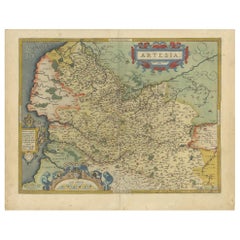
- Antique Map of the Artois Region of France by Ortelius, 'circa 1590'Located in Langweer, NLAntique map titled 'Artesia'. Original antique map of the Artois region, France. Published by A. Ortelius, circa 1590.Category
Antique 16th Century Maps
MaterialsPaper
- Antique Map of the Picardy Region of France by Ortelius, 'circa 1590'Located in Langweer, NLAntique map titled 'Picardiae Belgicae regionis descriptio'. Original antique map of the Picardy region, France. Published by A. Ortelius, circa 1590.Category
Antique 16th Century Maps
MaterialsPaper
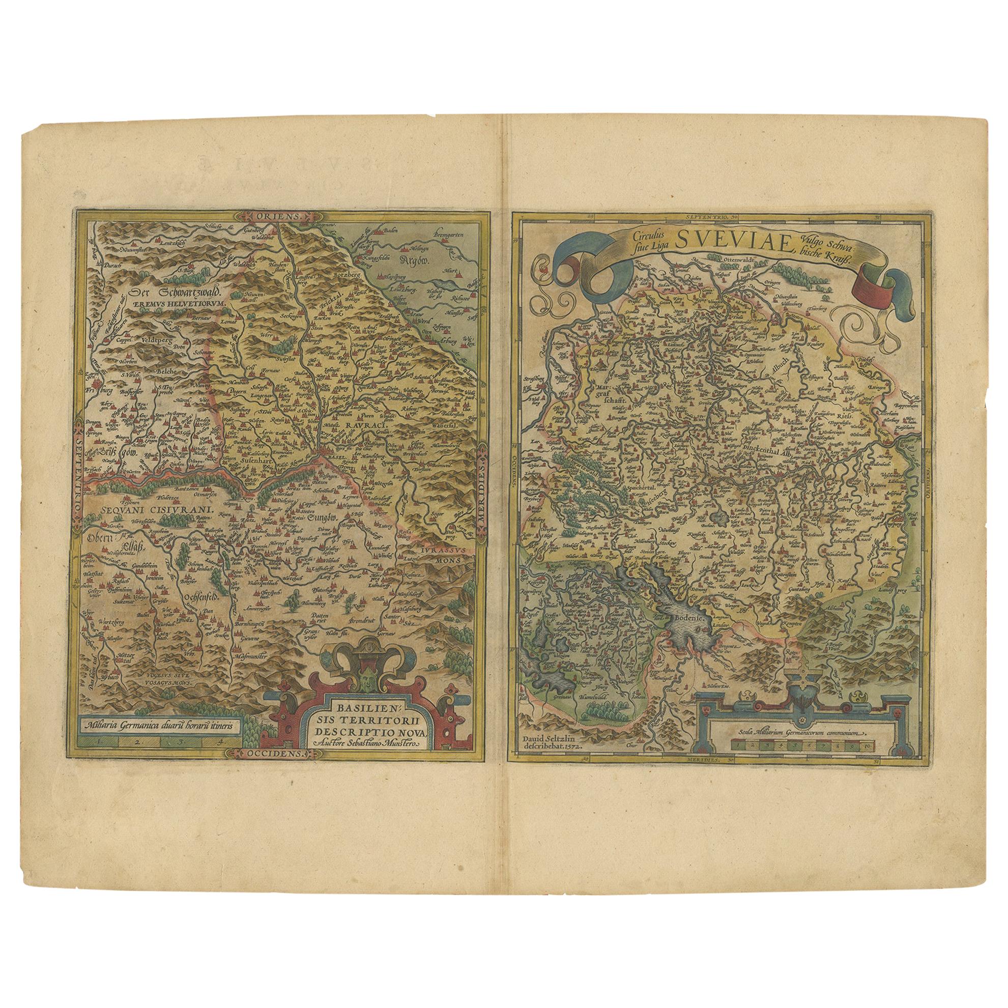
- Map of the Region of Basel and Northern Switzerland by Ortelius, circa 1603Located in Langweer, NLTwo original antique maps on one sheet titled 'Basiliensis Territorii Descriptio Nova [with] Circulus sive Liga Sueviae'. The first centers on Basel, Switzerland, located on the Rhine River...Category
Antique Early 17th Century Maps
MaterialsPaper
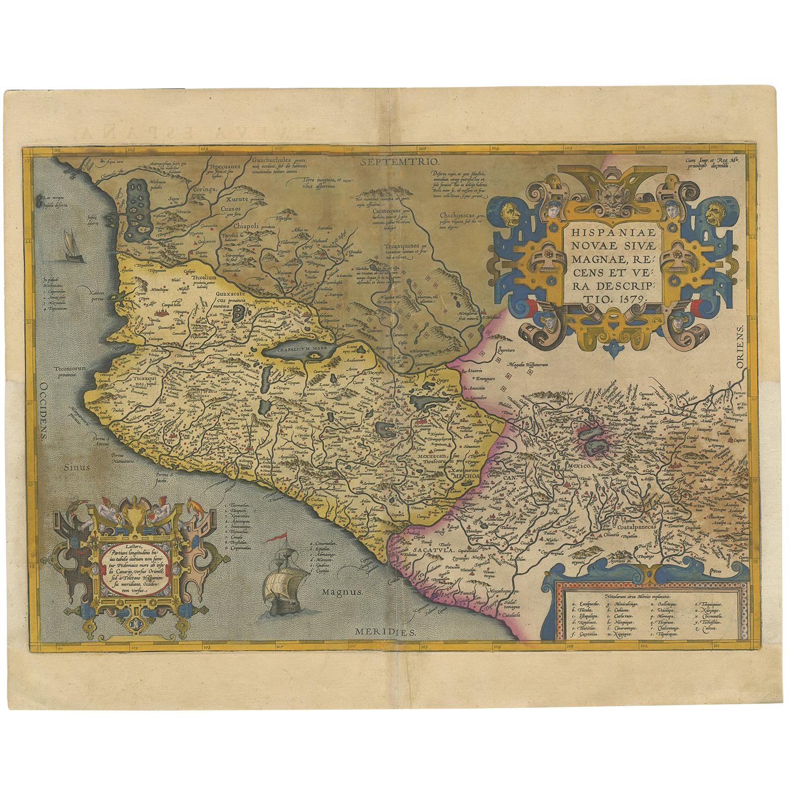
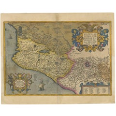
- Antique Map of Mexico by Ortelius, circa 1602By Abraham OrteliusLocated in Langweer, NLAntique map titled 'Hispaniae Novae Sivae Magnae Recens Et Vera Descriptio 1579'. Map of western New Spain, showing the recently-created Spanish settlements, many rivers, and large l...Category
Antique Early 17th Century Belgian Maps
MaterialsPaper


You May Also Like
- Antique Map of Italy by Andriveau-Goujon, 1843By Andriveau-GoujonLocated in New York, NYAntique Map of Italy by Andriveau-Goujon, 1843. Map of Italy in two parts by Andriveau-Goujon for the Library of Prince Carini at Palazzo Carini i...Category
Antique 1840s French Maps
MaterialsLinen, Paper
- 17th Century Hand Colored Map of the Liege Region in Belgium by VisscherBy Nicolaes Visscher IILocated in Alamo, CAAn original 17th century map entitled "Leodiensis Episcopatus in omnes Subjacentes Provincias distincté divisusVisscher, Leodiensis Episcopatus" by Nicolaes Visscher II, published in Amsterdam in 1688. The map is centered on Liege, Belgium, includes the area between Antwerp, Turnhout, Roermond, Cologne, Trier and Dinant. This attractive map is presented in a cream-colored mat measuring 30" wide x 27.5" high. There is a central fold, as issued. There is minimal spotting in the upper margin and a tiny spot in the right lower margin, which are under the mat. The map is otherwise in excellent condition. The Visscher family were one of the great cartographic families of the 17th century. Begun by Claes Jansz Visscher...Category
Antique Late 17th Century Dutch Maps
MaterialsPaper
- The Normandy Region of France: A 17th C. Hand-colored Map by Sanson and JaillotBy Nicolas SansonLocated in Alamo, CAThis large hand-colored map entitled "Le Duché et Gouvernement de Normandie divisée en Haute et Basse Normandie en divers Pays; et par evêchez, avec le Gouvernement General du Havre ...Category
Antique 1690s French Maps
MaterialsPaper
- Original Antique Map of Italy. C.1780Located in St Annes, LancashireGreat map of Italy Copper-plate engraving Published C.1780 Unframed.Category
Antique Early 1800s English Georgian Maps
MaterialsPaper

- Original Antique Map of The World by Thomas Clerk, 1817Located in St Annes, LancashireGreat map of The Eastern and Western Hemispheres On 2 sheets Copper-plate engraving Drawn and engraved by Thomas Clerk, Edinburgh. Published by Mackenzie And Dent, 1817 ...Category
Antique 1810s English Maps
MaterialsPaper
- Original Antique Map of South America, circa 1830Located in St Annes, LancashireGreat map of South America Copper plate engraving Published by Butterworth, Livesey & Co., circa 1830 Unframed.Category
Antique Early 1800s English Other Maps
MaterialsPaper


Recently Viewed
View AllMore Ways To Browse
Map Italy
Map Of Italy
Antique Maps Italy
Antique Map Italy
Antique Italian Maps
Antique Italy Maps
Antique Italian Map
Antique Italy Map
Italy Antique Map
Italy Map Antique
Antique Maps Of Italy
Antique Map Of Italy
Map Of Italy Antique
Verona Antique
Lago Italy
Antique Maps Ortelius
Antique Map Ortelius
Ortelius Map Italy