Items Similar to Pl. 81 Antique Print of Decorative Art in the 17th Century by Racinet, 1869

Want more images or videos?
Request additional images or videos from the seller
1 of 5
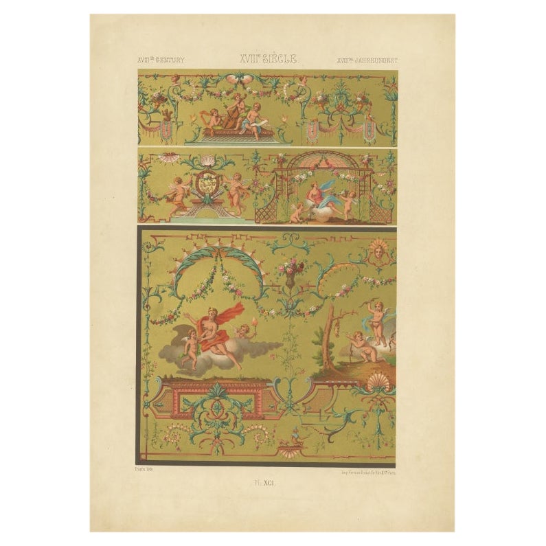
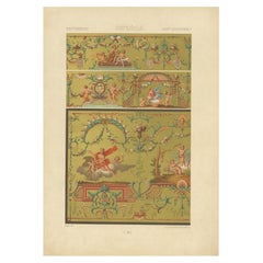
Pl. 81 Antique Print of Decorative Art in the 17th Century by Racinet, 1869
About the Item
Old print of decorative art in the 17th century. This print originates from 'L'Ornement polychrome'. A beautiful work containing about 2000 patterns of all the styles of Art old and Asian, middle ages, Renaissance, XVII and XVIII century. Artists and Engravers: Author: M.A. Racinet.
Artist: Author: M.A. Racinet.
Condition: Good,general age-related toning. Few stains, please study image carefully.
Date: 1869
Overall size: 28 x 39 cm.
Image size: 0.001 x 20 x 30 cm.
Antique prints have long been appreciated for both their aesthetic and investment value. They were the product of engraved, etched or lithographed plates. These plates were handmade out of wood or metal, which required an incredible level of skill, patience and craftsmanship. Whether you have a house with Victorian furniture or more contemporary decor an old engraving can enhance your living space. We offer a wide range of authentic antique prints for any budget
- Dimensions:Height: 15.36 in (39 cm)Width: 11.03 in (28 cm)Depth: 0 in (0.01 mm)
- Materials and Techniques:
- Period:
- Date of Manufacture:1869
- Condition:
- Seller Location:Langweer, NL
- Reference Number:
About the Seller
5.0
Platinum Seller
These expertly vetted sellers are 1stDibs' most experienced sellers and are rated highest by our customers.
Established in 2009
1stDibs seller since 2017
1,947 sales on 1stDibs
Typical response time: <1 hour
- ShippingRetrieving quote...Ships From: Langweer, Netherlands
- Return PolicyA return for this item may be initiated within 14 days of delivery.
More From This SellerView All
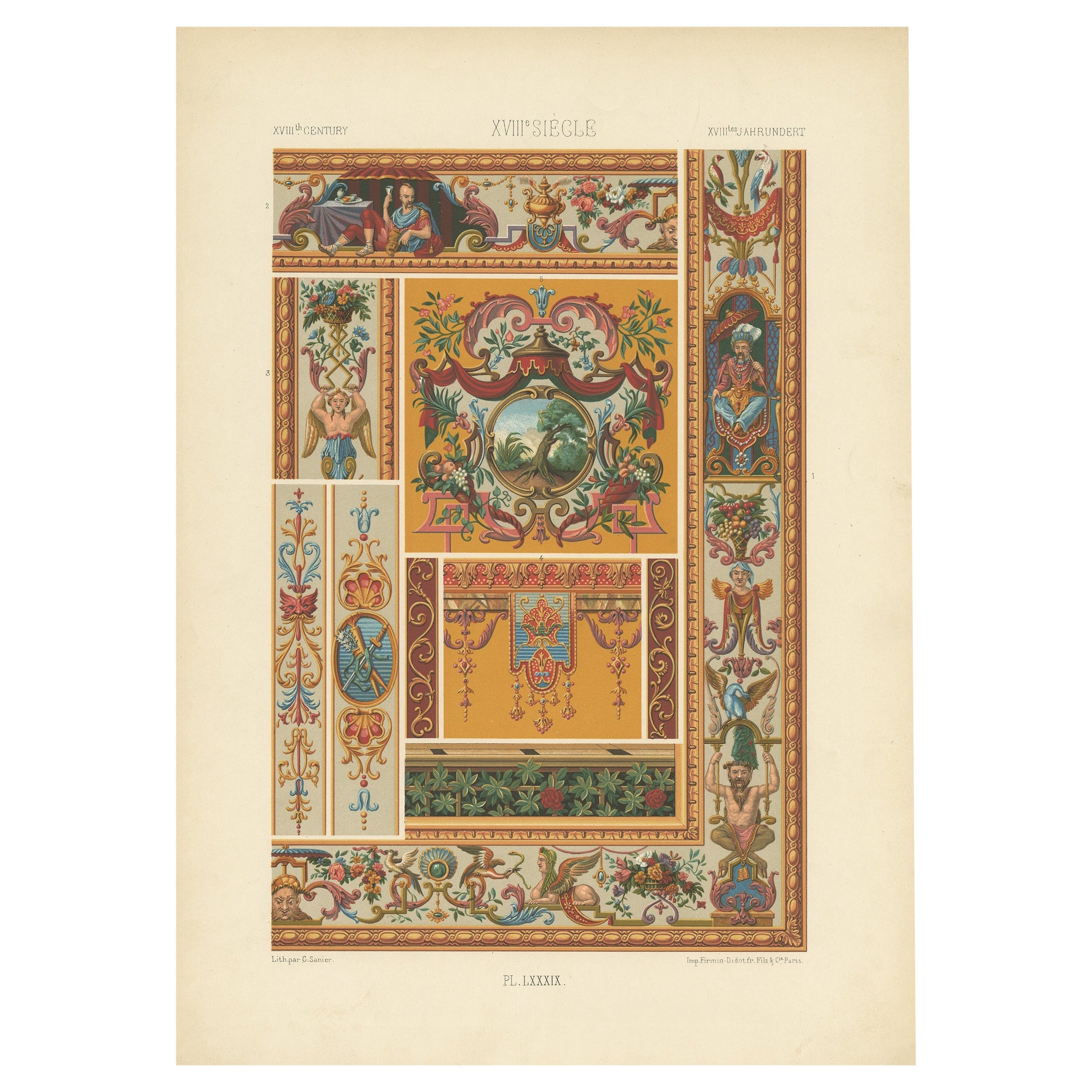
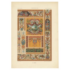
- Pl. 89 Antique Print of Decorative Art in the 18th Century by Racinet, 1869Located in Langweer, NLOld print of decorative art in the 18th century. This print originates from 'L'Ornement polychrome'. A beautiful work containing about 2000 patterns of all the styles of Art old and ...Category
Antique 19th Century Prints
MaterialsPaper
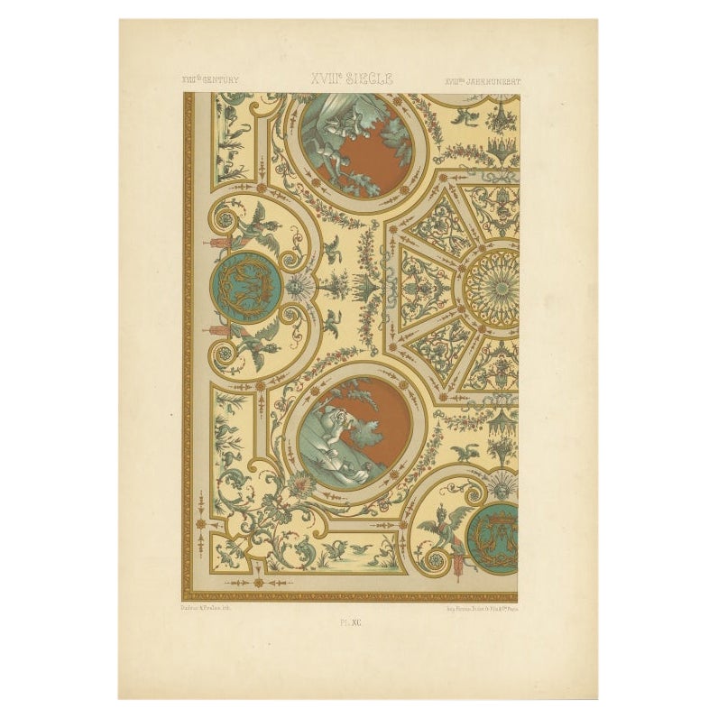
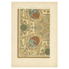
- Pl. 90 Antique Print of Decorative Art in the 18th Century by Racinet, 1869Located in Langweer, NLOld print of decorative art in the 18th century. This print originates from 'L'Ornement polychrome'. A beautiful work containing about 2000 patterns of all the styles of Art old and ...Category
Antique 19th Century Prints
MaterialsPaper
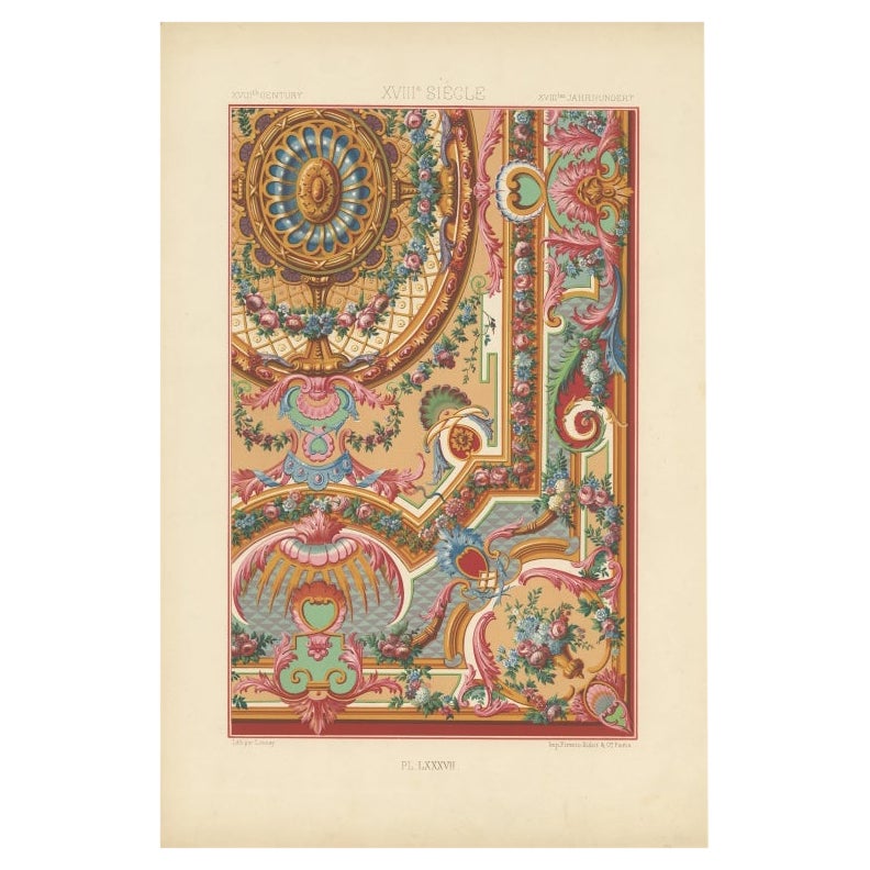
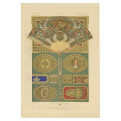
- Pl. 87 Antique Print of Decorative Art in the 18th Century by Racinet, 1869Located in Langweer, NLOld print of decorative art in the 18th century. This print originates from 'L'Ornement polychrome'. A beautiful work containing about 2000 patterns of all the styles of Art old and ...Category
Antique 19th Century Prints
MaterialsPaper
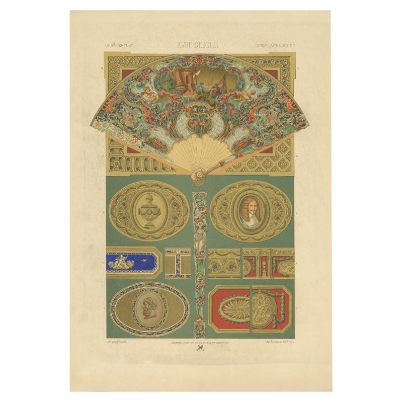
- Pl. 88 Antique Print of Decorative Art in the 18th Century by Racinet, 1869Located in Langweer, NLOld print of decorative art in the 18th century. This print originates from 'L'Ornement polychrome'. A beautiful work containing about 2000 patterns of all the styles of Art old and ...Category
Antique 19th Century Prints
MaterialsPaper
- Pl. 91 Antique Print of Decorative Art in the 18th Century by Racinet, 1869Located in Langweer, NLOld print of decorative art in the 18th century. This print originates from 'L'Ornement polychrome'. A beautiful work containing about 2000 patterns of all the styles of Art old and ...Category
Antique 19th Century Prints
MaterialsPaper
- Pl. 65 Antique Print of Decorative Art in the Renaissance Period by Racinet, 1869Located in Langweer, NLOld print of decorative art in the Renaissance period. This print originates from 'L'Ornement polychrome'. A beautiful work containing about 2000 patterns of all the styles of Art ol...Category
Antique 19th Century Prints
MaterialsPaper

You May Also Like
- 17th Century Hand Colored Map of the Liege Region in Belgium by VisscherBy Nicolaes Visscher IILocated in Alamo, CAAn original 17th century map entitled "Leodiensis Episcopatus in omnes Subjacentes Provincias distincté divisusVisscher, Leodiensis Episcopatus" by Nicolaes Visscher II, published in Amsterdam in 1688. The map is centered on Liege, Belgium, includes the area between Antwerp, Turnhout, Roermond, Cologne, Trier and Dinant. This attractive map is presented in a cream-colored mat measuring 30" wide x 27.5" high. There is a central fold, as issued. There is minimal spotting in the upper margin and a tiny spot in the right lower margin, which are under the mat. The map is otherwise in excellent condition. The Visscher family were one of the great cartographic families of the 17th century. Begun by Claes Jansz Visscher...Category
Antique Late 17th Century Dutch Maps
MaterialsPaper
- The Holy Land at the Time of Jesus: A 17th Century Dutch Map by VisscherBy Nicolaes Visscher IILocated in Alamo, CAThis detailed Dutch map entitled "Het Beloofe de Landt Canaan door wandelt van onsen Salichmaecker Iesu Christo, nessens syne Apostelen" by Nicolaes Visscher was published in Amsterd...Category
Antique Mid-17th Century Dutch Maps
MaterialsPaper
- 17th Century Hand-Colored Map of a Region in West Germany by JanssoniusBy Johannes JanssoniusLocated in Alamo, CAThis attractive highly detailed 17th century original hand-colored map is entitled "Archiepiscopatus Maghdeburgensis et Anhaltinus Ducatus cum terris adjacentibus". It was published ...Category
Antique Mid-17th Century Dutch Maps
MaterialsPaper
- 17th Century Hand-Colored Map of West Africa by Mercator/HondiusLocated in Alamo, CAA 17th century hand-colored map entitled "Guineae Nova Descriptio" by Gerard Mercator and Jodocus Hondius, published in their 'Atlas Minor' in Amsterdam in 1635. It is focused on the...Category
Antique Mid-17th Century Dutch Maps
MaterialsPaper
- 17th Century Map of Denmark by French Cartographer Sanson, Dated 1658By Nicolas SansonLocated in Copenhagen, K17th century map of Denmark by French cartographer Sanson. Nicolas Sanson (20 December 1600-7 July 1667) was a French cartographer, termed by some the creator of French geography an...Category
Antique 17th Century French Maps
MaterialsPaper
- "Africae Accurata", a Hand-Colored 17th Century Map of Africa by VisscherBy Nicolaes Visscher IILocated in Alamo, CAAn 18th century hand-colored map of Africa entitled "Africae Accurata Tabula ex officina" by Nicolaes Visscher, published in Amsterdam in 1680. This beautiful, colorful and detailed map is embellished by eleven sailing ships, a whale, flying fish and multiple land animals. It includes the Mediterranean Sea and adjacent portions of Portugal, Spain, Italy, Greece and Asia Minor. The map perpetuates several long-standing errors, including the origin of the Nile River from two imaginary lakes in southern Africa, which are shown adjacent to the imaginary Lunae Montes (Mountains of the Moon...Category
Antique Late 17th Century Dutch Maps
MaterialsPaper


Recently Viewed
View AllMore Ways To Browse
17th Decor
Asian Metal Wall Art
Victorian Polychromed
Small Table Chest
Pair Inlay Cabinets
Rosewood Cabinet With Inlaid
Antique Old Lock
Wall Tapestry In Frame
Mother Of Pearl Pattern
Antique Glazed Display Cabinet
Lockable Corner Cabinet
American Craft Cabinet
Antique Over Door Panel
Antique Paint Chest Of Drawers
Mounted Butterfly
Antique Hardware Pulls
Antique French Glass Doors
Chest Of Drawers White Marble