Items Similar to 1842 Wall Map of the United States by J. H. Young, Published by S. A. Mitchell


Want more images or videos?
Request additional images or videos from the seller
1 of 5
1842 Wall Map of the United States by J. H. Young, Published by S. A. Mitchell
$5,500
£4,176.28
€4,775.89
CA$7,684.30
A$8,546.62
CHF 4,462.78
MX$104,003.23
NOK 56,996.48
SEK 53,452.64
DKK 35,644.29
Shipping
Retrieving quote...The 1stDibs Promise:
Authenticity Guarantee,
Money-Back Guarantee,
24-Hour Cancellation
About the Item
Presented is an 1842 hanging “Map of the United States,” engraved by J. H. Young and published by Samuel Augustus Mitchell, Philadelphia. This is a beautiful example of the rare 1842 edition of Michell's map of the United States, that was first issued in 1831. This 1842 edition has been updated, with Arkansas and Michigan depicted as states. The depiction of Florida also is very interesting, with only the earliest counties present.
Elaborately detailed, the hanging wall map includes a large inset "Map of North America, including all the recent geographical discoveries'' at bottom right, as well as seven city map insets of the vicinities around Boston, New York, Philadelphia, Baltimore and Washington, Charleston, New Orleans, and Niagara. A distance table for the Erie and Champlain canals, an index of the counties of the United States, illustrated diagrams of comparative heights and lengths of United States mountains and rivers, and state population and area statistical tables fill the map’s border.
At top is an allegorical vignette, celebrating the then dramatic advances in transportation. A Young engraved a steam boat at left, a canal lock being operated at right, and, faintly visible cutting through the forest at center, a very early locomotive. All of this surrounds the crest of the United States set into a rock with a spread eagle flying over these symbols of American technological ingenuity.
When this map was first issued in 1831, it was Mitchell's first wall map as well as his first, original cartographic publication. Mitchell published other maps and an atlas in 1831, but these were all re-issues of works by Anthony Finley. This very skillful and information-filled wall map launched the Mitchell firm to a position of dominance in cartographic publishing, one that it would hold for over two decades. This map was also very likely the first, large-scale map to have been steel plate-engraved.
Condition:
Very good condition, considering age and past use. Hanging wall map, engraved and printed onto 4 sheets, joined. Original hand coloring. On wooden rollers. Several splits and cracks and small losses from past use and rolling. Toning and small areas of foxing and stains, mostly in margins. Map has since been stabilized and backed with new archival linen. Map measures 45" H x 38" W.
- Dimensions:Height: 45 in (114.3 cm)Width: 38 in (96.52 cm)Depth: 1 in (2.54 cm)
- Materials and Techniques:Paper,Engraved
- Place of Origin:
- Period:
- Date of Manufacture:1842
- Condition:Repaired: Map has since been cleaned, stabilized, and backed with new archival linen, by Green Dragon Bindery, in New York, in 2014. Wear consistent with age and use.
- Seller Location:Colorado Springs, CO
- Reference Number:Seller: M0441stDibs: LU909714012072
About the Seller
4.9
Platinum Seller
Premium sellers with a 4.7+ rating and 24-hour response times
Established in 2010
1stDibs seller since 2011
461 sales on 1stDibs
- ShippingRetrieving quote...Shipping from: Colorado Springs, CO
- Return Policy
Authenticity Guarantee
In the unlikely event there’s an issue with an item’s authenticity, contact us within 1 year for a full refund. DetailsMoney-Back Guarantee
If your item is not as described, is damaged in transit, or does not arrive, contact us within 7 days for a full refund. Details24-Hour Cancellation
You have a 24-hour grace period in which to reconsider your purchase, with no questions asked.Vetted Professional Sellers
Our world-class sellers must adhere to strict standards for service and quality, maintaining the integrity of our listings.Price-Match Guarantee
If you find that a seller listed the same item for a lower price elsewhere, we’ll match it.Trusted Global Delivery
Our best-in-class carrier network provides specialized shipping options worldwide, including custom delivery.More From This Seller
View All"The United States from the Latest Authorities" Antique Wall Map, 1835
Located in Colorado Springs, CO
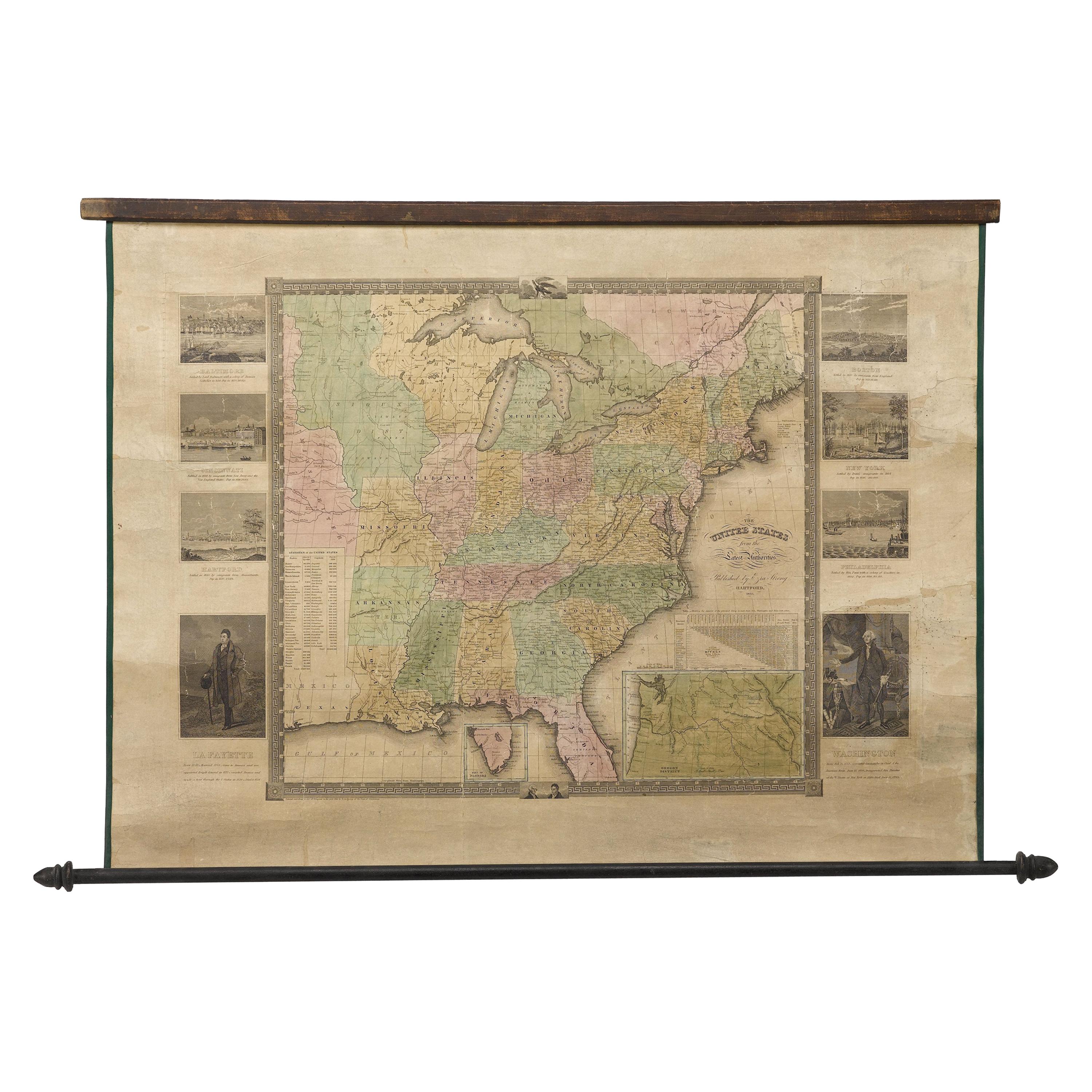
This is a 1835 map of “The United States from the Latest Authorities” by Ezra Strong. A hand-colored engraved wall map of the eastern half of the United States, this map has a large inset of the "Oregon District" and several engraved city views and two portraits.
The primary map extends to Mexico Texas and the Missouri Territory, showing the course of the Missouri River to Ft. Mandan and Old Ft. Mandan, and noting many forts along the river. The territories to the east of Missouri Territory are separately delineated as Sioux District and Huron District. The western details of the map are very good for a map of this time period, with many Native American settlements, villages, forts and other details noted.
The map is bordered with vignettes of Boston, New York, Philadelphia, Hartford, Cincinnati, and Baltimore. Each vignette notes the date settled, primary settler, and the population as of 1830. Two portraits of LaFayette and George Washington are presented in full length with related biographical information.
A large inset map at lower right shows the Oregon District, centered on the Columbia River and extending to the Rocky Mountains. This is one of the earliest commercial appearances of a separate map of Oregon...
Category
Antique 1830s American Maps
Materials
Paper

1859 "Map of the United States of America..." by J. H. Colton
By J.H. Colton
Located in Colorado Springs, CO
Presented is an 1859 “Map of the United States of America, the British Provinces, Mexico, the West Indies and Central America with Part of...
Category
Antique 1850s American Maps
Materials
Paper

1864 Map of North America, Antique Hand-Colored Map, by Adolphe Hippolyte Dufour
Located in Colorado Springs, CO
Offered is a map of North America entitled Amerique du Nord from 1864. This rare, separately published wall map was produced by Adolphe Hippolyte Dufour. This map includes vibrant an...
Category
Antique 1860s French Maps
Materials
Paper

1863 "Lloyd's New Map of the United States, the Canadas, and New Brunswick"
Located in Colorado Springs, CO
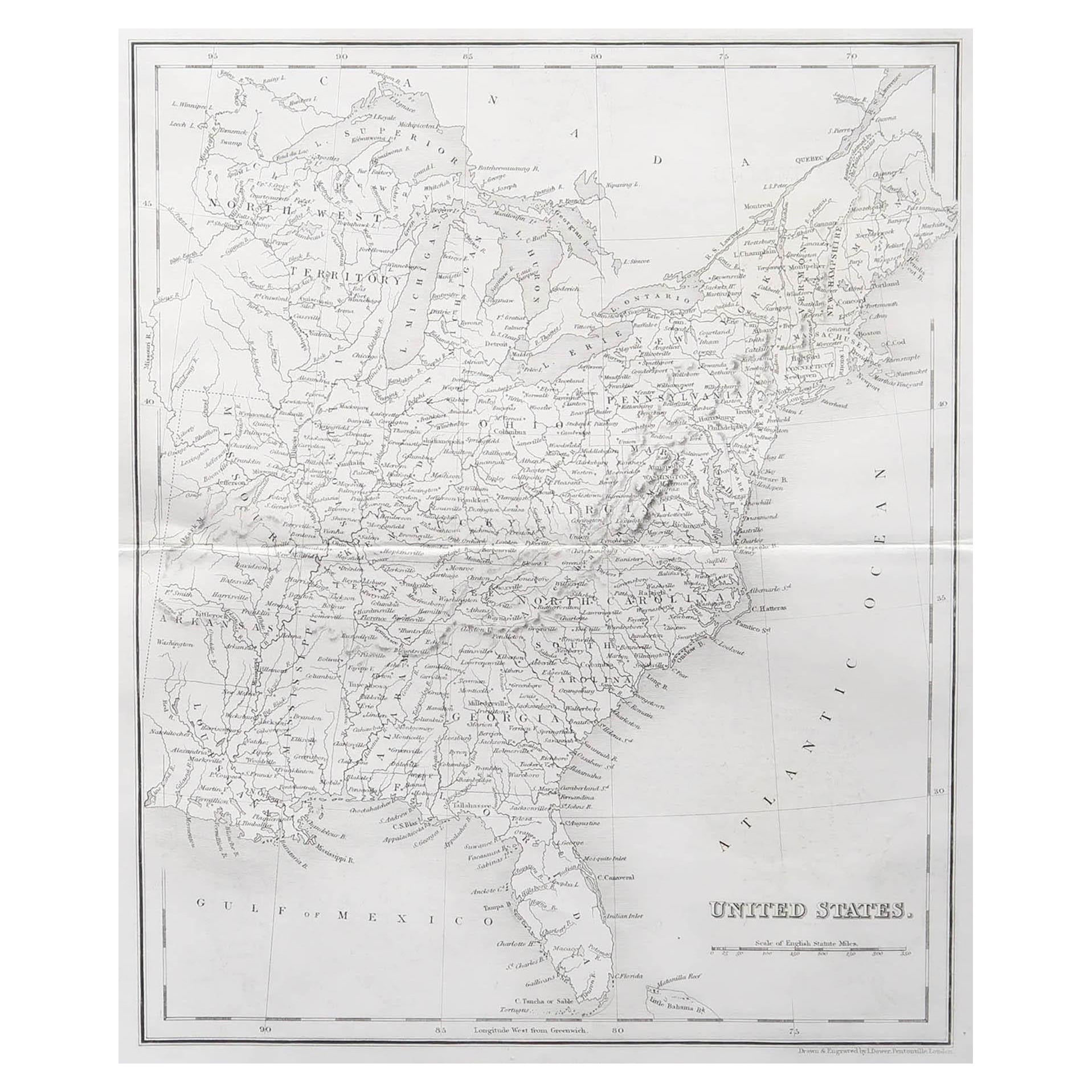
Presented is “Lloyd's New Map of the United States, the Canadas and New Brunswick, From the latest Surveys, Showing Every Railroad & Station Finished to June 1863, and the Atlantic and Gulf Coasts.” A large, Civil War-era hanging map of the United States and adjacent territories, this map covers the area from the Atlantic Ocean and extends as far west as the 103 meridian, to “Dacotah,” Nebraska, Kansas, "Indian Territory," and Texas. The southern continuation of Florida is shown in an inset map along the right margin. This map was published by J. T. Lloyd, in New York, in 1863. According to the publisher’s marking at lower right, this map was originally issued in two states: "in Sheets, Colored" for 50 cents, and "Varnished nicely, with Rollers" for $1.
Throughout the map, the counties are colored and the towns and cities well labeled. A reference key in the bottom margin provides symbols for railroads, turnpikes and wagon roads, state capitals, cities and towns, and village post offices. As emphasized in the map’s title, this map is especially notable for the countless railway lines and stations depicted, with distances noted between points, listing “every railroad and finished station to June 1863.” Additionally, two shipping agents and their routes are drawn out of New York City. The map includes details of the steamship routes into New York and Philadelphia from Liverpool and on to California and Oregon via an overland Nicaraguan trek, presumably to assist gold rush emigrants.
This expansive and impressive map depicts the eastern half of the United States in the third year of the Civil War. In order not to recognize the legitimacy of the Confederate States of America, each state is shown in the same manner as the Union states. The only indication that the American Civil War was in progress when this map was published is a printed notice that Gideon Wells, Secretary of the Navy, wishes to acquire a quote on 100 copies of Lloyd’s Mississippi River map...
Category
Antique 1860s American Maps
Materials
Linen, Wood, Paper

1868 "Lloyd's Topographical Railway Map of North America..." Hanging Wall Map
Located in Colorado Springs, CO
Presented is “Lloyd's Topographical Railway Map of North-America, or the United States Continent in 1900.” This map was published by J. T. Lloyd, in New York, in 1868. A large, hangi...
Category
Antique 1860s American Late Victorian Maps
Materials
Linen, Paper

1847 Ornamental Map of the United States & Mexico by H. Phelps
Located in Colorado Springs, CO
Offered is an original 1847 ornamental map of the U.S. entitled "Ornamental Map of the United States & Mexico" by Humphrey Phelps. The map was issued as an act of Congress by Phelps on Fulton Street, New York. The broadside is elaborately hand-colored.
This is a very detailed and graphic propaganda map of the United States expressing U.S. dominance of the North American continent. The hand-colored map proclaims the Manifest Destiny, with the recent acquisition of Upper California and Texas at the conclusion of the Mexican-American War. The newly acquired land is boldly colored, standing in stark contrast to the rest of the U.S. The map details a potential route for a railroad running from New York City, to Buffalo, to Chicago, then west along the Oregon Trail to Oregon City. This route anticipates the construction of the transcontinental railroad by nearly 20 years.
The map includes elaborately detailed renderings of George Washington, Hernan Cortez, and Montezuma at top to represent European expansion to the Americas. At bottom are four inset designs with text showing the following: a chronological history of the U.S. beginning from settlement to the U.S. victory in the Mexican-American war; an illustration of General Zachary Taylor with details on the Oregon Territory; an illustration of the Aztec Temple of the Sun in Tenochtitlan and a chronology of the Conquest of the Aztec Empire under Cortez; a portrait of General Antonio Lopez de Santa Anna...
Category
Antique 1840s American Maps
Materials
Paper

You May Also Like
Antique Map of the United States by Balbi '1847'
Located in Langweer, NL
Antique map titled 'Etats-Unis'. Original antique map of the United States. This map originates from 'Abrégé de Géographie (..)' by Ad...
Category
Antique Mid-19th Century Maps
Materials
Paper

$191 Sale Price
20% Off
Antique Map of the United States of America by Lapie '1842'
Located in Langweer, NL
Antique map titled 'Carte des États-Unis d'Amérique'. Map of the United States of America (USA). This map originates from 'Atlas universel...
Category
Antique Mid-19th Century Maps
Materials
Paper

$575 Sale Price
20% Off
Original Antique Map of The United States of America by Dower, circa 1835
Located in St Annes, Lancashire
Nice map of the USA
Drawn and engraved by J.Dower
Published by Orr & Smith. C.1835
Unframed.
Free shipping
Category
Antique 1830s English Maps
Materials
Paper

Antique Map of the United States by Titus '1871'
Located in Langweer, NL
Antique map titled 'The United States of America'. Original antique map of the United States. This map originates from 'Atlas of Prebl...
Category
Antique Late 19th Century Maps
Materials
Paper

$766 Sale Price
20% Off
Original Antique Map of United States, Grattan and Gilbert, 1843
Located in St Annes, Lancashire
Great map of United States
Drawn and engraved by Archer
Published by Grattan and Gilbert. 1843
Original colour
Unframed.
Category
Antique 1840s English Maps
Materials
Paper

Rare Antique Wall-Map of North America: French and Indian War Boundaries, 1793
Located in Langweer, NL
Rare 1793 Map of North America: French and Indian War Boundaries and Historical Notes
This remarkable engraved map of North America, printed in 1793 by Emanuel Bowen and John Gibs...
Category
Antique 1790s Maps
Materials
Paper
More Ways To Browse
Re Antiques
Antique Maps Of North America
Large Wall Maps
Antique Map New York
Charleston Antique
Antique Cutting Table
Used Furniture In Arkansas
Baltimore Antiques
Antique Paper Roller
Steam Locomotives
Antique Linen Map
Antique Maps Of New York City
Charleston Used Office Furniture
Steam Boat
River Rock Table
Antique Map Of Boston
Antique Florida Map
Antique Wooden Roller