Items Similar to 1850 Old French Map Depicting the Entire Earth's Surface Divided into Two Parts

Want more images or videos?
Request additional images or videos from the seller
1 of 19
1850 Old French Map Depicting the Entire Earth's Surface Divided into Two Parts
$1,557.59
£1,159.52
€1,300
CA$2,133.50
A$2,372.92
CHF 1,239.07
MX$28,875.94
NOK 15,824.77
SEK 14,840.84
DKK 9,896.45
Shipping
Retrieving quote...The 1stDibs Promise:
Authenticity Guarantee,
Money-Back Guarantee,
24-Hour Cancellation
About the Item
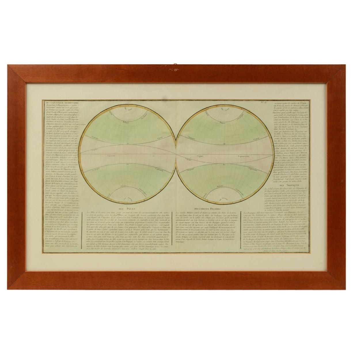
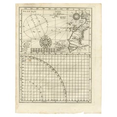
Geographical map depicting the entire earth’s surface divided into two parts that correspond to the two hemispheres or globes, the map deals with the latitudes and longitudes, the meridian 0 is indicated, also called the meridian of France fixed by Louis XIII in 1634 because it crossed the whole territory from Perpignan to Dunkerque and then replaced in 1884 by the Greenwich meridian. Detailed explanation in French. Printed on paper by engraving on copper plate, coeval coloring. Table n. 3, French manufacture from the mid-19th century, non-contemporary frame in cherry wood. Size with frame 65.7 x 47.2 cm - 25.8 x 18 inches, frame thickness 2 cm - 0.78 inches.
- Dimensions:Height: 18.19 in (46.2 cm)Width: 25.87 in (65.7 cm)Depth: 0.79 in (2 cm)
- Materials and Techniques:
- Place of Origin:
- Period:
- Date of Manufacture:Mid-19th Century
- Condition:Wear consistent with age and use.
- Seller Location:Milan, IT
- Reference Number:1stDibs: LU1020220893882
About the Seller
5.0
Vetted Professional Seller
Every seller passes strict standards for authenticity and reliability
Established in 1999
1stDibs seller since 2014
398 sales on 1stDibs
Typical response time: 1 hour
- ShippingRetrieving quote...Shipping from: Milan, Italy
- Return Policy
Authenticity Guarantee
In the unlikely event there’s an issue with an item’s authenticity, contact us within 1 year for a full refund. DetailsMoney-Back Guarantee
If your item is not as described, is damaged in transit, or does not arrive, contact us within 7 days for a full refund. Details24-Hour Cancellation
You have a 24-hour grace period in which to reconsider your purchase, with no questions asked.Vetted Professional Sellers
Our world-class sellers must adhere to strict standards for service and quality, maintaining the integrity of our listings.Price-Match Guarantee
If you find that a seller listed the same item for a lower price elsewhere, we’ll match it.Trusted Global Delivery
Our best-in-class carrier network provides specialized shipping options worldwide, including custom delivery.More From This Seller
View All1850 Old French Map Depicting the Entire Earth's Surface Divided into Two Parts
Located in Milan, IT
Map depicting the entire earth's surface divided into two parts corresponding to the two hemispheres and showing the Arctic to Antarctic polar circle, the tropics of Cancer and Capri...
Category
Antique Mid-19th Century French Maps
Materials
Glass, Wood, Paper
1850 Old French Map Depicting the Entire Earth's Surface Divided into Two Parts
Located in Milan, IT
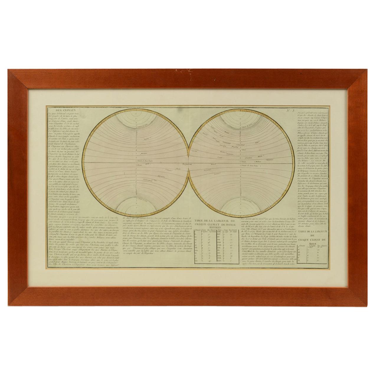
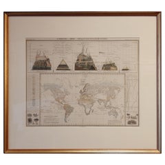
Geographical map depicting the entire earth's surface divided into two parts that correspond to the two hemispheres divided into small climatic zones that depict the climatic trend f...
Category
Antique Mid-19th Century French Scientific Instruments
Materials
Glass, Wood, Paper
1850 Old French Map Depicting the Entire Earth's Surface Divided into Two Parts
Located in Milan, IT
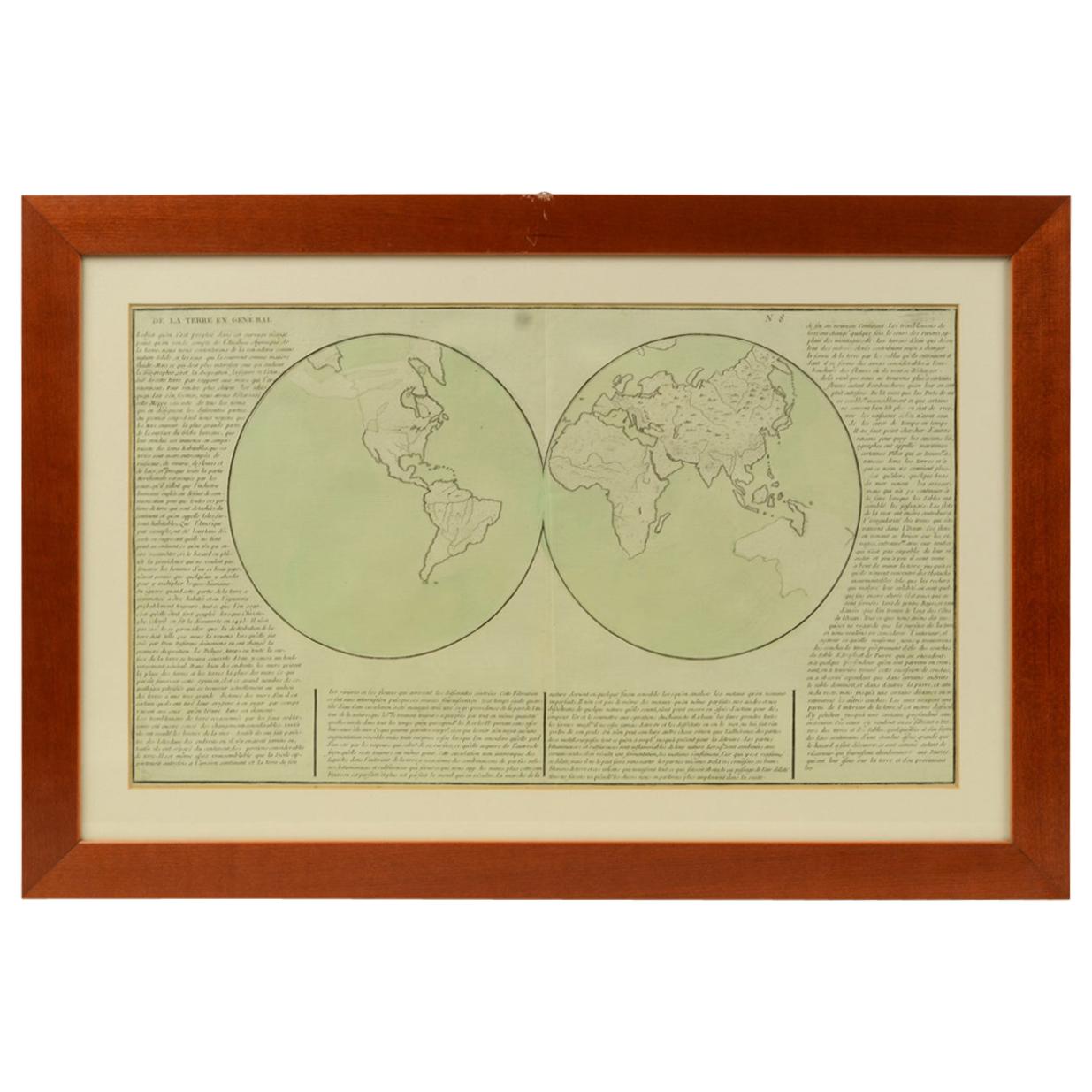
Geographical map depicting the entire earth's surface divided into two parts that correspond to the two hemispheres or globes, the map deals with the earth in general. Detailed expla...
Category
Antique Mid-19th Century French Maps
Materials
Glass, Wood, Paper

Old Map Depicting the Entire Earth's Surface Divided into Six Parts France 1850
Located in Milan, IT
Map depicting the entire earth's surface divided into six parts which depicts the position of peoples on Earth based on the assumption that it is impossible for each people to have t...
Category
Antique Mid-19th Century French Maps
Materials
Glass, Wood, Paper

1850 Old French Map Depicting the Entire Earth's Surface Divided into Two Parts
Located in Milan, IT
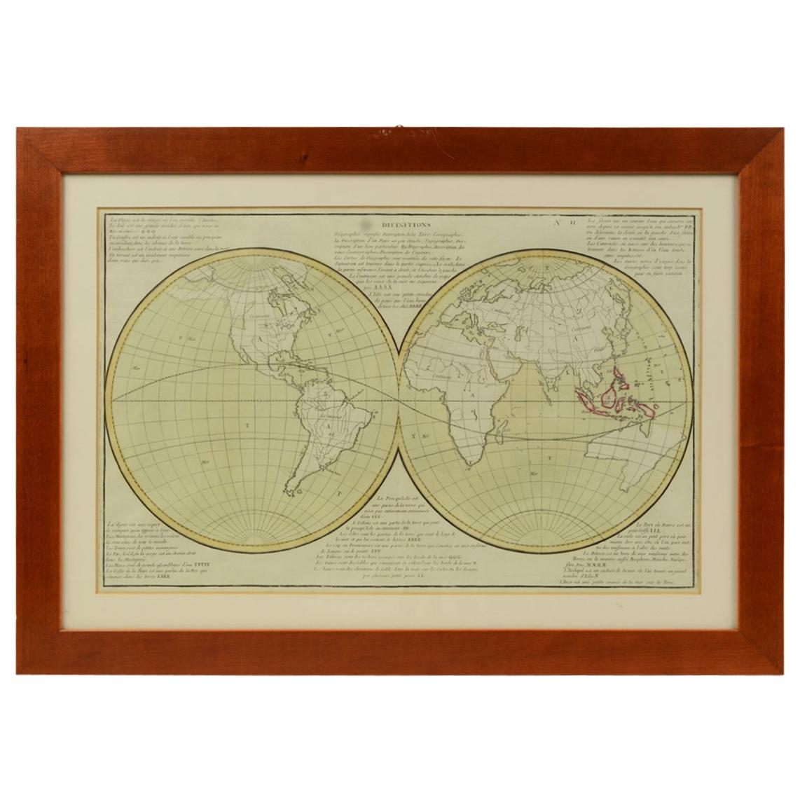
Geographical map depicting the entire earth's surface divided into two parts that correspond to the two hemispheres where the emerged lands are depicted which have been classified wi...
Category
Antique Mid-19th Century French Maps
Materials
Glass, Wood, Paper

1844 French Antique Nautical Portolan of Plan du Port de Cherfe by Antoine Roux
By Antoine Roux
Located in Milan, IT
Antique portolano, nautical map of Plan du Port de Cherfe engraved on a copper plate by Antoine Roux, Marseille France 1844, from his work Recueil des principaux plans des ports et d...
Category
Antique 1840s French Nautical Objects
Materials
Paper

You May Also Like
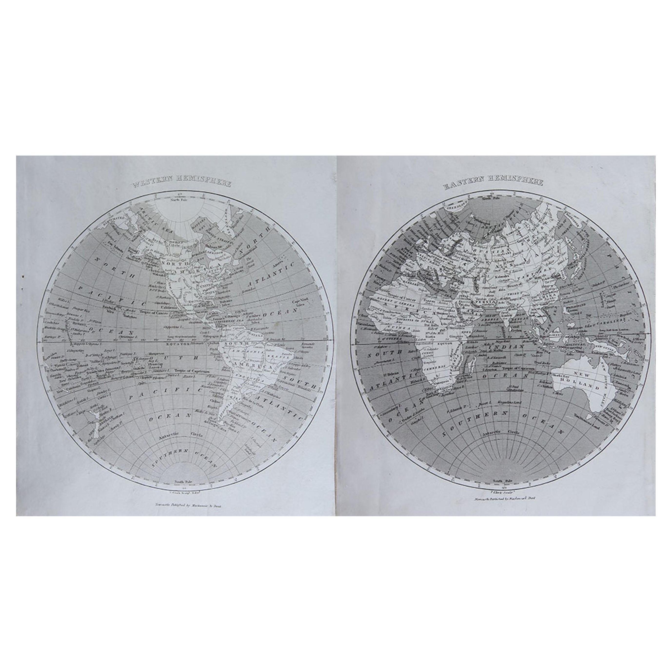
Original Antique Map of The World by Thomas Clerk, 1817
Located in St Annes, Lancashire
Great map of The Eastern and Western Hemispheres
On 2 sheets
Copper-plate engraving
Drawn and engraved by Thomas Clerk, Edinburgh.
Published by Mackenzie And Dent, 1817
...
Category
Antique 1810s English Maps
Materials
Paper

Antique Map of the Distribution of Vegetation throughout the World '1851'
Located in Langweer, NL
Antique map titled 'Umrisse der Pflanzengeographie'. Original antique map showing the distribution of vegetation throughout the world. Five drawings above the map show the vegetation...
Category
Antique Mid-19th Century Maps
Materials
Paper
$718 Sale Price
20% Off
Rare Antique Map of Part of Europe and Africa by Scherer, C.1703
Located in Langweer, NL
Antique map with two figures. The upper figures showing part of Europe and Africa. Below a chart. Printed for Scherer's 'Atlas Novus' (1702-1710). Artists and Engravers: Heinrich Sch...
Category
Antique 18th Century Maps
Materials
Paper
Original Large Antique Map of Paris, France by John Dower, 1861
Located in St Annes, Lancashire
Fabulous monochrome map of Paris.
Vignettes of St Germain En Laye, Saint Cloud, Versailles and Fontainbleau.
Unframed.
Drawn by J.Dower.
Lithography by Weller. 4 sheets joined to...
Category
Antique 1860s English Victorian Maps
Materials
Paper

Antique Map of the Eastern Hemisphere by Wyld, 1842
Located in Langweer, NL
Antique map titled 'Eastern Hemisphere'. Large map depicting the continents Europe, Asia, Afrika and Australia.
Artists and Engravers: James Wyld (1812–1887) was a British geograph...
Category
Antique 19th Century Maps
Materials
Paper

$1,054 Sale Price
20% Off
Antique Hemisphere Map of the World 'Two on One Sheet' by Levasseur, '1875'
Located in Langweer, NL
Antique map titled 'Mappemonde projetée sur l'Horizon de Paris et de son Antipode - Mappemonde sur la projection polaire'. Large map with two hemisphere world maps...
Category
Antique Late 19th Century Maps
Materials
Paper

$329 Sale Price
44% Off
More Ways To Browse
Antique Wood Furniture Parts
Divided Plate
Earth Globe
Hemispheres Map
Antique Compass Map
Blaeu Maps
Antique Collectables Australia
Military Map
Antique Maps Scotland
Mississippi Antique
Denmark Map
Antique Maps Of North America
Wine Map
Map Greece
Roman Map
Antique Maps Of Russia
Antique Roman Map
Maps Of Mediterranean