Items Similar to 1859 Detailed Map of North West Germany with Bavaria Inset - Blackie's Atlas


Want more images or videos?
Request additional images or videos from the seller
1 of 6
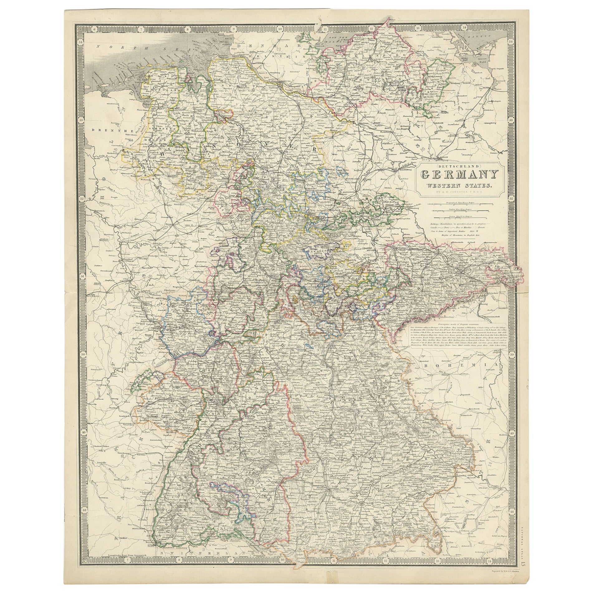
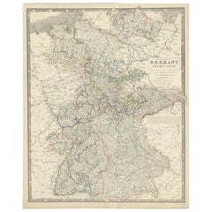
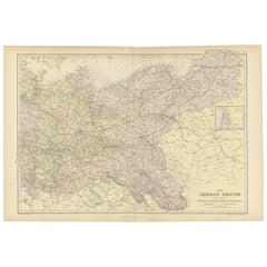
1859 Detailed Map of North West Germany with Bavaria Inset - Blackie's Atlas
$206.71
$295.2930% Off
£155.31
£221.8730% Off
€175
€25030% Off
CA$284.64
CA$406.6230% Off
A$318.56
A$455.0930% Off
CHF 166.75
CHF 238.2230% Off
MX$3,869.92
MX$5,528.4630% Off
NOK 2,117.36
NOK 3,024.8030% Off
SEK 1,998.09
SEK 2,854.4130% Off
DKK 1,331.92
DKK 1,902.7530% Off
About the Item
The "Antique Map of North West Germany" with an inset map of Bavaria is a distinguished piece from 'The Imperial Atlas of Modern Geography', published in 1859 by W. G. Blackie. This original antique map offers a detailed and historically significant portrayal of the northwestern region of Germany during the mid-19th century, supplemented by a focused inset of Bavaria.
**Key Features of the Map:**
1. **Geographical Coverage**: The map encompasses the northwestern part of Germany, including regions such as Lower Saxony, North Rhine-Westphalia, and parts of Hesse and Rhineland-Palatinate. It highlights the varied landscapes, from the North Sea coastline to the densely forested areas of the interior.
2. **Inset Map of Bavaria**: The inset provides a detailed view of Bavaria, a culturally and historically significant state in southeastern Germany. This additional map likely focuses on Bavaria's topography, major cities, and distinctive cultural landmarks.
3. **Political Divisions and Boundaries**: Reflecting the complex political landscape of 19th-century Germany, the map delineates the various kingdoms, principalities, and duchies that existed in the northwest region, offering insight into the political organization of the time.
4. **Urban Centers**: Key cities like Hamburg, Cologne, Frankfurt, and Düsseldorf are marked, along with other smaller towns and communities. The map provides a snapshot of urban development and population centers in northwestern Germany.
5. **Transportation Networks**: The map may illustrate the burgeoning railway lines, rivers, and roads, highlighting the transportation infrastructure that was instrumental in the region's economic development.
6. **Topographical Details**: Features such as the Harz Mountains, the Rhine River, and other natural landmarks are likely detailed, showcasing the geographic diversity of the region.
7. **Artistic and Aesthetic Elements**: In line with the Victorian era's cartographic style, the map likely includes ornate borders, an elegant title script, and possibly other artistic details, adding to its visual appeal.
8. **Educational and Historical Value**: As a historical document, this map is invaluable for educational purposes, providing insights into the geography and political divisions of northwestern Germany and Bavaria in the mid-19th century.
This map is not only a collector's item for enthusiasts of antique maps but also an important resource for historians, geographers, and anyone interested in the historical landscape and development of Germany.
- Dimensions:Height: 21.26 in (54 cm)Width: 14.57 in (37 cm)Depth: 0.02 in (0.5 mm)
- Materials and Techniques:
- Period:
- Date of Manufacture:1859
- Condition:Wear consistent with age and use. General age-related toning. some foxing, Please study image carefully.
- Seller Location:Langweer, NL
- Reference Number:Seller: BG-12685-1-181stDibs: LU3054325239502
About the Seller
5.0
Recognized Seller
These prestigious sellers are industry leaders and represent the highest echelon for item quality and design.
Platinum Seller
Premium sellers with a 4.7+ rating and 24-hour response times
Established in 2009
1stDibs seller since 2017
2,534 sales on 1stDibs
Typical response time: <1 hour
- ShippingRetrieving quote...Shipping from: Langweer, Netherlands
- Return Policy
Authenticity Guarantee
In the unlikely event there’s an issue with an item’s authenticity, contact us within 1 year for a full refund. DetailsMoney-Back Guarantee
If your item is not as described, is damaged in transit, or does not arrive, contact us within 7 days for a full refund. Details24-Hour Cancellation
You have a 24-hour grace period in which to reconsider your purchase, with no questions asked.Vetted Professional Sellers
Our world-class sellers must adhere to strict standards for service and quality, maintaining the integrity of our listings.Price-Match Guarantee
If you find that a seller listed the same item for a lower price elsewhere, we’ll match it.Trusted Global Delivery
Our best-in-class carrier network provides specialized shipping options worldwide, including custom delivery.More From This Seller
View AllMap of West Germany Incl Regions Wurtemberg, Bavaria, Hanover, Etc, c.1850
Located in Langweer, NL
Antique map titled '(Deutschland) Germany, Western States'.
Map of West Germany depicting many regions including Wurtemberg, Bavaria, Hanover and others. This map originates from...
Category
Antique 1850s Maps
Materials
Paper
$264 Sale Price
20% Off
Antique Map of South-Western Germany by A.K. Johnston, 1865
Located in Langweer, NL
Antique map titled 'South-Western Germany'. This map originates from the ‘Royal Atlas of Modern Geography’ by Alexander Keith Johnston. Published by William Blackwood and Sons, Edinb...
Category
Antique Mid-19th Century Maps
Materials
Paper
$236 Sale Price
20% Off
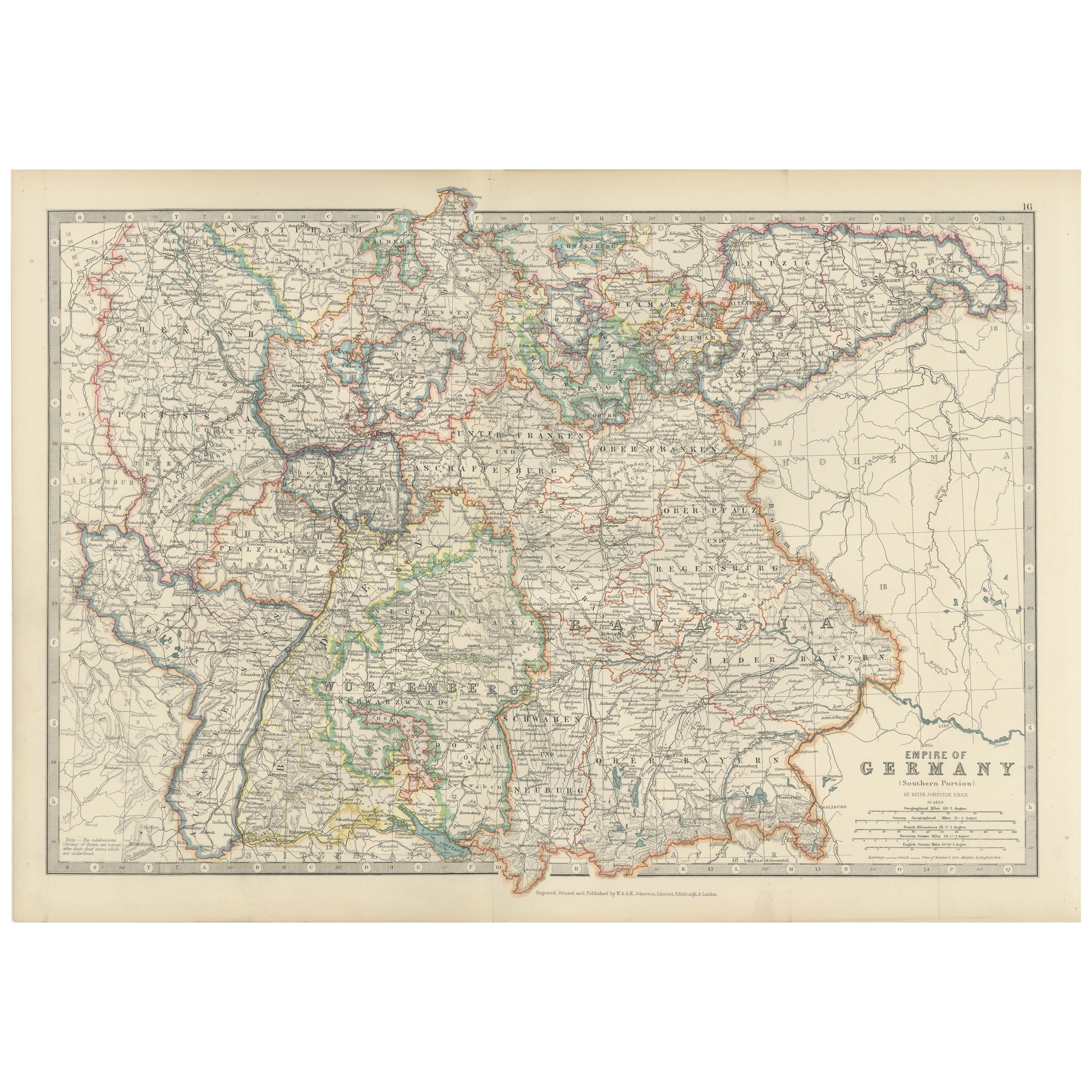
Antique Map of the German Empire, 1903, with Intricate Provincial Boundaries
Located in Langweer, NL
Title: Antique Map of the German Empire, 1903, with Intricate Provincial Boundaries
Description:
This antique map, titled "Empire of Germany (Southern Portion)," was engraved and pu...
Category
Early 20th Century Maps
Materials
Paper
Antique Map of Germany by Lapie, 1842
Located in Langweer, NL
Antique map titled 'Carte de la Germanie Ancienne'. Map of Germany. This map originates from 'Atlas universel de géographie ancienne et moderne (..)' by...
Category
Antique Mid-19th Century Maps
Materials
Paper

$472 Sale Price
20% Off
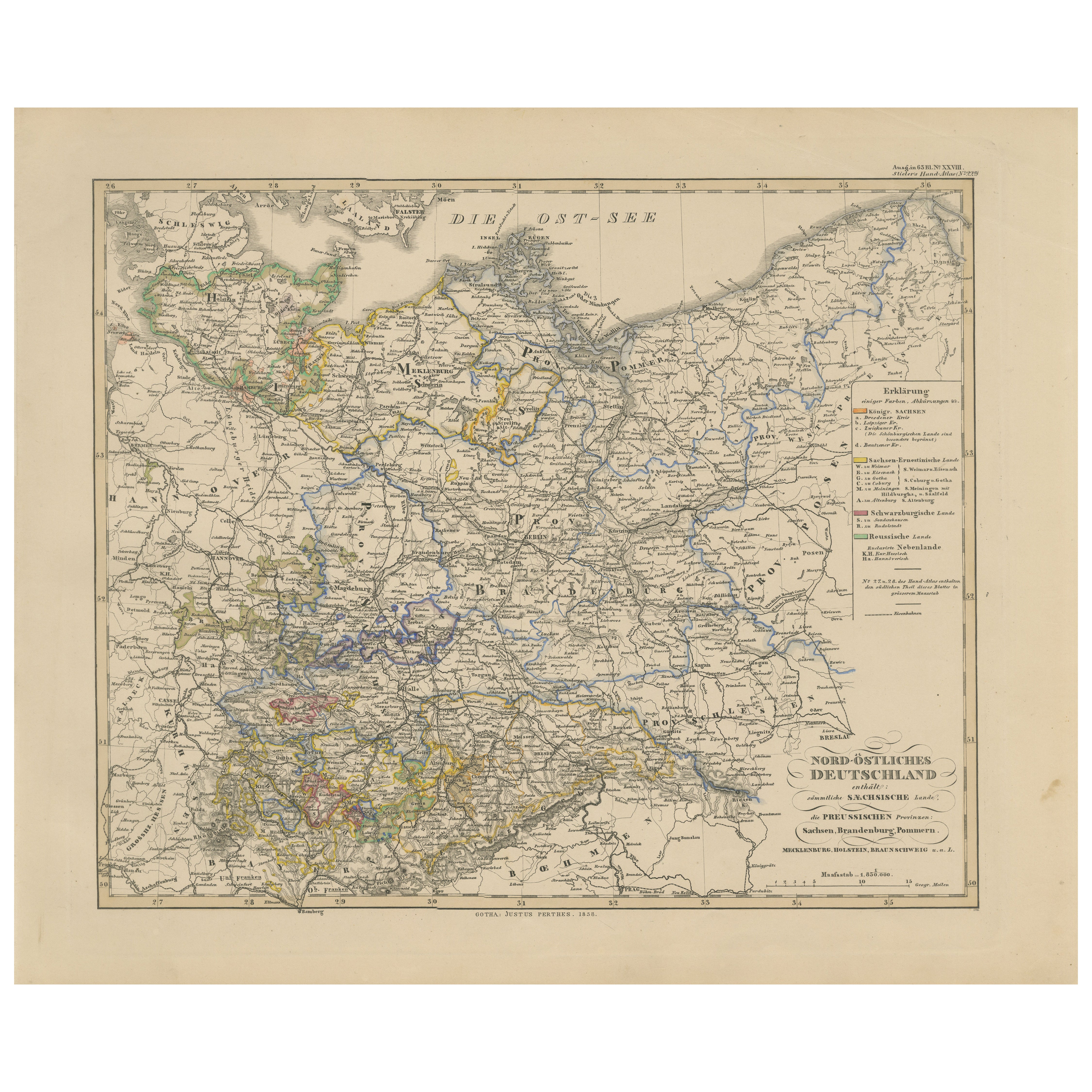
Antique Map of Northeastern Germany – Saxon & Prussian States, 1858
Located in Langweer, NL
Antique Map of Northeastern Germany – Saxon & Prussian States, 1858
Detailed and finely engraved map titled "Nord-Östliches Deutschland enthaltend die Sächsischen Länder und die Pre...
Category
Antique Mid-19th Century German Maps
Materials
Paper
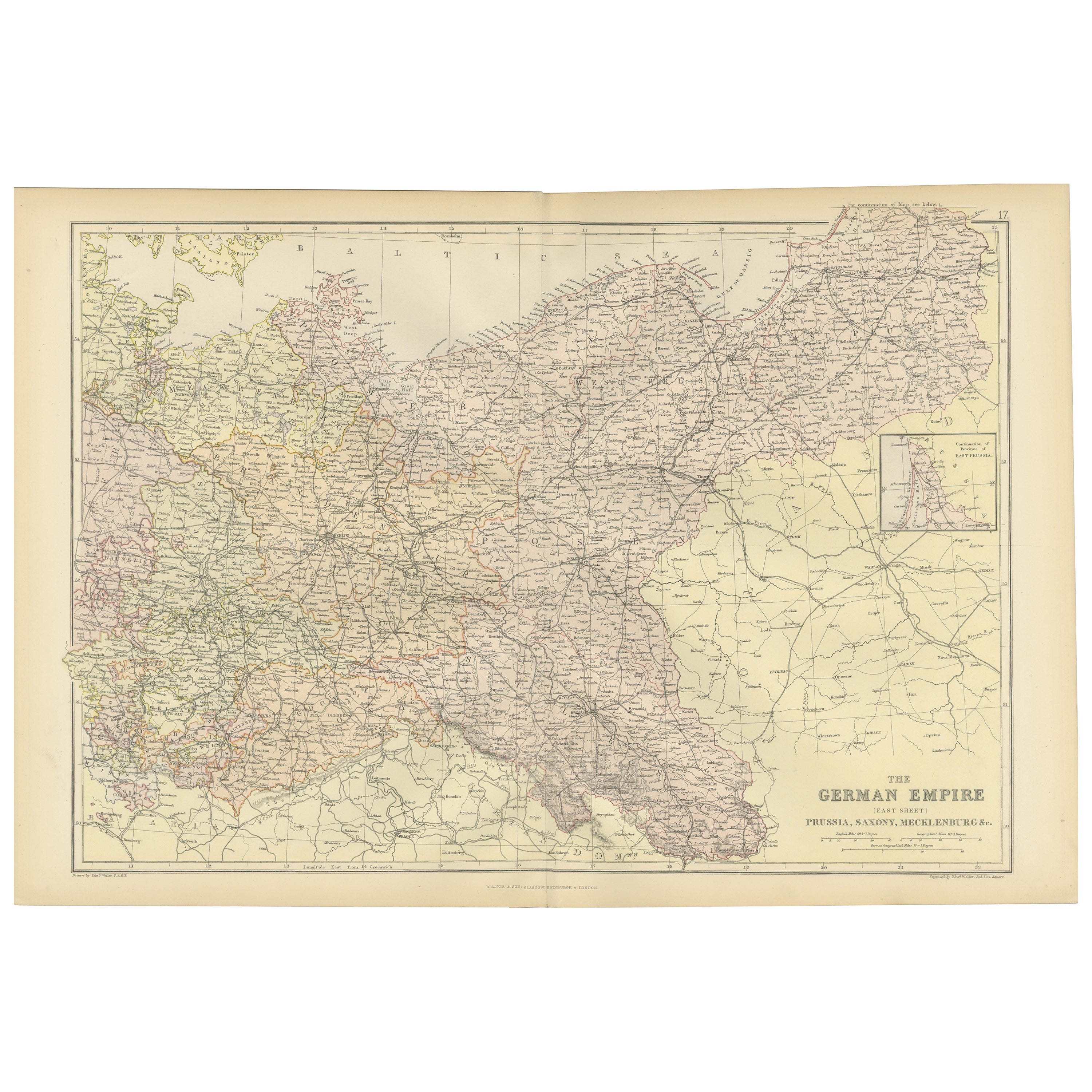
Antique Map of The German Empire (East Sheet), 1882
Located in Langweer, NL
Step into history with an authentic Antique Map of The German Empire (East Sheet) from the esteemed 'Comprehensive Atlas and Geography of the World,' meticulously crafted in 1882. Th...
Category
Antique 1880s Maps
Materials
Paper
$179 Sale Price
20% Off
You May Also Like
1853 Map of "Russia in Europe Including Poland" Ric.r016
Located in Norton, MA
Description
Russia in Europe incl. Poland by J Wyld c.1853
Hand coloured steel engraving
Dimension: Paper: 25 cm W x 33 cm H ; Sight: 22 cm W x 28 cm H
Condition: Good ...
Category
Antique 19th Century Unknown Maps
Materials
Paper

German Empire, Northern Part. Century Atlas antique vintage map
Located in Melbourne, Victoria
'The Century Atlas. German Empire, Northern Part.'
Original antique map, 1903.
Central fold as issued. Map name and number printed on the reverse corne...
Category
Early 20th Century Victorian More Prints
Materials
Lithograph

Original Antique English County Map, Nottinghamshire, J & C Walker, 1851
Located in St Annes, Lancashire
Great map of Nottinghamshire
Original colour
By J & C Walker
Published by Longman, Rees, Orme, Brown & Co. 1851
Unframed.
Category
Antique 1850s English Other Maps
Materials
Paper

German Empire, Southwestern Part. Century Atlas antique vintage map
Located in Melbourne, Victoria
'The Century Atlas. German Empire, Southwestern Part'
Original antique map, 1903.
Central fold as issued. Map name and number printed on the reverse co...
Category
Early 20th Century Victorian More Prints
Materials
Lithograph

1839 Map of Karte Des "Russischen Reiches in Europa Und Asien" Ric.R0013
Located in Norton, MA
1839 map of Karte Des
"Russischen Reiches in Europa and Asien"
Ric.r013
Map of the European and Asian parts of Russian Empire. Karte der Russischen Reiches in Europa und Asien...
Category
Antique 19th Century Unknown Maps
Materials
Paper

1849 Map of "Europaische Russland", 'Meyer Map of European Russia', Ric. R017
Located in Norton, MA
1849 Map of
"Europaische Russland"
( Meyer Map of European Russia)
Ric.r017
A lovely map of European Russia dating to 1849 by Joseph Meyer. It covers the European portions of...
Category
Antique 19th Century Unknown Maps
Materials
Paper

More Ways To Browse
Imperial German
Bavaria Antique
Used Furniture Key West
Railway Map
Map New Holland
Treasure Map
Caribbean Antiques
19th Century Map Of Africa
Antique Malaysia
Antique Map Of Ireland
Ships Log
Map Of Egypt
Nautical Maps
Antique Maps Of Long Island
James Cook Map
Antique Doctors Office Furniture
Pirate Furniture
Railroad Collectibles