Items Similar to 1863 "Lloyd's New Map of the United States, the Canadas, and New Brunswick"


Want more images or videos?
Request additional images or videos from the seller
1 of 6
1863 "Lloyd's New Map of the United States, the Canadas, and New Brunswick"
$4,000
£3,036.73
€3,473.37
CA$5,588.58
A$6,215.72
CHF 3,245.66
MX$75,638.71
NOK 41,451.98
SEK 38,874.65
DKK 25,923.12
Shipping
Retrieving quote...The 1stDibs Promise:
Authenticity Guarantee,
Money-Back Guarantee,
24-Hour Cancellation
About the Item
Presented is “Lloyd's New Map of the United States, the Canadas and New Brunswick, From the latest Surveys, Showing Every Railroad & Station Finished to June 1863, and the Atlantic and Gulf Coasts.” A large, Civil War-era hanging map of the United States and adjacent territories, this map covers the area from the Atlantic Ocean and extends as far west as the 103 meridian, to “Dacotah,” Nebraska, Kansas, "Indian Territory," and Texas. The southern continuation of Florida is shown in an inset map along the right margin. This map was published by J. T. Lloyd, in New York, in 1863. According to the publisher’s marking at lower right, this map was originally issued in two states: "in Sheets, Colored" for 50 cents, and "Varnished nicely, with Rollers" for $1.
Throughout the map, the counties are colored and the towns and cities well labeled. A reference key in the bottom margin provides symbols for railroads, turnpikes and wagon roads, state capitals, cities and towns, and village post offices. As emphasized in the map’s title, this map is especially notable for the countless railway lines and stations depicted, with distances noted between points, listing “every railroad and finished station to June 1863.” Additionally, two shipping agents and their routes are drawn out of New York City. The map includes details of the steamship routes into New York and Philadelphia from Liverpool and on to California and Oregon via an overland Nicaraguan trek, presumably to assist gold rush emigrants.
This expansive and impressive map depicts the eastern half of the United States in the third year of the Civil War. In order not to recognize the legitimacy of the Confederate States of America, each state is shown in the same manner as the Union states. The only indication that the American Civil War was in progress when this map was published is a printed notice that Gideon Wells, Secretary of the Navy, wishes to acquire a quote on 100 copies of Lloyd’s Mississippi River map for Rear Admiral Chas. E. Davis, “for use of his squadron."
J.T. Lloyd had publishing centers in both New York and London and was a prolific printer of maps depicting many countries. This map bears both a New York imprint, “No. 164 Broadway, New York,” and Lloyd's London address at “1 Strand, London England.” As the fighting of the Civil War increased, there was great demand in England for maps of the American Civil War, and LLoyd exploited it by providing his maps to English map sellers as well.
This map offers interesting insight about the map trade of the times, revealing the competitive and boastful nature of print publishing. In the legend, Lloyd claims to show "every man's house from St. Louis to New Orleans” --an impossible accomplishment which he fails to do. Lloyd also used the margins of this map to list and advertise his other maps for sale, with prices and quoted reviews. So sure of the quality of his work, Lloyd boasts that "Any one finding an error in this Map will be entitled to a copy, gratis, by writing to the Publisher." He also advises against his customers purchasing from other mapmakers, specifically warning them not to purchase wood engraved maps by another “spurious” Lloyd, who is copying his maps and making errors, for instance, confusing Corinth, Mississippi by naming it Farmington.
There is much to glean from this expansive and impressive 19th century hanging wall map.
CONDITION:
Very good condition, considering age and past use. Lithographed wall map. Hand-colored with light watercolor wash, original to map. Colors are attractive, without significant fading. Paper is healthy, with a few edge chips from rolling, minimal stains, and overall toning. Map is backed with linen. Presented on wooden rollers, as issued. Map is sold unframed, as-is. Unframed dimensions: 37”H x 49 ½” W.
- Dimensions:Height: 37 in (93.98 cm)Width: 49.5 in (125.73 cm)Depth: 1 in (2.54 cm)
- Materials and Techniques:
- Place of Origin:
- Period:
- Date of Manufacture:1863
- Condition:Wear consistent with age and use. Minor structural damages. Minor fading.
- Seller Location:Colorado Springs, CO
- Reference Number:Seller: M0031stDibs: LU909735330962
About the Seller
4.9
Platinum Seller
Premium sellers with a 4.7+ rating and 24-hour response times
Established in 2010
1stDibs seller since 2011
461 sales on 1stDibs
- ShippingRetrieving quote...Shipping from: Colorado Springs, CO
- Return Policy
Authenticity Guarantee
In the unlikely event there’s an issue with an item’s authenticity, contact us within 1 year for a full refund. DetailsMoney-Back Guarantee
If your item is not as described, is damaged in transit, or does not arrive, contact us within 7 days for a full refund. Details24-Hour Cancellation
You have a 24-hour grace period in which to reconsider your purchase, with no questions asked.Vetted Professional Sellers
Our world-class sellers must adhere to strict standards for service and quality, maintaining the integrity of our listings.Price-Match Guarantee
If you find that a seller listed the same item for a lower price elsewhere, we’ll match it.Trusted Global Delivery
Our best-in-class carrier network provides specialized shipping options worldwide, including custom delivery.More From This Seller
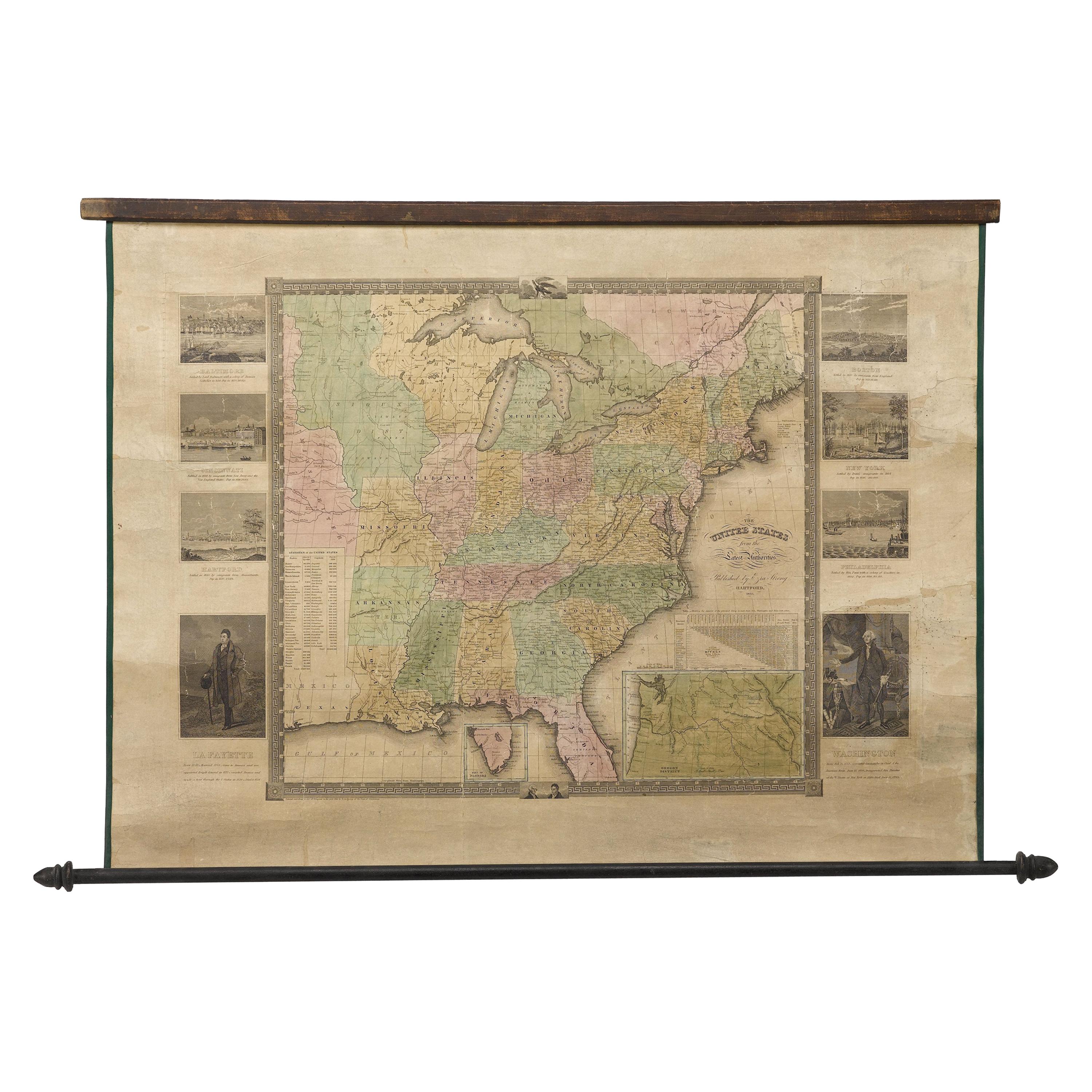
View All"The United States from the Latest Authorities" Antique Wall Map, 1835
Located in Colorado Springs, CO
This is a 1835 map of “The United States from the Latest Authorities” by Ezra Strong. A hand-colored engraved wall map of the eastern half of the United States, this map has a large inset of the "Oregon District" and several engraved city views and two portraits.
The primary map extends to Mexico Texas and the Missouri Territory, showing the course of the Missouri River to Ft. Mandan and Old Ft. Mandan, and noting many forts along the river. The territories to the east of Missouri Territory are separately delineated as Sioux District and Huron District. The western details of the map are very good for a map of this time period, with many Native American settlements, villages, forts and other details noted.
The map is bordered with vignettes of Boston, New York, Philadelphia, Hartford, Cincinnati, and Baltimore. Each vignette notes the date settled, primary settler, and the population as of 1830. Two portraits of LaFayette and George Washington are presented in full length with related biographical information.
A large inset map at lower right shows the Oregon District, centered on the Columbia River and extending to the Rocky Mountains. This is one of the earliest commercial appearances of a separate map of Oregon...
Category
Antique 1830s American Maps
Materials
Paper

1859 "Map of the United States of America..." by J. H. Colton
By J.H. Colton
Located in Colorado Springs, CO
Presented is an 1859 “Map of the United States of America, the British Provinces, Mexico, the West Indies and Central America with Part of...
Category
Antique 1850s American Maps
Materials
Paper

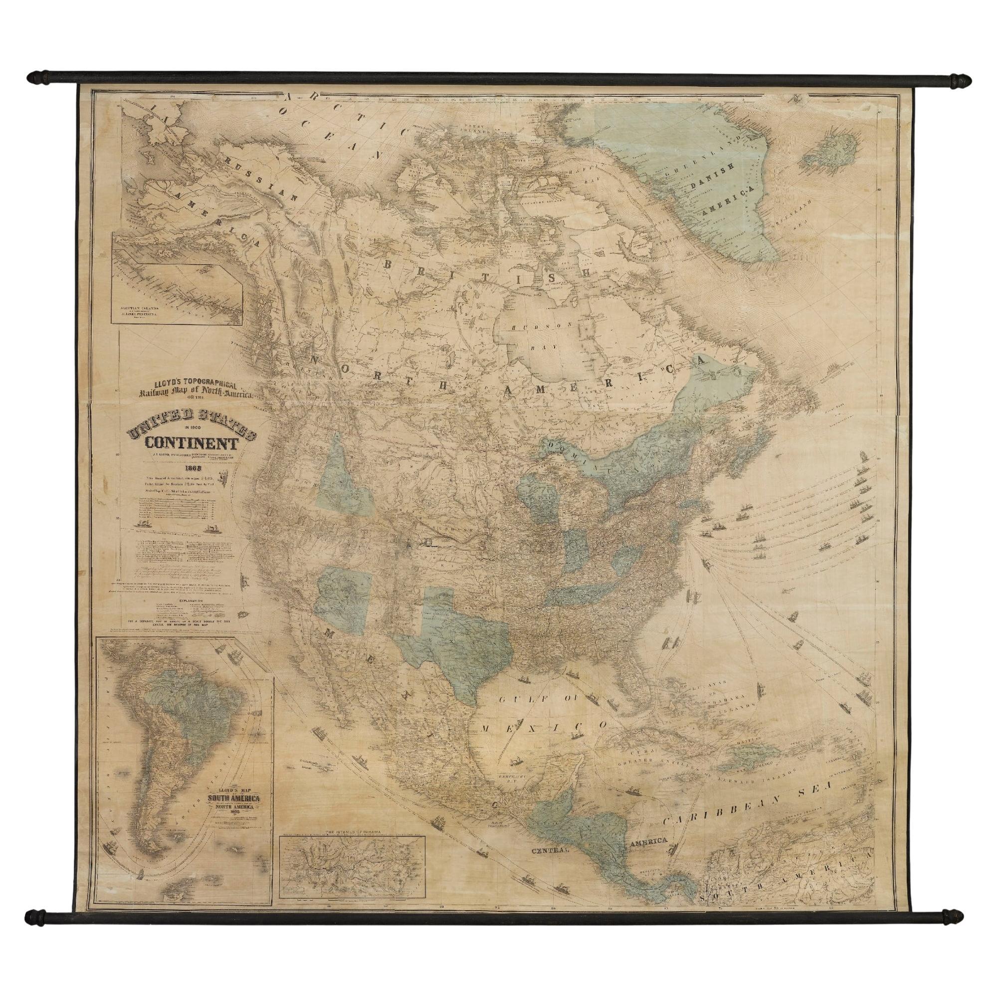
1868 "Lloyd's Topographical Railway Map of North America..." Hanging Wall Map
Located in Colorado Springs, CO
Presented is “Lloyd's Topographical Railway Map of North-America, or the United States Continent in 1900.” This map was published by J. T. Lloyd, in New York, in 1868. A large, hangi...
Category
Antique 1860s American Late Victorian Maps
Materials
Linen, Paper

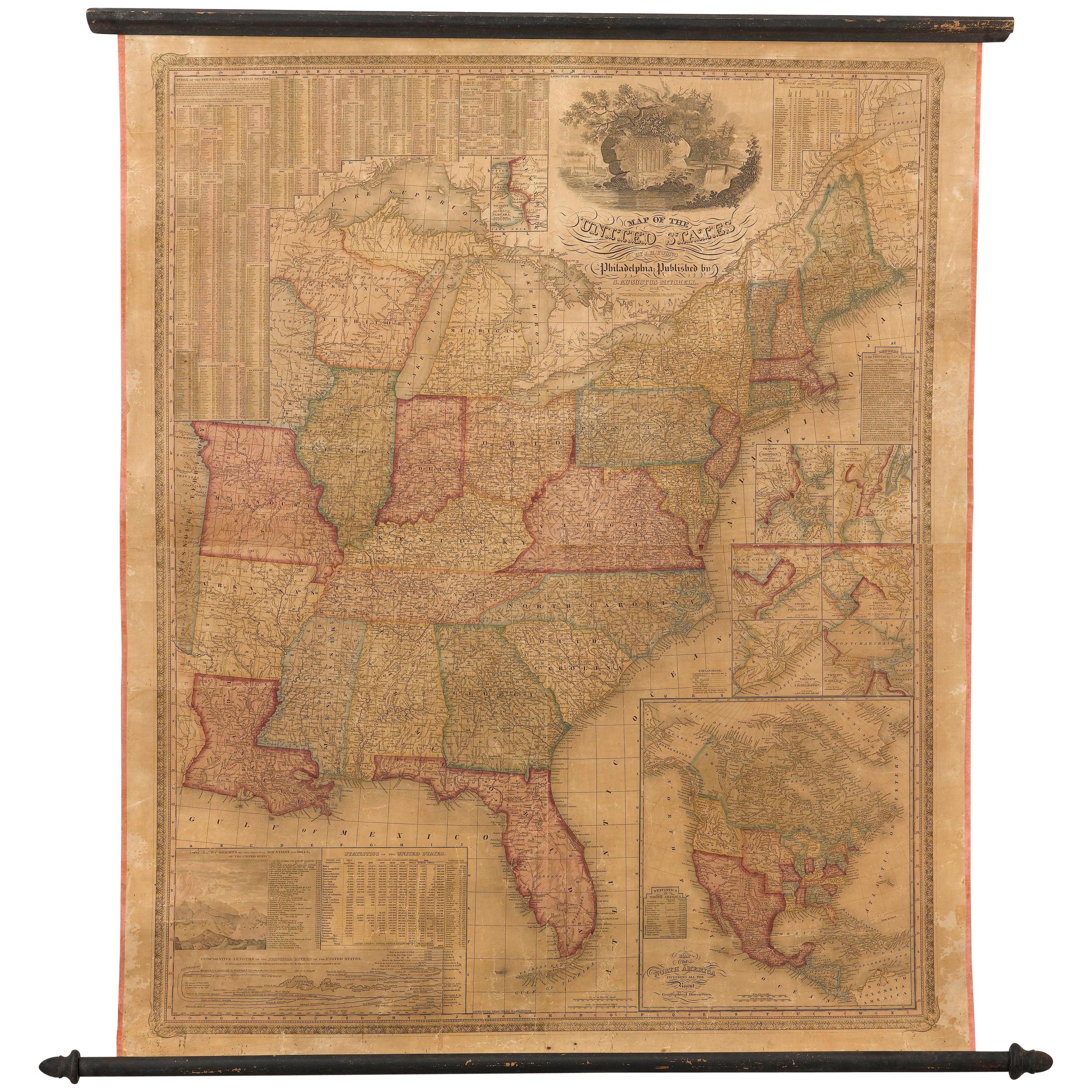
1842 Wall Map of the United States by J. H. Young, Published by S. A. Mitchell
Located in Colorado Springs, CO
Presented is an 1842 hanging “Map of the United States,” engraved by J. H. Young and published by Samuel Augustus Mitchell, Philadelphia. This is a beautiful example of the rare 1842...
Category
Antique 1840s American Maps
Materials
Paper

1866 Ensign & Bridgman's Rail Road Map of the United States
Located in Colorado Springs, CO
Presented is an 1866 issue of “Ensign & Bridgeman’s Rail Road Map of the United States, showing Depots & Stations.” First published in 1856, this is the third edition, following anot...
Category
Antique 1860s American Late Victorian Maps
Materials
Paper

1864 Map of North America, Antique Hand-Colored Map, by Adolphe Hippolyte Dufour
Located in Colorado Springs, CO
Offered is a map of North America entitled Amerique du Nord from 1864. This rare, separately published wall map was produced by Adolphe Hippolyte Dufour. This map includes vibrant an...
Category
Antique 1860s French Maps
Materials
Paper

You May Also Like
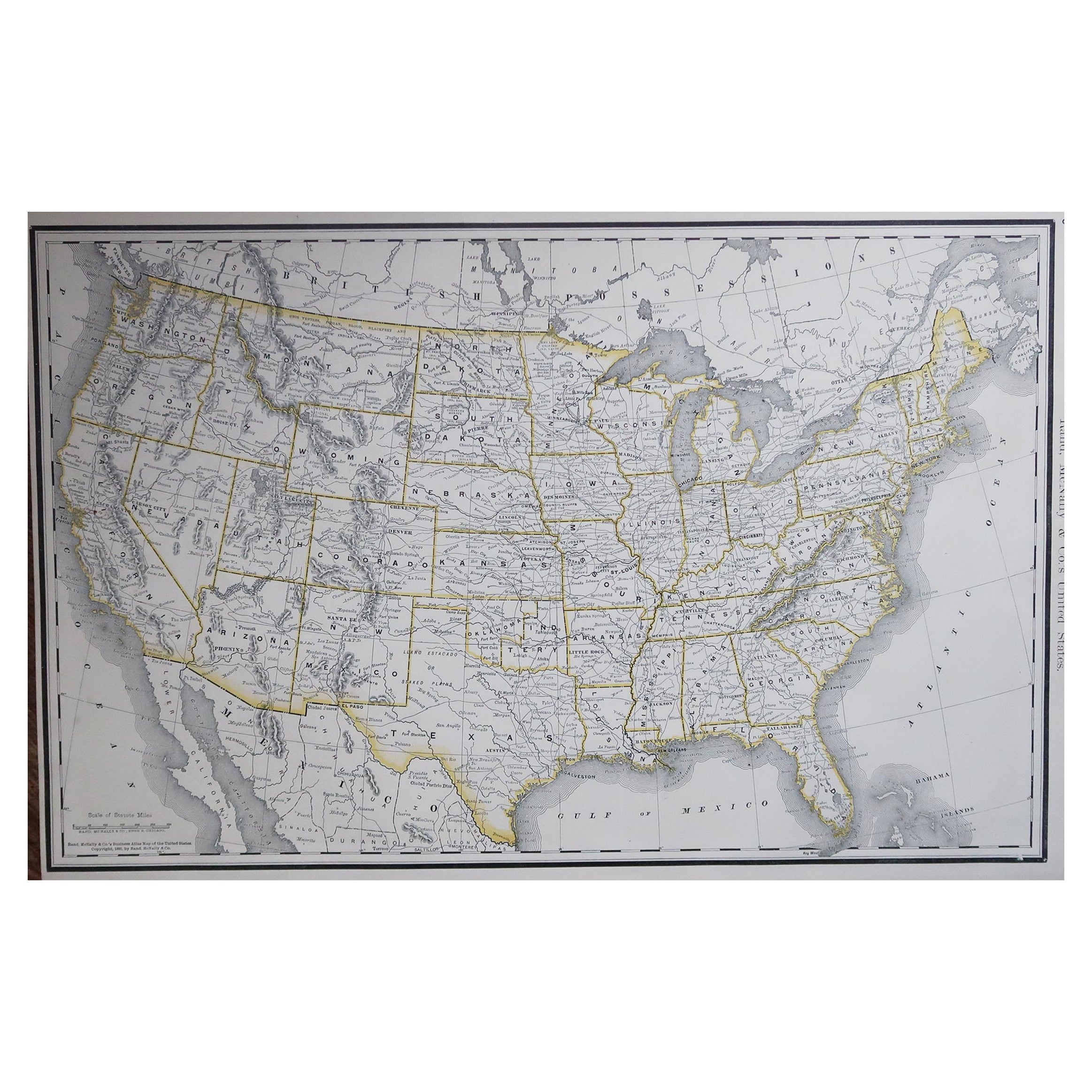
Large Original Antique Map of the United States of America. 1891
By Rand McNally & Co.
Located in St Annes, Lancashire
Fabulous map of The United States
Original color
By Rand, McNally & Co.
Dated 1891
Unframed
Free shipping.
Category
Antique 1890s American Maps
Materials
Paper

Antique Map of the United States of North America, c.1882
Located in Langweer, NL
Antique map titled 'United States of North America'. Old map of the United States of North America. This map originates from 'The Royal Atlas of Modern Geography, Exhibiting, in a Se...
Category
Antique 1880s Maps
Materials
Paper

$335 Sale Price
20% Off
Antique 1844 J Calvin Smith JH Colton Midwest United States Survey Map 27"
By J.H. Colton
Located in Dayton, OH
Antique framed black and white map of seven Midwestern American states. Guide Through Ohio, Michigan, Indiana, Illinois, Missouri, Wisco...
Category
Antique 1840s Maps
Materials
Paper

$940 Sale Price
20% Off
Antique Map of the United States by Titus '1871'
Located in Langweer, NL
Antique map titled 'The United States of America'. Original antique map of the United States. This map originates from 'Atlas of Prebl...
Category
Antique Late 19th Century Maps
Materials
Paper

$766 Sale Price
20% Off
Antique Map of The United States of North America, 1882
Located in Langweer, NL
This is a historical map titled "The United States of North America, Central Part" from the 1882 Blackie Atlas. It depicts the continental United States with a high level of detail, ...
Category
Antique 1880s Maps
Materials
Paper

Original Antique Map of United States, Grattan and Gilbert, 1843
Located in St Annes, Lancashire
Great map of United States
Drawn and engraved by Archer
Published by Grattan and Gilbert. 1843
Original colour
Unframed.
Category
Antique 1840s English Maps
Materials
Paper

More Ways To Browse
Canadian Antique Furniture
New England Hand Painted Furniture
Used Furniture In New Orleans
Large Wall Maps
Railway Map
American Wood Secretary
Antique Paper Roller
Antique Furniture Brunswick
Antique Wood Wagon
Wooden Wagon
Antique Indian Wall Hanging
Playful Chair
Giacometti Chairs
Antique Rug Wool Navy Blue Red
Bauhaus Flower Stand
French Table With Drawers
North Carolina Furniture
Antique Silver Platter