Items Similar to 18th Century Emanuel Bowen Map of County of York, c.1740

Want more images or videos?
Request additional images or videos from the seller
1 of 16
18th Century Emanuel Bowen Map of County of York, c.1740
$1,089.48
£795
€927.50
CA$1,492.32
A$1,659.79
CHF 866.69
MX$20,197.84
NOK 11,068.94
SEK 10,380.72
DKK 6,922.26
Shipping
Retrieving quote...The 1stDibs Promise:
Authenticity Guarantee,
Money-Back Guarantee,
24-Hour Cancellation
About the Item
Antique 18th century British rare and original Emanuel Bowen (1694-1767) map of the County of York divided into its Ridings and subdivided into wapontakes, mounted in solid wood frame with glazed front.
Emanuel Bowen was a Welsh map engraver, who achieved the unique distinction of becoming Royal Mapmaker to both to King George II of Great Britain and Louis XV of France. Bowen was highly regarded by his contemporaries for producing some of the largest, most detailed and most accurate maps of his era.
Condition
In good condition - Wear as expected with age and comes newly framed.
Size
Height: 57.5cm
Width: 74.5cm.
- Creator:Emanuel Bowen (Maker)
- Dimensions:Height: 22.64 in (57.5 cm)Width: 29.34 in (74.5 cm)Depth: 0.79 in (2 cm)
- Materials and Techniques:
- Place of Origin:
- Period:
- Date of Manufacture:circa 1740
- Condition:Wear consistent with age and use. Minor fading. In Good Condition - Wear as expected with age and comes newly framed.
- Seller Location:Royal Tunbridge Wells, GB
- Reference Number:Seller: A66811stDibs: LU1348223949742
About the Seller
5.0
Platinum Seller
Premium sellers with a 4.7+ rating and 24-hour response times
Established in 2014
1stDibs seller since 2015
509 sales on 1stDibs
Typical response time: 1 hour
- ShippingRetrieving quote...Shipping from: Royal Tunbridge Wells, United Kingdom
- Return Policy
Authenticity Guarantee
In the unlikely event there’s an issue with an item’s authenticity, contact us within 1 year for a full refund. DetailsMoney-Back Guarantee
If your item is not as described, is damaged in transit, or does not arrive, contact us within 7 days for a full refund. Details24-Hour Cancellation
You have a 24-hour grace period in which to reconsider your purchase, with no questions asked.Vetted Professional Sellers
Our world-class sellers must adhere to strict standards for service and quality, maintaining the integrity of our listings.Price-Match Guarantee
If you find that a seller listed the same item for a lower price elsewhere, we’ll match it.Trusted Global Delivery
Our best-in-class carrier network provides specialized shipping options worldwide, including custom delivery.More From This Seller
View All19th Century John Cary Map of South Part of West Riding of Yorkshire, circa 1805
By John Cary
Located in Royal Tunbridge Wells, Kent
Antique 19th century British original John Cary sr (1755-1835) map of South part of the West Riding of Yorkshire, From the beft Authorities. Engraved J Car...
Category
Antique 19th Century British Maps
Materials
Paper
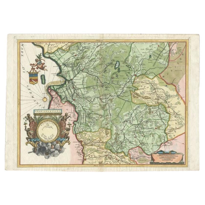
19th Century John Cary Map of North Part of West Riding of Yorkshire, C.1805
By John Cary
Located in Royal Tunbridge Wells, Kent
Antique 19th century British original John Cary sr (1755-1835) map of North part of the West Riding of Yorkshire, From the beft Authorities. Engraved J Car...
Category
Antique 19th Century British Maps
Materials
Paper

17th Century John Speed Map of the Barkshire Described, c.1616
By John Speed
Located in Royal Tunbridge Wells, Kent
Antique 17th century British very rare and original John Speed (1551-1629) map of the Barkshire Described, J. Sud and Georg Humble, publication (1616 or lat...
Category
Antique 17th Century British Maps
Materials
Paper

17th Century John Speed Map of Denbighshire, c.1610
By John Speed
Located in Royal Tunbridge Wells, Kent
Antique early 17th century British very rare and original John Speed, hand coloured map of Denbighshire, dated 1610, by John Sunbury and George Humble. John...
Category
Antique 17th Century British Maps
Materials
Wood, Paper

20thC Leather Cased Collection Of Bartholomew Maps Of Great Britain c.1920
Located in Royal Tunbridge Wells, Kent
Antique 20th Century leather-cased collection of Bartholomew British road maps by Edward Stanford Ltd of London. One volume features a map of the entire British Isles, divided into n...
Category
20th Century British Other Maps
Materials
Leather, Paper

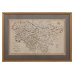
Antique 20th Century Victorian Framed Royal Standard Flag c.1900
Located in Royal Tunbridge Wells, Kent
An excellent 20th Century Victorian Royal Standard presented in a reclaimed wood frame. This flag, reserved for the British monarch, features the three lions of England and Wales, th...
Category
20th Century British Other Tapestries
Materials
Fabric, Glass
You May Also Like
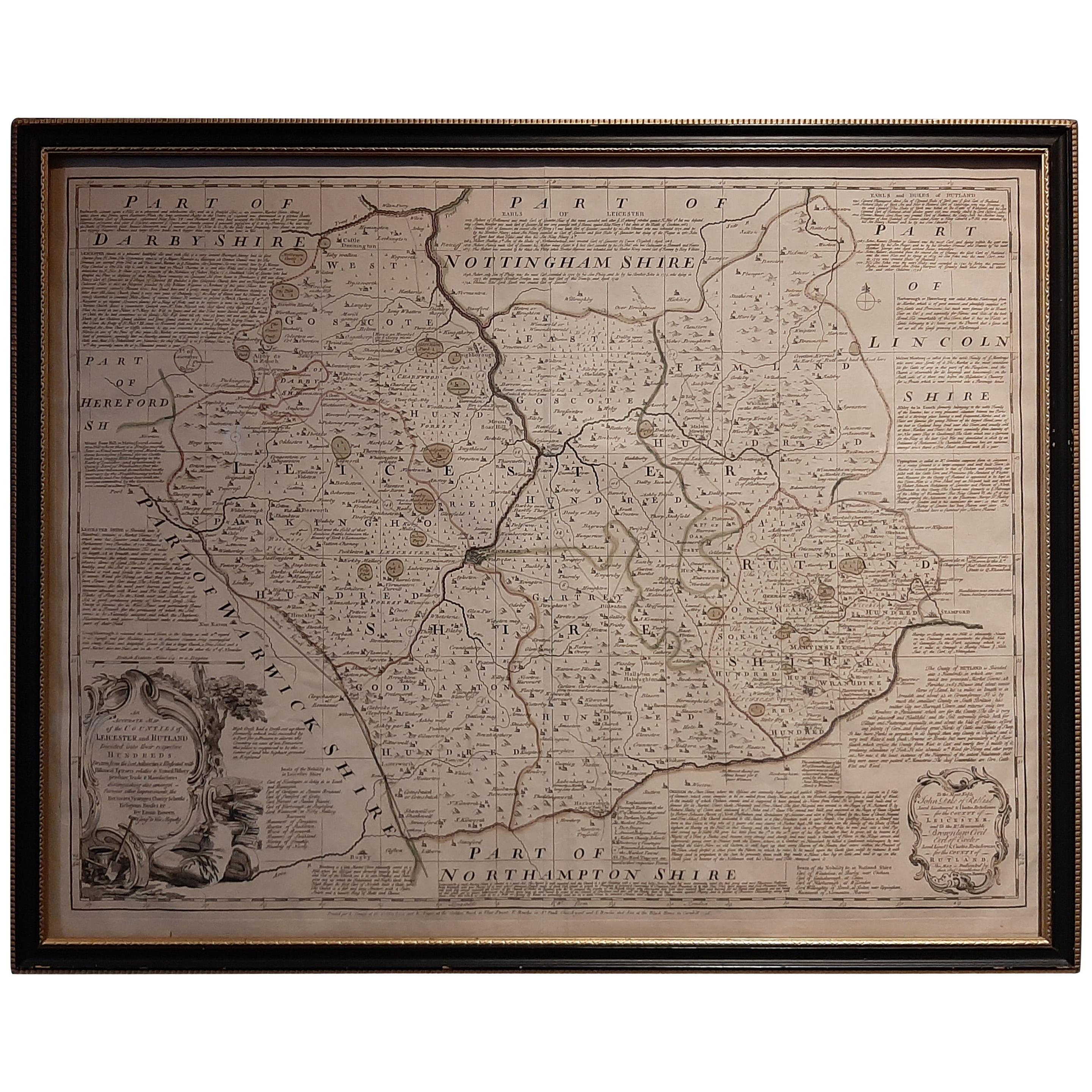
Antique Map of Leicester and Rutland by Tinney & Sayer, 'circa 1756'
Located in Langweer, NL
Antique map titled 'An Accurate Map of the Counties of Leicester and Rutland (..)'. Large map of Leicester and Rutland with dedications to the Most Noble John Duke of Rutland, and to...
Category
Antique Mid-18th Century Maps
Materials
Paper

$766 Sale Price
20% Off
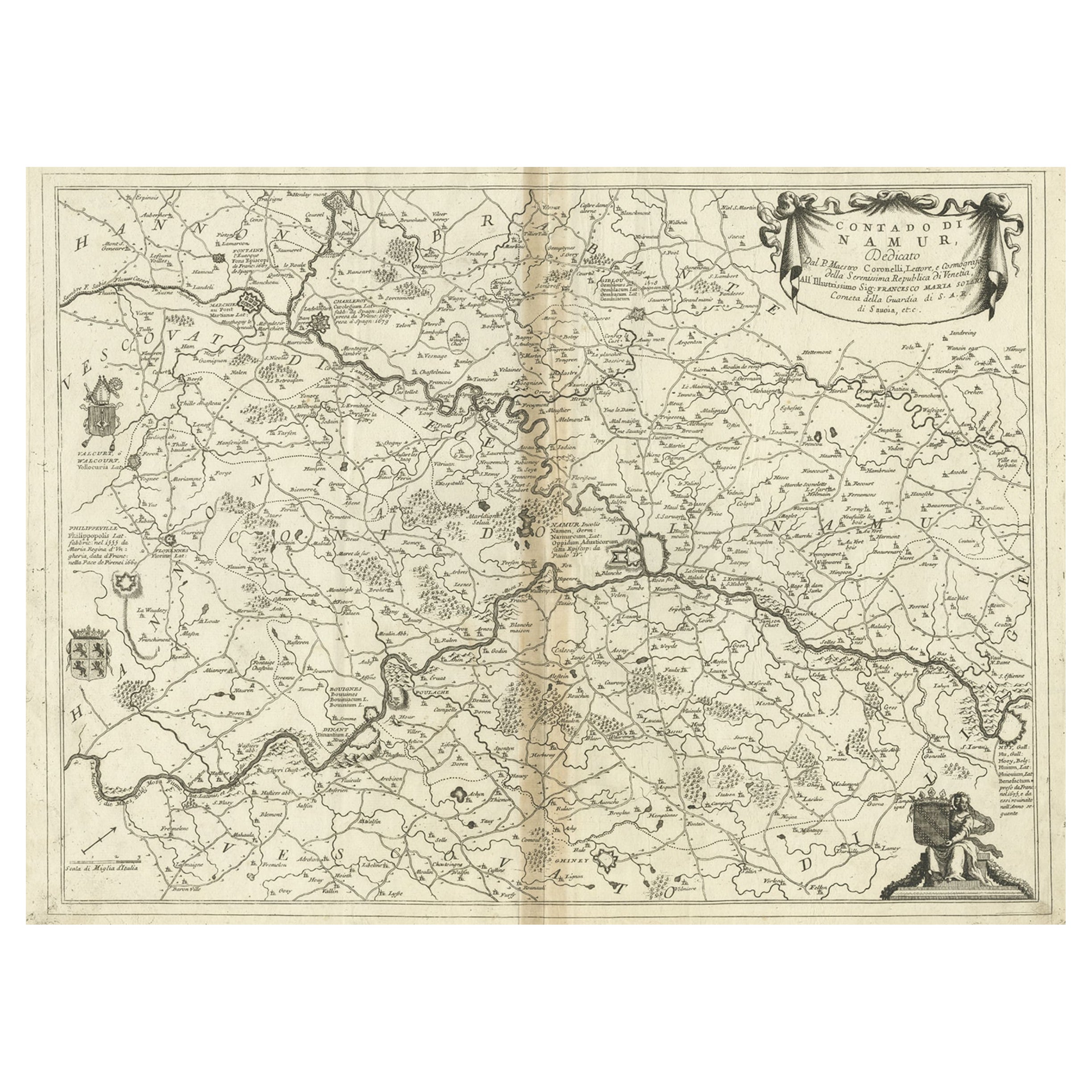
Antique Map of the Namur Region in France by Coronelli, c.1695
By Vincenzo Coronelli
Located in Langweer, NL
Antique map titled 'Contado di Namur (..)'. Old map of the Namur region in central Belgium. Includes several coats of arms.
Artists and Engravers: The remarkable Vincenzo Coronell...
Category
Antique 17th Century Maps
Materials
Paper
$450 Sale Price
20% Off
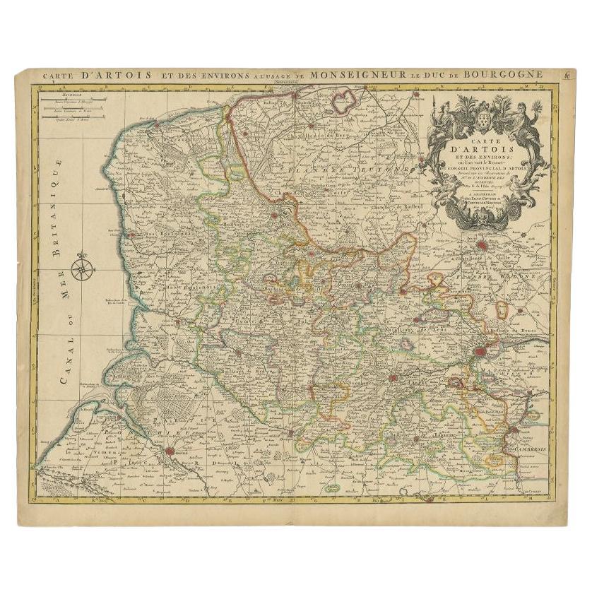
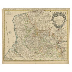
Antique Map of the Region of Artois by Covens & Mortier, c.1730
By Covens & Mortier
Located in Langweer, NL
Antique map titled 'Carte d'Artois et des environs'. Large map of the region of Artois, France. Artois is former province located in the northwestern part of France, boarding Belgium...
Category
Antique 18th Century Maps
Materials
Paper
$316 Sale Price
20% Off
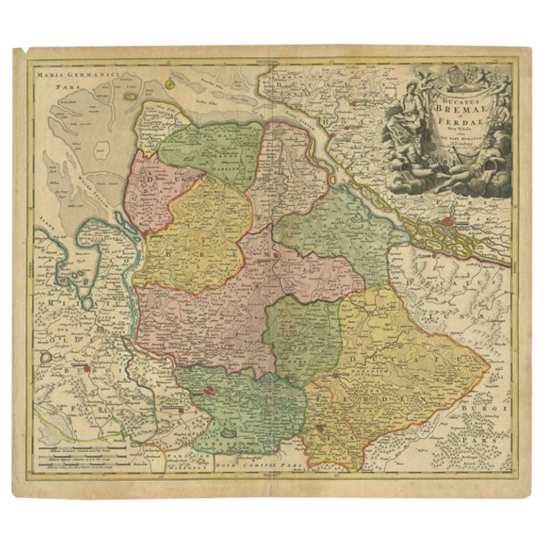
Antique Map of the Duchies of Bremen and Verden by Homann, c.1730
By Johann Baptist Homann
Located in Langweer, NL
Antique map titled 'Ducatus Bremae et Ferdae (..)'. Map of the Duchies of Bremen and Verden, Germany. Source unknown, to be determined.
Artists and Engravers: Johann Baptist Homan...
Category
Antique 18th Century Maps
Materials
Paper

$223 Sale Price
20% Off
Antique Map of Essex by Overton, circa 1710
Located in Langweer, NL
Antique map titled 'Essex, devided into Hundreds, with the most antient and fayre Towne Colchester (..)'. Map of Essex, England. Includes an inset town pl...
Category
Antique Early 18th Century Maps
Materials
Paper

$910 Sale Price
20% Off
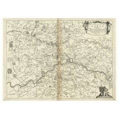
Antique Map of the Province of Overijssel by Coronelli, c.1692
Located in Langweer, NL
Antique map titled 'Tran-siselana' Splendid detailed and decorative map of the province of Overijssel in the Netherlands by Vincenzo Coronelli. An elaborate title cartouche garlanded...
Category
Antique 17th Century Maps
Materials
Paper

$516 Sale Price
20% Off
More Ways To Browse
King George Ii
Map Of Great Britain
Antique Mediterranean Map
Map Of Great Britain
Antique Map New York
Antique Wine Maps
Antique Map Of The South Of France
Antique Maps Of Greece
Large Framed Maps
Java Map
Antique Marine Maps
Antique Indian Maps
West Africa Map
Antique Maps Of Wales
Antique Map Denmark
Antique Mining
Antique World Globe Map
Antique Oregon