Emanuel Bowen Furniture
2
to
2
2
2
2
2
2
1
1
1
5,177
4,015
2,458
2,235
Creator: Emanuel Bowen
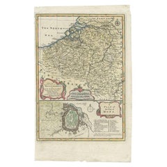
Antique Map of the Netherlands and Belgium by Bowen, 1747
By Emanuel Bowen
Located in Langweer, NL
Antique map Belgium titled 'A New and Accurate Map of the Netherlands or Low Countries'. Detailed map of South of the Netherlands and Belgium. With large inset of the city of Mons, B...
Category
18th Century Antique Emanuel Bowen Furniture
Materials
Paper
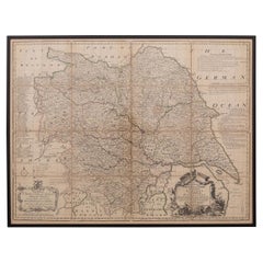
18th Century Emanuel Bowen Map of County of York, c.1740
By Emanuel Bowen
Located in Royal Tunbridge Wells, Kent
Antique 18th century British rare and original Emanuel Bowen (1694-1767) map of the County of York divided into its Ridings and subdivided into wapontakes, mounted in solid wood fram...
Category
Early 18th Century British Antique Emanuel Bowen Furniture
Materials
Paper
Related Items
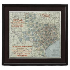
1908 "Map of Texas" by The Kenyon Company
Located in Colorado Springs, CO
Presented is an antique map of the state of Texas, printed as a pocket map in 1908 by The Kenyon Company. The state map is brightly colored by county, with principal cities and towns listed. The congressional districts are numbered and boldly outlined in red. Rivers, roads, and railroads all appear prominently on this fantastic map...
Category
Early 1900s American Antique Emanuel Bowen Furniture
Materials
Paper
Antique Map of Italy by Andriveau-Goujon, 1843
By Andriveau-Goujon
Located in New York, NY
Antique Map of Italy by Andriveau-Goujon, 1843. Map of Italy in two parts by Andriveau-Goujon for the Library of Prince Carini at Palazzo Carini i...
Category
1840s French Antique Emanuel Bowen Furniture
Materials
Linen, Paper
Original Antique Map of Spain and Portugal, Engraved By Barlow, 1806
Located in St Annes, Lancashire
Great map of Spain And Portugal
Copper-plate engraving by Barlow
Published by Brightly & Kinnersly, Bungay, Suffolk. 1806
Unframed.
Category
Early 1800s English Antique Emanuel Bowen Furniture
Materials
Paper
No Reserve
H 8 in W 10 in D 0.07 in
1854 Map of Massachusetts, Connecticut and Rhode Island, Antique Wall Map
Located in Colorado Springs, CO
This striking wall map was published in 1854 by Ensign, Bridgman & Fanning and has both full original hand-coloring and original hardware. This impression is both informative and highly decorative.
The states are divided into counties, outlined in red, green, and black, and subdivided into towns. Roads, canals, and railroad lines are prominently depicted, although they are not all labeled. The mapmakers also marked lighthouses, banks, churches, and prominent buildings, with a key at right. The map is an informative and comprehensive overview of the infrastructural development of New England prior to the Civil War. Physical geographies depicted include elevation, conveyed with hachure marks, rivers and lakes. The impression features an inset map of Boston...
Category
19th Century American Antique Emanuel Bowen Furniture
Materials
Paper
H 38.13 in W 45 in D 3.5 in
Original Antique Map of The Netherlands, Engraved by Barlow, Dated 1807
Located in St Annes, Lancashire
Great map of Netherlands
Copper-plate engraving by Barlow
Published by Brightly & Kinnersly, Bungay, Suffolk.
Dated 1807
Unframed.
Category
Early 1800s English Antique Emanuel Bowen Furniture
Materials
Paper
No Reserve
H 8 in W 10 in D 0.07 in
18th Century Antique Map of the Virgin Islands and Caribbean Inset Maps
Located in Langweer, NL
A fascinating piece of cartographic history! The map, titled "Carte du supplément pour les Isles Antilles," featuring inset maps of various islands in the Caribbean, is from the "Atl...
Category
Late 18th Century Antique Emanuel Bowen Furniture
Materials
Paper
Free Shipping
H 12.68 in W 18 in D 0.02 in
Map of the Republic of Genoa
Located in New York, NY
Framed antique hand-coloured map of the Republic of Genoa including the duchies of Mantua, Modena, and Parma.
Europe, late 18th century.
Dimension: 25...
Category
Late 18th Century European Antique Emanuel Bowen Furniture
Super Rare Antique French Map of Chine and the Chinese Empire, 1780
Located in Amsterdam, Noord Holland
Super Rare Antique French Map of Chine and the Chinese Empire, 1780
Very nice map of Asia. 1780 Made by Bonne.
Additional information:
Type: Map
...
Category
18th Century European Antique Emanuel Bowen Furniture
Materials
Paper
Antique 18th Century Map of the Province of Pensilvania 'Pennsylvania State'
Located in Philadelphia, PA
A fine antique of the colony of Pennsylvania.
Noted at the top of the sheet as a 'Map of the province of Pensilvania'.
This undated and anonymous map is thought to be from the Gentleman's Magazine, London, circa 1775, although the general appearance could date it to the 1760's.
The southern boundary reflects the Mason-Dixon survey (1768), the western boundary is placed just west of Pittsburgh, and the northern boundary is not marked.
The map has a number of reference points that likely refer to companion text and appear to be connected to boundaries. The western and southern boundaries are marked Q, R, S, for example. A diagonal line runs from the Susquehanna R to the Lake Erie P. A broken line marked by many letters A, B, N, O, etc., appears in the east.
There are no latitude or longitude markings, blank verso.
Framed in a shaped contemporary gilt wooden frame and matted under a cream colored matte.
Bearing an old Graham Arader Gallery...
Category
18th Century British American Colonial Antique Emanuel Bowen Furniture
Materials
Paper
H 10.25 in W 13.25 in D 0.5 in
Antique Map of Moscovy 'Russia' by E. Bowen, 1747
Located in Langweer, NL
Beautiful map of European Russia by the English cartographer Emmanuel Bowen. It depicts the European portion of Russia extending from the Gulf of Finland to the Ural Mountains. The m...
Category
Mid-18th Century Antique Emanuel Bowen Furniture
Materials
Paper
Original Antique Map of the American State of Oregon, 1889
Located in St Annes, Lancashire
Great map of Oregon
Drawn and Engraved by W. & A.K. Johnston
Published By A & C Black, Edinburgh.
Original colour
Unframed.
Category
1880s Scottish Victorian Antique Emanuel Bowen Furniture
Materials
Paper
1861 Topographical Map of the District of Columbia, by Boschke, Antique Map
Located in Colorado Springs, CO
Presented is an original map of Albert Boschke's extremely sought-after "Topographical Map of the District of Columbia Surveyed in the Years 1856 ...
Category
1860s American Antique Emanuel Bowen Furniture
Materials
Paper
H 53.25 in W 53.75 in D 3.5 in
Previously Available Items
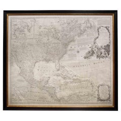
Rare Engraved "Map of North America", Emanuel Bowen & John Gibson Published 1776
By Emanuel Bowen
Located in Shippensburg, PA
"An Accurate Map Of North America. Describing and distinguishing the British and Spanish Dominions on the great Continent; According to the Definitive Treaty Concluded at Paris 10th ...
Category
18th Century British Neoclassical Antique Emanuel Bowen Furniture
Materials
Wood, Paper, Glass
H 46.63 in W 51.75 in D 1.38 in
Emanuel Bowen furniture for sale on 1stDibs.
Emanuel Bowen furniture are available for sale on 1stDibs. These distinctive items are frequently made of paper and are designed with extraordinary care. There are many options to choose from in our collection of Emanuel Bowen furniture, although brown editions of this piece are particularly popular. If you’re looking for additional options, many customers also consider furniture by Captain Greenvile Collins, John Cary, and Schreiber. Prices for Emanuel Bowen furniture can differ depending upon size, time period and other attributes — on 1stDibs, these items begin at $234 and can go as high as $985, while a piece like these, on average, fetch $609.


