Items Similar to Antique Map of the Arabian Peninsula by Bonne 'c.1780'


Want more images or videos?
Request additional images or videos from the seller
1 of 5
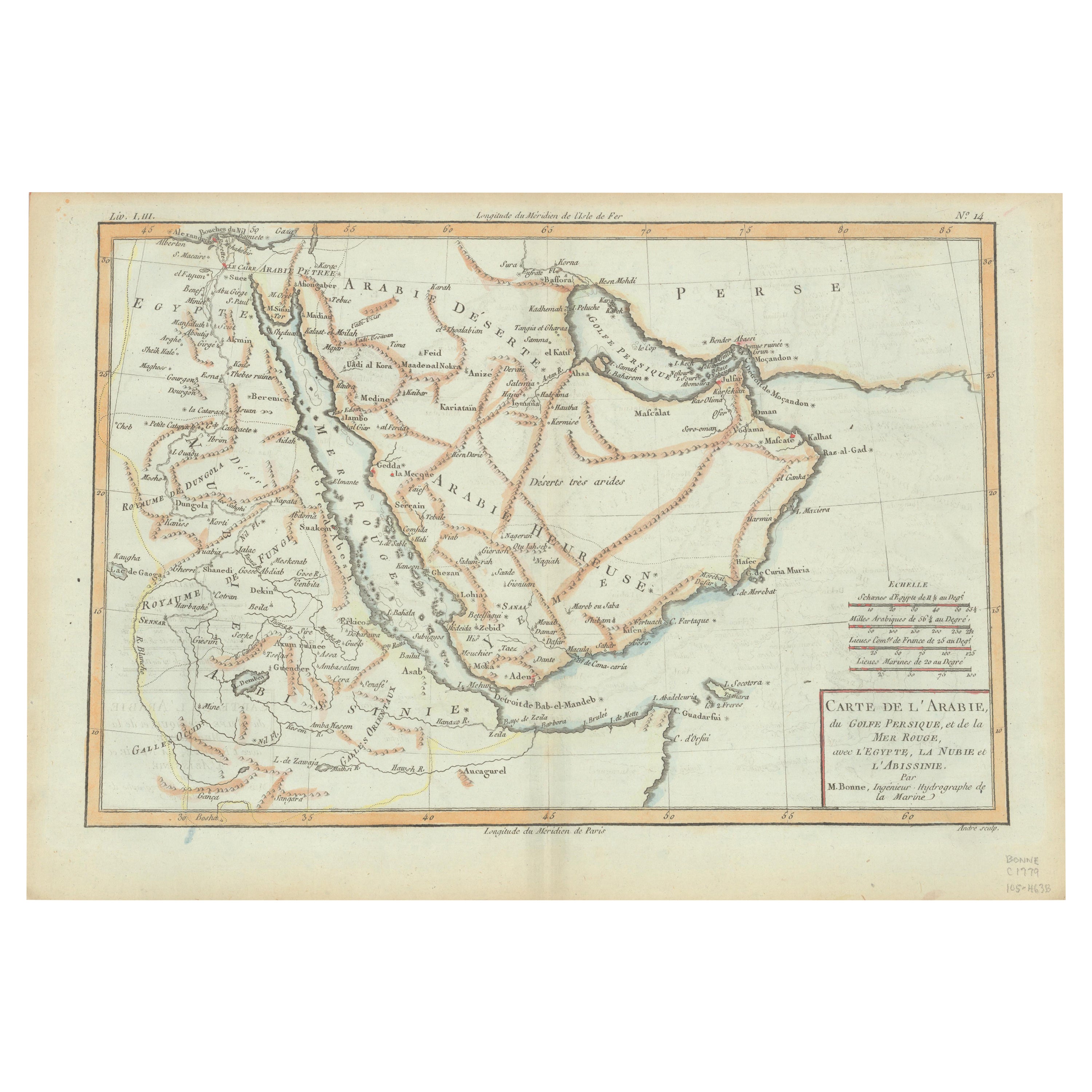
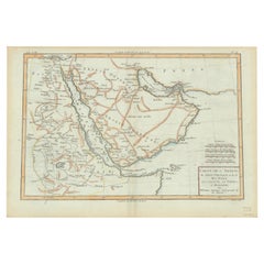
Antique Map of the Arabian Peninsula by Bonne 'c.1780'
$518.59
$648.2420% Off
£390.60
£488.2620% Off
€440
€55020% Off
CA$715.16
CA$893.9520% Off
A$803.45
A$1,004.3220% Off
CHF 419.81
CHF 524.7620% Off
MX$9,806.53
MX$12,258.1620% Off
NOK 5,330.31
NOK 6,662.8920% Off
SEK 5,017.36
SEK 6,271.7020% Off
DKK 3,349.11
DKK 4,186.3920% Off
About the Item
Antique map titled 'Carte de l'Arabie, du Golfe Persique, et de la Mer Rouge (..)'. Original antique map of the Arabian Peninsula, including the horn of Africa and part of Southwest Iran. Pictorial elevations rendered throughout as well as town names, rivers and lakes. This map originates from 'Atlas de toutes les parties connues du globe terrestre' by R. Bonne. Published circa 1780.
- Dimensions:Height: 9.85 in (25 cm)Width: 13.59 in (34.5 cm)Depth: 0.02 in (0.5 mm)
- Materials and Techniques:
- Period:
- Date of Manufacture:circa 1780
- Condition:Original foling line. Genral age-related toning. Shows some wear and creasing, blank verso. Later hand coloring. Few tiny defects in margins. Please study image carefully.
- Seller Location:Langweer, NL
- Reference Number:Seller: BG-12949-41stDibs: LU3054323451102
About the Seller
5.0
Recognized Seller
These prestigious sellers are industry leaders and represent the highest echelon for item quality and design.
Platinum Seller
Premium sellers with a 4.7+ rating and 24-hour response times
Established in 2009
1stDibs seller since 2017
2,533 sales on 1stDibs
Typical response time: <1 hour
- ShippingRetrieving quote...Shipping from: Langweer, Netherlands
- Return Policy
Authenticity Guarantee
In the unlikely event there’s an issue with an item’s authenticity, contact us within 1 year for a full refund. DetailsMoney-Back Guarantee
If your item is not as described, is damaged in transit, or does not arrive, contact us within 7 days for a full refund. Details24-Hour Cancellation
You have a 24-hour grace period in which to reconsider your purchase, with no questions asked.Vetted Professional Sellers
Our world-class sellers must adhere to strict standards for service and quality, maintaining the integrity of our listings.Price-Match Guarantee
If you find that a seller listed the same item for a lower price elsewhere, we’ll match it.Trusted Global Delivery
Our best-in-class carrier network provides specialized shipping options worldwide, including custom delivery.More From This Seller
View AllAntique Map of the Arabian Peninsula by Bonne 'c.1780'
Located in Langweer, NL
Antique map titled 'Carte de l'Arabie, du Golfe Persique, et de la Mer Rouge (..)'. Original antique map of the Arabian Peninsula, including the horn...
Category
Antique Late 18th Century Maps
Materials
Paper

$471 Sale Price
20% Off
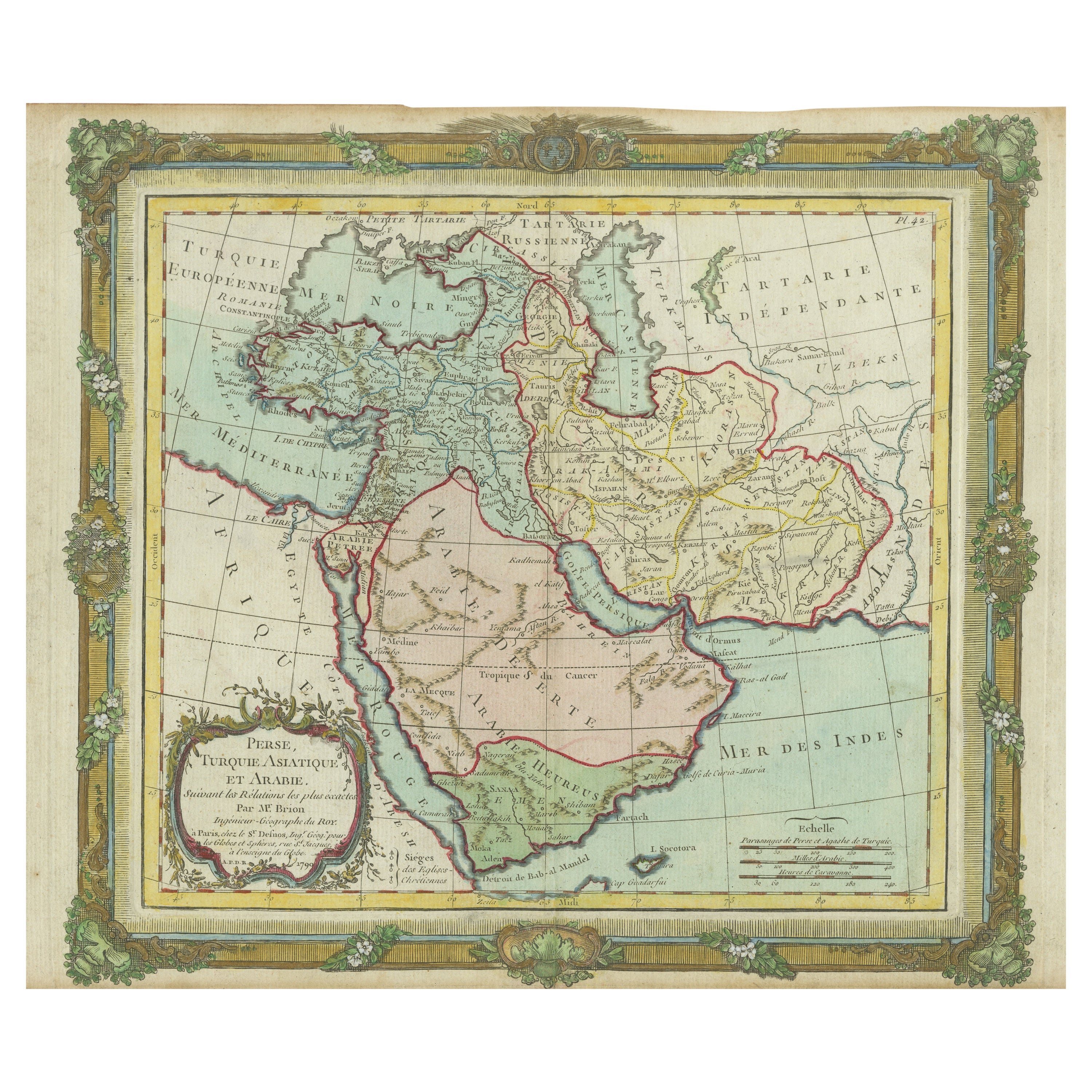
Antique Map of the Middle East with a Large Arabia, 1799
Located in Langweer, NL
Antique map titled 'Perse, Turquie Asiatique et Arabie (..)'. Map of the Middle East with a large Arabia, extending from the Black Sea to the In...
Category
Antique Late 18th Century Maps
Materials
Paper
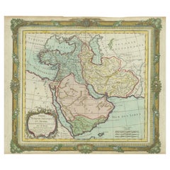
Antique Map of the Arabian Peninsula by Franceschini, '1739'
Located in Langweer, NL
Antique map titled 'Conventus et Residentiae'. Rare map of the Arabian Peninsula. This map originates from 'Provinciarum et Conventum Fratrum Discalc...
Category
Antique Mid-18th Century Maps
Materials
Paper

$530 Sale Price
40% Off
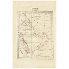
Antique Map of Arabia by Tardieu '1843'
Located in Langweer, NL
Antique map titled 'Arabie'. Attractive small map of Arabia. This map originates from 'Dictionnaire Universel de Geographie Moderne' 4th Edition, by A.Pe...
Category
Antique Mid-19th Century Maps
Materials
Paper
$188 Sale Price
20% Off
Old Map of the Arabian Peninsula with Parts of Egypt, Sudan, Eritrea & Ethiopia
Located in Langweer, NL
"Carte de l'Arabie, du Golfe Persique, et de la Mer Rouge, avec l'Egypte, la Nubie et l'Abissinie", Bonne, Rigobert
Subject: Arabia
Period: 1780 (circa)
Publication: Atlas de Toutes...
Category
Antique 1780s Maps
Materials
Paper
$358 Sale Price
20% Off
Antique Map of the Arabian Peninsula by Bellin 'c.1740'
Located in Langweer, NL
Antique map titled 'Carte de la Coste d'Arabie, Mer Rouge et Golfe de Perse'. Original antique map of the Arabian Peninsula, labes both Mecca and Med...
Category
Antique Mid-18th Century Maps
Materials
Paper

$471 Sale Price
20% Off
You May Also Like
Persia, Armenia & Adjacent Regions: A Hand-colored 17th Century Map by De Wit
By Frederick de Wit
Located in Alamo, CA
This colorful and detailed 17th century copperplate map by Frederick De Wit was published in Amsterdam between 1666 and 1690. It depicts the Caspian Se...
Category
Late 17th Century Old Masters More Prints
Materials
Engraving

Antique French Map of Asia Including China Indoneseia India, 1783
Located in Amsterdam, Noord Holland
Very nice map of Asia. 1783 Dedie au Roy.
Additional information:
Country of Manufacturing: Europe
Period: 18th century Qing (1661 - 1912)
Condition: Overall Condition B (Good Used)...
Category
Antique 18th Century European Maps
Materials
Paper

$648 Sale Price
20% Off
London 1744 Published Watercolour Antique Map of East Africa by Eman Bowen
Located in West Sussex, Pulborough
We are delighted to offer for sale this New and Accurate Map of Nubia & Abissinia, together with all the Kingdoms Tributary Thereto, and bordering upon them published in 1744 by Emanuel Bowen
This is a decorative antique engraved map of East Africa...
Category
Antique 1740s English George III Maps
Materials
Paper

Antique 1803 Italian Map of Asia Including China Indoneseia India
Located in Amsterdam, Noord Holland
Antique 1803 Italian Map of Asia Including China Indoneseia India
Very nice map of Asia. 1803.
Additional information:
Type: Map
Country of Manufacturing: Europe
Period: 19th centu...
Category
Antique 19th Century European Maps
Materials
Paper

$584 Sale Price
20% Off
Persiae, Armeniae, Natoliae et Arabiae Descriptio per Frederick deWit 1666 map
Located in Paonia, CO
Map of Persiae, Armeniae, Natoliae et Arabiae Descriptio per F de Wit 1688 engraving from: Atlas Contractus Orbis Terrarum Praecipuas ac Novissimas Complectens Tabulas. Amsterdam, N. Visscher, 1656-77. (Koeman III, Vis5-8) This highly decorative map of the Middle East is by the Dutch engraver, publisher, and map seller...
Category
1660s Realist Landscape Prints
Materials
Engraving

1790 Thomas Stackhouse Map, Entitled "Russia in Europe, " , Ric.a004
Located in Norton, MA
1790 Thomas Stackhouse map, entitled
"Russia in Europe"
Ric.a004
Stackhouse, Thomas
Russia in Europe [map]
London: T. Stackhouse, 1783. Map. Matted hand-colored copper engraving. Image size: 14.5 x 15.25 inches. Mat size: 22.75 x 23.75 inches. A beautiful example of this map of Eastern Europe...
Category
Antique 17th Century Unknown Maps
Materials
Paper

More Ways To Browse
Arabian Antique
Iran Map
Map Of Arabia
Turkey Map
Map Of Austria
Antique Mediterranean Map
Antique Furniture Building Plans
Map Of Ireland
18th Century Compass
18th Century Maps America
Map Of Great Britain
Miniature Maps
Antique Map New York
Antique Wine Maps
Antique Map Of The South Of France
Antique Maps Of Greece
Large Framed Maps
Java Map