Items Similar to Antique Map of Central Asia by Johnston '1909'

Want more images or videos?
Request additional images or videos from the seller
1 of 5
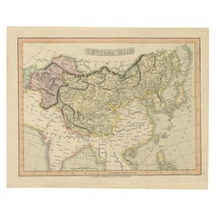
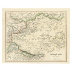
Antique Map of Central Asia by Johnston '1909'
$239.63
$299.5420% Off
£178.35
£222.9420% Off
€200
€25020% Off
CA$328.23
CA$410.2920% Off
A$365.07
A$456.3320% Off
CHF 190.63
CHF 238.2820% Off
MX$4,442.45
MX$5,553.0720% Off
NOK 2,434.58
NOK 3,043.2220% Off
SEK 2,283.21
SEK 2,854.0120% Off
DKK 1,522.53
DKK 1,903.1620% Off
Shipping
Retrieving quote...The 1stDibs Promise:
Authenticity Guarantee,
Money-Back Guarantee,
24-Hour Cancellation
About the Item
Antique map titled 'Central Asia'. Original antique map of Central Asia. This map originates from the ‘Royal Atlas of Modern Geography’. Published by W. & A.K. Johnston, 1909.
- Dimensions:Height: 19.49 in (49.5 cm)Width: 24.41 in (62 cm)Depth: 0.02 in (0.5 mm)
- Materials and Techniques:
- Period:
- Date of Manufacture:1909
- Condition:Minor fading. General age-related toning, some foxing. Please study image carefully.
- Seller Location:Langweer, NL
- Reference Number:Seller: BG-12940-291stDibs: LU3054324698912
About the Seller
5.0
Recognized Seller
These prestigious sellers are industry leaders and represent the highest echelon for item quality and design.
Platinum Seller
Premium sellers with a 4.7+ rating and 24-hour response times
Established in 2009
1stDibs seller since 2017
2,508 sales on 1stDibs
Typical response time: <1 hour
- ShippingRetrieving quote...Shipping from: Langweer, Netherlands
- Return Policy
Authenticity Guarantee
In the unlikely event there’s an issue with an item’s authenticity, contact us within 1 year for a full refund. DetailsMoney-Back Guarantee
If your item is not as described, is damaged in transit, or does not arrive, contact us within 7 days for a full refund. Details24-Hour Cancellation
You have a 24-hour grace period in which to reconsider your purchase, with no questions asked.Vetted Professional Sellers
Our world-class sellers must adhere to strict standards for service and quality, maintaining the integrity of our listings.Price-Match Guarantee
If you find that a seller listed the same item for a lower price elsewhere, we’ll match it.Trusted Global Delivery
Our best-in-class carrier network provides specialized shipping options worldwide, including custom delivery.More From This Seller
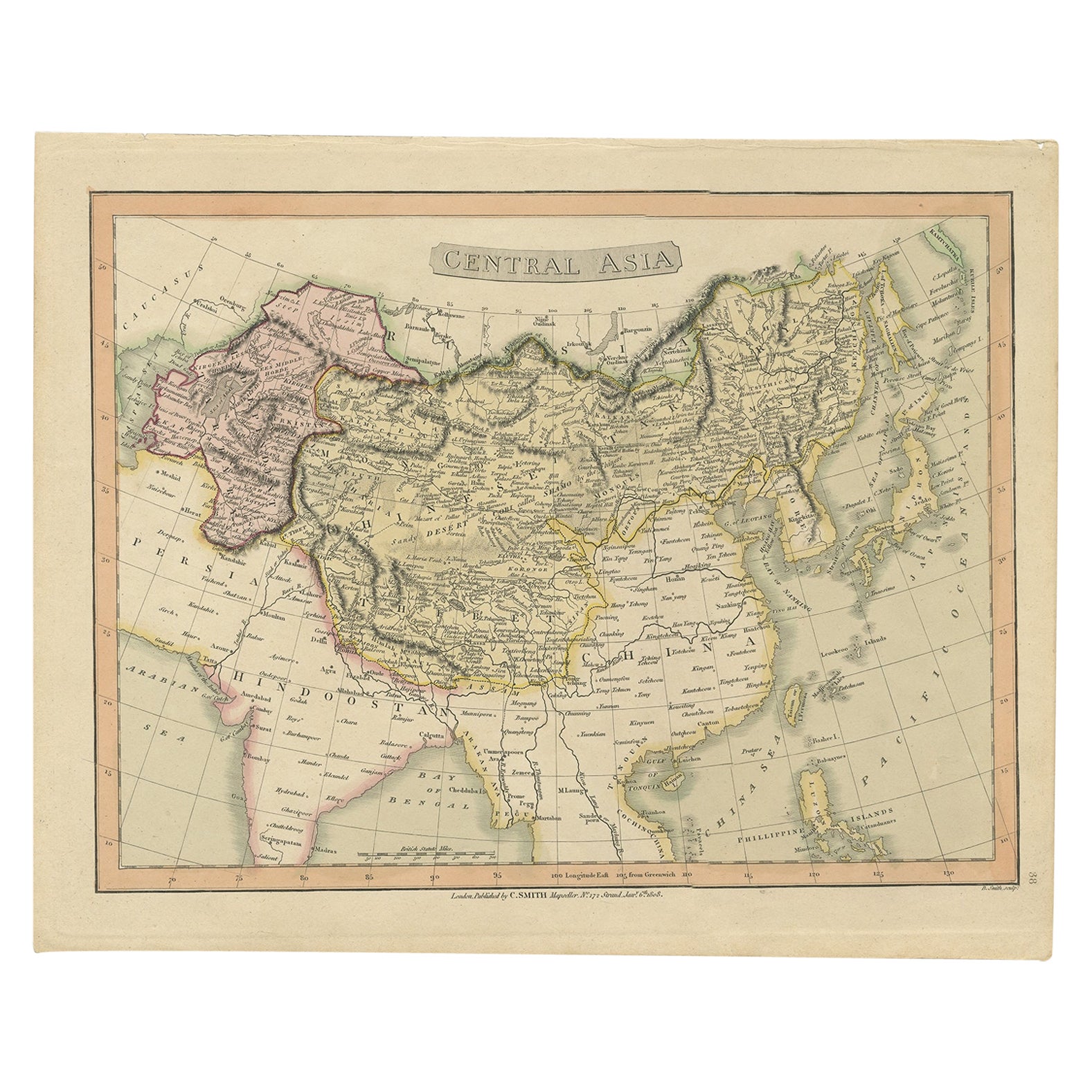
View AllOriginal Antique Map of Central Asia by Smith, 1808
Located in Langweer, NL
Antique map titled 'Central Asia'. Old map of central Asia originating from 'Smith's New General Atlas Containing Distinct Maps Of all the Principal Empires, Kingdoms, & States Throu...
Category
Antique 19th Century Maps
Materials
Paper
$230 Sale Price
20% Off
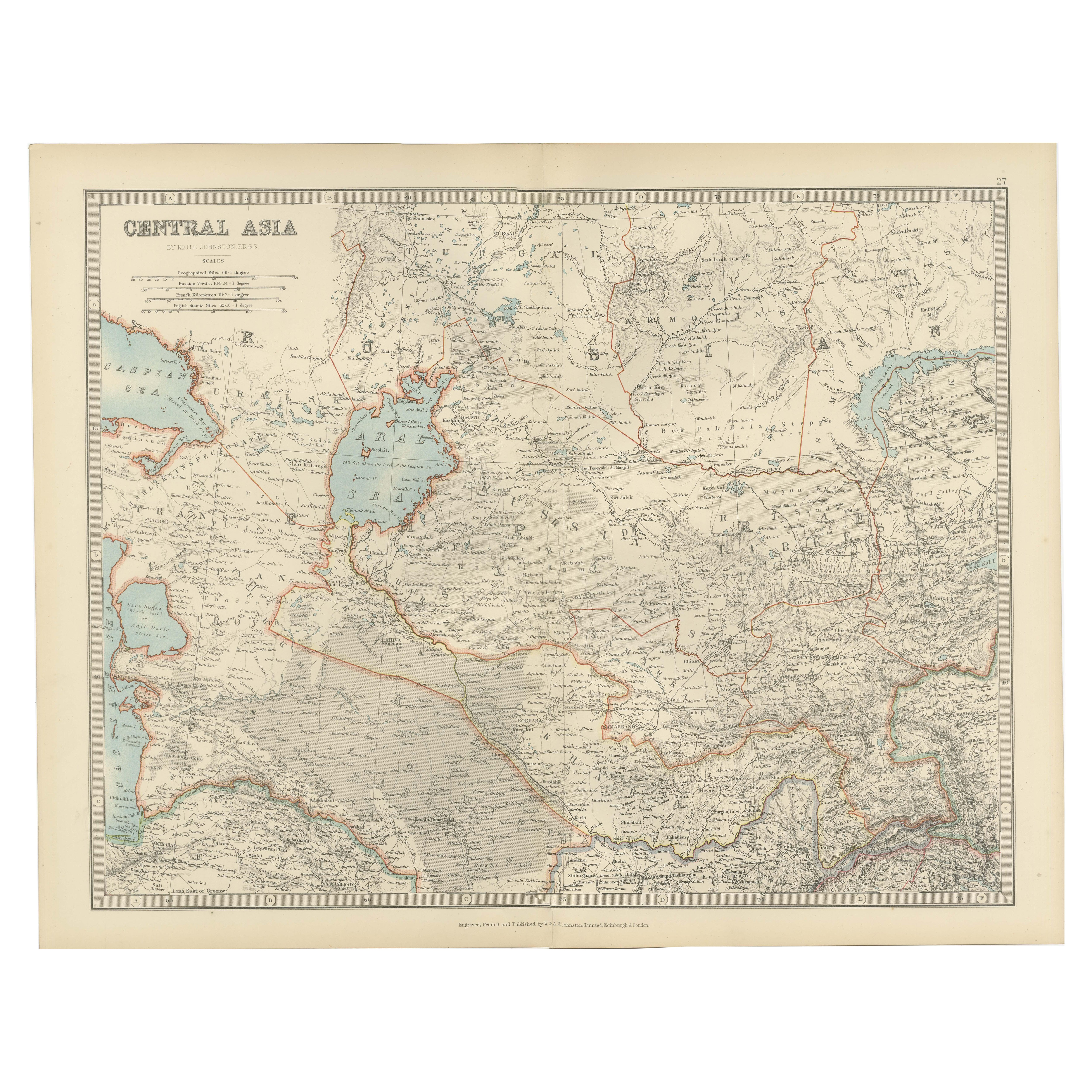
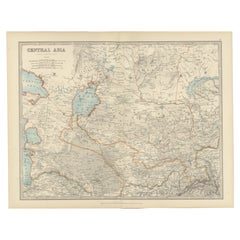
Antique Map of Central Asia - Featuring the Caspian Sea and Silk Road Regions
Located in Langweer, NL
Antique Map of Central Asia, 1903, Featuring the Caspian Sea and Silk Road Regions
This antique map, titled "Central Asia," was engraved and published in 1903 by W. & A.K. Johnston ...
Category
Early 20th Century Maps
Materials
Paper
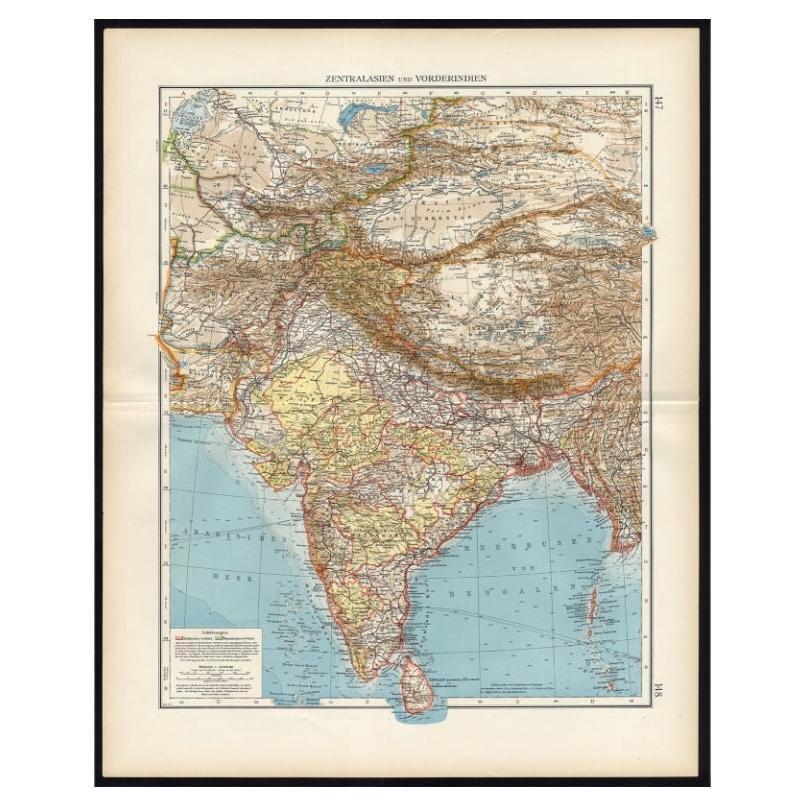
Antique Map of Central Asia and India, 1904
Located in Langweer, NL
Antique map titled 'Zentralasien und Vorderindien'. Map of Central Asia and India. This large antique map is taken from; 'Andrees Allgemeiner Handatlas in 126 Haupt-Und 139 Nebenkart...
Category
20th Century Maps
Materials
Paper

$129 Sale Price
20% Off
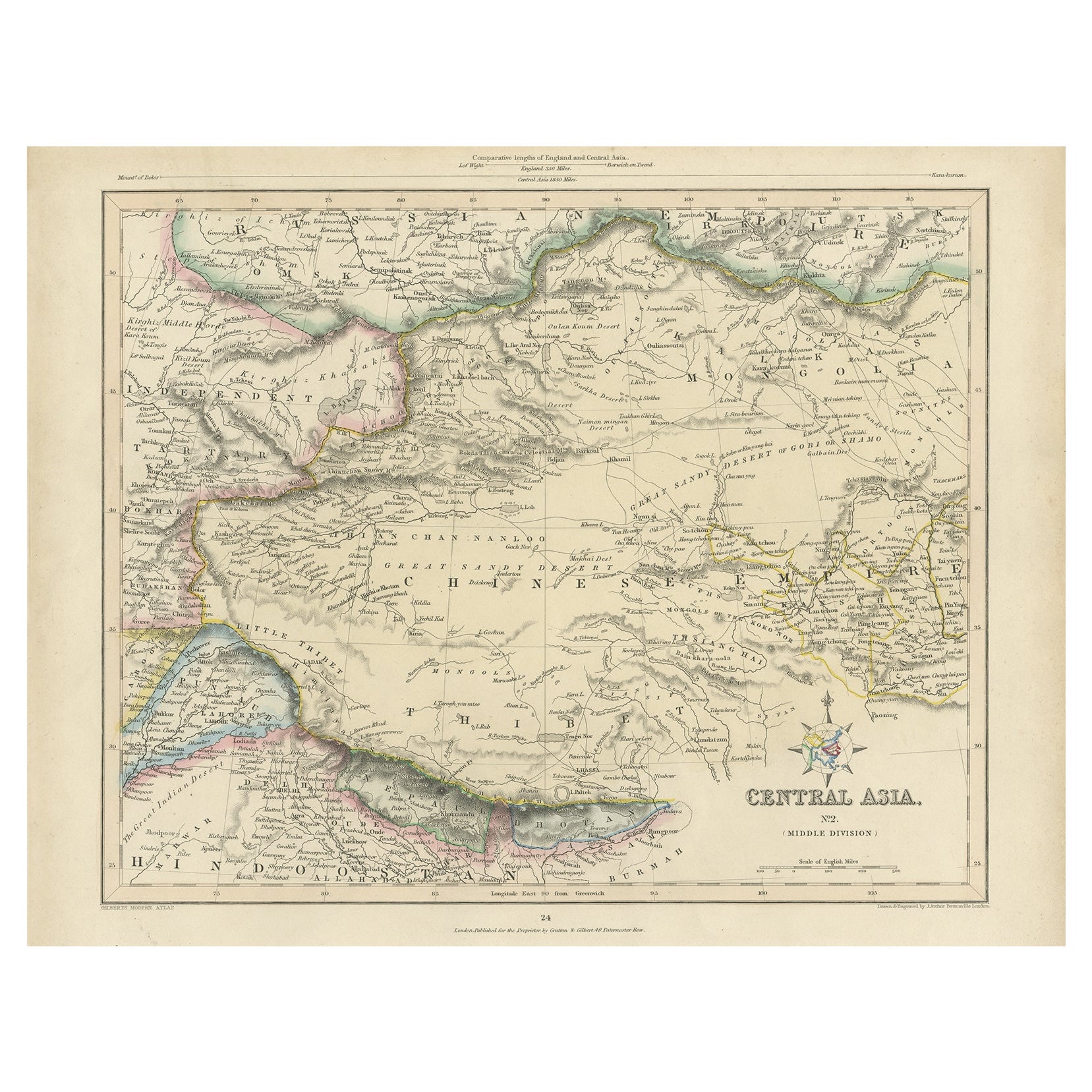
Antique Map of Central Asia, Finely Engraved, 1841
Located in Langweer, NL
Antique map titled 'Central Asia, Middle Division'. A finely engraved and attractive mid 19th Century map of Central Asia which was drawn and engraved by Joshua Archer and published ...
Category
Antique 19th Century Maps
Materials
Paper
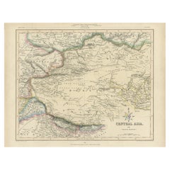
$230 Sale Price
20% Off
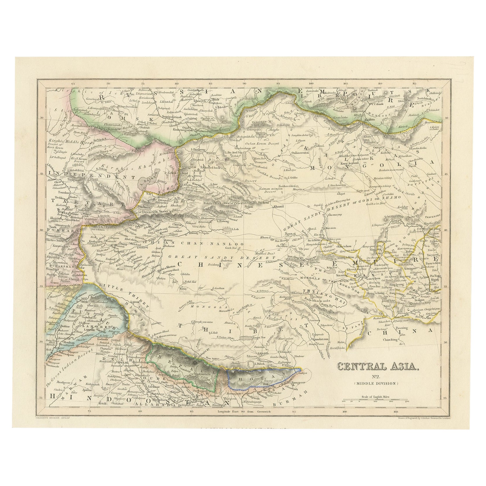
Steel Engraved Map of Central Asia Covering the Chinese Empire, Tibet Etc, C1843
Located in Langweer, NL
Antique map titled 'Central Asia (Middle Division)'.
Steel engraved map of Central Asia covering the Chinese Empire, Tibet and surroundings. This map originates from 'Gilberts Mo...
Category
Antique 1840s Maps
Materials
Paper
$249 Sale Price
20% Off
Antique Map of Asia by K. Johnston, circa 1879
Located in Langweer, NL
No. 28 of Keith Johnston's General Atlas. Published by William Blackwood & Sons Edinburgh & London, circa 1879.
Category
Antique Late 19th Century Maps
Materials
Paper

$254 Sale Price
20% Off
You May Also Like
Large Original Vintage Map of China, circa 1920
Located in St Annes, Lancashire
Great map of China.
Original color. Good condition.
Published by Alexander Gross
Unframed.
Category
Vintage 1920s English Edwardian Maps
Materials
Paper

Russia, Western and Southern Part. Century Atlas antique vintage map
Located in Melbourne, Victoria
'The Century Atlas. Russia, Western and Southern Part'
Original antique map, 1903.
Inset map tilted 'St Petersburg and Environs'.
Central fold as issued. Map name and number printe...
Category
Early 20th Century Victorian More Prints
Materials
Lithograph

Antique 1803 Italian Map of Asia Including China Indoneseia India
Located in Amsterdam, Noord Holland
Antique 1803 Italian Map of Asia Including China Indoneseia India
Very nice map of Asia. 1803.
Additional information:
Type: Map
Country of Manufacturing: Europe
Period: 19th centu...
Category
Antique 19th Century European Maps
Materials
Paper

$584 Sale Price
20% Off
Original Antique Map of China, Arrowsmith, 1820
Located in St Annes, Lancashire
Great map of China
Drawn under the direction of Arrowsmith
Copper-plate engraving
Published by Longman, Hurst, Rees, Orme and Brown, 1820
Unfr...
Category
Antique 1820s English Maps
Materials
Paper

Large1852 Map "Russian Empire" Ric.r0011
Located in Norton, MA
Large
1852 map "Russian Empire"
George Phillips & Son 1852
Ric.r0011
Dimension: Paper: 67 cm W x 52 cm H ; Sight: 60cm W x 50 cm H
Condition: Good Condition with aged tonin...
Category
Antique 19th Century Unknown Maps
Materials
Paper

Large Original Antique Map of Asia by Sidney Hall, 1847
Located in St Annes, Lancashire
Great map of Asia
Drawn and engraved by Sidney Hall
Steel engraving
Original colour outline
Published by A & C Black. 1847
Unframed
Free shipping
Category
Antique 1840s Scottish Maps
Materials
Paper

More Ways To Browse
Antique Marine Maps
Antique Indian Maps
Antique Maps Of Wales
Antique Map Denmark
Antique World Globe Map
Hemispheres Map
Map New Holland
Treasure Map
Caribbean Antiques
19th Century Map Of Africa
Antique Malaysia
Antique Map Of Ireland
Ships Log
Map Of Egypt
Nautical Maps
Antique Maps Of Long Island
James Cook Map
Antique Doctors Office Furniture