Items Similar to Antique Map of the Diocese of Toul by Covens & Mortier, circa 1720


Want more images or videos?
Request additional images or videos from the seller
1 of 5
Antique Map of the Diocese of Toul by Covens & Mortier, circa 1720
$695.52
$869.4020% Off
£517.40
£646.7520% Off
€580
€72520% Off
CA$952.41
CA$1,190.5120% Off
A$1,058.95
A$1,323.6920% Off
CHF 552.93
CHF 691.1620% Off
MX$12,890
MX$16,112.5020% Off
NOK 7,055.09
NOK 8,818.8620% Off
SEK 6,610.28
SEK 8,262.8520% Off
DKK 4,415.22
DKK 5,519.0220% Off
Shipping
Retrieving quote...The 1stDibs Promise:
Authenticity Guarantee,
Money-Back Guarantee,
24-Hour Cancellation
About the Item
Antique map titled 'Civitas Leucorum sive Pagus Tullensis'. Detailed map of the Diocese of Toul, France. Centered on the cities of Nancy and Toul and including Metz, Verdun, S. Dizier, Nas, Neuchataeu, Mircourt, Remiremont, Pagi, etc.
- Creator:Covens & Mortier (Artist)
- Dimensions:Height: 21.26 in (54 cm)Width: 24.02 in (61 cm)Depth: 0.02 in (0.5 mm)
- Materials and Techniques:
- Period:
- Date of Manufacture:circa 1720
- Condition:Great condition, original/contemporary hand coloring. Minor wear, please study images carefully.
- Seller Location:Langweer, NL
- Reference Number:Seller: BG-12390-181stDibs: LU3054318013912
About the Seller
5.0
Recognized Seller
These prestigious sellers are industry leaders and represent the highest echelon for item quality and design.
Platinum Seller
Premium sellers with a 4.7+ rating and 24-hour response times
Established in 2009
1stDibs seller since 2017
2,510 sales on 1stDibs
Typical response time: <1 hour
- ShippingRetrieving quote...Shipping from: Langweer, Netherlands
- Return Policy
Authenticity Guarantee
In the unlikely event there’s an issue with an item’s authenticity, contact us within 1 year for a full refund. DetailsMoney-Back Guarantee
If your item is not as described, is damaged in transit, or does not arrive, contact us within 7 days for a full refund. Details24-Hour Cancellation
You have a 24-hour grace period in which to reconsider your purchase, with no questions asked.Vetted Professional Sellers
Our world-class sellers must adhere to strict standards for service and quality, maintaining the integrity of our listings.Price-Match Guarantee
If you find that a seller listed the same item for a lower price elsewhere, we’ll match it.Trusted Global Delivery
Our best-in-class carrier network provides specialized shipping options worldwide, including custom delivery.More From This Seller
View AllAntique Map of the Limoges Region in France, c.1690
Located in Langweer, NL
Antique map titled 'Le Diocèse de Limoges'. Large map of the Limoges region, France.
The map is dedicated to the bishop of Limoges, Antoine de Charpin.
Artists and Engravers:...
Category
Antique 17th Century Maps
Materials
Paper

$623 Sale Price
20% Off
Antique Map of the Region of Touraine by Janssonius 'circa 1650'
By Johannes Janssonius
Located in Langweer, NL
Antique map of France titled 'Touraine - Turonensis Ducatus'. Decorative map of the Touraine region, France. It shows the cities of Tours, Amboise and others. Published by J. Jansson...
Category
Antique Mid-17th Century Maps
Materials
Paper

$431 Sale Price
20% Off
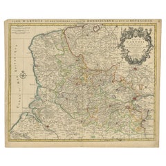
Antique Map of the Artois Region 'France' by F. de Wit, circa 1680
Located in Langweer, NL
Antique map titled 'Tabula Comitatus Artesiae emendata'. Large map of the Artois region, France. Published by F. de Wit, circa 1680.
Category
Antique Late 17th Century Maps
Materials
Paper

$517 Sale Price
25% Off
Antique Map of the Region of Île-de-France by Hondius, circa 1630
Located in Langweer, NL
Antique map titled Gouvernement de l'Isle de France'. Old map of the region of Île-de-France, France. It is located in the north-central part of the country and often called the régi...
Category
Antique Mid-17th Century Maps
Materials
Paper

$527 Sale Price
20% Off
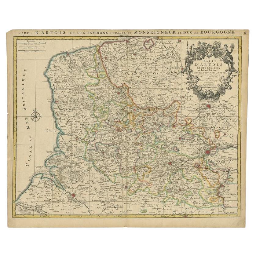
Antique Map of the Region of Artois by Covens & Mortier, c.1730
By Covens & Mortier
Located in Langweer, NL
Antique map titled 'Carte d'Artois et des environs'. Large map of the region of Artois, France. Artois is former province located in the northwestern part of France, boarding Belgium...
Category
Antique 18th Century Maps
Materials
Paper
$316 Sale Price
20% Off
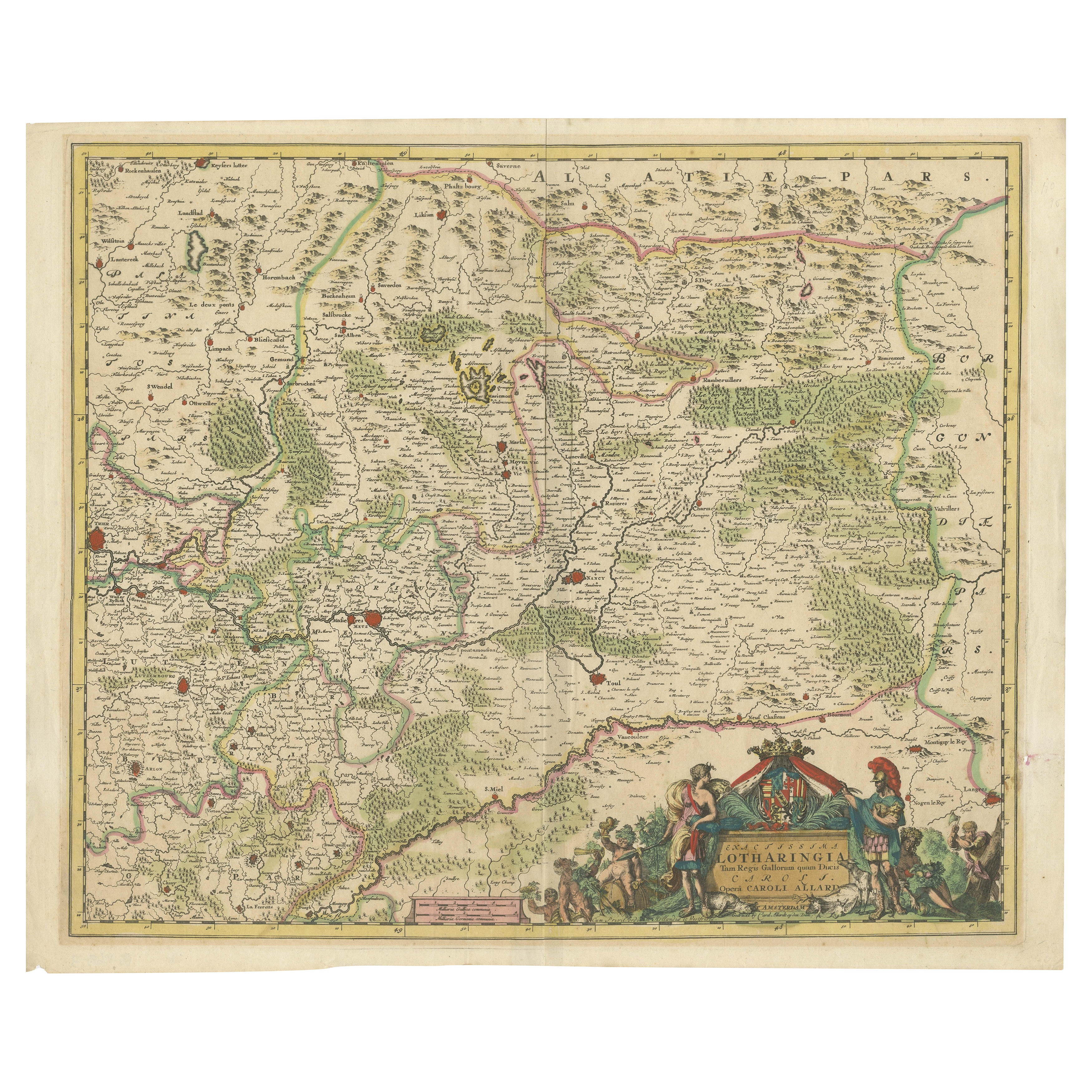
Historic 1690 Map of Lorraine in France by Allard - Cities of Toul, Nancy, Metz
Located in Langweer, NL
Exactissima Lotharingia - A Rare 17th Century Map of Lorraine by Carel Allard
This fascinating map of Lorraine, created by Carel Allard around 1690, is a stunning example of coppe...
Category
Antique 1690s Maps
Materials
Paper
$661 Sale Price
20% Off
You May Also Like
1640 Joan Bleau Map Entitled"Diocecese de rheims et le pais de rethel, " Eic.a011
Located in Norton, MA
1640 Joan Bleau map entitled
"Diocecese de rheims et le pais de rethel,"
Ric.a011
OAN BLAEU
Diocecese de Rheims, et le pais de Rethel.
Handcolored engraving, c.1640.
...
Category
Antique 17th Century Dutch Maps
Materials
Paper

1771 Bonne Map of Poitou, Touraine and Anjou, France, Ric.a015
Located in Norton, MA
1771 Bonne Map of Poitou,
Touraine and Anjou, France
Ric.a015
1771 Bonne map of Potiou, Touraine and Anjou entitled "Carte des Gouvernements D'Anjou et du Saumurois, de la Touraine, du Poitou,du Pays d'aunis, Saintonge?Angoumois,"
Carte des gouvernements d'Anjou et du Saumurois, de la Touraine, du Poitou, du Pays d'Aunis, Saintonge-Angoumois. Projettee et assujettie au ciel par M. Bonne, Hyd. du Roi. A Paris, Chez Lattre, rue St. Jacques a la Ville de Bord(ea)ux. Avec priv. du Roi. 1771. Arrivet inv. & sculp., Atlas moderne ou collection de cartes sur toutes...
Category
Antique 17th Century Unknown Maps
Materials
Paper

1656 Jansson Map Metz Region of France Entitled "Territorium Metense" Ric0014
Located in Norton, MA
1656 Jansson map Metz Region of France entitled "Territorium Metense."
Ric0014
" Authentic" - Map of the historical region surrounding Metz, in Lorraine, France.
Oriented with ...
Category
Antique 17th Century Dutch Maps
Materials
Paper

1625 Mercator Map of the Provenience of Quercy, "Quercy Cadvrcivm Ric.0013
Located in Norton, MA
1625 Mercator map of the provenience of Quercy, entitled
"Quercy Cadvrcivm,"
Ric.0013
" Authentic" - Map of the provenience of Quercy Cadvrcivm
D...
Category
Antique 17th Century French Maps
Materials
Paper

1657 Janssonius Map of Vermandois and Cappelle, Ric. A-004
Located in Norton, MA
1657 Janssonius map of
Vermandois and Cappelle
Ric.a004
Description: Antique map of France titled 'Descriptio Veromanduorum - Gouvernement de la Cappelle'. Two detailed maps o...
Category
Antique 17th Century Unknown Maps
Materials
Paper

17th Century Hand-Colored Map of a Region in West Germany by Janssonius
By Johannes Janssonius
Located in Alamo, CA
This attractive highly detailed 17th century original hand-colored map is entitled "Archiepiscopatus Maghdeburgensis et Anhaltinus Ducatus cum terris adjacentibus". It was published ...
Category
Antique Mid-17th Century Dutch Maps
Materials
Paper

More Ways To Browse
Antique Maps Of Africa
Antiques Compasses
Antique Navigation
Colonial Furniture Company
Mississippi Furniture
Antique Scottish Wood Furniture
Indonesia Map
Antique Framed Map Engravings
Atlas Furniture Company
Used Office Furniture Edinburgh
Antique 16th Century Plates
Scotland Map
Antique Maps Indonesia
Map Of Japan
Antique Rollers
Compass Rose Antique
Dutch Empire
Swiss Antiques And Collectables