Items Similar to Antique Map of Independent Tartary by W. G. Blackie, 1859


Want more images or videos?
Request additional images or videos from the seller
1 of 6
Antique Map of Independent Tartary by W. G. Blackie, 1859
$236.29
$295.3620% Off
£177.11
£221.3920% Off
€200
€25020% Off
CA$324.62
CA$405.7820% Off
A$362.41
A$453.0120% Off
CHF 189.90
CHF 237.3720% Off
MX$4,436.27
MX$5,545.3320% Off
NOK 2,411.71
NOK 3,014.6320% Off
SEK 2,273.93
SEK 2,842.4220% Off
DKK 1,522.47
DKK 1,903.0920% Off
About the Item
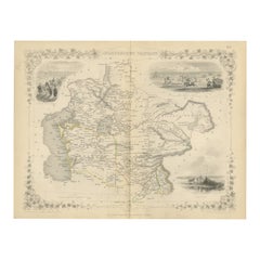
Antique map titled 'Turkestan or Independent Tartary'. Original antique map of Turkestan or Independent Tartary. This map originates from ‘The Imperial Atlas of Modern Geography’. Published by W. G. Blackie, 1859.
- Dimensions:Height: 14.57 in (37 cm)Width: 21.26 in (54 cm)Depth: 0.02 in (0.5 mm)
- Materials and Techniques:
- Period:
- Date of Manufacture:1859
- Condition:Wear consistent with age and use. General age-related toning. some foxing, Please study image carefully.
- Seller Location:Langweer, NL
- Reference Number:Seller: BG-12685-1-491stDibs: LU3054325241242
About the Seller
5.0
Recognized Seller
These prestigious sellers are industry leaders and represent the highest echelon for item quality and design.
Platinum Seller
Premium sellers with a 4.7+ rating and 24-hour response times
Established in 2009
1stDibs seller since 2017
2,513 sales on 1stDibs
Typical response time: <1 hour
- ShippingRetrieving quote...Shipping from: Langweer, Netherlands
- Return Policy
Authenticity Guarantee
In the unlikely event there’s an issue with an item’s authenticity, contact us within 1 year for a full refund. DetailsMoney-Back Guarantee
If your item is not as described, is damaged in transit, or does not arrive, contact us within 7 days for a full refund. Details24-Hour Cancellation
You have a 24-hour grace period in which to reconsider your purchase, with no questions asked.Vetted Professional Sellers
Our world-class sellers must adhere to strict standards for service and quality, maintaining the integrity of our listings.Price-Match Guarantee
If you find that a seller listed the same item for a lower price elsewhere, we’ll match it.Trusted Global Delivery
Our best-in-class carrier network provides specialized shipping options worldwide, including custom delivery.More From This Seller
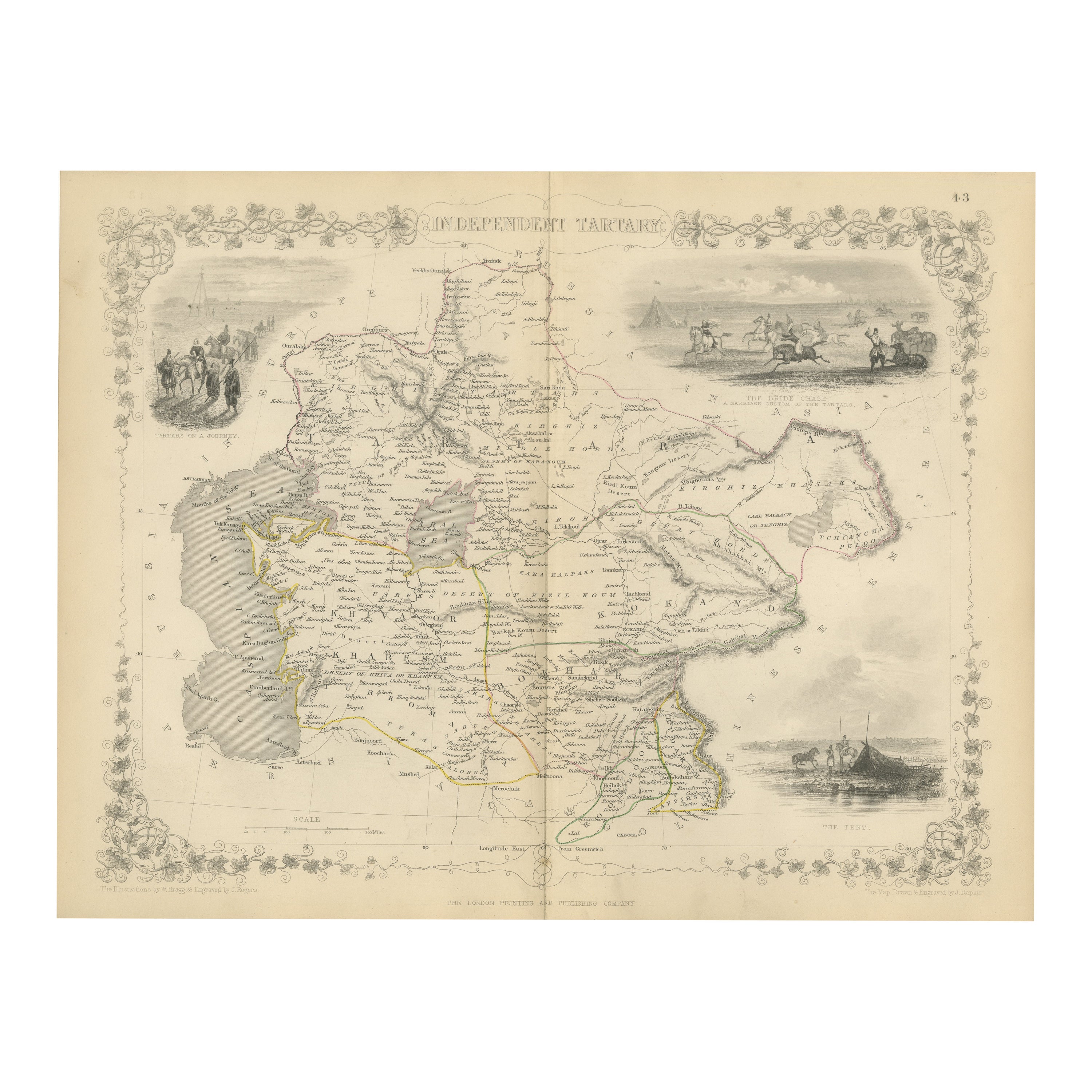
View AllMap of Independent Tartary with Vignettes of the Region's Culture, 1851
Located in Langweer, NL
The map of Independent Tartary is part of the collection by John Tallis & Company, which were unique for their elaborate decorative elements and detailed illustrations.
**The Maker ...
Category
Antique 1850s Maps
Materials
Paper
$274 Sale Price
20% Off
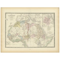
Antique Map of Northern Africa by Levasseur, '1875'
Located in Langweer, NL
Antique map titled 'Carte de l'Afrique Septentrionale'. Large map of Northern Africa. This map originates from 'Atlas de Géographie Moderne Physique et...
Category
Antique Late 19th Century Maps
Materials
Paper
$378 Sale Price
20% Off
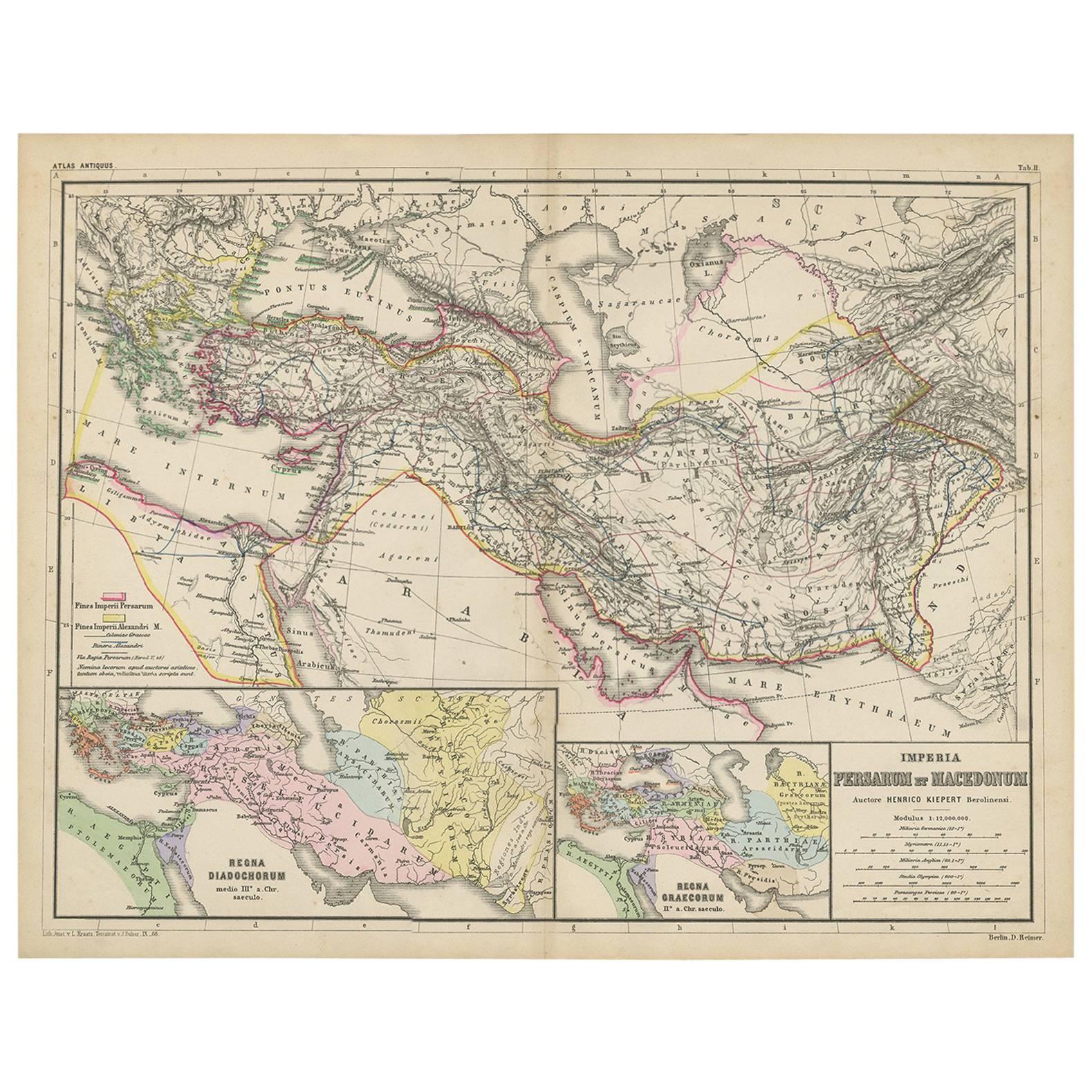
Antique Map of Part of the Roman Empire by H. Kiepert, circa 1870
By Heinrich Kiepert
Located in Langweer, NL
Antique map titled 'Imperia Persarum et Macedonum'. Depicts part of the Roman Empire, from Greece to Eastern India. This map originates from 'Atlas Antiqus. Zwölf Karten zur Alten Ge...
Category
Antique Late 19th Century Maps
Materials
Paper

$141 Sale Price
20% Off
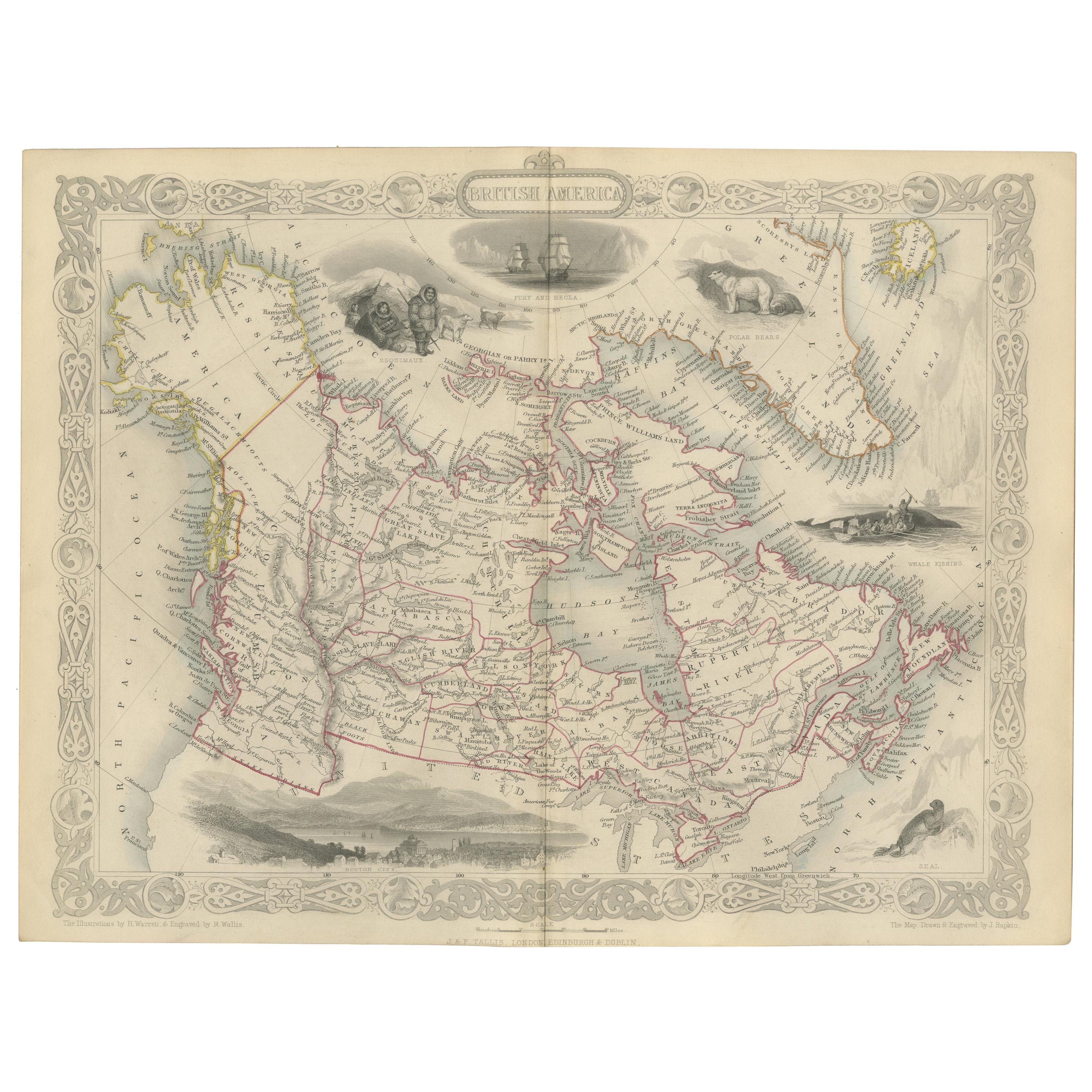
Antique Map of British America by Tallis 'c.1850'
Located in Langweer, NL
Antique map titled 'British America'. Decorative map of British America, with vignettes showing Whale Fishing, Montreal, Fury and Hecla ships asail. Thi...
Category
Antique Mid-19th Century Maps
Materials
Paper

$443 Sale Price
25% Off
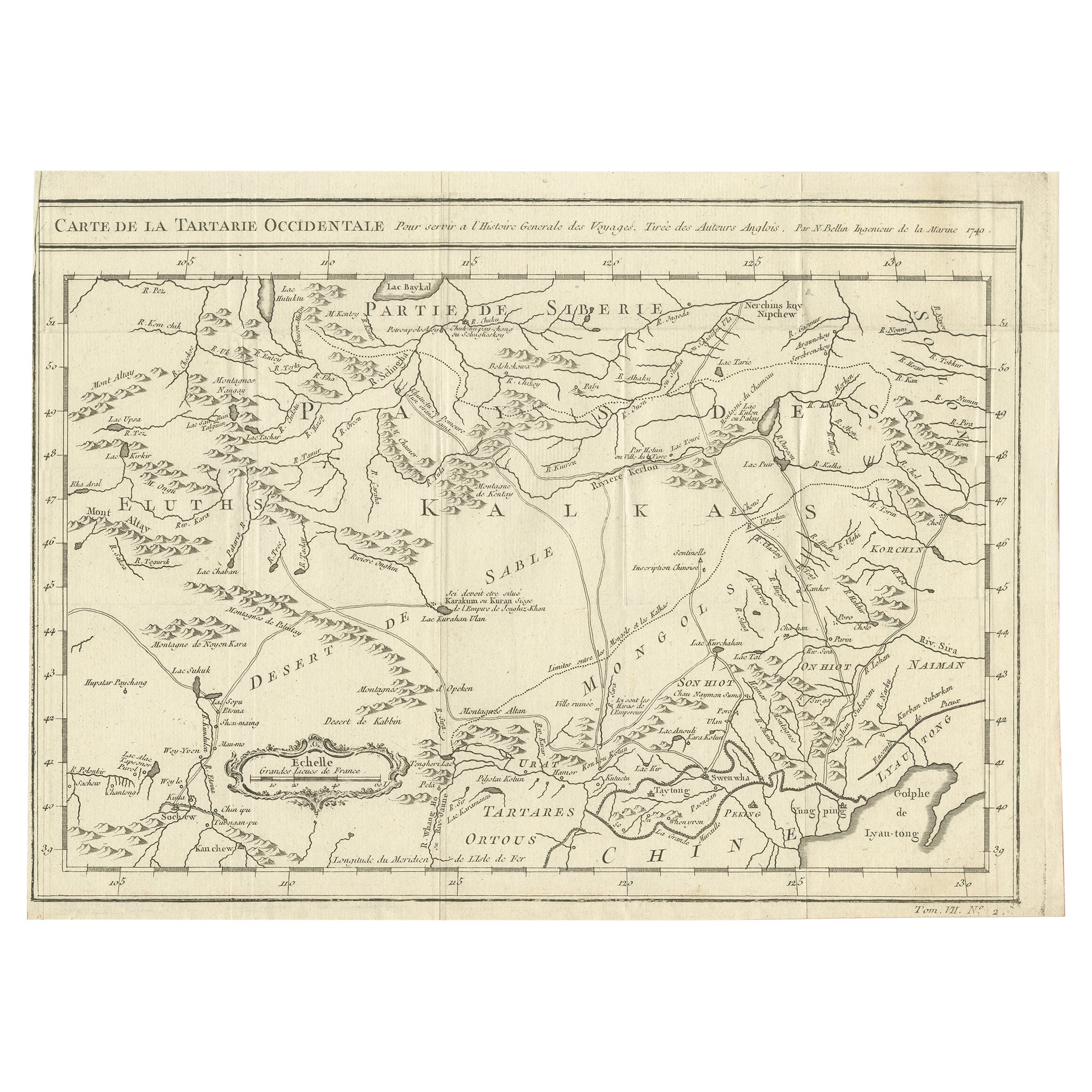
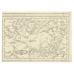
Antique Map of Western Tartary, with Information from Kyrkov's Surveys
Located in Langweer, NL
Antique map titled 'Carte de la Tartarie Occidentale'. This map covers western Tartary with a focus on the region of present-day Mongolia. This map includes information from Kyrkov's...
Category
Antique Mid-18th Century Maps
Materials
Paper
$293 Sale Price
20% Off
Antique Map of Europe by W. G. Blackie, 1859
Located in Langweer, NL
Antique map titled 'Europe'. Original antique map of Europe. This map originates from ‘The Imperial Atlas of Modern Geography’. Published by W. G. Blackie, 1859.
Category
Antique Mid-19th Century Maps
Materials
Paper

$236 Sale Price
20% Off
You May Also Like
1851 Map of "Independent Tartary", Ric. R018
Located in Norton, MA
1851 Map of
Independent Tartary
"Russia"
Ric.r018
A highly decorative 1851 map of Independent Tartary by John Tallis and John Rapkin. Covers the regions between the Caspian Sea and Lake Bakquash and between Russia and Afghanistan. These include the ancient Silk Route kingdoms of Khiva, Tartaria, Kokand, and Bokhara. Today this region roughly includes Kazakhstan, Uzbekistan, Turkmenistan, Kyrgyzstan, and Tajikistan. This wonderful map offers a wealth of detail for anyone with an interest in the Central Asian portion of the ancient Silk Road. Identifies various caravan routes, deserts, wells, and stopping points, including the cities of Bokhara and Samarkand. Three vignettes by W. Bragg decorate the map, these including an image of Tartars on a Journey, a horseback Bride Chase, and a tartar camp site. Surrounded by a vine motif border. Engraved by J. Rapkin for John Tallis's 1851 Illustrated Atlas .
Tartary Antique Map...
Category
Antique 19th Century Unknown Maps
Materials
Paper

1849 Map of "Europaische Russland", 'Meyer Map of European Russia', Ric. R017
Located in Norton, MA
1849 Map of
"Europaische Russland"
( Meyer Map of European Russia)
Ric.r017
A lovely map of European Russia dating to 1849 by Joseph Meyer. It covers the European portions of...
Category
Antique 19th Century Unknown Maps
Materials
Paper

1790 Thomas Stackhouse Map, Entitled "Russia in Europe, " , Ric.a004
Located in Norton, MA
1790 Thomas Stackhouse map, entitled
"Russia in Europe"
Ric.a004
Stackhouse, Thomas
Russia in Europe [map]
London: T. Stackhouse, 1783. Map. Matted hand-colored copper engraving. Image size: 14.5 x 15.25 inches. Mat size: 22.75 x 23.75 inches. A beautiful example of this map of Eastern Europe...
Category
Antique 17th Century Unknown Maps
Materials
Paper

1839 Map of Karte Des "Russischen Reiches in Europa Und Asien" Ric.R0013
Located in Norton, MA
1839 map of Karte Des
"Russischen Reiches in Europa and Asien"
Ric.r013
Map of the European and Asian parts of Russian Empire. Karte der Russischen Reiches in Europa und Asien...
Category
Antique 19th Century Unknown Maps
Materials
Paper

1860 Large Map "Carte De La Siberie Russie D'asie, " Ric.R0001
Located in Norton, MA
Large 1860 map "Carte De La Siberie Russie D'Asie," R-0001
" Authentic" - 1860 map "Carte De La Siberie Russie D'Asie,"
Dimension: Paper: 68 cm W x 51 cm H ; Sight: 51cm W x 4...
Category
Antique 19th Century Unknown Maps
Materials
Paper

Original Antique Map of United States, Grattan and Gilbert, 1843
Located in St Annes, Lancashire
Great map of United States
Drawn and engraved by Archer
Published by Grattan and Gilbert. 1843
Original colour
Unframed.
Category
Antique 1840s English Maps
Materials
Paper

More Ways To Browse
Map New Holland
Treasure Map
Caribbean Antiques
19th Century Map Of Africa
Antique Malaysia
Antique Map Of Ireland
Ships Log
Map Of Egypt
Nautical Maps
Antique Maps Of Long Island
James Cook Map
Antique Doctors Office Furniture
Pirate Furniture
Railroad Collectibles
Antique Map Mexico
Framed Map Of Paris
Antique Map Of Rome
Used Nautical Charts