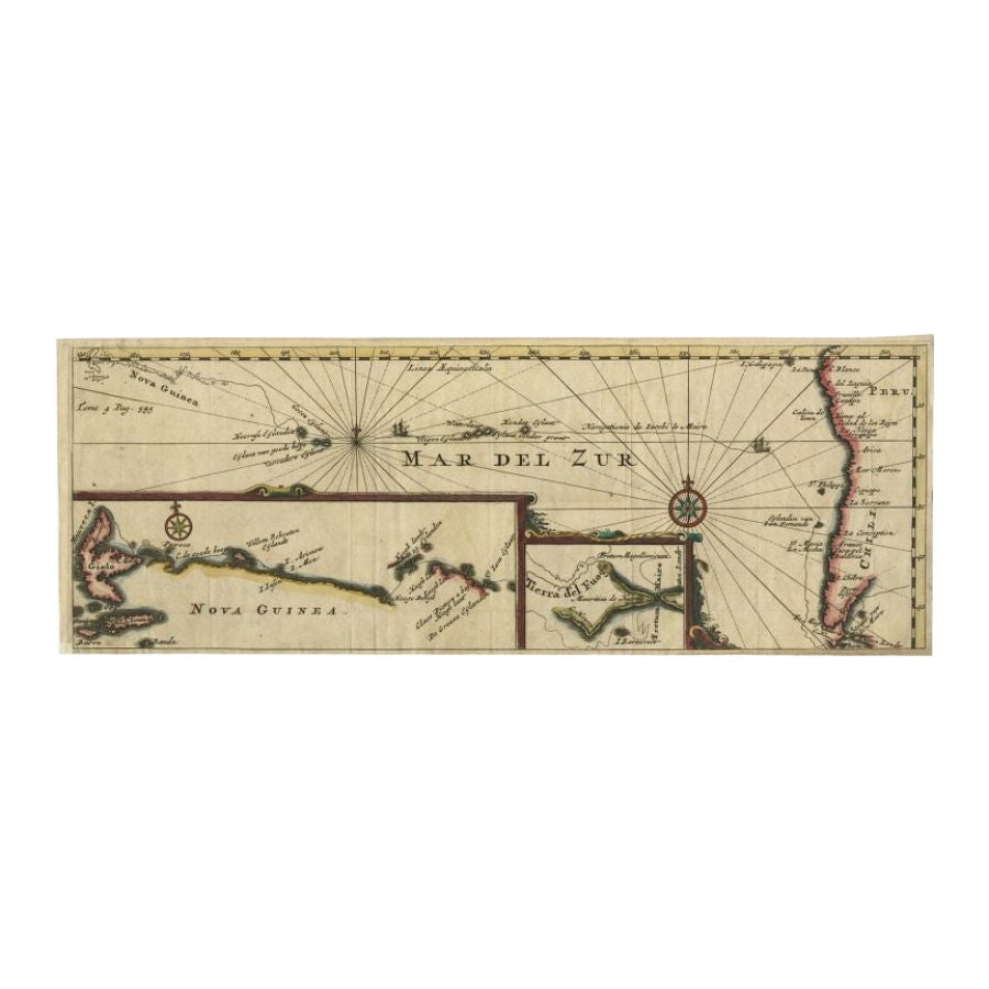
Items Similar to Antique Map of Mar del Sur, Chile, Peru, New Guinea and Tierra del Fuego, 1621


Want more images or videos?
Request additional images or videos from the seller
1 of 5
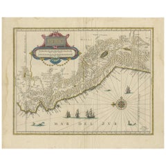
Antique Map of Mar del Sur, Chile, Peru, New Guinea and Tierra del Fuego, 1621
$718.89
$898.6120% Off
£535.16
£668.9620% Off
€600
€75020% Off
CA$984.69
CA$1,230.8720% Off
A$1,095.20
A$1,368.9920% Off
CHF 571.88
CHF 714.8520% Off
MX$13,327.36
MX$16,659.2020% Off
NOK 7,303.74
NOK 9,129.6720% Off
SEK 6,849.62
SEK 8,562.0220% Off
DKK 4,567.59
DKK 5,709.4920% Off
Shipping
Retrieving quote...The 1stDibs Promise:
Authenticity Guarantee,
Money-Back Guarantee,
24-Hour Cancellation
About the Item
Uncommon and rare map of Mar del Sur and the coast of Peru. With inset maps of part of New Guinea and Tierra del Fuego. This map originates from 'Miroir Oost & West-Indical, auquel sont descriptes les deux dernieres navigations (..)' published by J. Janssonius. It is one of the most famous early voyages around the world by Joris van Spilbergen (1568-1620), a veteran Dutch East Indies naval officer-turned-pirate, undertaken from 1614 to 1618. A short survey of another of the most important early voyages around the world, by Schouten and Le Maire in the years 1615 to 1617, is added at the end. It reports Le Maire's proof that Tierra del Fuego is an island and his discovery of what is still called the Strait of Le Maire, an alternative route to the Pacific Artists and Engravers: Jan Janssonius (also known as Johann or Jan Jansson or Janszoon) (1588-1664) was a renowned geographer and publisher of the seventeenth century, when the Dutch dominated map publishing in Europe.
Artist: Jan Janssonius (also known as Johann or Jan Jansson or Janszoon) (1588-1664) was a renowned geographer and publisher of the seventeenth century, when the Dutch dominated map publishing in Europe.
Condition: Good, general age-related toning. Original folding line, minor wear. Blank verso, please study image carefully.
Date: 1621
Overall size: 44 x 17 cm.
Image size: 43 x 15 cm.
- Dimensions:Height: 17.33 in (44 cm)Width: 6.7 in (17 cm)Depth: 0 in (0.01 mm)
- Materials and Techniques:
- Period:
- Date of Manufacture:1621
- Condition:
- Seller Location:Langweer, NL
- Reference Number:Seller: JAK-12631stDibs: LU3054326373442
About the Seller
5.0
Recognized Seller
These prestigious sellers are industry leaders and represent the highest echelon for item quality and design.
Platinum Seller
Premium sellers with a 4.7+ rating and 24-hour response times
Established in 2009
1stDibs seller since 2017
2,510 sales on 1stDibs
Typical response time: <1 hour
- ShippingRetrieving quote...Shipping from: Langweer, Netherlands
- Return Policy
Authenticity Guarantee
In the unlikely event there’s an issue with an item’s authenticity, contact us within 1 year for a full refund. DetailsMoney-Back Guarantee
If your item is not as described, is damaged in transit, or does not arrive, contact us within 7 days for a full refund. Details24-Hour Cancellation
You have a 24-hour grace period in which to reconsider your purchase, with no questions asked.Vetted Professional Sellers
Our world-class sellers must adhere to strict standards for service and quality, maintaining the integrity of our listings.Price-Match Guarantee
If you find that a seller listed the same item for a lower price elsewhere, we’ll match it.Trusted Global Delivery
Our best-in-class carrier network provides specialized shipping options worldwide, including custom delivery.More From This Seller
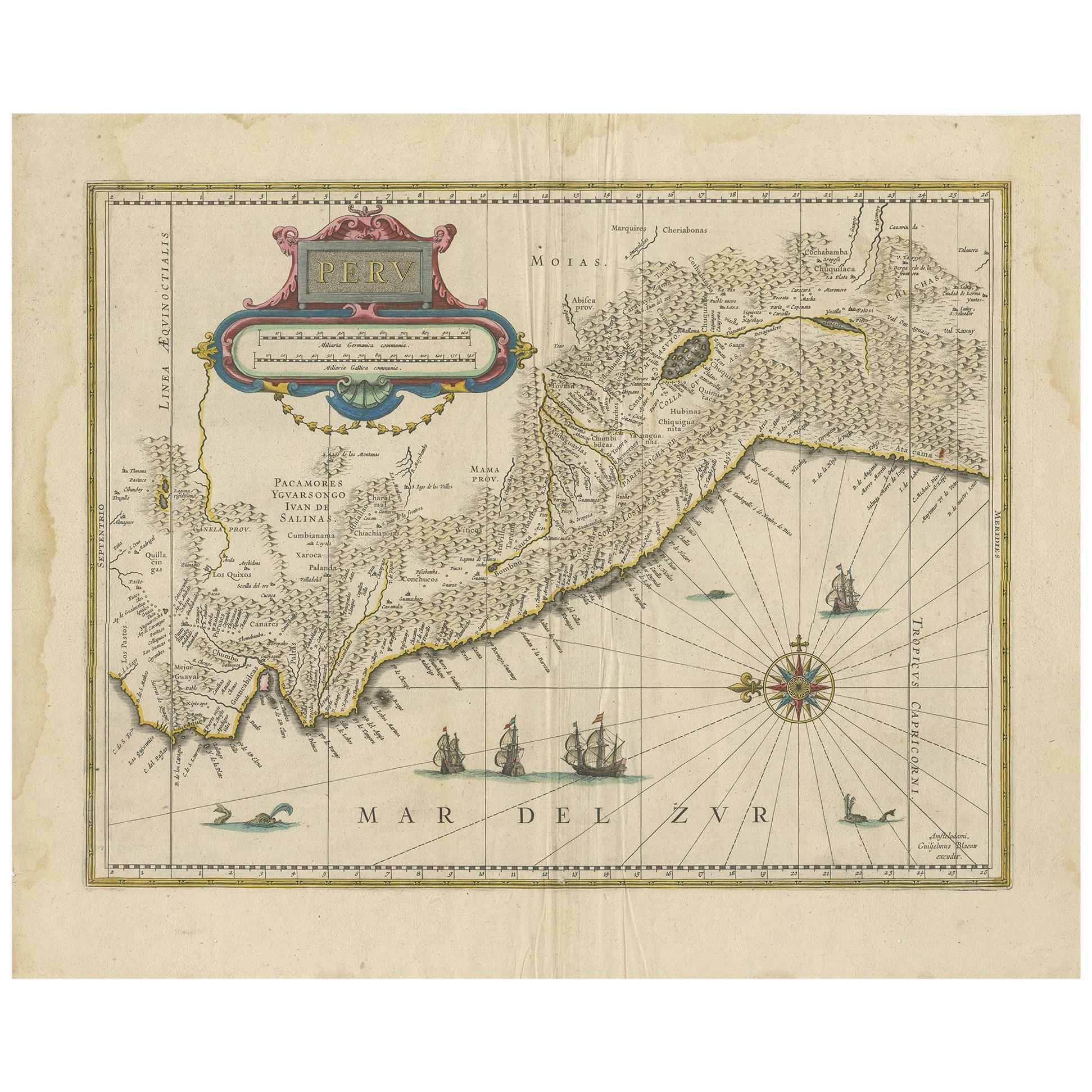
View AllAntique Map of Peru in South America by Blaeu, circa 1645
Located in Langweer, NL
Antique map titled 'Peru'. Original antique map of Peru. With cartouche, compass rose, ships and two sea-monsters. Published by W. Blaeu, circa 1645.
Category
Antique Mid-17th Century Maps
Materials
Paper
$674 Sale Price
24% Off
Antique Map of Peru by van der Aa, 'circa 1720'
Located in Langweer, NL
Antique map titled 'Le Perou, Grand Pays de l Amerique Meridionale (..)'. Decorative map of Peru including portions of Ecuador and northern Chile and Boliv...
Category
Antique Early 18th Century Maps
Materials
Paper

$718 Sale Price
20% Off
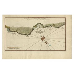
Antique Map of a Bay on the Coast of Chile, South America, c.1749
Located in Langweer, NL
Antique map titled 'Plan van een Baai en Haven aan de Kust van Chili (..) - Plan d'une Baye de la Côte du Chili (..)'. Original antique map of a bay on the coast of Chile discovered ...
Category
Antique 18th Century Maps
Materials
Paper

$306 Sale Price
20% Off
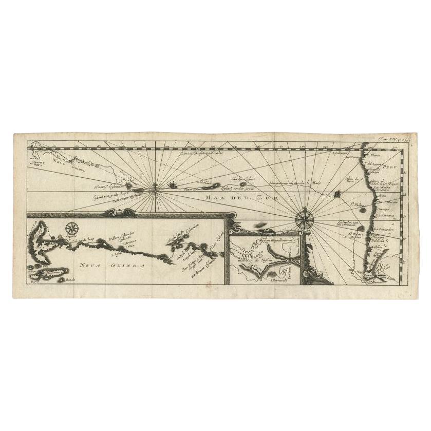
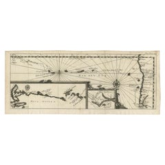
Antique Map of the Pacific Ocean by Renneville, 1725
Located in Langweer, NL
Rare map of the Southern Pacific, illustrating Le Maire's tracks, extending from the La Maire Straits to Nova Guinea, with a large inset of the northern Coastline of New Guinea and a...
Category
Antique 18th Century Maps
Materials
Paper

$431 Sale Price
20% Off
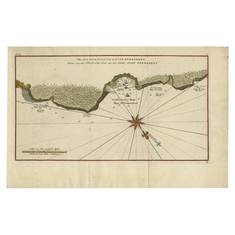
Juan Fernandez Island Map – Antique Chilean Chart circa 1750
Located in Langweer, NL
Antique map titled 'Plan de la Côte du N.E. de l 'Ile de Juan Fernandes'.
Map of the northeast coast of the island of Juan Fernandez with Cumberland Bay, South America. In 1740 Ans...
Category
Antique 18th Century Maps
Materials
Paper
$335 Sale Price
20% Off
Antique Map of the Pacific Ocean by Renneville, 1702
Located in Langweer, NL
Antique map, untitled. A map of the Pacific Ocean, with the coast of Peru in the right edge and the outline of New Guinea in the left edge. In betwe...
Category
Antique 18th Century Maps
Materials
Paper
You May Also Like
Original Antique Map of South America. C.1780
Located in St Annes, Lancashire
Great map of South America
Copper-plate engraving
Published C.1780
Two small worm holes to left side of map
Unframed.
Category
Antique Early 1800s English Georgian Maps
Materials
Paper

West Coast of Africa, Guinea & Sierra Leone: An 18th Century Map by Bellin
By Jacques-Nicolas Bellin
Located in Alamo, CA
Jacques Bellin's copper-plate map entitled "Partie de la Coste de Guinee Dupuis la Riviere de Sierra Leona Jusquau Cap das Palmas", depicting the coast of Guinea and Sierra Leone in ...
Category
Antique Mid-18th Century French Maps
Materials
Paper

California, Alaska and Mexico: 18th Century Hand-Colored Map by de Vaugondy
By Didier Robert de Vaugondy
Located in Alamo, CA
This is an 18th century hand-colored map of the western portions of North America entitled "Carte de la Californie et des Pays Nord-Ouest separés de l'Asie par le détroit d'Anian, ex...
Category
Antique 1770s French Maps
Materials
Paper

North & South America: A 17th Century Hand-colored Map by Jansson & Goos
By Johannes Janssonius
Located in Alamo, CA
A 17th century hand-colored map of North & South America entitled "Americae Descriptio" by the cartographer Johannes Jansson, published in Jansson's Atlas Minor in Amsterdam in 1628....
Category
Antique 1620s Dutch Maps
Materials
Paper

Antique Map - Mare Pacificum - Etching by Johannes Janssonius - 1650s
By Johannes Janssonius
Located in Roma, IT
Mare Pacificum is an antique map realized in 1650 by Johannes Janssonius (1588-1664).
The Map is Hand-colored etching, with coeval watercolorang.
Good conditions with slight foxing...
Category
1650s Modern Figurative Prints
Materials
Etching

1654 Joan Blaeu Map the Sutherland, Scotland, Entitled "Southerlandia, "Ric0007
Located in Norton, MA
1654 Joan Blaeu map of the
Sutherland, Scotland, entitled
"Southerlandia,"
Hand Colored
Ric0007
Description:
Lovely map centered on Sedan and D...
Category
Antique 17th Century Dutch Maps
Materials
Paper

More Ways To Browse
Antique Peruvian Furniture
Peruvian Antiques
Antique Maps West Indies
Pirate Antique
Antique Map Chile
Caribbean Colonial Furniture
Antique Maps West Indies
California Island Map
Pirate Antique
Map Of Holy Land
Antique Blackwood Furniture
Antique Macedonia
Antique Maps Of New York City
Victorian Compass
Antique Maps Caribbean Islands
Hungary Map
Cartographer Tool
Goa Furniture