Items Similar to Antique Map of South West Germany with an Inset of Brisac or Brisach, France

Want more images or videos?
Request additional images or videos from the seller
1 of 6
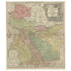
Antique Map of South West Germany with an Inset of Brisac or Brisach, France
$326.11
£247.04
€280
CA$451.79
A$506.71
CHF 265.36
MX$6,157.01
NOK 3,369.57
SEK 3,194.59
DKK 2,131.85
About the Item
Antique map Germany titled 'A New and Accurate Map of the South West part of Germany. Comprehending the Archbishoprics of Mentz and Treves, the Electoral Palat, of the Rhine, Duchy of Wirtemberg, Franconia, Swabia, Alsace, Lorrain etc'. This map covers the southwestern parts of Germany along with parts of modern day France and Luxemburg. With a large inset of New and Old Brisach. Originates from 'A Complete System of Geography'. Artists and Engravers: Emanuel Bowen (1694-1767) was a British engraver and print seller.
Artist: Emanuel Bowen (1694-1767) was a British engraver and print seller.
Condition: Good, some toning and a few stains. Please study image carefully.
Date: 1747
Overall size: 26 x 39 cm.
Image size: 22.5 x 32 cm.
Antique prints have long been appreciated for both their aesthetic and investment value. They were the product of engraved, etched or lithographed plates. These plates were handmade out of wood or metal, which required an incredible level of skill, patience and craftsmanship. Whether you have a house with Victorian furniture or more contemporary decor an old engraving can enhance your living space. We offer a wide range of authentic antique prints for any budget.
- Dimensions:Height: 15.36 in (39 cm)Width: 10.24 in (26 cm)Depth: 0 in (0.01 mm)
- Materials and Techniques:
- Period:
- Date of Manufacture:1747
- Condition:Condition: Good, some toning and a few stains. Please study image carefully.
- Seller Location:Langweer, NL
- Reference Number:Seller: BG-094701stDibs: LU3054327621252
About the Seller
5.0
Recognized Seller
These prestigious sellers are industry leaders and represent the highest echelon for item quality and design.
Platinum Seller
Premium sellers with a 4.7+ rating and 24-hour response times
Established in 2009
1stDibs seller since 2017
2,517 sales on 1stDibs
Typical response time: <1 hour
- ShippingRetrieving quote...Shipping from: Langweer, Netherlands
- Return Policy
Authenticity Guarantee
In the unlikely event there’s an issue with an item’s authenticity, contact us within 1 year for a full refund. DetailsMoney-Back Guarantee
If your item is not as described, is damaged in transit, or does not arrive, contact us within 7 days for a full refund. Details24-Hour Cancellation
You have a 24-hour grace period in which to reconsider your purchase, with no questions asked.Vetted Professional Sellers
Our world-class sellers must adhere to strict standards for service and quality, maintaining the integrity of our listings.Price-Match Guarantee
If you find that a seller listed the same item for a lower price elsewhere, we’ll match it.Trusted Global Delivery
Our best-in-class carrier network provides specialized shipping options worldwide, including custom delivery.More From This Seller
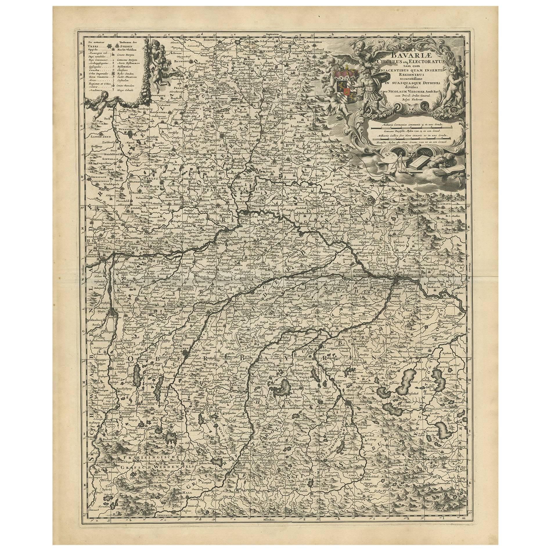
View AllAntique Map of Bavaria with many details, Germany
Located in Langweer, NL
Antique map titled 'Bavariae Circulus atq Electoratus tam cum Adiacentibus quam insertis Regionibus (..)'. Dutch map of Bavaria, showing the many cities, towns, and other features of...
Category
Antique Late 17th Century Maps
Materials
Paper
$614 Sale Price
20% Off
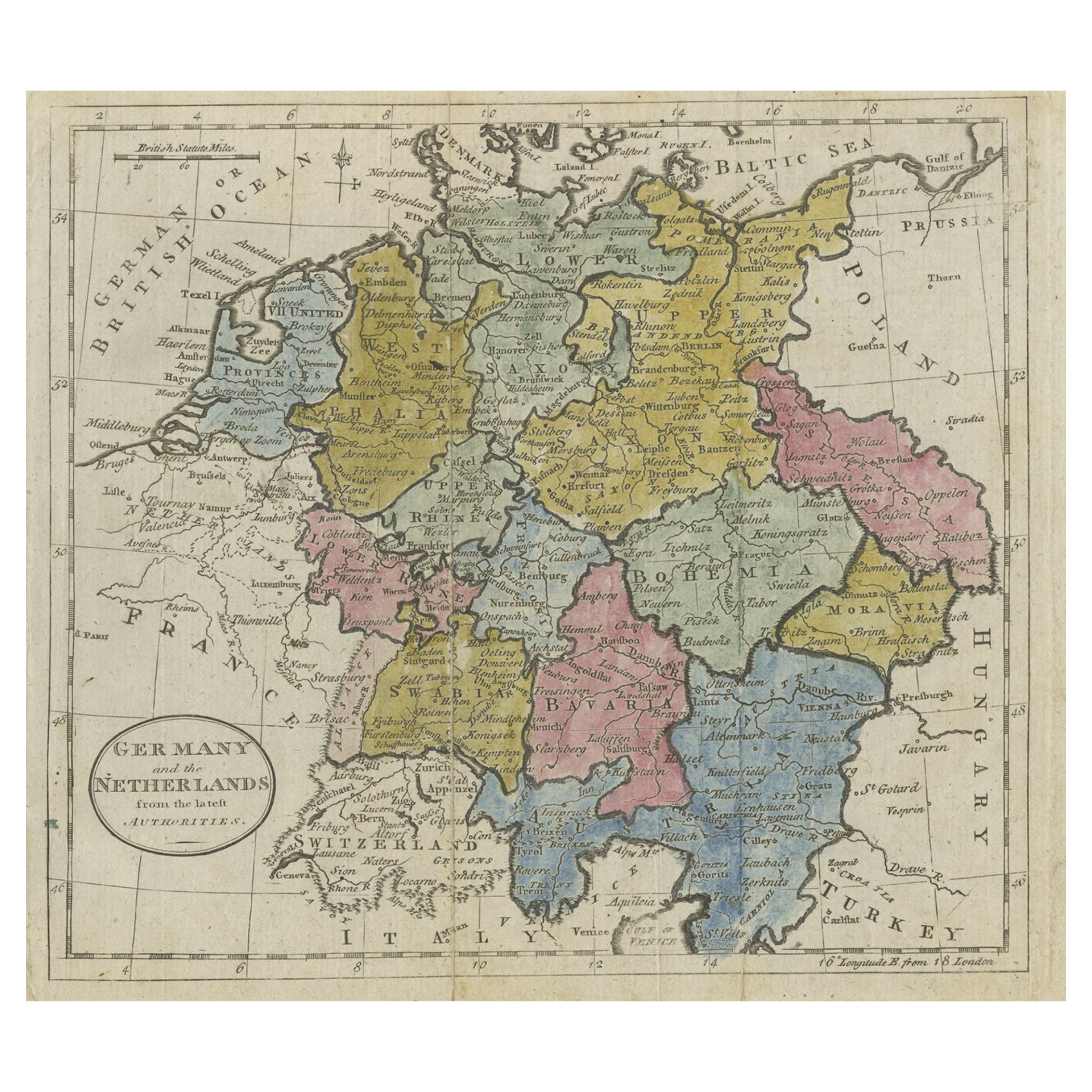
Antique Map of Germany, the Netherlands, Bohemia, Bavaria and Switzerland, 1785
Located in Langweer, NL
Antique map titled 'Germany and the Netherlands from the latest authorities'. Depicts Germany, the Netherlands and the surrounding region including Bohemia, Bavaria, and Switzerland....
Category
Antique 18th Century Maps
Materials
Paper
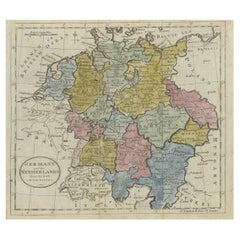
$130 Sale Price
20% Off
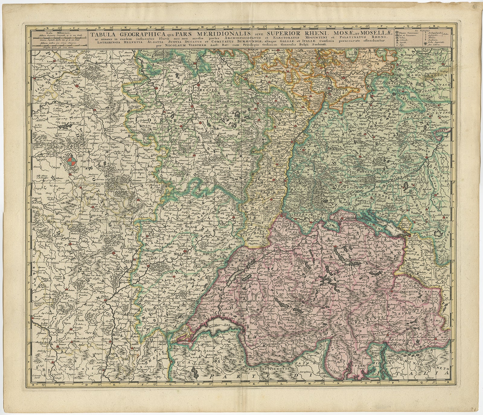
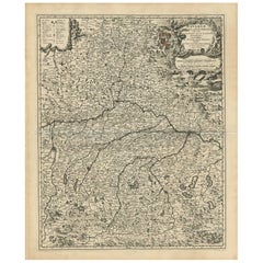
Antique Map of Switzerland by N. Visscher, circa 1690
Located in Langweer, NL
Antique map titled 'Tabula Geogaphica qua Pars Meridionalis sive Superior Rheni, Mosae, et Mosellae (..)'. Published by N. Visscher, Amsterdam, circa 1690. Contemporary coloring.
Category
Antique Late 17th Century Maps
Materials
Paper
$619 Sale Price
20% Off
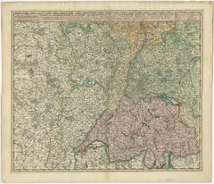
Antique Map of the Nassau Region in Western Germany
Located in Langweer, NL
Antique map titled 'Nassovia Principatus (..)'. Detailed map of the Nassau region in western Germany between Koblenz, Hadamar, Giessen, Frankfurt and Mainz. The map is filled with in...
Category
Antique Early 18th Century Maps
Materials
Paper

$614 Sale Price
20% Off
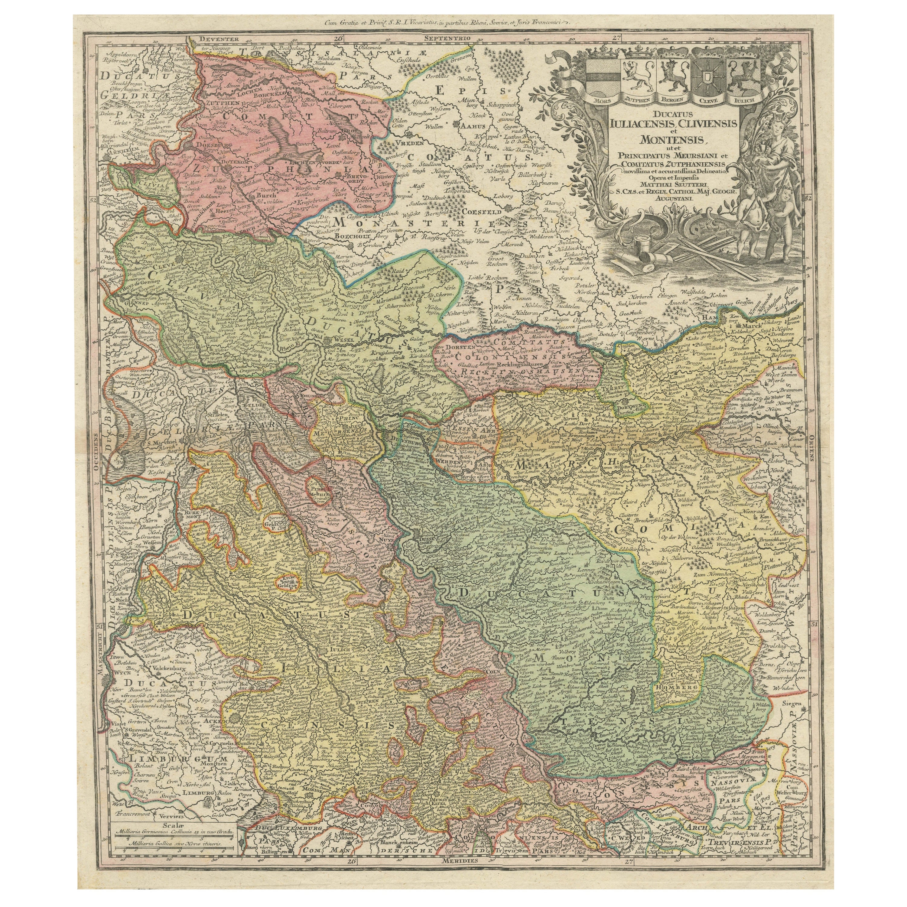
Antique Map of Western Germany with part of the Netherlands
Located in Langweer, NL
Antique map titled 'Ducatus Iuliacensis Cliviensis et Montensis (..)'. Original old map of Western Germany with part of the Netherlands. Published by M. Seutter, circa 1750.
George...
Category
Antique Mid-18th Century Maps
Materials
Paper
$419 Sale Price
20% Off
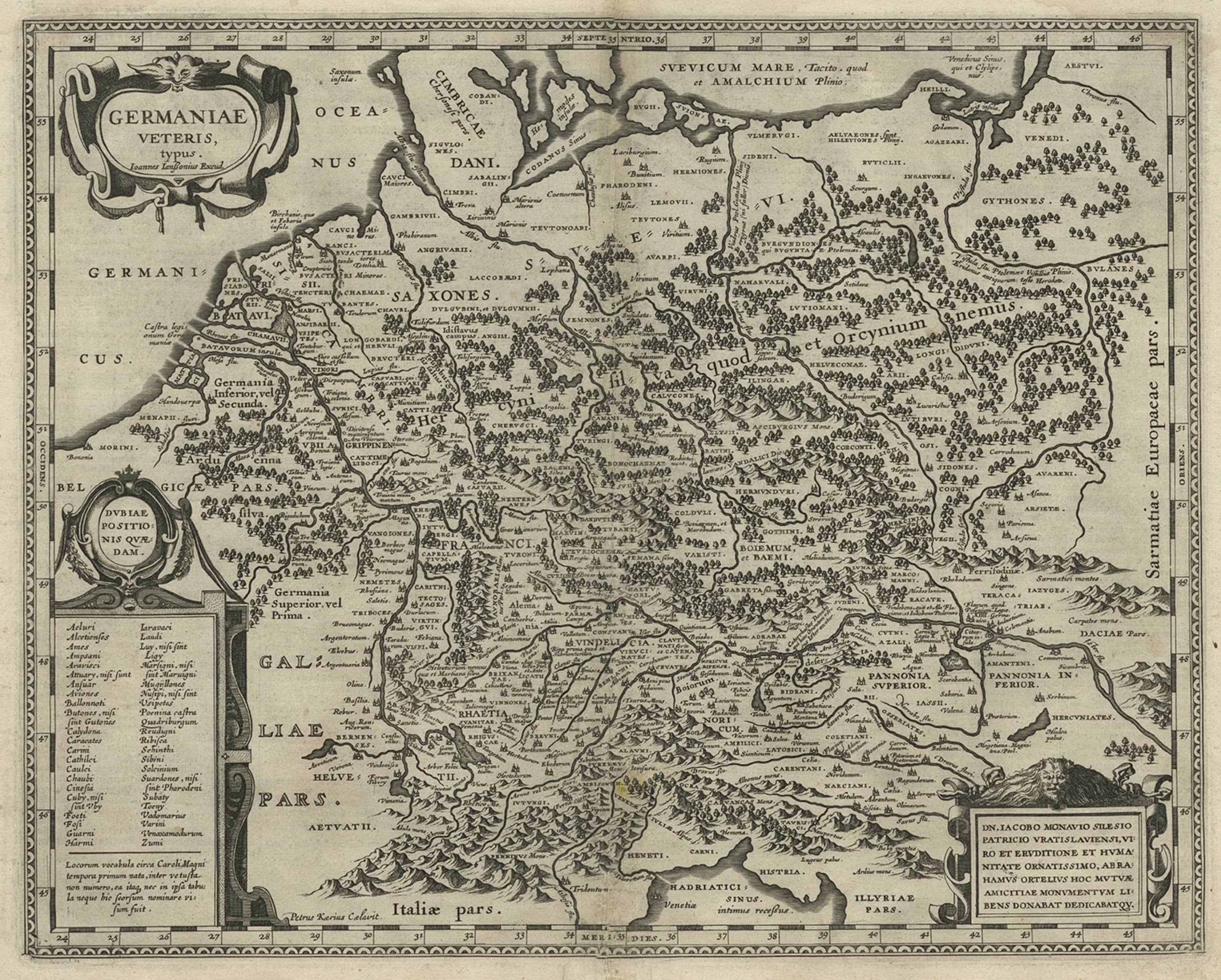
Original Rare Antique Map of the Ancient German Empire in Northern Europe, c1650
Located in Langweer, NL
Antique map titled 'Germaniae Veteris typus.'
Map of the ancient German Empire in Northern Europe, based upon an earlier map by Ortelius. Extends fr...
Category
Antique 1650s Maps
Materials
Paper
$614 Sale Price
20% Off
You May Also Like
17th Century Hand-Colored Map of a Region in West Germany by Janssonius
By Johannes Janssonius
Located in Alamo, CA
This attractive highly detailed 17th century original hand-colored map is entitled "Archiepiscopatus Maghdeburgensis et Anhaltinus Ducatus cum terris adjacentibus". It was published ...
Category
Antique Mid-17th Century Dutch Maps
Materials
Paper

Original Antique Map of Switzerland, Engraved By Barlow, Dated 1807
Located in St Annes, Lancashire
Great map of Switzerland
Copper-plate engraving by Barlow
Published by Brightly & Kinnersly, Bungay, Suffolk.
Dated 1807
Unframed.
Category
Antique Early 1800s English Maps
Materials
Paper

18th Century Hand-Colored Homann Map of Germany, Including Frankfurt and Berlin
By Johann Baptist Homann
Located in Alamo, CA
An 18th century hand-colored map entitled "Tabula Marchionatus Brandenburgici et Ducatus Pomeraniae quae sunt Pars Septentrionalis Circuli Saxoniae Superioris" by Johann Baptist Homa...
Category
Antique Early 18th Century German Maps
Materials
Paper

West Germany: Original Hand Colored 17th Century Map by Johannes Janssonius
By Johannes Janssonius
Located in Alamo, CA
An original hand colored copperplate engraved map entitled in Latin "Archiepiscopatus Maghdeburgensis et Anhaltinus Ducatus cum terris adjacentibus", published in Amsterdam in 1640 i...
Category
Mid-17th Century Old Masters More Prints
Materials
Engraving

17th Century Hand Colored Map of the Liege Region in Belgium by Visscher
By Nicolaes Visscher II
Located in Alamo, CA
An original 17th century map entitled "Leodiensis Episcopatus in omnes Subjacentes Provincias distincté divisusVisscher, Leodiensis Episcopatus" by Nicolaes Visscher II, published in Amsterdam in 1688. The map is centered on Liege, Belgium, includes the area between Antwerp, Turnhout, Roermond, Cologne, Trier and Dinant.
This attractive map is presented in a cream-colored mat measuring 30" wide x 27.5" high. There is a central fold, as issued. There is minimal spotting in the upper margin and a tiny spot in the right lower margin, which are under the mat. The map is otherwise in excellent condition.
The Visscher family were one of the great cartographic families of the 17th century. Begun by Claes Jansz Visscher...
Category
Antique Late 17th Century Dutch Maps
Materials
Paper

Prussia, Poland, N. Germany, Etc: A Hand-colored 17th Century Map by Janssonius
By Johannes Janssonius
Located in Alamo, CA
This is an attractive hand-colored copperplate engraved 17th century map of Prussia entitled "Prussia Accurate Descripta a Gasparo Henneberg Erlichensi", published in Amsterdam by Joannes Janssonius in 1664. This very detailed map from the golden age of Dutch cartography includes present-day Poland, Latvia, Lithuania, Estonia and portions of Germany. This highly detailed map is embellished by three ornate pink, red, mint green and gold...
Category
Antique Mid-17th Century Dutch Maps
Materials
Paper

More Ways To Browse
Antique German Lithographs
18th Century French Lithograph
John Speed Antique Maps
Malaysia Map
Sebastian Munster
Antique Map Chile
Antique Map Of Boston
Ipswich Antique Furniture
Maps Balkans
Missouri Map
Antique Maps Of Texas
Antique Maps Virginia
Antique Railroad Scale
Jamaican Antique
Hindeloopen Furniture
Romania Map
Stanford Antique Furniture
Sardinia Map