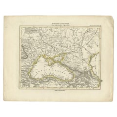
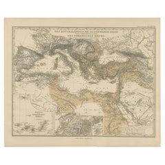
Items Similar to Black Sea in Antiquity: Pontus Euxinus Map, Published in 1880
Want more images or videos?
Request additional images or videos from the seller
1 of 7
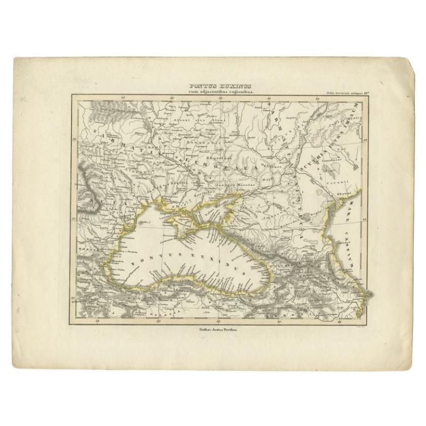
Black Sea in Antiquity: Pontus Euxinus Map, Published in 1880
$354.53
$443.1620% Off
£262.73
£328.4120% Off
€296
€37020% Off
CA$484
CA$60520% Off
A$538.43
A$673.0420% Off
CHF 282.25
CHF 352.8220% Off
MX$6,579.51
MX$8,224.3920% Off
NOK 3,594.14
NOK 4,492.6820% Off
SEK 3,383.39
SEK 4,229.2320% Off
DKK 2,253.72
DKK 2,817.1520% Off
Shipping
Retrieving quote...The 1stDibs Promise:
Authenticity Guarantee,
Money-Back Guarantee,
24-Hour Cancellation
About the Item
This map, titled "PONTUS EUXINUS," depicts the Black Sea region, historically known as the Pontus Euxinus. The Black Sea was central to ancient trade routes and cultural exchange, bordered by several important ancient empires and peoples.
**Features of the map include:**
1. **Regional Focus**: It focuses on the area surrounding the Black Sea, including parts of modern-day Turkey, Russia, Ukraine, Georgia, Bulgaria, and Romania.
2. **Topography**: The map renders the region's complex topography with detailed depictions of mountain ranges, rivers, and the coastline.
3. **Settlements and Cities**: Various symbols and labels indicate the locations of ancient cities, settlements, and other significant sites.
4. **Political Divisions**: Different territories might be color-coded to show the various tribal or political entities that historically bordered the Black Sea.
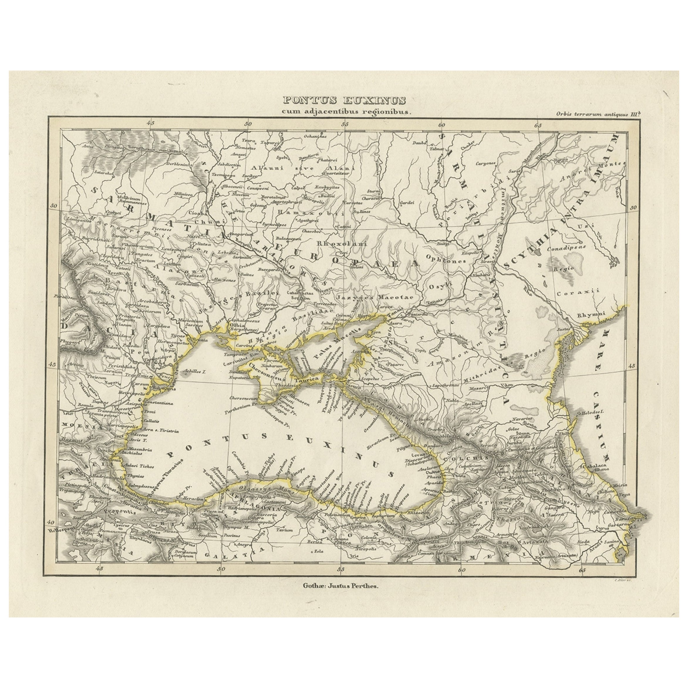
5. **Insets**: Two inset maps are included:
- The upper left shows the Bosporus Thracius (the Strait of Istanbul), a crucial waterway connecting the Black Sea to the Sea of Marmara.
- The upper right features the Bosporus Cimmerius (the Strait of Kerch), connecting the Black Sea to the Sea of Azov.
6. **Annotations**: There are annotations and labels in Latin, which provide historical context, names of regions, and descriptions of the geographic features.
This map is a valuable historical document, capturing the geography of a region that was a crossroads of commerce, culture, and conflict in antiquity. The detailed cartography would have been especially useful for educational purposes in the late 19th century, when the map was likely published as part of the "Spruner-Menke Atlas Antiquus."
More about Pontus:
The historical region of Pontus is situated on the southern coast of the Black Sea, corresponding to the modern-day northeastern Turkish coast. Here are some key points about its history and significance:
1. **Ancient Kingdom**: In the Hellenistic period, after the fall of the Persian Empire, Pontus emerged as an independent kingdom. It was initially part of the Persian satrapy of Cappadocia and later achieved full independence under the Mithridatic dynasty, especially during the reign of Mithridates VI, also known as Mithridates the Great.
2. **Roman Conflict**: Mithridates VI expanded the kingdom significantly, which eventually led to conflict with Rome. The Mithridatic Wars were a series of three wars fought between Rome and the Kingdom of Pontus in the 1st century BC.
3. **Cultural Melting Pot**: The region was a melting pot of Greek, Persian, and indigenous cultures. Pontus was notably Hellenized, meaning that Greek cultural and linguistic influences were strong, but it also retained much of its Persian and local heritage.
4. **Geopolitical Importance**: Due to its location, Pontus controlled important trade routes and had access to rich resources, making it economically significant in the ancient world.
5. **Roman Province**: After the final defeat of Mithridates VI by Pompey, the region was incorporated into the Roman Empire as the province of Bithynia et Pontus, and later as the separate provinces of Pontus Polemoniacus and Pontus Galaticus.
6. **Byzantine Era**: In the Byzantine period, Pontus remained important due to its strategic location, serving as a buffer zone against invasions from the east and playing a role in trade routes between the Black Sea and the Mediterranean.
7. **Cultural Heritage**: Pontus was also a significant center for early Christianity. The region's mountainous terrain allowed for the establishment of monastic traditions that played a vital role in the spiritual and cultural life of the Byzantine Empire.
8. **Modern Significance**: Today, the historical legacy of Pontus is evident in the architectural ruins, linguistic traces, and cultural practices found in the northeastern region of Turkey.
In summary, Pontus was a region of great strategic, economic, and cultural importance throughout ancient and medieval history, serving as a crossroads between East and West and a bridge between various civilizations.
- Dimensions:Height: 15.56 in (39.5 cm)Width: 18.51 in (47 cm)Depth: 0 in (0.02 mm)
- Materials and Techniques:
- Period:
- Date of Manufacture:1880
- Condition:Good, given age. General age-related toning, especially around the edges. Vertical folding line as issued. Please study scan carefully.
- Seller Location:Langweer, NL
- Reference Number:Seller: BG-13686-2-81stDibs: LU3054338537642
About the Seller
5.0
Recognized Seller
These prestigious sellers are industry leaders and represent the highest echelon for item quality and design.
Platinum Seller
Premium sellers with a 4.7+ rating and 24-hour response times
Established in 2009
1stDibs seller since 2017
2,502 sales on 1stDibs
Typical response time: <1 hour
- ShippingRetrieving quote...Shipping from: Langweer, Netherlands
- Return Policy
Authenticity Guarantee
In the unlikely event there’s an issue with an item’s authenticity, contact us within 1 year for a full refund. DetailsMoney-Back Guarantee
If your item is not as described, is damaged in transit, or does not arrive, contact us within 7 days for a full refund. Details24-Hour Cancellation
You have a 24-hour grace period in which to reconsider your purchase, with no questions asked.Vetted Professional Sellers
Our world-class sellers must adhere to strict standards for service and quality, maintaining the integrity of our listings.Price-Match Guarantee
If you find that a seller listed the same item for a lower price elsewhere, we’ll match it.Trusted Global Delivery
Our best-in-class carrier network provides specialized shipping options worldwide, including custom delivery.More From This Seller
View AllAntique Map of the Black Sea by Perthes, 1848
Located in Langweer, NL
Antique map titled 'Pontus Euxinus'. Old map of the Black Sea and surroundings originating from 'Orbis Terrarum Antiquus in usum Scholarum'. Artists and Engravers: Published by Justu...
Category
Antique 19th Century Maps
Materials
Paper
$94 Sale Price
20% Off
Old Map of the Black Sea, The Krim, Ukraine, Russia, etc in Historic Times, 1848
Located in Langweer, NL
Antique map titled 'Pontus Euxinus'. Old map of the black Sea and surroundings originating from 'Orbis Terrarum Antiquus in usum Scholarum'.
Artists and Engravers: Published by J...
Category
Antique 1840s Maps
Materials
Paper
$229 Sale Price
20% Off
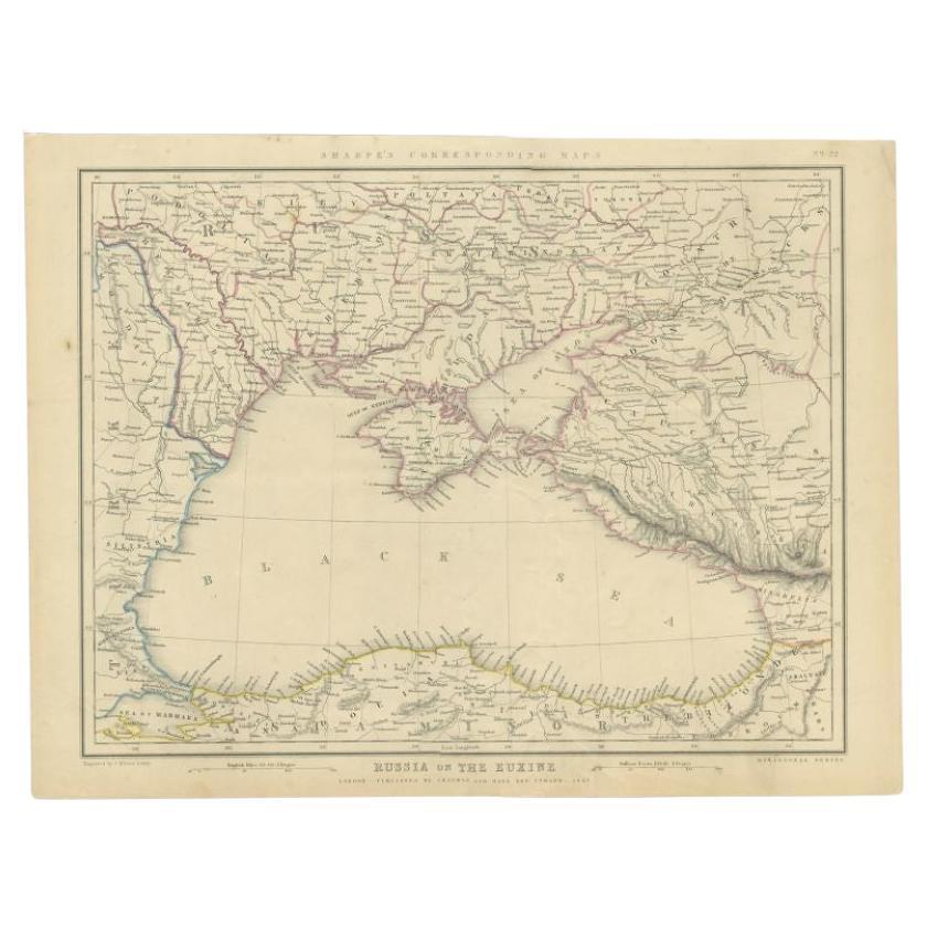
Antique Map of the Black Sea and Surroundings by Sharpe, 1849
Located in Langweer, NL
Antique map titled 'Russia on the Euxine'. Old map of the Black Sea and the surrounding (Russia). This map originates from 'Sharpe's Corresponding Atlas (..)' by J. Sharpe. Artists and Engravers: Published by Chapman and Hall...
Category
Antique 19th Century Maps
Materials
Paper

$91 Sale Price
20% Off
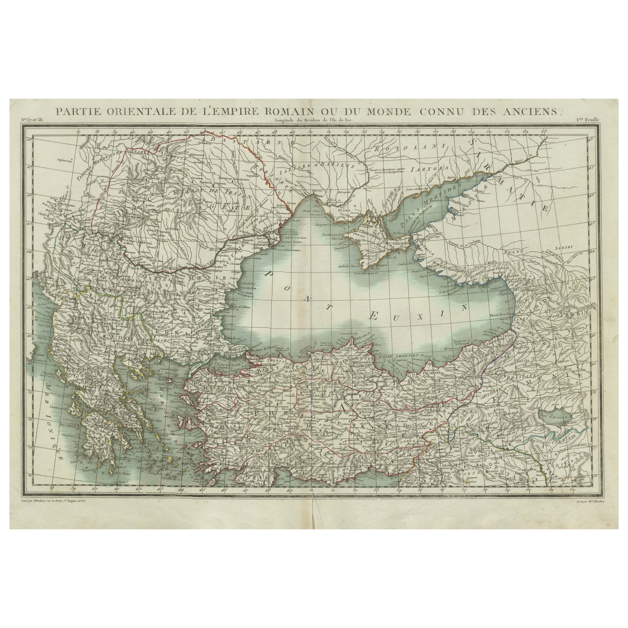
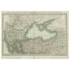
Black Sea & Eastern Mediterranean Map: Eastern Roman Empire, Tardieu Atlas, 1802
Located in Langweer, NL
Antique Map with Title: "Partie Orientale de l'Empire Romain ou du Monde connu des Anciens"
Publication Details:
- **Atlas Title:** Nouvel Atlas Universel de Géographie Ancienne e...
Category
Antique Early 1800s Maps
Materials
Paper
$498 Sale Price
20% Off
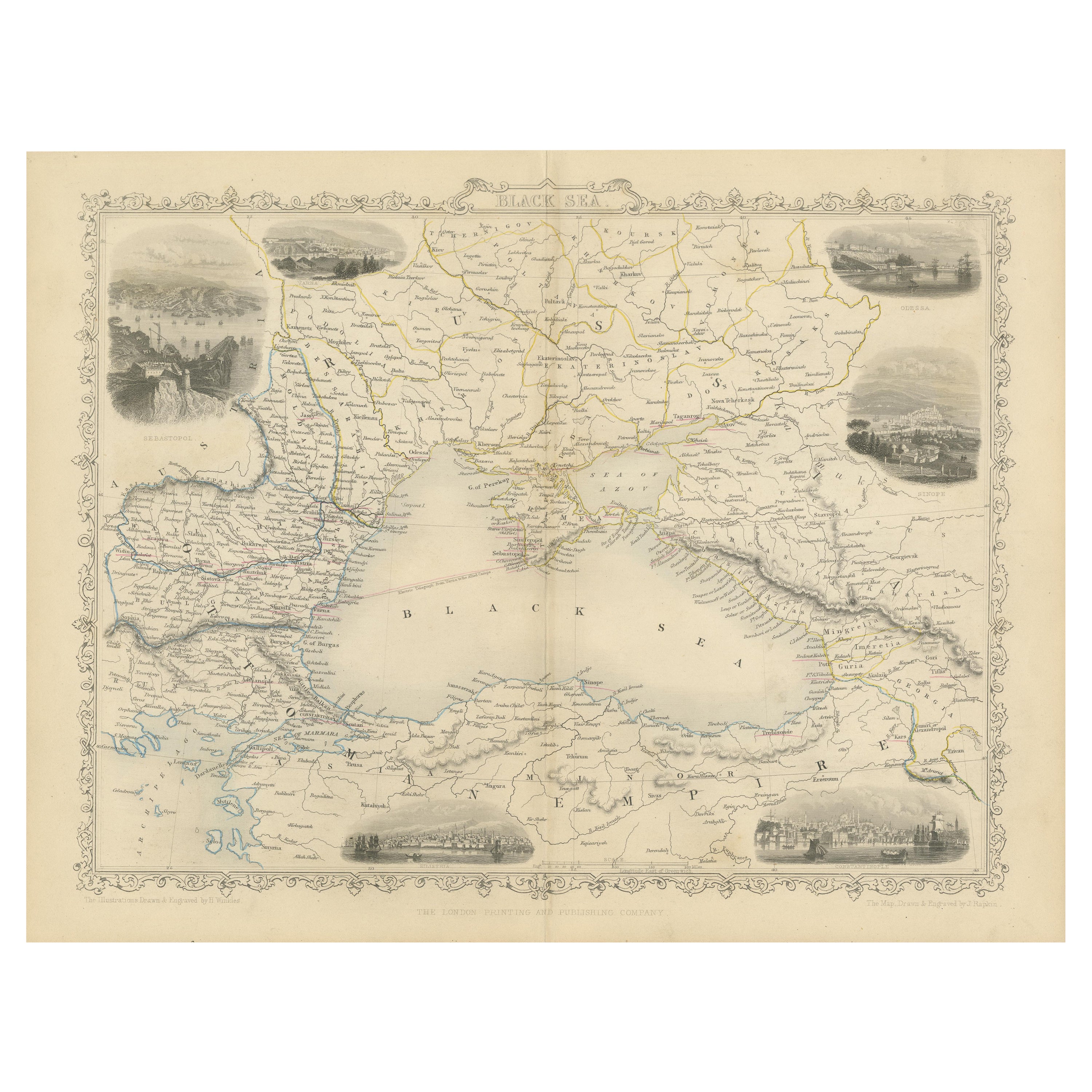
Mid 19th Century Map of the Black Sea with Decorative Vignettes, 1851
Located in Langweer, NL
Map of the Black Sea and contingent lands, including Turkey, Russia, Georgia, Azerbaijan, Bulgaria, Crimea and Armenia, with decorative vignettes views of Sebastopol, Varna, Odessa, Sinope, Constantinople and Silistria.
Fine antique map...
Category
Antique Mid-19th Century Maps
Materials
Paper

$431 Sale Price
20% Off
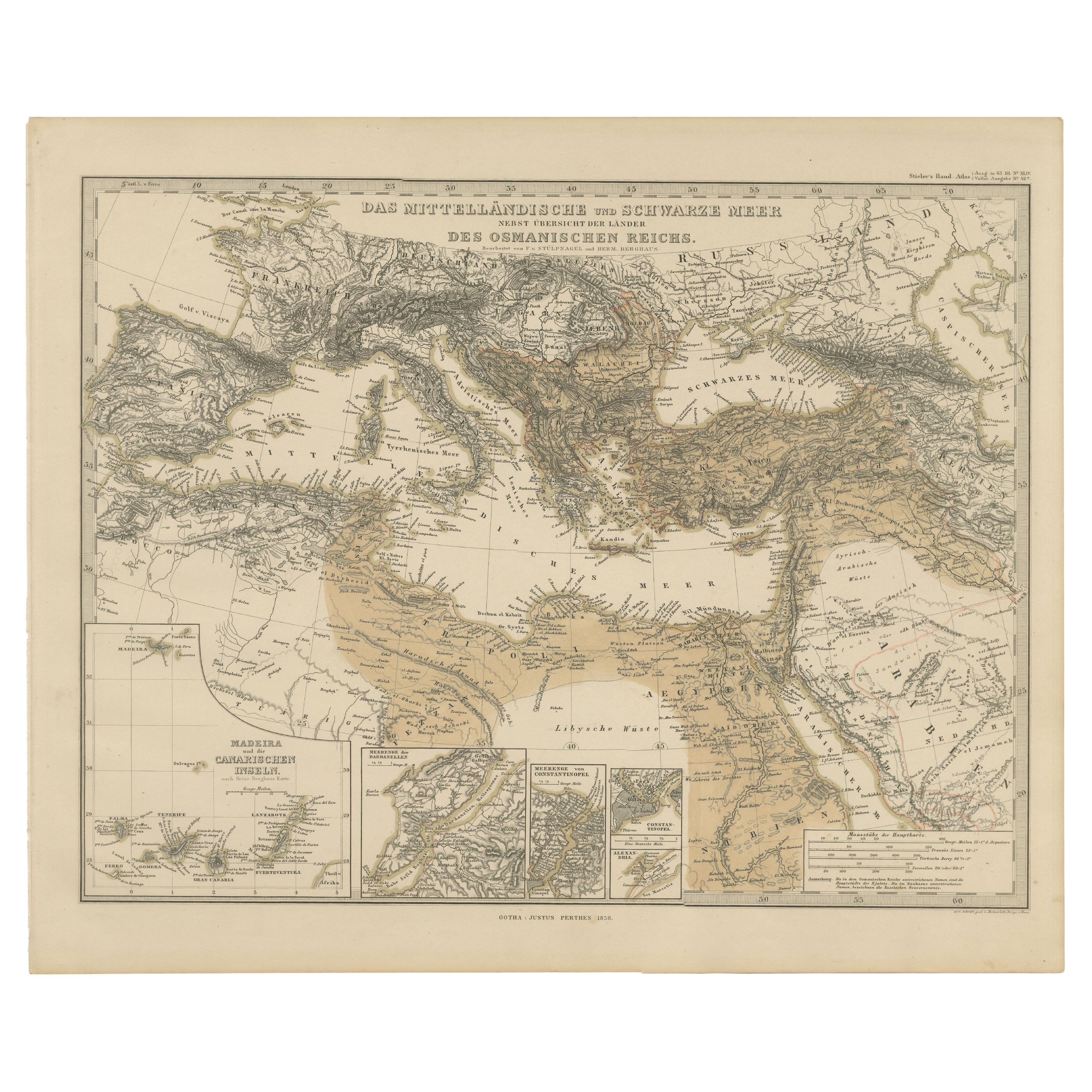
Mediterranean, Black Sea & Ottoman Empire Map 1853
Located in Langweer, NL
Mediterranean, Black Sea & Ottoman Empire Map 1853
This impressive antique print shows the Mediterranean and Black Sea regions with a focus on the Ottoman Empire, titled “Das Mittel...
Category
Antique Mid-19th Century German Maps
Materials
Paper
You May Also Like
1849 Map of "Europaische Russland", 'Meyer Map of European Russia', Ric. R017
Located in Norton, MA
1849 Map of
"Europaische Russland"
( Meyer Map of European Russia)
Ric.r017
A lovely map of European Russia dating to 1849 by Joseph Meyer. It covers the European portions of...
Category
Antique 19th Century Unknown Maps
Materials
Paper

Antique Lithography Map, Black Sea, English, Framed, Cartography, Victorian
Located in Hele, Devon, GB
This is an antique lithography map of the Black Sea region. An English, framed atlas engraving of cartographic interest by John Rapkin, dating to the early Victorian period and later...
Category
Antique Mid-19th Century British Early Victorian Maps
Materials
Wood

Original Antique Map of Ancient Greece, Achaia, Corinth, 1786
Located in St Annes, Lancashire
Great map of Ancient Greece. Showing the region of Thessaly, including Mount Olympus
Drawn by J.D. Barbie Du Bocage
Copper plate engraving by P.F Tardieu
Original hand color...
Category
Antique 1780s French Other Maps
Materials
Paper

1814 Map of "Russian Empire" Ric.r032
Located in Norton, MA
1814 Map of
"Russian Empire"
Ric.r032
Russian Empire. Description: This is an 1814 John Thomson map of the Russian Empire. The map depicts the region from the Baltic Sea, Prussia, and Sweden to the Aleutian Islands and from the Arctic Ocean to the Yellow River. Highly detailed, myriad cities, towns, and villages are labeled throughout, including St. Petersburg, Moscow, Minsk, Kiev, and Kharkov. Rivers and mountain ranges are also identified, as are islands and numerous locations along the coastlines. It is important to note that the long-disputed sea between Korea and Japan is identified as the 'Sea of Japan.
Historical Context:
In 1815, Tsarist Russia emerged from the Napoleonic Wars economically insolvent and politically fearful of the Revolutionary fervor that had just swept through Europe. In order to shore up Russia's economic position, the Tsars began an aggressive series of expansions into the Caucuses and Central Asia that would vastly increase the landmass of the Russian Empire.
Publication History
Thomson maps are known for their stunning color, awe inspiring size, and magnificent detail. Thomson's work, including this map, represents some of the finest cartographic art...
Category
Antique 19th Century Unknown Maps
Materials
Paper

1860 Large Map "Carte De La Siberie Russie D'asie, " Ric.R0001
Located in Norton, MA
Large 1860 map "Carte De La Siberie Russie D'Asie," R-0001
" Authentic" - 1860 map "Carte De La Siberie Russie D'Asie,"
Dimension: Paper: 68 cm W x 51 cm H ; Sight: 51cm W x 4...
Category
Antique 19th Century Unknown Maps
Materials
Paper

Map of Eastern Roman Empire -Vintage Offset Print - Early 20th Century
Located in Roma, IT
This map of Eastern Roman Empire is a vintage offset print realized in the early 20th Century.
The state of preservation of the artwork is aged with dif...
Category
Early 20th Century Figurative Prints
Materials
Offset

More Ways To Browse
Used Furniture Fall River
Antique Greek Pots
Persian Antiquities
Antique Turkish Pots
Vintage Wood Table With Glass Top
19th Century Square Table
Galle Chairs
Large Chinese Rug
1940s Vintage French Art Deco
20th Century Spanish Table
Antonio Bellini
Retro Fiberglass Furniture
Shipping Crate
Antique Oushak Carpets
Blue Coffee Tables
German Bauhaus Posters
1945 Chair Juhl
Antique Three Leg Table