Items Similar to Double Sided and Glazed Cheshire 1645 Hand Colored Antique Print Map Rare Find

Want more images or videos?
Request additional images or videos from the seller
1 of 14
Double Sided and Glazed Cheshire 1645 Hand Colored Antique Print Map Rare Find
$433.07
$618.6830% Off
£315
£45030% Off
€370.56
€529.3730% Off
CA$592.90
CA$84730% Off
A$664.24
A$948.9230% Off
CHF 345.74
CHF 493.9130% Off
MX$8,089.18
MX$11,555.9730% Off
NOK 4,404.22
NOK 6,291.7530% Off
SEK 4,147.54
SEK 5,925.0530% Off
DKK 2,766.18
DKK 3,951.6930% Off
Shipping
Retrieving quote...The 1stDibs Promise:
Authenticity Guarantee,
Money-Back Guarantee,
24-Hour Cancellation
About the Item
We are delighted to offer for sale this lovely antique Atlas page map of Cheshire printed in 1645 Amsterdam Staffordiensis Comitatvs Vulgo
I have three of these maps each covering a different part of the country, the other two are listed under my other items. They are double sided and glazed both back and front so you can see the map on the front and read about it on the back
This one is two pages from an antique atlas, it has been plate printed and hand coloured, the detail is exquisite, you can see the plate print impression around the edges and hand written notation number
I have no idea on the age, it looks circa 1800 to me, it was originally printed in 1645 by Joan Bleau so could be older
Dimensions:
Height 54.5cm
Width 65cm
Depth 2cm
Please note all measurements are taken at the widest point
This item is available for collection from our Wimbledon warehouses
Condition
Please view the very detailed pictures as they form part of the description around condition
Please note vintage period and original items such as leather seating will always have natural patina in the form of cracking creasing and wear, we recommend regular waxing to ensure no moisture is lost, also hand dyed leather is not recommended to sit in direct sunlight for prolonged periods of time as it will dry out and fade.
- Dimensions:Height: 21.46 in (54.5 cm)Width: 25.6 in (65 cm)Depth: 0.79 in (2 cm)
- Style:Georgian (Of the Period)
- Materials and Techniques:
- Place of Origin:
- Period:
- Date of Manufacture:1800
- Condition:Wear consistent with age and use. Minor fading.
- Seller Location:West Sussex, GB
- Reference Number:1stDibs: LU2823320358932
About the Seller
4.7
Platinum Seller
Premium sellers with a 4.7+ rating and 24-hour response times
Established in 2012
1stDibs seller since 2017
1,993 sales on 1stDibs
Typical response time: 1 hour
- ShippingRetrieving quote...Shipping from: West Sussex, United Kingdom
- Return Policy
Authenticity Guarantee
In the unlikely event there’s an issue with an item’s authenticity, contact us within 1 year for a full refund. DetailsMoney-Back Guarantee
If your item is not as described, is damaged in transit, or does not arrive, contact us within 7 days for a full refund. Details24-Hour Cancellation
You have a 24-hour grace period in which to reconsider your purchase, with no questions asked.Vetted Professional Sellers
Our world-class sellers must adhere to strict standards for service and quality, maintaining the integrity of our listings.Price-Match Guarantee
If you find that a seller listed the same item for a lower price elsewhere, we’ll match it.Trusted Global Delivery
Our best-in-class carrier network provides specialized shipping options worldwide, including custom delivery.More From This Seller
View AllStaffordshire 1645 Hand Colored Antique Print Staffordiensis Comitatvs Map
Located in West Sussex, Pulborough
We are delighted to offer for sale this lovely antique Atlas page map of Staffordshire printed in 1645 Amsterdam Staffordiensis Comitatvs Vulgo
This o...
Category
Antique Early 1800s English Georgian Maps
Materials
Paper

$433 Sale Price
30% Off
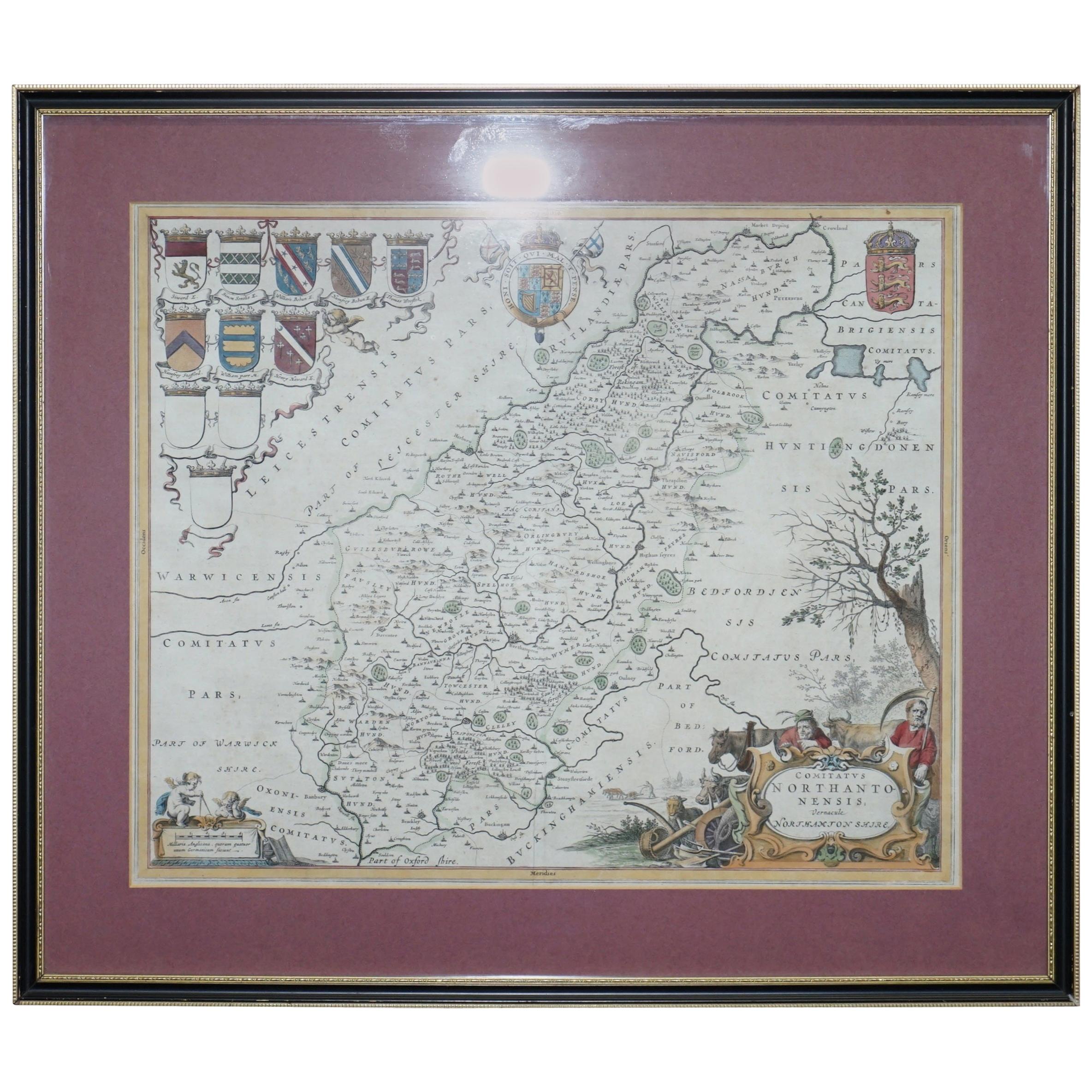
Double Sided Northamptonshire 1645 Hand Colored Antique Print Map Rare Find
Located in West Sussex, Pulborough
We are delighted to this lovely antique Atlas page map of Northamptonshire printed in 1645 Amsterdam Staffordiensis Comitatvs Vulgo
I have three of th...
Category
Antique Early 1800s English Georgian Maps
Materials
Paper

$433 Sale Price
30% Off
Fine Antique 1856 Hand Watercolour Map of Dept Des Hautes Alpes by Levasseur's
Located in West Sussex, Pulborough
We are delighted to offer for sale this stunning 1856 hand watercolour map of the Austrian Alps titled Dept Des Hautes Alpes taken from the Atlas National...
Category
Antique 1850s French Early Victorian Maps
Materials
Paper

Greece 1660 Jan Jansson Watercolour Map Peloponesus Sive Morea I Laurenbergio
Located in West Sussex, Pulborough
We are delighted to offer for sale this Jan Jansson Date: 1660 (published) Amsterdam map of Greece.
This is an authentic antique map of Peloponnese or...
Category
Antique 1660s Danish Dutch Colonial Maps
Materials
Copper

Fine French Antique 1856 Hand Watercolour Map of Dept Des Hautes Pyrenees
Located in West Sussex, Pulborough
We are delighted to offer for sale this stunning 1856 hand watercolour map of the Austrian Alps titled Dept Des Hautes Pyrenees taken from the Atlas Nat...
Category
Antique 1850s French Early Victorian Maps
Materials
Paper

London 1744 Published Watercolour Antique Map of East Africa by Eman Bowen
Located in West Sussex, Pulborough
We are delighted to offer for sale this New and Accurate Map of Nubia & Abissinia, together with all the Kingdoms Tributary Thereto, and bordering upon them published in 1744 by Emanuel Bowen
This is a decorative antique engraved map of East Africa...
Category
Antique 1740s English George III Maps
Materials
Paper

You May Also Like
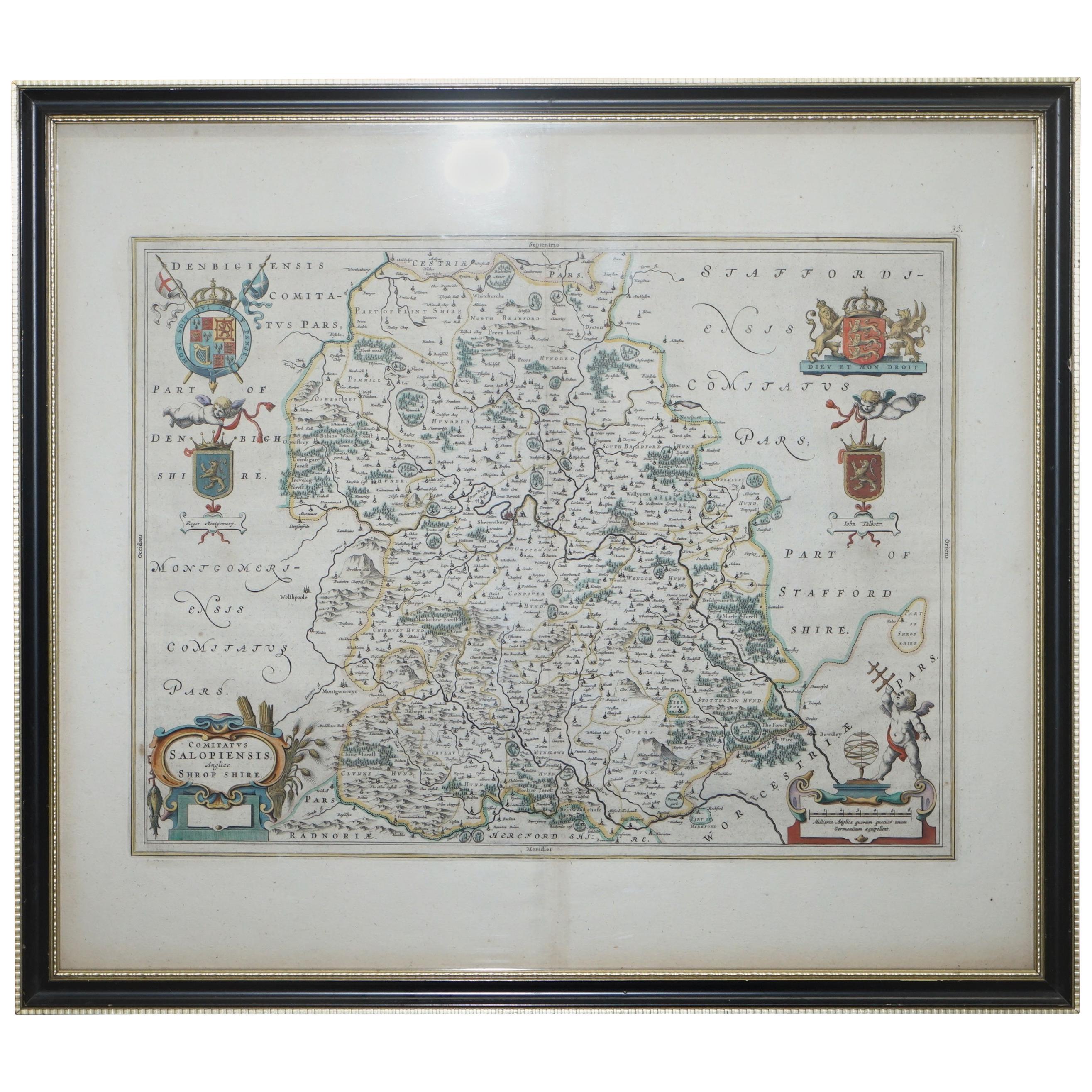
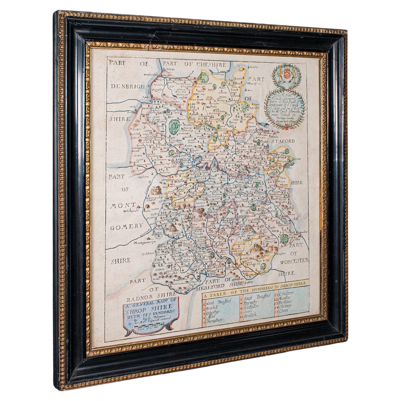
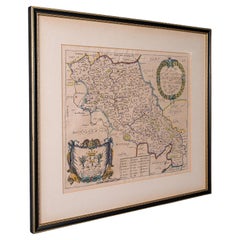
Antique County Map, Shropshire, English, Atlas Engraving, Richard Blome, C.1673
Located in Hele, Devon, GB
This is an antique county map of Shropshire. An English, framed atlas engraving by Richard Blome, dating to the 17th century and later.
A treat for the collector or county native, ...
Category
Antique 17th Century British Restauration Maps
Materials
Glass, Wood, Paper

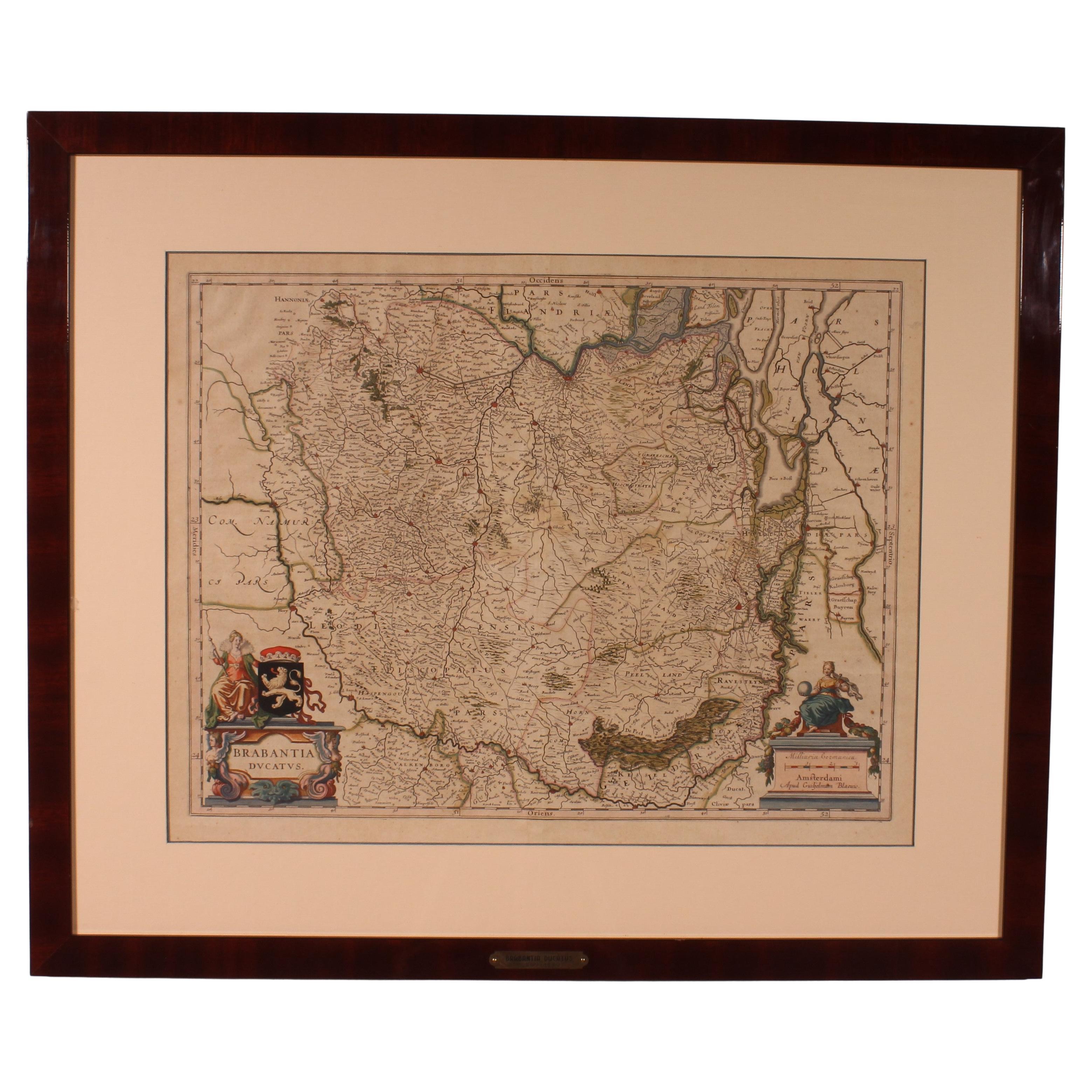
Antique Map Of Brabantia Ducantus By Bleau Circa 1640
Located in Brussels, Brussels
map of theBrabantia Ducantus (Belgium) circa 1640 by Bléau. Bléau was well known for antique atlas that he draw during the 17 century
beautiful map, double page folded in the middle,...
Category
Antique 17th Century French Renaissance Maps
Materials
Paper

Antique County Map of Cheshire, Dutch, Framed, Cartography, Janssonius, C.1660
Located in Hele, Devon, GB
This is an antique county map of Cheshire. A Dutch, framed atlas engraving by Johannes Janssonius, dating to the 17th century and later.
A treat for the collector or county native,...
Category
Antique Mid-17th Century Dutch Charles II Maps
Materials
Glass, Wood, Paper

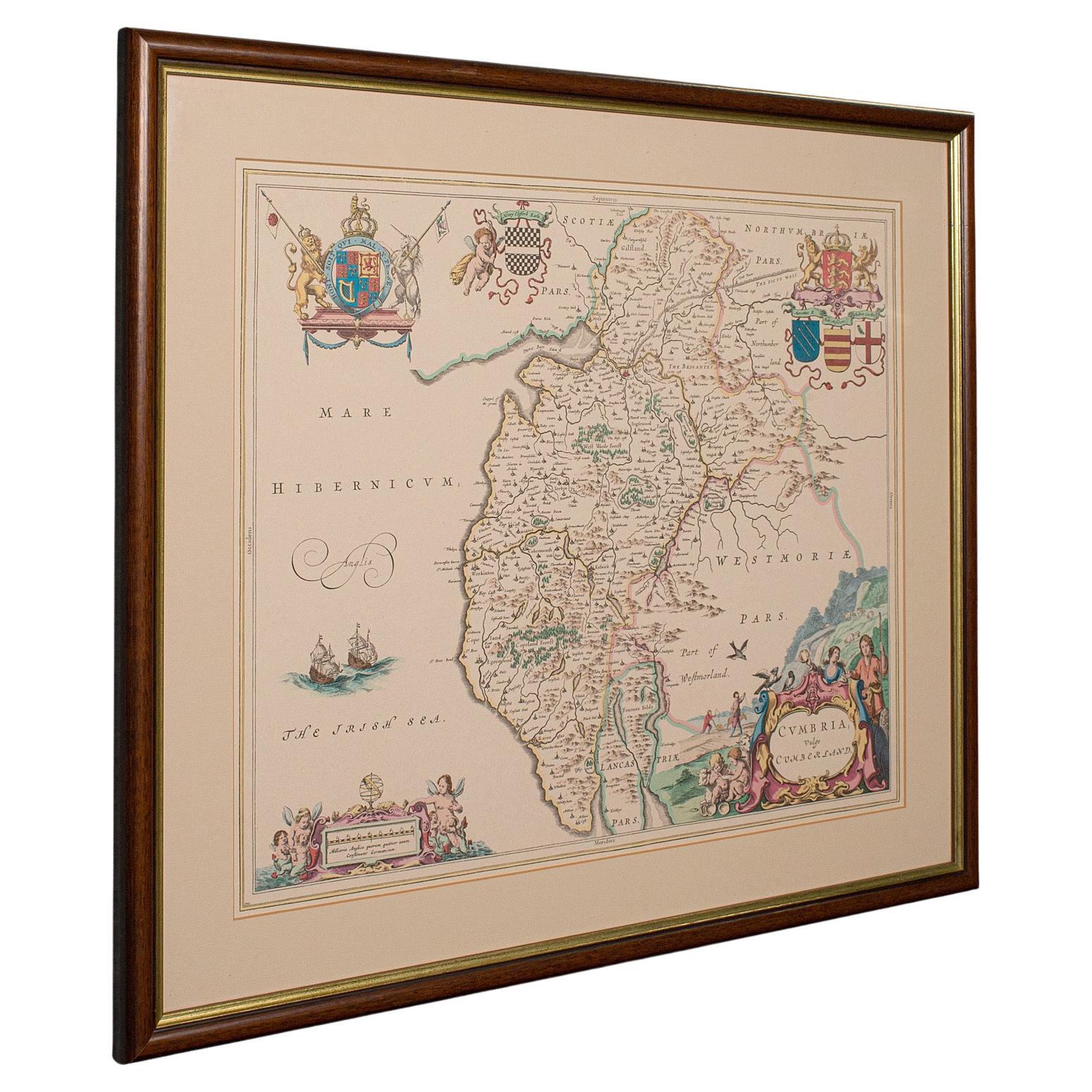
Antique Lithography Map, Cumbria, English, Framed Cartography Interest, Georgian
Located in Hele, Devon, GB
This is an antique lithography map of Cumbria. An English, framed engraving of cartographic interest, dating to the early 18th century and later.
...
Category
Antique Early 18th Century British Georgian Maps
Materials
Wood

Antique Berkshire Map, English County, Framed Engraving, Cartography, Lithograph
Located in Hele, Devon, GB
This is an antique county map of Berkshire. An English, framed atlas engraving of cartographic interest, dating to the mid 19th century and later.
Superb lithography of Berkshire a...
Category
Antique Mid-19th Century British Victorian Maps
Materials
Glass, Wood, Paper

Antique County Map, Northamptonshire, English, Framed Cartography, Richard Blome
Located in Hele, Devon, GB
This is an antique county map of Northamptonshire. An English, framed atlas engraving by Richard Blome, dating to the 17th century and later.
Fascinating cartography, oriented 90 d...
Category
Antique Late 17th Century British Charles II Maps
Materials
Glass, Wood, Paper
More Ways To Browse
Antique Map Of Georgia
Antique Furniture Cheshire
Antique Maps Indonesia
Compass Rose Antique
Swiss Antiques And Collectables
Antique Compass Map
Blaeu Maps
Coat Of Arms German
Antique Collectables Australia
Military Map
Spanish Empire
Antique Maps Scotland
Mississippi Antique
Denmark Map
Antique Maps Of North America
Wine Map
Map Greece
Roman Map