Items Similar to Flanders, Holland & Norfolk: Hand-Colored 17th Century Sea Chart by Collins

Want more images or videos?
Request additional images or videos from the seller
1 of 8
Flanders, Holland & Norfolk: Hand-Colored 17th Century Sea Chart by Collins
$2,775
£2,118.70
€2,448.14
CA$3,895.57
A$4,342.02
CHF 2,278.11
MX$53,023.19
NOK 28,845.84
SEK 27,263.70
DKK 18,271.53
About the Item
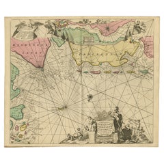
This hand-colored chart of the seas about Flanders, Holland, Frisia, and Norfolk is from "Great Britain's Coasting Pilot. Being a New and Exact Survey of the Sea-Coast of England" by Captain Greenville Collins, first published in 1693. It depicts the seas between the east coast of England and the west coast of Flanders and Holland, along with multiple islands adjacent to the coasts. Prominent land features include the cities of Amsterdam, Antwerp, Bruges, Delft, Rotterdam, Yarmouth and Dover. The chart includes several compass roses and extensive rhumb lines. A beautiful and colorful cartouche in the lower right includes a dedication to Sir John Ashby, "Admiral of the Blew".
These sea charts by Captain Greenvile Collins (1643-1694) are beautiful, colorful and striking, as well as historically very important to the British navy for approximately 100 years. Captain Collins was appointed “His Majesty’s Hydrographer” by King Charles II and asked to survey the coast of Great Britain and plot all of the harbors, rivers and islands, etc. This took seven years and the resulting charts were first published in 1693. They were published until 1792.
We have 16 sea charts from this series that are all the same size and are framed and matted identically. The frames are a unique plexiglass sleeve design, measuring 27.75" x 23' x 0.5" and the mats are a cream color. There is a central fold, as issued, and one tiny spot in the left lower chart. It is otherwise in excellent condition.
The provenance for these sea charts is very interesting. They were owned by Tom Perkins, who is considered one of the fathers of Silicon Valley. He was one of the founders of Kleiner Perkins Cauffield and Byers, the first big and most influential Silicon Valley venture capital company. Perkins himself was an avid sailor and had at the time the largest and most technologically advanced sailing yacht in the world, the Maltese Falcon. I have 16 of his sea charts that are all the same size and are framed and matted identically. The frames are a unique plexiglass sleeve design.
- Creator:Captain Greenvile Collins (Artist)
- Dimensions:Height: 23 in (58.42 cm)Width: 27.75 in (70.49 cm)Depth: 0.5 in (1.27 cm)
- Materials and Techniques:Paper,Engraved
- Place of Origin:
- Period:Late 17th Century
- Date of Manufacture:1693
- Condition:Wear consistent with age and use.
- Seller Location:Alamo, CA
- Reference Number:Seller: # 32481stDibs: LU5206220338442
About the Seller
5.0
Vetted Professional Seller
Every seller passes strict standards for authenticity and reliability
1stDibs seller since 2020
15 sales on 1stDibs
- ShippingRetrieving quote...Shipping from: Alamo, CA
- Return Policy
Authenticity Guarantee
In the unlikely event there’s an issue with an item’s authenticity, contact us within 1 year for a full refund. DetailsMoney-Back Guarantee
If your item is not as described, is damaged in transit, or does not arrive, contact us within 7 days for a full refund. Details24-Hour Cancellation
You have a 24-hour grace period in which to reconsider your purchase, with no questions asked.Vetted Professional Sellers
Our world-class sellers must adhere to strict standards for service and quality, maintaining the integrity of our listings.Price-Match Guarantee
If you find that a seller listed the same item for a lower price elsewhere, we’ll match it.Trusted Global Delivery
Our best-in-class carrier network provides specialized shipping options worldwide, including custom delivery.More From This Seller
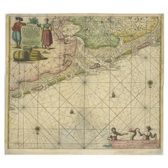
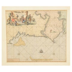
View AllPlymouth, England: A Hand-Colored 17th Century Sea Chart by Captain Collins
By Captain Greenvile Collins
Located in Alamo, CA
This hand-colored sea chart of the area around Plymouth, England from "Great Britain's Coasting Pilot. Being a New and Exact Survey of the Sea-Coast of England", first published in 1...
Category
Antique Late 17th Century English Maps
Materials
Paper

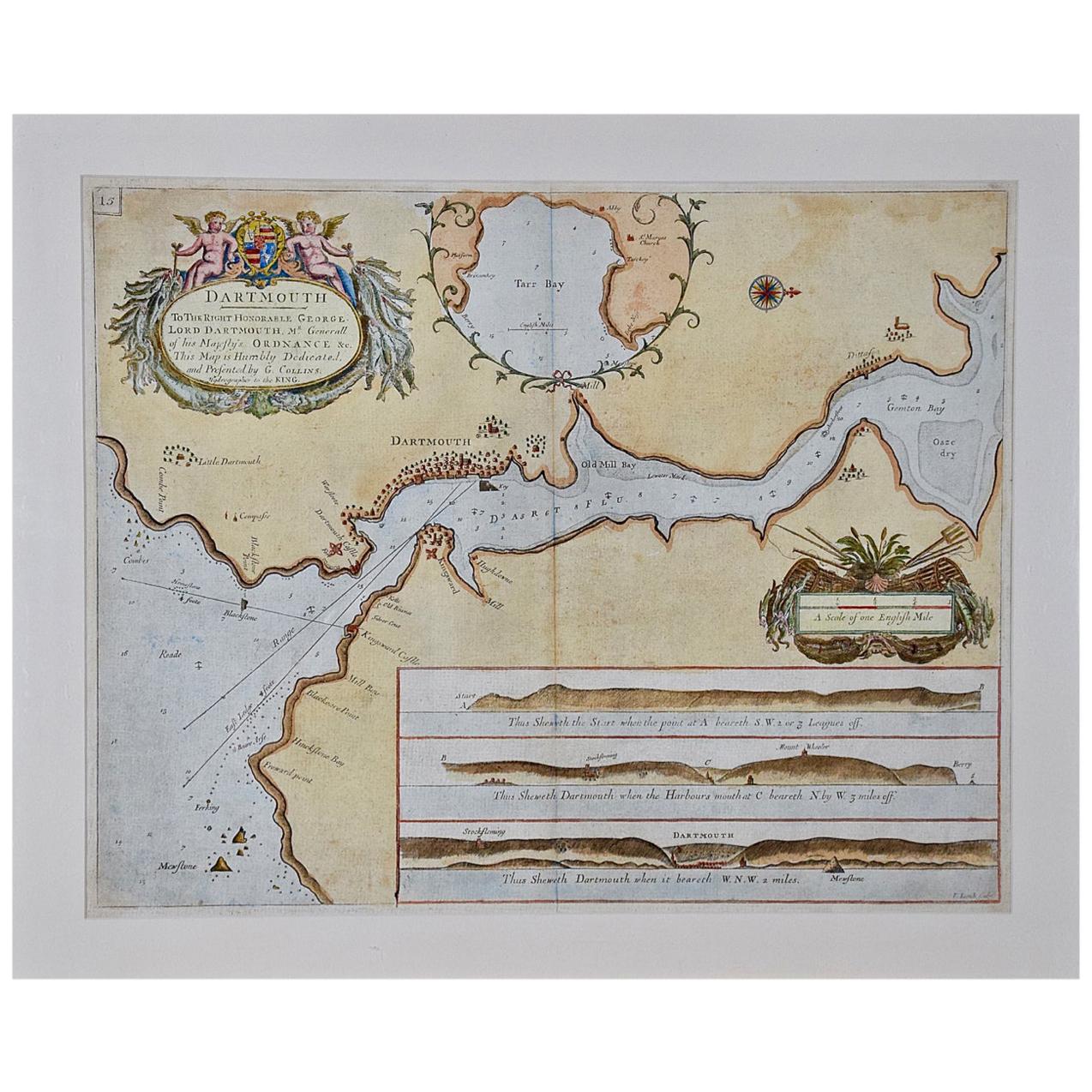
Dartmouth, England: A Hand-Colored 17th Century Sea Chart by Captain Collins
By Captain Greenvile Collins
Located in Alamo, CA
This hand-colored sea chart of the area around Dartmouth, England is from "Great Britain's Coasting Pilot. Being a New and Exact Survey of the Sea-Coast of England", first published ...
Category
Antique Late 17th Century English Maps
Materials
Paper

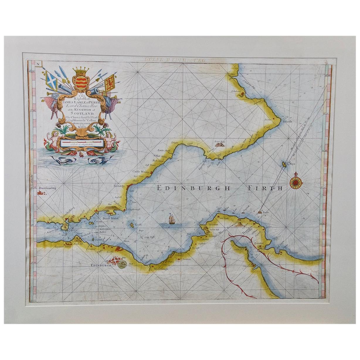
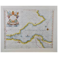
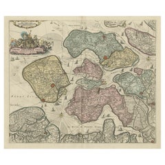
Edinburgh, Scotland Coast: A 17th Century Hand-Colored Sea Chart by Collins
By Captain Greenvile Collins
Located in Alamo, CA
This hand-colored sea chart is entitled "Edinburgh Firth" from "Great Britain's Coasting Pilot. Being a New and Exact Survey of the Sea-Coast of England" by Captain Greenville Collin...
Category
Antique Late 17th Century English Maps
Materials
Paper
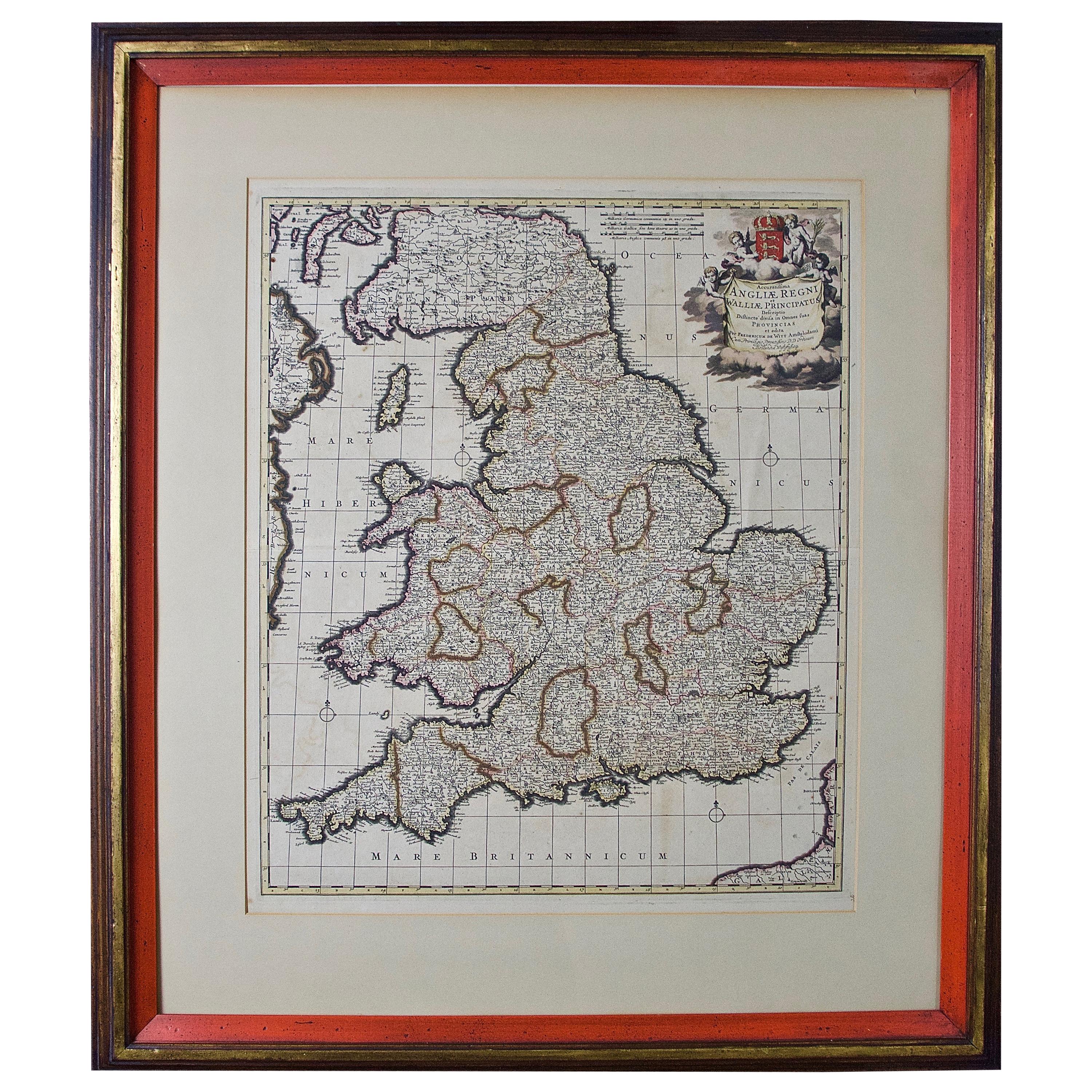
Large 17th Century Hand Colored Map of England and the British Isles by de Wit
By Frederick de Wit
Located in Alamo, CA
A large hand colored 17th century map of England and the British Isles by Frederick de Wit entitled "Accuratissima Angliæ Regni et Walliæ Principatus", published in Amsterdam in 1680. It is a highly detailed map of England, Scotland, the Scottish Isles...
Category
Antique Late 17th Century Dutch Maps
Materials
Paper

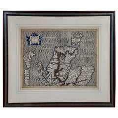
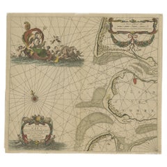
Northern Scotland: A 17th Century Hand-colored Map by Mercator
By Gerard Mercator
Located in Alamo, CA
This is a framed hand-colored 17th century map of Northern Scotland by Gerard Mercator entitled "Scotiae pars Septentrionalis", published in Amsterdam in 1636. It is a highly detailed map of the northern part of Scotland, with the northwest Highlands and the cities Inverness and Aberdeen, as well as the Orkney Islands and the Hebrides. There is a decorative title cartouche in the upper left corner.
The map is presented in an antiqued brown wood...
Category
Antique 1630s Dutch Maps
Materials
Paper

Northern Scotland: A 16th Century Hand-colored Map by Mercator
By Gerard Mercator
Located in Alamo, CA
A framed hand-colored 16th century map of Northern Scotland by Gerard Mercator entitled "Scotiae pars Septentrionalis", published in Amsterdam in 1636. It is a highly detailed map of the northern part of Scotland, with the northwest Highlands and the cities Inverness and Aberdeen, as well as the Orkney Islands and the Hebrides. There is a decorative title cartouche in the upper left corner.
The map is presented in an antiqued brown wood...
Category
Antique 16th Century Dutch Maps
Materials
Paper
You May Also Like
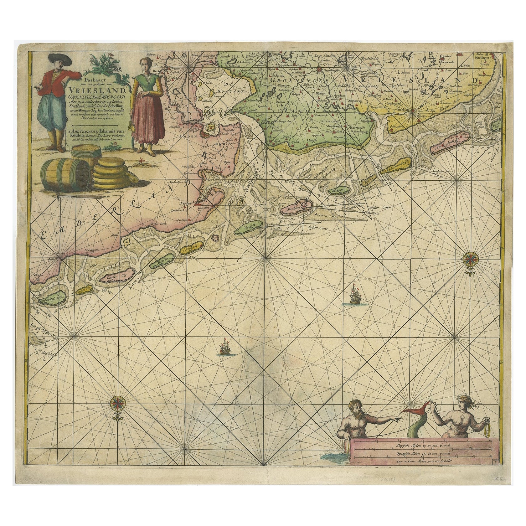
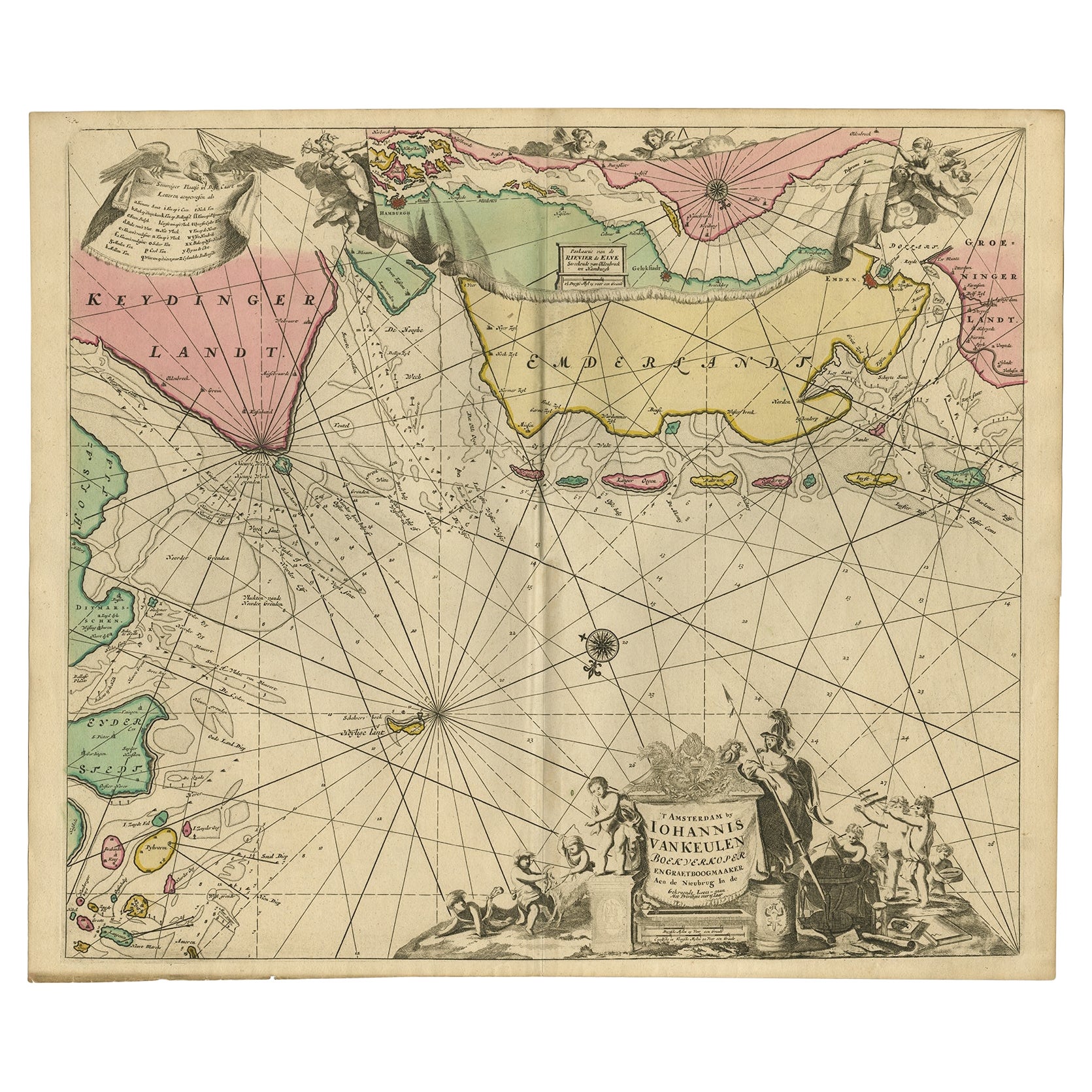
Old Decorative & Highly Detailed Sea Chart of the North Dutch-German Coast, 1681
Located in Langweer, NL
Antique map titled 'Paskaart van een gedeelte van Vriesland, Groeninger, en Emderland. Met zyn onderhoorige Eylanden; Strekkende van't Eylant der Schelling'.
Decorative and highl...
Category
Antique 1680s Maps
Materials
Paper
$1,556 Sale Price
20% Off
Rare Sea Chart of the East Frisian Islands or Watten and the North Sea, c.1700
Located in Langweer, NL
Description: Antique map titled 'Paskaarte van de rievier de Elve streckende van Oldenbroek tot Hamburgh.'
Rare and interesting chart of the East Frisian Islands (or Watten) and ...
Category
Antique Early 1700s Maps
Materials
Paper
$1,745 Sale Price
20% Off
Original Hand-Coloured Nautical Chart of West-Africa, c.1680
Located in Langweer, NL
NIEUWE PASKAERT VAN DE KUST VAN GENEHOA (Senegal) alsmede een gedeelte van Gambia beginnende an C. Blanco tot C. Verde (...). Amsterdam, Johannus van Keulen, c. 1680.
Large folio...
Category
Antique 17th Century Maps
Materials
Paper
$1,368 Sale Price
20% Off
Antique Sea Chart of North America by Ottens, circa 1745
Located in Langweer, NL
Antique map titled 'Septemtrionaliora Americae a Groenlandia (..)'. Sea chart of the northern waters of North America, including the coast of Labrador and pa...
Category
Antique Mid-18th Century Maps
Materials
Paper

Decorative Antique Sea Chart of Zeeland, a Province of the Netherlands, ca.1730
Located in Langweer, NL
Antique map titled 'Comitatus Zelandiae Tabula emendata a Frederico De Wit'.
Decorative sea chart of Zeeland, a province of the Netherlands. Although the title reads F. de Wit, thi...
Category
Antique 1730s Maps
Materials
Paper
$1,084 Sale Price
20% Off
Original Antique Sea Chart of the Maas 'or Meuse' River with Neptunes, 1684
Located in Langweer, NL
Antique map titled 'Paskaerte van het inkoomen van de Maes (..)'.
Original antique sea chart of the Maas (or Meuse) river and part of the Dutch c...
Category
Antique 1680s Maps
Materials
Paper
$707 Sale Price
20% Off
More Ways To Browse
Holland And Company
Sea Captain
Norfolk Furniture
Map Of Great Britain
Sea Captains Furniture
Map New Holland
British Compass
Antique Maltese Furniture
Tom Collins
Navy Compass
Antique Maps Of Malta
Maltese Falcon
Antique Maps Indonesia
Compass Rose Antique
Swiss Antiques And Collectables
Antique Compass Map
Blaeu Maps
Coat Of Arms German