Items Similar to Hand-Colored 18th Century Homann Map of Denmark and Islands in the Baltic Sea


Want more images or videos?
Request additional images or videos from the seller
1 of 6
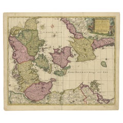
Hand-Colored 18th Century Homann Map of Denmark and Islands in the Baltic Sea
$775
£588.48
€672.97
CA$1,082.79
A$1,204.30
CHF 628.85
MX$14,655
NOK 8,031.32
SEK 7,531.96
DKK 5,022.60
Shipping
Retrieving quote...The 1stDibs Promise:
Authenticity Guarantee,
Money-Back Guarantee,
24-Hour Cancellation
About the Item
An 18th century copper plate hand-colored map entitled "Insulae Danicae in Mari Balthico Sitae utpote Zeelandia, Fionia, Langelandia, Lalandia, Falstria, Fembria Mona" created by Johann Baptist Homann (1663-1724) in his 'Atlas Novus Terrarum', published in Nuremberg, Germany in 1720. It depicts the country of Denmark, including Copenhagen, Malmö, Cronenburg and its islands located in the Baltic Sea, including Zeeland, Fionia, Langeland, Laland, Falstria and Fembria Mona. The beautiful and detailed cartouche in the lower right corner depicts ships in the strait between Sweden and Denmark, as well as two children holding up a royal coat-of-arms at the top and mermaids or gods of the sea in the water on the left.
There is a central vertical fold as issued with associated mild toning adjacent toning. Minimal toning in the lower margin, but the map is otherwise in very good condition.
Johann Baptist Homann (1663-1724) was a mapmaker who founded a respected and prolific publishing company, which continued long after his death as Homann Heirs. Homann lived his entire life in Bavaria, particularly in Nuremberg. Initially, Johann trained to become a priest before converting to Protestantism and working as a notary. In 1702, Johann founded a publishing house that specialized in engravings. The firm flourished, becoming the leading map publisher in Germany and an important entity in the European map market. In 1715, Johann was named Imperial Geographer to the Holy Roman Empire by Charles VI and made a member of the Prussian Academy of Sciences. Most importantly for his business, his reputation and contacts gained him imperial printing privileges which protected his publications and recommended him to customers.
- Creator:Johann Baptist Homann (Artist)
- Dimensions:Height: 20.25 in (51.44 cm)Width: 23.25 in (59.06 cm)Depth: 0.07 in (1.78 mm)
- Materials and Techniques:Paper,Engraved
- Place of Origin:
- Period:
- Date of Manufacture:1728
- Condition:Wear consistent with age and use.
- Seller Location:Alamo, CA
- Reference Number:Seller: # 12861stDibs: LU5206221025212

Johann Baptist Homann
Johann Baptist Homann (1663-1724) was a mapmaker who founded a respected and prolific publishing company, which continued long after his death as Homann Heirs. Homann lived his entire life in Bavaria, particularly in Nuremberg. Initially, Johann trained to become a priest before converting to Protestantism and working as a notary. In 1702, Johann founded a publishing house that specialized in engravings. The firm flourished, becoming the leading map publisher in Germany and an important entity in the European map market. In 1715, Johann was named Imperial Geographer to the Holy Roman Empire by Charles VI and made a member of the Prussian Academy of Sciences. Most importantly for his business, his reputation and contacts gained him imperial printing privileges which protected his publications and recommended him to customers.
About the Seller
5.0
Vetted Professional Seller
Every seller passes strict standards for authenticity and reliability
1stDibs seller since 2020
15 sales on 1stDibs
- ShippingRetrieving quote...Shipping from: Alamo, CA
- Return Policy
Authenticity Guarantee
In the unlikely event there’s an issue with an item’s authenticity, contact us within 1 year for a full refund. DetailsMoney-Back Guarantee
If your item is not as described, is damaged in transit, or does not arrive, contact us within 7 days for a full refund. Details24-Hour Cancellation
You have a 24-hour grace period in which to reconsider your purchase, with no questions asked.Vetted Professional Sellers
Our world-class sellers must adhere to strict standards for service and quality, maintaining the integrity of our listings.Price-Match Guarantee
If you find that a seller listed the same item for a lower price elsewhere, we’ll match it.Trusted Global Delivery
Our best-in-class carrier network provides specialized shipping options worldwide, including custom delivery.More From This Seller
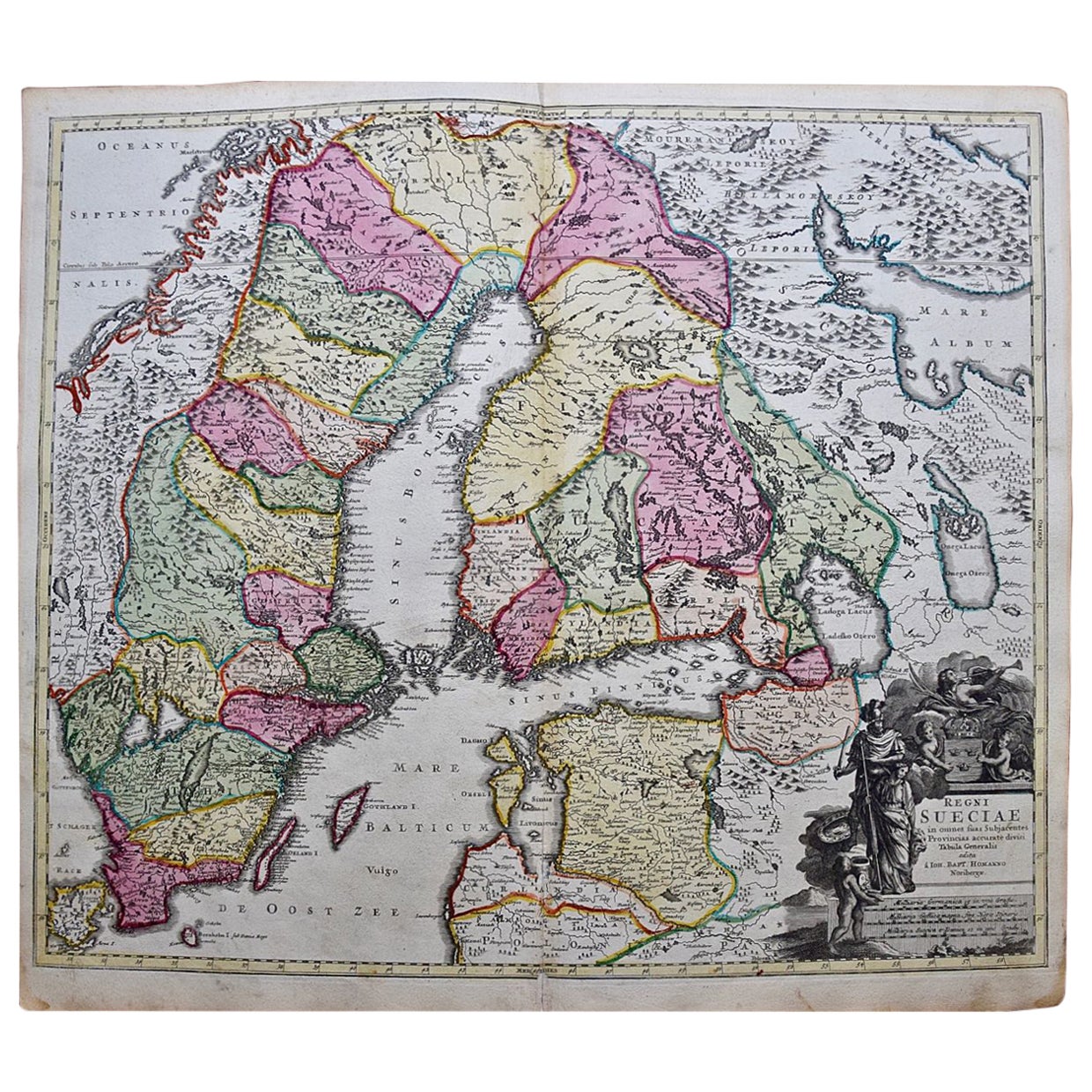
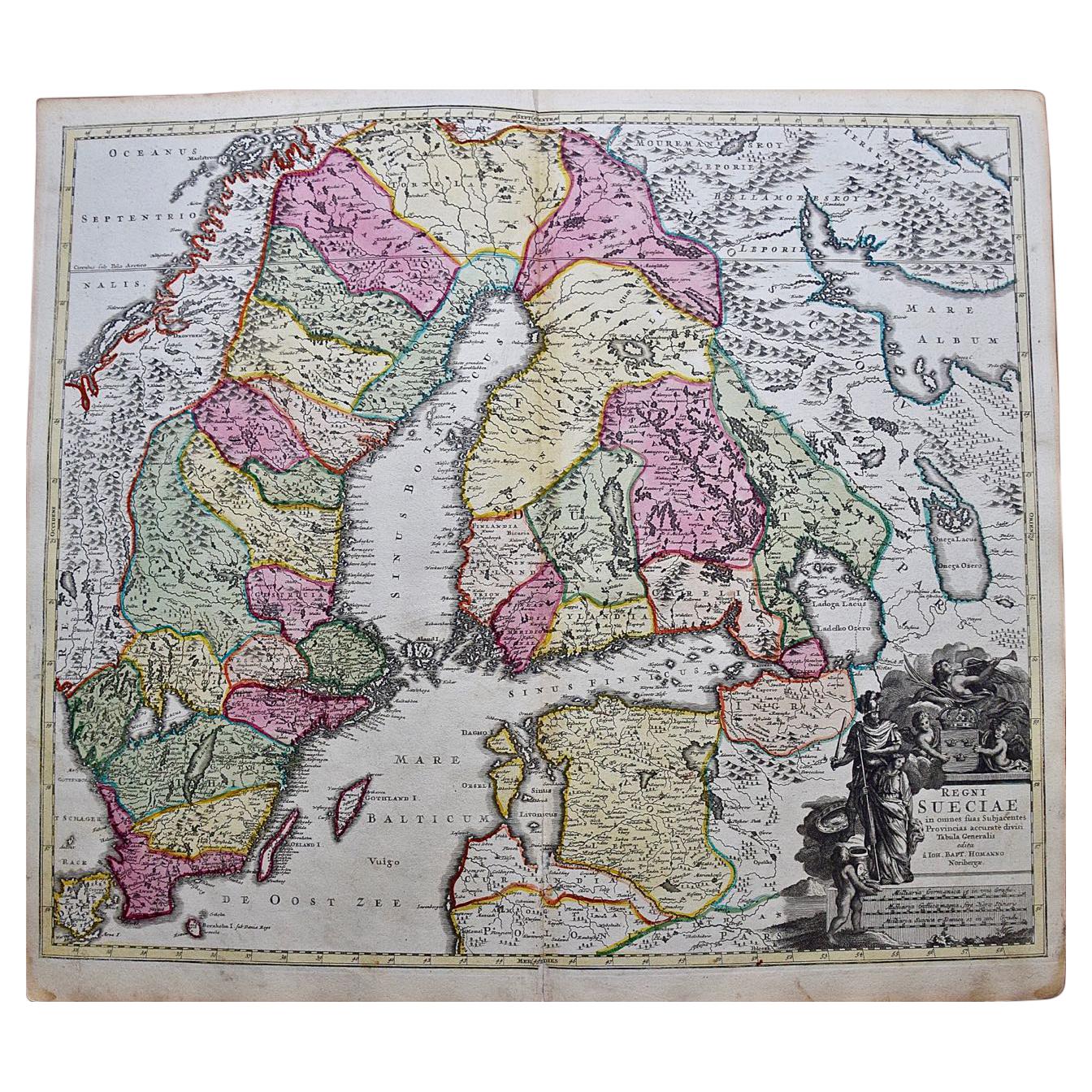
View AllScandinavia & Portions of Eastern Europe: 18th Century Hand-Colored Homann Map
By Johann Baptist Homann
Located in Alamo, CA
An early 18th century hand-colored copper-plate map entitled "Regni Sueciae in omnes suas Subjacentes Provincias accurate divisi Tabula Generalis" by Johann Baptist Homann (1663-1724...
Category
Antique Early 18th Century German Maps
Materials
Paper

Sweden & Adjacent Portions of Scandinavia: A Hand-Colored 18th C. Map by Homann
By Johann Baptist Homann
Located in Alamo, CA
This hand-colored map of Sweden and adjacent portions of Scandinavia entitled "Regni Sueciae in Omnes suas Subjacentes Provincias accurate divisi Tabula Generalis" was created by Joh...
Category
Antique 1720s German Maps
Materials
Paper

Hand-Colored 18th Century Homann Map of the Black Sea, Turkey and Asia Minor
By Johann Baptist Homann
Located in Alamo, CA
An attractive original early 18th century hand-colored map of the Black Sea and Turkey entitled "Carte de L'Asie Minevre ou de la Natolie et du Pont Evxin Tiree des Voyages et des Ob...
Category
Antique Early 18th Century German Maps
Materials
Paper

18th Century Hand-Colored Homann Map of Germany, Including Frankfurt and Berlin
By Johann Baptist Homann
Located in Alamo, CA
An 18th century hand-colored map entitled "Tabula Marchionatus Brandenburgici et Ducatus Pomeraniae quae sunt Pars Septentrionalis Circuli Saxoniae Superioris" by Johann Baptist Homa...
Category
Antique Early 18th Century German Maps
Materials
Paper

Hand-Colored 18th Century Homann Map of the Danube, Italy, Greece, Croatia
By Johann Baptist Homann
Located in Alamo, CA
"Fluviorum in Europa principis Danubii" is a hand colored map of the region about the Danube river created by Johann Baptist Homann (1663-1724) in his 'Atlas Novus Terrarum', publish...
Category
Antique Early 18th Century German Maps
Materials
Paper

California, Alaska and Mexico: 18th Century Hand-Colored Map by de Vaugondy
By Didier Robert de Vaugondy
Located in Alamo, CA
This is an 18th century hand-colored map of the western portions of North America entitled "Carte de la Californie et des Pays Nord-Ouest separés de l'Asie par le détroit d'Anian, ex...
Category
Antique 1770s French Maps
Materials
Paper

You May Also Like
Original Hand-colored Antique Map of Denmark by S. Neele, 1790
Located in Langweer, NL
Antique very decorative engraving of Denmark engraved by S. Neele. Published in November 1790 by John Trusler. Tape on verso.
Category
Antique Late 18th Century Maps
Materials
Paper

$201 Sale Price
20% Off
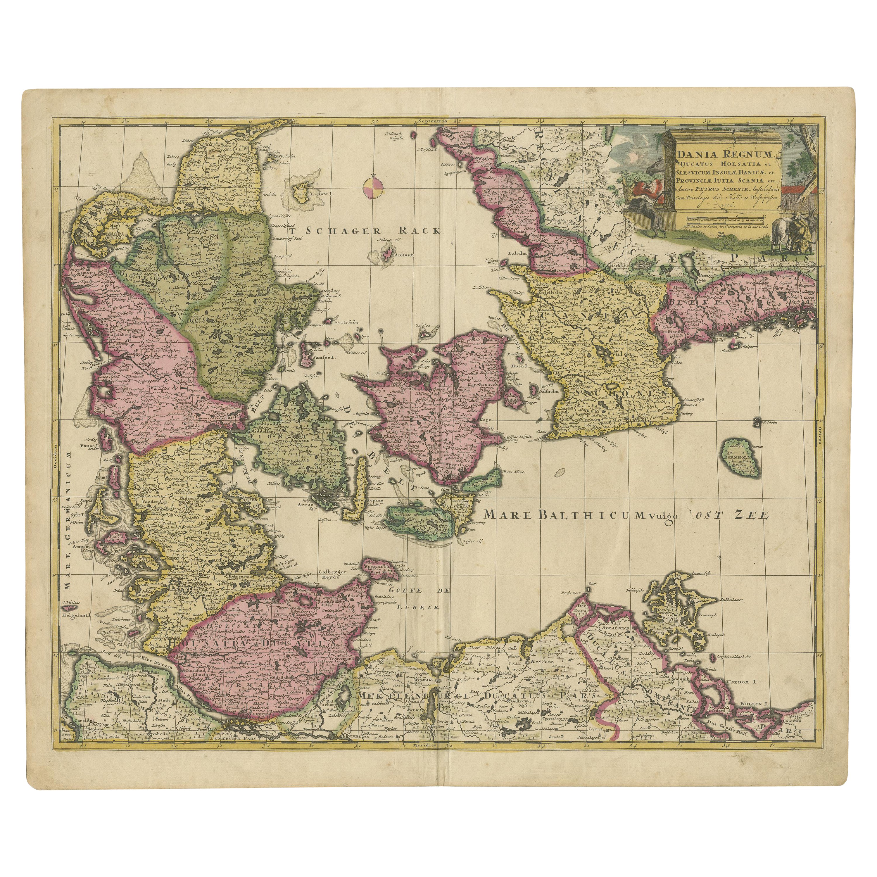
Early 18th Century Map of Denmark in Old Coloring, Published in 1706
Located in Langweer, NL
Denmark. Schenk (Petrus), Dania Regnum Ducatus Holsatia. et Slesvicum Insulae Danicae et Provinciae Jutia Scania etc. Amsterdam, 1706, engraved reticulated map on thick paper with co...
Category
Antique Early 1700s Maps
Materials
Paper
$680 Sale Price
20% Off
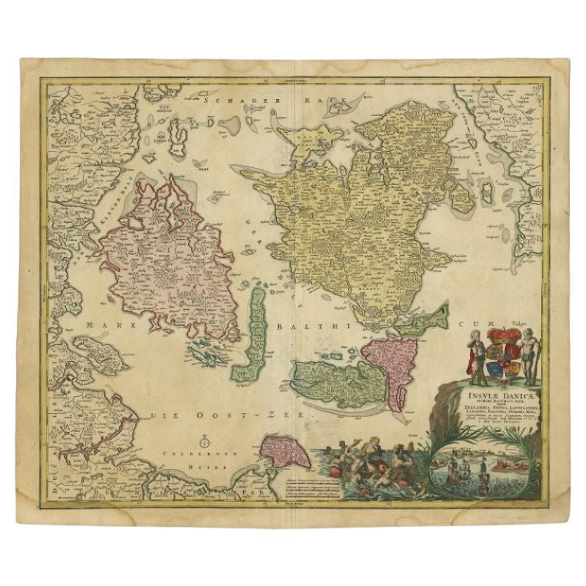
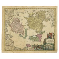
Antique Map of the Islands of Denmark by Homann Heirs, 1720
Located in Langweer, NL
Antique map titled 'Insula Danicae in Mari Balthico sitae (..).' - Map of the Danish islands situated in the Baltic Sea by J. B. Homann, (after J. Hübner's map of the region ) with g...
Category
Antique 18th Century Maps
Materials
Paper
$333 Sale Price
20% Off
Antique Map of Denmark by Valk 'circa 1690'
Located in Langweer, NL
The map titled "Regnum Daniae, divisum in Dioeceses Arhusiam, Albergum, Viborgum, et Ripam (..)" is a meticulously detailed representation of the Kingdom of Denmark during a historic...
Category
Antique Late 17th Century Maps
Materials
Paper

$527 Sale Price
20% Off
Antique Map of Denmark with Details of Fortresses, Cities, Towns Etc, c.1680
Located in Langweer, NL
Antique map of Denmark titled 'Insularum Danicarum ut Zee-Landiae, Fioniae, Langelandiae, Lalandiae Falstriae, Fembriae, Monae (..)'. This map depicts the main Danish Islands and a s...
Category
Antique 17th Century Maps
Materials
Paper

$718 Sale Price
20% Off
Free Shipping
Antique Map of Denmark with the Danish Royal Crest, c.1730
By Homann Heirs
Located in Langweer, NL
Antique map titled 'Regni Daniae in quo sunt Ducatus Holsatia and Slesuicum Insulae Danicae Jutia, Scania Blekingia (..).' Map of Denmark and islands, part of Sweden and Germany, dra...
Category
Antique 18th Century Maps
Materials
Paper
$431 Sale Price
20% Off
More Ways To Browse
18th Century Copper
Imperial German
Denmark Map
Antique Map Denmark
Antique Holy Water
Antique Swedish Copper
Antique Maps Of Long Island
Roman Empire Map
Royal Copenhagen Antique Plates
Copper Printing Plate
Ship Mermaid
Zeeland Furniture Company
Mermaid Plate
Royal Copenhagen Mermaid
Antique Compass Map
Blaeu Maps
Antique Collectables Australia
Military Map